
Search for another town

Free U.S. delivery 7 to 10 days after you order
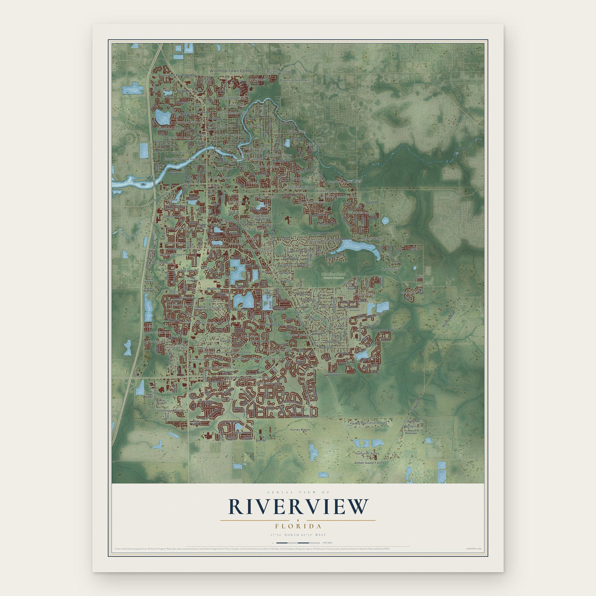
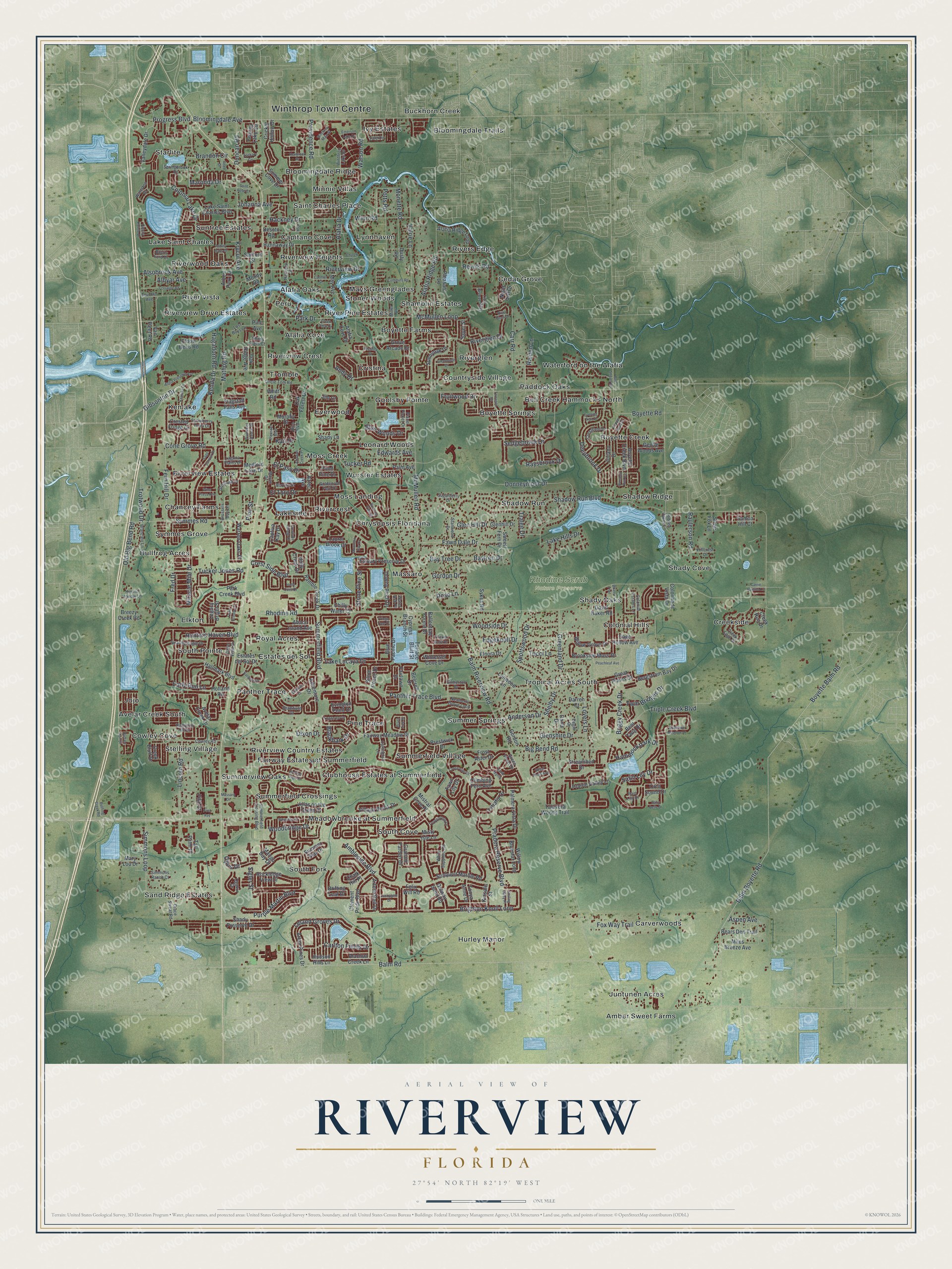
Riverview, Florida Map Art
Building by building, with labeled streets and shaded relief.
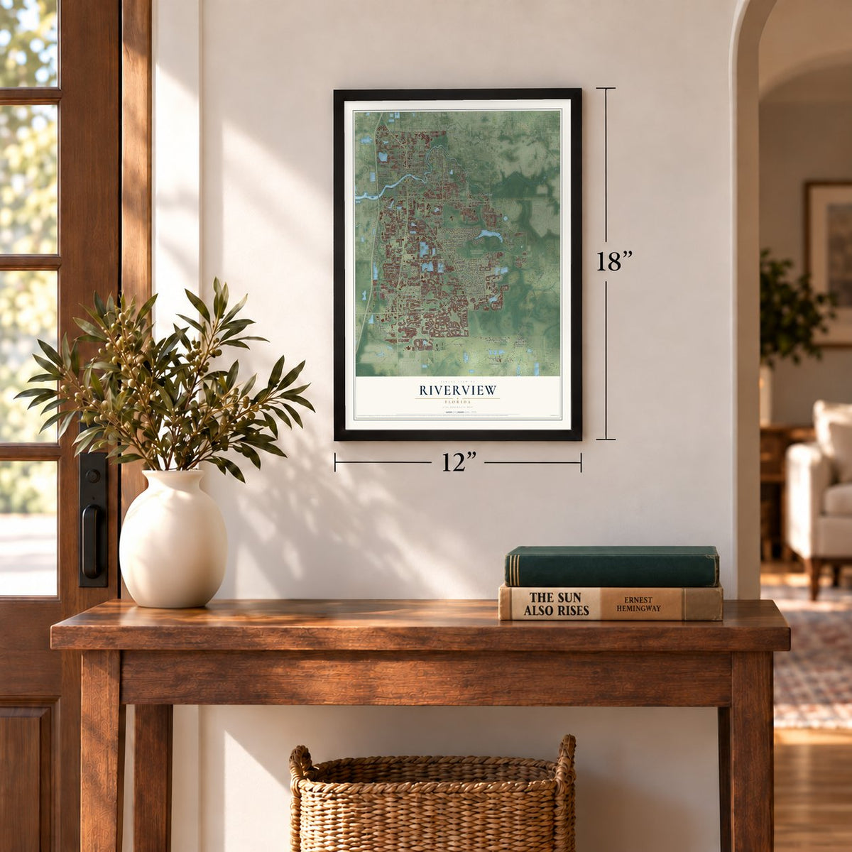
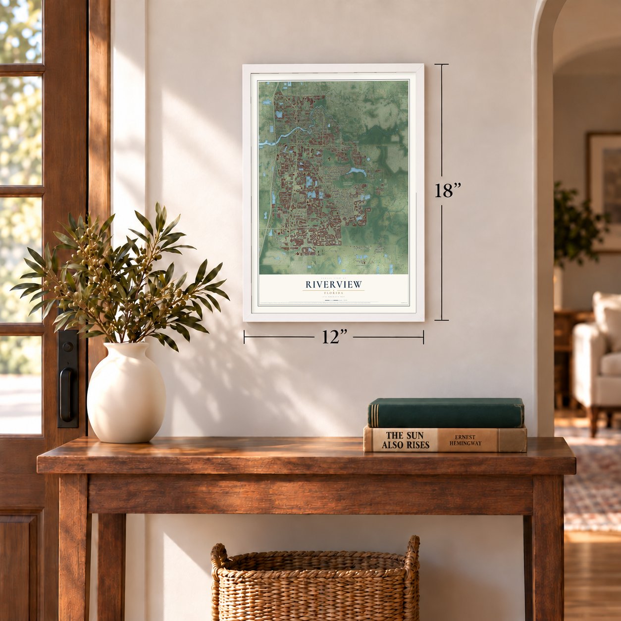
12" x 18" Archival Matte Print
A Map of Home. A Work of Art.
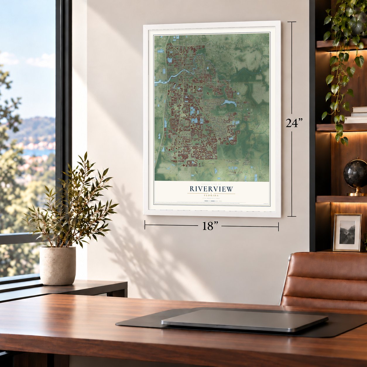
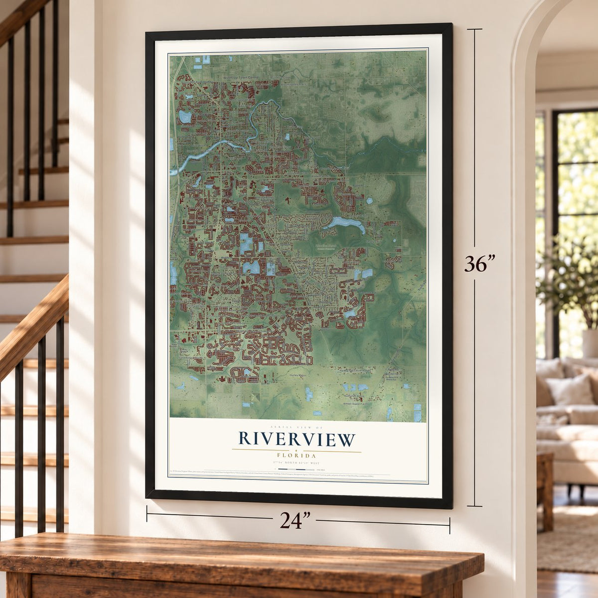
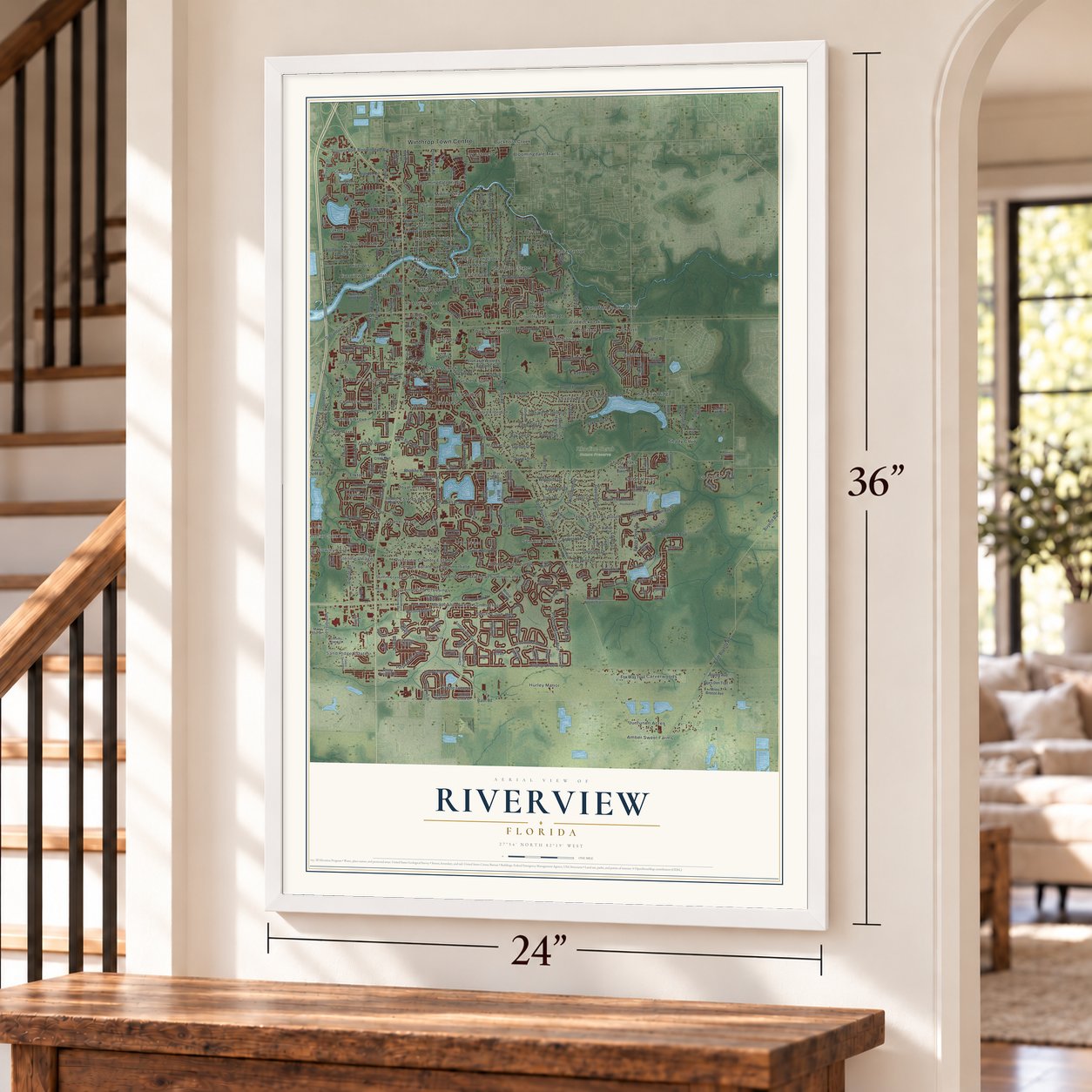
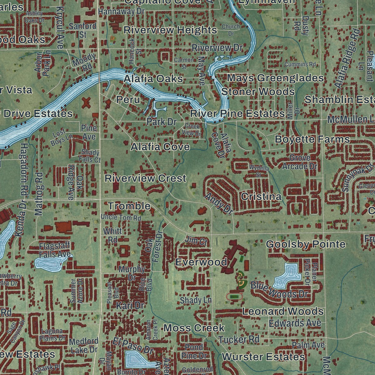
Explore Riverview, Florida from a whole new perspective. Created using aerial imagery and detailed geographic data, this map captures Riverview building by building, with labeled streets, familiar landmarks, and shaded topographical relief that highlights the natural contours of the landscape.
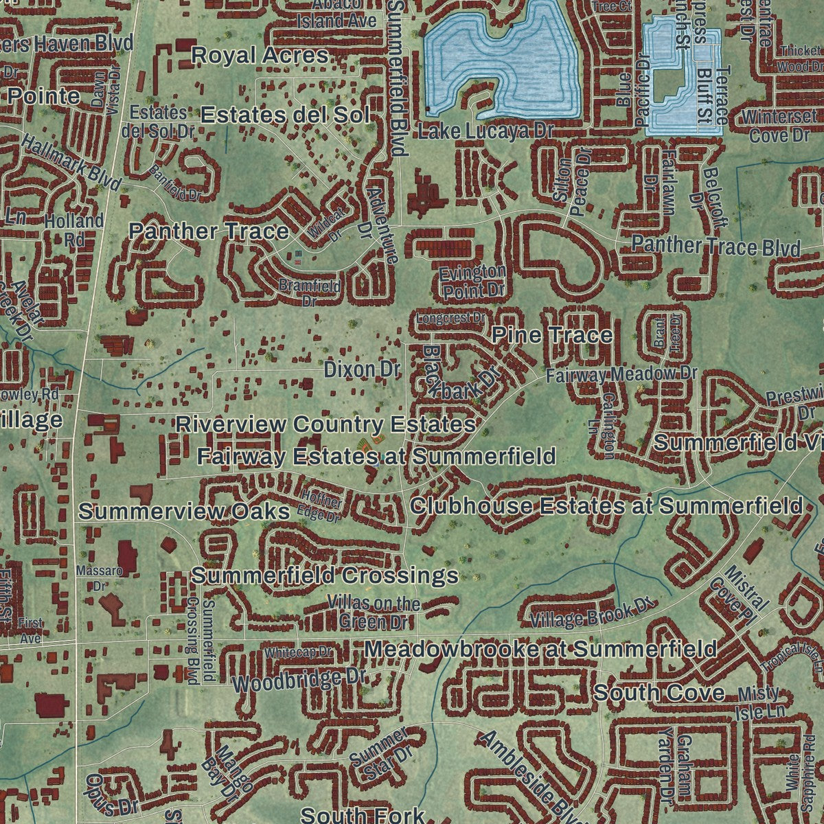
Combining modern data with the timeless character of a vintage atlas, this map is just as interesting up close as it is beautiful on the wall. Whether you grew up in Riverview, spent memorable years there, or call it home today, this unique map is a great way to celebrate a place that means something to you. Zoom in on the preview to look for your street, and then order a print to put your memories on the wall.
Three ways to hang it
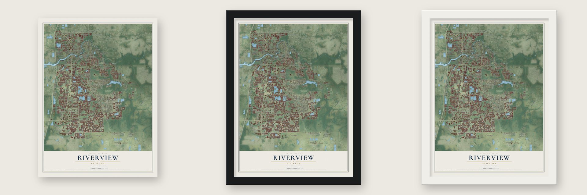
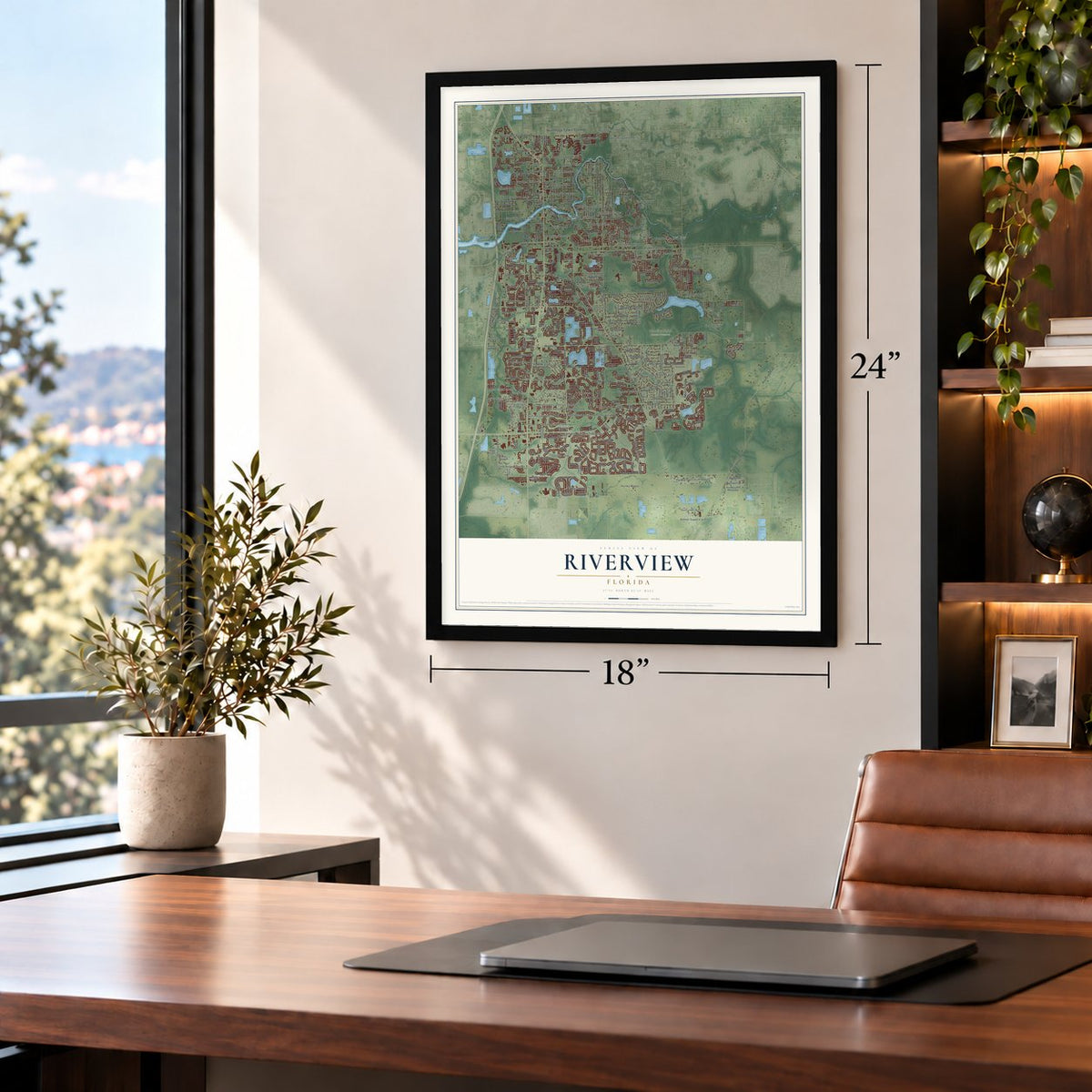
Unframed archival matte, a black wood frame or a white wood frame.
Up close
Geography Worth Displaying
This map was created using accurate cartographic data and authoritative geographic sources, including the U.S. Geological Survey and the Census Bureau. The map brings together terrain, waterways, roads, and building detail. The majority of the streets are labeled, houses are accurately depicted, and the topography is derived from government sources. Combining local data with carefully composed color and shading leads to this beautifully detailed Riverview artwork for your wall.
Rather than simply showing street outlines, we’ve included as many of the street names as we could reasonably fit on the map while keeping their names legible. Zoom in on the high resolution preview to see exactly what’s on the map. We truly set out to create a statement piece for anyone who loves Riverview. So whether it’s for you, or a gift for someone you love, we hope this map of Riverview brings back fond memories.
Read the story behind this map of Riverview, Florida from 2026.

Find your street
Names on the Riverview map
Every name below is printed on this map. Look for your street, your school, the park where you played, or the pond down the road.
Places and landmarks84
- Winthrop Town Centre
- Rhodine Scrub Nature Preserve
- Sand Ridge Estates
- Juntunen Acres
- Bullfrog Acres
- Riverview Drive Estates
- Waterford on the Alafia
- Clubhouse Estates at Summerfield
- River Pine Estates
- Lakeside
- Cowley Cove
- Hurley Manor
Show all 84 places
- Creekside
- Leonard Woods
- Summer Springs
- Shadow Ridge
- Buckhorn Creek
- Rivers Edge
- Estates del Sol
- Boyette Springs
- Tropical Acres South
- South Fork
- Saint Charles Place
- Kenlake
- Carverwoods
- Massaro
- Riverwood Oaks
- Tromble
- Shadow Run
- Shamblin Estates
- South Pointe
- Moss Landing
- Summerfield Crossings
- Riverview Heights
- Fairway Estates at Summerfield
- Symmes Grove
- Goolsby Pointe
- Boyette Creek
- South Cove
- Ivy Estates
- Colonial Hills
- Pine Trace
- Riverglen
- Shady Cove
- Chancey Farms
- Minnie Villas
- Riverview Country Estates
- Panther Trace
- Peru
- Everwood
- Bell Creek Hammocks North
- Riverview Estates
- Boyette Farms
- Capitano Cove
- Moss Creek
- Cedar Grove
- Alafia Cove
- Suntree Estates
- Bloomingdale Ridge
- Royal Acres
- Wurster Estates
- Rivercrest
- Jojo
- River Vista
- Lynnhaven
- Elkton
- Cristina
- Avelar Creek South
- Chrysopsis Floridana
- Bloomingdale Trails
- Paddock Oaks
- Meadowbrooke at Summerfield
- Alafia Oaks
- Summerview Oaks
- Stoner Woods
- Shady Oaks
- Stelling Village
- Mays Greenglades
- Amber Sweet Farms
- Summerfield Village
- Countryside Village
- Starlite
- Lake Saint Charles
- Riverview Crest
Streets and roads330
- Boyette Road
- Balm Riverview Road
- Big Bend Road
- Rhodine Road
- Balm Road
- Balm Boyette Road
- Old Big Bend Road
- Boyette Balm Road
- Panther Trace Boulevard
- Ambleside Boulevard
- McMullen Road
- Donneymoor Drive
- McMullen Loop
- Shadow Run Boulevard
- Symmes Road
- Riverview Drive
- Gibsonton Drive
- Bloomingdale Avenue
- Brighton Knoll Loop
- Triple Creek Boulevard
- Lake Lucaya Drive
- Providence Road
- Early Run Lane
- Summerfield Boulevard
- Deepbrook Drive
- Simmons Loop
- Pradera Reserve Boulevard
- Colonial Lake Drive
- Valrie Lane
- Fern Hill Drive
Show all 330 streets
- Satin Lily Drive
- Lincoln Road
- Cone Grove Road
- Hackney Drive
- Leland Groves Drive
- Spottswood Drive
- Tucker Road
- Carlton Fields Drive
- Lovers Lane
- Krycul Avenue
- Fox Way Trail
- Hunters Haven Boulevard
- Dixon Drive
- Sedgebrook Drive
- Miracle Mile Drive
- Andy Drive
- Watson Road
- Alafia Ridge Road
- Stone Pine Street
- Purple Martin Boulevard
- Carr Road
- Shelby Drive
- Raysbrook Drive
- Tucker Jones Road
- Potts Road
- Fawn Dale Drive
- Alafia Drive
- Edgeknoll Drive
- Monette Road
- El Toro Drive
- Bay Tree Drive
- Baytree Drive
- Riverglen Drive
- Greenland Drive
- Glenshire Drive
- Raulerson Road
- Mathog Road
- Brandon Circle
- Boggy Creek Drive
- Glen Hill Drive
- Maronda Drive
- Woodbridge Drive
- Progress Boulevard
- Twin Bridges Drive
- Lake Hills Drive
- Opus Drive
- Tralee Drive
- Rose Lane
- Hammock Park Drive
- Woodside Drive
- Winn Road
- Fruitwood Drive
- El Paso Drive
- Johanna Avenue
- Alsobrook Avenue
- Kenda Drive
- Gordon Drive
- Revels Road
- Albyar Avenue
- Crest Side Boulevard
- Park Drive
- Duncan Road
- Anderson Drive
- Trotwood Drive
- Blue Woods Drive
- Blackbark Drive
- Tocci Lane
- Hagadorn Road
- Edwards Avenue
- Fred Drive
- Aspen Avenue
- Raiden Lane
- Pine Street
- Sigler Street
- Kari Drive
- Prestwick Drive
- Clement Pride Boulevard
- Fairway Meadow Drive
- Streambed Drive
- Sunburst Marble Road
- Graham Yarden Drive
- Sunnyoak Drive
- Rockledge View Drive
- Boyette Creek Boulevard
- Bergstrom Bay Drive
- Misty Isle Lane
- Adventure Drive
- Palmera Vista Drive
- Blue Pacific Drive
- Willow Bluestar Loop
- Ramble Creek Drive
- Alafia Ridge Loop
- Tetrafin Drive
- Belcroft Drive
- Artesa Bell Drive
- Desoto Road
- Laurel Brook Court
- Arbor Pines Drive
- Hannaway Drive
- Ballentrae Forest Drive
- Elnora Drive
- Winterset Cove Drive
- Shady Preserve Drive
- Evington Point Drive
- Oak Forest Drive
- Colonnade Vista Drive
- Holland Road
- Hallmark Boulevard
- Estates del Sol Drive
- Orca Sound Drive
- Lake Saint Charles Boulevard
- Village Brook Drive
- Talavera Woods Trail
- Glenhill Drive
- Miles Breeze Avenue
- Willow Grove Drive
- Fairlawn Drive
- Frost Aster Drive
- Darla Drive
- Fifth Street
- Captiva Kay Drive
- Osprey Lake Circle
- Summer Cove Drive
- Legacy Bright Street
- Silton Peace Drive
- Brookside Moss Drive
- Downy Birch Drive
- Tonya Anne Drive
- Cricket Hollow Drive
- Fawn Lily Drive
- Estuary Preserve Drive
- Climbing Fern Avenue
- Hudson Hills Lane
- Avelar Creek Drive
- Valleydale Drive
- Prairie Valley Lane
- Chilly Water Court
- Villas on the Green Drive
- Medford Lake Drive
- David Baker Road
- Juliano Drive
- Creek Bluff Drive
- Grove Arcade Drive
- Gordon Road
- Dusty Road
- Night Owl Drive
- Sweet Fern Drive
- Creek Run Drive
- Holly Creek Drive
- Palm Avenue
- Crested Fringe Drive
- Warren Oaks Place
- Alachua Creek Lane
- Pond Pine Drive
- Pleasant Lane
- Bears Den Trail
- Felix Will Road
- Elbow Bend Road
- Chalk Hill Place
- Great Plains Drive
- Summer Star Drive
- Sage Hollow Avenue
- Cypress Branch Street
- Park Creek Boulevard
- Mary Lou Drive
- Abaco Island Avenue
- Moody Road
- Murphy Drive
- Whitt Road
- Pine Avenue
- Galway Sand Road
- May Avenue
- Flagstaff Falls Avenue
- Alafia Cove Drive
- Sanford Street
- Gentle Woods Avenue
- Breezy Creek Road
- Bent Twig Drive
- Kinsale Street
- Drifting Leaf Drive
- Terrace Bluff Street
- Oak Ridge Avenue
- Lenwood Lane
- Mango Bay Drive
- Samoa Hill Court
- Shady Lane
- Van Fleet Road
- Sykes Road
- Sayer Street
- Aztec Avenue
- Silver Fox Lane
- Darren Court
- Tall Palm Place
- Mistral Cove Place
- Jim Court
- Arbor Park Lane
- Creek Edge Drive
- Dawn Vista Drive
- Bramfield Drive
- Colonial Estates Lane
- Newberry Grove Loop
- Summerfield Crossing Boulevard
- Cowley Road
- Laguna Plains Drive
- Waterton Drive
- Planer Picket Drive
- Yale Circle
- Summer Azure Drive
- Bucks Ford Drive
- Hancock Street
- Strawberry Tetra Drive
- Gilmerton Drive
- Brussels Boy Lane
- White Sapphire Road
- Crestfield Drive
- Ogakor Drive
- Soaring Eagle Drive
- Green Violet Drive
- Burrito Drive
- Winthrop Lake Drive
- Hampton Hill Drive
- Tidal Breeze Way
- Carlington Lane
- Grace Sweat Road
- Springbrook Drive
- Uncle Tom Road
- Begin Drive
- Goldenrod Fern Drive
- Hidden Valley Lane
- Brancato Lane
- Stanwood Drive
- Goshawk Place
- Sugarberry Drive
- Miller Drive
- Simmons Ranch Court
- Hermit Hollow Lane
- Hillcrest Drive
- Mayan Drive
- Lost Boys Lane
- Rain Lily Drive
- Shady Falls Court
- Rice Boulevard
- Lou Ann Avenue
- Water Ash Place
- Sage Canyon Drive
- Ashley Oaks Drive
- Longcrest Drive
- Running Pine Drive
- Hoffner Edge Drive
- Tarragon Drive
- Royal Pines Avenue
- Wydella Street
- Wildflower Meadow Lane
- Kenbrook Drive
- Zackary Circle
- Crestlake Village Drive
- Holly Cone Drive
- River Birch Drive
- Brant Tree Drive
- Banfield Drive
- Church Drive
- Kenlake Drive
- Thicket Wood Drive
- Peachleaf Avenue
- Bamboo Rod Circle
- Winthrop Main Street
- Cross Vine Drive
- Glenpointe Drive
- Mountain Bay Drive
- Wildcat Drive
- Baby Belle Drive
- Alafia Preserve Avenue
- Whitecap Drive
- Colony Pointe Drive
- Tropical Isle Lane
- Copper Head Drive
- Bikers Trail
- Bell Shoals Road
- Cummins Road
- Lorrayne Road
- Fawn Brindle Drive
- Buffalo Run Drive
- Evening Trail Drive
- Bullfrog Creek Road
- Carrie Pauline Lane
- Creek View Drive
- Wine Press Avenue
- Smiling Daisy Place
- Carmon Street
- Luckygem Drive
- Emerson Lake Drive
- Amazon Creek Place
- Oak Lane
- Pleasant Boulevard
- Massaro Drive
- First Avenue
- Saint Rose Court
- Sand Myrtle
- Fringe Tree Court
- Reed Drive
Names are listed as they appear on the printed map. Zoom into the product photos to find them.
About Riverview, Florida
Riverview is a community of 107,396 people in Hillsborough County, on the Alafia River south of Brandon. It began as two settlements facing each other across the river. Settlers reached the south bank in the 1830s and called their place Peru, said Pee-Roo, from an Indigenous name for a straight stretch of river. Benjamin Moody, the first settler on record within today's Riverview, made his homestead here in 1842.
Later, settlers on the north bank started a town of their own called Riverview. At first a ferry carried people between the two. Then a bridge went up, put together from pieces of an old span that had crossed the Hillsborough River in downtown Tampa. Because the post office kept moving from one bank to the other, the mail got mixed up and the two sides grew tense. In the early 1940s the post office settled on the Riverview name for both sides, and Peru now shows up only on the oldest maps.
- A school in a church, 1893The area's first school opened in 1893 inside the Peru Baptist Church, on the south side of the river.
- Florida's first poultry farmEmmet and Myrtle Tope opened the first commercial poultry farm in Florida here in 1921. The Topes were among the early families of Peru and Riverview.
- The River of FireAlafia is usually translated as River of Fire, because phosphorus on the early river bottom glowed at night. The Peruvian Mining Company, which took phosphate from the Alafia, was named for the Peru settlement.
Keep exploring Florida
Riverview is one of 1,039 Florida towns we've mapped. Every dot on the map is a print of its own.
The search covers every state, Florida first.
Near Riverview
Order 2 or more town maps and save 10%. Shown in the size and finish you picked above, so they hang as a set.
- Bloomingdale 12" x 18" / Archival Matte Print $39.99
- Gibsonton 12" x 18" / Archival Matte Print $39.99
- Boyette 12" x 18" / Archival Matte Print $39.99
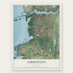

More maps nearby: Balm, Progress Village, Fish Hawk, Apollo Beach and Brandon.
The art of mapping a place
How This Map Was Made
Real places. Remarkable detail. Discover the layers that turn geographic data into a map of home.

The view from above
Aerial imagery reveals the character of the land: woodland, open fields, and the patterns of a place.

The shape of the land
Elevation data brings hills, valleys, and subtle changes in the landscape into view.

The details of home
Roads, waterways, and building footprints come together to make the map feel unmistakably local.

Geography becomes art
Considered color, shading, and typography bring the layers together in a map made for your wall.


Process illustrated with Mendon, Massachusetts. Aerial imagery: USDA NAIP. Terrain: USGS 3D Elevation Program. Map details and finished artwork: KNOWOL.
The Details
About This Print
Choose an archival matte print, or a black or white Ayous wood frame. The archival matte print is unframed.
Select your size and finish above to see the matching product image and price.
Materials & Craftsmanship
A contemporary map with the character of a classic atlas, printed on archival matte paper. Optional frames are made from Ayous wood.
Your printed map does not include the watermark shown in the full-map preview.
Shipping & Delivery
Free shipping within the United States. Every print is made to order in the USA.
Buying a gift? Add a note in your cart and we'll include it. We never put prices in the package.
Prints ship within 2 to 3 business days. Allow 7 to 10 days total from ordering for delivery. Timing may vary during holidays or periods of high order volume.
Read our shipping policy.
Returns and damaged prints
Each print is made to order. Change-of-mind refunds are not available after production.
If your print arrives damaged, misprinted or incorrect, contact support@knowol.com within 30 days of receiving it. Include your order number, photos and a description of the issue.
Read our full refund and replacement policy. For questions about your order, email support@knowol.com.