


Search for another town





Free U.S. delivery 7 to 10 days after you order
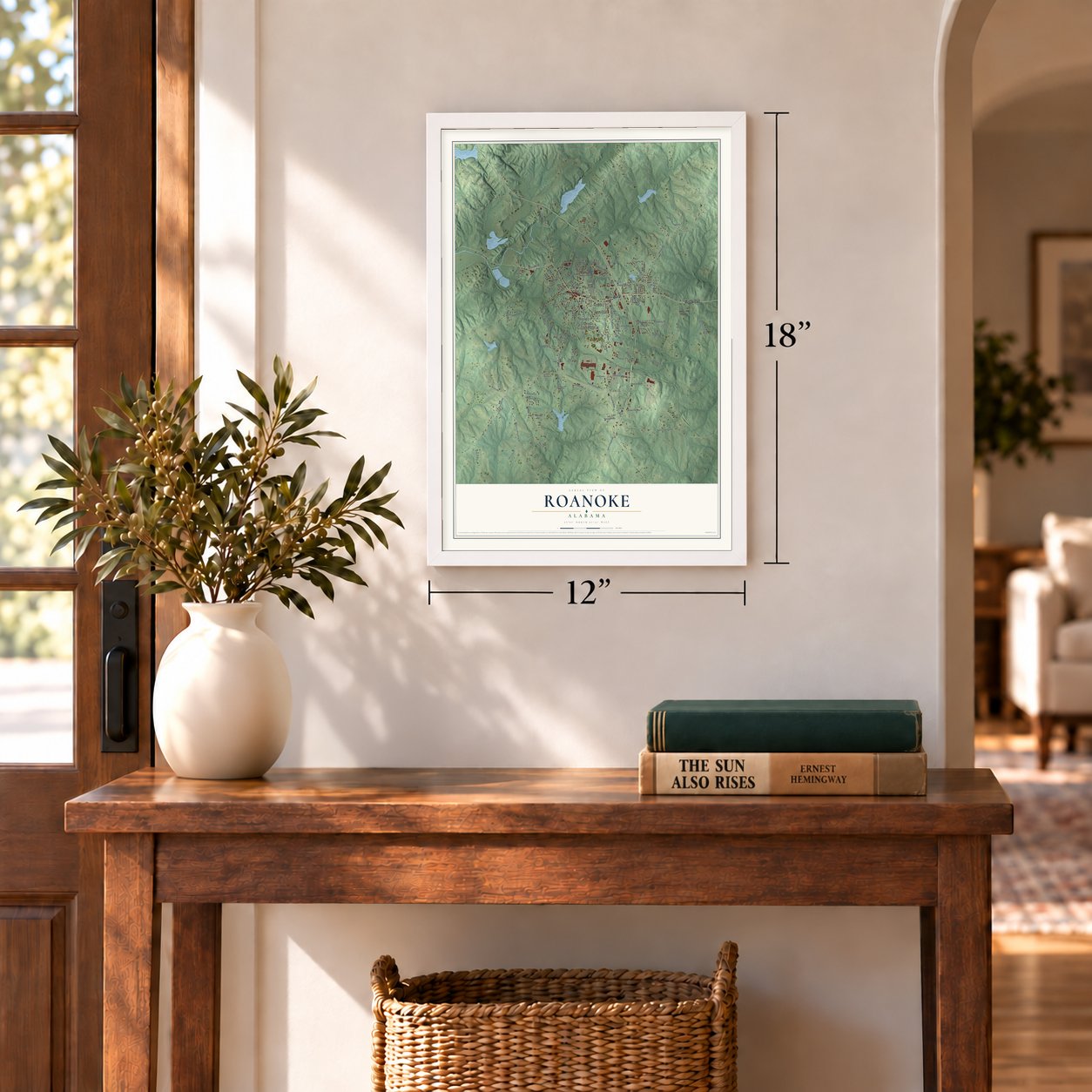
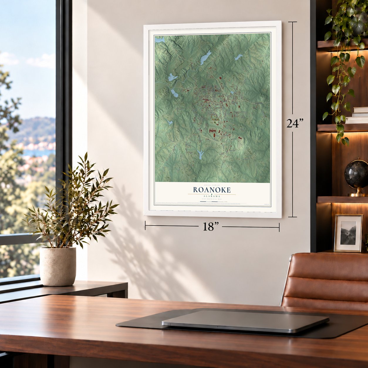
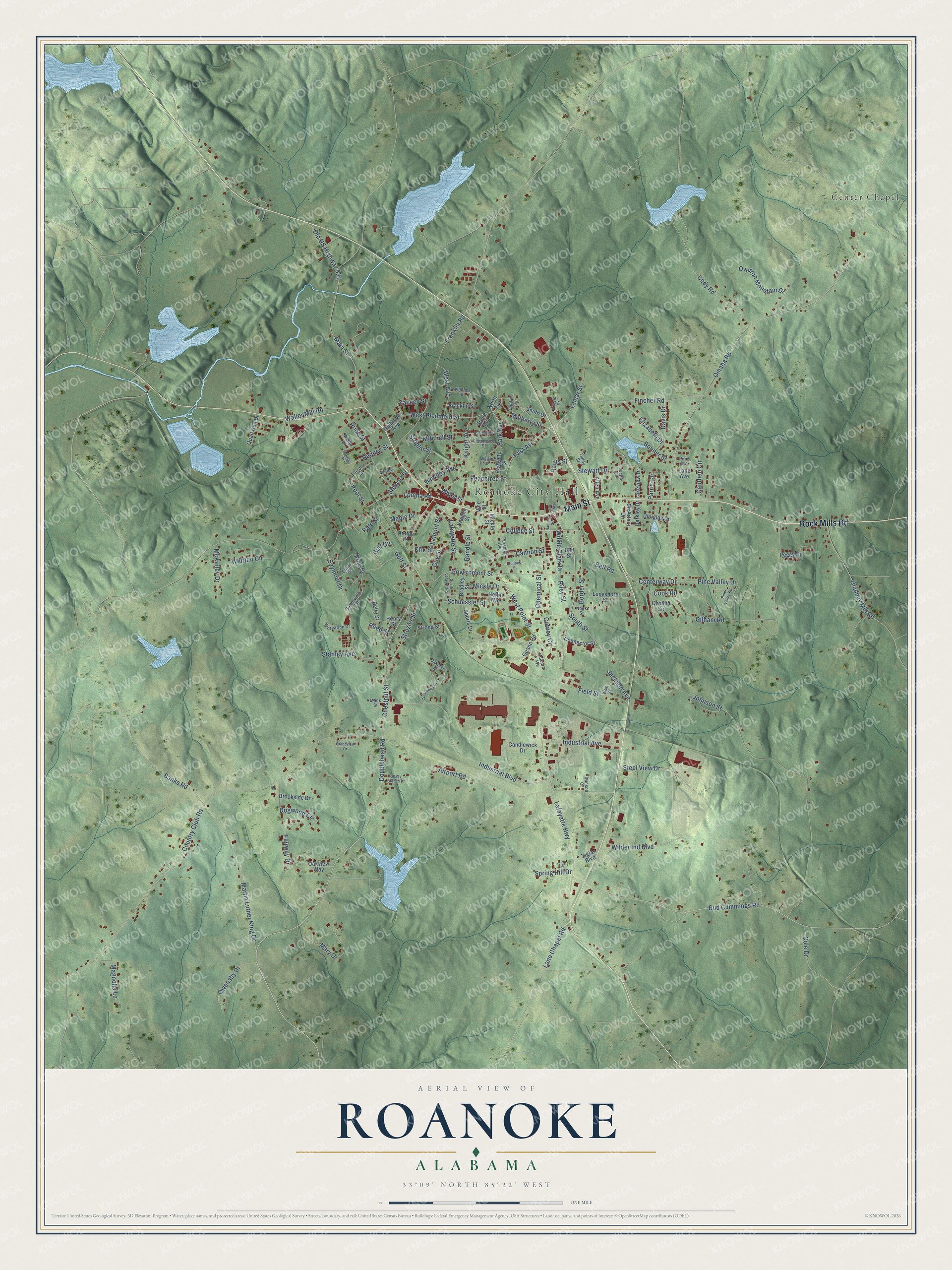
Roanoke, Alabama Map Art
Building by building, with labeled streets and shaded relief.
12" x 18" Archival Matte Print
A Map of Home. A Work of Art.
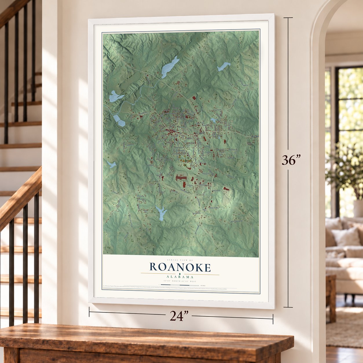
Explore Roanoke, Alabama from a whole new perspective. Created using aerial imagery and detailed geographic data, this map captures Roanoke building by building, with labeled streets, familiar landmarks, and shaded topographical relief that highlights the natural contours of the landscape.
Combining modern data with the timeless character of a vintage atlas, this map is just as interesting up close as it is beautiful on the wall. Whether you grew up in Roanoke, spent memorable years there, or call it home today, this unique map is a great way to celebrate a place that means something to you. Zoom in on the preview to look for your street, and then order a print to put your memories on the wall.
Three ways to hang it
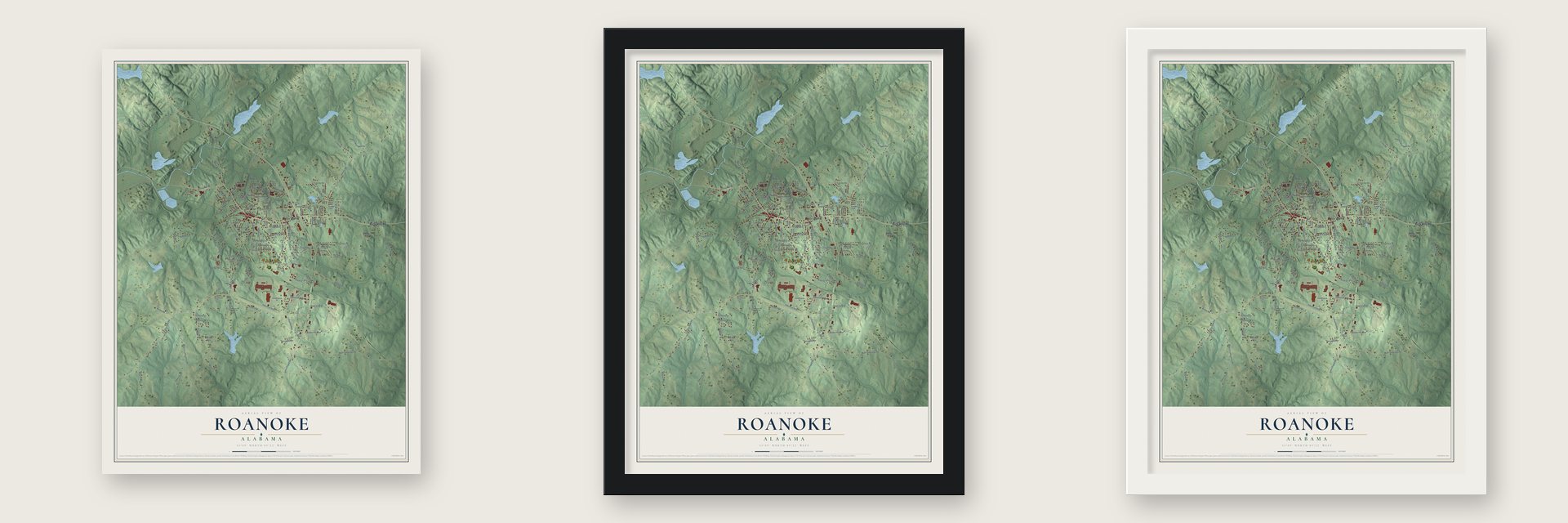
Unframed archival matte, a black wood frame or a white wood frame.
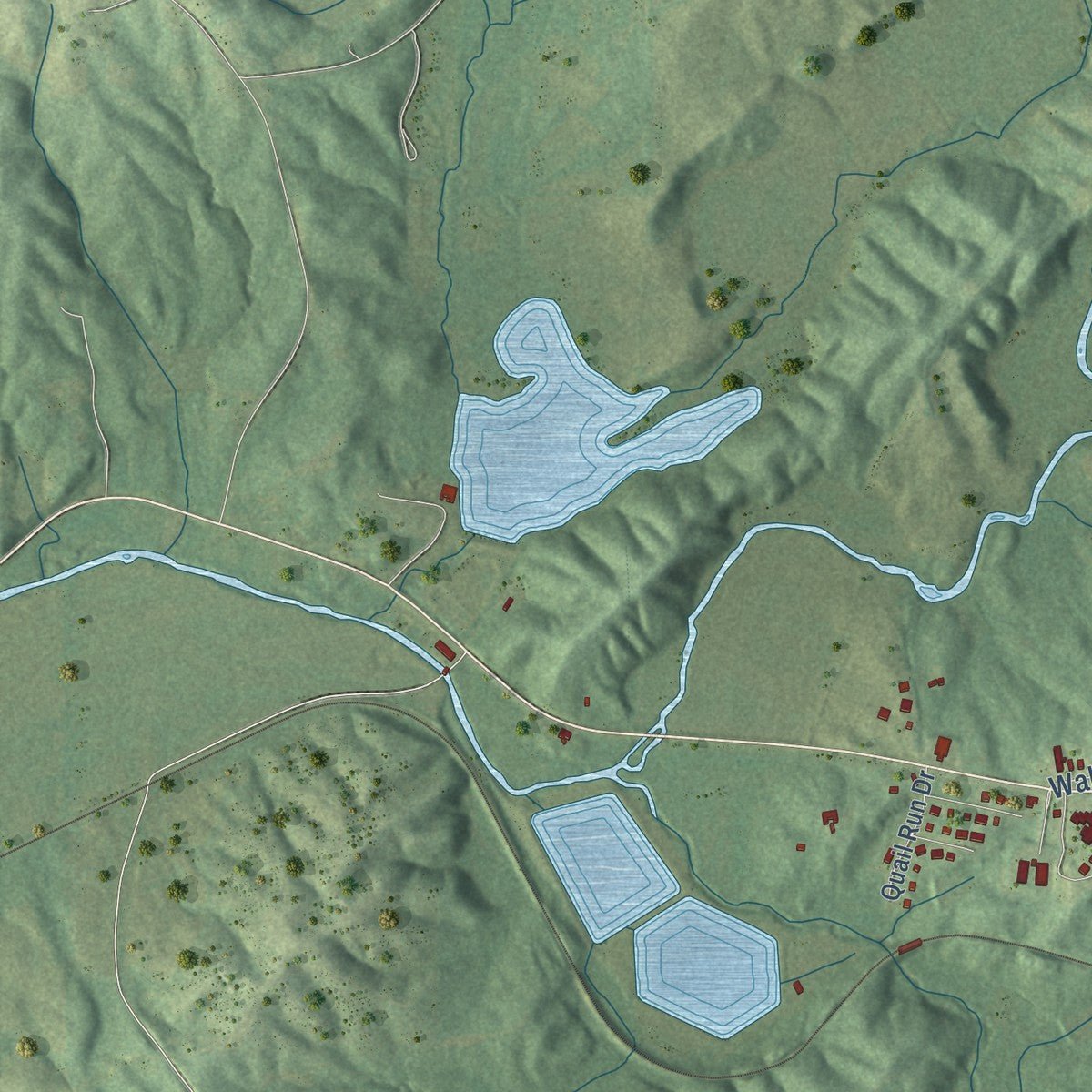
Up close
Geography Worth Displaying
This map was created using accurate cartographic data and authoritative geographic sources, including the U.S. Geological Survey and the Census Bureau. The map brings together terrain, waterways, roads, and building detail. The majority of the streets are labeled, houses are accurately depicted, and the topography is derived from government sources. Combining local data with carefully composed color and shading leads to this beautifully detailed Roanoke artwork for your wall.
Rather than simply showing street outlines, we’ve included as many of the street names as we could reasonably fit on the map while keeping their names legible. Zoom in on the high resolution preview to see exactly what’s on the map. We truly set out to create a statement piece for anyone who loves Roanoke. So whether it’s for you, or a gift for someone you love, we hope this map of Roanoke brings back fond memories.
Read the story behind this map of Roanoke, Alabama from 2026.

Find your street
Names on the Roanoke map
Every name below is printed on this map. Look for your street, your school, the park where you played, or the pond down the road.
Places and landmarks2
- Roanoke City Hall
- Center Chapel
Streets and roads156
- Main Street
- Rock Mills Road
- Old US Highway 431
- Doublehead Road
- Chestnut Street
- West Point Street
- College Street
- East Avenue
- Guy Street
- Pool Street
- Cook Road
- Kirk Street
- Industrial Boulevard
- Omaha Road
- Stewart Drive
- Waller Mill Road
- Centerway Drive
- Lafayette Highway
- Country Club Road
- Johnson Street
- Gilham Road
- Louina Road
- Bud Cummings Road
- Airport Road
- Cody Road
- Government Street
- Martin Luther King Drive
- Franklin Road
- Seymour Drive
- Peachtree Street
Show all 156 streets
- South Street
- Fincher Road
- Knight Avenue
- Cauthen Circle
- Lamar Street
- Field Street
- Gladney Mill Road
- Mary Drive
- West Piedmont Street
- Price Street
- Border Street
- Overton Mountain Drive
- Wilder Ind Boulevard
- Strozier Street
- Magnolia Lane
- Banks Road
- Steel View Drive
- Gulf Street
- Industrial Avenue
- Handley Avenue
- Park Avenue
- Schuessler Street
- West Avenue
- Davis Drive
- Whitten Circle
- Pine Valley Drive
- Parris Circle
- Mulberry Street
- Owensby Drive
- Striplin Street
- Maple Drive
- Fairway Drive
- Elizabeth Drive
- Bell Road
- Bonner Street
- Lane Chapel Road
- McKinley Drive
- Jackson Avenue
- Cannon Street
- Lafayette Street
- Radney Street
- Cole Drive
- Wilkie Clark Drive
- Lamont Street
- Randle Street
- Dogwood Circle
- Riley Street
- Mickle Drive
- White Street
- Spring Hill Drive
- Mitchell Street
- Reed Street
- Pate Street
- Pine Street
- Gulf Circle
- Cotney Circle
- Chemical Street
- Stanley Avenue
- Yancey Street
- Stewart Street
- Harris Street
- North Avenue
- Longshore Street
- Smith Drive
- Heflin Avenue
- Lakeview Drive
- Strong Street
- Sports Drive
- Peggy Drive
- Highland Avenue
- Stone Avenue
- Brookside Drive
- Padgette Street
- Vine Street
- Candlewick Drive
- Connector Street
- Quail Run Drive
- Oakview Way
- Henry Street
- Bradley Street
- Allen Avenue
- McArthur Drive
- Franklin Street
- Barkley Drive
- Douglas Drive
- Guano Road
- Cynthia Circle
- Ziglar Boulevard
- Vaughn Street
- Antigo Place
- Betty Street
- Lane Avenue
- Bell Street
- Mickle Street
- Commerce Street
- Satterwhite Street
- Talley Street
- Central Avenue
- Nook Street
- Pershing Avenue
- Oakcrest Drive
- Recreation Drive
- Clark Street
- Auburn Avenue
- Pilgrim Drive
- Lincoln Street
- Willow Lane
- Williams Street
- Waller Drive
- Wes Street
- Pine Avenue
- Mack Street
- Dunson Court
- Lucille Circle
- Hornsby Street
- Bullock Street
- Harris Avenue
- Randolph Street
- Crestwood Drive
- Pine Valley Road
- South Lafayette Street
- Grandview Drive
- Shady Branch Drive
- Morgan Street
- Railroad Street
- Kay Lane
Names are listed as they appear on the printed map. Zoom into the product photos to find them.
About Roanoke, Alabama
Roanoke is a city of 5,311 people in Randolph County, in the Piedmont of eastern Alabama. Its first settlers came in the 1830s and called the place High Pine, after a creek nearby. In 1840 it became Chulafinee, and soon after it took the name Roanoke, because one early settler had come from Roanoke, Virginia. Those first families ran a saw mill, a grist mill and a tanning yard, organized a school in 1840 and finished its first building in 1848.
In 1888 the East Alabama Railway built a spur line into town. That year Roanoke counted 350 people, and the city was incorporated in December 1890. Growth came quickly after the trains arrived. A city hall went up in 1897, and the population rose to 1,155 by 1900 and 3,538 by 1916, with a cotton mill, a cottonseed oil mill, an ice factory and three cotton warehouses.
- The Indestructible DollElla Gantt Smith started making dolls, animals and decorative fruit out of plaster and other materials in Roanoke in 1897. At the 1904 World's Fair in St. Louis, her sturdy Ella Smith Doll won the grand prize as the most innovative toy shown there. She ran her factory here until 1922 and held 11 patents, a rare thing for a woman then. The Randolph County Historical Museum on Main Street keeps a collection of her dolls.
- Handley's cotton millWilliam Anderson Handley, a businessman and former congressman who lived in Roanoke for many years, founded the W. A. Handley Manufacturing Company in 1905. The cotton mill drew on the many cotton farms around town and carried the local economy for decades, stopping only briefly in 1907 and 1920, until it closed in the 1970s.
- First Baptist since 1845First Baptist Church was organized in 1845, the same year the Southern Baptist Convention was founded. Its plain unpainted first building gave way to a handsome new one in 1876, and a brick church followed in 1902. The congregation hosted the Alabama Baptist Convention's yearly meeting in 1908. After fire destroyed the church in November 1977, members built the one that stands today.
- Roanoke Normal CollegeRoanoke Normal College opened in 1874 and received its charter in 1889. The school burned in 1890, and the town rebuilt it. The city board of education later took it over, and the building went on to house an elementary school.
- Two companies in grayWhen the Civil War came, about 120 men from Roanoke went off to fight for the Confederacy. Two companies were raised in town, and men from one of them fought at the Battle of Chancellorsville in Virginia.
Keep exploring Alabama
Roanoke is one of 675 Alabama towns we've mapped. Every dot on the map is a print of its own.
The search covers every state, Alabama first.
Near Roanoke
Order 2 or more town maps and save 10%. Shown in the size and finish you picked above, so they hang as a set.
- Rock Mills 12" x 18" / Archival Matte Print $39.99
- Standing Rock 12" x 18" / Archival Matte Print $39.99
- Five Points 12" x 18" / Archival Matte Print $39.99


More maps nearby: Abanda, Penton, Wadley, Fredonia and Wedowee.
The art of mapping a place
How This Map Was Made
Real places. Remarkable detail. Discover the layers that turn geographic data into a map of home.

The view from above
Aerial imagery reveals the character of the land: woodland, open fields, and the patterns of a place.

The shape of the land
Elevation data brings hills, valleys, and subtle changes in the landscape into view.

The details of home
Roads, waterways, and building footprints come together to make the map feel unmistakably local.

Geography becomes art
Considered color, shading, and typography bring the layers together in a map made for your wall.


Process illustrated with Mendon, Massachusetts. Aerial imagery: USDA NAIP. Terrain: USGS 3D Elevation Program. Map details and finished artwork: KNOWOL.
The Details
About This Print
Choose an archival matte print, or a black or white Ayous wood frame. The archival matte print is unframed.
Select your size and finish above to see the matching product image and price.
Materials & Craftsmanship
A contemporary map with the character of a classic atlas, printed on archival matte paper. Optional frames are made from Ayous wood.
Your printed map does not include the watermark shown in the full-map preview.
Shipping & Delivery
Free shipping within the United States. Every print is made to order in the USA.
Buying a gift? Add a note in your cart and we'll include it. We never put prices in the package.
Prints ship within 2 to 3 business days. Allow 7 to 10 days total from ordering for delivery. Timing may vary during holidays or periods of high order volume.
Read our shipping policy.
Returns and damaged prints
Each print is made to order. Change-of-mind refunds are not available after production.
If your print arrives damaged, misprinted or incorrect, contact support@knowol.com within 30 days of receiving it. Include your order number, photos and a description of the issue.
Read our full refund and replacement policy. For questions about your order, email support@knowol.com.