
Search for another town



Free U.S. delivery 7 to 10 days after you order
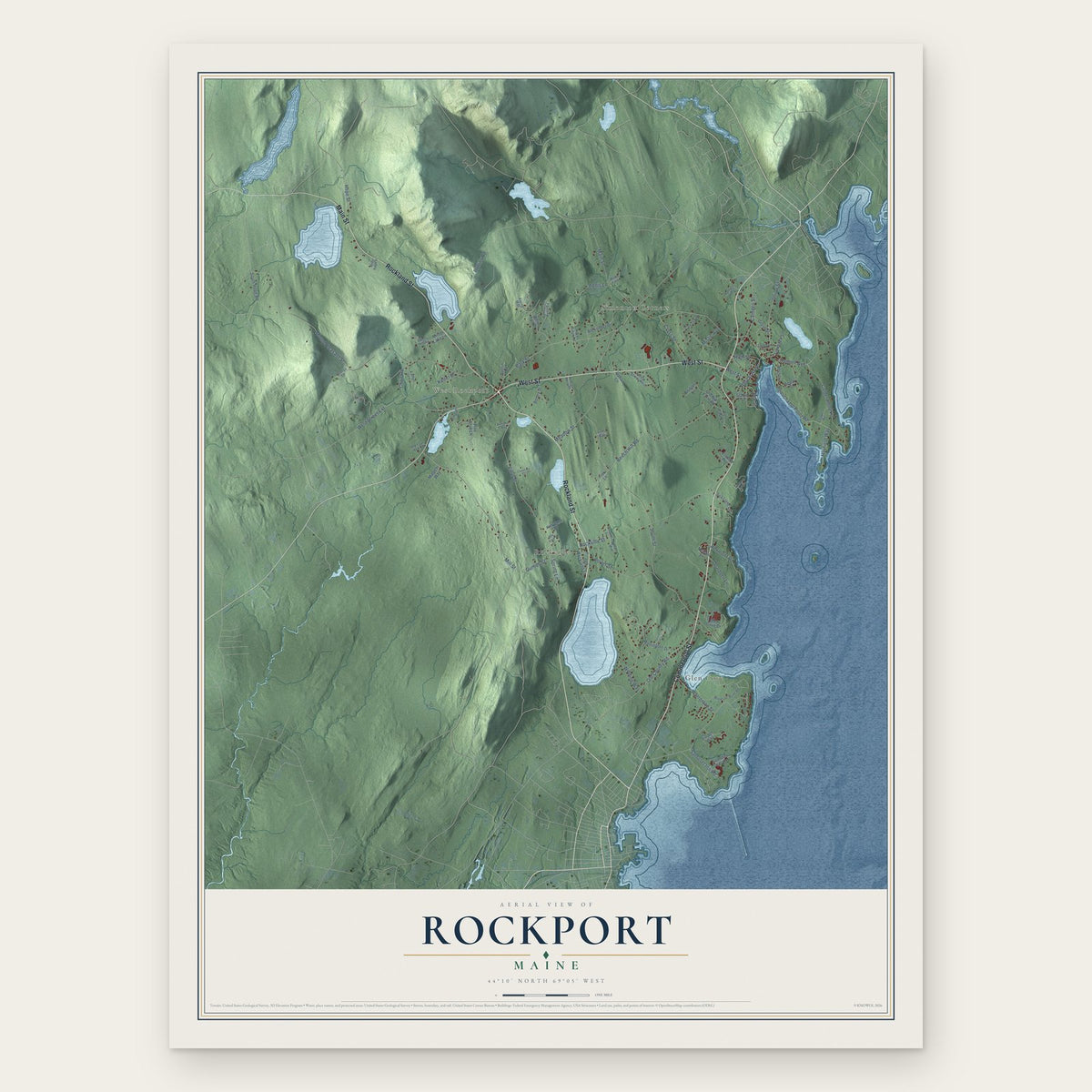
Rockport, Maine Map Art
Building by building, with labeled streets and shaded relief.
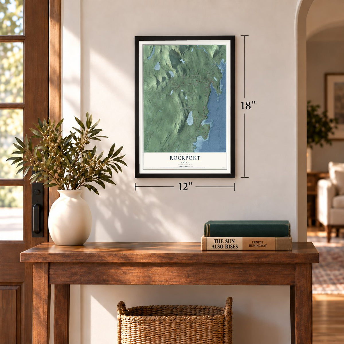
12" x 18" Archival Matte Print
A Map of Home. A Work of Art.
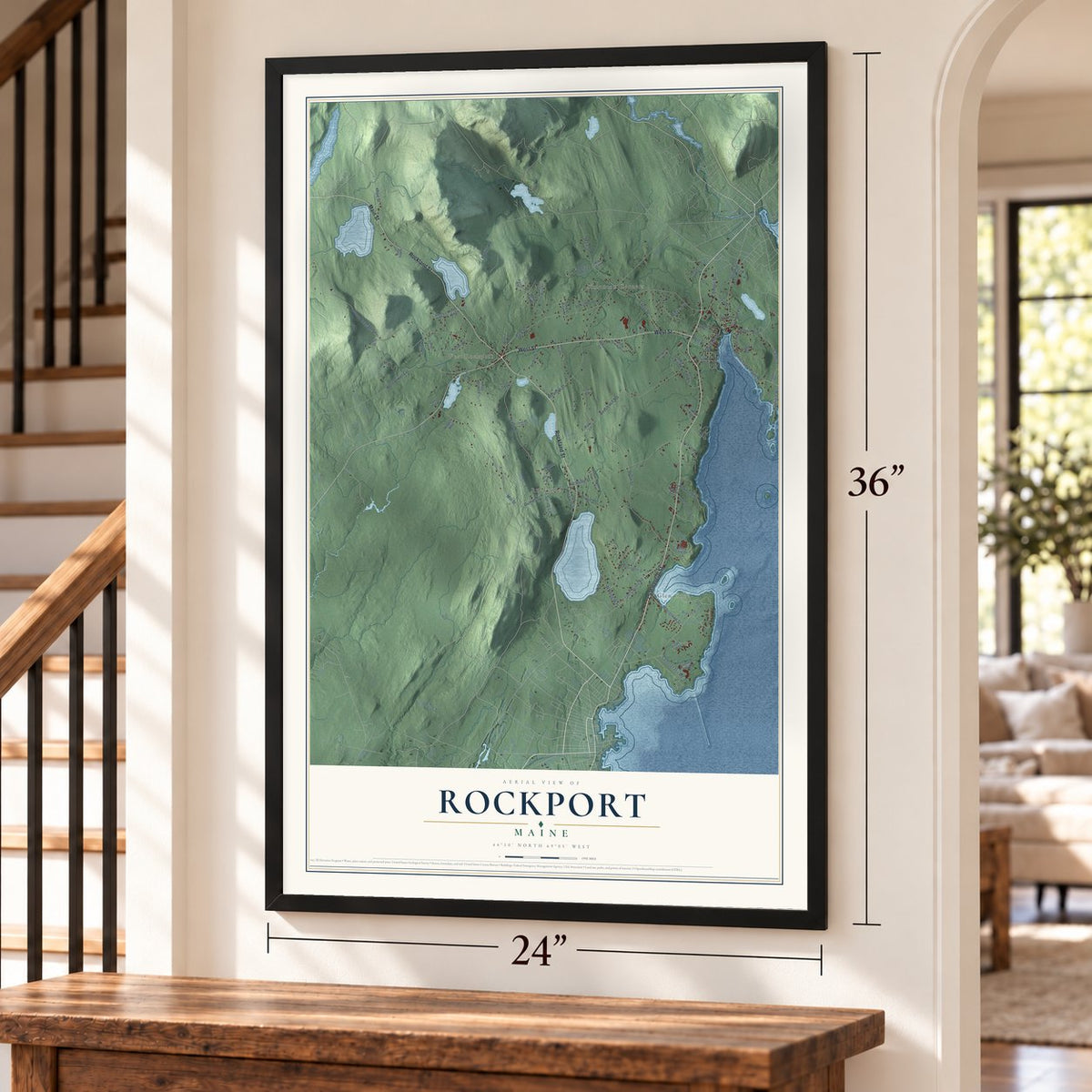
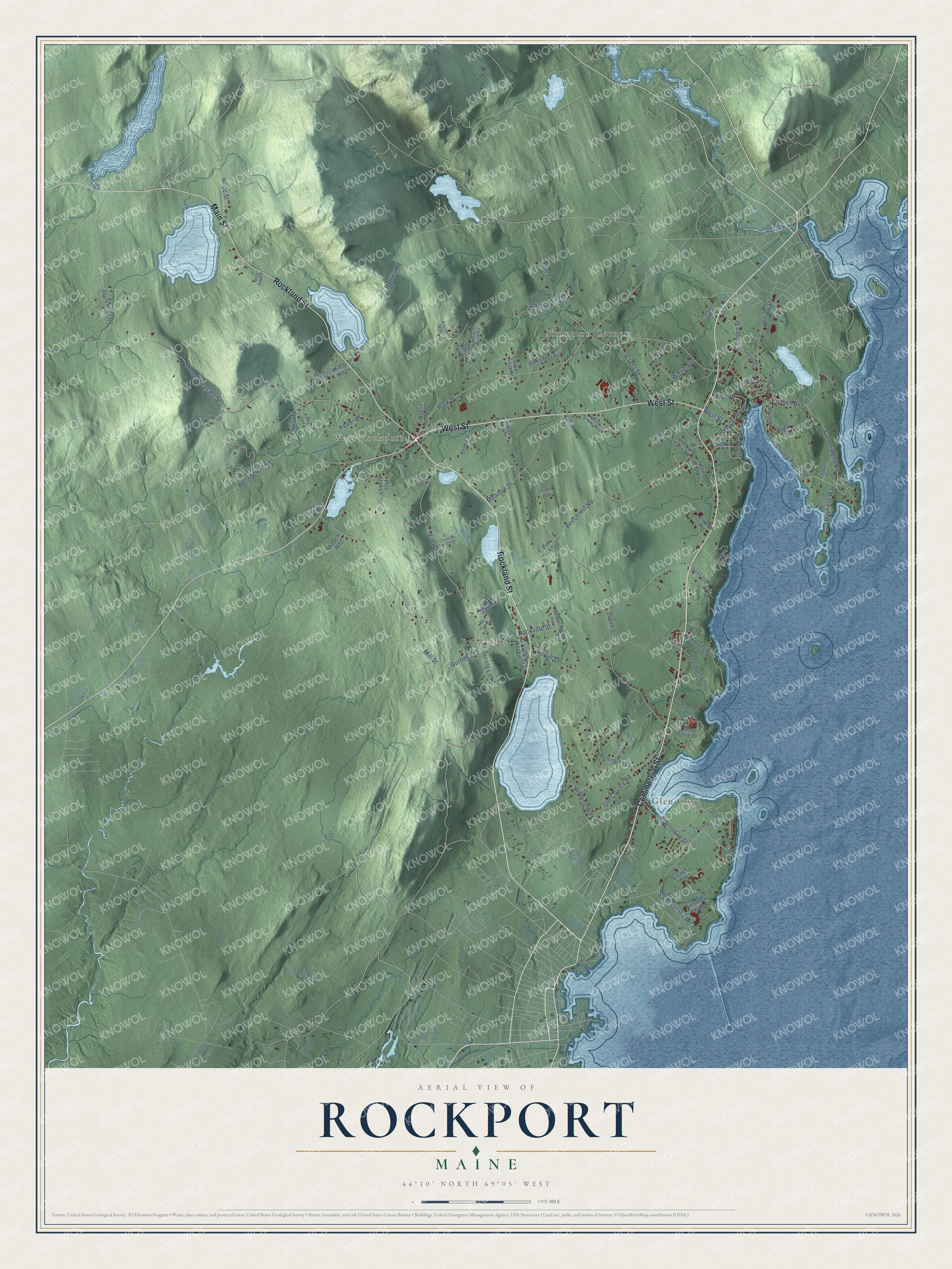
Explore Rockport, Maine from a whole new perspective. Created using aerial imagery and detailed geographic data, this map captures Rockport building by building, with labeled streets, familiar landmarks, and shaded topographical relief that highlights the natural contours of the landscape.
Combining modern data with the timeless character of a vintage atlas, this map is just as interesting up close as it is beautiful on the wall. Whether you grew up in Rockport, spent memorable years there, or call it home today, this unique map is a great way to celebrate a place that means something to you. Zoom in on the preview to look for your street, and then order a print to put your memories on the wall.
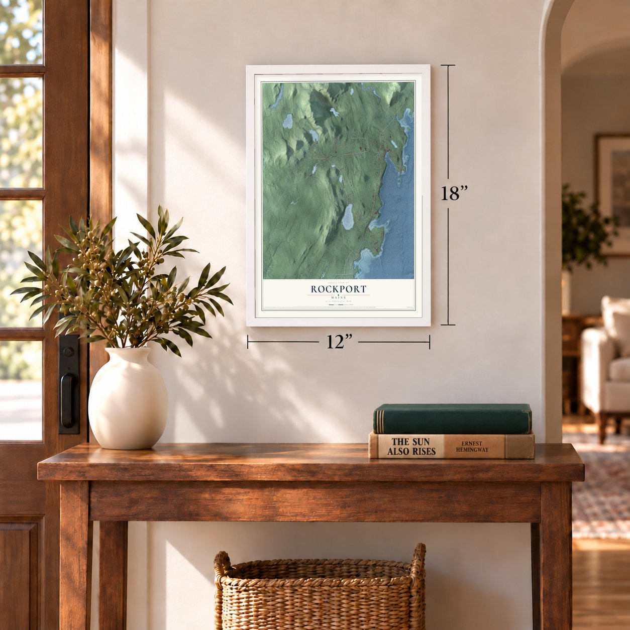
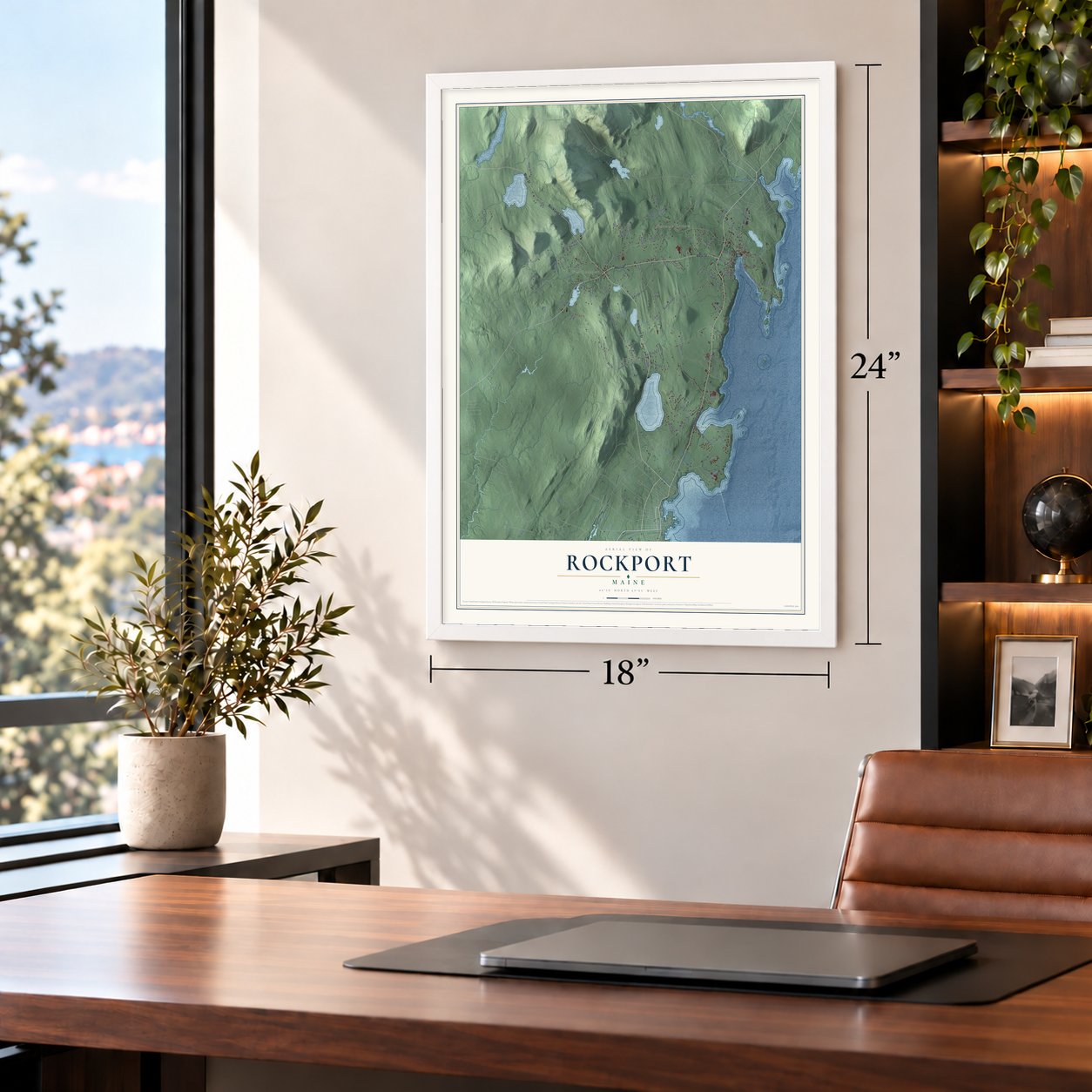
Three ways to hang it
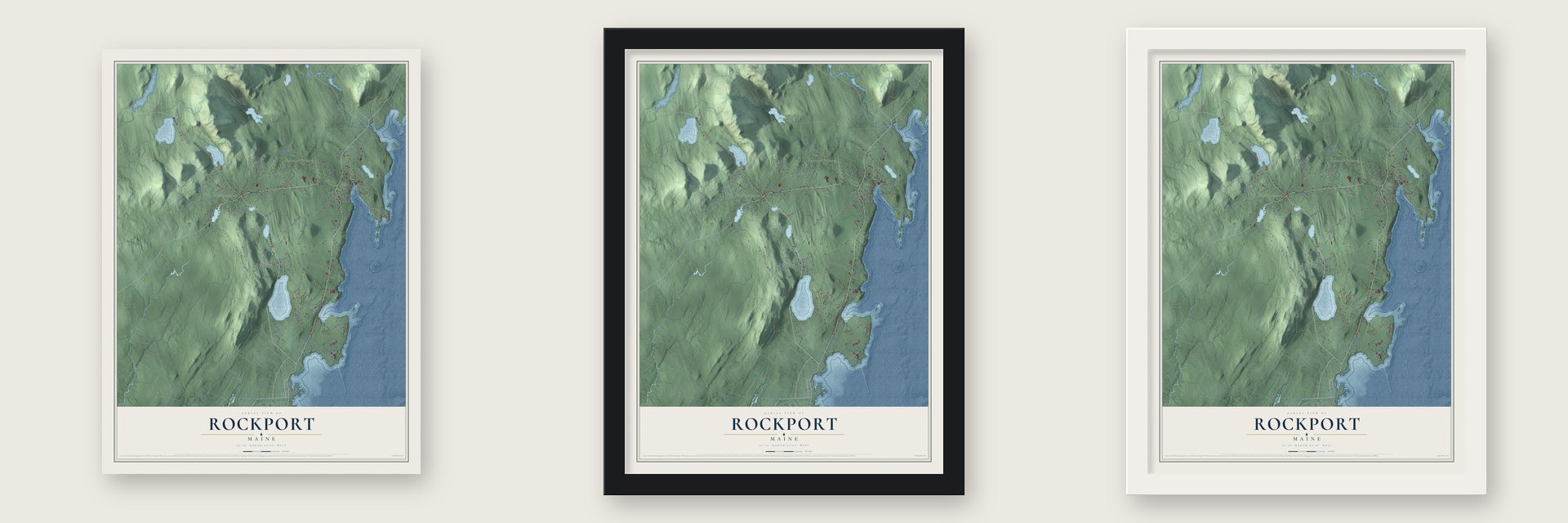
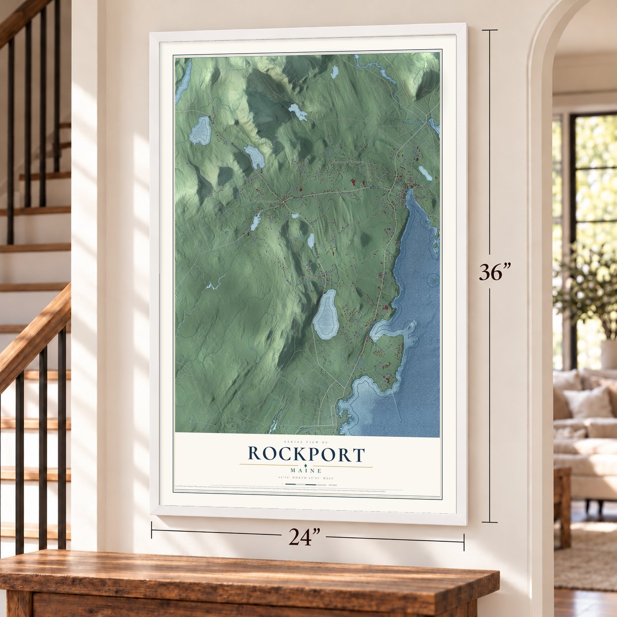
Unframed archival matte, a black wood frame or a white wood frame.
Up close
Geography Worth Displaying
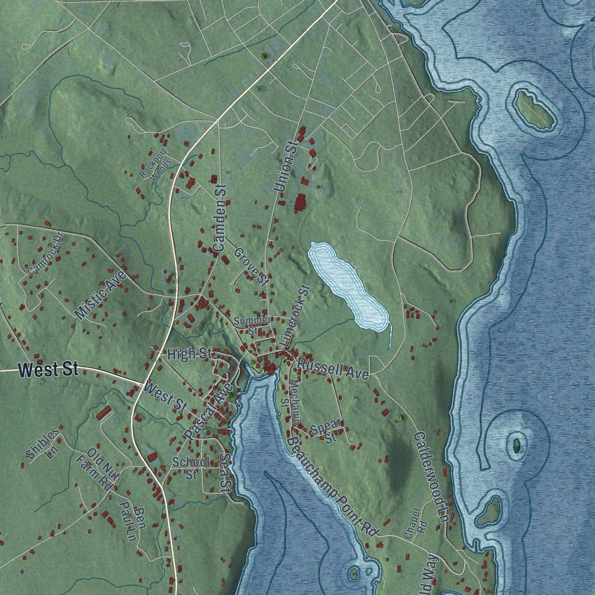
This map was created using accurate cartographic data and authoritative geographic sources, including the U.S. Geological Survey (USGS) and FEMA. The map brings together terrain, waterways, roads, and building detail. The majority of the streets are labeled, houses are accurately depicted, and the topography is derived from government sources. Combining local data with carefully composed color and shading leads to this beautifully detailed Rockport artwork for your wall.
Rather than simply showing street outlines, we’ve included as many of the street names as we could reasonably fit on the map while keeping their names legible. Zoom in on the high resolution preview to see exactly what’s on the map. We truly set out to create a statement piece for anyone who loves Rockport. So whether it’s for you, or a gift for someone you love, we hope this map of Rockport brings back fond memories.
Explore the full map of Rockport, Maine and read about the local places it shows.
Find your street
Names on the Rockport map
Every name below is printed on this map. Look for your street, your school, the park where you played, or the pond down the road.
Places and landmarks4
- West Rockport
- Glen Cove
- Simonton Corners
- Rockville
Streets and roads91
- Commercial Street
- Rockland Street
- West Street
- Main Street
- Park Street
- Hope Street
- Old County Road
- Samoset Inn Road
- Rockville Street
- Beauchamp Point Road
- Russell Avenue
- Mount Pleasant Street
- South Street
- Vinal Street
- Mill Street
- Beech Hill Road
- Meadow Street
- West Street Extension
- Calderwood Lane
- Warrenton Street
- Mistic Avenue
- Union Street
- Porter Street
- Gurney Street
- Camden Street
- Dearborn Lane
- Rollins Road
- Roxmont Road
- Pascal Avenue
- Cross Street
Show all 91 streets
- Hayfield Way
- Chris Road
- Keller Drive
- Winding Way
- High Street
- Sea Street
- Spring Lane
- Annis Lane
- Village Way
- Fisk Lane
- Samoset Village
- Wellington Drive
- White Tail Drive
- Glen Cove Drive
- Old Rockland Street
- Pine Brae Lane
- Ben Paul Lane
- Alexander Drive
- South Hope Road
- Sea Light Lane
- Bonny Street
- Grove Street
- Limerock Street
- Kerygma Drive
- Mirror Lake Lane
- Spear Street
- Old Nut Farm Road
- School Street
- Upham Lane
- Austin Lane
- Malachi Way
- Elwood Avenue
- Shibles Lane
- Nelson Lane
- Brewster Point Road
- Reflection Pond Road
- Forest Street West
- Rock Ridge Road
- Mechanic Street
- Stoney Hill Road
- Camrock Drive
- Chapel Road
- Miller Farm
- Kathys Lane
- Old Four Rod Road
- Bella's Way
- Tolman Lane
- Summer Street
- Alpine Way
- Fern Way
- Barrett Drive
- Kimberly Drive
- Roberts Roost Road
- Terrier Circle
- Rockport Ledges
- Robinson Drive
- Bay View Drive
- Rockport Woods
- Christine Court
- Misty Ridge Drive
- Pumpkin Way
Names are listed as they appear on the printed map. Zoom into the product photos to find them.
About Rockport, Maine
Rockport is a town of 3,644 people in Knox County, on Penobscot Bay. Before Europeans came, the Wabanaki hunted and gathered along this coast and in its forests. Robert Thorndike, the first European settler, arrived in 1769. The settlement was called "the River" and then Goose River Village, and it was part of Megunticook Plantation, which became the town of Camden in 1791.
Villagers voted in 1852 to rename Goose River Village as Rockport, after its rocky shore. Later a quarrel over who would pay for a new bridge, known as "The Bridge Question," split Camden apart. On February 25, 1891, Rockport became a town of its own, taking half of Camden's people, three-quarters of its land and the lime and ice businesses that earned the most money.
- Lime for the CapitolStone from fifteen nearby quarries went into Rockport's kilns, which burned day and night, all 365 days of the year, and came out as lime that builders used in plaster and mortar. Three hundred casks of Rockport lime went to Washington, D.C., in 1817 for rebuilding the U.S. Capitol, which the British had damaged in the War of 1812.
- Ice clear enough to read throughEach winter Lily Pond gave up 50,000 tons of ice, which was shipped around the world. The Rockport Ice Company sold it as "Lily Pond Ice," said to be so clear that a person could read a newspaper through a thick block. Later a fire broke out in the lime sheds and jumped the water to burn the ice houses, and neither business was rebuilt.
- The last kilns on the coastA fire in 1907 destroyed many of the waterfront kilns, just as cement was taking the place of lime in new buildings. The kilns that survive in Rockport Marine Park are the last group of several kilns left on the Maine coast, and the Rockport Historic Kiln Area joined the National Register in 1970. A Vulcan locomotive that once hauled limestone from the quarries to the harbor is kept in the park too.
- Andre the SealHarbormaster Harry Goodridge adopted a harbor seal pup named Andre in 1961. Until 1986, Andre spent his winters at aquariums in Boston and Connecticut and swam back to Rockport Harbor every spring, drawing crowds, books, PBS documentaries and a 1994 feature film. Andre himself was there in 1978 when his statue was unveiled in Rockport Marine Park, and in 2018 townspeople raised $14,000 to restore it.
- Summer music since 1961Mary Louise Curtis Bok, who helped found the Curtis Institute of Music, ranked among Rockport's largest landowners, at one point holding most of the eastern shore, and she helped shape the landscaping around the inner harbor. Bay Chamber Concerts began in 1961 to carry on the Curtis Institute's summer music lessons. Mary Lea Park, beside the Rockport Opera House, honors Curtis Bok and the Rockport violinist Lea Luboshutz.
Keep exploring Maine
Rockport is one of 536 Maine towns we've mapped. Every dot on the map is a print of its own.
The search covers every state, Maine first.
Near Rockport
Order 2 or more town maps and save 10%. Shown in the size and finish you picked above, so they hang as a set.
- Rockland 12" x 18" / Archival Matte Print $39.99
- Camden 12" x 18" / Archival Matte Print $39.99
- Thomaston 12" x 18" / Archival Matte Print $39.99
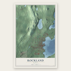
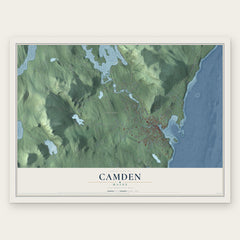

More maps nearby: Hope, Owls Head, Ash Point, Warren and Lincolnville.
The art of mapping a place
How This Map Was Made
Real places. Remarkable detail. Discover the layers that turn geographic data into a map of home.

The view from above
Aerial imagery reveals the character of the land: woodland, open fields, and the patterns of a place.

The shape of the land
Elevation data brings hills, valleys, and subtle changes in the landscape into view.

The details of home
Roads, waterways, and building footprints come together to make the map feel unmistakably local.

Geography becomes art
Considered color, shading, and typography bring the layers together in a map made for your wall.


Process illustrated with Mendon, Massachusetts. Aerial imagery: USDA NAIP. Terrain: USGS 3D Elevation Program. Map details and finished artwork: KNOWOL.
The Details
About This Print
Choose an archival matte print, or a black or white Ayous wood frame. The archival matte print is unframed.
Select your size and finish above to see the matching product image and price.
Materials & Craftsmanship
A contemporary map with the character of a classic atlas, printed on archival matte paper. Optional frames are made from Ayous wood.
Your printed map does not include the watermark shown in the full-map preview.
Shipping & Delivery
Free shipping within the United States. Every print is made to order in the USA.
Buying a gift? Add a note in your cart and we'll include it. We never put prices in the package.
Prints ship within 2 to 3 business days. Allow 7 to 10 days total from ordering for delivery. Timing may vary during holidays or periods of high order volume.
Read our shipping policy.
Returns and damaged prints
Each print is made to order. Change-of-mind refunds are not available after production.
If your print arrives damaged, misprinted or incorrect, contact support@knowol.com within 30 days of receiving it. Include your order number, photos and a description of the issue.
Read our full refund and replacement policy. For questions about your order, email support@knowol.com.