
Search for another town




Free U.S. delivery 7 to 10 days after you order
Rosamond, California Map Art
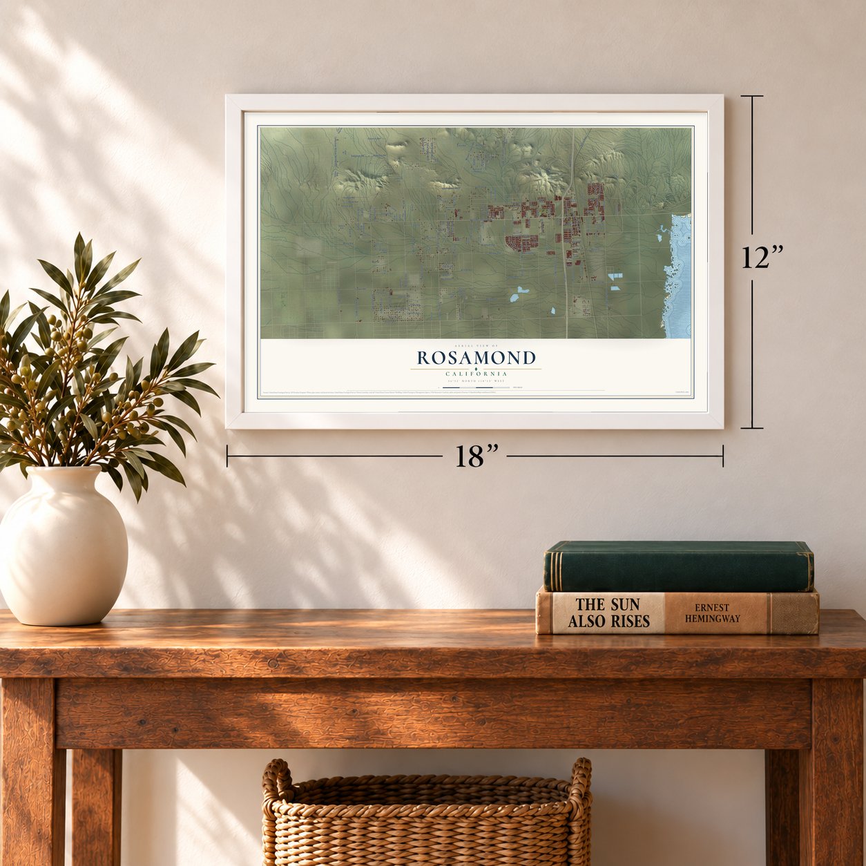
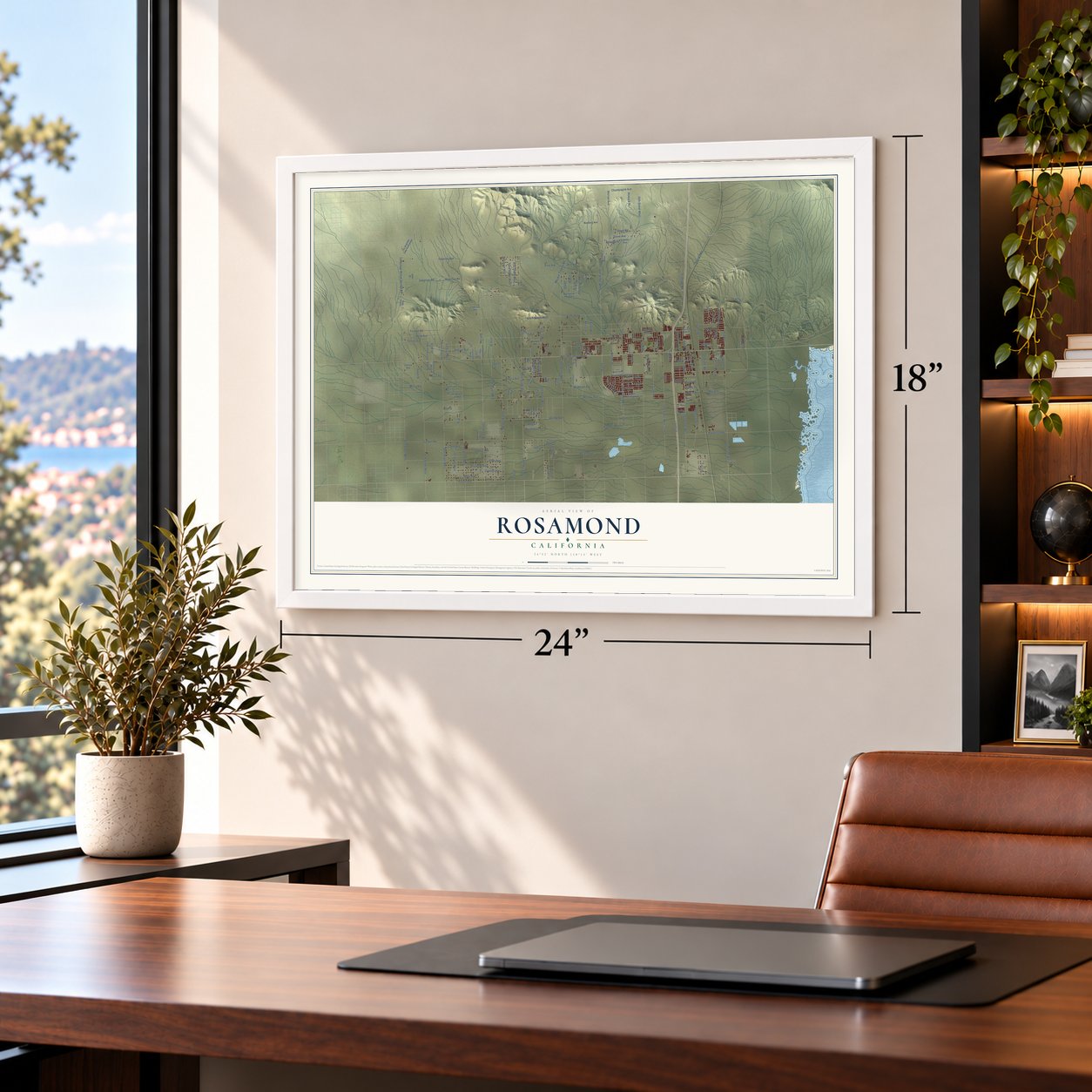
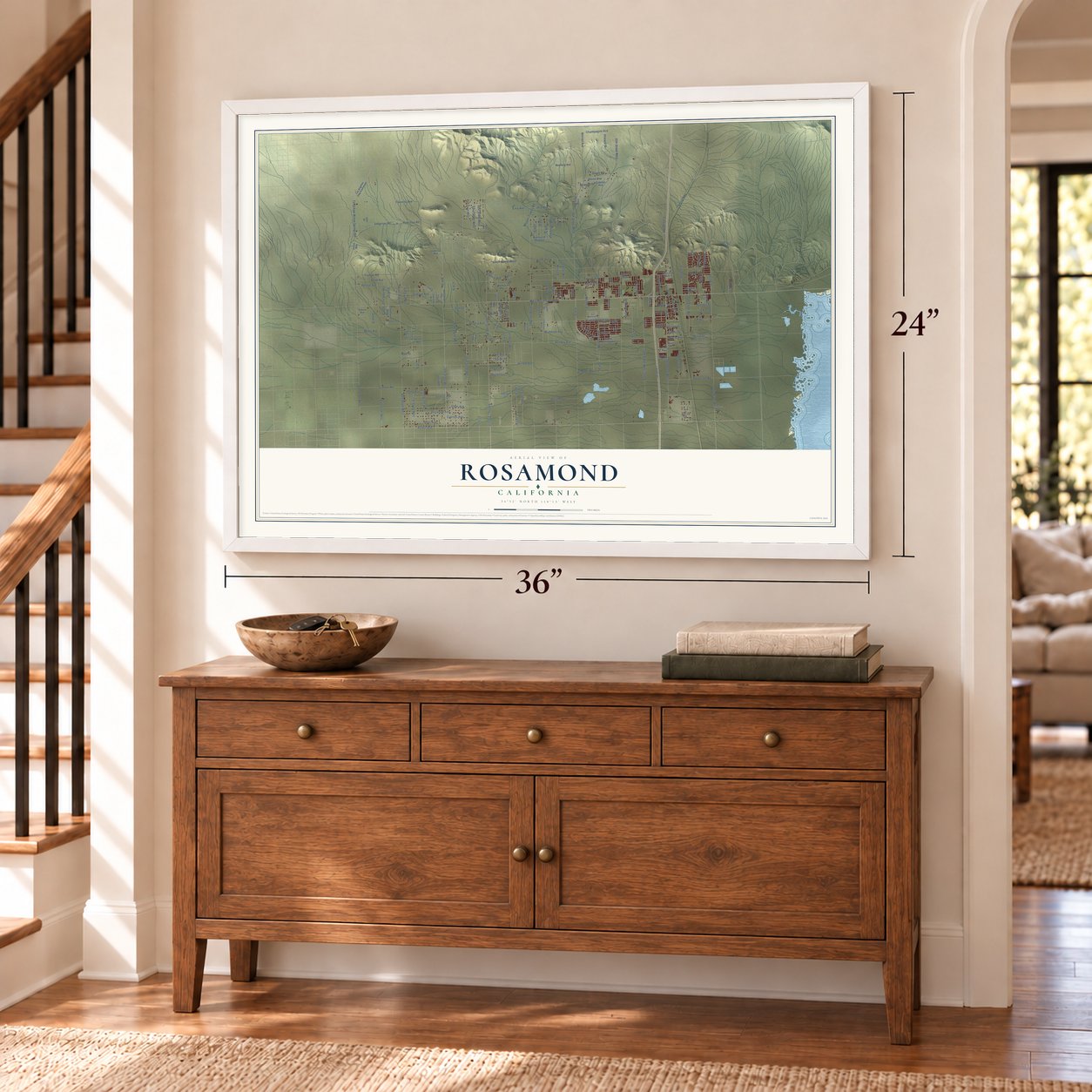
A new map of Rosamond, California, made in 2026 and printed to order on thick archival matte paper.
12" x 18" Archival Matte Print
A Map of Home. A Work of Art.
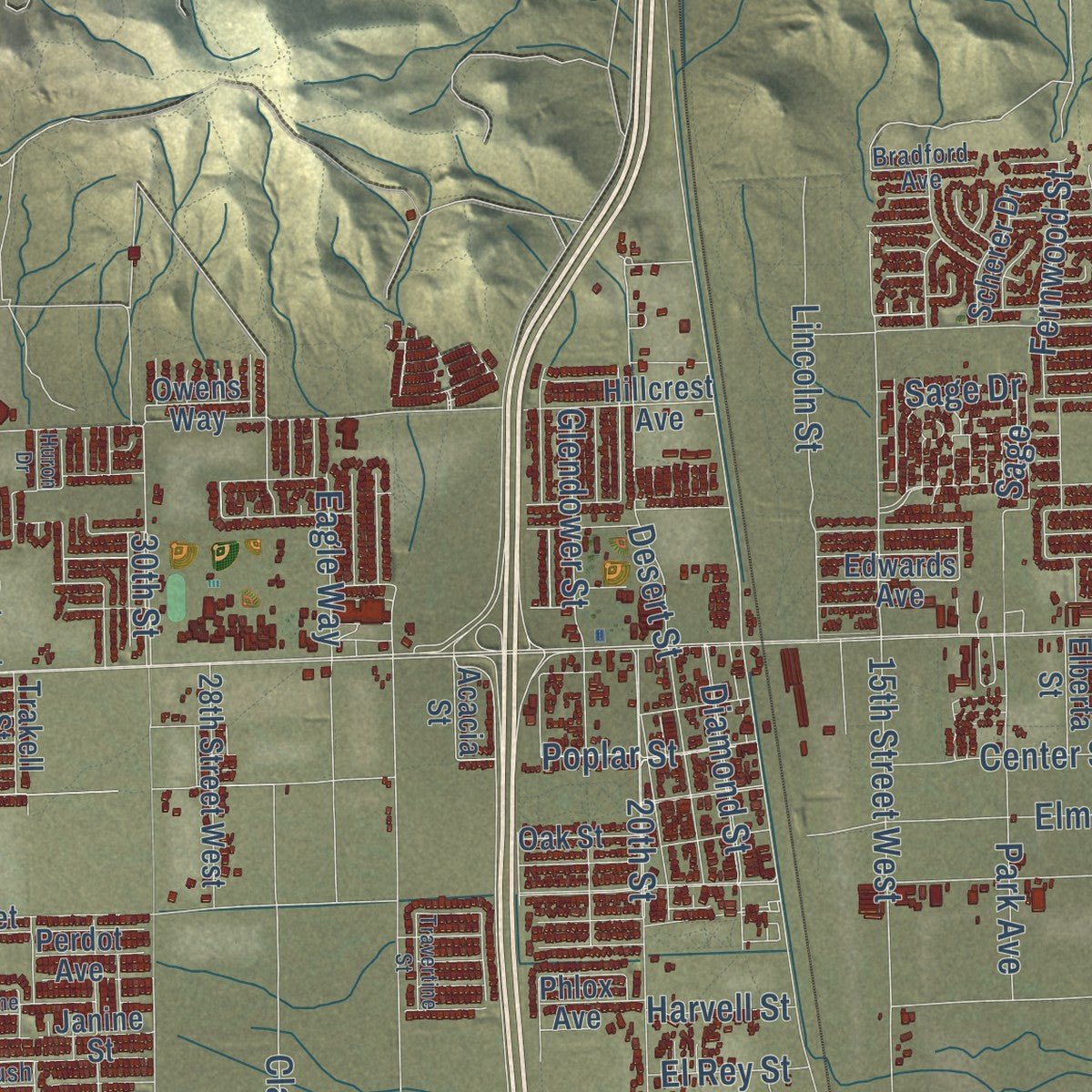
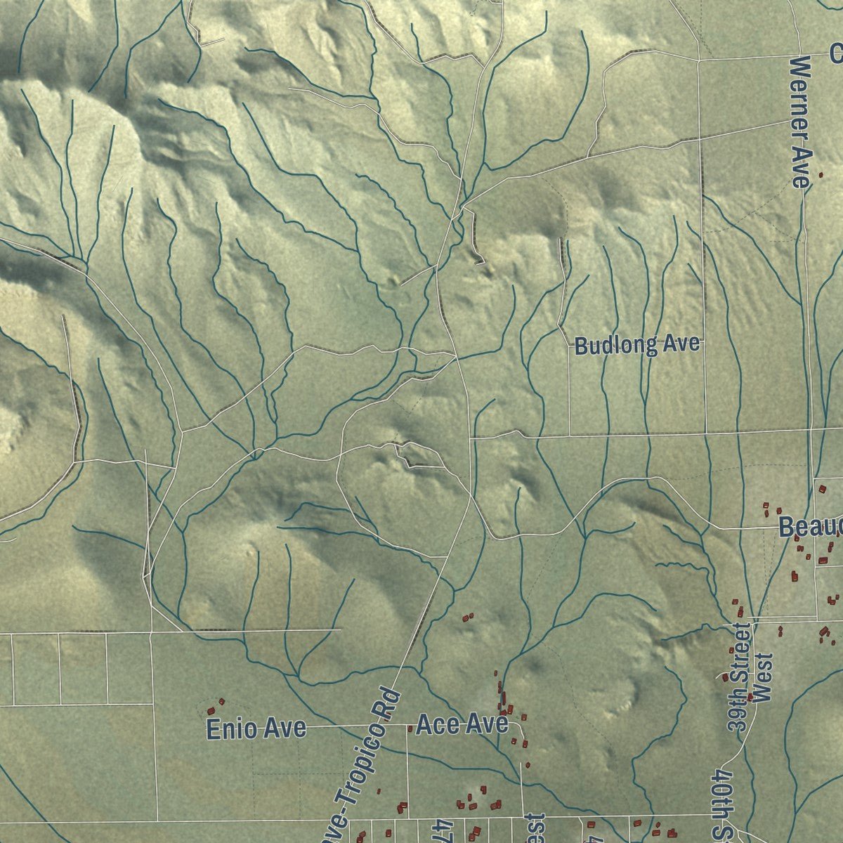
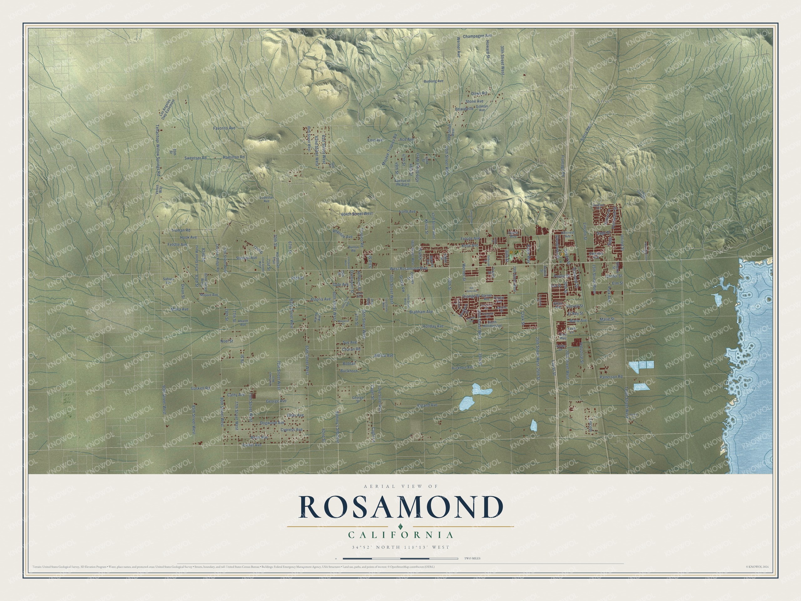
Explore Rosamond, California from a whole new perspective. Created using aerial imagery and detailed geographic data, this map captures Rosamond building by building, with labeled streets, familiar landmarks, and shaded topographical relief that highlights the natural contours of the landscape.
Combining modern data with the timeless character of a vintage atlas, this map is just as interesting up close as it is beautiful on the wall. Whether you grew up in Rosamond, spent memorable years there, or call it home today, this unique map is a great way to celebrate a place that means something to you. Zoom in on the preview to look for your street, and then order a print to put your memories on the wall.
Three ways to hang it
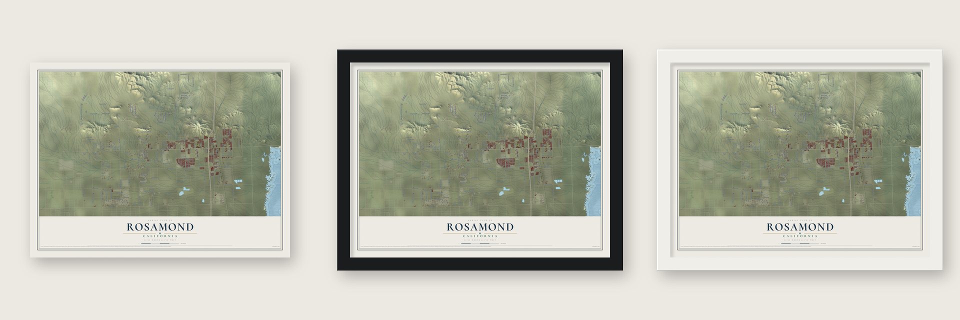
Unframed archival matte, a black wood frame or a white wood frame.
Up close
Geography Worth Displaying
This map was created using accurate cartographic data and authoritative geographic sources, including the U.S. Geological Survey and the Census Bureau. The map brings together terrain, waterways, roads, and building detail. The majority of the streets are labeled, houses are accurately depicted, and the topography is derived from government sources. Combining local data with carefully composed color and shading leads to this beautifully detailed Rosamond artwork for your wall.
Rather than simply showing street outlines, we’ve included as many of the street names as we could reasonably fit on the map while keeping their names legible. Zoom in on the high resolution preview to see exactly what’s on the map. We truly set out to create a statement piece for anyone who loves Rosamond. So whether it’s for you, or a gift for someone you love, we hope this map of Rosamond brings back fond memories.
Read the story behind this map of Rosamond, California from 2026.

About Rosamond, California
Rosamond is a community of 20,961 people in Kern County, at the north end of the Antelope Valley near the Los Angeles County line. The town began in 1877 on land owned by the Southern Pacific Railroad, and its first settlers made a living from cattle and mining. Rosamond got its first post office in 1885, but it shut down in 1887 and reopened in 1888.
Gold turned up in the area in the 1890s, and miners and prospectors soon rushed in. That boom faded and mining slowly declined, though a smaller second boom came in the 1930s. In 1933 the Army opened Muroc Army Air Field about 20 miles from town. The field later took the name Edwards Air Force Base, honoring the test pilot Glenn Edwards, and many Rosamond residents work there today.
“Rosamond was named for a daughter of one of the Southern Pacific railroad officials.”
- 33,301 miles in 33 daysFord wanted proof that its new V-8 engine would hold up, so in July 1932 a team led by the racing driver Eddie Pullen took a Ford V-8, model 18, out to a rough 82-mile desert course near Rosamond. Over 33 days the team covered 33,301 miles, averaging 42 miles per hour in heat that climbed as high as 114 degrees.
- Water at Willow SpringsFor generations, stagecoach passengers stopped for water at Willow Springs, west of Rosamond. The springs have since dried up. Today the nearby Willow Springs Raceway holds motor races that draw fans from all over Southern California.
- A poet and an actorRosamond counts the poet and writer Kay Ryan and the actor John Quade among its notable people.
Find your street
Names on the Rosamond map
Every name below is printed on this map. Look for your street, your school, the park where you played, or the pond down the road.
Places and landmarks1
- Ansel
Streets and roads191
- 70th Street
- Felsite Avenue
- Tenth Street West
- 77th Street
- 60th Street West
- Parker Avenue
- Marie Street
- Favorito Avenue
- 80th Street West
- 30th Street West
- 65th Street West
- 45th Street
- 65th Street
- 25th Street
- West Rosamond Boulevard
- Sierra Highway
- 40th Street West
- Sammy's Shortcut
- Gobi Avenue
- Knox Avenue
- 67th Street West
- 25th Street West
- 15th Street West
- Cagel Street
- 62nd Street
- Holiday Avenue
- 90th Street West
- Dawn Road
- Sweetser Road
- Gaskell Road
Show all 191 streets
- Astoria Avenue
- 85th Street West
- 20th Street West
- Elder Avenue
- 70th Street West
- Willow Avenue
- 50th Street West
- Beaudette
- Mojave-Tropico Road
- Frontage Road
- Orange Street
- 35th Street West
- Laurel Street
- 75th Street West
- 55th Street West
- Champagne Avenue
- Irone Avenue
- Tehachapi Willow Springs Road
- Truman Road
- Hook Avenue
- Stetson Avenue
- 40th Street
- 62nd Street West
- Roland Avenue
- 45th Street West
- Brabham Avenue
- Cypress Avenue
- Poplar Street
- George Avenue
- Howard Street
- United Street
- Patterson Road
- Werner Avenue
- Dogwood Avenue
- Hamilton Road
- Charan Road
- Birch Avenue
- Werner Street
- Industrial Street
- 77th Street West
- Park Avenue
- Cagle Lane
- Clark Street
- Diamond Street
- 61st Street West
- Tropico Road
- Sue Avenue
- 35th Street
- Center Street
- Felstte Avenue
- Elm Street
- Lincoln Street
- Eagle Way
- 67th Street
- Desert Street
- 604th Street West
- 20th Street
- Ace Avenue
- 76 Street
- Dixon Street
- Matra Avenue
- Stone Avenue
- 46th Street
- 47th Street
- 82nd Street
- 57th Street
- Cathy Avenue
- 49th Street
- Jefferies Street
- Rhyolite Avenue
- Lincoln
- Krista Street
- 78th Street
- Glendower Street
- Fernwood Street
- Green Vw
- Enio Avenue
- Davenport Street
- Buckhorn
- Sage Drive
- 71st Street
- 83rd Street
- Marie Avenue
- Bobtail
- El Rey Street
- Harvell Street
- 30th Street
- 53rd Street
- Noel Street
- Sage
- Ashe Avenue
- 39th Street West
- 72nd Street
- 78th Street West
- Edwards Avenue
- Los Angeles Dwp Easement
- Gillman Avenue
- 52nd Street West
- Mojave Avenue
- Avenue of the Stars
- 83rd Street West
- 46th Street West
- Westpark Drive
- Checker Ridge Road
- 42nd Street West
- 64th Street West
- South Holliday Avenue
- Abarth Avenue
- 28th Street West
- Elberta Street
- Buckhorn Avenue
- Hillcrest Avenue
- 82nd Street West
- Budlong Avenue
- Sonja Drive
- Garnet Avenue
- Scherer Drive
- Horsethief Trail
- Harris Avenue
- Lodestar Avenue
- Oak Street
- George Street
- Trakell Street
- Burton Road
- Owens Way
- Sedona Avenue
- Venus Way
- Janine Street
- Cara Way
- Sahara Avenue
- Perdot Avenue
- Acacia Street
- Sabre Street
- Phlox Avenue
- Charles Street
- 42nd Street
- 85th Street
- Keith Lane
- 59th Street
- 47th Street West
- 60th Street
- Stevenson Street
- 72nd Street West
- Appleblossom Street
- 71st Street West
- Firebush Avenue
- 51st Street West
- Bradford Avenue
- Deborah Street
- Lode Starr Road
- 57th Street West
- 58th Street West
- Imperial Avenue
- Margarita Lane
- Greenhill Street
- Half Dome Avenue
- Travertine Street
- Gemstone Avenue
- Cyprus Lane
- Leslie Avenue
- Huron Drive
Names are listed as they appear on the printed map. Zoom into the product photos to find them.
The art of mapping a place
How This Map Was Made
Real places. Remarkable detail. Discover the layers that turn geographic data into a map of home.

The view from above
Aerial imagery reveals the character of the land: woodland, open fields, and the patterns of a place.

The shape of the land
Elevation data brings hills, valleys, and subtle changes in the landscape into view.

The details of home
Roads, waterways, and building footprints come together to make the map feel unmistakably local.

Geography becomes art
Considered color, shading, and typography bring the layers together in a map made for your wall.


Process illustrated with Mendon, Massachusetts. Aerial imagery: USDA NAIP. Terrain: USGS 3D Elevation Program. Map details and finished artwork: KNOWOL.
The Details
About This Print
Choose an archival matte print, or a black or white Ayous wood frame. The archival matte print is unframed.
Select your size and finish above to see the matching product image and price.
Materials & Craftsmanship
A contemporary map with the character of a classic atlas, printed on archival matte paper. Optional frames are made from Ayous wood.
Your printed map does not include the watermark shown in the full-map preview.
Shipping & Delivery
Free shipping within the United States. Every print is made to order in the USA.
Buying a gift? Add a note in your cart and we'll include it. We never put prices in the package.
Prints ship within 2 to 3 business days. Allow 7 to 10 days total from ordering for delivery. Timing may vary during holidays or periods of high order volume.
Read our shipping policy.
Returns and damaged prints
Each print is made to order. Change-of-mind refunds are not available after production.
If your print arrives damaged, misprinted or incorrect, contact support@knowol.com within 30 days of receiving it. Include your order number, photos and a description of the issue.
Read our full refund and replacement policy. For questions about your order, email support@knowol.com.
Find your town
Looking for another city?
Find a map of home in our California collection, or any town in the country.
Nearby
Maps of towns near Rosamond
Know someone from one of these towns? Their map makes a great gift.
 Mojave
, California
From $39.99See the map
 Lancaster
, California
From $39.99See the map
 Del Sur
, California
From $39.99See the map
More maps nearby: Quartz Hill, Edwards AFB, Elizabeth Lake, Leona Valley and Lake Hughes.