
Search for another town





Free U.S. delivery 7 to 10 days after you order
Ross, Allegheny County, Pennsylvania Map Art
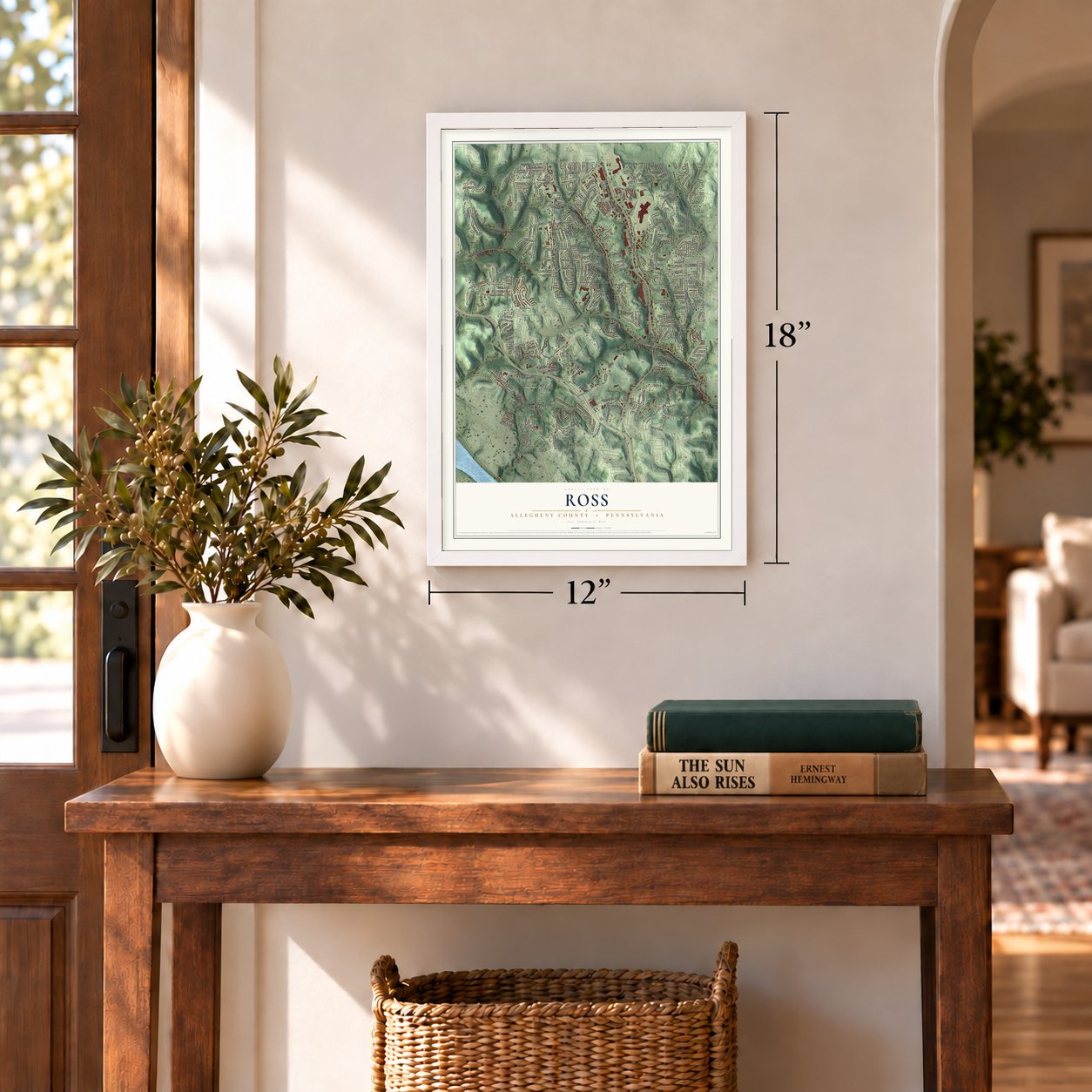
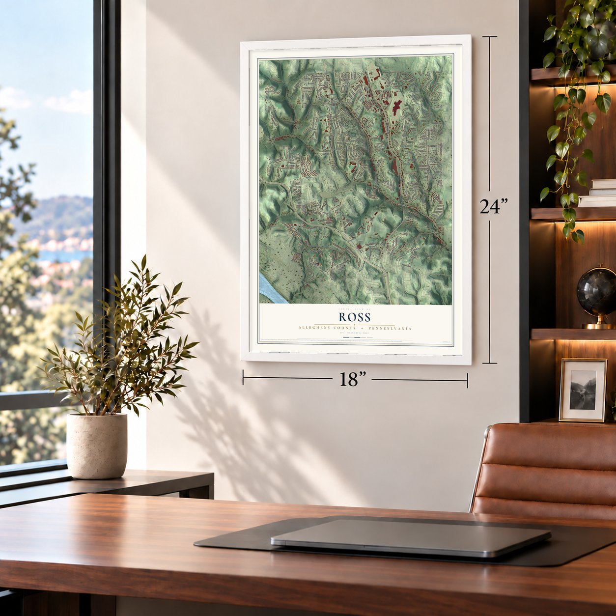
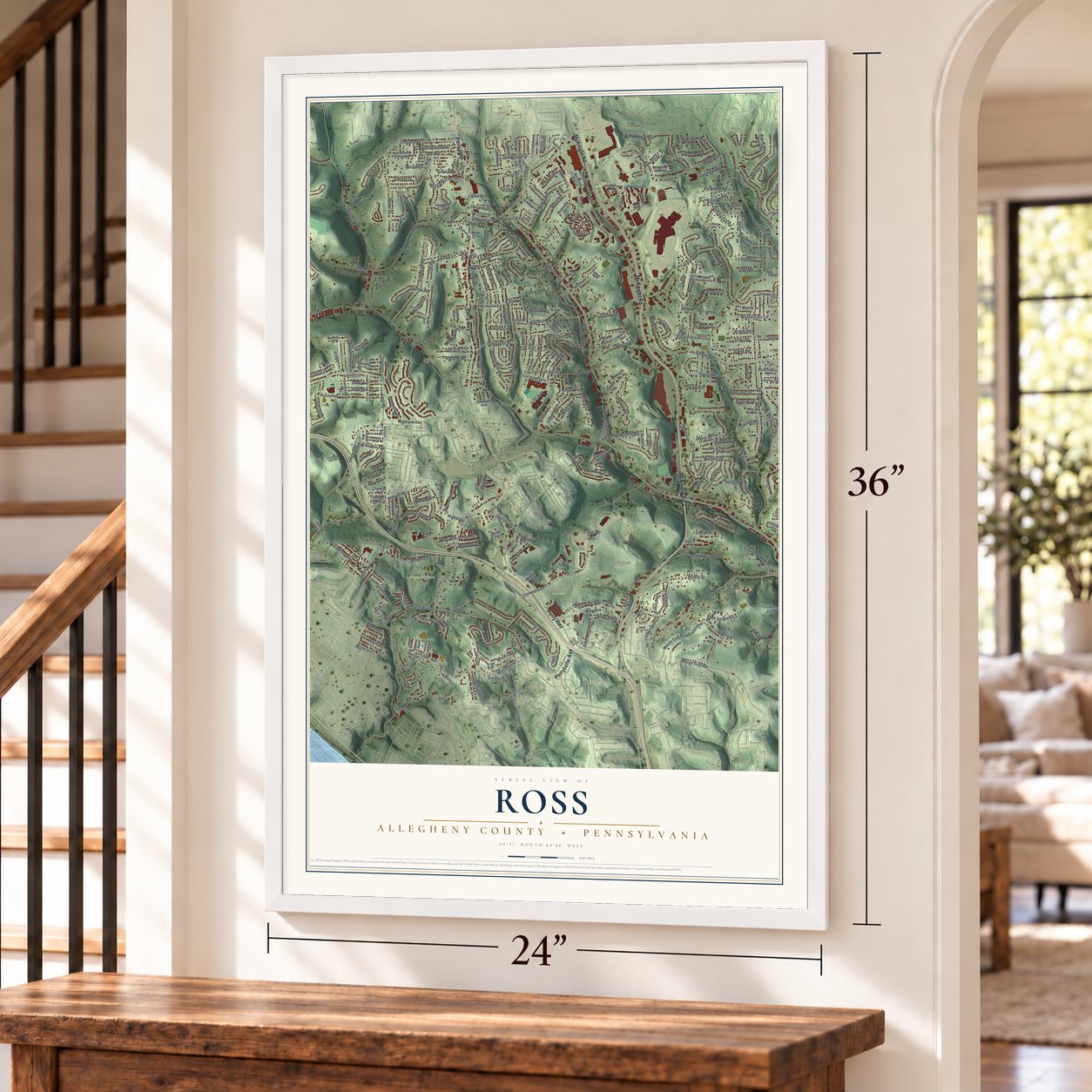
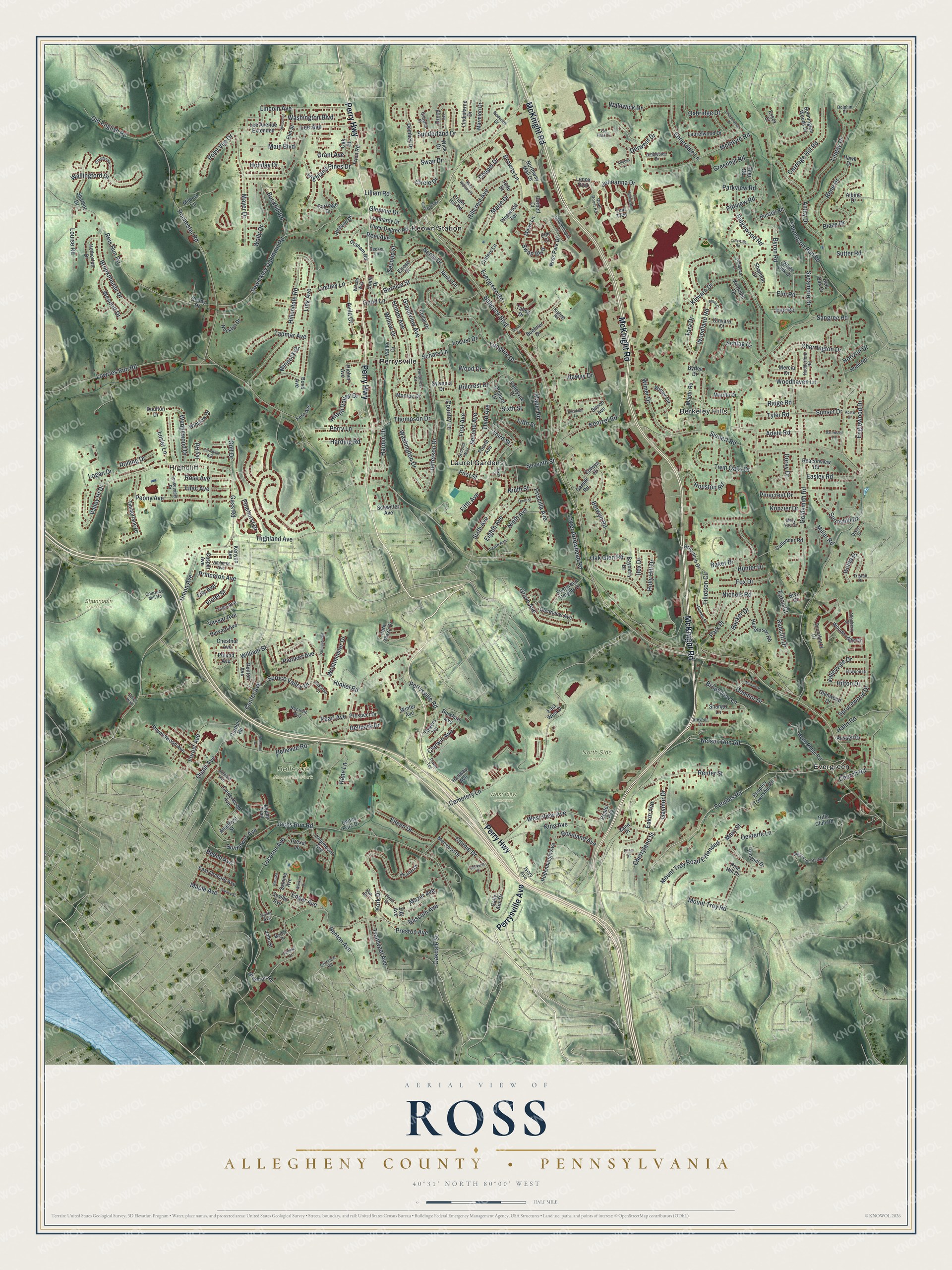
A new map of Ross, Allegheny County, Pennsylvania, made in 2026 and printed to order on thick archival matte paper.
12" x 18" Archival Matte Print
A Map of Home. A Work of Art.
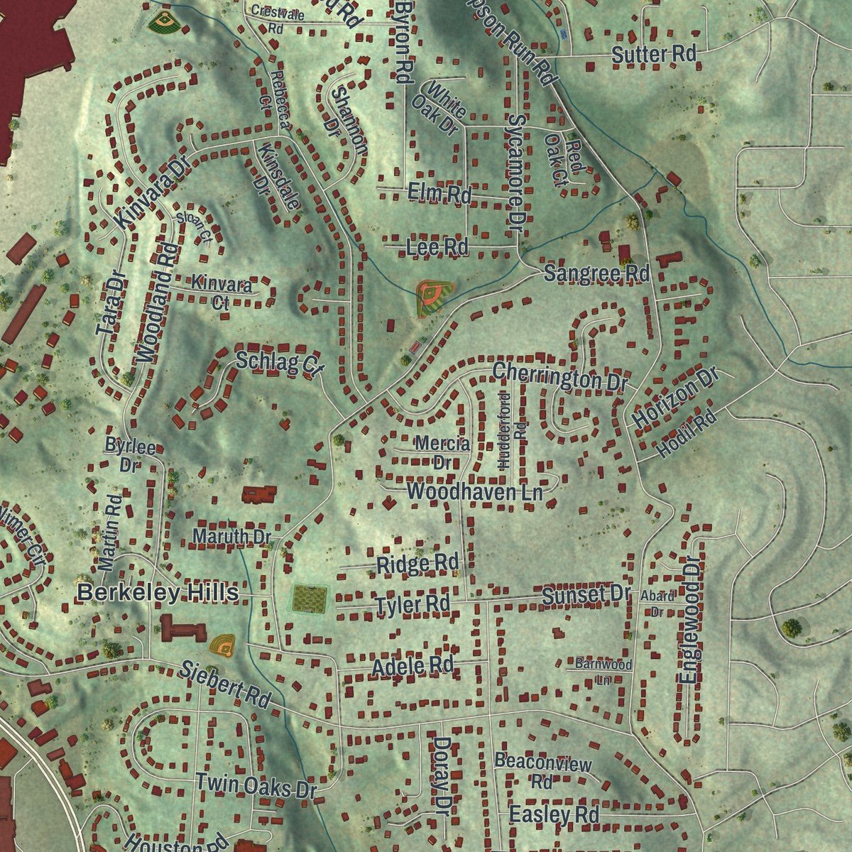
Explore Ross, Pennsylvania from a whole new perspective. Created using aerial imagery and detailed geographic data, this map captures Ross building by building, with labeled streets, familiar landmarks, and shaded topographical relief that highlights the natural contours of the landscape.
Combining modern data with the timeless character of a vintage atlas, this map is just as interesting up close as it is beautiful on the wall. Whether you grew up in Ross, spent memorable years there, or call it home today, this unique map is a great way to celebrate a place that means something to you. Zoom in on the preview to look for your street, and then order a print to put your memories on the wall.
Three ways to hang it
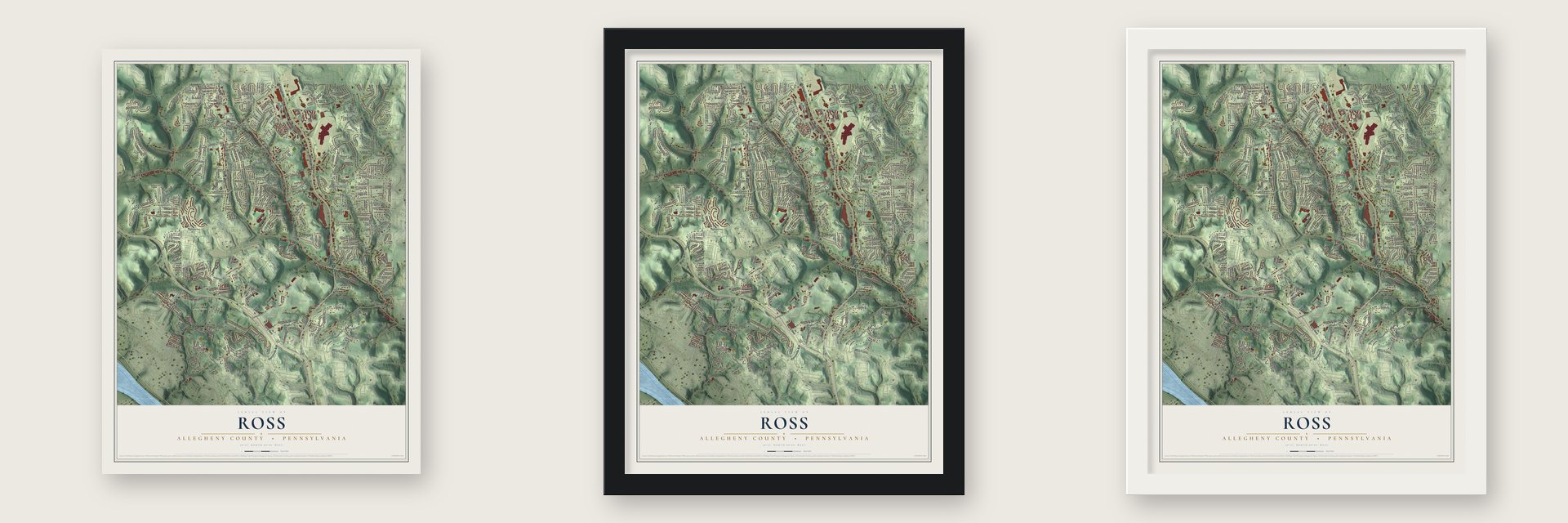
Unframed archival matte, a black wood frame or a white wood frame.
Up close
Geography Worth Displaying
This map was created using accurate cartographic data and authoritative geographic sources, including the U.S. Geological Survey and the Census Bureau. The map brings together terrain, waterways, roads, and building detail. The majority of the streets are labeled, houses are accurately depicted, and the topography is derived from government sources. Combining local data with carefully composed color and shading leads to this beautifully detailed Ross artwork for your wall.
Rather than simply showing street outlines, we’ve included as many of the street names as we could reasonably fit on the map while keeping their names legible. Zoom in on the high resolution preview to see exactly what’s on the map. We truly set out to create a statement piece for anyone who loves Ross. So whether it’s for you, or a gift for someone you love, we hope this map of Ross brings back fond memories.
Read the story behind this map of Ross, Allegheny County, Pennsylvania from 2026.

About Ross, Allegheny County, Pennsylvania
From the Early History of the Fifteenth Ward: "The name of the Hon. James Ross is commemorated in the name of Ross Street, Pittsburgh; Ross Township, Allegheny County, Pa.; and Ross County, Ohio."
Find your street
Names on the Ross map
Every name below is printed on this map. Look for your street, your school, the park where you played, or the pond down the road.
Places and landmarks10
- Highcliff
- Bellevue Memorial Park
- North Side Cemetery
- Shannopin Country Club
- West View Cemetery
- Berkeley Hills
- Evergreen
- Keown Station
- Laurel Gardens
- Perrysville
Streets and roads392
- Perry Highway
- Perrysville Avenue
- McKnight Road
- Babcock Boulevard
- Evergreen Road
- Peoples Road
- Oakdale Street
- Center Avenue
- Union Avenue
- Sunnyhill Drive
- Ennerdale Lane
- Clarwin Avenue
- Thompson Run Road
- Rochester Road
- Jacks Run Road
- Gass Road
- Siebert Road
- Cemetery Lane
- McIntyre Road
- Bellevue Road
- Nelson Run Road
- Goldsmith Road
- Bascom Avenue
- Lowries Run Road
- William Street
- Sangree Road
- Sewickley Oakmont Road
- Reis Run Road
- Woodland Road
- Sixth Avenue
Show all 392 streets
- Byron Road
- Mount Troy Road Extended
- Park Place
- Link Avenue
- West View Avenue
- Brookview Lane
- York Drive
- Longvue Drive
- Hillendale Road
- Kinvara Drive
- Buckhill Road
- Connie Drive
- Washington Drive
- Lucerne Avenue
- Jefferson Drive
- Valley Hi Drive
- Highland Pines Drive
- Fifth Avenue
- Browns Lane
- Harden Drive
- Holly Hill Drive
- Mayer Drive
- Amity Drive
- Wedgewood Drive
- Bernice Street
- Brookmeade Drive
- Baker Drive
- Grandview Avenue
- Kentzel Road
- Lingay Drive
- Maple Road
- Mount Troy Road
- Wood Drive
- Highland Avenue
- Peony Avenue
- Johnanna Drive
- Perrysville Road
- Lincoln Avenue
- Eighth Avenue
- Sunderland Drive
- Blaze Drive
- Nichols Road
- Hillcrest Drive
- Renfer Street
- Forest Avenue
- Grove Avenue
- Pinecrest Drive
- Berwyn Road
- Greenhill Road
- Schars Lane
- Willow Drive
- Washington Boulevard
- Cherrington Drive
- Ridgewood Road
- Carriage Hill Road
- Old English Road
- Spruce Valley Drive
- Reel Avenue
- Rene Drive
- Tillotson Circle
- Wallingford Drive
- Lillian Road
- Houston Road
- First Street
- Sycamore Drive
- Lindley Lane
- Sprucewood Drive
- Hillcrest Avenue
- Idaway Drive
- Chapel Drive
- Fox Drive
- Second Avenue
- Swan Drive
- King Avenue
- Main Boulevard
- Eileen Drive
- Oak Glen Road
- Wimer Drive
- Priscilla Avenue
- Thompson Drive
- Second Street
- Louise Road
- Tadmar Avenue
- Homer Avenue
- Donmor Drive
- Marie Drive
- Lower Arrowhead Road
- Lee Avenue
- Woodhaven Lane
- Neola Drive
- Isolda Drive
- Twin Oaks Drive
- Third Street
- Hinkel Road
- Radcliff Drive
- First Avenue
- Easley Road
- Country Lane
- Circle Drive
- Perry Lane
- Point Vue Drive
- Enger Avenue
- Tara Drive
- Wescott Drive
- Sutter Road
- Lilac Avenue
- Sunflower Avenue
- Hahn Road
- Gaymor Drive
- Englewood Drive
- Cherryland Street
- Oesterle Lane
- Kane Lane
- Holiday Drive
- Hiland Valley Drive
- Sunset Drive
- Seventh Street
- Valleyvale Drive
- Hunter Drive
- Transvaal Avenue
- Roseland Avenue
- Harding Road
- Benton Avenue
- Rose Avenue
- Good Lane
- Church Road
- Oxbridge Drive
- Swan Boulevard
- Westminster Drive
- Pioneer Avenue
- Ninth Avenue
- Preston Avenue
- Adele Road
- Waldwick Drive
- Third Avenue
- Hilton Drive
- Locust Drive
- Violet Street
- Pittview Road
- Pinehurst Drive
- Princeton Avenue
- Fifth Street
- Eakin Avenue
- Miller Road
- Elm Road
- Avila Court
- Mazer Avenue
- Parkview Road
- Rolling Drive
- Quaill Avenue
- Minnock Drive
- Lee Road
- Tyler Road
- Lorlei Lane
- Maple Avenue
- Grant Avenue
- Ilex Drive
- Ridge Road
- Vassar Avenue
- Golf Drive
- Doray Drive
- Bellpark Drive
- Logan Drive
- Konzier Drive
- Schlag Court
- Glenvue Drive
- Horizon Drive
- Lily Avenue
- Derwent Drive
- Beech Avenue
- Pearl Avenue
- Becker Drive
- Ninth Street
- Sixth Street
- Ivy Road
- Eaton Court
- Wally Drive
- Mary Street
- Ivory Avenue
- Burkhart Avenue
- Peoples Township Road
- Buehner Drive
- Bennington Woods Drive
- Woodbridge Drive
- Dombey Drive
- Clearview Avenue
- Talley Drive
- Kenyon Avenue
- Northway Mall Drive
- Teal Trce
- Timberlane Drive
- Rock Ridge Road
- Rifle Club Road
- Lenox Oval
- Ravenswood Avenue
- Carriage Drive
- White Oak Drive
- Drood Lane
- Nocklyn Drive
- Thornberry Drive
- Neola Circle
- Valley Drive
- Laurelwood Drive
- Henderson Road
- Three Degree Road
- Sharbot Drive
- Sylvania Drive
- Ross Park Drive
- Graham Road
- Wimer Circle
- Crider Hill Road
- Evergreen Heights Drive
- Longmount Avenue
- Cedar Drive
- Milbert Lane
- Fourth Avenue
- Calderwood Avenue
- Pinehill Drive
- Park Plaza Drive
- Shannon Drive
- Rodenbaugh Avenue
- Merwood Drive
- Criders Lane
- Lee Avenue Extended
- Elrose Drive
- Richard Drive
- Oak Street
- East Orchard Avenue
- Elm Street
- Shangri Lane
- Hetherton Drive
- Trion Road
- Corbett Court
- Seville Avenue
- Valleyvue Drive
- Cardiff Road
- Simon Avenue
- Sunny Drive
- Braunlich Drive
- Aspen Trail
- Winter Avenue
- John Street
- Glenwood Drive
- Harvard Avenue
- Denny Park Drive
- Lindisfarne Drive
- Martin Road
- Elm Court
- Beaconview Road
- Winslow Drive
- Monroe Drive
- Callender Road
- Lombardy Drive
- Renton Avenue
- Russell Drive
- Marmion Drive
- East West Drive
- Schwitter Avenue
- Kinvara Court
- Wick Drive
- Russell Road
- Brighton Road
- Pinewood Terrace
- Zug Avenue
- Prospect Drive
- Hodil Road
- Salome Avenue
- Towers Terrace
- Hieber Avenue
- Maruth Drive
- Orchard Drive
- Drexel Lane
- Casper Avenue
- Chestnut Avenue
- Doulton Drive
- Amethyst Street
- Cornell Road
- Bayberry Drive
- Kinsdale Drive
- Mews Lane
- Yale Avenue
- Bepler Avenue
- Colwyn Drive
- Hawk Drive
- Mercia Drive
- Poland Avenue
- Bond Avenue
- Fern Avenue
- Red Oak Court
- Smith Drive
- Hanway Avenue
- Byrlee Drive
- Pine Hill Drive
- Jude Drive
- Bryn Court
- Deer Road
- Sally Ann Drive
- Albine Drive
- Essex Court
- Zane Place
- Courtney Mill Road
- Schuetzen Park Road
- Hilands Place
- Charlemagne Circle
- Nazareth Way
- Hudderford Road
- Roderick Drive
- Sunsetview Drive
- Gadshill Place
- Ellwood Drive
- Brunner Drive
- Heidcrest Drive
- Allenberry Drive
- Amherst Avenue
- Rossmor Court
- Ambard Avenue
- Oak Drive
- Penn Drive
- Quail Roost Road
- Ambleside Drive
- Tenth Avenue
- Sylvia Avenue
- Rebecca Court
- Tristan Drive
- Second Way
- Tower Terrace
- Cliffview Road
- Dixon Drive
- Mary Vue Drive
- Stevens Drive
- Dolphin Drive
- Kipling Road
- Decker Lane
- Mattys Drive
- Wilson Way
- Edies Way
- Cresthaven Lane
- Sixth Place
- Carnation Avenue
- Crestvale Road
- Elizabeth Lane
- Charterwood Drive
- Morelli Drive
- Cold Spring Drive
- Saint William Place
- Darlington Road
- Fox Hollow Drive
- Spruce Street
- Bellwood Drive
- Tenth Street
- Elmer Street
- Wanker Drive
- Varney Street
- Barnwood Lane
- Van Fleet Circle
- Short Street
- Sloan Court
- Mulkerin Drive
- Gamble Street
- Abard Drive
- Nina Road
- Kinross Lane
Names are listed as they appear on the printed map. Zoom into the product photos to find them.
The art of mapping a place
How This Map Was Made
Real places. Remarkable detail. Discover the layers that turn geographic data into a map of home.

The view from above
Aerial imagery reveals the character of the land: woodland, open fields, and the patterns of a place.

The shape of the land
Elevation data brings hills, valleys, and subtle changes in the landscape into view.

The details of home
Roads, waterways, and building footprints come together to make the map feel unmistakably local.

Geography becomes art
Considered color, shading, and typography bring the layers together in a map made for your wall.


Process illustrated with Mendon, Massachusetts. Aerial imagery: USDA NAIP. Terrain: USGS 3D Elevation Program. Map details and finished artwork: KNOWOL.
The Details
About This Print
Choose an archival matte print, or a black or white Ayous wood frame. The archival matte print is unframed.
Select your size and finish above to see the matching product image and price.
Materials & Craftsmanship
A contemporary map with the character of a classic atlas, printed on archival matte paper. Optional frames are made from Ayous wood.
Your printed map does not include the watermark shown in the full-map preview.
Shipping & Delivery
Free shipping within the United States. Every print is made to order in the USA.
Buying a gift? Add a note in your cart and we'll include it. We never put prices in the package.
Prints ship within 2 to 3 business days. Allow 7 to 10 days total from ordering for delivery. Timing may vary during holidays or periods of high order volume.
Read our shipping policy.
Returns and damaged prints
Each print is made to order. Change-of-mind refunds are not available after production.
If your print arrives damaged, misprinted or incorrect, contact support@knowol.com within 30 days of receiving it. Include your order number, photos and a description of the issue.
Read our full refund and replacement policy. For questions about your order, email support@knowol.com.
Find your town
Looking for another city?
Find a map of home in our Pennsylvania collection, or any town in the country.
Nearby
Maps of towns near Ross
Know someone from one of these towns? Their map makes a great gift.
 West View
, Pennsylvania
From $39.99See the map
 Summer Hill
, Pennsylvania
From $39.99See the map
 Ben Avon Heights
, Pennsylvania
From $39.99See the map
More maps nearby: Bellevue, Perry North, Glenshaw, Avalon and Brighton Heights.