
Search for another town





Free U.S. delivery 7 to 10 days after you order
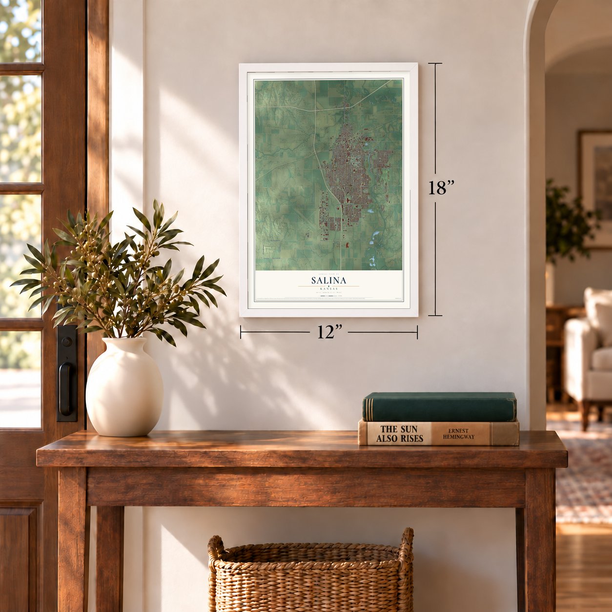
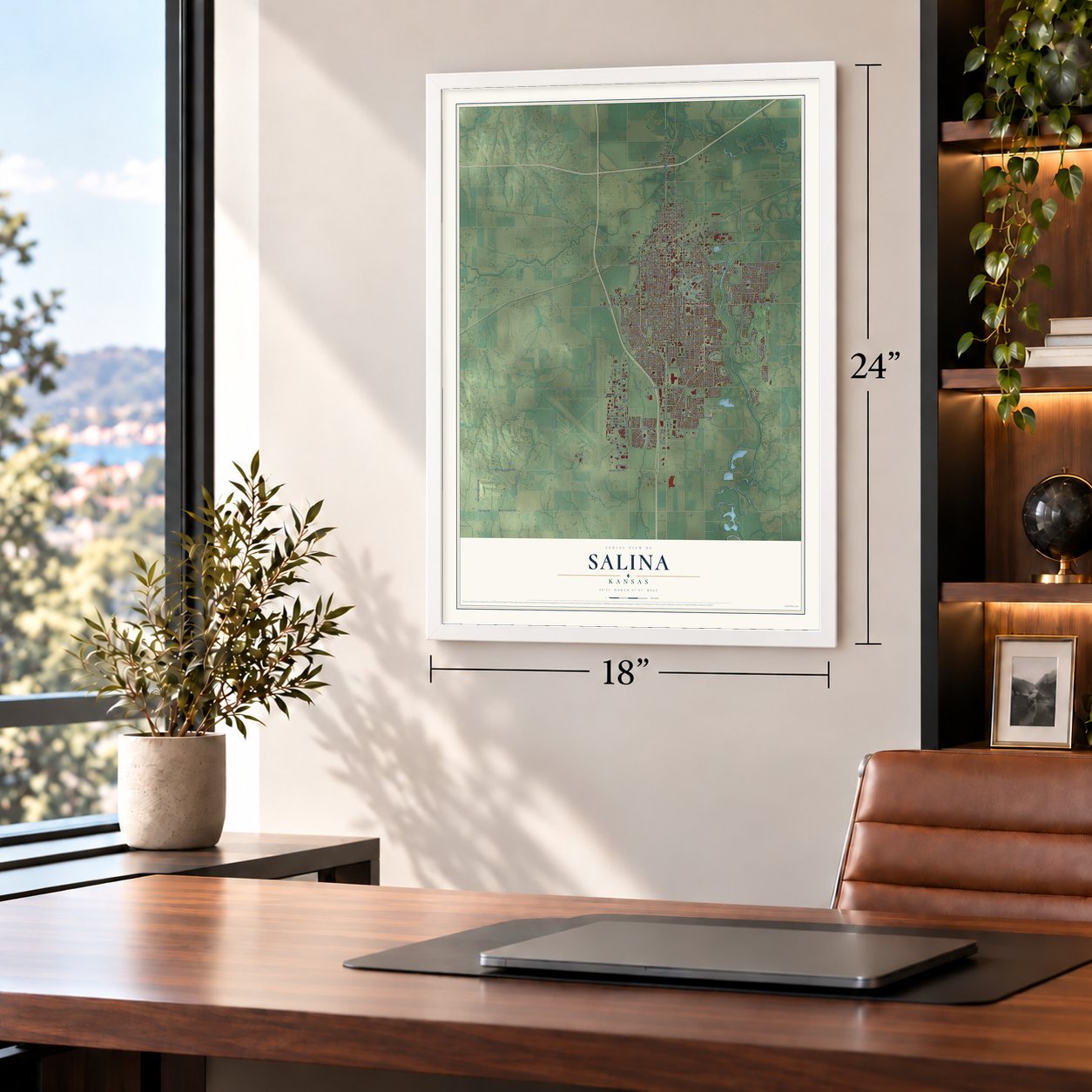
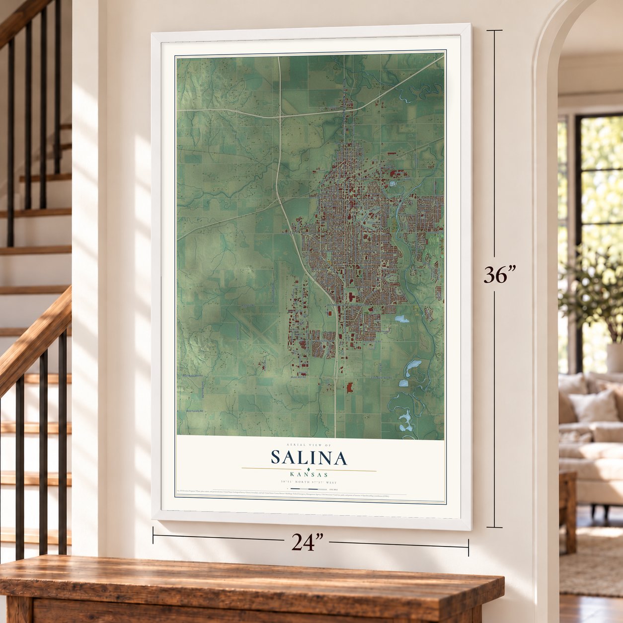
Salina, Kansas Map Art
Building by building, with labeled streets and shaded relief.
12" x 18" Archival Matte Print
A Map of Home. A Work of Art.
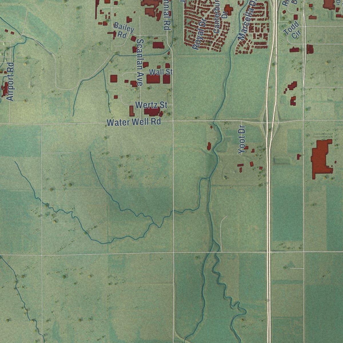
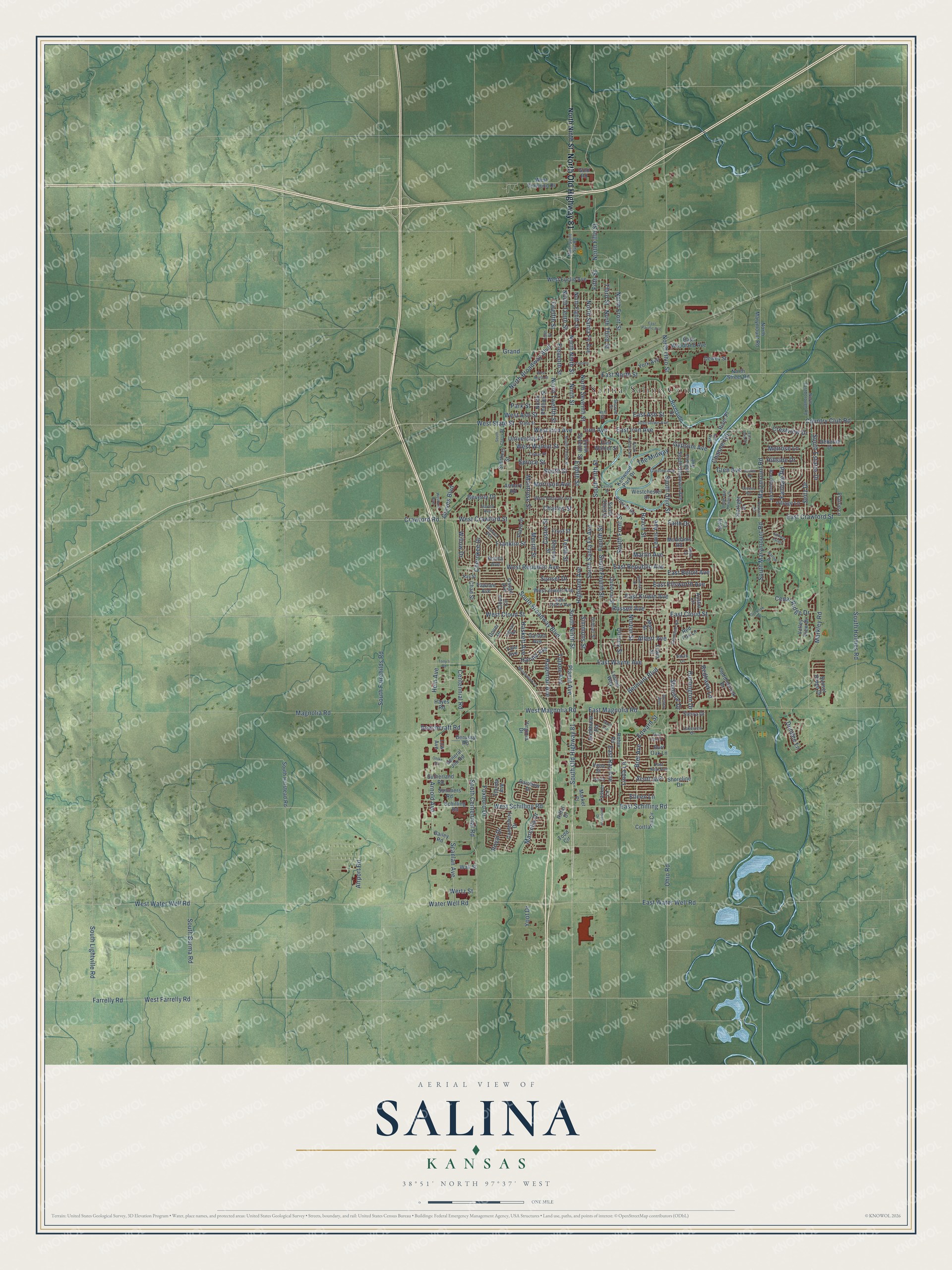
Explore Salina, Kansas from a whole new perspective. Created using aerial imagery and detailed geographic data, this map captures Salina building by building, with labeled streets, familiar landmarks, and shaded topographical relief that highlights the natural contours of the landscape.
Combining modern data with the timeless character of a vintage atlas, this map is just as interesting up close as it is beautiful on the wall. Whether you grew up in Salina, spent memorable years there, or call it home today, this unique map is a great way to celebrate a place that means something to you. Zoom in on the preview to look for your street, and then order a print to put your memories on the wall.
Three ways to hang it
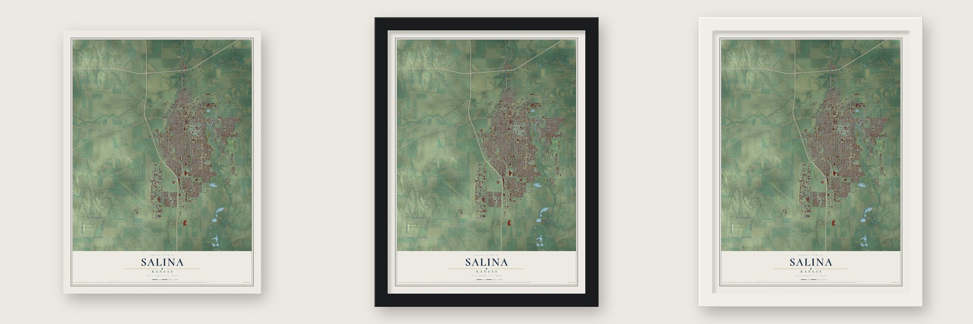
Unframed archival matte, a black wood frame or a white wood frame.
Up close
Geography Worth Displaying
This map was created using accurate cartographic data and authoritative geographic sources, including the U.S. Geological Survey and the Census Bureau. The map brings together terrain, waterways, roads, and building detail. The majority of the streets are labeled, houses are accurately depicted, and the topography is derived from government sources. Combining local data with carefully composed color and shading leads to this beautifully detailed Salina artwork for your wall.
Rather than simply showing street outlines, we’ve included as many of the street names as we could reasonably fit on the map while keeping their names legible. Zoom in on the high resolution preview to see exactly what’s on the map. We truly set out to create a statement piece for anyone who loves Salina. So whether it’s for you, or a gift for someone you love, we hope this map of Salina brings back fond memories.

Find your street
Names on the Salina map
Every name below is printed on this map. Look for your street, your school, the park where you played, or the pond down the road.
Streets and roads252
- North Old Highway 81
- Ninth Street
- South Old Highway 81
- South Ninth Street
- South Santa Fe Avenue
- East Iron Avenue
- West Walnut Street
- Crestview Drive
- West Iron Avenue
- North Ninth Street
- South Broadway Boulevard
- North Santa Fe Avenue
- Water Well Road
- Marymount Road
- Simmons Street
- South Marymount Road
- Scott Avenue
- South Front Street
- Cherokee Drive
- East Ray Avenue
- South Estates Drive
- West State Street
- East Cloud Street
- Foxboro Drive
- North Tenth Street
- West Farrelly Road
- Hageman Avenue
- Arnold Avenue
- South Ohio Street
- Fifth Street
Show all 252 streets
- South Centennial Road
- South Fourth Street
- Centennial Road
- Eleventh Street
- North Fifth Street
- Tenth Street
- East Crawford Street
- Highland Avenue
- East Magnolia Road
- Scanlan Avenue
- Twelfth Street
- North Ohio Street
- Roach Street
- Third Street
- West Crawford Street
- Lewis Avenue
- Markley Road
- Fourth Street
- West Schilling Road
- Eighth Street
- East North Street
- Belmont Boulevard
- South Holmes Road
- East Schilling Road
- Quincy Street
- South Fifth Street
- Magnolia Road
- North Third Street
- North Front Street
- Fairdale Road
- North Seventh Street
- East Republic Avenue
- North Broadway Boulevard
- West Republic Avenue
- Edward Street
- North Twelfth Street
- South Fairchilds Road
- Ohio Road
- West Cloud Street
- East Beloit Avenue
- East Wayne Avenue
- South Street
- East Ellsworth Avenue
- West Magnolia Road
- East Water Well Road
- Farrelly Road
- West Water Well Road
- Redhawk Lane
- South Lightville Road
- South Burma Road
- Country Club Road
- Gypsum Avenue
- Glen Avenue
- East Kirwin Avenue
- Planet Avenue
- Norton Street
- Grand
- Seitz Drive
- East Ash Street
- West Ash Street
- Franklin Street
- Albert Avenue
- Shalimar Drive
- Hein Avenue
- Cedar Ridge Drive
- Park Street
- Beverly Drive
- Tulane Avenue
- Faith Drive
- Martin Avenue
- Harold Avenue
- Bret Avenue
- Hillside Drive
- Haskett Avenue
- Linda Lane
- Marcella Drive
- Channel Road
- Russell Avenue
- Custer Street
- Merrill Street
- Montrose Street
- Huntington Drive
- Morrison Avenue
- Willow Drive
- Airport Road
- Charles Street
- Wertz Street
- University Place
- Melrose Lane
- Crawford Road
- Beechcraft Road
- Graves Boulevard
- Spruce Street
- Royal Drive
- Sunset Drive
- Dundee Lane
- The Midway
- Eileen Lane
- Yoot Drive
- Iron Avenue
- East Walnut Street
- Kenwood Park Drive
- Rainbow Drive
- West Diamond Drive
- Dewey Street
- Schilling Road
- North Eighth Street
- South Halstead Road
- Red Fox Lane
- Osage Avenue
- South Third Street
- South Delaware Avenue
- Riverside Drive
- McAdams Road
- Market Place
- Yale Avenue
- West Jewell Avenue
- Cortland Circle
- General Jim Road
- Leland Way
- Virginia Drive
- Indiana Avenue
- North Marymount Road
- Robin Road
- Dover Drive
- Westchester Drive
- Canterbury Drive
- Lewis Street
- Sherman Street
- West Euclid Avenue
- Osborne Street
- Austin Circle
- Plaza Drive
- South Seventh Street
- York Avenue
- Summers Road
- Shoreline Drive
- Village Lane
- Bailey Road
- Sutherland Road
- Starlight Drive
- Marc Street
- North Phillips Street
- East Woodland Avenue
- Wall Street
- Florida Avenue
- Todd Circle
- Rockhurst Road
- Valley View Drive
- Saddlebrook Drive
- Pawnee Avenue
- Garden Avenue
- Cloud Circle
- Sierra Drive
- Riffel Drive
- Deborah Drive
- Tasker Lane
- Derussy Road
- North Street Road
- Armory Road
- Prairie Lane
- Gold Road
- Chad Street
- Smithers Street
- Sunset Ridge Drive
- Irene Street
- Frost Street
- River Place
- Burr Oak Lane
- Low Avenue
- Ponca Avenue
- Holly Lane
- Hayes Road
- Prescott Road
- West Prescott Avenue
- State Street
- Lakeview Drive
- Second Street
- South Tenth Street
- East Neal Avenue
- 13th Street
- Johnstown Avenue
- Glendale Road
- North Eastborough Road
- Seneca Avenue
- West Claflin Avenue
- Greeley Avenue
- Beechwood Road
- Ninth Saint Svc Road
- Gebhart Street
- Cedar Street
- Ingman Road
- Iowa Avenue
- Haven Avenue
- Kay Street
- Aurora Avenue
- Sarah Lane
- Ash Street
- Fairway Estate
- Upper Mill Heights Drive
- South Oakdale Avenue
- East Pacific Avenue
- West North Street
- Sunrise Drive
- Lincoln
- Overlook Drive
- Queens Road
- Meadowlark Lane
- Westport Boulevard
- Gail Drive
- Meyer Drive
- Barlow Drive
- Tony's Road
- South Cherry Street
- Center Street
- Briarcliff Road
- Ruskin Road
- Ohlke Road
- Enterprise Drive
- Reed Avenue
- East Lake Drive
- Twin Oaks Drive
Names are listed as they appear on the printed map. Zoom into the product photos to find them.
About Salina, Kansas
Salina is a city of 46,889 people and the county seat of Saline County, on the Smoky Hill River. In April 1858, William A. Phillips, a lawyer and journalist from Lawrence, came here with David Phillips, Alexander M. Campbell Sr., A.C. Spillman and James Muir. The men lived in a dugout on the west bank while they planned their first building, a two-story home and store for Campbell. Raids were a constant danger, so they kept their wagons in a circle around the town well. They named the town for the salty Saline River.
That same month the founders chartered the Salina Town Company with the territorial legislature. The next year they organized Saline County around it. As the farthest town west on the Smoky Hill Trail, Salina traded with emigrants, Pikes Peak gold seekers and local tribes. The Civil War stalled that growth when many men left for the Union Army. The veterans came home, the railroad reached Salina in 1867, and the town became a city in 1870.
“The first attempt at anything like manufacturing in the county was a saw-mill erected at Salina on the Smoky, by W. A. Phillips, which was kept pretty busy for some time sawing the native timber into lumber for building purposes.”
- The Battle of Indian RockIn 1857 a Cheyenne leader called Big Chief attacked a hunting party from the eastern tribes without warning at Spring Creek, 20 miles west of the future town. The hunters retreated to a butte where the Smoky Hill River curves, and Kaw reinforcements with rifles joined them there. Firing from behind sandstone boulders, they killed Big Chief on the first of five charges. The raids near Salina ended, and settlers could return.
- A stockade turned schoolResidents built the Salina Stockade in May and June 1864 to guard the town against raids, and Union troops stayed there until March 1865. The building inside was remodeled, and in September 1864 it opened as Salina's first public school, with a term that ran until March 1865.
- Cattle, wheat and Lee jeansThe cattle trade made Salina a rowdy cowtown in 1872, but it moved west two years later. Wheat took its place, and steam flour mills went up. In 1874 E. R. Switzer of Salina brought alfalfa to local farmers, and the crop spread across Kansas. In 1889 the jeans maker Lee opened its first garment factory here.
- Schilling Air Force BaseThe Army opened Smoky Hill Army Airfield southwest of the city in 1943 for World War II bombers. It reopened in 1951 as Schilling Air Force Base, and Salina's population grew by nearly two-thirds in the 1950s. When the base closed in 1965, the city reused the grounds for an industrial park and Salina Municipal Airport, and firms such as Beechcraft moved in.
Keep exploring Kansas
Salina is one of 764 Kansas towns we've mapped. Every dot on the map is a print of its own.
The search covers every state, Kansas first.
Near Salina
Order 2 or more town maps and save 10%. Shown in the size and finish you picked above, so they hang as a set.
- Mentor 12" x 18" / Archival Matte Print $39.99
- Smolan 12" x 18" / Archival Matte Print $39.99
- New Cambria 12" x 18" / Archival Matte Print $39.99

The art of mapping a place
How This Map Was Made
Real places. Remarkable detail. Discover the layers that turn geographic data into a map of home.

The view from above
Aerial imagery reveals the character of the land: woodland, open fields, and the patterns of a place.

The shape of the land
Elevation data brings hills, valleys, and subtle changes in the landscape into view.

The details of home
Roads, waterways, and building footprints come together to make the map feel unmistakably local.

Geography becomes art
Considered color, shading, and typography bring the layers together in a map made for your wall.


Process illustrated with Mendon, Massachusetts. Aerial imagery: USDA NAIP. Terrain: USGS 3D Elevation Program. Map details and finished artwork: KNOWOL.
The Details
About This Print
Choose an archival matte print, or a black or white Ayous wood frame. The archival matte print is unframed.
Select your size and finish above to see the matching product image and price.
Materials & Craftsmanship
A contemporary map with the character of a classic atlas, printed on archival matte paper. Optional frames are made from Ayous wood.
Your printed map does not include the watermark shown in the full-map preview.
Shipping & Delivery
Free shipping within the United States. Every print is made to order in the USA.
Buying a gift? Add a note in your cart and we'll include it. We never put prices in the package.
Prints ship within 2 to 3 business days. Allow 7 to 10 days total from ordering for delivery. Timing may vary during holidays or periods of high order volume.
Read our shipping policy.
Returns and damaged prints
Each print is made to order. Change-of-mind refunds are not available after production.
If your print arrives damaged, misprinted or incorrect, contact support@knowol.com within 30 days of receiving it. Include your order number, photos and a description of the issue.
Read our full refund and replacement policy. For questions about your order, email support@knowol.com.