
Search for another town

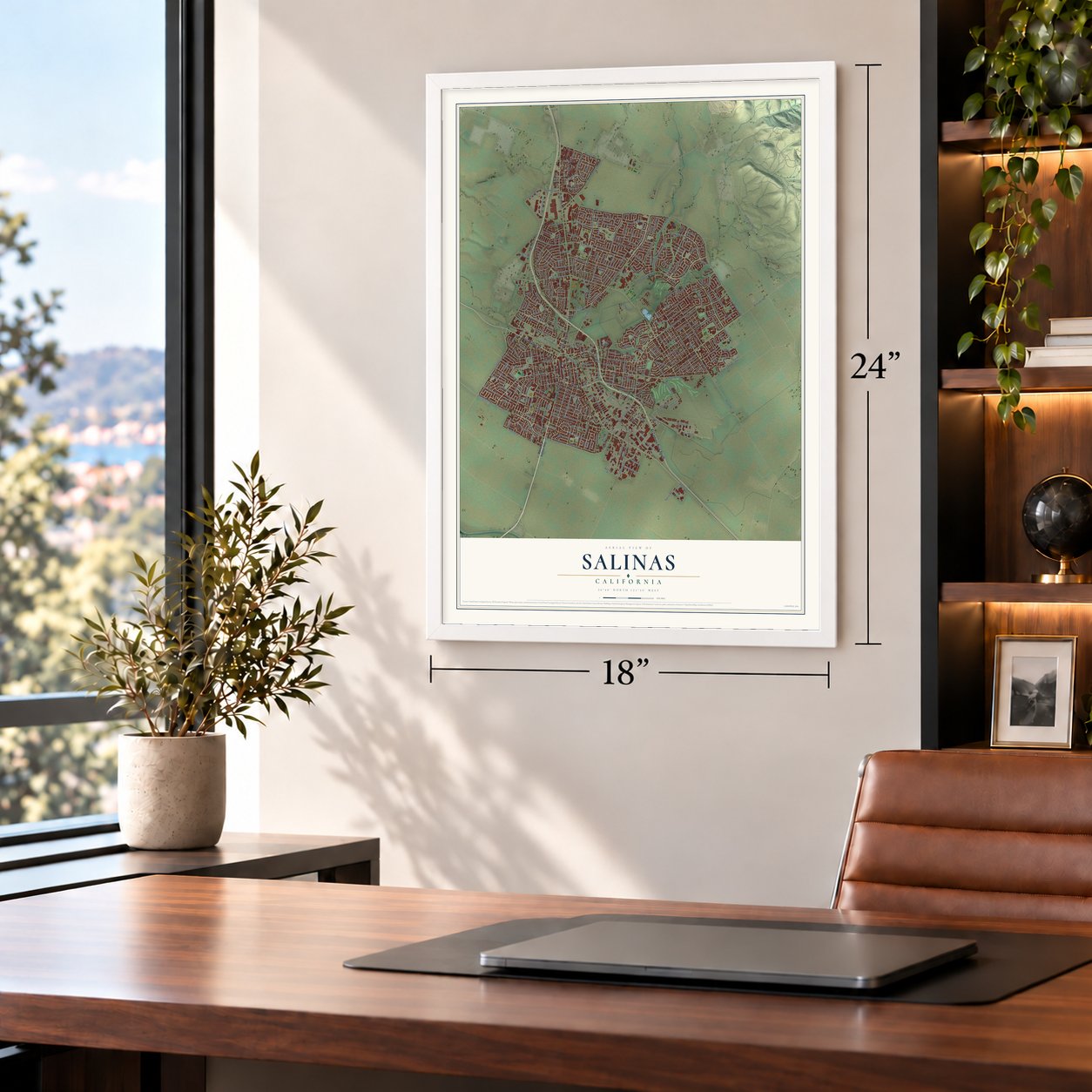

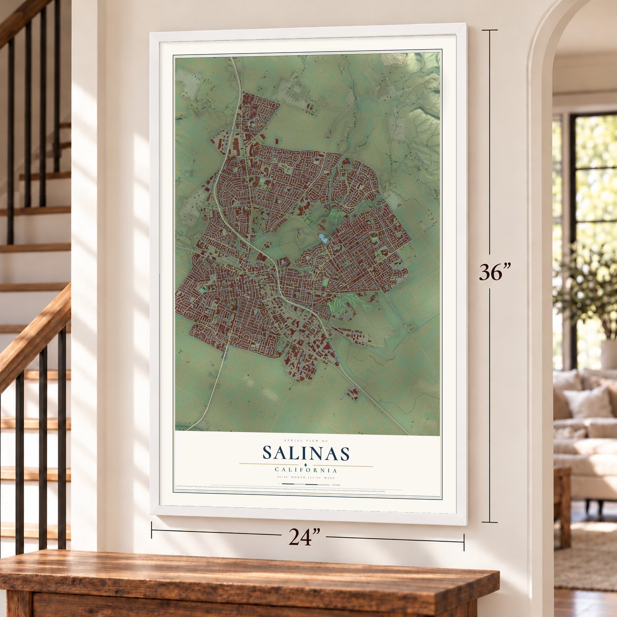
Free U.S. delivery 7 to 10 days after you order
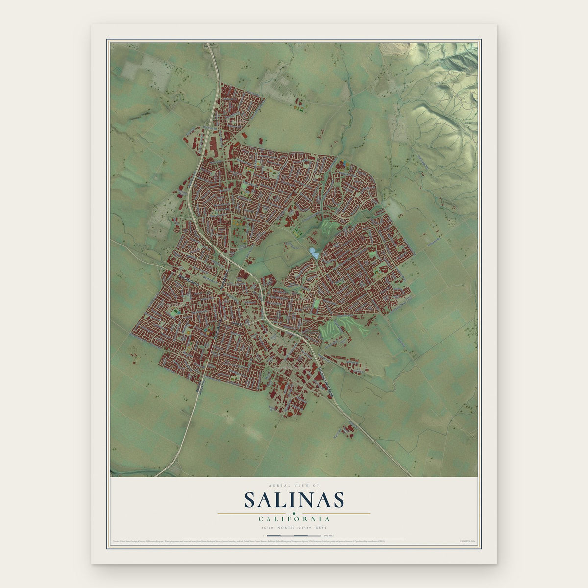
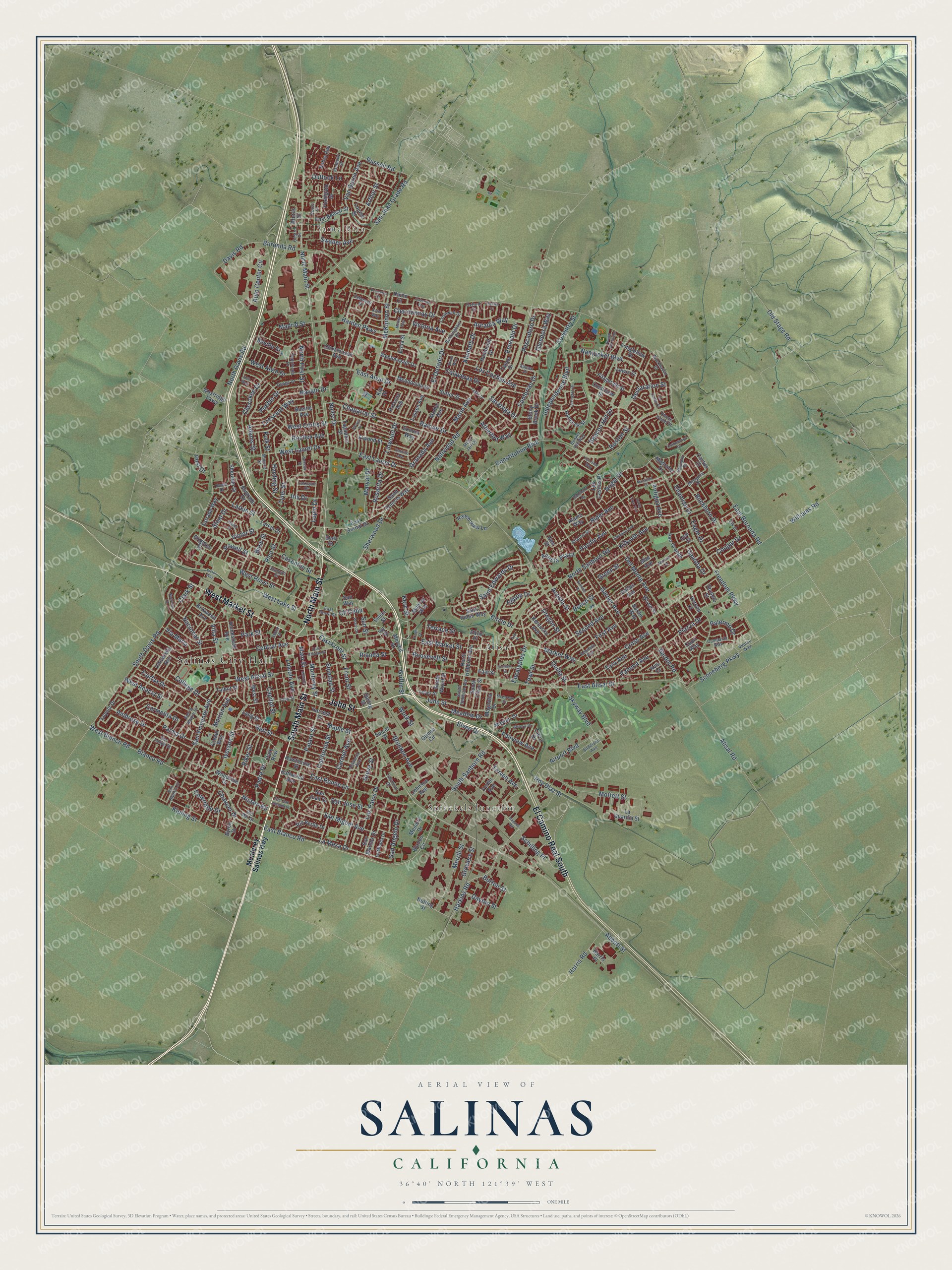
Salinas, California Map Art
Building by building, with labeled streets and shaded relief.
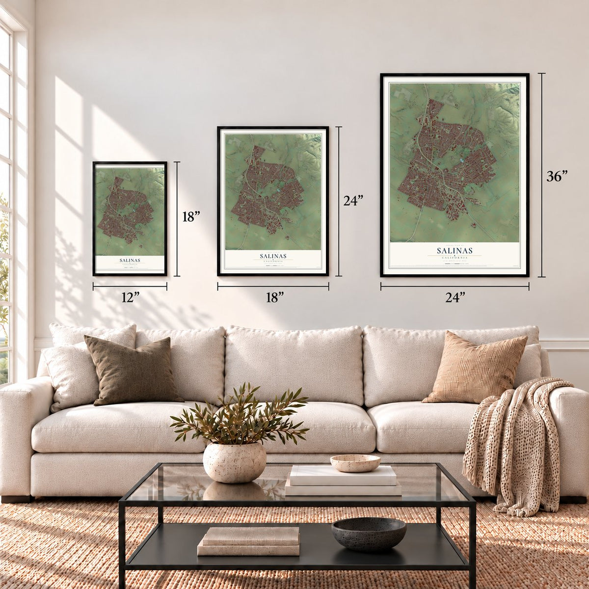
12" x 18" Archival Matte Print
A Map of Home. A Work of Art.
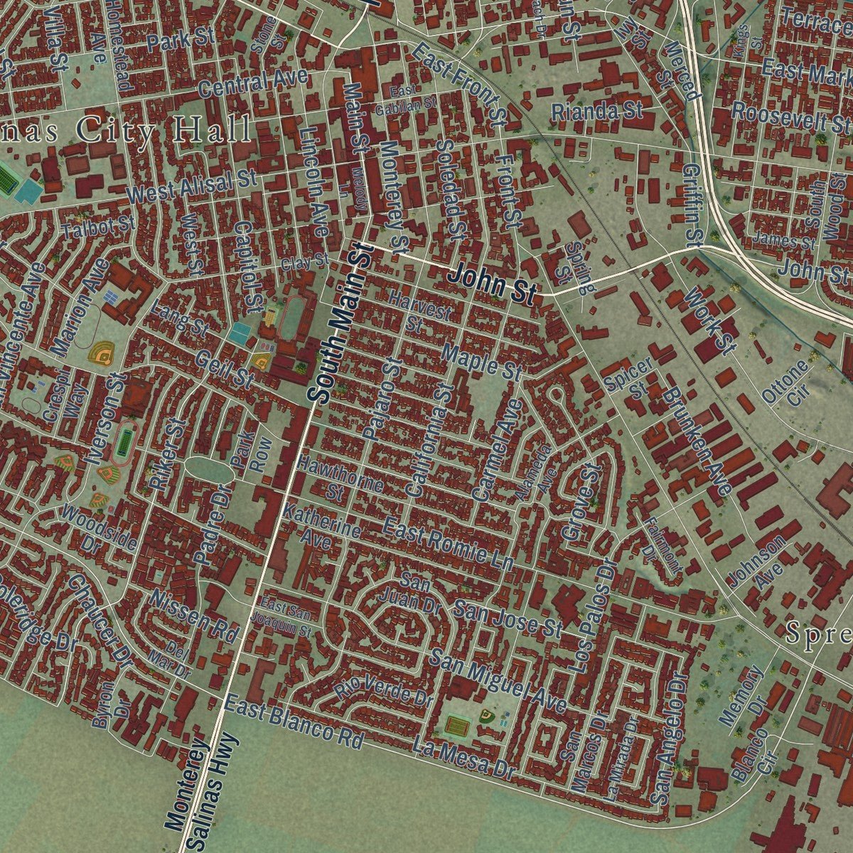
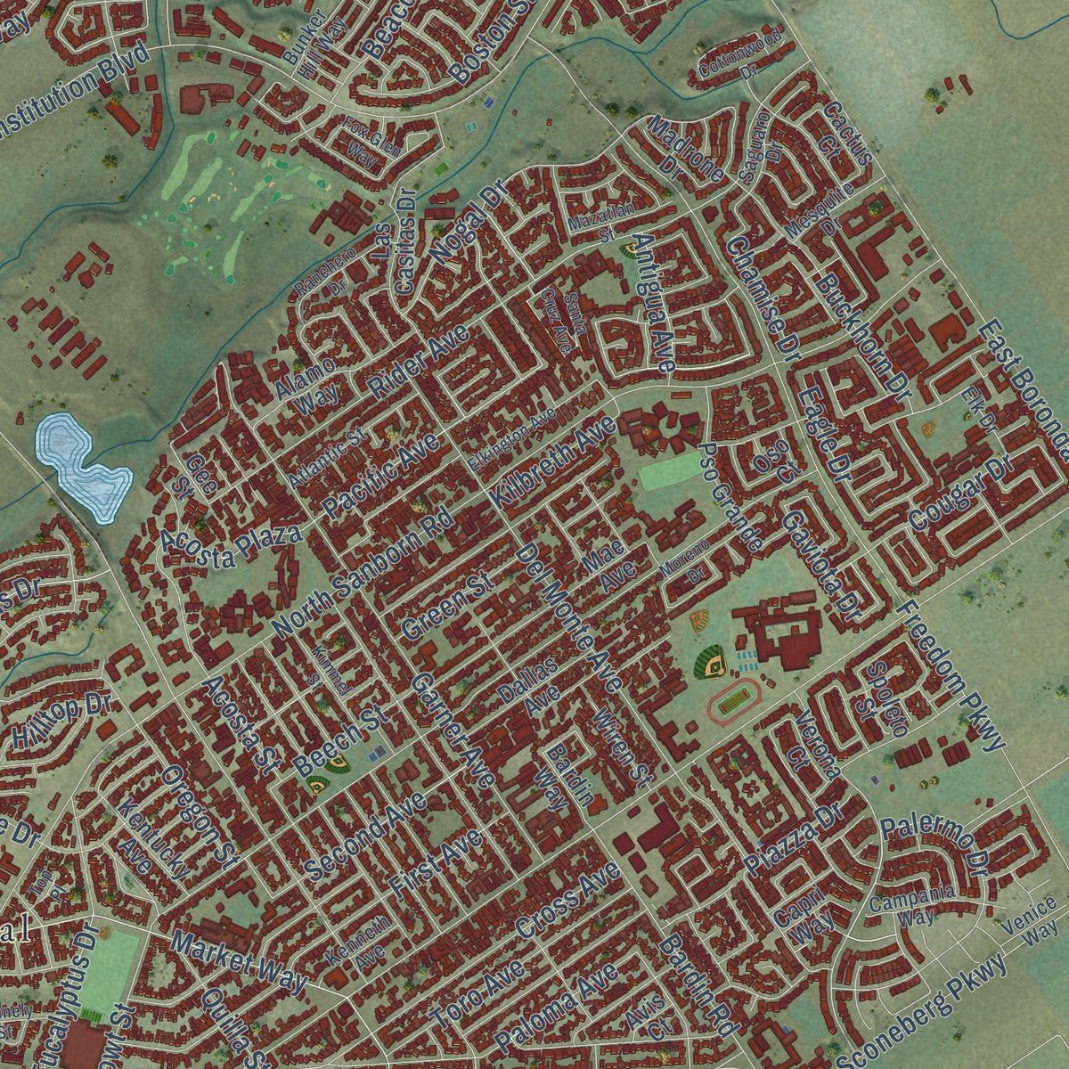
Explore Salinas, California from a whole new perspective. Created using aerial imagery and detailed geographic data, this map captures Salinas building by building, with labeled streets, familiar landmarks, and shaded topographical relief that highlights the natural contours of the landscape.
Combining modern data with the timeless character of a vintage atlas, this map is just as interesting up close as it is beautiful on the wall. Whether you grew up in Salinas, spent memorable years there, or call it home today, this unique map is a great way to celebrate a place that means something to you. Zoom in on the preview to look for your street, and then order a print to put your memories on the wall.
Three ways to hang it
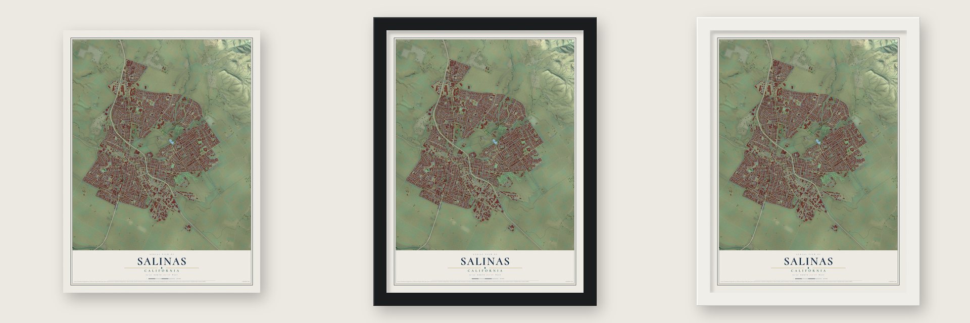
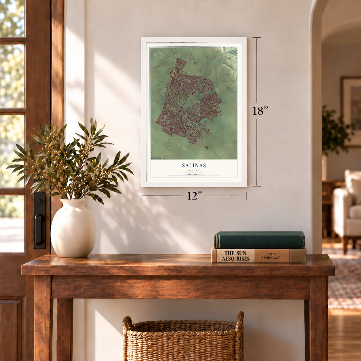
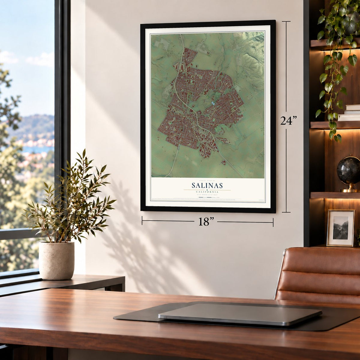
Unframed archival matte, a black wood frame or a white wood frame.
Up close
Geography Worth Displaying
This map was created using accurate cartographic data and authoritative geographic sources, including the U.S. Geological Survey and the Census Bureau. The map brings together terrain, waterways, roads, and building detail. The majority of the streets are labeled, houses are accurately depicted, and the topography is derived from government sources. Combining local data with carefully composed color and shading leads to this beautifully detailed Salinas artwork for your wall.
Rather than simply showing street outlines, we’ve included as many of the street names as we could reasonably fit on the map while keeping their names legible. Zoom in on the high resolution preview to see exactly what’s on the map. We truly set out to create a statement piece for anyone who loves Salinas. So whether it’s for you, or a gift for someone you love, we hope this map of Salinas brings back fond memories.
Read the story behind this map of Salinas, California from 2026.
Find your street
Names on the Salinas map
Every name below is printed on this map. Look for your street, your school, the park where you played, or the pond down the road.
Places and landmarks4
- Salinas City Hall
- Santa Rita
- Alisal
- Spreckels Junction
Streets and roads356
- South Main Street
- North Main Street
- John Street
- West Market Street
- El Camino Real South
- Sherwood Drive
- Lupin Drive
- East Blanco Road
- Harkins Road
- East Market Street
- South Sanborn Road
- Main Street
- Riker Street
- Pacific Avenue
- West Laurel Drive
- Schilling Place
- Abbott Street
- East Boronda Road
- Williams Road
- East Alisal Street
- Natividad Road
- East Laurel Drive
- North Sanborn Road
- Market Way
- Constitution Boulevard
- Freedom Parkway
- Towt Street
- Old Stage Road
- North Davis Road
- Pajaro Street
Show all 356 streets
- Blanco Road
- West Blanco Road
- West Alisal Street
- Cherokee Drive
- San Juan Grade Road
- West Acacia Street
- Rider Avenue
- East Alvin Drive
- Central Avenue
- California Street
- South Davis Road
- Davis Road
- West Rossi Street
- Garner Avenue
- Del Monte Avenue
- East Romie Lane
- Independence Boulevard
- Harden Parkway
- Chaparral Street
- Airport Boulevard
- Nantucket Boulevard
- La Mesa Drive
- Work Street
- Palma Drive
- Russell Road
- First Avenue
- San Miguel Avenue
- Maryal Drive
- Circle Drive
- Moffett Street
- Capitol Street
- Padre Drive
- Alisal Road
- Beacon Hill Drive
- Nogal Drive
- El Dorado Drive
- Park Street
- Ambrose Drive
- Paloma Avenue
- San Vincente Avenue
- Eagle Drive
- Navajo Drive
- McKinnon Street
- Atherton Way
- Van Buren Avenue
- Iverson Street
- Larkin Street
- Sconeberg Parkway
- North First Street
- Second Avenue
- Granada Avenue
- Tyler Street
- Rainier Drive
- Skyway Boulevard
- Merrill Street
- Cross Avenue
- Auto Center Circle
- Palermo Drive
- Lincoln Avenue
- Griffin Street
- West Alvin Drive
- Victor Street
- Adams Street
- Pescadero Drive
- Linwood Drive
- Calaveras Drive
- Polk Street
- Maple Street
- Soledad Street
- Acosta Plaza
- Monterey Street
- Buckhorn Drive
- Kern Street
- Carmelita Drive
- Boston Street
- Bardin Road
- Toro Avenue
- Los Palos Drive
- West Curtis Street
- Eucalyptus Drive
- Arcadia Way
- Los Coches Avenue
- Front Street
- East Front Street
- Kipling Street
- College Drive
- Nacional Street
- Crescent Way
- Saint Edwards Drive
- Piazza Drive
- Rochex Avenue
- Rico Street
- Boronda Road
- Elvee Drive
- Grove Street
- Noice Drive
- West Lake Street
- Pueblo Drive
- Brunken Avenue
- Villa Street
- Cougar Drive
- Geil Street
- Cambrian Drive
- Chardonnay Drive
- Fairfax Drive
- Casentini Street
- Powell Street
- Harris Road
- Terven Avenue
- Coventry Street
- Klamath Drive
- Arthur Street
- Meadow Drive
- Declaration Street
- Acosta Street
- Swaner Avenue
- Rosarita Drive
- Madrid Street
- Roosevelt Street
- Marin Avenue
- Sun Street
- Growers Street
- Fairview Avenue
- Roy Diaz Street
- Chaucer Drive
- Carmel Avenue
- Chamise Drive
- San Angelo Drive
- Iris Drive
- Coleridge Drive
- Quilla Street
- Outlook Lane
- Glendora Way
- Beech Street
- Marion Avenue
- Terrace Street
- San Jose Street
- Emerald Drive
- Kilbreth Avenue
- Oregon Street
- Victoria Avenue
- Sloat Drive
- Via Maria
- Dayton Street
- Harding Street
- Nissen Road
- Green Street
- Antigua Avenue
- Bush Street
- Hilltop Drive
- Saratoga Drive
- Rianda Street
- Clark Street
- Gaviota Drive
- Seville Street
- Cll Cebu
- Burton Street
- Post Drive
- Monterey Salinas Highway
- East Bernal Drive
- North Hebbron Avenue
- Gee Street
- Homestead Avenue
- University Avenue
- West Street
- San Juan Drive
- Larkin Drive
- Mae Avenue
- Hawthorne Street
- Katherine Avenue
- Las Casitas Drive
- Loyola Drive
- Hancock Street
- Mayfair Drive
- Harvest Street
- Woodside Drive
- Elwood Street
- Vertin Avenue
- Pso Grande
- Westridge Parkway
- East Bolivar Street
- Verona Court
- San Marcos Drive
- Ranch View Lane
- Alamo Way
- La Guardia Street
- Tapadero Street
- Christensen Avenue
- Mendocino Drive
- Madrone Drive
- Saint Francis Way
- Sherman Drive
- Stony Brook Drive
- Westminster Drive
- Rio Verde Drive
- Saint Helen Way
- Boeing Avenue
- Lang Street
- Alvarado Drive
- Fitzgerald Street
- Humboldt Drive
- Dallas Avenue
- Tahoe Drive
- Fieldgate Drive
- Carol Drive
- Mobray Way
- South Filice Street
- East Street
- Estrada Way
- Sutter Street
- Oso Court
- Memory Drive
- Kentucky Avenue
- Longfellow Drive
- Lassen Avenue
- Modoc Avenue
- Cactus Court
- Spoleto Street
- South Wood Street
- Crestview Street
- Louise Street
- Kirkwood Avenue
- Brutus Street
- Magnolia Drive
- Rhine Court
- Sonora Way
- Johnson Avenue
- Wiren Street
- Bahia Avenue
- Harris Place
- Parsons Avenue
- Talbot Street
- Brighton Street
- Nutting Street
- Bardin Way
- Blanco Circle
- Crespi Way
- Merced Street
- Lewis Street
- Spring Street
- Byron Drive
- Capri Way
- Elton Place
- Ercia Street
- Sun Way
- Kip Drive
- Park Row
- Ottone Circle
- Simas Street
- Spicer Street
- Avis Court
- Deer Street
- Ivy Street
- Alameda Avenue
- Sierra Madre Drive
- Clay Street
- San Felipe Street
- Osage Drive
- Kennedy Street
- McSo Jail Dy
- Rockhaven Court
- Monroe Street
- Delancey Drive
- Atlantic Street
- Sepulveda Drive
- Oxford Court
- Cromwell Drive
- Del Mar Drive
- Buckingham Drive
- South Hebbron Avenue
- Bunker Hill Way
- Campania Way
- East Rossi Street
- La Mirada Drive
- Mesquite Drive
- Anderson Avenue
- Kenneth Avenue
- Perez Street
- San Blanco Drive
- Castro Street
- Fairmont Drive
- James Street
- Rhode Island Street
- Saguaro Drive
- Elk Drive
- Stone Street
- Larkspur Drive
- Venice Way
- Howe Drive
- Sausal Drive
- Stanyan Street
- Lexington Drive
- Elkington Avenue
- Santa Cruz Avenue
- De Cunha Court
- Nacional Court
- Kings Street
- Chelsea Court
- East Gabilan Street
- Parkside Street
- Ranchero Drive
- Leslie Drive
- Melody Lane
- Beverly Drive
- McGowan Drive
- Princeton Court
- Kimmel Street
- Merlot Way
- Cabernet Way
- Dororo Drive
- Hansen Road
- Mazatlan Street
- Round Hill Farms
- Adobe Drive
- Inca Way
- Moreno Drive
- Peach Drive
- Cottonwood Drive
- East San Joaquin Street
- Connely Street
- Cabrillo Avenue
- Fox Glen Way
- Ukiah Way
- Astor Way
- Victor Way
- Top Place
Names are listed as they appear on the printed map. Zoom into the product photos to find them.
About Salinas, California
Salinas is a city of 163,542 people and the seat of Monterey County, at the mouth of the Salinas Valley. In the 1850s two main stagecoach roads met 18 miles east of Monterey, beside a bend in the Alisal Slough. In 1854 American settlers living near that crossing opened a post office and called their town Salinas, after Rancho Las Salinas, an old land grant named in Spanish for the salt marshes nearby.
A traveler's inn called the Halfway House opened at the junction in 1856. The streets were laid out in 1867, and the railroad arrived the next year, so farmers began turning the old cattle range into fields of wheat, barley, potatoes and mustard seed. Salinas was incorporated in 1874. Chinese workers drained thousands of acres of swamp to make farmland, and irrigation later shifted the fields to row crops such as root vegetables and sugar beets. By 1924 Salinas had the highest income per person of any city in the United States.
- Won the county seat in 1872Monterey had been the county seat since the county was organized in April 1850 and fought hard to keep it. But the railroad shifted the center of population, and Salinas City was growing fast. Voters petitioned for an election, held on November 6, 1872, alongside the presidential vote. Salinas won 1,436 votes to Monterey's 488, and the county seat moved the next February. The art deco Monterey County Court House stands in Salinas today.
- A river named for the townThe Salinas River was once known as the Rio de Monterey. An American mapmaker gave it its present name in 1858, after Salinas, the nearest town, so the river took its name from the town and not the other way around.
- The Rodeo Grounds in 1942After President Roosevelt issued Executive Order 9066, the Salinas Rodeo Grounds became the Salinas Assembly Center, one of seventeen temporary camps for people of Japanese ancestry. It opened on April 27, 1942, held 3,608 people in all, and closed on July 4, when they were sent on to more remote camps. Salinas had 300 Japanese-American families before the war, and only 25 of them came back.
- Steinbeck's hometownJohn Steinbeck, the Nobel Prize-winning writer, was born in Salinas in 1902, and many of his stories take place in Monterey and in the valley around his hometown. His family home in Oldtown, the John Steinbeck House, joined the National Register in 2000. The National Steinbeck Center and the John Steinbeck Library are downtown as well.
Keep exploring California
Salinas is one of 1,914 California towns we've mapped. Every dot on the map is a print of its own.
The search covers every state, California first.
Near Salinas
Order 2 or more town maps and save 10%. Shown in the size and finish you picked above, so they hang as a set.
- Boronda 12" x 18" / Archival Matte Print $39.99
- Natividad 12" x 18" / Archival Matte Print $39.99
- Spreckels 12" x 18" / Archival Matte Print $39.99


More maps nearby: Castroville, Prunedale, Marina, Elkhorn and Chualar.
The art of mapping a place
How This Map Was Made
Real places. Remarkable detail. Discover the layers that turn geographic data into a map of home.

The view from above
Aerial imagery reveals the character of the land: woodland, open fields, and the patterns of a place.

The shape of the land
Elevation data brings hills, valleys, and subtle changes in the landscape into view.

The details of home
Roads, waterways, and building footprints come together to make the map feel unmistakably local.

Geography becomes art
Considered color, shading, and typography bring the layers together in a map made for your wall.


Process illustrated with Mendon, Massachusetts. Aerial imagery: USDA NAIP. Terrain: USGS 3D Elevation Program. Map details and finished artwork: KNOWOL.
The Details
About This Print
Choose an archival matte print, or a black or white Ayous wood frame. The archival matte print is unframed.
Select your size and finish above to see the matching product image and price.
Materials & Craftsmanship
A contemporary map with the character of a classic atlas, printed on archival matte paper. Optional frames are made from Ayous wood.
Your printed map does not include the watermark shown in the full-map preview.
Shipping & Delivery
Free shipping within the United States. Every print is made to order in the USA.
Buying a gift? Add a note in your cart and we'll include it. We never put prices in the package.
Prints ship within 2 to 3 business days. Allow 7 to 10 days total from ordering for delivery. Timing may vary during holidays or periods of high order volume.
Read our shipping policy.
Returns and damaged prints
Each print is made to order. Change-of-mind refunds are not available after production.
If your print arrives damaged, misprinted or incorrect, contact support@knowol.com within 30 days of receiving it. Include your order number, photos and a description of the issue.
Read our full refund and replacement policy. For questions about your order, email support@knowol.com.