
Search for another town




Free U.S. delivery 7 to 10 days after you order
Sanger, California Map Art
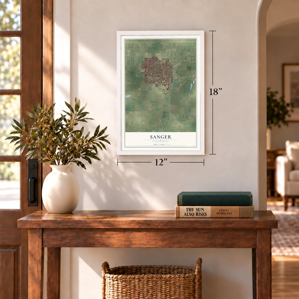
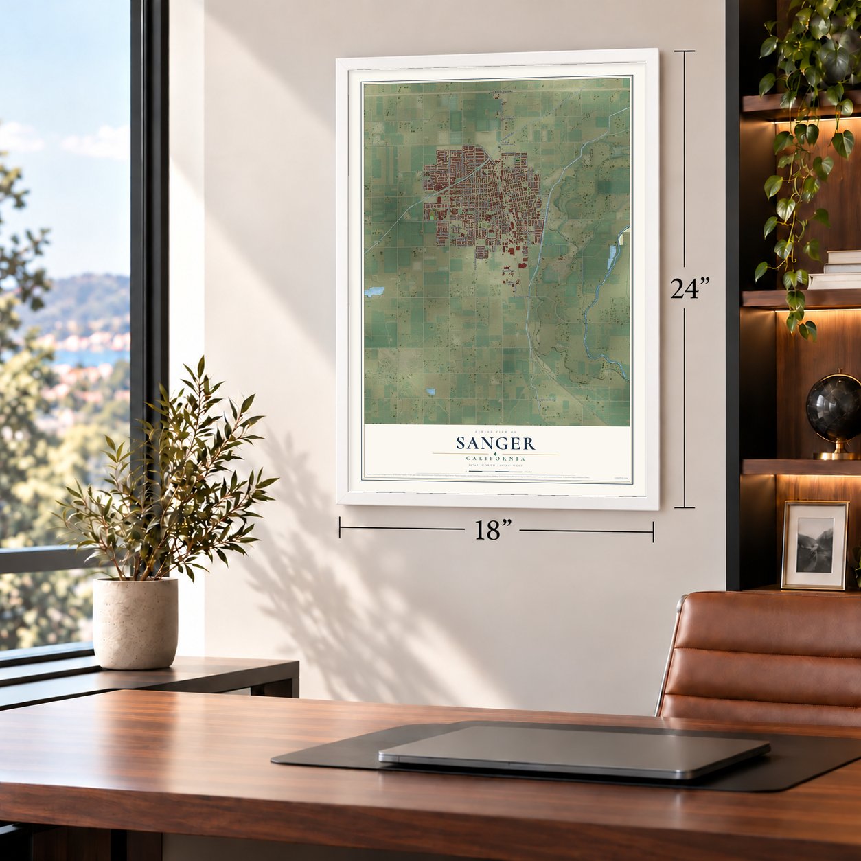
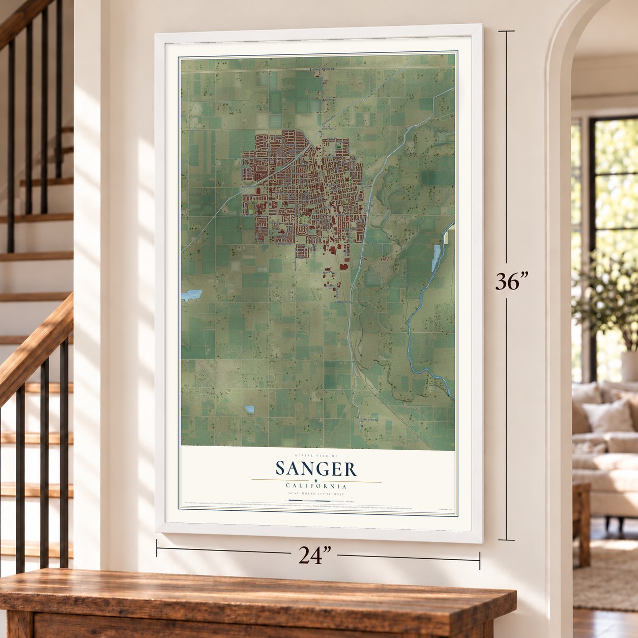
A new map of Sanger, California, made in 2026 and printed to order on thick archival matte paper.
12" x 18" Archival Matte Print
A Map of Home. A Work of Art.
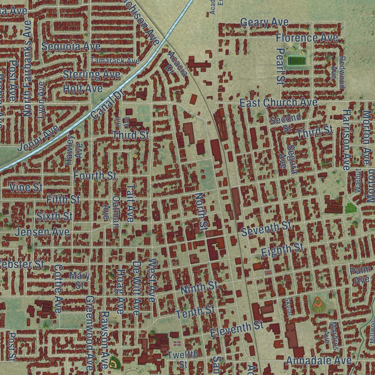
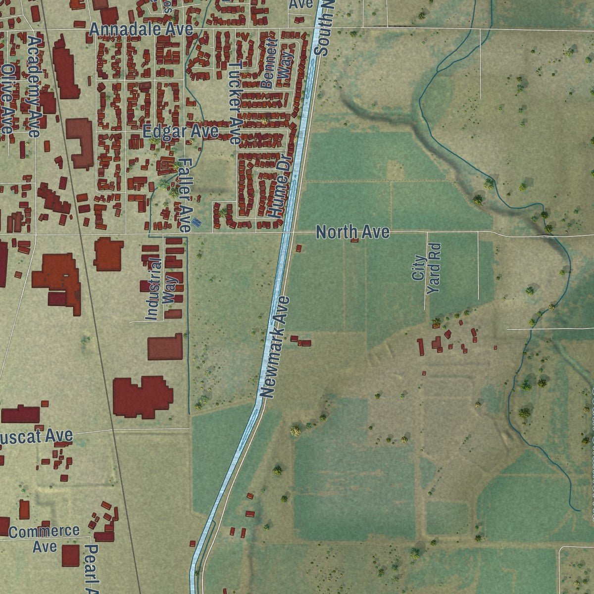
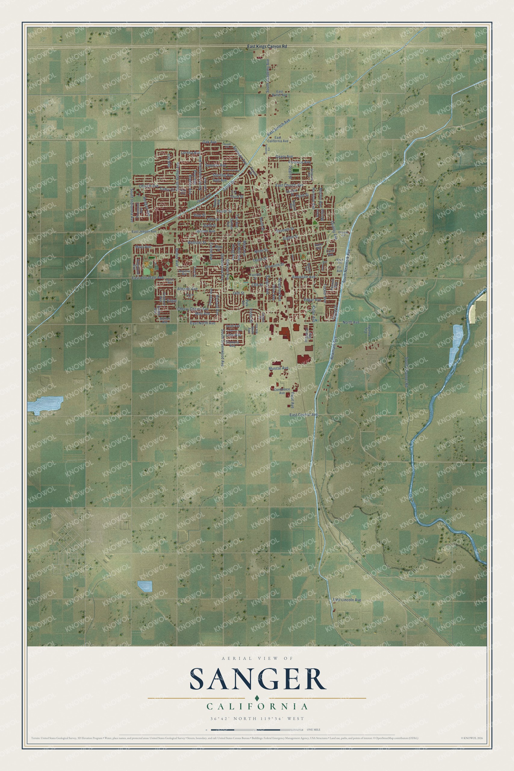
Explore Sanger, California from a whole new perspective. Created using aerial imagery and detailed geographic data, this map captures Sanger building by building, with labeled streets, familiar landmarks, and shaded topographical relief that highlights the natural contours of the landscape.
Combining modern data with the timeless character of a vintage atlas, this map is just as interesting up close as it is beautiful on the wall. Whether you grew up in Sanger, spent memorable years there, or call it home today, this unique map is a great way to celebrate a place that means something to you. Zoom in on the preview to look for your street, and then order a print to put your memories on the wall.
Three ways to hang it
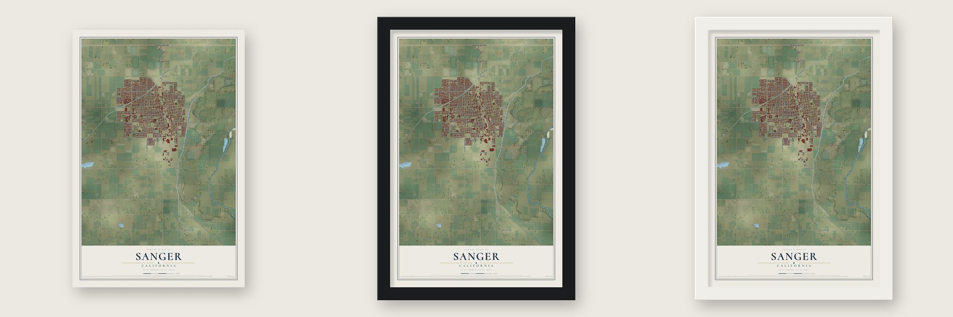
Unframed archival matte, a black wood frame or a white wood frame.
Up close
Geography Worth Displaying
This map was created using accurate cartographic data and authoritative geographic sources, including the U.S. Geological Survey and the Census Bureau. The map brings together terrain, waterways, roads, and building detail. The majority of the streets are labeled, houses are accurately depicted, and the topography is derived from government sources. Combining local data with carefully composed color and shading leads to this beautifully detailed Sanger artwork for your wall.
Rather than simply showing street outlines, we’ve included as many of the street names as we could reasonably fit on the map while keeping their names legible. Zoom in on the high resolution preview to see exactly what’s on the map. We truly set out to create a statement piece for anyone who loves Sanger. So whether it’s for you, or a gift for someone you love, we hope this map of Sanger brings back fond memories.
Read the story behind this map of Sanger, California from 2026.

About Sanger, California
Sanger is a city of 26,617 people in Fresno County, 13 miles east-southeast of Fresno. Yokuts people lived here first. In 1886 the Southern Pacific Company was calling the spot Sanger Junction as it planned better access to the rich farmland, and the name was soon shortened to Sanger. It honors Joseph Sanger Jr., who worked for the Pacific Improvement Company, a railroad affiliate.
The depot was built in 1887 beside the railroad line running from Fresno to Porterville. Town lots went on sale through the Pacific Improvement Company in 1888, the same year Sanger got its first post office. Two years later a 62-mile log flume, the work of the Kings River Lumber Company, began carrying timber down from the High Sierras, and more than 75 buildings went up in town during 1890. By 1908 Sanger had two schools, seven churches, two newspapers, an opera house and a bank, and it incorporated in 1911.
- Nation's Christmas Tree CityIn 1949 the U.S. Postal Service gave Sanger the title "Nation's Christmas Tree City."
- A depot turned museumThe two-story Southern Pacific depot of 1887 made Sanger a shipping point for grain, citrus and lumber from the mountains. When the railroad retired it, it was the oldest building in the city. It went to the Sanger Historical Society, which opened it as the Sanger Depot Museum in 1977. The Jeremiah D. and Mary Hyde House, another old home in town, is on the National Register.
- Eight charter BaptistsThe 1919 county history records that the first church organized in Sanger was a Baptist church with eight charter members. J. T. Walton and his wife were two of them.
- Tom Flores on the wallSanger native Tom Flores, a pro football player and coach, joined the Pro Football Hall of Fame in 2021. That same year Omar Huerta painted a mural of him at 7th and N Street. Downtown also has a 1982 mural of the actress Nastassja Kinski by Jose Maro Alvarado, who grew up in Sanger.
Find your street
Names on the Sanger map
Every name below is printed on this map. Look for your street, your school, the park where you played, or the pond down the road.
Streets and roads126
- Newmark Avenue
- Sterling Avenue
- South Newmark Avenue
- Eighth Street
- Atchison Avenue
- Lorena Avenue
- East Central Avenue
- Greenwood Avenue
- Florence Avenue
- Rawson Avenue
- Bethel Avenue
- Fourth Street
- Jenni Avenue
- Cherry Avenue
- Annadale Avenue
- Harrison Avenue
- Fifth Street
- Third Street
- South Bethel Avenue
- Brehler Avenue
- North Street
- Hume Drive
- Church Avenue
- South Academy Avenue
- Geary Avenue
- 14th Street
- Cottle Avenue
- Mary Avenue
- Academy Avenue
- Ninth Street
Show all 126 streets
- Faller Avenue
- East Church Avenue
- Jensen Avenue
- Tenth Street
- Seventh Street
- East North Avenue
- Holt Avenue
- North Avenue
- West Avenue
- Tucker Avenue
- Almond Avenue
- South Channel Road
- De Witt Avenue
- Quality Avenue
- Edgar Avenue
- Sequoia Avenue
- Sanger Avenue
- Eleventh Street
- Lily Avenue
- Webster Street
- North Fairbanks Avenue
- Hoag Avenue
- South Indianola Avenue
- East Lincoln Avenue
- East Annadale Avenue
- Reagan Avenue
- Muscat Avenue
- South Greenwood Avenue
- Vine Street
- Moir Avenue
- Richard Avenue
- Canal Drive
- Catsy Court
- Morton Avenue
- Oak Avenue
- Sixth Street
- Pearl Street
- Tait Avenue
- East Switch Avenue
- Olive Avenue
- Post Avenue
- Pearl Avenue
- Edgar
- Lime Avenue
- 13th Street
- Kister Street
- Morton
- Cherry
- East Kings Canyon Road
- Walton Avenue
- Diamond Avenue
- Park Avenue
- Dalton Avenue
- Pinewood Avenue
- Post Street
- Lyon Avenue
- Hawley Avenue
- Palm Avenue
- Rosewood Avenue
- Twelfth Street
- Oatman Avenue
- Fenmore Avenue
- Second Street
- George Avenue
- East Jensen Avenue
- Industrial Way
- Commerce Avenue
- East California Avenue
- East Butler Avenue
- Mary Street
- Acacia Drive
- City Yard Road
- Heidi Avenue
- Segura Avenue
- Bennett Way
- James Street
- Swan Avenue
- Carol Avenue
- Fir Avenue
- Redwood Avenue
- Magnolia Avenue
- Tamarack Avenue
- Myrtle Avenue
- Circle Drive
- Walnut
- Nile Avenue
- Mardros Avenue
- Birch Avenue
- Kelli Avenue
- Acacia Avenue
- Elizabeth Avenue
- Millwood Drive
- Hill Avenue
- Catherine Avenue
- Academy Extension
- Skylar
Names are listed as they appear on the printed map. Zoom into the product photos to find them.
The art of mapping a place
How This Map Was Made
Real places. Remarkable detail. Discover the layers that turn geographic data into a map of home.

The view from above
Aerial imagery reveals the character of the land: woodland, open fields, and the patterns of a place.

The shape of the land
Elevation data brings hills, valleys, and subtle changes in the landscape into view.

The details of home
Roads, waterways, and building footprints come together to make the map feel unmistakably local.

Geography becomes art
Considered color, shading, and typography bring the layers together in a map made for your wall.


Process illustrated with Mendon, Massachusetts. Aerial imagery: USDA NAIP. Terrain: USGS 3D Elevation Program. Map details and finished artwork: KNOWOL.
The Details
About This Print
Choose an archival matte print, or a black or white Ayous wood frame. The archival matte print is unframed.
Select your size and finish above to see the matching product image and price.
Materials & Craftsmanship
A contemporary map with the character of a classic atlas, printed on archival matte paper. Optional frames are made from Ayous wood.
Your printed map does not include the watermark shown in the full-map preview.
Shipping & Delivery
Free shipping within the United States. Every print is made to order in the USA.
Buying a gift? Add a note in your cart and we'll include it. We never put prices in the package.
Prints ship within 2 to 3 business days. Allow 7 to 10 days total from ordering for delivery. Timing may vary during holidays or periods of high order volume.
Read our shipping policy.
Returns and damaged prints
Each print is made to order. Change-of-mind refunds are not available after production.
If your print arrives damaged, misprinted or incorrect, contact support@knowol.com within 30 days of receiving it. Include your order number, photos and a description of the issue.
Read our full refund and replacement policy. For questions about your order, email support@knowol.com.
Find your town
Looking for another city?
Find a map of home in our California collection, or any town in the country.
Nearby
Maps of towns near Sanger
Know someone from one of these towns? Their map makes a great gift.
 Del Rey
, California
From $39.99See the map
 Centerville
, Fresno County, California
From $39.99See the map
 Minkler
, California
From $39.99See the map
More maps nearby: Parlier, Sunnyside, Fowler, Reedley and Selma.