
Search for another town





Free U.S. delivery 7 to 10 days after you order
Shively, Kentucky Map Art
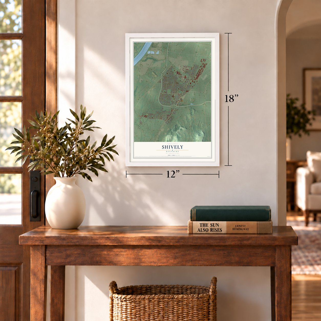
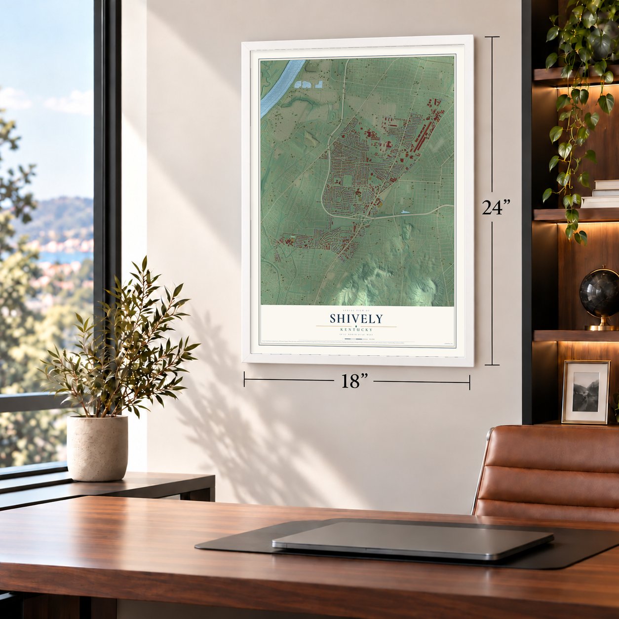
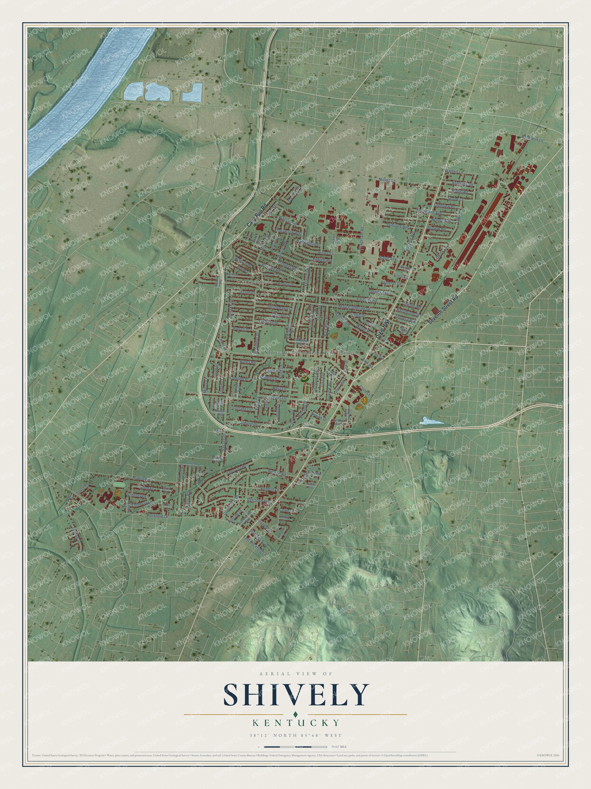
A new map of Shively, Kentucky, made in 2026 and printed to order on thick archival matte paper.
12" x 18" Archival Matte Print
A Map of Home. A Work of Art.
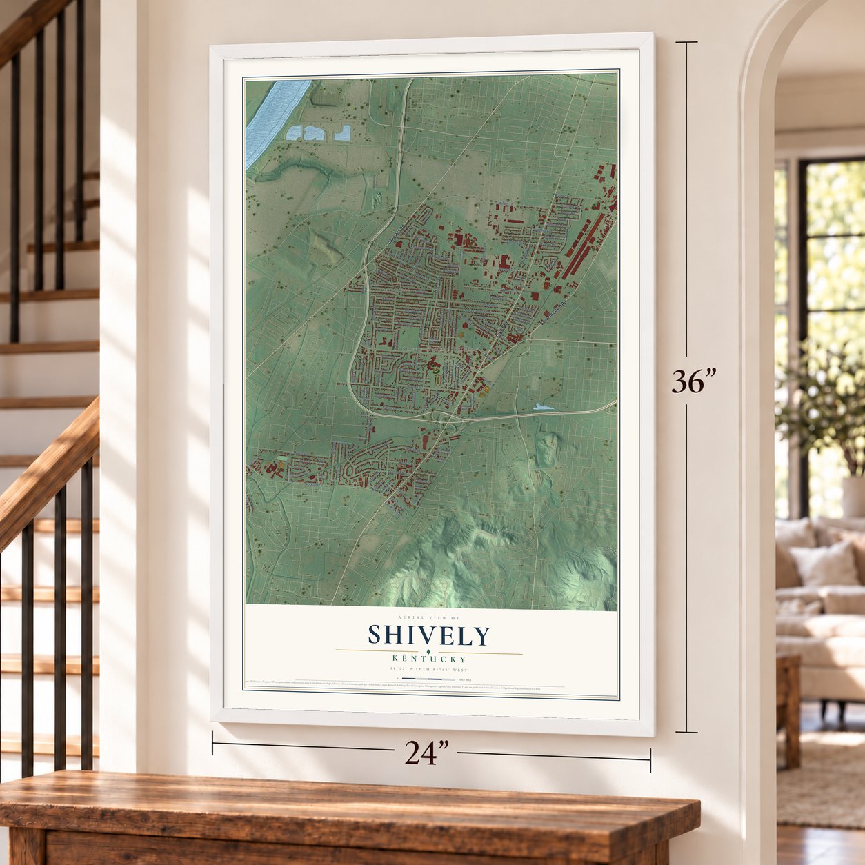
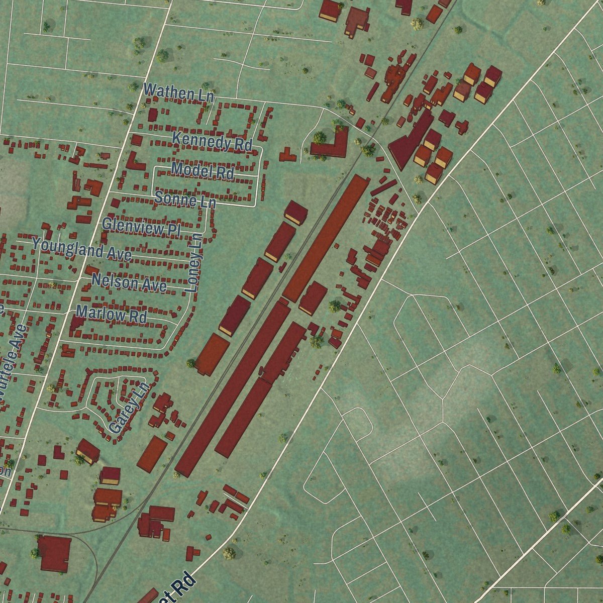
Explore Shively, Kentucky from a whole new perspective. Created using aerial imagery and detailed geographic data, this map captures Shively building by building, with labeled streets, familiar landmarks, and shaded topographical relief that highlights the natural contours of the landscape.
Combining modern data with the timeless character of a vintage atlas, this map is just as interesting up close as it is beautiful on the wall. Whether you grew up in Shively, spent memorable years there, or call it home today, this unique map is a great way to celebrate a place that means something to you. Zoom in on the preview to look for your street, and then order a print to put your memories on the wall.
Three ways to hang it
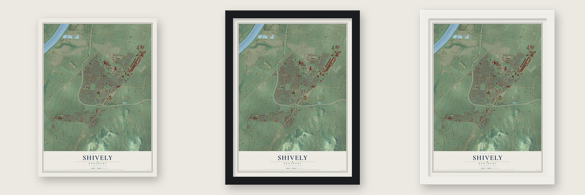
Unframed archival matte, a black wood frame or a white wood frame.
Up close
Geography Worth Displaying
This map was created using accurate cartographic data and authoritative geographic sources, including the U.S. Geological Survey and the Census Bureau. The map brings together terrain, waterways, roads, and building detail. The majority of the streets are labeled, houses are accurately depicted, and the topography is derived from government sources. Combining local data with carefully composed color and shading leads to this beautifully detailed Shively artwork for your wall.
Rather than simply showing street outlines, we’ve included as many of the street names as we could reasonably fit on the map while keeping their names legible. Zoom in on the high resolution preview to see exactly what’s on the map. We truly set out to create a statement piece for anyone who loves Shively. So whether it’s for you, or a gift for someone you love, we hope this map of Shively brings back fond memories.
Read the story behind this map of Shively, Kentucky from 2026.

About Shively, Kentucky
Shively is a city of 15,636 people in Jefferson County, about 5 miles southwest of downtown Louisville. Louisville began at the Falls of the Ohio in 1778, and farms soon spread into the country around it. Christian Shively was one of the early landowners here. He opened a mill and a tavern on his 1,000-acre tract by Mill Creek, beside the road from Louisville to the Salt River, and the settlement that grew up around them became known as the Shively precinct.
German families, most of them from Bavaria, settled the area shortly before the Civil War, and in 1897 they built St. Helen's Catholic Church. People called the whole community St. Helen's for a few years. When the post office opened in 1902, though, it couldn't take that name, because Lee County already had a St. Helen's. A streetcar line reached the area in 1904.
- A church from 1816In 1816 Christian Shively gave land for a church, known today as Parkview Methodist. A stagecoach stop opened in 1831, and the Elizabethtown and Paducah Railroad came through in the 1870s.
- A city made by whiskeyEight distilleries opened near Shively after Prohibition ended. During the Great Depression, Louisville tried to annex them so it could tax them. The distillers persuaded Shively's residents to form a city of their own and take in the distillery district instead. Incorporation became final on May 23, 1938, and the distilleries' $20-million revenue stream kept the new city well funded.
- The Wade house, 1954Andrew Wade IV, a Black Korean War veteran and electrician, and his wife Charlotte were kept from buying a suburban home by housing discrimination. In 1954 activists Carl and Anne Braden bought a Shively house and deeded it to them. Attackers burned a cross, threw rocks, fired rifle shots and finally set off dynamite under their daughter's bedroom. No one was hurt or convicted, but the Wades moved away. A historical marker honors them as open housing pioneers.
- Bourbon still made hereBrown-Forman's Early Times distillery still operates in Shively. Early Times was first made in 1860, and Old Forester, first made in 1870, was the first bourbon sold only in sealed bottles. The old Stitzel-Weller distillery became a Bulleit Bourbon stop on the Kentucky Bourbon Trail in 2014, and Michter's opened a new distillery here in 2015.
- First Black mayor in 2018On November 5, 2018, voters elected Beverly Chester Burton, a Democrat, as Shively's first African-American mayor.
Find your street
Names on the Shively map
Every name below is printed on this map. Look for your street, your school, the park where you played, or the pond down the road.
Places and landmarks2
- Shively-Newman Building
- Heatherfield
Streets and roads137
- Dixie Highway
- Seventh Street Road
- Cane Run Road
- Loney Lane
- Fernheather Drive
- Wayside Drive
- Park Drive
- Model Road
- Farnsley Road
- Ralph Avenue
- Rockford Lane
- Garrs Lane
- Crums Lane
- Mary Catherine Drive
- Burrell Drive
- San Jose Avenue
- Martin Avenue
- Fern Lea Road
- Janell Road
- Lynn Lea Road
- Wathen Lane
- Nelson Avenue
- Kendall Lane
- Heaton Road
- Savage Drive
- Fitzgerald Road
- Pioneer Road
- Peaslee Road
- Millers Lane
- Appleton Lane
Show all 137 streets
- Auburn Drive
- Youngland Avenue
- Hillside Drive
- Quinn Drive
- Dubourg Avenue
- Thistledawn Drive
- Kingswood Way
- Mildred Drive
- Deveron Drive
- Garey Lane
- Darlene Drive
- Nobel Place
- Matheis Lane
- Dohn Road
- Hillview Avenue
- Park Road
- Bernheim Lane
- Park Row Drive
- Jenlee Lane
- Neblett Avenue
- Thurman Drive
- Wurtele Avenue
- Lomond Drive
- Kiefer Road
- Glenhurst Avenue
- Sanders Lane
- Sonne Lane
- North Lane
- Cheviot Drive
- Amboy Drive
- Robin Drive
- Peleske Drive
- Grandview Drive
- Eden Lane
- East Lane
- Kennedy Road
- Clyde Drive
- West Lane
- Rausch Drive
- Gagel Avenue
- Wessel Road
- Lisa Avenue
- Middle Lane
- Olenda Avenue
- East Rockford Lane
- Glenview Place
- Dover Road
- Marlow Road
- Schaffner Drive
- Hampstead Drive
- Butler Road
- Bachmann Drive
- Theresa Avenue
- Legene Drive
- Neville Drive
- Embassy Lane
- Chester Road
- Cottage Lane
- Lindsey Drive
- Ecton Lane
- Timothy Lane
- Moray Court
- Stallings Avenue
- Verna Road
- Shadow Fern Drive
- Riedley Road
- Heatherfield Drive
- Spen Lea Road
- Luken Drive
- Addison Lane
- Perth Drive
- Candor Avenue
- Valley View Drive
- Oehrle Drive
- Clinton Place
- Stonestreet Avenue
- Elgin Way
- Sadie Lane
- Mill Creek Drive
- Tucker Avenue
- Cardinal Court
- Herbert Avenue
- Leroy Avenue
- Parkay Place
- Wessel Avenue
- Hartlage Court
- Mercer Avenue
- Laura Avenue
- Colony Court
- Quinn Court
- Judy Lane
- Donna Road
- Strotman Road
- Atterberry Court
- Luckert Avenue
- Stewart Avenue
- Perth Court
- Van Hoose Road
- Saint Joseph Avenue
- Gillette Avenue
- Searcy Lane
- Kevin Court
- Leeds Road
- Cavalier Drive
- Jacks Lane
- Edgin Court
- Nobel Court
Names are listed as they appear on the printed map. Zoom into the product photos to find them.
The art of mapping a place
How This Map Was Made
Real places. Remarkable detail. Discover the layers that turn geographic data into a map of home.

The view from above
Aerial imagery reveals the character of the land: woodland, open fields, and the patterns of a place.

The shape of the land
Elevation data brings hills, valleys, and subtle changes in the landscape into view.

The details of home
Roads, waterways, and building footprints come together to make the map feel unmistakably local.

Geography becomes art
Considered color, shading, and typography bring the layers together in a map made for your wall.


Process illustrated with Mendon, Massachusetts. Aerial imagery: USDA NAIP. Terrain: USGS 3D Elevation Program. Map details and finished artwork: KNOWOL.
The Details
About This Print
Choose an archival matte print, or a black or white Ayous wood frame. The archival matte print is unframed.
Select your size and finish above to see the matching product image and price.
Materials & Craftsmanship
A contemporary map with the character of a classic atlas, printed on archival matte paper. Optional frames are made from Ayous wood.
Your printed map does not include the watermark shown in the full-map preview.
Shipping & Delivery
Free shipping within the United States. Every print is made to order in the USA.
Buying a gift? Add a note in your cart and we'll include it. We never put prices in the package.
Prints ship within 2 to 3 business days. Allow 7 to 10 days total from ordering for delivery. Timing may vary during holidays or periods of high order volume.
Read our shipping policy.
Returns and damaged prints
Each print is made to order. Change-of-mind refunds are not available after production.
If your print arrives damaged, misprinted or incorrect, contact support@knowol.com within 30 days of receiving it. Include your order number, photos and a description of the issue.
Read our full refund and replacement policy. For questions about your order, email support@knowol.com.
Find your town
Looking for another city?
Find a map of home in our Kentucky collection, or any town in the country.
Nearby
Maps of towns near Shively
Know someone from one of these towns? Their map makes a great gift.
 Parkway Village
, Kentucky
From $39.99See the map
 Louisville
, Kentucky
From $39.99See the map
 Audubon Park
, Kentucky
From $39.99See the map
More maps nearby: Lynnview, Watterson Park, Strathmoor Manor, Strathmoor Village and Seneca Gardens.