
Search for another town


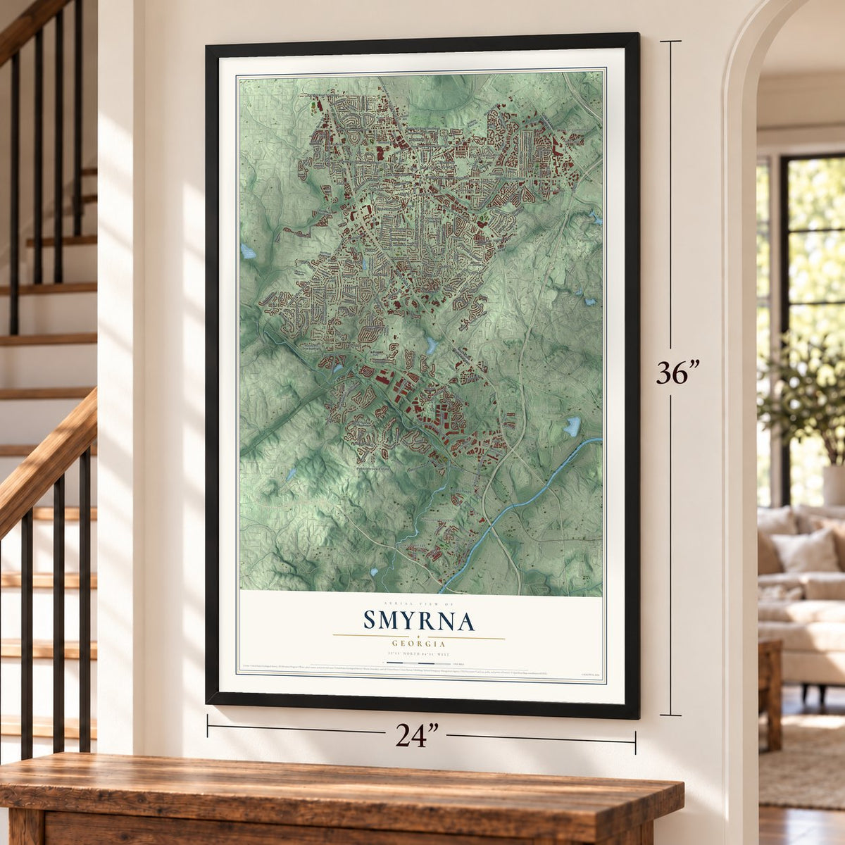
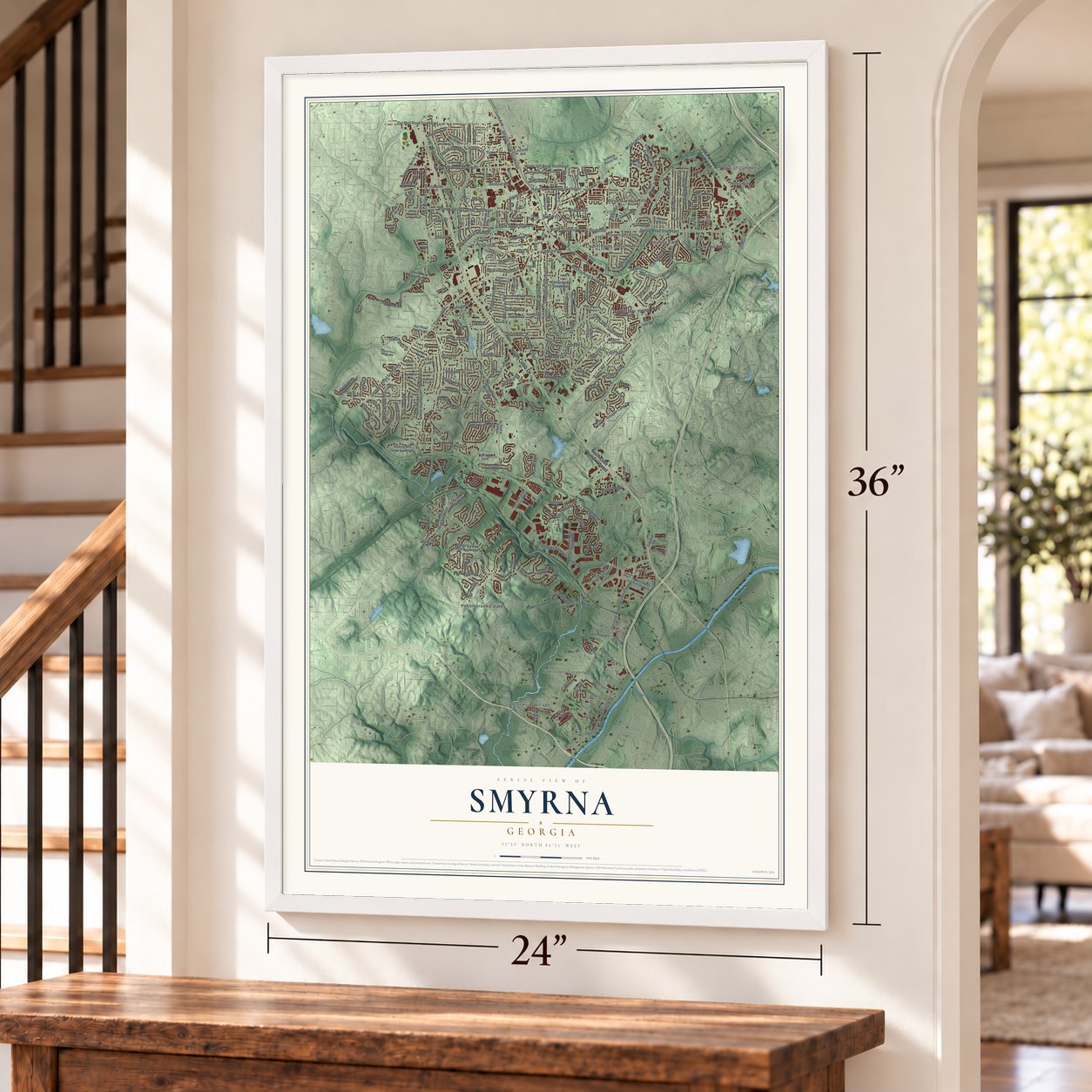

Free U.S. delivery 7 to 10 days after you order
Smyrna, Georgia Map Art
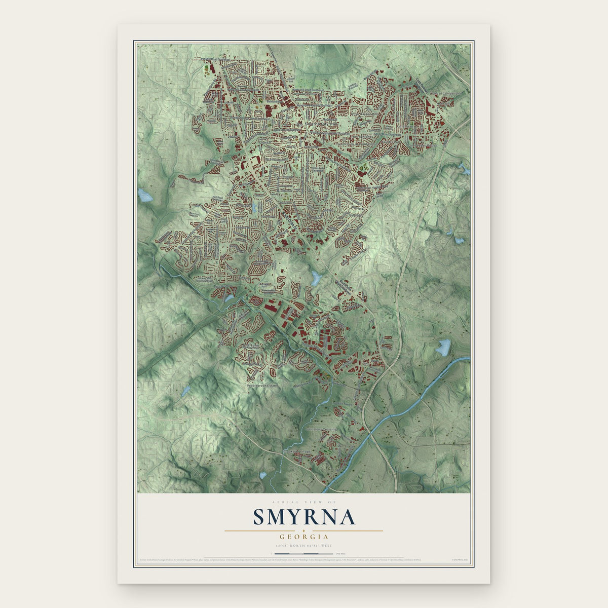
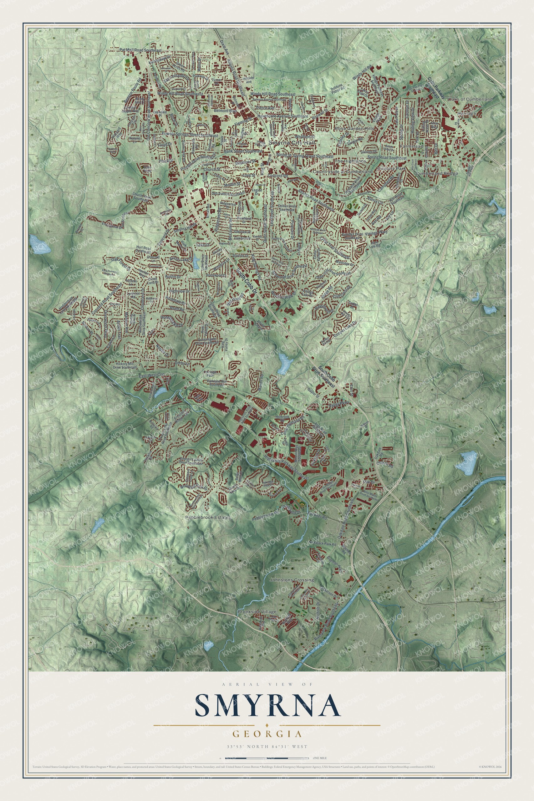
A new map of Smyrna, Georgia, made in 2026 and printed to order on thick archival matte paper.
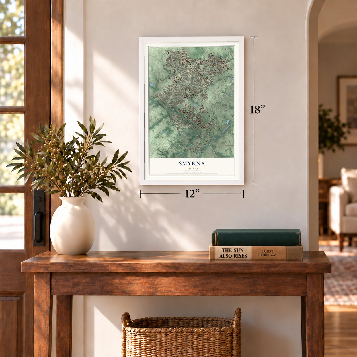
12" x 18" Archival Matte Print
A Map of Home. A Work of Art.
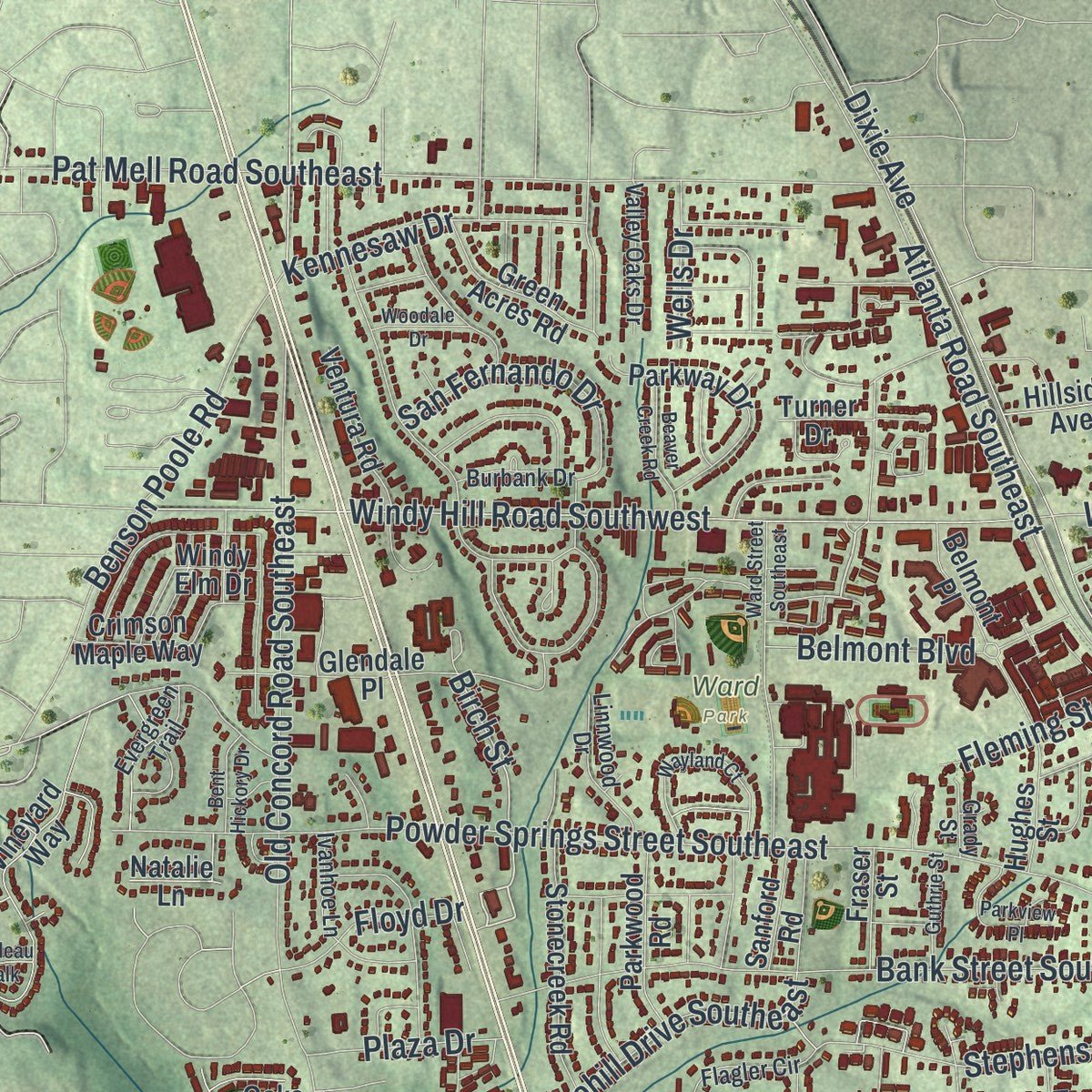
Explore Smyrna, Georgia from a whole new perspective. Created using aerial imagery and detailed geographic data, this map captures Smyrna building by building, with labeled streets, familiar landmarks, and shaded topographical relief that highlights the natural contours of the landscape.
Combining modern data with the timeless character of a vintage atlas, this map is just as interesting up close as it is beautiful on the wall. Whether you grew up in Smyrna, spent memorable years there, or call it home today, this unique map is a great way to celebrate a place that means something to you. Zoom in on the preview to look for your street, and then order a print to put your memories on the wall.
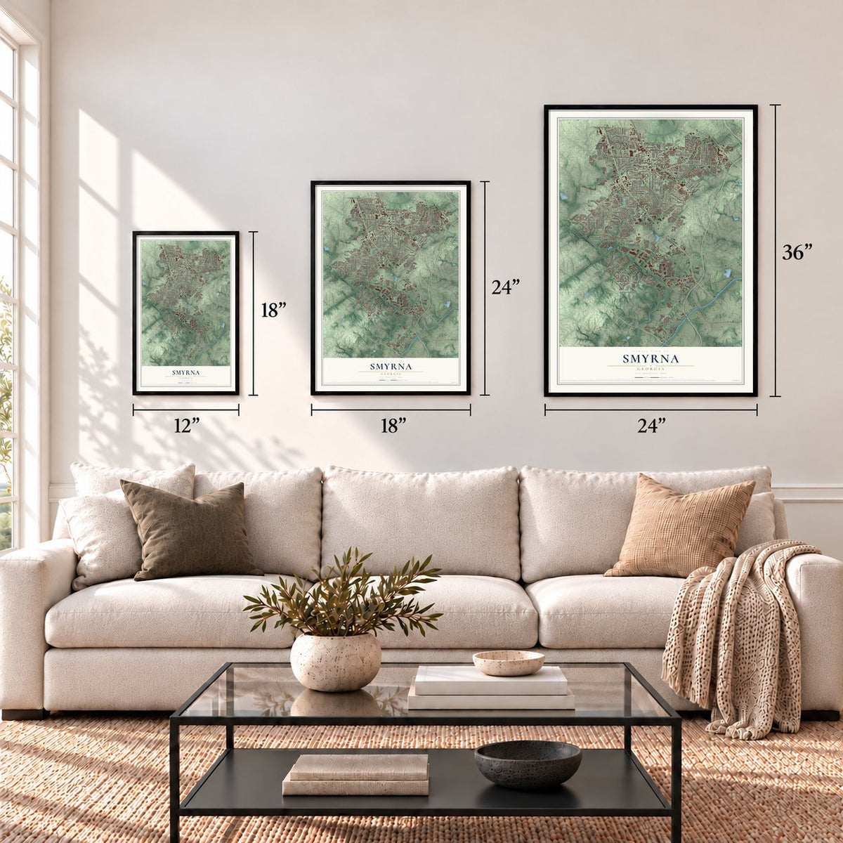
Three ways to hang it
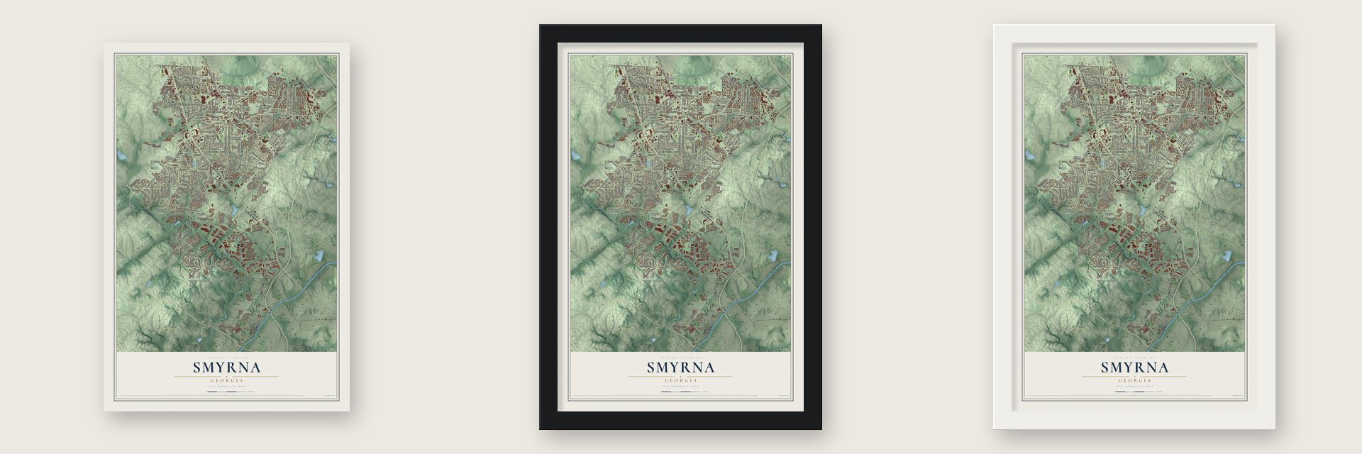
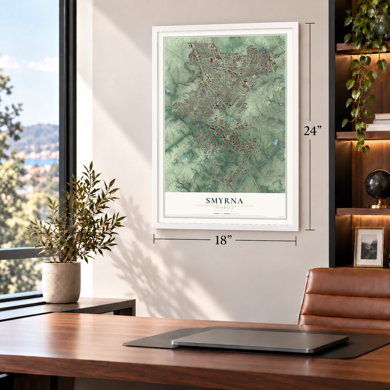
Unframed archival matte, a black wood frame or a white wood frame.
Up close
Geography Worth Displaying
This map was created using accurate cartographic data and authoritative geographic sources, including the U.S. Geological Survey (USGS) and FEMA. The map brings together terrain, waterways, roads, and building detail. The majority of the streets are labeled, houses are accurately depicted, and the topography is derived from government sources. Combining local data with carefully composed color and shading leads to this beautifully detailed Smyrna artwork for your wall.
Rather than simply showing street outlines, we’ve included as many of the street names as we could reasonably fit on the map while keeping their names legible. Zoom in on the high resolution preview to see exactly what’s on the map. We truly set out to create a statement piece for anyone who loves Smyrna. So whether it’s for you, or a gift for someone you love, we hope this map of Smyrna brings back fond memories.
Explore the full map of Smyrna, Georgia and read about the local places it shows.

About Smyrna, Georgia
Smyrna is a city of 55,663 people in Cobb County, northwest of Atlanta. Pioneers started settling here in 1832, and by the late 1830s a religious gathering place called Smyrna Camp Ground was drawing travelers and was known all over Georgia. The camp took its name from the Biblical city of Smyrna, today's İzmir in Turkey, which was home to the Christian martyr Polycarp.
When the Western and Atlantic Railroad was finished in 1842, the settlement began to grow along the tracks. Over the next three decades the stop went by several names, among them Neal Dow, Varner's Station, Ruff's Siding and Ruff's Station, until the town was incorporated in 1872 under the old camp's name, Smyrna.
- Two battles on July 4, 1864On July 4, 1864, Civil War troops fought twice in the area on a single day, once at Smyrna Camp Ground and once at Ruff's Mill. Afterward Sherman's troops burned the area's homes and businesses.
- Lockheed reopened in 1951During World War II the nearby Bell Bomber plant built B-29 bombers. Lockheed reopened the plant in 1951, and the work it brought helped the city grow fast. Smyrna had 2,005 people in 1950 and almost 20,000 by 1970.
- Market Village, from 1991In 1991 the city began a project called Market Village to give Smyrna a clear downtown. It added a community center and a 28,000-square-foot public library, along with shops and homes laid out like a village of the early 1900s around a square with a fountain. The Smyrna Public Library is the only library in Cobb County outside the county system, and the square now hosts open-air concerts and festivals.
- The Jonquil CitySmyrna's official symbol is the jonquil. Thousands of them bloom in yards and beside the streets each spring, which gave the city its nickname, the Jonquil City.
Find your street
Names on the Smyrna map
Every name below is printed on this map. Look for your street, your school, the park where you played, or the pond down the road.
Places and landmarks14
- Smyrna City Hall
- Oaks of Cumberland
- Heritage
- Tolleson Park
- Ward Park
- Brookside Village
- Country Park
- Countryside at Cumberland
- Cumberland Bridge
- Farmstead
- Johnstons Crossing
- Pebblebrook Estates
Show all 14 places
- Rose Garden Hills
- The Highlands
Streets and roads280
- South Cobb Drive
- East-West Con
- Spring Road Southeast
- Spring Street Southeast
- Concord Road
- Concord Road Southeast
- Teasley Drive
- Whitefield Drive
- Birch Street
- Turpin Road
- Highlands Parkway Southeast
- Atlanta Road Southeast
- Windy Hill Road Southeast
- Old Concord Road Southeast
- Oakdale Road Southeast
- King Springs Road
- Atlanta Road Southwest
- Powder Springs Street Southeast
- Pat Mell Road Southeast
- Windy Hill Road Southwest
- Lee Street Southeast
- Pebblebrook Road
- Riverview Road Southeast
- Church Street
- Windy Hill Road
- Roswell Street
- Bank Street Southeast
- Dunn Street Southeast
- Ridge Road
- Dixie Avenue
Show all 280 streets
- Campbell Road
- Hawthorne Avenue Southeast
- Reed Road
- Concord Drive
- Manson Avenue
- Spring Street
- Spring Drive
- Carolyn Drive
- McCauley Road
- Stephens Street
- Honeysuckle Drive
- Benson Poole Road
- Ashwood Drive Southeast
- Ridgehurst Drive
- Deerwood Parkway
- Highview Drive
- Cooper Lake Drive
- Derby Lane
- Medlin Street
- Austin Drive
- Cliff Crest Drive
- Cloudland Drive
- San Fernando Drive
- Camp Highland Road
- Valley Parkway
- Fawn Lane
- Wexford Walk Drive
- Austin Lake Drive
- Creat Trail Southeast
- Pinehill Drive Southeast
- Kennesaw Drive
- Pinetree Drive
- Buckner Road
- Oak Forest Drive
- Ridgecrest Road
- Pierce Avenue
- Rolling View Drive
- Belmont Boulevard
- Norton Place
- Nancy Circle
- Reed Street
- Mill Pond Road
- King Street
- Mavell Road
- Ann Road
- Whitfield Street
- Bell Drive
- Woodleaf Park Drive
- Vinings Parkway
- Antler Trail
- Jay Lane
- Nichols Drive
- Smyrna Hill Drive
- Floyd Drive
- Fleming Street
- Wisteria Lane
- Duxford Drive
- Nowlin Drive
- Love Street
- Wells Drive
- Rosedale Drive
- Lake Court
- Plaza Drive
- Church Road
- Oak Drive
- Lois Street
- Cobb Parkway Southeast
- South Cobb Drive Southeast
- Village Parkway Southeast
- Vinings Estates Drive Southeast
- Village Parkway
- Church Road Southeast
- Glenroy Drive
- Carriage Path
- Gaylor Street
- Cooper Lake Road Southeast
- Lake Drive Southeast
- Queensgate Drive Southeast
- Ennisbrook Drive Southeast
- Highland Drive Southeast
- Gann Road Southeast
- Galleria Lane
- Collier Drive Southeast
- Freeman Parkway
- Willowbrook Drive Southeast
- Argo Road Southeast
- Wilson Way Southeast
- Cedar Cliff Drive Southeast
- Vineyard Way
- Grand View Drive
- Glendale Place
- Oakdale Drive
- Parkway Drive
- Oakview Drive
- Hickory Mill Drive Southeast
- Dell Avenue Southeast
- Stonecreek Road
- Ann Road Southeast
- Pinehurst Drive
- Jane Lyle Road
- Parkland Run Southeast
- Lake Park Drive
- Falling Water Drive
- Park Manor Drive
- Afton Way
- Belmont Place
- Concord Circle
- Nickajack Park Road
- Park Road
- Crimson Maple Way
- Haddenham Lane Southeast
- Green Acres Road
- Cloud Land Drive
- Dickerson Drive
- Lakes Edge Drive
- King Valley Drive
- Parkwood Road
- Havilon Way
- Belridge Drive Southeast
- Starline Drive
- Brentwood Drive
- Hurt Road Southeast
- Ventura Road
- Crescent Cove Lane
- Brown Road
- Ridgecrest Drive
- Drewsbury Court
- Vinings Falls Drive
- Windy Elm Drive
- Crescent Ridge Trail
- Cedar Valley Drive
- Howell Drive
- Dobbins Patrol Road
- Wynridge Drive
- Evadale Trce
- Hughes Street
- Belair Bluff Court
- Mitchell Road
- River Valley Drive
- Oakdale Road
- Mayfield Way
- Lynhurst Road
- Sanford Road
- Fraser Street
- Civitania Road
- Rhyne Chase
- Concord Lane
- Autumn Lane
- Holbrook Road
- Hillside Avenue
- Kathy Lane
- Sadler Drive
- Legion Drive
- Shirley Street
- Turner Drive
- Oaks Parkway
- Brooks Court
- Natalie Lane
- Felix Way
- Millwood Trail Southeast
- Belmont Avenue Southeast
- Forest Drive Southeast
- Glenhurst Drive
- Vinings Mill Trail
- Doeskin Lane
- Collier Gate Court Southeast
- Gilbert Street Southeast
- Lake Ridge Drive Southeast
- Daniell Drive
- Fontaine Road Southeast
- Ivanhoe Lane
- Spring Hill Parkway
- Isoline Way
- Clifton Road
- Highlands Ridge Road Southeast
- Mosswood Lane
- Winding Valley Drive
- West Maner Road Southeast
- Nickajack Road
- Linnwood Drive
- Evergreen Trail
- Healey Drive
- Valley Oaks Drive
- Lakeview Terrace
- Woodcrest Drive
- Beech Valley Drive
- Village Green Circle
- Sharp Drive Southeast
- Flagler Circle
- Highland Avenue
- Burbank Drive
- Garden Park Drive
- Elizabeth Street
- Oak Ridge Court
- Ridgebend Way
- Cottesford Drive
- Prince Road
- Oakridge View Drive
- Rebecca Lane
- Memorial Place
- Hornell Lane
- Wills Street
- Sophia Lane
- Legacy Cv Lane
- Grady Street
- Hanson Drive
- Telfair Drive
- Lewis Drive
- Lake Park Drive Southeast
- Ward Street Southeast
- Clay Brooke Drive Southeast
- Windsor Green Court Southeast
- Gordon Circle
- Walton Way
- Jonquil Drive
- Parkwood Oaks Lane
- Wayland Court
- Oakwood Way
- Adderbury Lane
- Harmony Walk Way
- Woodruff Drive
- Spruce Drive Southeast
- Bent Hickory Drive
- Beaver Creek Road
- Crescentry Brk
- Parkview Place
- Wynbrook Trce
- Mohawk Place Southeast
- Justine Way Southeast
- Early Parkway Southeast
- Guthrie Street
- Benell Court
- Hawthorne Court
- Emory Lane
- Montclair Court
- Rhyne Circle
- Pineview Drive
- Aline Wolfe Drive
- Walton Lane
- Woodale Drive
- Koa Court Southeast
- Magbee Drive
- Highview Terrace
- Valley Drive
- Davis Street
- Hunter Street
- Hargrove Road
- Oakdale Court
- Bordeau Walk
- Tululah Trail
Names are listed as they appear on the printed map. Zoom into the product photos to find them.
The art of mapping a place
How This Map Was Made
Real places. Remarkable detail. Discover the layers that turn geographic data into a map of home.

The view from above
Aerial imagery reveals the character of the land: woodland, open fields, and the patterns of a place.

The shape of the land
Elevation data brings hills, valleys, and subtle changes in the landscape into view.

The details of home
Roads, waterways, and building footprints come together to make the map feel unmistakably local.

Geography becomes art
Considered color, shading, and typography bring the layers together in a map made for your wall.


Process illustrated with Mendon, Massachusetts. Aerial imagery: USDA NAIP. Terrain: USGS 3D Elevation Program. Map details and finished artwork: KNOWOL.
The Details
About This Print
Choose an archival matte print, or a black or white Ayous wood frame. The archival matte print is unframed.
Select your size and finish above to see the matching product image and price.
Materials & Craftsmanship
A contemporary map with the character of a classic atlas, printed on archival matte paper. Optional frames are made from Ayous wood.
Your printed map does not include the watermark shown in the full-map preview.
Shipping & Delivery
Free shipping within the United States. Every print is made to order in the USA.
Buying a gift? Add a note in your cart and we'll include it. We never put prices in the package.
Prints ship within 2 to 3 business days. Allow 7 to 10 days total from ordering for delivery. Timing may vary during holidays or periods of high order volume.
Read our shipping policy.
Returns and damaged prints
Each print is made to order. Change-of-mind refunds are not available after production.
If your print arrives damaged, misprinted or incorrect, contact support@knowol.com within 30 days of receiving it. Include your order number, photos and a description of the issue.
Read our full refund and replacement policy. For questions about your order, email support@knowol.com.
Find your town
Looking for another city?
Find a map of home in our Georgia collection, or any town in the country.
Nearby
Maps of towns near Smyrna
Know someone from one of these towns? Their map makes a great gift.
 Vinings
, Georgia
From $39.99See the map
 Whittier Mill Village
, Georgia
From $39.99See the map
 Riverside
, Georgia
From $39.99See the map
More maps nearby: Paces, Chattahoochee, Fair Oaks, Whitewater Creek and Pleasant Hill.