
Search for another town




Free U.S. delivery 7 to 10 days after you order
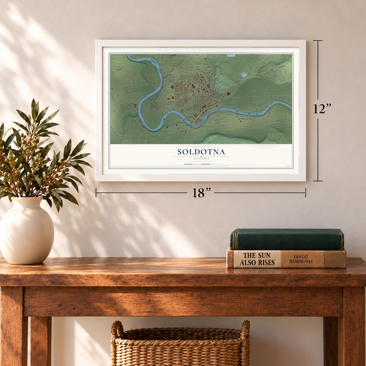
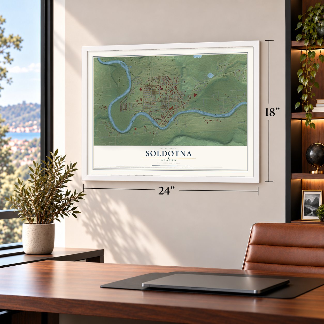
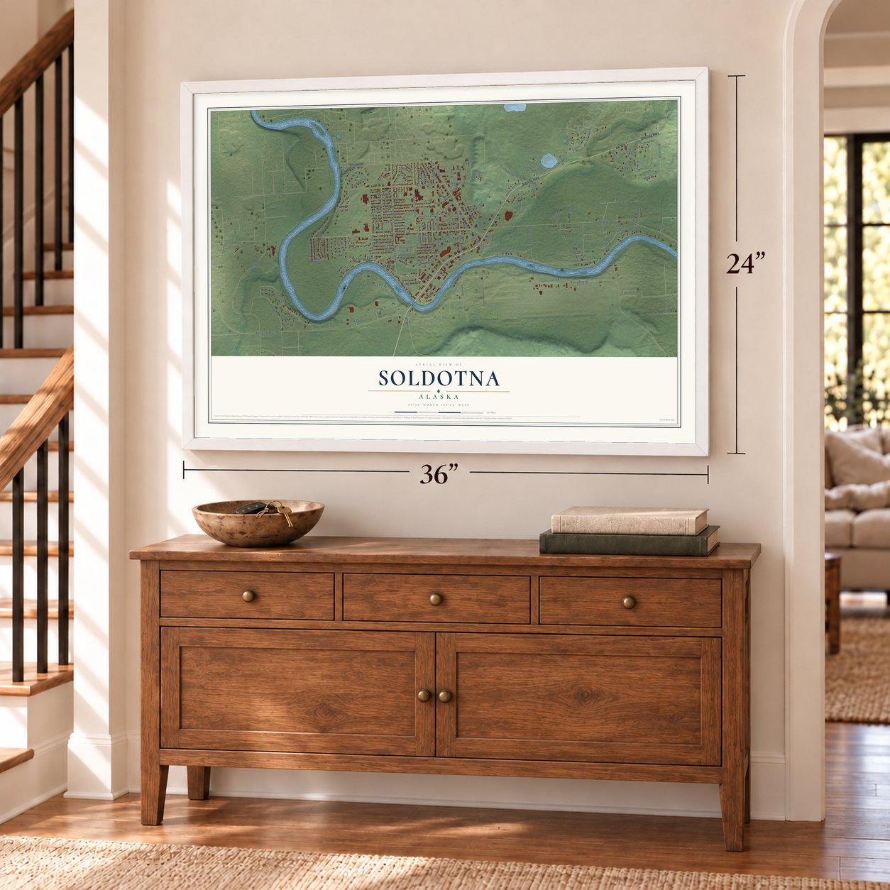
Soldotna, Alaska Map Art
Building by building, with labeled streets and shaded relief.
12" x 18" Archival Matte Print
A Map of Home. A Work of Art.
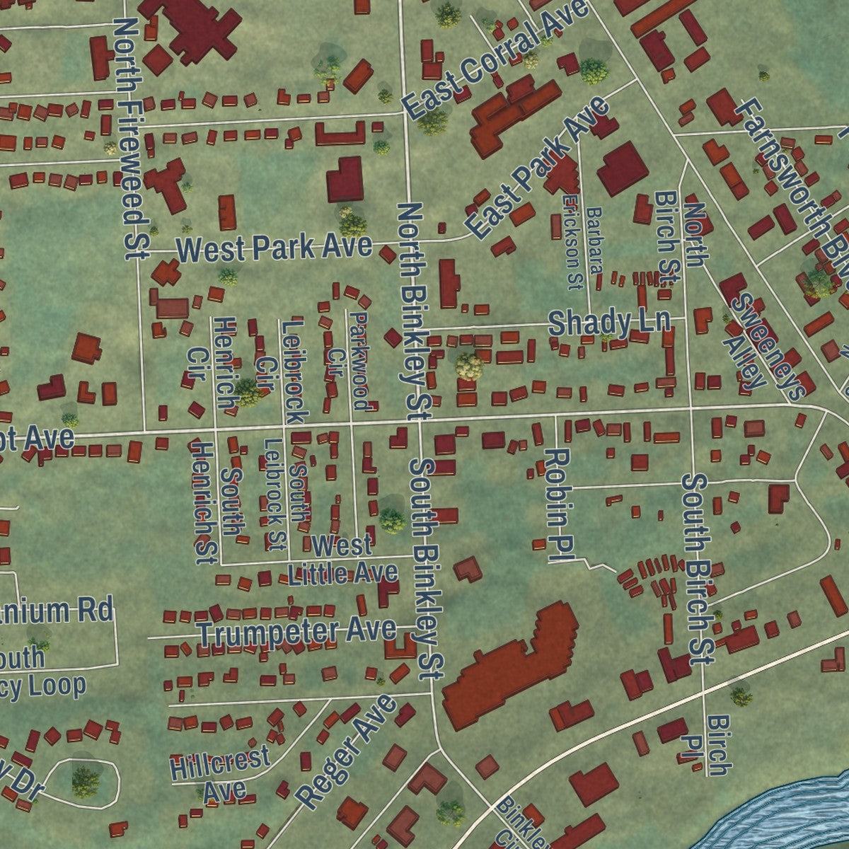
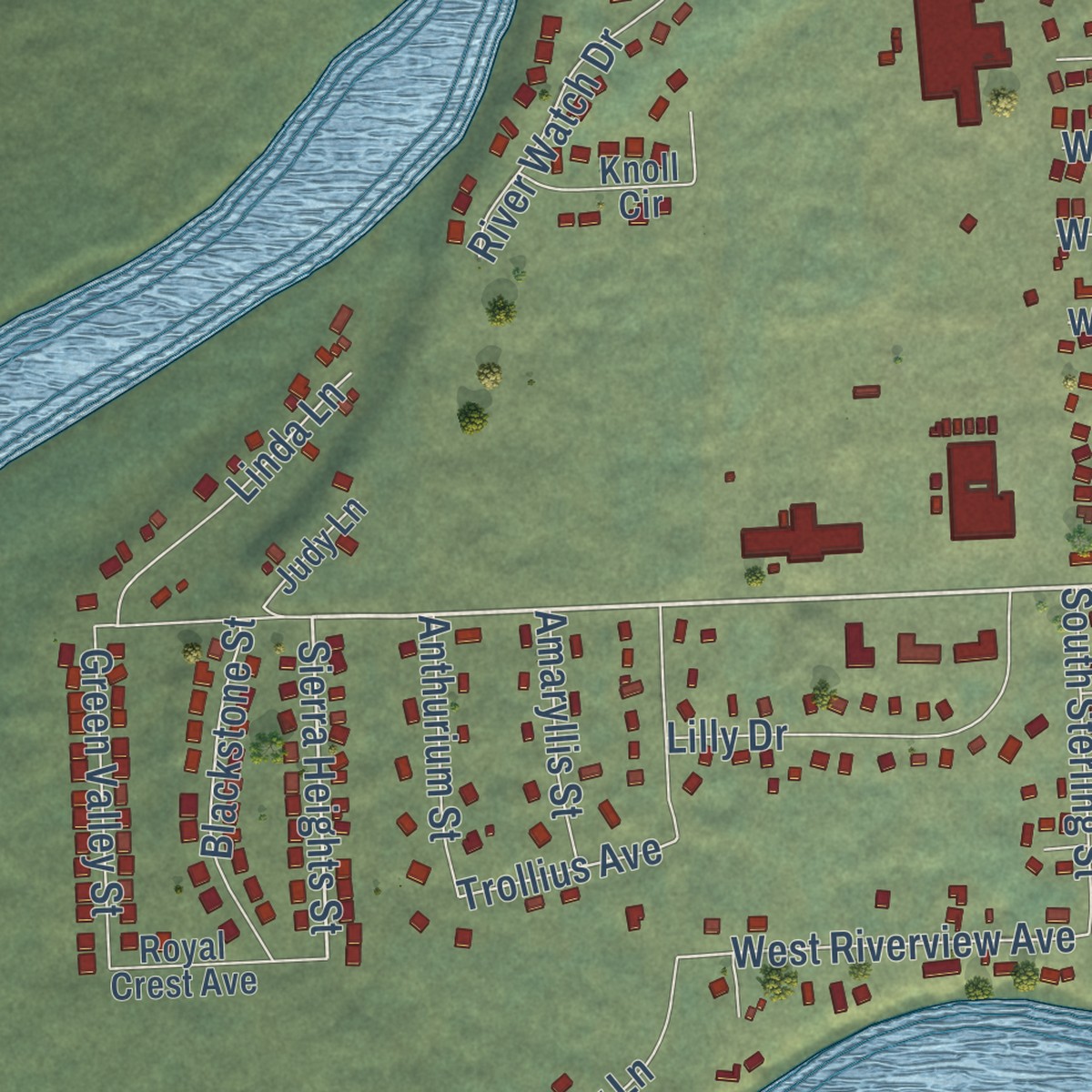
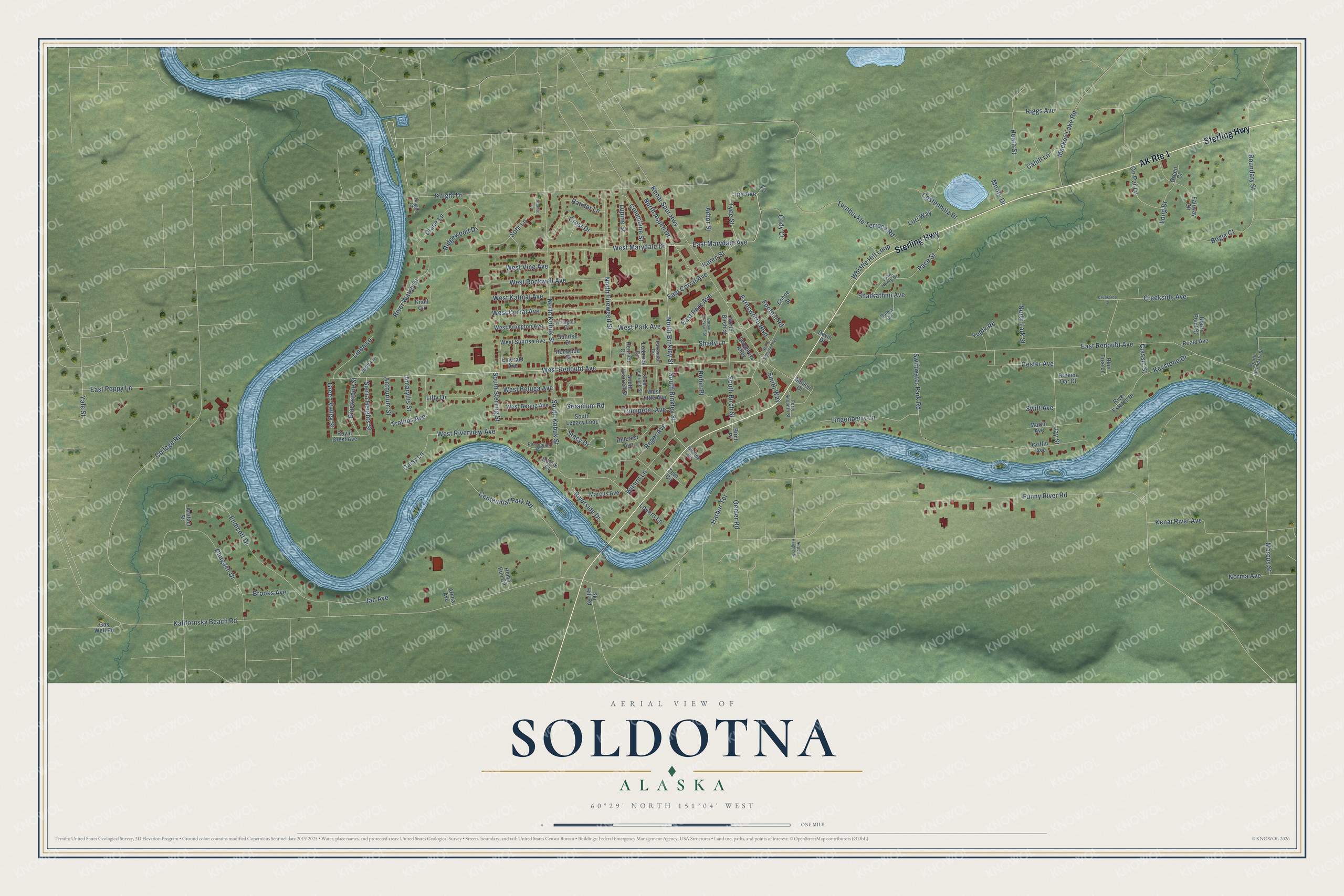
Explore Soldotna, Alaska from a whole new perspective. Created using aerial imagery and detailed geographic data, this map captures Soldotna building by building, with labeled streets, familiar landmarks, and shaded topographical relief that highlights the natural contours of the landscape.
Combining modern data with the timeless character of a vintage atlas, this map is just as interesting up close as it is beautiful on the wall. Whether you grew up in Soldotna, spent memorable years there, or call it home today, this unique map is a great way to celebrate a place that means something to you. Zoom in on the preview to look for your street, and then order a print to put your memories on the wall.
Three ways to hang it
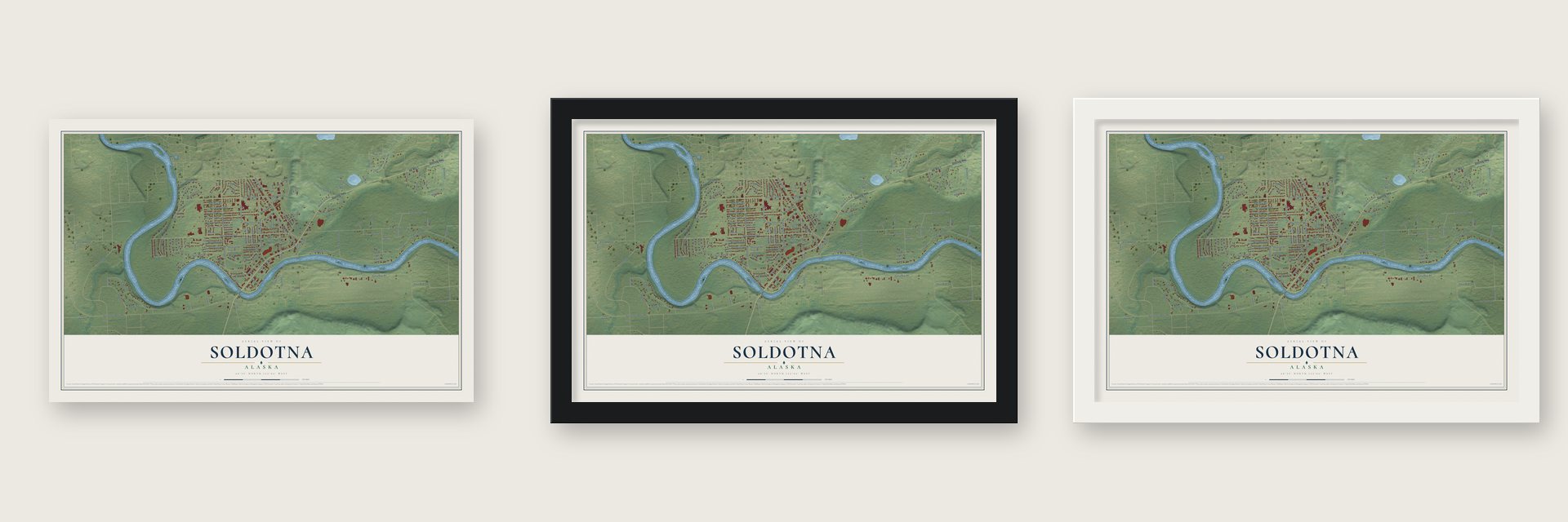
Unframed archival matte, a black wood frame or a white wood frame.
Up close
Geography Worth Displaying
This map was created using accurate cartographic data and authoritative geographic sources, including the U.S. Geological Survey and the Census Bureau. The map brings together terrain, waterways, roads, and building detail. The majority of the streets are labeled, houses are accurately depicted, and the topography is derived from government sources. Combining local data with carefully composed color and shading leads to this beautifully detailed Soldotna artwork for your wall.
Rather than simply showing street outlines, we’ve included as many of the street names as we could reasonably fit on the map while keeping their names legible. Zoom in on the high resolution preview to see exactly what’s on the map. We truly set out to create a statement piece for anyone who loves Soldotna. So whether it’s for you, or a gift for someone you love, we hope this map of Soldotna brings back fond memories.
Read the story behind this map of Soldotna, Alaska from 2026.
Find your street
Names on the Soldotna map
Every name below is printed on this map. Look for your street, your school, the park where you played, or the pond down the road.
Streets and roads153
- AK Route 1
- Sterling Highway
- West Redoubt Avenue
- North Binkley Street
- East Marydale Avenue
- Foothill Road
- Iris Avenue
- East Redoubt Avenue
- Tyee Street
- Sierra Heights Street
- South Binkley Street
- Classic Street
- West Riverview Avenue
- Boundary Street
- Trollius Avenue
- College Road
- Kalifornsky Beach Road
- Funny River Road
- Knight Drive
- West Marydale Drive
- Kenai Spur Highway
- Endicott Drive
- South Kobuk Street
- Swiftwater Park Road
- Chugach Drive
- North Kobuk Street
- North Fireweed Street
- West Corral Avenue
- Centennial Park Road
- Turnbuckle Terrace Road
Show all 153 streets
- Kenai River Avenue
- Keystone Drive
- East Poppy Lane
- West Rockwell Avenue
- West Katmai Avenue
- Diane Lane
- North Aspen Drive
- Lingonberry Lane
- Jay Street
- Banner Lane
- Whistle Hill Loop
- Pace Street
- Mackey Lake Road
- Creekside Avenue
- Sohi Lane
- Lilly Drive
- Wilson Lane
- Stacy Drive
- Riverside Drive
- River Watch Drive
- Bogie Court
- Geranium Road
- Hester Avenue
- Oehler Road
- Castenholz Drive
- Reger Avenue
- East Park Avenue
- Riggs Avenue
- South Birch Street
- Harbor Terrace
- Jan Avenue
- Trumpeter Avenue
- On Par Lane
- Blackstone Street
- West Park Avenue
- Linda Lane
- Heath Street
- Lupine Street
- Marcus Street
- Shady Lane
- South Sterling Street
- Columbine Street
- Green Valley Street
- West Beluga Avenue
- West Vine Avenue
- Sharkathmi Avenue
- Farnsworth Boulevard
- Arbor Street
- Brooks Avenue
- Cahill Lane
- Cody Court
- North Lark Street
- Anthurium Street
- Ridgewood Drive
- East Corral Avenue
- Smith Way
- Crest Drive
- Daisy Lane
- Amaryllis Street
- Long Drive
- Karen Street
- Norma Avenue
- Lori Way
- Yupik Road
- Robin Place
- Monte Drive
- Swift Avenue
- Lovers Lane
- Yale Street
- West Sunrise Avenue
- South Henrich Street
- West Little Avenue
- River Estates Drive
- Cohoe Street
- Griffin Avenue
- West Bering Avenue
- West Arlington Avenue
- North Birch Street
- Martin Avenue
- South Legacy Loop
- Marcus Avenue
- Sweeneys Alley
- Fairway Circle
- Knoll Circle
- Hillcrest Avenue
- Royal Crest Avenue
- Gas Well Road
- Roald Avenue
- Rain Tree Lane
- Judy Lane
- Sunrise Court
- Redwood Court
- North Point Street
- Arena Avenue
- Artifact Street
- Home Run Circle
- Henrich Circle
- Leibrock Circle
- Broken Oar Court
- Emerald Avenue
- Ski Hill Road
- Mullen Drive
- Tern Circle
- Devin Drive
- Kobuk Court
- Green Court
- Birch Place
- South Boundary Street
- Porcupine Court
- John Henry Drive
- Dalhia Circle
- South Leibrock Street
- Forty Seventh Street
- Arlington Court
- Parkwood Circle
- Binkley Circle
- Knight Court
- Barbara Erickson Street
- North Soldotna Avenue
- Creekside Court
- Airport Heights Street
- Starlite Lane
- Iris Court
Names are listed as they appear on the printed map. Zoom into the product photos to find them.
About Soldotna, Alaska
Soldotna is a city of 4,342 people on the Kenai River and the seat of the Kenai Peninsula Borough. After World War II, in 1947, the federal government took several townships near Cook Inlet and the lower Kenai River out of the Kenai National Moose Range so homesteaders could claim them, and veterans got a 90-day head start on choosing land. Crews cleared a path for the Sterling Highway that same year and picked this spot for its bridge over the Kenai.
The new road tied the area to the rest of Alaska, so more families took homesteads and anglers began arriving to fish. A post office opened in 1949, and other businesses followed over the next few years. The discovery of oil in the Swanson River area in 1957 brought new work, and in 1960 Soldotna incorporated as a fourth class city of 332 people covering 7.4 square miles. It became a first class city in 1967 and won home rule in 2016.
- The log post officeSoldotna's first post office, opened in 1949, is a small two-story log building, 16 by 18 feet, standing where the Kenai Spur Highway meets East Corral Street. The city grew up around it, and it joined the National Register in 2008.
- A 97-pound king salmonOn May 17, 1985, Les Anderson, who then owned Soldotna's Ford dealership, landed a king salmon here that weighed 97 lb 4 oz, the largest ever recorded. Today the wildlife displays at the Soldotna Visitor Center, beside the Kenai River Bridge, include the world record king salmon.
- Borough and college, 1964The Kenai Peninsula Borough government, its school district and Kenai Peninsula College were all formed in 1964, and all three are based in Soldotna. The college's Kenai River Campus sits on 300 wooded acres on the city's west side and enrolls about 2,500 students a semester.
- Named for Soldotna CreekThe city takes its name from nearby Soldotna Creek, though no one agrees on where the word itself comes from. During the 1950s and 1960s the name was most often spelled Soldatna.
Keep exploring Alaska
Soldotna is one of 381 Alaska towns we've mapped. Every dot on the map is a print of its own.
The search covers every state, Alaska first.
Near Soldotna
Order 2 or more town maps and save 10%. Shown in the size and finish you picked above, so they hang as a set.
- Ridgeway 12" x 18" / Archival Matte Print $39.99
- Kalifornsky 12" x 18" / Archival Matte Print $39.99
- Kenai 12" x 18" / Archival Matte Print $39.99
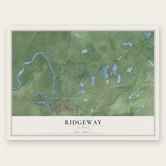


More maps nearby: Sterling, Funny River, Salamatof, Kasilof and Cohoe.
The art of mapping a place
How This Map Was Made
Real places. Remarkable detail. Discover the layers that turn geographic data into a map of home.

The view from above
Aerial imagery reveals the character of the land: woodland, open fields, and the patterns of a place.

The shape of the land
Elevation data brings hills, valleys, and subtle changes in the landscape into view.

The details of home
Roads, waterways, and building footprints come together to make the map feel unmistakably local.

Geography becomes art
Considered color, shading, and typography bring the layers together in a map made for your wall.


Process illustrated with Mendon, Massachusetts. Aerial imagery: USDA NAIP. Terrain: USGS 3D Elevation Program. Map details and finished artwork: KNOWOL.
The Details
About This Print
Choose an archival matte print, or a black or white Ayous wood frame. The archival matte print is unframed.
Select your size and finish above to see the matching product image and price.
Materials & Craftsmanship
A contemporary map with the character of a classic atlas, printed on archival matte paper. Optional frames are made from Ayous wood.
Your printed map does not include the watermark shown in the full-map preview.
Shipping & Delivery
Free shipping within the United States. Every print is made to order in the USA.
Buying a gift? Add a note in your cart and we'll include it. We never put prices in the package.
Prints ship within 2 to 3 business days. Allow 7 to 10 days total from ordering for delivery. Timing may vary during holidays or periods of high order volume.
Read our shipping policy.
Returns and damaged prints
Each print is made to order. Change-of-mind refunds are not available after production.
If your print arrives damaged, misprinted or incorrect, contact support@knowol.com within 30 days of receiving it. Include your order number, photos and a description of the issue.
Read our full refund and replacement policy. For questions about your order, email support@knowol.com.