
Search for another town





Free U.S. delivery 7 to 10 days after you order
Solvang, California Map Art
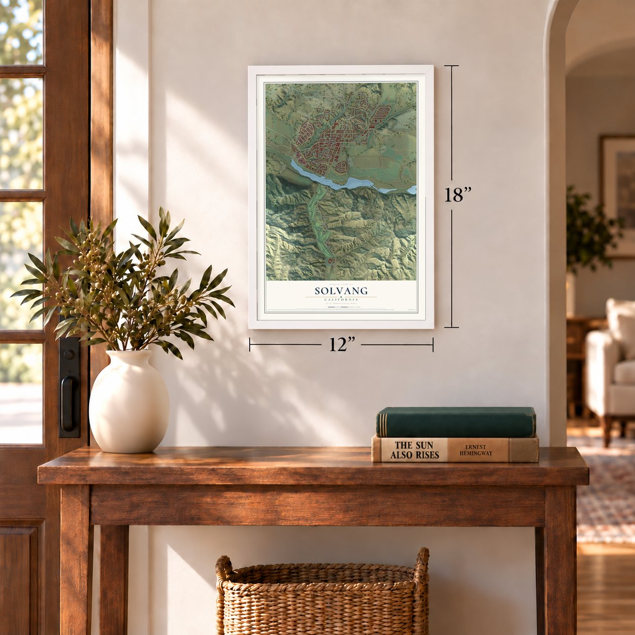
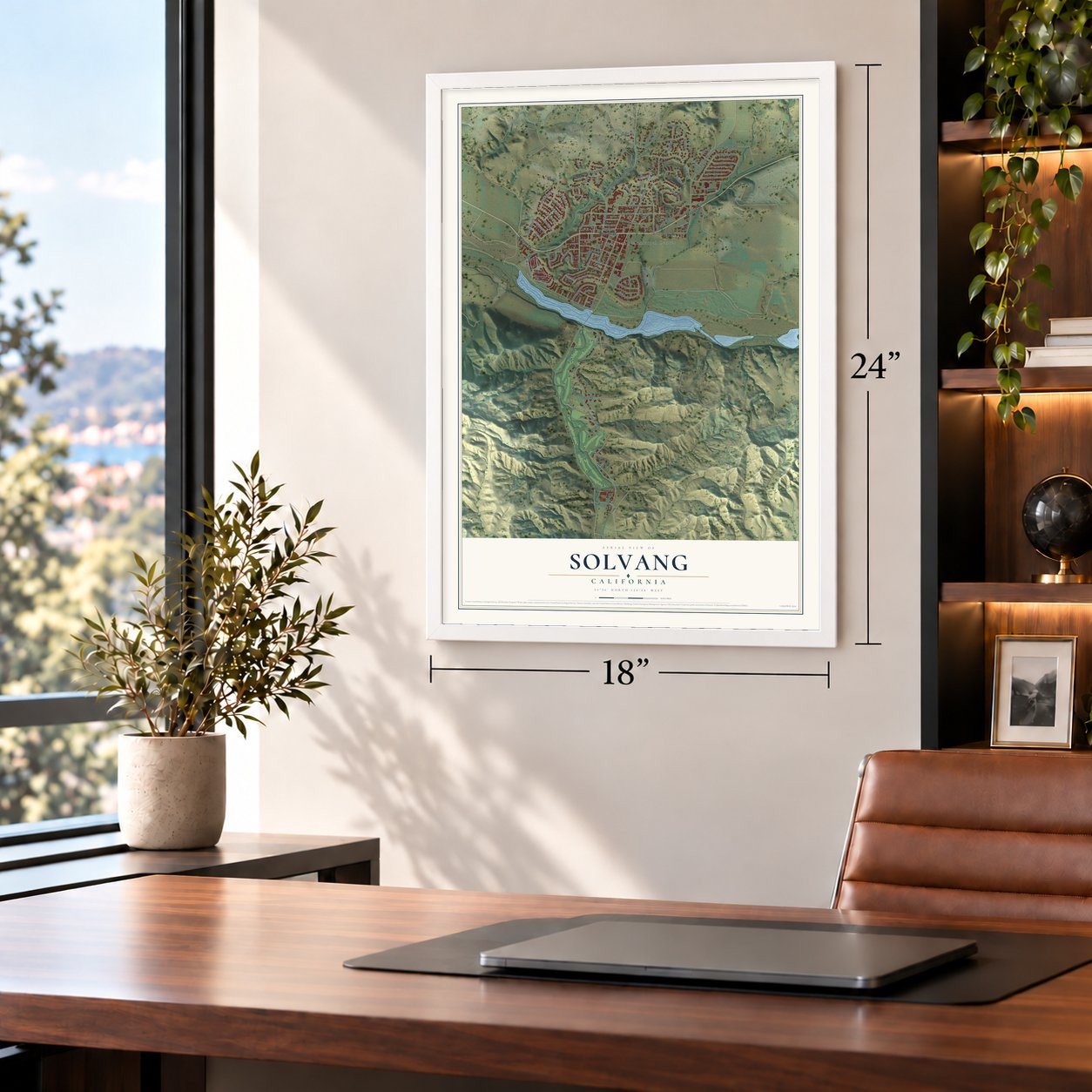
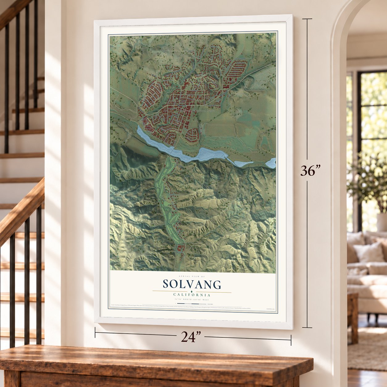
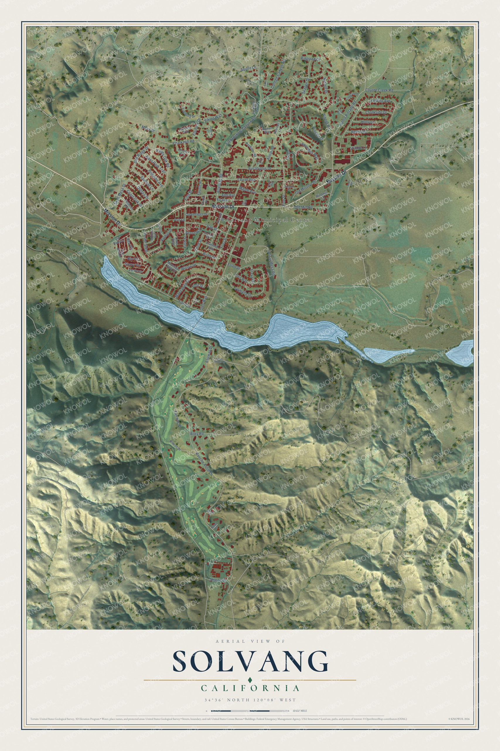
A new map of Solvang, California, made in 2026 and printed to order on thick archival matte paper.
12" x 18" Archival Matte Print
A Map of Home. A Work of Art.
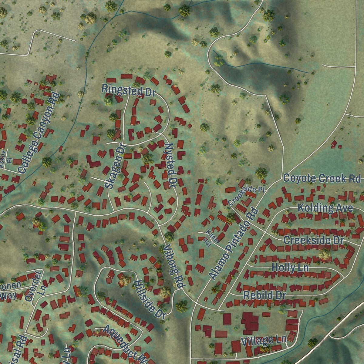
Explore Solvang, California from a whole new perspective. Created using aerial imagery and detailed geographic data, this map captures Solvang building by building, with labeled streets, familiar landmarks, and shaded topographical relief that highlights the natural contours of the landscape.
Combining modern data with the timeless character of a vintage atlas, this map is just as interesting up close as it is beautiful on the wall. Whether you grew up in Solvang, spent memorable years there, or call it home today, this unique map is a great way to celebrate a place that means something to you. Zoom in on the preview to look for your street, and then order a print to put your memories on the wall.
Three ways to hang it
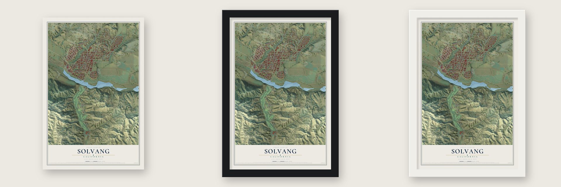
Unframed archival matte, a black wood frame or a white wood frame.
Up close
Geography Worth Displaying
This map was created using accurate cartographic data and authoritative geographic sources, including the U.S. Geological Survey and the Census Bureau. The map brings together terrain, waterways, roads, and building detail. The majority of the streets are labeled, houses are accurately depicted, and the topography is derived from government sources. Combining local data with carefully composed color and shading leads to this beautifully detailed Solvang artwork for your wall.
Rather than simply showing street outlines, we’ve included as many of the street names as we could reasonably fit on the map while keeping their names legible. Zoom in on the high resolution preview to see exactly what’s on the map. We truly set out to create a statement piece for anyone who loves Solvang. So whether it’s for you, or a gift for someone you love, we hope this map of Solvang brings back fond memories.
Read the story behind this map of Solvang, California from 2026.

About Solvang, California
Solvang is a city of 6,126 people in Santa Barbara County, in the Santa Ynez Valley. Its name is Danish for "sunny field." In 1910 Danish Americans in San Francisco formed the Danish-American Colony Company. They wanted land for a Danish town far from cold Midwestern winters. In 1911 the company bought almost 9,000 acres of the old Rancho San Carlos de Jonata, at an average of $40 per acre. It built Solvang around Mission Santa Inés.
Newcomers stayed in a hotel near the mission, and the first school started in 1911 with 21 pupils. Land sales slowed in 1912, so the town's backers went to Iowa and Nebraska to find Danish buyers. New settlers came west. By the 1930s Solvang was the biggest town in the valley. On May 1, 1985, it became California's 440th city.
- Mission Santa Inés, 1804Father Estévan Tapís founded the mission in 1804, halfway between the missions at Santa Barbara and La Purísima Concepción, to take pressure off both and reach the Chumash east of the Coast Range. After Mexico seized the mission lands, it declined and for a time served as a seminary. The Donahue family repaired it in 1884, and Fr. Alexander Buckler renovated it in 1904. The Mission Santa Ines church joined the National Register in 1999.
- Atterdag College, 1914Atterdag College opened in 1914 as a Danish folk high school. It was named for King Valdemar IV of Denmark. Teenage students lived, ate and studied with their teachers. They learned through lectures, singing, gymnastics and folk dancing, with no exams or degrees. Enrollment fell during World War I, and the Solvang Lutheran church bought the school in 1921. It stayed in use as a folk school, meeting hall and gym until it was torn down in 1970.
- Danish facades from 1931Solvang's early buildings looked like any others in the area. Bethania Lutheran Church opened in 1928. It was modeled on a rural Danish church of the 14th century and was the first building here with a Danish design. In 1931 local architect Earl Petersen began adding Danish Provincial facades to older buildings. In the mid-1940s Ferdinand Sorensen, from Nebraska, built his Danish-style home, Møllebakken. Then he built the first of the village's four windmills.
- "Little Denmark" in 1947In 1947 The Saturday Evening Post ran a story about Solvang called "Little Denmark." Weekend visitors from Los Angeles and San Francisco soon poured in. Half-timbered buildings like rural Danish houses spread through downtown. Today the town draws 1.5 million visitors a year.
- Danish Days since 1936Solvang first held Danish Days on June 5, 1936, Denmark's Constitution Day. That first year had parades, folk dancing, gymnastics, theater and concerts. The festival returns every year, led by a Danish Maid. It brings æbleskiver eating contests and a parade of floats and bands through downtown. On Sunday there is a breakfast of medisterpølser sausage and æbleskiver.
Find your street
Names on the Solvang map
Every name below is printed on this map. Look for your street, your school, the park where you played, or the pond down the road.
Places and landmarks1
- Solvang Municipal Center
Streets and roads101
- Mission Drive
- Village Lane
- Olesen Drive
- Oak Ridge Drive
- Valley Oak Road
- Ringsted Drive
- Atterdag Road
- Squire Lane
- Alisal Road
- Rancho Alisal Drive
- Alamo Pintado Road
- Hillside Drive
- Fredensborg Canyon Road
- Viborg Road
- First Street
- Laurel Avenue
- Fjord Drive
- Chalk Hill Road
- Eucalyptus Drive
- Valhalla Drive
- Alisal Mesa Road
- Third Street
- Kolding Avenue
- Fifth Street
- Rebild Drive
- Maple Avenue
- Oak Street
- Old Mission Drive
- Skytt Mesa Drive
- Fairway Drive
Show all 101 streets
- Aarhus Drive
- Sierra Vis
- Elm Avenue
- College Canyon Road
- Skagen Drive
- Freya Drive
- Coyote Creek Road
- Old Mill Road
- Creekside Drive
- Manzanita Drive
- Willow Drive
- Pine Street
- Sharon Place
- Pistache Avenue
- Viking Way
- Fourth Place
- Nysted Drive
- Vester Sted
- Elsinore Drive
- Holly Lane
- Hans Park Trail
- Alta Vis
- Fairway Place
- Aqueduct Way
- Sawleaf Lane
- Mesa Drive
- Fir Avenue
- Coast Oak Drive
- Ivy Lane
- Riley Road
- Birch Drive
- Glen Way
- Acorn Way
- Rio Vis
- Ash Lane
- Copenhagen Drive
- Kronborg Drive
- Adobe Creek Road
- Second Street
- Elverhoy Way
- Rincon Drive
- Odin Way
- Aalborg Way
- Roskilde Road
- Val Verde
- Petersen Avenue
- Via Reposa
- Overdel Lane
- Midten Hof
- Kronen Way
- Pso del Rio
- Oster Sted
- Windmill Lane
- Mountain View Drive
- Esrom Drive
- Bowl Place
- Aebeltoft Way
- Creekside Place
- Amber Way
- Floral Drive
- Aalborg Court
- First Place
- Nykobing
- Kanin Hoj
- Three Springs Road
- Adelgade Drive
- Sycamore Way
- Oxbow Place
- Askov Place
- Ranch Road
- First Court
Names are listed as they appear on the printed map. Zoom into the product photos to find them.
The art of mapping a place
How This Map Was Made
Real places. Remarkable detail. Discover the layers that turn geographic data into a map of home.

The view from above
Aerial imagery reveals the character of the land: woodland, open fields, and the patterns of a place.

The shape of the land
Elevation data brings hills, valleys, and subtle changes in the landscape into view.

The details of home
Roads, waterways, and building footprints come together to make the map feel unmistakably local.

Geography becomes art
Considered color, shading, and typography bring the layers together in a map made for your wall.


Process illustrated with Mendon, Massachusetts. Aerial imagery: USDA NAIP. Terrain: USGS 3D Elevation Program. Map details and finished artwork: KNOWOL.
The Details
About This Print
Choose an archival matte print, or a black or white Ayous wood frame. The archival matte print is unframed.
Select your size and finish above to see the matching product image and price.
Materials & Craftsmanship
A contemporary map with the character of a classic atlas, printed on archival matte paper. Optional frames are made from Ayous wood.
Your printed map does not include the watermark shown in the full-map preview.
Shipping & Delivery
Free shipping within the United States. Every print is made to order in the USA.
Buying a gift? Add a note in your cart and we'll include it. We never put prices in the package.
Prints ship within 2 to 3 business days. Allow 7 to 10 days total from ordering for delivery. Timing may vary during holidays or periods of high order volume.
Read our shipping policy.
Returns and damaged prints
Each print is made to order. Change-of-mind refunds are not available after production.
If your print arrives damaged, misprinted or incorrect, contact support@knowol.com within 30 days of receiving it. Include your order number, photos and a description of the issue.
Read our full refund and replacement policy. For questions about your order, email support@knowol.com.
Find your town
Looking for another city?
Find a map of home in our California collection, or any town in the country.
Nearby
Maps of towns near Solvang
Know someone from one of these towns? Their map makes a great gift.
 Santa Ynez
, California
From $39.99See the map
 Buellton
, California
From $39.99See the map
 Ballard
, California
From $39.99See the map
More maps nearby: Los Olivos, Las Cruces, Los Alamos, Goleta and Lompoc.