


Search for another town





Free U.S. delivery 7 to 10 days after you order
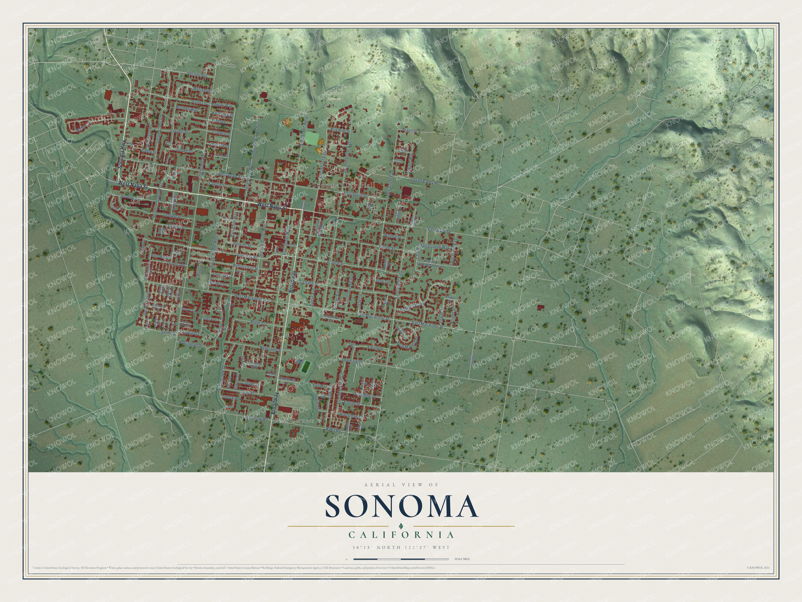
Sonoma, California Map Art
Building by building, with labeled streets and shaded relief.
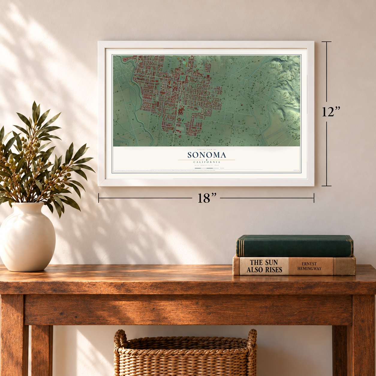
12" x 18" Archival Matte Print
A Map of Home. A Work of Art.
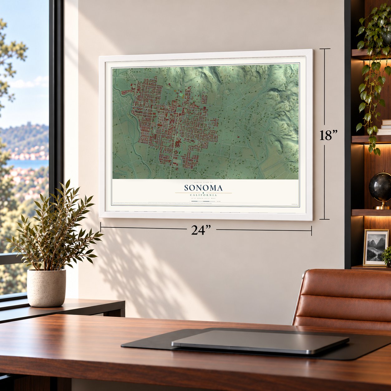
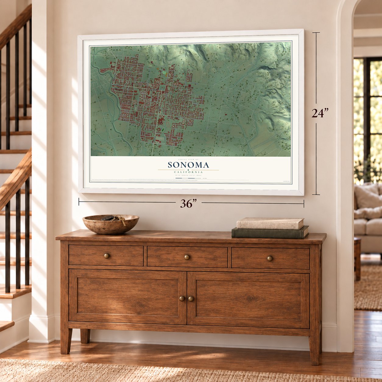
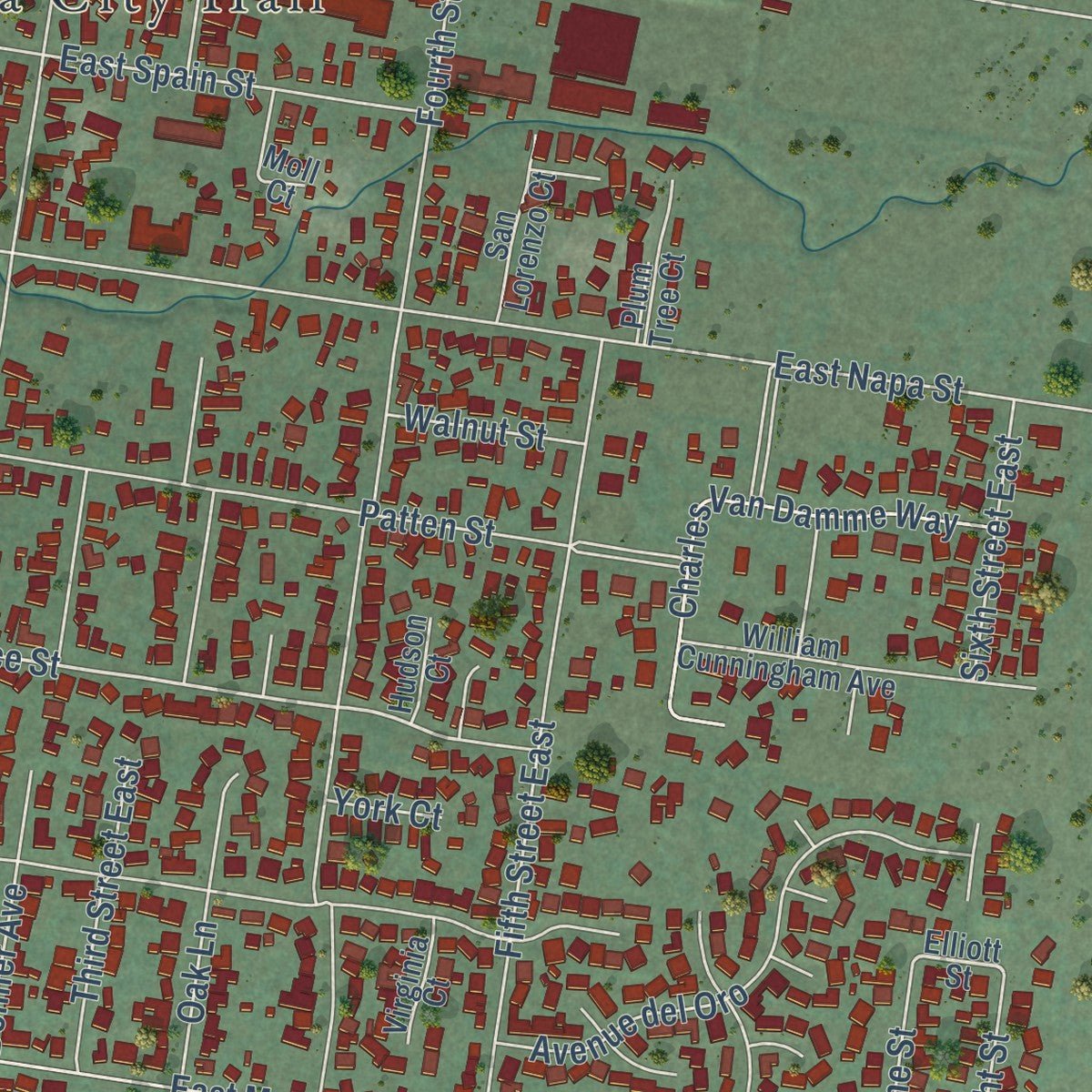
Explore Sonoma, California from a whole new perspective. Created using aerial imagery and detailed geographic data, this map captures Sonoma building by building, with labeled streets, familiar landmarks, and shaded topographical relief that highlights the natural contours of the landscape.
Combining modern data with the timeless character of a vintage atlas, this map is just as interesting up close as it is beautiful on the wall. Whether you grew up in Sonoma, spent memorable years there, or call it home today, this unique map is a great way to celebrate a place that means something to you. Zoom in on the preview to look for your street, and then order a print to put your memories on the wall.
Three ways to hang it
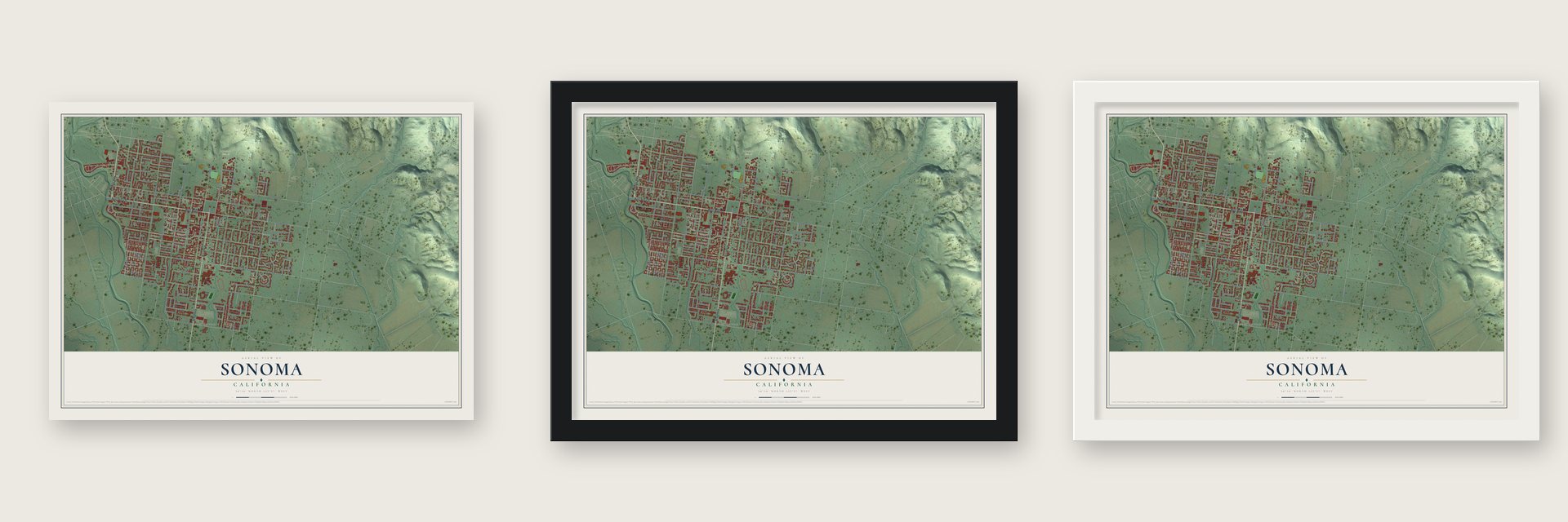
Unframed archival matte, a black wood frame or a white wood frame.
Up close
Geography Worth Displaying
This map was created using accurate cartographic data and authoritative geographic sources, including the U.S. Geological Survey and the Census Bureau. The map brings together terrain, waterways, roads, and building detail. The majority of the streets are labeled, houses are accurately depicted, and the topography is derived from government sources. Combining local data with carefully composed color and shading leads to this beautifully detailed Sonoma artwork for your wall.
Rather than simply showing street outlines, we’ve included as many of the street names as we could reasonably fit on the map while keeping their names legible. Zoom in on the high resolution preview to see exactly what’s on the map. We truly set out to create a statement piece for anyone who loves Sonoma. So whether it’s for you, or a gift for someone you love, we hope this map of Sonoma brings back fond memories.
Read the story behind this map of Sonoma, California from 2026.

Find your street
Names on the Sonoma map
Every name below is printed on this map. Look for your street, your school, the park where you played, or the pond down the road.
Places and landmarks4
- Sonoma City Hall
- Mountain Cemetery
- Four Corners
- Vallejo Home State Park
Streets and roads146
- West Napa Street
- Sonoma Highway
- Broadway
- Verano Avenue
- Montini Way
- Fano Lane
- Fourth Street West
- Andrieux Street
- Third Street West
- Fourth Street East
- France Street
- Curtin Lane
- Fifth Street West
- First Street West
- West Spain Street
- Second Street East
- Fifth Street East
- East Mac Arthur Street
- East Macarthur Street
- East Napa Street
- West Macarthur Street
- Patten Street
- Chase Street
- Second Street West
- First Street East
- Fryer Creek Drive
- Junipero Serra Drive
- East Spain Street
- Ramon Street
- Oregon Street
Show all 146 streets
- Napa Road
- Studley Street
- Brockman Lane
- Joaquin Drive
- Bettencourt Street
- Austin Avenue
- Avenue del Oro
- Lovall Valley Road
- Norrbom Road
- Charles Van Damme Way
- Donner Avenue
- Este Madera Drive
- Robinson Road
- Manor Drive
- Church Street
- Oak Lane
- Seventh Street West
- Leveroni Road
- Lasuen Street
- Newcomb Street
- Eastin Drive
- Clay Street
- East Brockman Lane
- Third Street East
- Malet Street
- Linda Drive
- Mariano Drive
- Del Rio Paseo
- Denmark Street
- Larkin Drive
- Saunders Drive
- Engler Street
- Sonora Drive
- Dewell Drive
- Perkins Street
- Smith Street
- Pickett Street
- Harrington Drive
- Sixth Street East
- Barracchi Way
- Arroyo Way
- Towne Street
- Knight Street
- Palou Street
- La Quinta Lane
- Wilking Way
- Mitchell Way
- Haraszthy Drive
- Rosalie Drive
- Claudia Drive
- Walnut Street
- Brazil Street
- Cox Street
- Cooper Street
- Fine Avenue
- Nicoli Lane
- Nash Street
- Todd Avenue
- Hayes Street
- Park Lane
- Troy Lane
- York Court
- Elliott Street
- Beasley Way
- William Cunningham Avenue
- San Lorenzo Court
- Jones Street
- Pearce Drive
- Ingram Drive
- Nathanson Creek Lane
- Sixth Street West
- Bernice Lane
- Nicora Place
- White Briar Drive
- Cazares Circle
- Guadalajara Drive
- Evans Avenue
- Blue Wing Drive
- Woodworth Lane
- Plum Tree Court
- Macarthur Court
- Greve Lane
- Pueblo Avenue
- Moll Court
- Amedeo Court
- Virginia Court
- Janero Place
- Buena Vista Drive
- Hudson Court
- Marcy Court
- Iris Way
- The Plaza
- Ivy Court
- Arroyo Court
- Gregory Circle
- La Serena Way
- Chiquita Camino
- Manuella Lane
- Pso Palencia
- Este Madera Court
- Pina Avenue
- Davila Court
- Lucca Court
- Lee Court
- Boccoli
- Robinson Street
- Lubeck Street
- El Castillo Vis
- Seventh Street East
- Casabonne Lane
- Emilys Meadow Court
- Maple Street
- Lyon Street
- Hatchery Lane
- Spring Lane
- Eda Court
Names are listed as they appear on the printed map. Zoom into the product photos to find them.
About Sonoma, California
Sonoma is a city of 10,739 people in Sonoma County, at the heart of California's Wine Country. After Mexico's Congress passed its secularization act of 1833, Governor José Figueroa put Mariano Guadalupe Vallejo in charge of closing Mission San Francisco Solano and turning it into a town. Vallejo also brought the soldiers of the San Francisco presidio north to guard against the Russians at Fort Ross and Bodega Bay.
In 1835 Vallejo and William A. Richardson laid out the Pueblo de Sonoma by the Spanish Laws of the Indies, with a grid of streets and lots, a central plaza and a broad main avenue. The town stayed under military rule until Vallejo asked the governor for a civil government. In 1844 Sonoma got its own town council, and Jacobo Leese became its first alcalde.
“On July 4, 1823, Padre José Altamira founded this northernmost of California's Franciscan missions, the only one established in California under independent Mexico.”
- The Bear Flag Revolt, 1846Before dawn on June 14, 1846, thirty-three American rebels rode into Sonoma, some of them from John C. Frémont's camp. They took General Vallejo and three of his associates prisoner, and the twenty-four who stayed made the Sonoma Barracks their headquarters and made their Bear Flag. Their California Republic ended on July 9, when a U.S. Navy officer, Lieutenant Joseph Warren Revere, raised the American flag outside the barracks.
- Vallejo's Rancho PetalumaGovernor Figueroa gave Vallejo about 44,000 acres of Rancho Petaluma, just west of town, and named him Director of Colonization, so he could start land grants for other settlers. Those early grants, along with rival alcaldes selling town lots, left titles so tangled that some lots were sold twice. It took more than thirty years of lawsuits before Sonoma's owners held clear title.
- First county seat, 1850When California became the 31st state on September 9, 1850, Sonoma was named the first county seat of Sonoma County. The miners soon stopped passing through, the Army left, and business slumped in 1851 while Petaluma and Santa Rosa grew faster. An 1854 special election moved the county seat and its courthouse to Santa Rosa.
- City Hall on the PlazaSonoma City Hall stands in the middle of the Sonoma Plaza, the square Vallejo laid out in 1835, and it was dedicated on September 9, 1908. The Plaza's National Register district was enlarged in 1992, and the square still holds a farmers market on Tuesdays in season.
Keep exploring California
Sonoma is one of 1,990 California towns we've mapped. Every dot on the map is a print of its own.
The search covers every state, California first.
Near Sonoma
Order 2 or more town maps and save 10%. Shown in the size and finish you picked above, so they hang as a set.
- Verano 12" x 18" / Archival Matte Print $39.99
- El Verano 12" x 18" / Archival Matte Print $39.99
- Boyes Hot Springs 12" x 18" / Archival Matte Print $39.99
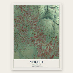
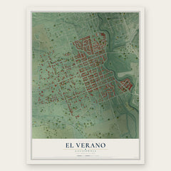
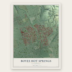
More maps nearby: Fetters Hot Springs-Agua Caliente, Temelec, Eldridge, Glen Ellen and Napa.
The art of mapping a place
How This Map Was Made
Real places. Remarkable detail. Discover the layers that turn geographic data into a map of home.

The view from above
Aerial imagery reveals the character of the land: woodland, open fields, and the patterns of a place.

The shape of the land
Elevation data brings hills, valleys, and subtle changes in the landscape into view.

The details of home
Roads, waterways, and building footprints come together to make the map feel unmistakably local.

Geography becomes art
Considered color, shading, and typography bring the layers together in a map made for your wall.


Process illustrated with Mendon, Massachusetts. Aerial imagery: USDA NAIP. Terrain: USGS 3D Elevation Program. Map details and finished artwork: KNOWOL.
The Details
About This Print
Choose an archival matte print, or a black or white Ayous wood frame. The archival matte print is unframed.
Select your size and finish above to see the matching product image and price.
Materials & Craftsmanship
A contemporary map with the character of a classic atlas, printed on archival matte paper. Optional frames are made from Ayous wood.
Your printed map does not include the watermark shown in the full-map preview.
Shipping & Delivery
Free shipping within the United States. Every print is made to order in the USA.
Buying a gift? Add a note in your cart and we'll include it. We never put prices in the package.
Prints ship within 2 to 3 business days. Allow 7 to 10 days total from ordering for delivery. Timing may vary during holidays or periods of high order volume.
Read our shipping policy.
Returns and damaged prints
Each print is made to order. Change-of-mind refunds are not available after production.
If your print arrives damaged, misprinted or incorrect, contact support@knowol.com within 30 days of receiving it. Include your order number, photos and a description of the issue.
Read our full refund and replacement policy. For questions about your order, email support@knowol.com.