
Search for another town



Free U.S. delivery 7 to 10 days after you order
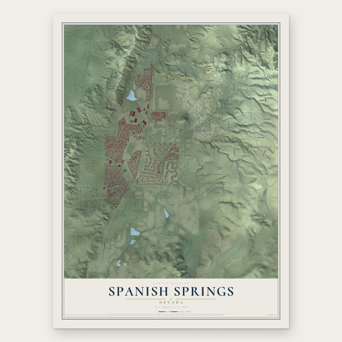
Spanish Springs, Nevada Map Art
Building by building, with labeled streets and shaded relief.
12" x 18" Archival Matte Print
A Map of Home. A Work of Art.
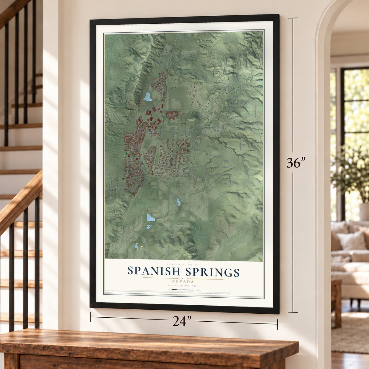
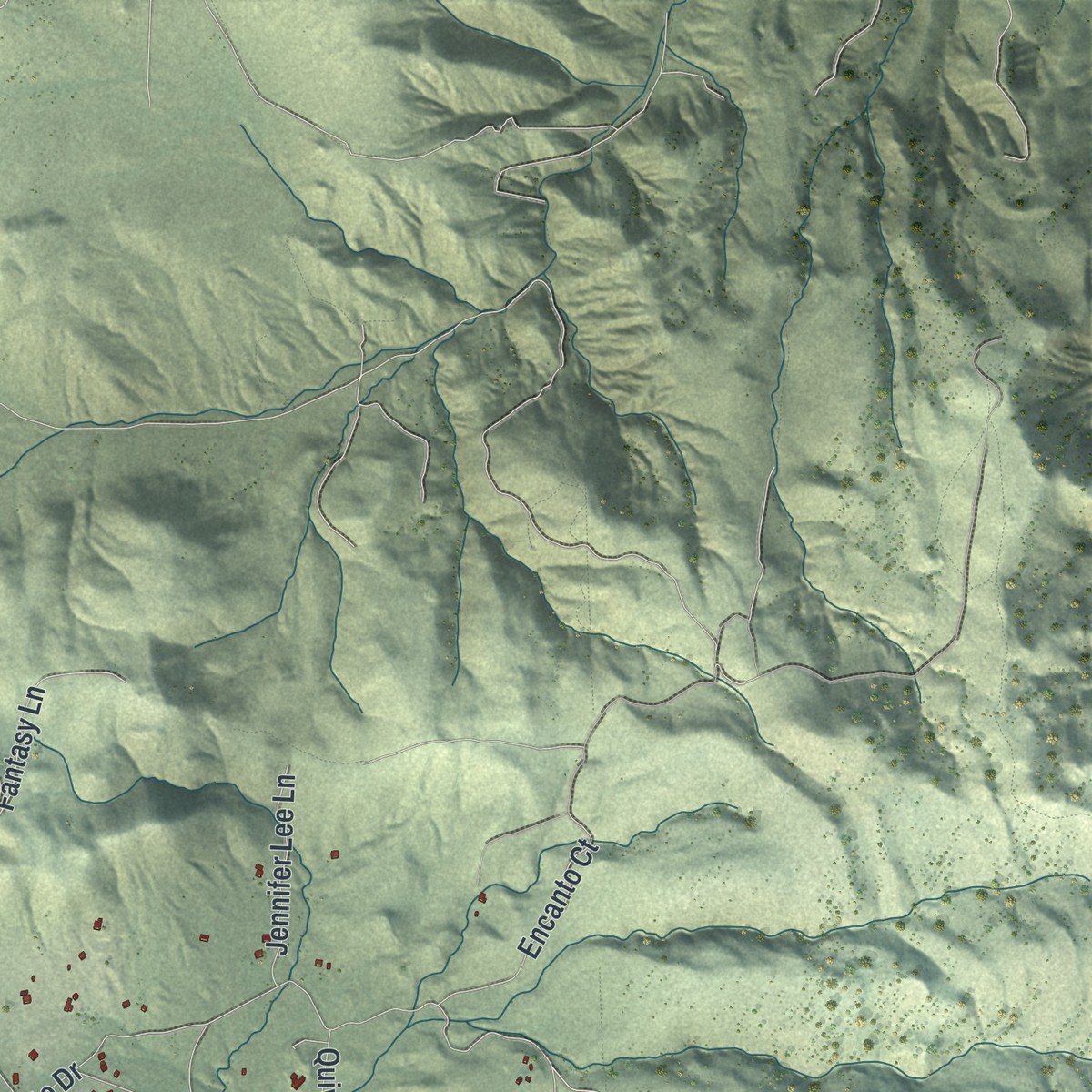
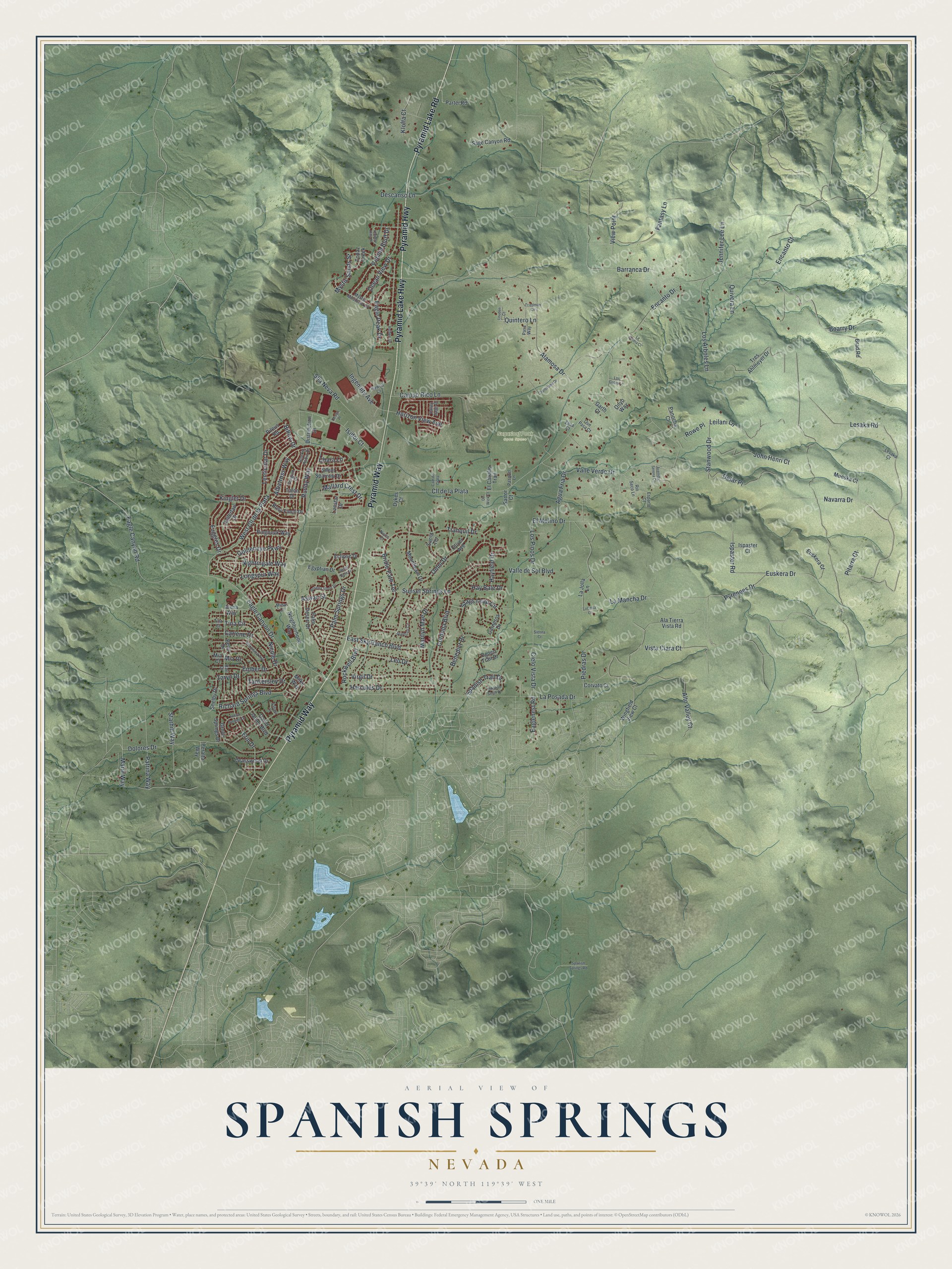
Explore Spanish Springs, Nevada from a whole new perspective. Created using aerial imagery and detailed geographic data, this map captures Spanish Springs building by building, with labeled streets, familiar landmarks, and shaded topographical relief that highlights the natural contours of the landscape.
Combining modern data with the timeless character of a vintage atlas, this map is just as interesting up close as it is beautiful on the wall. Whether you grew up in Spanish Springs, spent memorable years there, or call it home today, this unique map is a great way to celebrate a place that means something to you. Zoom in on the preview to look for your street, and then order a print to put your memories on the wall.
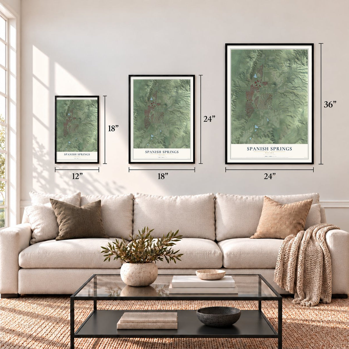
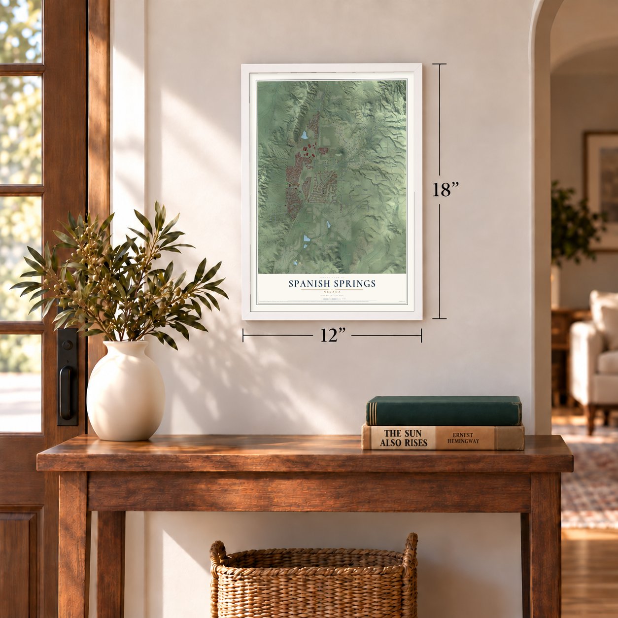
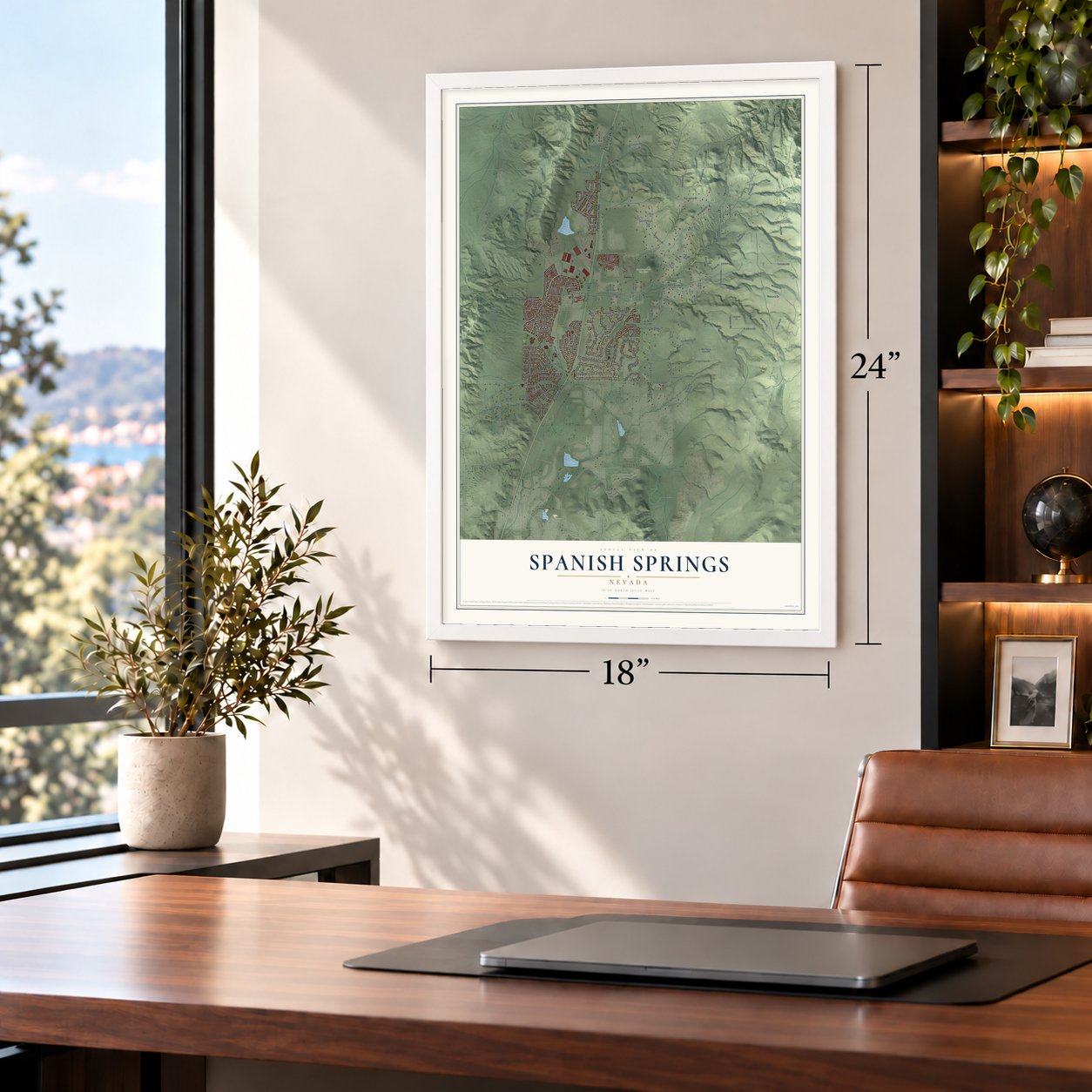
Three ways to hang it
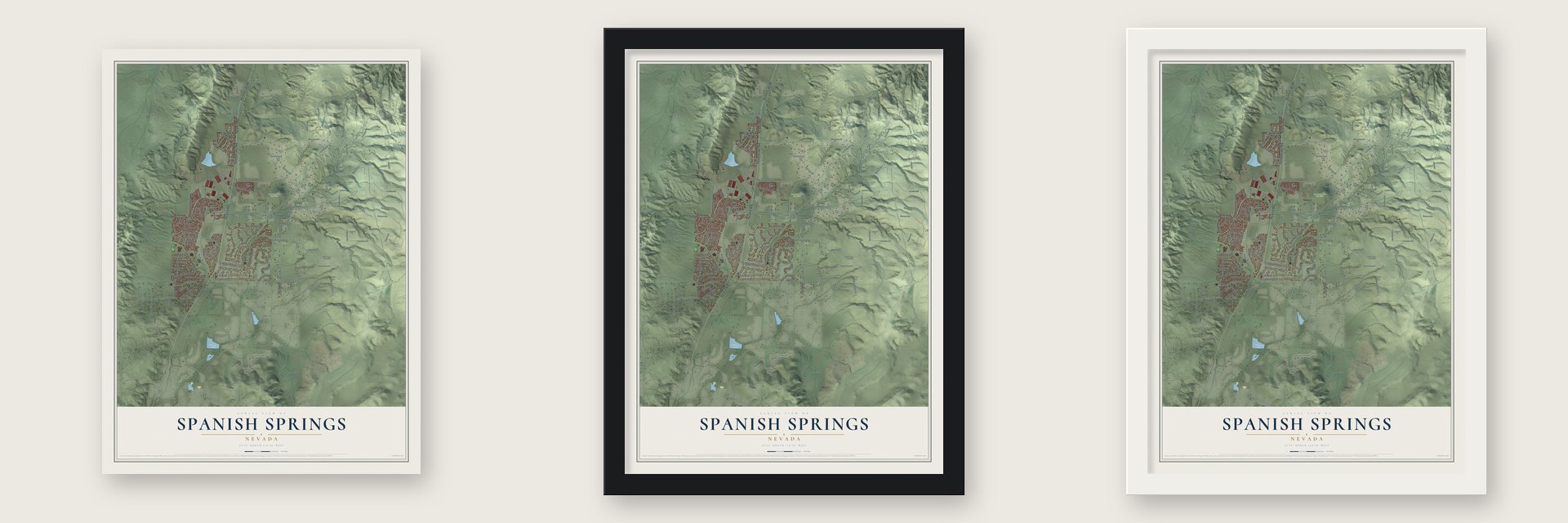
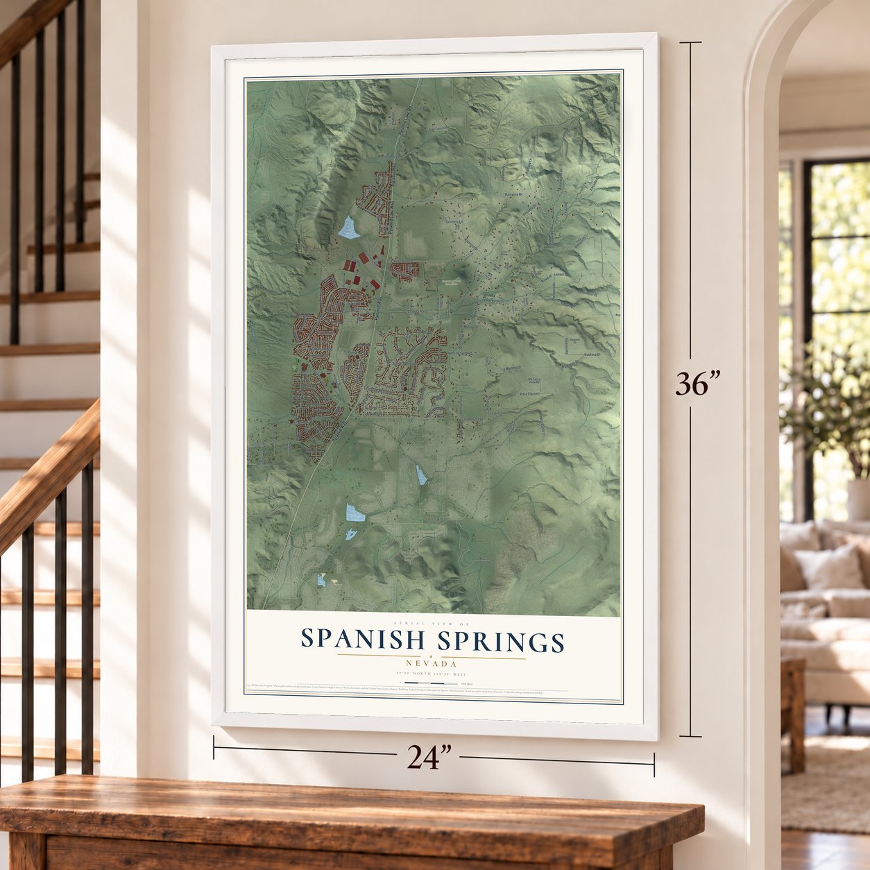
Unframed archival matte, a black wood frame or a white wood frame.
Up close
Geography Worth Displaying
This map was created using accurate cartographic data and authoritative geographic sources, including the U.S. Geological Survey and the Census Bureau. The map brings together terrain, waterways, roads, and building detail. The majority of the streets are labeled, houses are accurately depicted, and the topography is derived from government sources. Combining local data with carefully composed color and shading leads to this beautifully detailed Spanish Springs artwork for your wall.
Rather than simply showing street outlines, we’ve included as many of the street names as we could reasonably fit on the map while keeping their names legible. Zoom in on the high resolution preview to see exactly what’s on the map. We truly set out to create a statement piece for anyone who loves Spanish Springs. So whether it’s for you, or a gift for someone you love, we hope this map of Spanish Springs brings back fond memories.
Read the story behind this map of Spanish Springs, Nevada from 2026.
Find your street
Names on the Spanish Springs map
Every name below is printed on this map. Look for your street, your school, the park where you played, or the pond down the road.
Places and landmarks1
- Sugarloaf Peak Open Space
Streets and roads176
- Pyramid Lake Road
- Pyramid Way
- Pyramid Highway
- Pyramid Lake Highway
- Bridle Path Terrace
- Eaglenest Road
- Cll de la Plata
- Campo Rico Lane
- La Mancha Drive
- Encanto Drive
- Lesaka Road
- Valle Verde Drive
- Alamosa Drive
- West Cll de la Plata
- Eagle Canyon Road
- Dolores Drive
- Euskera Drive
- Omni Drive
- Cordoba Boulevard
- Eagle Canyon Drive
- Alto Valley Court
- Sunset Springs Lane
- Boarry Drive
- Fantasy Lane
- Barranca Drive
- East Sky Ranch Boulevard
- Navarra Drive
- Isidor Court
- Albatross Way
- Tranquil Drive
Show all 176 streets
- Richard Springs Boulevard
- Kinglet Drive
- Ocean View Drive
- Goldeneye Parkway
- La Posada Drive
- John Henri Court
- Sha Neva Road
- Vista Clara Court
- Los Arboles Lane
- Detar Place
- Hercules Drive
- Leilani Lane
- Erin Drive
- Virgil Drive
- Benedict Drive
- Lenticular Drive
- Patrina Way
- Hayfield Drive
- Palm Springs Drive
- Marie Way
- Ruddy Way
- Cielo Vista Drive
- Descanso Lane
- Eagle Peak Drive
- Longspur Way
- Pyrenees Drive
- Ember Drive
- Stags Leap Circle
- Leo Drive
- Nightingale Way
- Nicole Drive
- Encanto Court
- Rockwell Boulevard
- Piedras Drive
- Horizon View Avenue
- El Molino Drive
- Fuggles Drive
- Starhill Way
- Carlene Drive
- Stanwood Drive
- Ingenuity Avenue
- Mallard Crest Drive
- Marilyn Mae Drive
- View Point
- Agua Fria Drive
- Hay Bale Drive
- Ispaster Road
- Jennifer Lee Lane
- Los Pinos Drive
- Valle de Sol Boulevard
- Spanish Trail Drive
- Mystic Sands Street
- Aswan Street
- Tankersley Drive
- Klofta Court
- Pebble Bluff Drive
- Rowe Place
- Quintero Lane
- Tina Circle
- Quivera Lane
- Mia Drive
- Pitarra Court
- Taryn Drive
- Billow Drive
- Chara Lane
- Shelby Drive
- Oliver Avenue
- Ala Tierra Vista Road
- Tres Ahlmeyer Drive
- David James Boulevard
- Alena Way
- Neighborhood Way
- Ogden Trail Drive
- Egyptian Drive
- Brad Road
- Palm Desert Drive
- Lanstar Drive
- Moonbeam Drive
- Wingfield View Court
- Ringneck Way
- Mueska Court
- Beau Drive
- Sage Canyon Road
- Silent Sparrow Drive
- Partei Road
- Hallertau Drive
- Rosy Finch Drive
- Sunlit Terrace
- Grasswood Drive
- El Caballo Trail
- Carneros Drive
- Onyo Way
- Euskera Court
- Panocha Court
- Topaz Creek
- Distribution Drive
- Talon Drive
- Peralta Way
- Grove Springs Drive
- Milke Way
- Corvato Court
- La Jolla Lane
- Eclipse Drive
- Ispaster Court
- Pileus Road
- Sartor Court
- Dykes Court
- Garth Court
- Mia Court
- Rockin Robin Drive
- Mystic Mountain Drive
- Veronica Avenue
- Rio Seco Lane
- Esparto Court
- Pasa Way
- Rae Drive
- Penguin Drive
- Hawco Court
- Pasquel Lane
- Valley Sage Drive
- Que Pasa Court
- Lesaka Court
- Midas Court
- Nives Court
- Tina Court
- Eliza Court
- Friedman Circle
- Starburst Circle
- Capistrano Drive
- Anthem Drive
- Rosetta Stone Drive
- Avenida Serena Court
- Indian Springs Drive
- Desert Rose Drive
- La Calma Court
- Lucinda Court
- Jedediah Smith Drive
- Hidden Hills Drive
- Spanish Springs Road
- Cam de Grata
- Los Gatos Lane
- De Wick Court
- Louden Court
- Sahara Court
- Sienna Court
- Design Place
Names are listed as they appear on the printed map. Zoom into the product photos to find them.
About Spanish Springs, Nevada
Spanish Springs is a community of 17,314 people in Washoe County, at the northeastern edge of the Reno and Sparks area. The Paiute and Washoe peoples both claimed this country. In the late 1960s archaeologists found stone circles, rock art and what may have been a village above Spanish Springs Canyon. These finds show that people returned season after season, perhaps for 2,500 years.
Sky Ranch, a 2,000-foot dirt airstrip, was an auxiliary field here in the 1940s. It stood northeast of where State Route 445 meets Spanish Springs Road, and in 1964 and 1965 it hosted the first Reno Air Races. Sky Ranch closed in 1970, and houses now cover the old airfield as the Reno and Sparks area keeps growing.
- Rocket engines in the desertAfter the air races, Sky Ranch became the headquarters of Rocketdyne's Nevada Field Laboratory. The laboratory covered 126,000 acres, and in the late 1960s and early 1970s its crews tested rocket engines for the space program.
- An airport since 1971When Sky Ranch closed in 1970, a new airfield was graded about 2 miles to the west. That field is now Spanish Springs Airport (N86), and it has never stopped operating since it opened in 1971.
- Paiute taught in 2013In 2013 the Washoe County School District began offering the Paiute language as an elective at Spanish Springs High School. No other school district in Nevada had offered Paiute classes before.
Keep exploring Nevada
Spanish Springs is one of 148 Nevada towns we've mapped. Every dot on the map is a print of its own.
The search covers every state, Nevada first.
Near Spanish Springs
Order 2 or more town maps and save 10%. Shown in the size and finish you picked above, so they hang as a set.
- Sparks 12" x 18" / Archival Matte Print $39.99
- Sun Valley 12" x 18" / Archival Matte Print $39.99
- Golden Valley 12" x 18" / Archival Matte Print $39.99

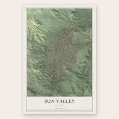
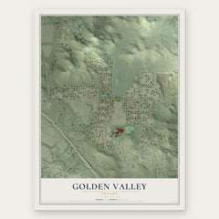
More maps nearby: Lemmon Valley, Hidden Valley, Reno, Mogul and Cold Springs.
The art of mapping a place
How This Map Was Made
Real places. Remarkable detail. Discover the layers that turn geographic data into a map of home.

The view from above
Aerial imagery reveals the character of the land: woodland, open fields, and the patterns of a place.

The shape of the land
Elevation data brings hills, valleys, and subtle changes in the landscape into view.

The details of home
Roads, waterways, and building footprints come together to make the map feel unmistakably local.

Geography becomes art
Considered color, shading, and typography bring the layers together in a map made for your wall.


Process illustrated with Mendon, Massachusetts. Aerial imagery: USDA NAIP. Terrain: USGS 3D Elevation Program. Map details and finished artwork: KNOWOL.
The Details
About This Print
Choose an archival matte print, or a black or white Ayous wood frame. The archival matte print is unframed.
Select your size and finish above to see the matching product image and price.
Materials & Craftsmanship
A contemporary map with the character of a classic atlas, printed on archival matte paper. Optional frames are made from Ayous wood.
Your printed map does not include the watermark shown in the full-map preview.
Shipping & Delivery
Free shipping within the United States. Every print is made to order in the USA.
Buying a gift? Add a note in your cart and we'll include it. We never put prices in the package.
Prints ship within 2 to 3 business days. Allow 7 to 10 days total from ordering for delivery. Timing may vary during holidays or periods of high order volume.
Read our shipping policy.
Returns and damaged prints
Each print is made to order. Change-of-mind refunds are not available after production.
If your print arrives damaged, misprinted or incorrect, contact support@knowol.com within 30 days of receiving it. Include your order number, photos and a description of the issue.
Read our full refund and replacement policy. For questions about your order, email support@knowol.com.