
Search for another town





Free U.S. delivery 7 to 10 days after you order
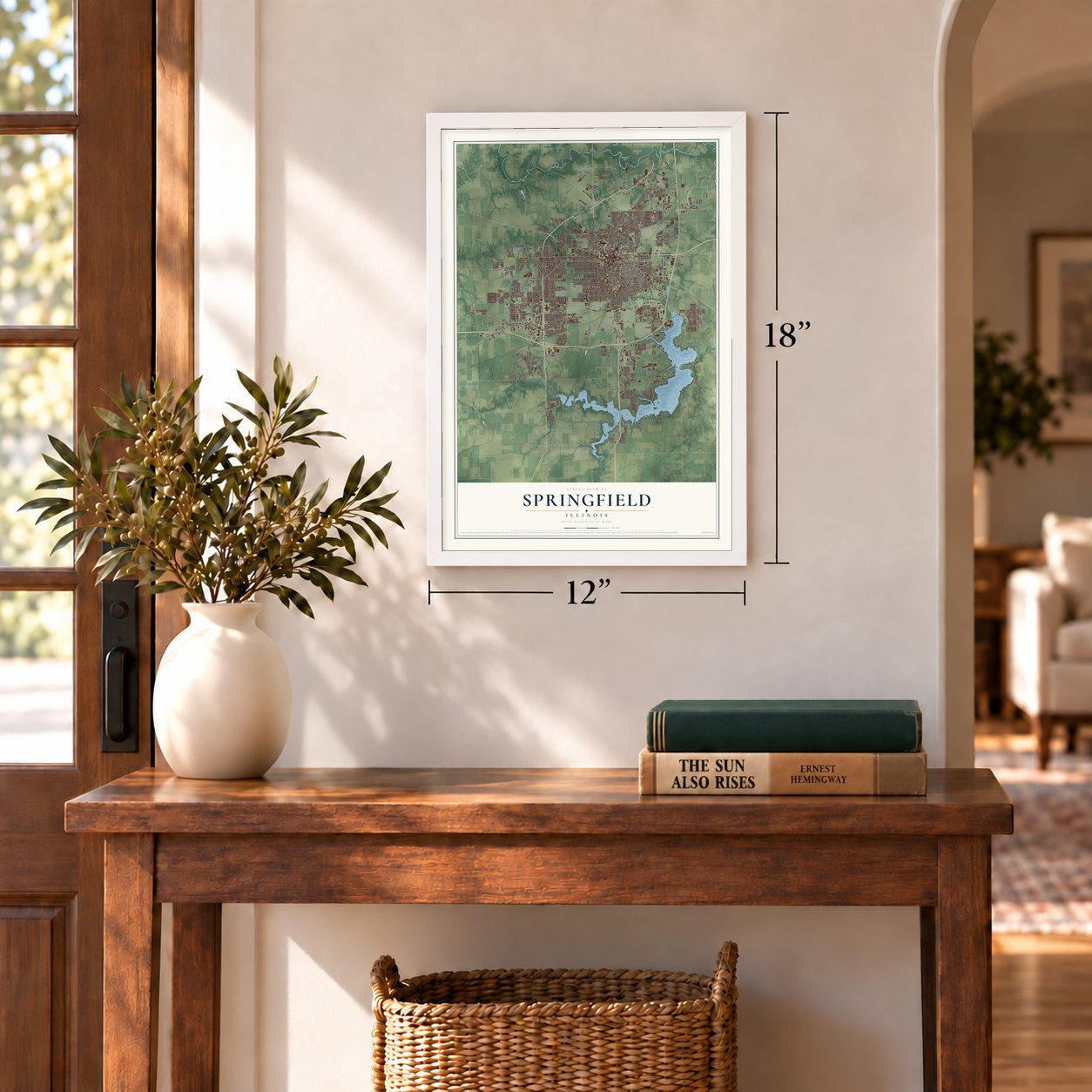
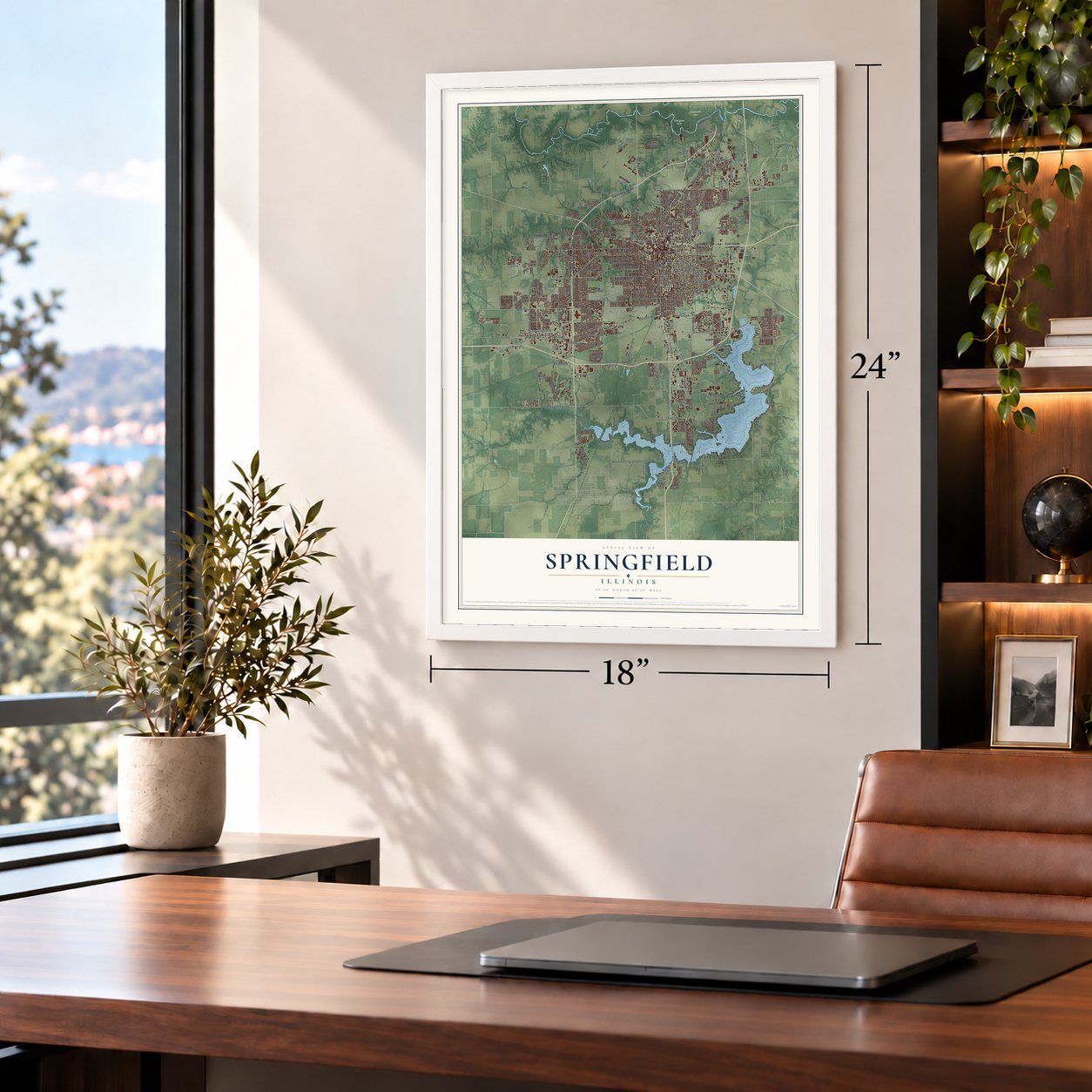
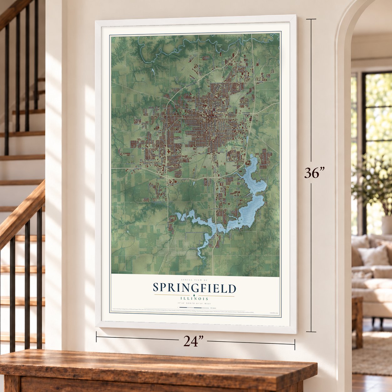
Springfield, Illinois Map Art
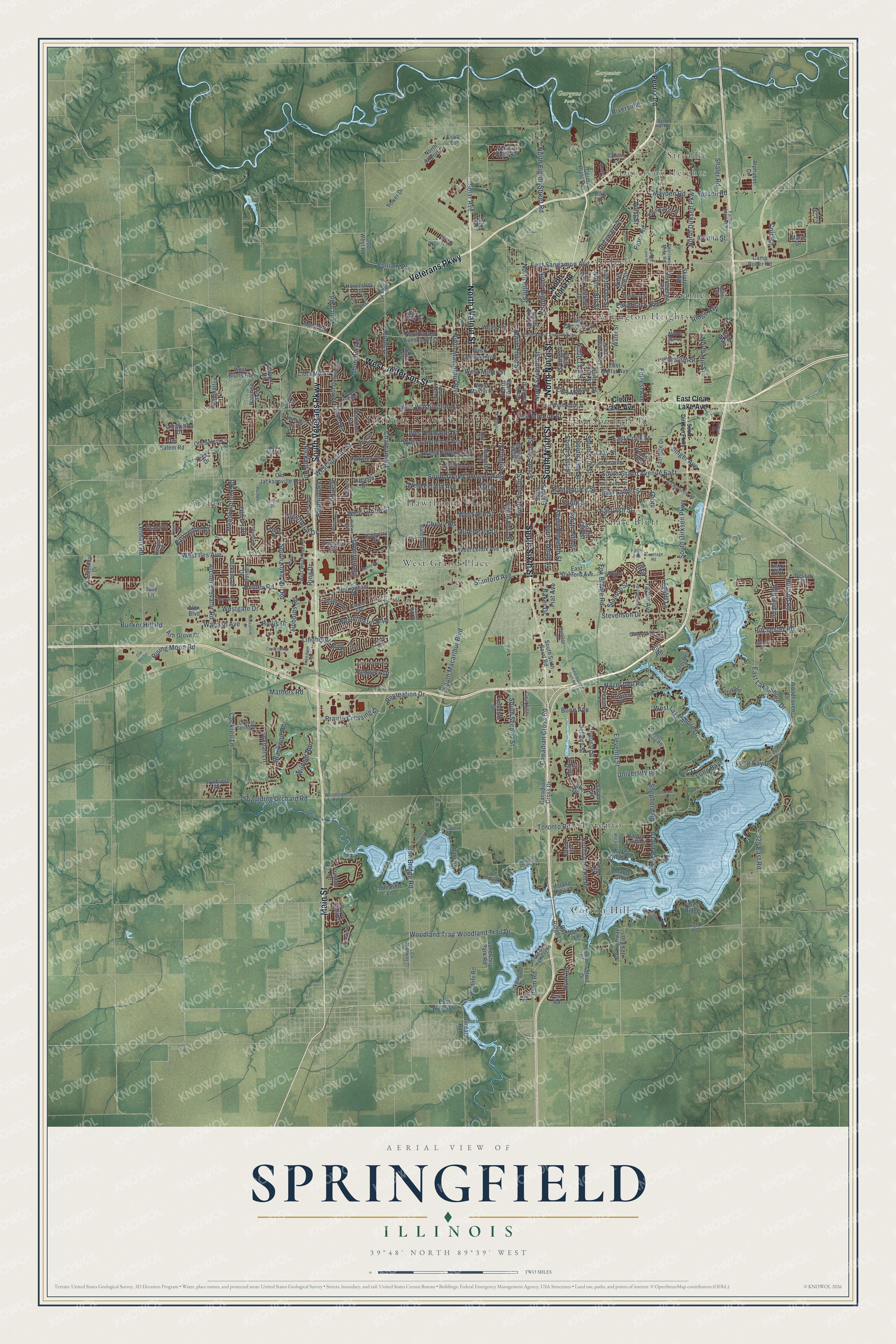
A new map of Springfield, Illinois, made in 2026 and printed to order on thick archival matte paper.
12" x 18" Archival Matte Print
A Map of Home. A Work of Art.
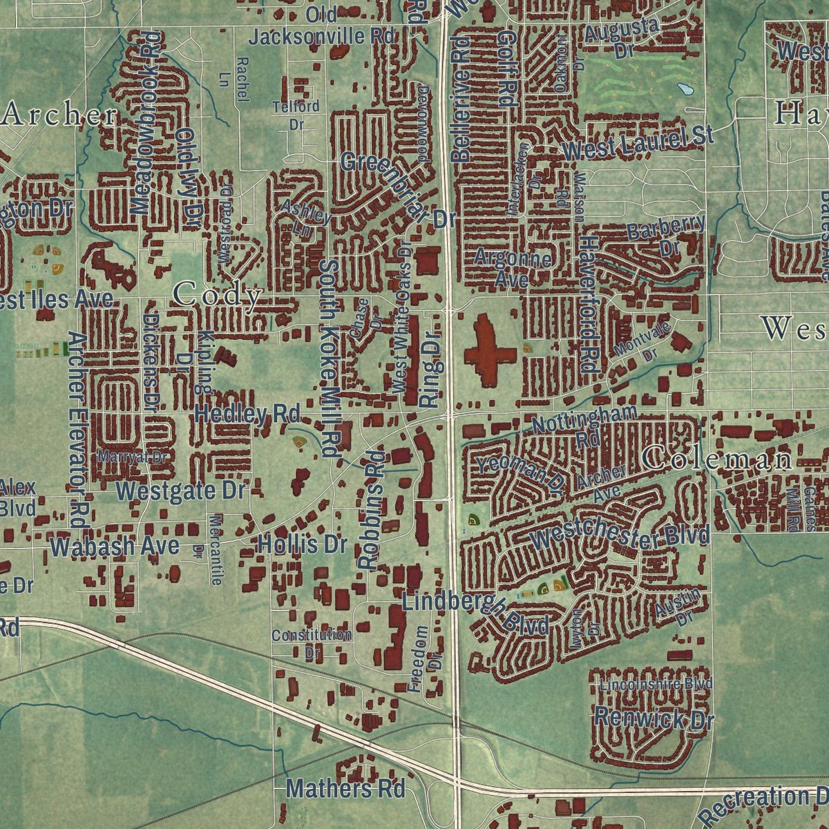
Explore Springfield, Illinois from a whole new perspective. Created using aerial imagery and detailed geographic data, this map captures Springfield building by building, with labeled streets, familiar landmarks, and shaded topographical relief that highlights the natural contours of the landscape.
Combining modern data with the timeless character of a vintage atlas, this map is just as interesting up close as it is beautiful on the wall. Whether you grew up in Springfield, spent memorable years there, or call it home today, this unique map is a great way to celebrate a place that means something to you. Zoom in on the preview to look for your street, and then order a print to put your memories on the wall.
Three ways to hang it
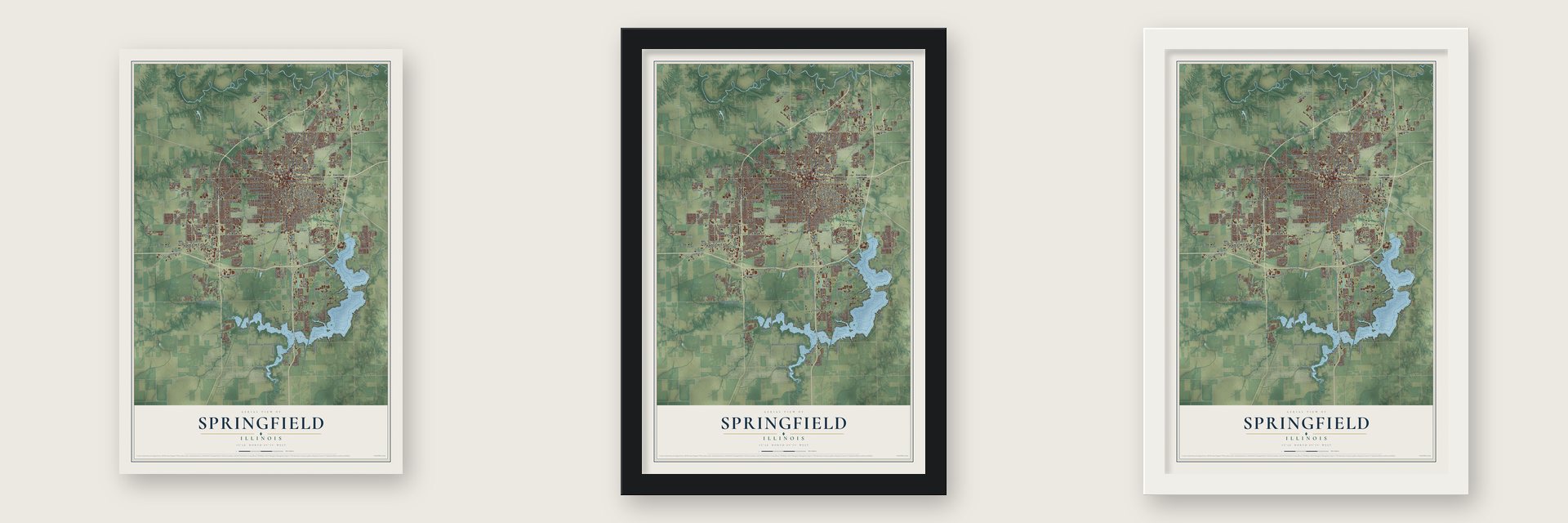
Unframed archival matte, a black wood frame or a white wood frame.
Up close
Geography Worth Displaying
This map was created using accurate cartographic data and authoritative geographic sources, including the U.S. Geological Survey and the Census Bureau. The map brings together terrain, waterways, roads, and building detail. The majority of the streets are labeled, houses are accurately depicted, and the topography is derived from government sources. Combining local data with carefully composed color and shading leads to this beautifully detailed Springfield artwork for your wall.
Rather than simply showing street outlines, we’ve included as many of the street names as we could reasonably fit on the map while keeping their names legible. Zoom in on the high resolution preview to see exactly what’s on the map. We truly set out to create a statement piece for anyone who loves Springfield. So whether it’s for you, or a gift for someone you love, we hope this map of Springfield brings back fond memories.
Read the story behind this map of Springfield, Illinois from 2026.

About Springfield, Illinois
Springfield is the state capital and the seat of Sangamon County, and the 2020 census counted 114,394 people in the city. Trappers and fur traders reached the Sangamon River here in 1818. In 1820 John Kelly, drawn by the deer and other game, built a cabin on a hill above the creek later called the Town Branch. The settlement first took the name Calhoun, for Senator John C. Calhoun of South Carolina, and in 1821 it was chosen as county seat for its central spot, good soil and trade.
Families from Kentucky, Virginia and North Carolina soon moved in. By 1832 Calhoun had lost favor with the public, so the town renamed itself Springfield, a name Kelly's wife is said to have suggested for Spring Creek, which ran through Kelly's Field. Vandalia had been the capital since 1819, but Abraham Lincoln and the lawmakers called the Long Nine, whose heights added up to 54 feet, worked to move it, and in 1839 Springfield became the third capital of Illinois.
“The first house built in Springfield was erected fifteen years since. The town has increased more than half within the last three years.”
- Lincoln's home for 24 yearsLincoln came to the area in 1831 and spent six years at New Salem, where he began studying law and won a seat in the General Assembly. He moved to Springfield in 1837 and practiced law and politics here until 1861, when he left for Washington as president. His farewell speech to the town is remembered as one of the great American addresses. The Lincoln Home National Historic Site and the Old State Capitol both stand in the city.
- Grant's first regimentsIllinois regiments trained in Springfield during the Civil War, and Ulysses S. Grant commanded the earliest of them. Camp Butler opened in August 1861, seven miles northeast of the city, to train Illinois soldiers, and it held Confederate prisoners through 1865. A Springfield man, Colonel Elmer E. Ellsworth, was the first official death of the war.
- Frank Lloyd Wright's Dana HouseSusan Lawrence Dana, a local arts patron, hired Frank Lloyd Wright, who began her house in 1902 and shaped it around her love of performing music. Oak Park artisans made art glass for 250 windows, doors and panels and over 200 light fixtures across 12,000 square feet. The house joined the National Register in 1974, the state bought it for its architecture alone, and it opened as a museum in September 1990.
- A Lutheran seminary in 1874German Lutherans who came to the Midwest after the 1848 revolutions had few ministers, so Concordia Theological Seminary was founded in Fort Wayne, Indiana, in 1846 to train them. The school moved to St. Louis in 1869 and then to Springfield in 1874, and its graduates went on to staff congregations across the region.
- Vachel Lindsay's golden cityThe poet Vachel Lindsay wrote just one novel, The Golden Book of Springfield, published in 1920. In it he imagined his hometown moving step by step toward a utopia built on ideas of anarchistic socialism. The Vachel Lindsay House is on the National Register.
Find your street
Names on the Springfield map
Every name below is printed on this map. Look for your street, your school, the park where you played, or the pond down the road.
Places and landmarks19
- Illinois State Capitol
- Devereux Heights
- Carpenter Park
- Gurgens Park
- Archer
- Arlington Heights
- Cody
- Coleman
- Cotton Hill
- East Springfield
- Hawthorne Place
- Iles
Show all 19 places
- Jess
- Ridgely
- Shale Bluff
- Starne
- Streadle
- Toronto
- West Grand Place
Streets and roads326
- South Veterans Parkway
- Veterans Parkway
- South Sixth Street
- North Ninth Street
- South Ninth Street
- Main Street
- West Jefferson Street
- North Walnut Street
- Stevenson Drive
- South First Street
- South Grand Avenue West
- West Miller Street
- Fiat Avenue
- East Lake Shore Drive
- West Laurel Street
- North Fifth Street
- Recreation Drive
- Greenbriar Drive
- South Macarthur Boulevard
- Chatham Road
- South Eleventh Street
- Spaulding Orchard Road
- West Lake Shore Drive
- Wabash Avenue
- West Washington Street
- West Iles Avenue
- West Monroe Street
- South Second Street
- East Sangamon Avenue
- West Lawrence Avenue
Show all 326 streets
- East Cook Street
- Canadian Cross Road
- Eleventh Street
- South Grand Avenue East
- South Koke Mill Road
- Hazel Dell Road
- Meadowbrook Road
- North Dirksen Parkway
- South Fourth Street
- East Ash Street
- Cockrell Lane
- South Dirksen Parkway
- South 13th Street
- Taylor Avenue
- South 14th Street
- Toronto Road
- Woodland Trail
- Woodland Trail Drive
- Hedley Road
- South 15th Street
- East Laurel Street
- North 19th Street
- East Black Avenue
- Shepherd Road
- North Seventh Street
- Spring Street
- Archer Elevator Road
- North Eighth Street
- East Monroe Street
- North Third Street
- Bruns Lane
- Westchester Boulevard
- Lindbergh Boulevard
- North Eighth Street Road
- Outer Park Drive
- North 15th Street
- South 17th Street
- West Edwards Street
- Stanford Avenue
- Lenhart Road
- Iron Bridge Road
- University Drive
- North Macarthur Boulevard
- Rochester Road
- Mayden Road
- East Spruce Street
- Fox Bridge Road
- West Fayette Avenue
- North Hill Street
- South Tenth Street
- Bunker Hill Road
- Foxhall Lane
- East Mason Street
- Clay Street
- Golf Road
- Piper Road
- West Ash Street
- Hill Top Road
- Churchill Road
- Ridge Avenue
- Bellerive Road
- Rising Moon Road
- Bissell Road
- Pulliam Road
- Adloff Lane
- Prairie Crossing Drive
- Stanton Street
- Hunt Road
- Mathers Road
- Robbins Road
- Blackwolf Road
- Solar Avenue
- West Leland Avenue
- Hollis Drive
- Island Bay Lane
- Red Bud Lane
- Wildcat Run
- Singer Avenue
- South Street
- 325 East Road
- Cherry Road
- Westgate Drive
- Industrial Drive
- Delaware Drive
- Palm Road
- Winch Road
- North 21st Street
- Atlanta Street
- Colt Road
- Long Bay Drive
- Haverford Road
- East Elm Street
- Rickard Road
- Barrington Drive
- Bunn Avenue
- Riverside
- Groth
- West Street
- Renwick Drive
- Forrest Avenue
- Ring Drive
- Old Ivy Drive
- Shaler Road
- Long Bay
- Baker Drive
- Jeffory Street
- North Peoria Road
- East Clear Lake Avenue
- Clear Lake Avenue
- Peoria Road
- North Grand Avenue West
- North First Street
- County Highway 125 East
- East Walnut Street
- Lake Drive
- Water Street
- Augusta Drive
- East Converse Street
- Stout Drive
- Color Plant Road
- Venetian Drive
- North Cotton Hill Road
- Old Jacksonville Road
- South 16th Street
- North Sixth Street
- South Eighth Street
- Canadian Cross Drive
- South Third Street
- North Fourth Street
- Maple Grove Lane
- East Stanford Avenue
- Wildlife Road
- Hazel Dell
- Linden Lane
- North 17th Street
- Old Salem Lane
- West Calhoun Avenue
- Camp Butler Road
- Preston Drive
- Idlewild Lane
- Nottingham Road
- Forest Ridge
- Maple Grove
- Twin Lakes Drive
- North Twelfth Street
- West Lenox Avenue
- West Mason Street
- East Moffat Avenue
- Yates Avenue
- Bates Avenue
- Woodhaven Drive
- North Oxford Road
- Parkview Drive
- Ash Grove Drive
- North Airport Drive
- Stonehenge Road
- North 24th Street
- Cider Mill Lane
- Kipling Drive
- Wienold Lane
- Longfellow Drive
- Eastdale Drive
- Sanctuary Park Road
- Old Salem Road
- Henrietta Street
- South Sixth Saint Road
- Walnut Valley Drive
- North Indiana Avenue
- Lakewood Drive
- 2.25 North Road
- Centennial Drive
- Mesa Road
- Appomattox Drive
- Horseshoe Drive
- Victoria Drive
- Barberry Drive
- Yeoman Drive
- Sarah Avenue
- Skipton Road
- Alphabet Drive
- Lynhurst Road
- Fairfield Drive
- Dickens Drive
- Tower Drive
- Oak Lane
- Natchez Trce
- West Bluffs Road
- Oxford Road
- Croydon Drive
- 200 West Road
- Dickinson Road
- Argonne Avenue
- Alex Boulevard
- Destiny Drive
- Gilreath Road
- Harbor Landing
- Crane Drive
- York Road
- Poplar Avenue
- Bay Ridge Lane
- Island View Lane
- Clipper Road
- Estill Drive
- Piper Glen Drive
- Phlox Drive
- Buford Street
- Brent Drive
- Diane Court
- Creek Drive
- Chip Avenue
- Marie Drive
- Kerry Boulevard
- Jade Lane
- Post Road
- Star Avenue
- Cory Drive
- Rita Road
- North Grand Avenue East
- East Washington Street
- Archer Avenue
- Stout Road
- East Cedar Street
- West White Oaks Drive
- East Stuart Street
- Kenyon Drive
- South Ring Road
- Austin Drive
- Farmers Market Road
- Dunwich Street
- Queensway Road
- Woodland Avenue
- County Highway 22
- Catalina Lane
- Freedom Drive
- Crystal Spring Drive
- Old US Highway 66
- West Cedar Street
- Pickfair Road
- New Street
- Clearwater Lane
- Woodside Road
- Peerless Mine Road
- North Bruns Lane
- Stone Valley Drive
- Zoo Trail
- Chapel Hill Road
- Celeste Court
- Ashley Lane
- Quade Drive
- Harrier Road
- Milton Manor
- Sand Hill Road
- Miller Road
- Faith Avenue
- North Lincoln Avenue
- Interlacken Drive
- West Fairview Lane
- Old Rochester Road
- North 16th Street
- Palomino Road
- Lincolnshire Boulevard
- Oakmont Drive
- Hoechester Road
- Constitution Drive
- West Hazel Dell Road
- Hedge Lane Road
- Plateau Drive
- Wentworth Drive
- Orchard Lane
- Montvale Drive
- College Street
- Westroad Drive
- Normandy Road
- Rachel Lane
- Old Route 54
- Crows Mill Lane
- Warson Road
- Devonwood
- Mercantile Drive
- Birch Drive
- Poorman Drive
- Hermitage Road
- Marryat Drive
- Lick Creek Lane
- Westwood Lane
- Cash River Road
- Gaines Mill Road
- Bontjes
- Brighton Road
- Birkdale Drive
- Telford Drive
- Chase Drive
- Ivyton Drive
- Plover Road
- Fuqua Drive
- Vigal Road
Names are listed as they appear on the printed map. Zoom into the product photos to find them.
The art of mapping a place
How This Map Was Made
Real places. Remarkable detail. Discover the layers that turn geographic data into a map of home.

The view from above
Aerial imagery reveals the character of the land: woodland, open fields, and the patterns of a place.

The shape of the land
Elevation data brings hills, valleys, and subtle changes in the landscape into view.

The details of home
Roads, waterways, and building footprints come together to make the map feel unmistakably local.

Geography becomes art
Considered color, shading, and typography bring the layers together in a map made for your wall.


Process illustrated with Mendon, Massachusetts. Aerial imagery: USDA NAIP. Terrain: USGS 3D Elevation Program. Map details and finished artwork: KNOWOL.
The Details
About This Print
Choose an archival matte print, or a black or white Ayous wood frame. The archival matte print is unframed.
Select your size and finish above to see the matching product image and price.
Materials & Craftsmanship
A contemporary map with the character of a classic atlas, printed on archival matte paper. Optional frames are made from Ayous wood.
Your printed map does not include the watermark shown in the full-map preview.
Shipping & Delivery
Free shipping within the United States. Every print is made to order in the USA.
Buying a gift? Add a note in your cart and we'll include it. We never put prices in the package.
Prints ship within 2 to 3 business days. Allow 7 to 10 days total from ordering for delivery. Timing may vary during holidays or periods of high order volume.
Read our shipping policy.
Returns and damaged prints
Each print is made to order. Change-of-mind refunds are not available after production.
If your print arrives damaged, misprinted or incorrect, contact support@knowol.com within 30 days of receiving it. Include your order number, photos and a description of the issue.
Read our full refund and replacement policy. For questions about your order, email support@knowol.com.
Find your town
Looking for another city?
Find a map of home in our Illinois collection, or any town in the country.
Nearby
Maps of towns near Springfield
Know someone from one of these towns? Their map makes a great gift.
 Leland Grove
, Illinois
From $39.99See the map
 Grandview
, Illinois
From $39.99See the map
 Jerome
, Illinois
From $39.99See the map
More maps nearby: Southern View, Riverton, Sherman, Rochester and Spaulding.