
Search for another town


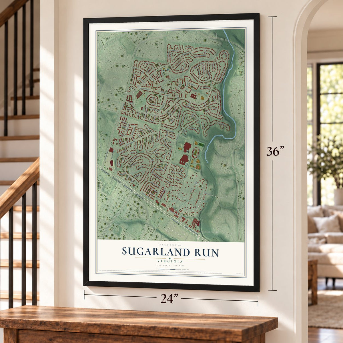
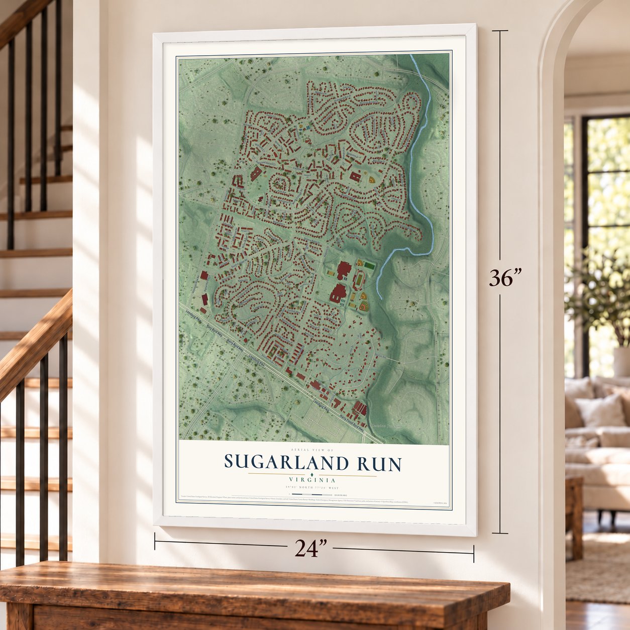

Free U.S. delivery 7 to 10 days after you order
Sugarland Run, Virginia Map Art
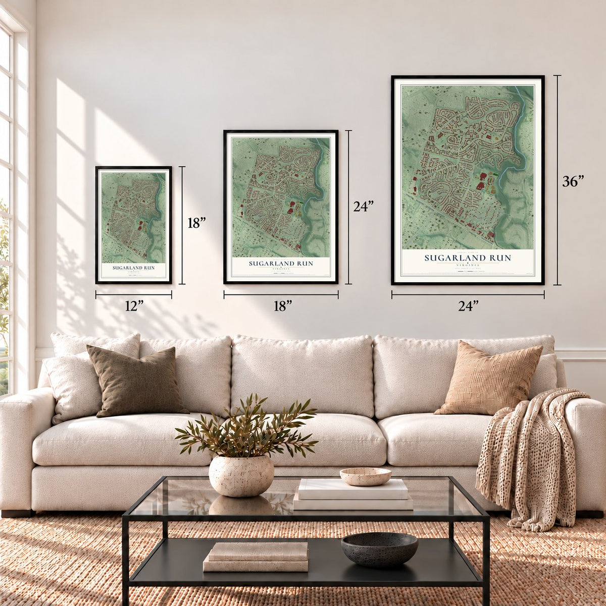
A new map of Sugarland Run, Virginia, made in 2026 and printed to order on thick archival matte paper.
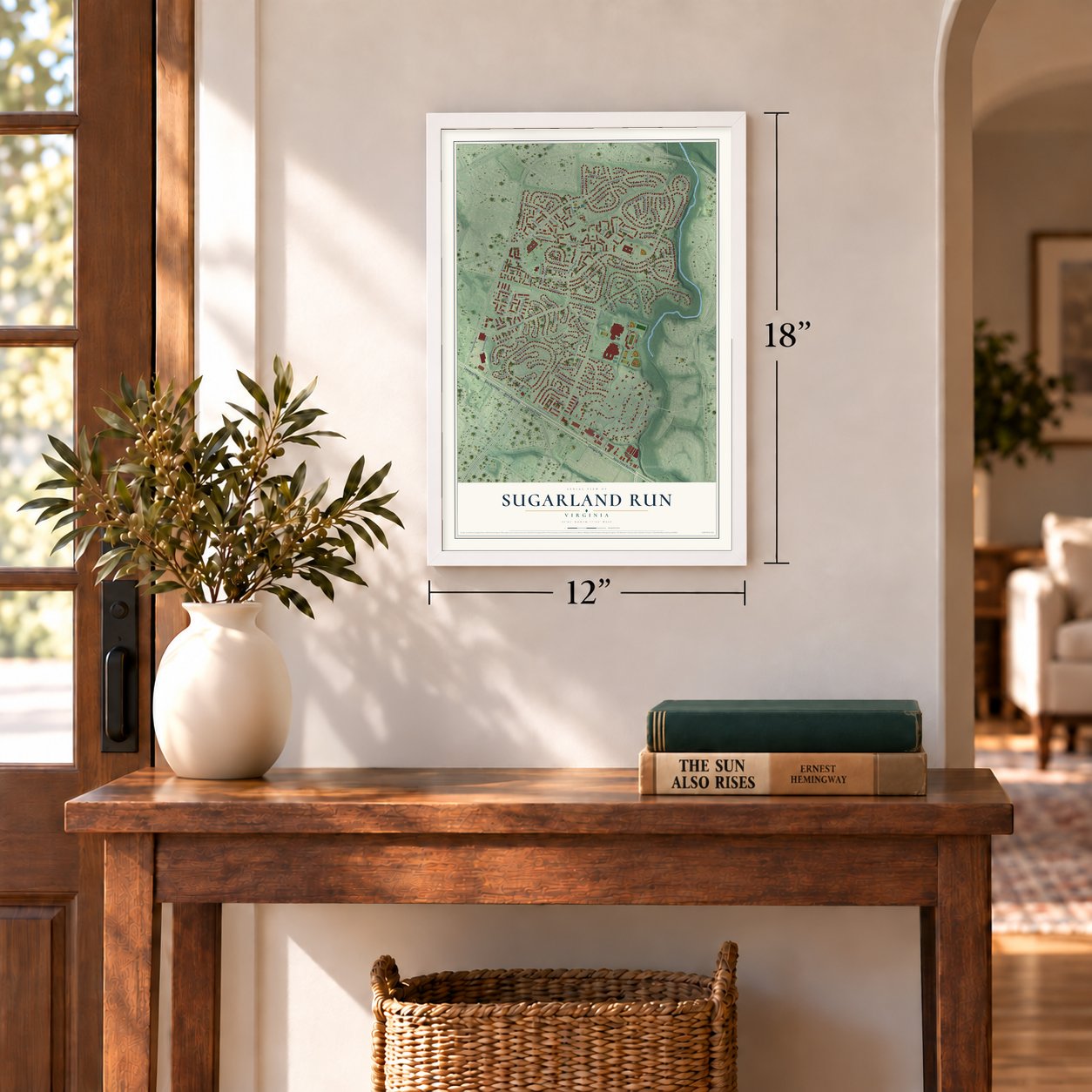
12" x 18" Archival Matte Print
A Map of Home. A Work of Art.
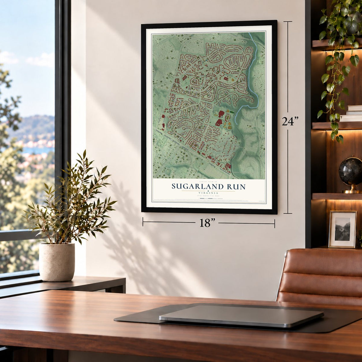
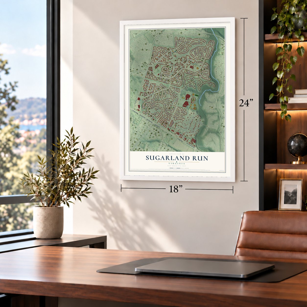
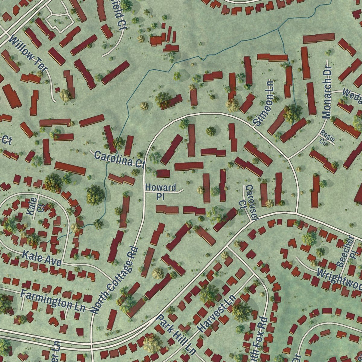
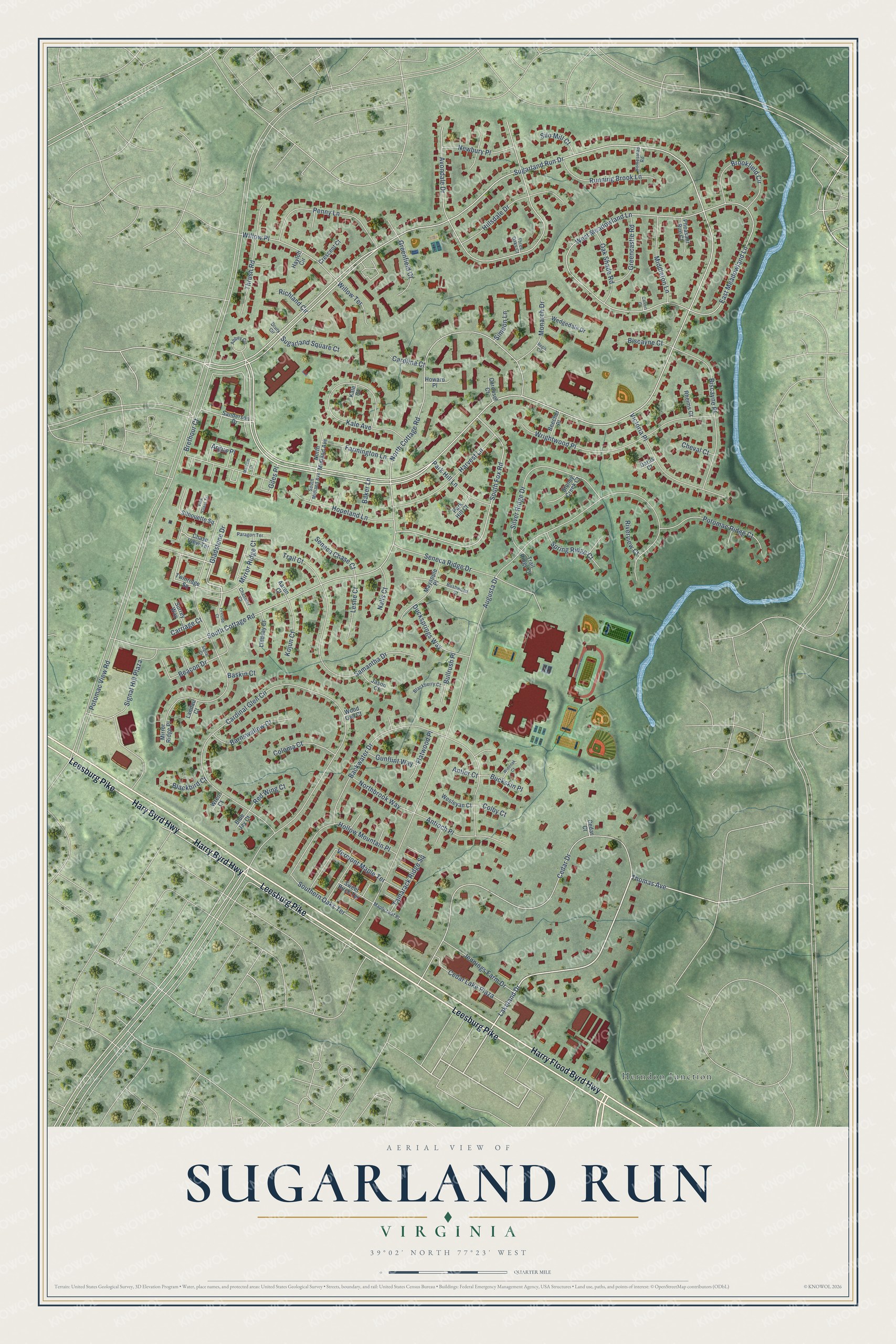
Explore Sugarland Run, Virginia from a whole new perspective. Created using aerial imagery and detailed geographic data, this map captures Sugarland Run building by building, with labeled streets, familiar landmarks, and shaded topographical relief that highlights the natural contours of the landscape.
Combining modern data with the timeless character of a vintage atlas, this map is just as interesting up close as it is beautiful on the wall. Whether you grew up in Sugarland Run, spent memorable years there, or call it home today, this unique map is a great way to celebrate a place that means something to you. Zoom in on the preview to look for your street, and then order a print to put your memories on the wall.
Three ways to hang it
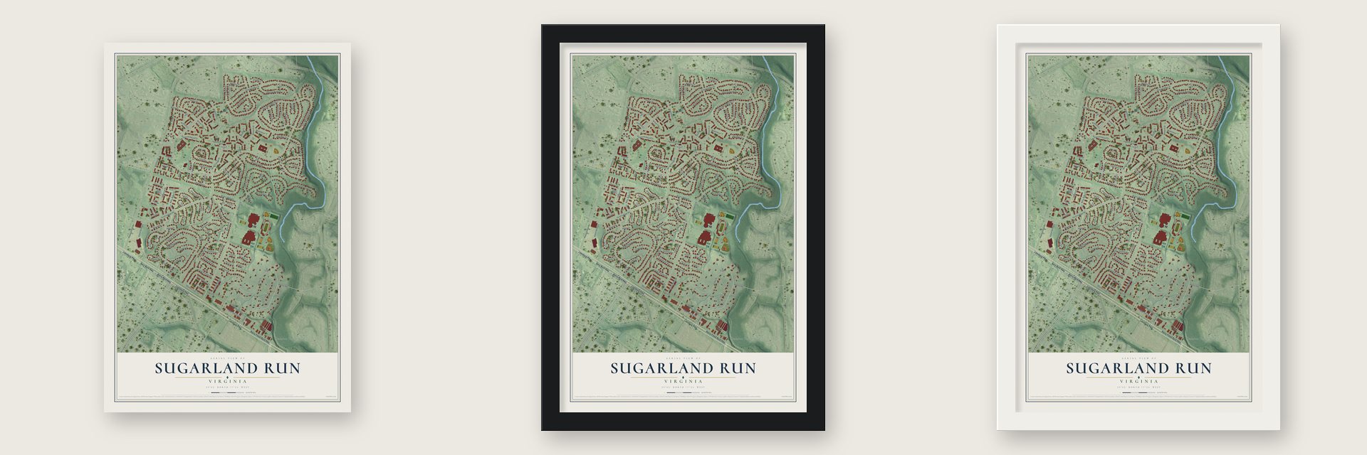
Unframed archival matte, a black wood frame or a white wood frame.
Up close
Geography Worth Displaying
This map was created using accurate cartographic data and authoritative geographic sources, including the U.S. Geological Survey and the Census Bureau. The map brings together terrain, waterways, roads, and building detail. The majority of the streets are labeled, houses are accurately depicted, and the topography is derived from government sources. Combining local data with carefully composed color and shading leads to this beautifully detailed Sugarland Run artwork for your wall.
Rather than simply showing street outlines, we’ve included as many of the street names as we could reasonably fit on the map while keeping their names legible. Zoom in on the high resolution preview to see exactly what’s on the map. We truly set out to create a statement piece for anyone who loves Sugarland Run. So whether it’s for you, or a gift for someone you love, we hope this map of Sugarland Run brings back fond memories.
Read the story behind this map of Sugarland Run, Virginia from 2026.

About Sugarland Run, Virginia
Sugarland Run is a planned community at Loudoun County's eastern edge, 2 miles north of Route 7 and 3 miles south of the Potomac River. It takes its name from Sugarland Run, a stream that runs along its east side on the way to the Potomac. The census counted 11,799 people here in 2010.
Loudoun County was carved out of Fairfax in 1757 and took its name from Lord Loudoun, who led British forces in America and held the title of governor of Virginia. Sugarland Run came two centuries later, when builders put up its houses and townhouses during the 1970s and 1980s.
- California homes in VirginiaThe neighborhoods around it went up in the colonial style, but Sugarland Run's builders chose the California contemporary look instead, giving the houses modern exteriors and high vaulted ceilings. Buyers chose from four single-family models named Balboa, Laguna, Malibu and Redondo, and from at least four townhouse models. Some houses came with garages and others with car ports, and owners' later additions have given each street more variety.
- 26 miles of wooded trailsMost homes in Sugarland Run sit against woods, streams or the community's paved walking trails, which run for 26 miles. Three homeowners' associations, for Sugarland Run, Sugarland Square and the townhouses, look after a community center, an Olympic-size pool, a fishing lake, tennis courts and playgrounds.
- Two schools of its ownSugarland Elementary and Meadowland Elementary both stand inside the community. Older students go on to Seneca Ridge Middle School and Dominion High School, which houses Loudoun Academy of Science, the county's gifted high school.
Find your street
Names on the Sugarland Run map
Every name below is printed on this map. Look for your street, your school, the park where you played, or the pond down the road.
Places and landmarks1
- Herndon Junction
Streets and roads134
- Leesburg Pike
- Harry Flood Byrd Highway
- Harry Byrd Highway
- Hary Byrd Highway
- Lakeland Drive
- Gladstone Drive
- Sugarland Run Drive
- Thomas Avenue
- Signal Hill Plaza
- Brethour Court
- Willow Place
- Potomac View Road
- Cardinal Glen Circle
- Augusta Drive
- Seneca Ridge Drive
- South Cottage Road
- Cedar Drive
- Avondale Drive
- West Meadowland Lane
- Backwater Drive
- North Cottage Road
- South Fox Road
- Wrightwood Place
- Kale Avenue
- Samantha Drive
- East Meadowland Lane
- Silver Ridge Drive
- Biscayne Place
- Hollow Mountain Place
- Penny Lane
Show all 134 streets
- Victoria Place
- Harvest Lane
- Hillsdale Drive
- Potomac Ridge Court
- Brookfield Circle
- Thrush Road
- Vermont Maple Terrace
- Running Brook Lane
- Hopeland Lane
- Antioch Place
- Mirror Ridge Court
- Cedar Lake Plaza
- Middleton Lane
- Jennings Farm Drive
- Barnswallow Court
- Greenfield Court
- Ducksprings Way
- Greencastle Road
- Oak Shade Road
- Monarch Drive
- Southern Oaks Terrace
- Beacon Drive
- Newbury Place
- Northbrook Way
- Park Hill Lane
- Farmington Lane
- Spring Ridge Court
- Coloma Court
- Tamarack Ridge Square
- Leslie Court
- Sugarland Square Court
- Argus Place
- Kojun Court
- Seneca Chase Court
- Gunflint Way
- Willow Terrace
- Flatwood Place
- Bullrush Place
- Biscayne Court
- Trail Court
- Giles Place
- Buckskin Place
- Red Wing Court
- Nalls Court
- Silo Mill Court
- Blackbird Court
- Riverview Court
- Baker Lane
- Richland Circle
- Carolina Court
- Carriage Court
- Cheval Court
- Simeon Lane
- Colby Court
- Baskin Court
- Antler Court
- Twinridge Square
- Sanderson Drive
- Chase View Terrace
- Mirror Ridge Place
- Mayapple Place
- Silhouette Square
- Wedgedale Drive
- North Midland Avenue
- Stoney Creek Court
- Sweet Birch Terrace
- Lindsay Court
- Pheasant Run Court
- Wesleyan Court
- Crescent Court
- Jason Court
- Beecher Place
- Surrey Way
- Rheims Court
- Howard Place
- Trail Ridge Court
- Carousel Court
- Park Hill Court
- Blue Jay Court
- Landau Court
- Aaron Court
- Hayloft Circle
- Wren Court
- Wood Owl Court
- Cedar Court
- Darus Court
- Kale Court
- Abbey Circle
- Blackberry Court
- Bushwood Court
- Paragon Terrace
- Maple Leaf Place
- South Midland Avenue
- Homestead Road
- Chandler Court
- Three Oaks Court
- Drury Circle
- Marcum Court
- View Glass Terrace
- Wideoak Court
- Fireside Court
- Signal Court
- Calvert Court
- Regis Circle
Names are listed as they appear on the printed map. Zoom into the product photos to find them.
The art of mapping a place
How This Map Was Made
Real places. Remarkable detail. Discover the layers that turn geographic data into a map of home.

The view from above
Aerial imagery reveals the character of the land: woodland, open fields, and the patterns of a place.

The shape of the land
Elevation data brings hills, valleys, and subtle changes in the landscape into view.

The details of home
Roads, waterways, and building footprints come together to make the map feel unmistakably local.

Geography becomes art
Considered color, shading, and typography bring the layers together in a map made for your wall.


Process illustrated with Mendon, Massachusetts. Aerial imagery: USDA NAIP. Terrain: USGS 3D Elevation Program. Map details and finished artwork: KNOWOL.
The Details
About This Print
Choose an archival matte print, or a black or white Ayous wood frame. The archival matte print is unframed.
Select your size and finish above to see the matching product image and price.
Materials & Craftsmanship
A contemporary map with the character of a classic atlas, printed on archival matte paper. Optional frames are made from Ayous wood.
Your printed map does not include the watermark shown in the full-map preview.
Shipping & Delivery
Free shipping within the United States. Every print is made to order in the USA.
Buying a gift? Add a note in your cart and we'll include it. We never put prices in the package.
Prints ship within 2 to 3 business days. Allow 7 to 10 days total from ordering for delivery. Timing may vary during holidays or periods of high order volume.
Read our shipping policy.
Returns and damaged prints
Each print is made to order. Change-of-mind refunds are not available after production.
If your print arrives damaged, misprinted or incorrect, contact support@knowol.com within 30 days of receiving it. Include your order number, photos and a description of the issue.
Read our full refund and replacement policy. For questions about your order, email support@knowol.com.
Find your town
Looking for another city?
Find a map of home in our Virginia collection, or any town in the country.
Nearby
Maps of towns near Sugarland Run
Know someone from one of these towns? Their map makes a great gift.
 Cascades
, Virginia
From $39.99See the map
 Lowes Island
, Virginia
From $39.99See the map
 Dulles Town Center
, Virginia
From $39.99See the map
More maps nearby: Sterling, Countryside, Dranesville, Kincora and Oak Grove.