
Search for another town


Free U.S. delivery 7 to 10 days after you order
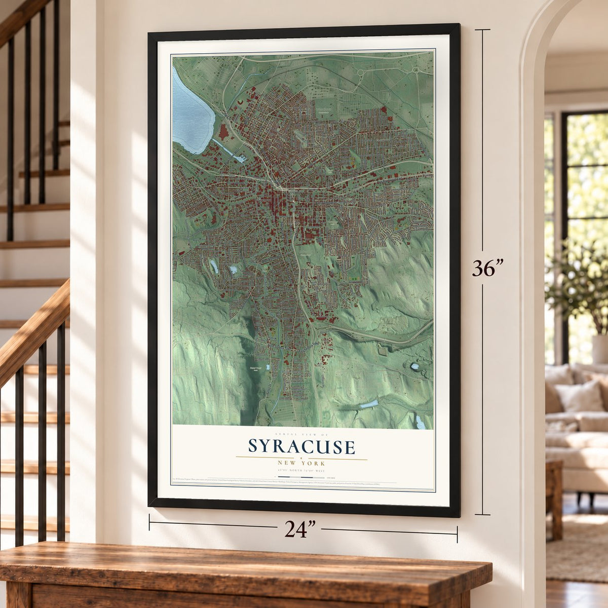
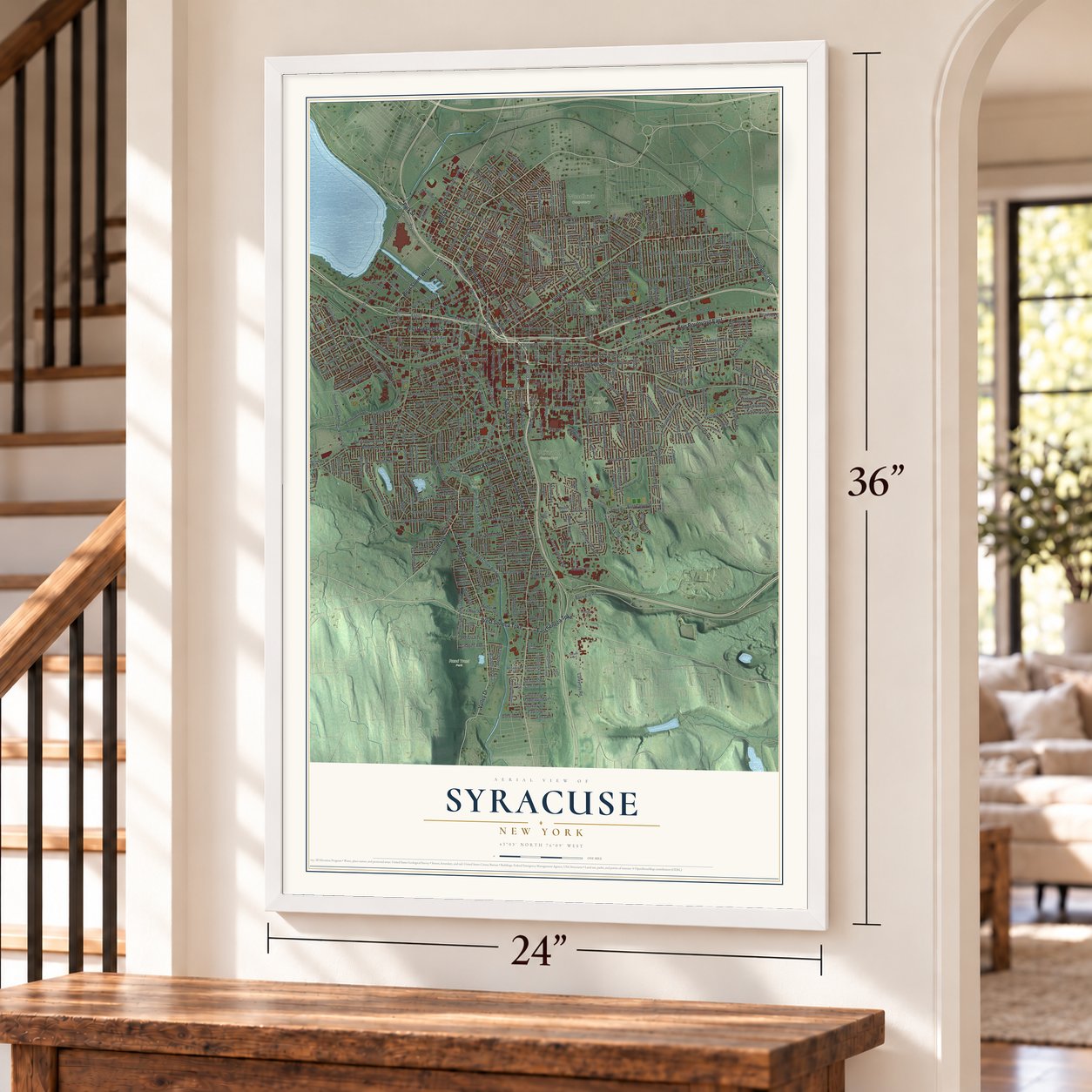
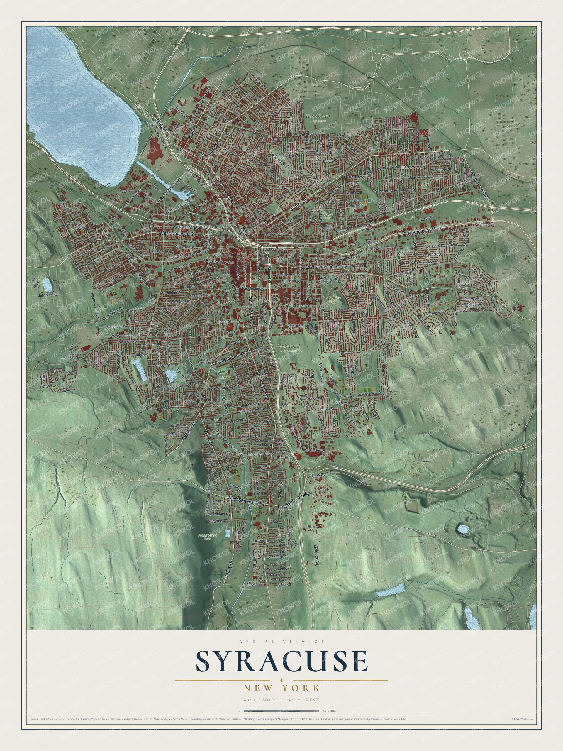
Syracuse, New York Map Art
Building by building, with labeled streets and shaded relief.
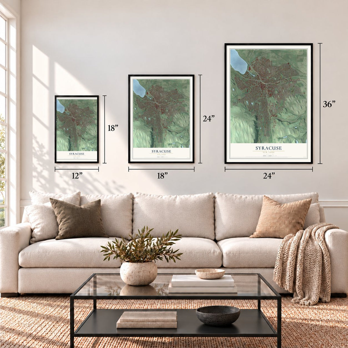
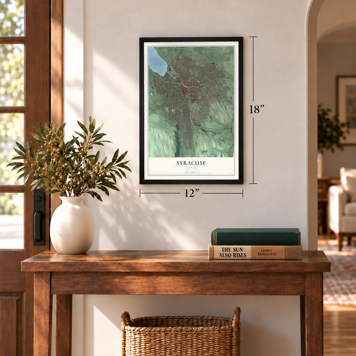
12" x 18" Archival Matte Print
A Map of Home. A Work of Art.
Explore Syracuse, New York from a whole new perspective. Created using aerial imagery and detailed geographic data, this map captures Syracuse building by building, with labeled streets, familiar landmarks, and shaded topographical relief that highlights the natural contours of the landscape.
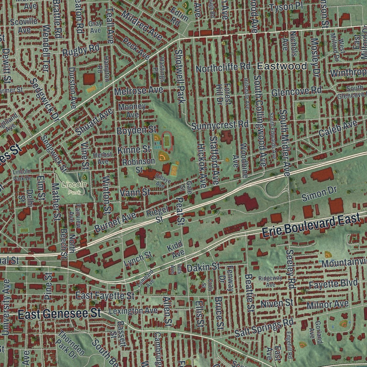
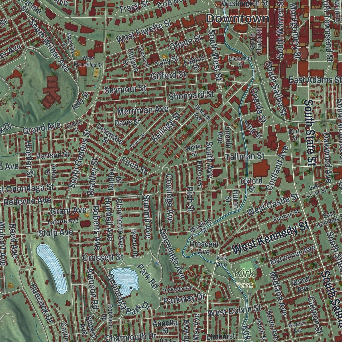
Combining modern data with the timeless character of a vintage atlas, this map is just as interesting up close as it is beautiful on the wall. Whether you grew up in Syracuse, spent memorable years there, or call it home today, this unique map is a great way to celebrate a place that means something to you. Zoom in on the preview to look for your street, and then order a print to put your memories on the wall.
Three ways to hang it
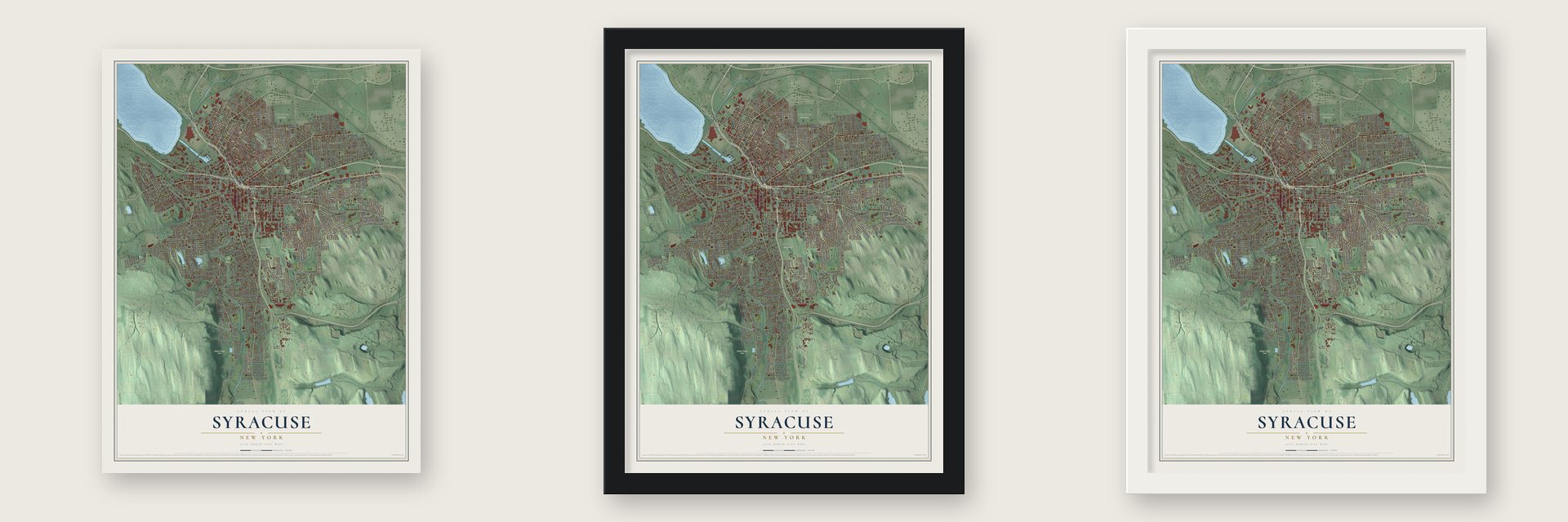
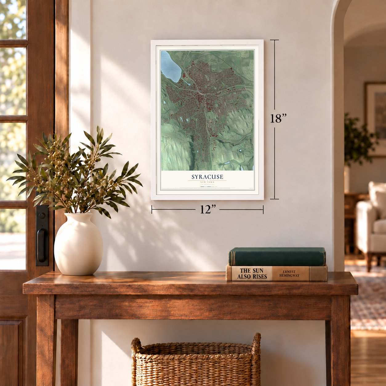
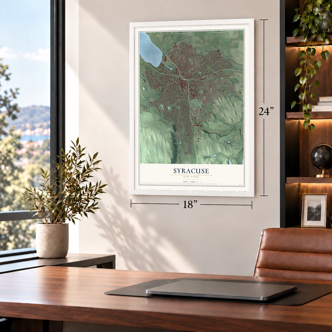
Unframed archival matte, a black wood frame or a white wood frame.
Up close
Geography Worth Displaying
This map was created using accurate cartographic data and authoritative geographic sources, including the U.S. Geological Survey (USGS) and FEMA. The map brings together terrain, waterways, roads, and building detail. The majority of the streets are labeled, houses are accurately depicted, and the topography is derived from government sources. Combining local data with carefully composed color and shading leads to this beautifully detailed Syracuse artwork for your wall.
Rather than simply showing street outlines, we’ve included as many of the street names as we could reasonably fit on the map while keeping their names legible. Zoom in on the high resolution preview to see exactly what’s on the map. We truly set out to create a statement piece for anyone who loves Syracuse. So whether it’s for you, or a gift for someone you love, we hope this map of Syracuse brings back fond memories.
Explore the full map of Syracuse, New York and read about the local places it shows.
Find your street
Names on the Syracuse map
Every name below is printed on this map. Look for your street, your school, the park where you played, or the pond down the road.
Places and landmarks10
- Downtown
- Kirk Park
- Lincoln Park
- Oakwood Cemetery
- Rand Tract Park
- Thornden Park
- Woodlawn Cemetery
- Eastwood
- Skytop
- Shotwell Park
Streets and roads514
- North Salina Street
- South State Street
- Wolf Street
- Erie Boulevard East
- Park Street
- Court Street
- West Kennedy Street
- East Genesee Street
- South Salina Street
- James Street
- Valley Drive
- West Genesee Street
- South Avenue
- West Seneca Turnpike
- East Seneca Turnpike
- Thompson Road
- Bear Street West
- Lodi Street
- Oakwood Avenue
- Garfield Avenue
- East Colvin Street
- South Townsend Street
- West Kirkpatrick Street
- Demong Drive
- Moore Avenue
- Erie Boulevard West
- Spencer Street
- North Clinton Street
- Skytop Road
- North Townsend Street
Show all 514 streets
- South West Street
- First North Street
- Alanson Road
- Salt Springs Road
- Emerson Avenue
- Pond Street
- Lambreth Lane
- Almond Street
- South Collingwood Avenue
- Meadowbrook Drive
- Burnet Avenue
- Midland Avenue
- Grant Boulevard
- East Fayette Street
- Bellevue Avenue
- Comstock Avenue
- Euclid Avenue
- Westmoreland Avenue
- West Onondaga Street
- Butternut Street
- Spring Street
- South Geddes Street
- Glenwood Avenue
- West Fayette Street
- Burnet Park Drive
- Teall Avenue
- Willis Avenue
- Westcott Street
- Park Avenue
- East Brighton Avenue
- Canal Street
- Oak Street
- Jamesville Avenue
- Hiawatha Boulevard West
- Lemoyne Avenue
- Onondaga Creek Boulevard
- Hawley Avenue
- Caleb Avenue
- Milton Avenue
- Sedgwick Drive
- Northcliffe Road
- East Water Street
- West Colvin Street
- Carbon Street
- Wadsworth Street
- Harrison Street
- Madison Street
- East Adams Street
- Lancaster Avenue
- Montgomery Street
- Avery Avenue
- Hillsboro Parkway
- Highland Street
- Stolp Avenue
- South Midler Avenue
- Cumberland Avenue
- Kirkpatrick Street
- Grand Avenue
- Fellows Avenue
- Turtle Street
- Crawford Avenue
- Sunnycrest Road
- Solar Street
- Seymour Street
- West Brighton Avenue
- Hiawatha Boulevard East
- Rugby Road
- Lafayette Road
- Harborside Drive
- West Newell Street
- Bradford Parkway
- Seventh North Street
- Onondaga Avenue
- Gifford Street
- Winkworth Parkway
- Irving Avenue
- South Beech Street
- Rowland Avenue
- West Lafayette Avenue
- Dewitt Street
- Brattle Road
- Onondaga Park Drive
- Tex Simone Drive
- Ostrom Avenue
- West Belden Avenue
- Kirk Park Drive
- Broad Street
- Hickok Avenue
- University Avenue
- Stafford Avenue
- Scott Avenue
- Velasko Road
- Allen Street
- Cortland Avenue
- Duke Drive
- Glencove Road
- Mountainview Avenue
- Danforth Street
- Cannon Street
- Tallman Street
- Shonnard Street
- Ballantyne Road
- Salisbury Road
- Walnut Avenue
- Genant Drive
- Darlington Road
- Roberts Avenue
- Fayette Boulevard
- Hancock Drive
- Bear Street
- Whittier Avenue
- Catherine Street
- Thurber Street
- South Wilbur Avenue
- Mosley Drive
- Myrtle Street
- Fitch Street
- Second North Street
- Tracy Street
- West Ostrander Avenue
- South Warren Street
- Tompkins Street
- Kimber Road
- Otisco Street
- Barnes Avenue
- Helen Street
- Ulster Street
- Schuyler Street
- Rich Street
- Hamilton Street
- South Avery Avenue
- Wilkinson Street
- Ackerman Avenue
- Cadillac Street
- Summit Avenue
- West Castle Street
- Richmond Avenue
- Liberty Street
- Dorwin Avenue
- Tyson Place
- John Street
- Wendell Terrace
- Elm Street
- Lockwood Road
- Vine Street
- Melrose Avenue
- Merriman Avenue
- Beattie Street
- Evans Street
- Wolcott Avenue
- Renwick Avenue
- Green Street
- Boyden Street
- Plum Street
- Reed Avenue
- Winton Street
- South McBride Street
- North Collingwood Avenue
- Lillian Avenue
- Standish Drive
- Seeley Road
- Bruce Street
- Dewitt Road
- Clover Ridge Drive
- University Place
- Crossett Street
- Douglas Street
- Charmouth Drive
- Arnold Avenue
- Ainsley Drive
- Cayuga Street
- Boston Street
- Sunrise Drive
- Pleasantview Avenue
- Hillside Street
- Roosevelt Avenue
- Edgemont Drive
- Vann Street
- Academy Place
- Hopper Road
- Hood Avenue
- Oneida Street
- Kellogg Street
- Sims Drive
- Coldbrook Drive
- Maplewood Avenue
- Shuart Avenue
- Hoefler Street
- Barrington Road
- Lakeview Avenue
- Mildred Avenue
- Vincent Street
- Oakley Drive
- Coolidge Avenue
- Houston Avenue
- Mather Street
- Maryland Avenue
- North Avenue
- Hurlburt Road
- Parrish Lane
- Grant Avenue
- Seneca Drive
- Hubbell Avenue
- Essex Street
- Rock Cut Road
- Springfield Road
- Wheaton Road
- Chaffee Avenue
- Loomis Avenue
- Merritt Avenue
- Cleveland Avenue
- Dakin Street
- Milburn Drive
- Lamson Street
- Peat Street
- Dale Street
- Lynch Avenue
- Park Road
- Milnor Avenue
- Deforest Road
- Austin Avenue
- Hall Avenue
- Lilac Street
- Harford Road
- Basin Street
- Winthrop Road
- Smith Street
- Brooklea Place
- Leon Street
- Seward Street
- Parkway Drive
- Conifer Drive
- Simon Drive
- Clyde Avenue
- Headson Drive
- Edna Road
- Ferndale Drive
- Bradley Street
- Pine Street
- Lime Street
- Stadium Place
- Mains Avenue
- Elk Street
- Niven Street
- Ellis Street
- Elsner Street
- Alton Street
- Kinne Street
- North State Street
- Farmers Market Place
- Small Road
- Smith Lane
- Berkeley Drive
- Huron Street
- Doll Parkway
- Thornden Park Drive
- Forest Hill Drive
- Buckingham Avenue
- Brookford Road
- State Fair Boulevard
- Stinard Avenue
- South Crouse Avenue
- Woodbine Avenue
- Nichols Avenue
- Scottholm Boulevard
- Durston Avenue
- Schiller Park Drive
- Nottingham Road
- Bryant Avenue
- Delaware Street
- Mertens Avenue
- Carousel Center
- Lexington Avenue
- Remington Avenue
- Tully Street
- North Midler Avenue
- Norwood Avenue
- Ridgewood Drive
- Robinson Street
- Longmeadow Drive
- Burns Avenue
- North Franklin Street
- Mount Olympus Drive
- West Calthrop Avenue
- Scoville Avenue
- West Pleasant Avenue
- Martin Street
- Pulaski Street
- Woodruff Avenue
- Fabius Street
- Walrath Road
- Erie Street
- Marshall Street
- Carlton Road
- Lincoln Avenue
- Loma Avenue
- South Orchard Road
- Fenway Drive
- Hartson Street
- Clairmonte Avenue
- North Beech Street
- Jasper Street
- Elmhurst Avenue
- West Washington Street
- Rigi Avenue
- Briggs Street
- Albert Road
- Edison Street
- Davis Street
- Dudley Street
- Mitchell Avenue
- Bassett Street
- Strong Avenue
- Hope Avenue
- McLennan Avenue
- Hutchinson Avenue
- Spencer
- Cambridge Street
- Sumner Avenue
- Lorraine Avenue
- Chapple Way
- Fillmore Avenue
- Forman Avenue
- Searlwyn Road
- Syracuse Street
- Peck Avenue
- Riegel Street
- Sedgwick Street
- Wall Street
- Gilbert Avenue
- Grumbach Avenue
- Lewis Street
- East Avenue
- Anderson Avenue
- Taft Avenue
- Polk Street
- Kramer Drive
- Wood Avenue
- College Place
- Kimber Avenue
- Robert Drive
- Wiman Avenue
- Bertram Place
- Mooney Avenue
- Rosemont Drive
- Pacific Avenue
- Sackett Street
- Berwyn Avenue
- Delhi Street
- East Milford Drive
- Claire Road
- Wayne Street
- Richard Road
- Steuben Street
- Oxford Street
- Crescent Avenue
- Croyden Road
- Saint Louis Avenue
- Lynn Circle
- May Avenue
- King Street
- Merrill Road
- Ontario Street
- Archer Road
- Wente Terrace
- Alden Street
- Lynch Street
- Feigel Avenue
- Eureka Street
- Hobart Avenue
- Annetta Street
- Edtim Road
- Schiller Avenue
- Julian Place
- Amy Street
- Arnts Place
- Rill Avenue
- Kidd Avenue
- Byrne Place
- Fire Lane
- C-D Road
- Ethel Street
- Grant Terrace
- Dyer Court
- Lea Lane
- North West Street
- Van Rensselaer Street
- South Clinton Street
- North McBride Street
- Robineau Road
- Willumae Drive
- Kirk Avenue
- West Matson Avenue
- North Lowell Avenue
- Hudson Street
- Clarendon Street
- Highland Avenue
- Burt Street
- Farmer Street
- East Glen Avenue
- Fobes Avenue
- Waverly Avenue
- Furman Street
- Arthur Street
- South Alvord Street
- Kensington Place
- Miles Avenue
- Chemung Street
- Richfield Avenue
- Bishop Avenue
- Highridge Drive
- Livingston Avenue
- Hatch Street
- East Kennedy Street
- Hastings Place
- Harding Place
- Harrington Road
- Hampton Road
- South Glencove Road
- West Milford Drive
- Laforte Avenue
- East Florence Avenue
- South Mc Bride Street
- Elmwood Avenue
- Brighton Place
- Slocum Avenue
- Colby Avenue
- Greenland Drive
- Herbst Avenue
- Fairview Avenue
- Beverly Road
- Gray Avenue
- Intrepid Lane
- Juneway Road
- Gorland Avenue
- White Street
- Game Road
- Roney Road
- Marginal Street
- Solcum Heights
- Olive Street
- Vale Street
- Saturn Drive
- Arbor Lane
- Gale Street
- Manley Field House
- Hillsdale Avenue
- South Edwards Avenue
- Coleridge Avenue
- Lincoln Park Drive
- Lombard Avenue
- Warner Avenue
- Croly Street
- Ivy Ridge Road
- East Castle Street
- Marlborough Road
- Grace Street
- Hillview Avenue
- Latter Drive
- West Division Street
- Magnolia Street
- Huntley Street
- Farm Acre Road
- Montana Street
- West Marcellus Street
- North Crouse Avenue
- Ridgeway Avenue
- Woodside Drive
- Edgehill Road
- Harriette Avenue
- Parkside Avenue
- Seneca Street
- Locksley Road
- Dillaye Avenue
- Amherst Avenue
- Crippen Avenue
- Dickerson Street
- Delong Avenue
- Fenton Street
- Hilton Road
- Academy Street
- Crafton Avenue
- Brace Street
- Ives Avenue
Names are listed as they appear on the printed map. Zoom into the product photos to find them.
About Syracuse, New York
Syracuse is a city of 148,620 people and the county seat of Onondaga County. For centuries before Europeans came, this was the land of the Onondaga Nation, and its village of Onondaga was where the Haudenosaunee Grand Council traditionally met. In the mid-17th century the French Jesuit Simon Le Moyne built the mission of Ste. Marie de Gannentaha beside Onondaga Lake, and the missionaries wrote about salty springs at the lake's south end.
After the Revolution, New York set the land aside as the Onondaga Salt Springs Reservation. Salt making here lasted from the late 1700s into the early 1900s and gave the place the nickname "The Salt City." The cluster of small villages had no name, so it couldn't get a post office. Joshua Forman favored Corinth, but Saratoga County already used it. John Wilkinson had read a poem about Syracuse in Sicily and saw the same lake and salt springs there. On February 4, 1820, he proposed the name Syracuse, and both the village and its post office took it.
“The conditions of admission shall be equal to all persons.... There shall be no invidious discrimination here against woman.... Brains and heart shall have a fair chance....”
- State Fair since 1841The first New York State Fair met in Syracuse in 1841. From 1842 to 1889 it traveled among 11 cities before Syracuse became its permanent home. It has run every year since, with two breaks: from 1942 to 1947, when the fairgrounds became a wartime military base, and in 2020, when the COVID-19 pandemic stopped it.
- A university chartered in 1870Syracuse University was founded on March 24, 1870, with its own charter from the state. A year earlier, Genesee College had tried and failed to move to Syracuse. The new school admitted women from the start. Through the 19th century its College of Liberal Arts enrolled men and women in roughly equal numbers, and its College of Fine Arts was mostly women.
- Green on top since 1928On Tipperary Hill, local youths kept throwing rocks at a traffic signal because it had the "British red" light on top. In 1928 the city gave up and installed a signal with green on top, the only one of its kind. The rock throwers became known as stonethrowers. The Tipperary Hill Heritage Memorial, at Tompkins Street and Milton Avenue, remembers them.
- Salt, soda ash and enginesIn 1884 the Solvay Process Company opened its first American plant on the southwest shore of Onondaga Lake, making soda ash from brine and limestone by Ernest Solvay's 1861 method. As salt faded after the Civil War, factories took over. The Franklin Automobile Company built the world's first air-cooled engine here, and Smith Corona and Gustav Stickley's Craftsman Workshops grew up in the city. The chemical works brought jobs but left Onondaga Lake the nation's most polluted.
Keep exploring New York
Syracuse is one of 2,165 New York towns we've mapped. Every dot on the map is a print of its own.
The search covers every state, New York first.
Near Syracuse
Order 2 or more town maps and save 10%. Shown in the size and finish you picked above, so they hang as a set.
- University Hill 12" x 18" / Archival Matte Print $39.99
- Southwest 12" x 18" / Archival Matte Print $39.99
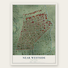
- Near Westside 12" x 18" / Archival Matte Print $39.99

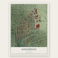
More maps nearby: Westcott, Near Eastside, University Neighborhood, Outer Comstock and Elmwood.
The art of mapping a place
How This Map Was Made
Real places. Remarkable detail. Discover the layers that turn geographic data into a map of home.

The view from above
Aerial imagery reveals the character of the land: woodland, open fields, and the patterns of a place.

The shape of the land
Elevation data brings hills, valleys, and subtle changes in the landscape into view.

The details of home
Roads, waterways, and building footprints come together to make the map feel unmistakably local.

Geography becomes art
Considered color, shading, and typography bring the layers together in a map made for your wall.


Process illustrated with Mendon, Massachusetts. Aerial imagery: USDA NAIP. Terrain: USGS 3D Elevation Program. Map details and finished artwork: KNOWOL.
The Details
About This Print
Choose an archival matte print, or a black or white Ayous wood frame. The archival matte print is unframed.
Select your size and finish above to see the matching product image and price.
Materials & Craftsmanship
A contemporary map with the character of a classic atlas, printed on archival matte paper. Optional frames are made from Ayous wood.
Your printed map does not include the watermark shown in the full-map preview.
Shipping & Delivery
Free shipping within the United States. Every print is made to order in the USA.
Buying a gift? Add a note in your cart and we'll include it. We never put prices in the package.
Prints ship within 2 to 3 business days. Allow 7 to 10 days total from ordering for delivery. Timing may vary during holidays or periods of high order volume.
Read our shipping policy.
Returns and damaged prints
Each print is made to order. Change-of-mind refunds are not available after production.
If your print arrives damaged, misprinted or incorrect, contact support@knowol.com within 30 days of receiving it. Include your order number, photos and a description of the issue.
Read our full refund and replacement policy. For questions about your order, email support@knowol.com.