Search for another town





Free U.S. delivery 7 to 10 days after you order
Town of Orchard Park, New York Map Art
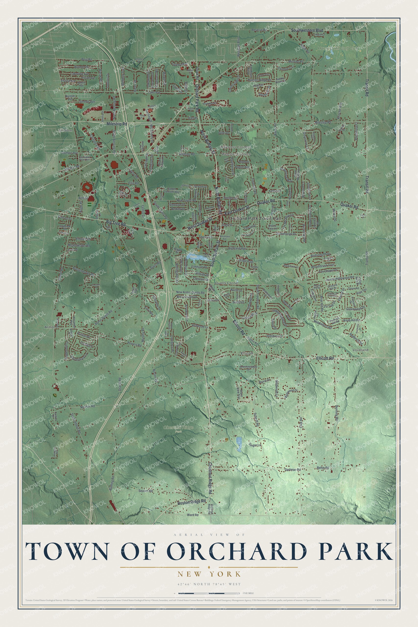
A new map of Town of Orchard Park, New York, made in 2026 and printed to order on thick archival matte paper.
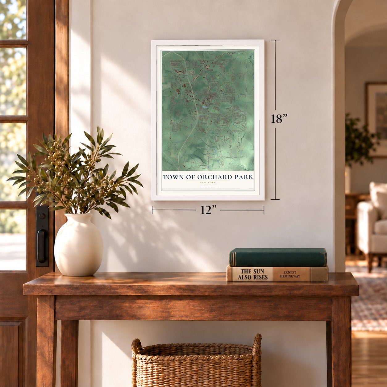
12" x 18" Archival Matte Print
A Map of Home. A Work of Art.
Bring a piece of Orchard Park home. Whether it’s where you grew up, your current home, or simply a moment in your life, this Orchard Park, New York map print brings those memories to your wall. Antique-inspired styling and modern geographic detail combine to create artwork that’s beautiful from across the room, with plenty to study and explore when you get up close.
Three ways to hang it
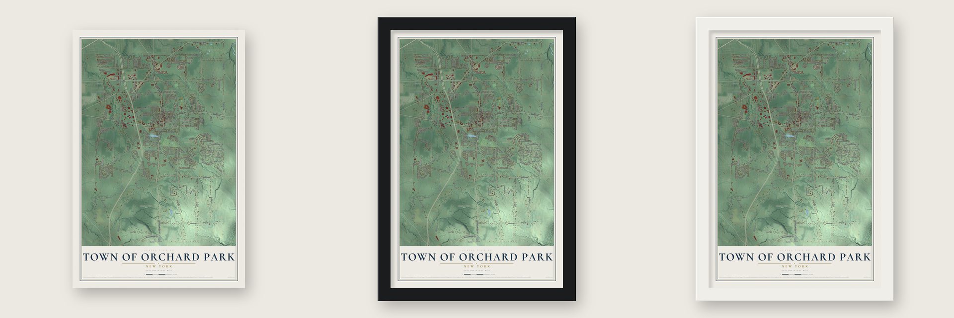
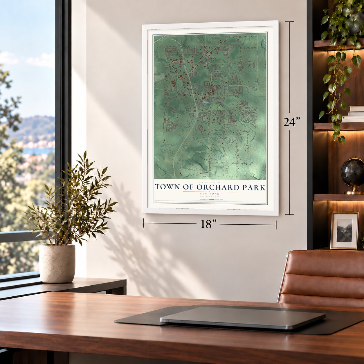
Unframed archival matte, a black wood frame or a white wood frame.
Up close
Real geography. Art worth displaying.
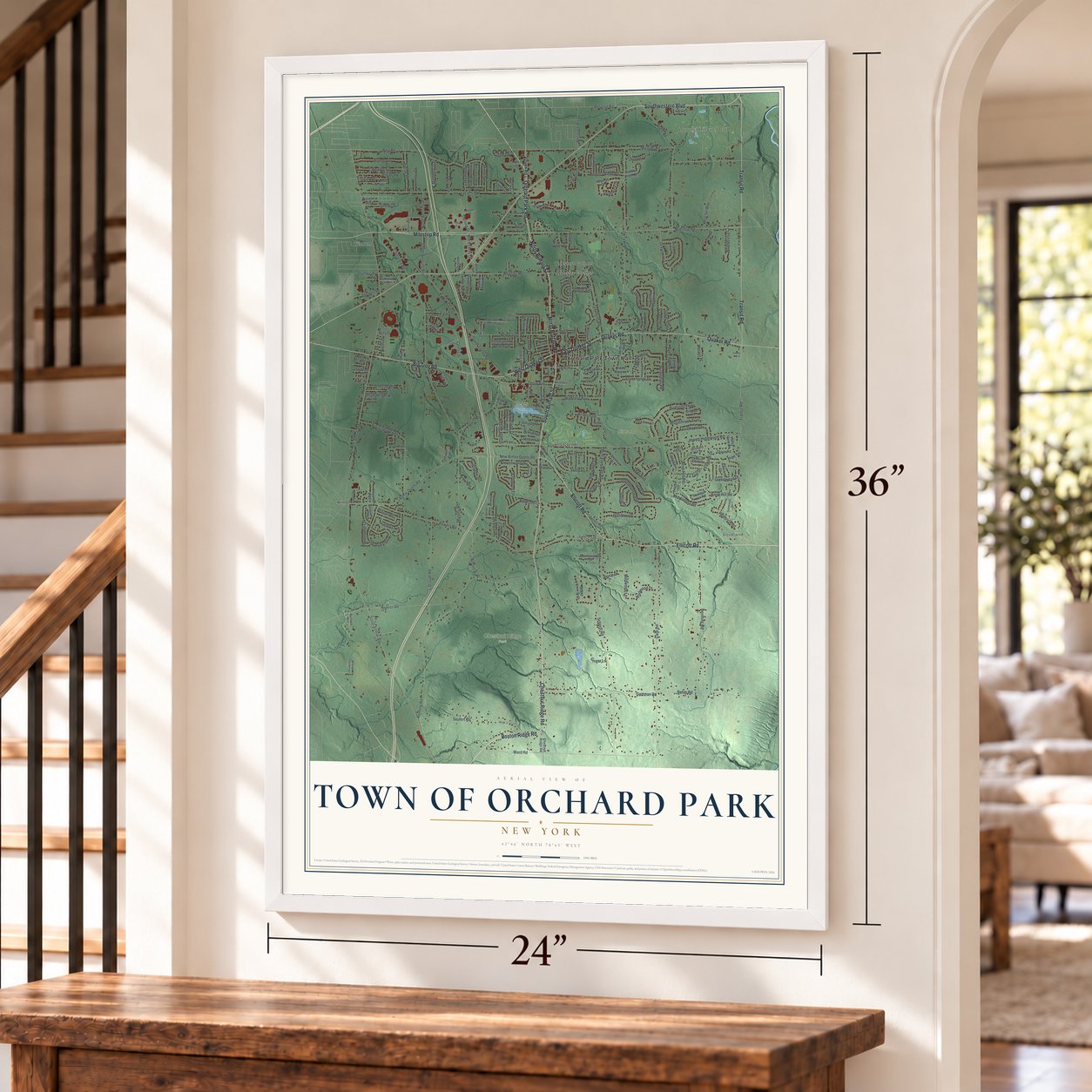
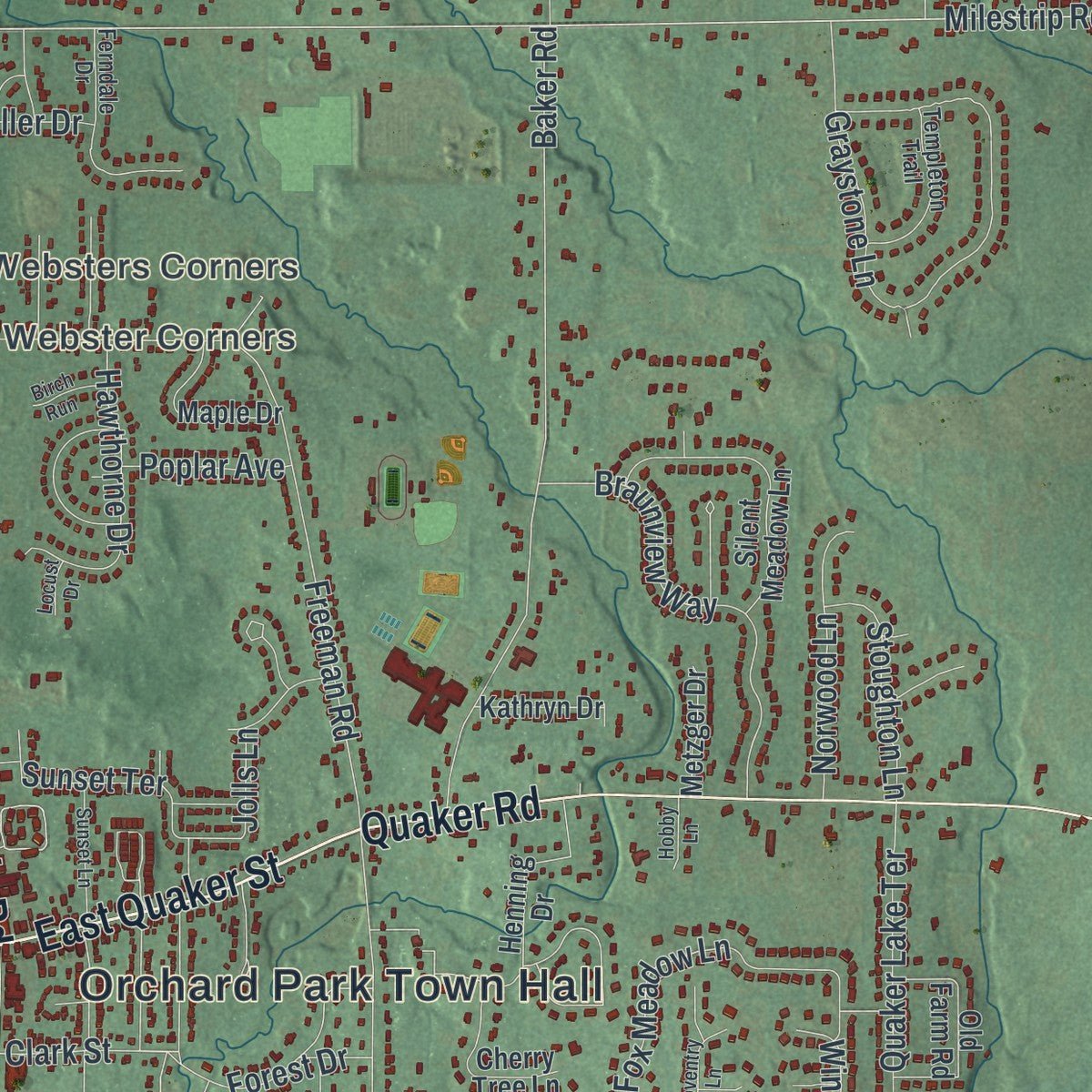
This map was created using accurate cartographic data and authoritative geographic sources, including the U.S. Geological Survey (USGS) and FEMA. The map brings together terrain, waterways, roads, and building detail. The majority of the streets are labeled, houses are accurately depicted, and the topography is derived from government sources. Combining local data with carefully composed color and shading leads to this beautifully detailed Orchard Park artwork for your wall.
Rather than simply showing street outlines, we’ve included as many of the street names as we could reasonably fit on the map while keeping their names legible. Zoom in on the high resolution preview to see exactly what’s on the map. We truly set out to create a statement piece for anyone who loves Orchard Park. So whether it’s for you, or a gift for someone you love, we hope this map of Orchard Park brings back fond memories.
Explore the full map of Town of Orchard Park, New York and read about the local places it shows.

About the Town of Orchard Park, New York
Within New York State, Town of Orchard Park is classified as a community, with an identity tied to places residents know by name. Local reference points include Windom and Chestnut Ridge Road, connecting the community's present landscape with the names that define this part of the state.
- Named local placesSources connect Town of Orchard Park with Websters Corners, Loveland and Windom.
- Familiar local routesChestnut Ridge Road, Buffalo Road and Buffalo Street cross the community.
Find your street
Names on the Orchard Park map
Every name below is printed on this map. Look for your street, your school, the park where you played, or the pond down the road.
Places and landmarks12
- Orchard Park Town Hall
- Windom
- Loveland
- Websters Corners
- Webster Corners
- Birdsong
- Chestnut Ridge Park
- Yates Park
- Armor
- Duells Corner
- Ellicott
- Harvest Hill Golf Club
Streets and roads240
- Chestnut Ridge Road
- North Buffalo Road
- North Buffalo Street
- South Buffalo Street
- Orchard Park Road
- Boston Ridge Road
- West Quaker Street
- Ellicott Road
- East Quaker Street
- Milestrip Road
- Southwestern Boulevard
- Transit Road
- Big Tree Road
- Quaker Road
- Ward Road
- Armor Duells Road
- Forest Drive
- South Abbott Road
- Centre Drive
- Abbott Road
- California Road
- Powers Road
- Michael Road
- Scherff Road
- Newton Road
- Jewett Holmwood Road
- Cole Road
- Baker Road
- Lake Avenue
- Freeman Road
Show all 240 streets
- Webster Road
- Benning Road
- Bunting Road
- Angle Road
- Berg Road
- Seufert Road
- Gartman Road
- Bussendorfer Road
- Draudt Road
- Duerr Road
- Graystone Lane
- South Freeman Road
- Independence Drive
- Old Orchard Lane
- Behm Road
- New Taylor Road
- Ashwood Lane
- New Armor Duells Road
- Taylor Road
- Breezewood Drive
- Knob Hill Road
- Hillsboro Drive
- Murphy Road
- Reserve Road
- Birdsong Parkway
- Briar Hill Road
- Middlebury Road
- Minden Drive
- Braunview Way
- Stonehenge Drive
- Thorn Avenue
- South Lane
- Fox Meadow Lane
- Burmon Drive
- Lakeview Avenue
- Highland Avenue
- Fox Chapel Drive
- Summit Avenue
- Hunters Ridge Road
- Burton Road
- Woodthrush Trail
- South Taylor Road
- Squire Drive
- Edgewater Drive
- Deer Run
- Hawthorne Drive
- Redbrick Road
- Countryside Lane
- Bielak Road
- Norwood Lane
- Sunset Terrace
- Woodland Drive
- Elmhurst Drive
- Arrowood Lane
- Candy Lane
- Westgate Boulevard
- Elmtree Road
- Quaker Lake Terrace
- Lakewood Drive
- North Benzing Road
- South Benzing Road
- Lakeridge Drive
- Winterhall Road
- Pine Terrace
- Hilltowne Drive
- Rolling Hills Drive
- Southwick Drive
- Ellis Road
- Vistula Avenue
- Carriage Drive
- Wildwood Lane
- Stoughton Lane
- Lawrence Place
- Ponderosa Court
- Hart Place
- Hillside Drive
- Meadowlawn Road
- Melberry Trail
- Greenwood Drive
- Larned Lane
- Faahs Drive
- Knoche Way
- North Lane
- Bieler Road
- Sheldon Road
- Bridle Path
- Wildwood Drive
- Mid County Drive
- Puritan Place
- Melant Drive
- Bruce Drive
- Royalcrest Road
- Peppermill Lane
- Olympic Avenue
- Errington Terrace
- Crescent Drive
- Iroquois Drive
- Berkley Drive
- Emerson Drive
- Edward Drive
- Poplar Avenue
- Sterling Drive
- Fir Top Drive
- Ginger Lane
- Clark Street
- Bills Drive
- Pilger Place
- Diller Drive
- Jolls Lane
- Boldt Court
- Union Road
- Hammocks Drive
- Fox Run Lane
- Henning Drive
- Timberlake Drive
- Burbank Drive
- Grand View Trail
- Hillside Avenue
- Curley Drive
- Silent Meadow Lane
- Velore Avenue
- Hastings Drive
- Old Farm Road
- Green Lake Drive
- Sonnet Drive
- Golden Crescent Way
- Cherry Tree Lane
- Chisholm Trail
- Greenmeadow Drive
- Hazel Court
- East Royal Hill Drive
- Maple Drive
- Saddle Brook Court
- Orchard Hill Drive
- Kingswood Drive
- Scattertree Lane
- Eaglebrook Drive
- Rockdove Lane
- Quaker Hollow Lane
- Dennis Road
- Cranwood Lane
- Alexander Way
- Chase Road
- Valley View Drive
- Penhurst Street
- North Davis Street
- Bender Drive
- Windom Avenue
- Concord Drive
- Riley Mdw
- Metzger Drive
- Saybrook Road
- Kathryn Drive
- Amelia Drive
- Shadow Lane
- Philson Drive
- Hemlock Hill Road
- Breem Street
- Bank Street
- Aaron Trail
- Short Drive
- Carlton Drive
- Briggs Drive
- Daisy Lane
- Allen Lane
- James Place
- South Lincoln Avenue
- Ferndale Drive
- Falconcrest Lane
- Templeton Trail
- Tranquility Lane
- Lexington Avenue
- Princeton Place
- Fairway Drive
- North Lake Drive
- East Abbott Grove Avenue
- Washington Avenue
- Schultz Road
- Kings Court
- Stepping Stone Lane
- Woodlawn Avenue
- Brompton Court
- Lindsey Lane
- Swallow Lane
- Sandpiper Court
- Pinyon Drive
- Airmont Drive
- Mount Airy Drive
- Windgate Drive
- Weiss Street
- Tanglewood Drive West
- South Meadow Drive
- Hearthstone Terrace
- Redtail Drive
- Sunset Lane
- Hobby Lane
- Hampton Court
- Coventry Lane
- Windward Road
- Nieman Drive
- Harmony Circle
- Cobham Drive
- Reppien Place
- Deacon Road
- Lawrence Woods
- Pinewood Drive
- Birch Run
- Schaefer Road
- Colony Drive
- Locust Drive
Names are listed as they appear on the printed map. Zoom into the product photos to find them.
The art of mapping a place
How This Map Was Made
Real places. Remarkable detail. Discover the layers that turn geographic data into a map of home.

The view from above
Aerial imagery reveals the character of the land: woodland, open fields, and the patterns of a place.

The shape of the land
Elevation data brings hills, valleys, and subtle changes in the landscape into view.

The details of home
Roads, waterways, and building footprints come together to make the map feel unmistakably local.

Geography becomes art
Considered color, shading, and typography bring the layers together in a map made for your wall.


Process illustrated with Mendon, Massachusetts. Aerial imagery: USDA NAIP. Terrain: USGS 3D Elevation Program. Map details and finished artwork: KNOWOL.
The Details
About This Print
Choose an archival matte print, or a black or white Ayous wood frame. The archival matte print is unframed.
Select your size and finish above to see the matching product image and price.
Materials & Craftsmanship
A contemporary map with the character of a classic atlas, printed on archival matte paper. Optional frames are made from Ayous wood.
Your printed map does not include the watermark shown in the full-map preview.
Shipping & Delivery
Free shipping within the United States. Every print is made to order in the USA.
Buying a gift? Add a note in your cart and we'll include it. We never put prices in the package.
Prints ship within 2 to 3 business days. Allow 7 to 10 days total from ordering for delivery. Timing may vary during holidays or periods of high order volume.
Read our shipping policy.
Returns and damaged prints
Each print is made to order. Change-of-mind refunds are not available after production.
If your print arrives damaged, misprinted or incorrect, contact support@knowol.com within 30 days of receiving it. Include your order number, photos and a description of the issue.
Read our full refund and replacement policy. For questions about your order, email support@knowol.com.
Find your town
Looking for another city?
Find a map of home in our New York collection.
Nearby
Maps of towns near Town of Orchard Park
Know someone from one of these towns? Their map makes a great gift.