
Search for another town



Free U.S. delivery 7 to 10 days after you order
Towson, Maryland Map Art
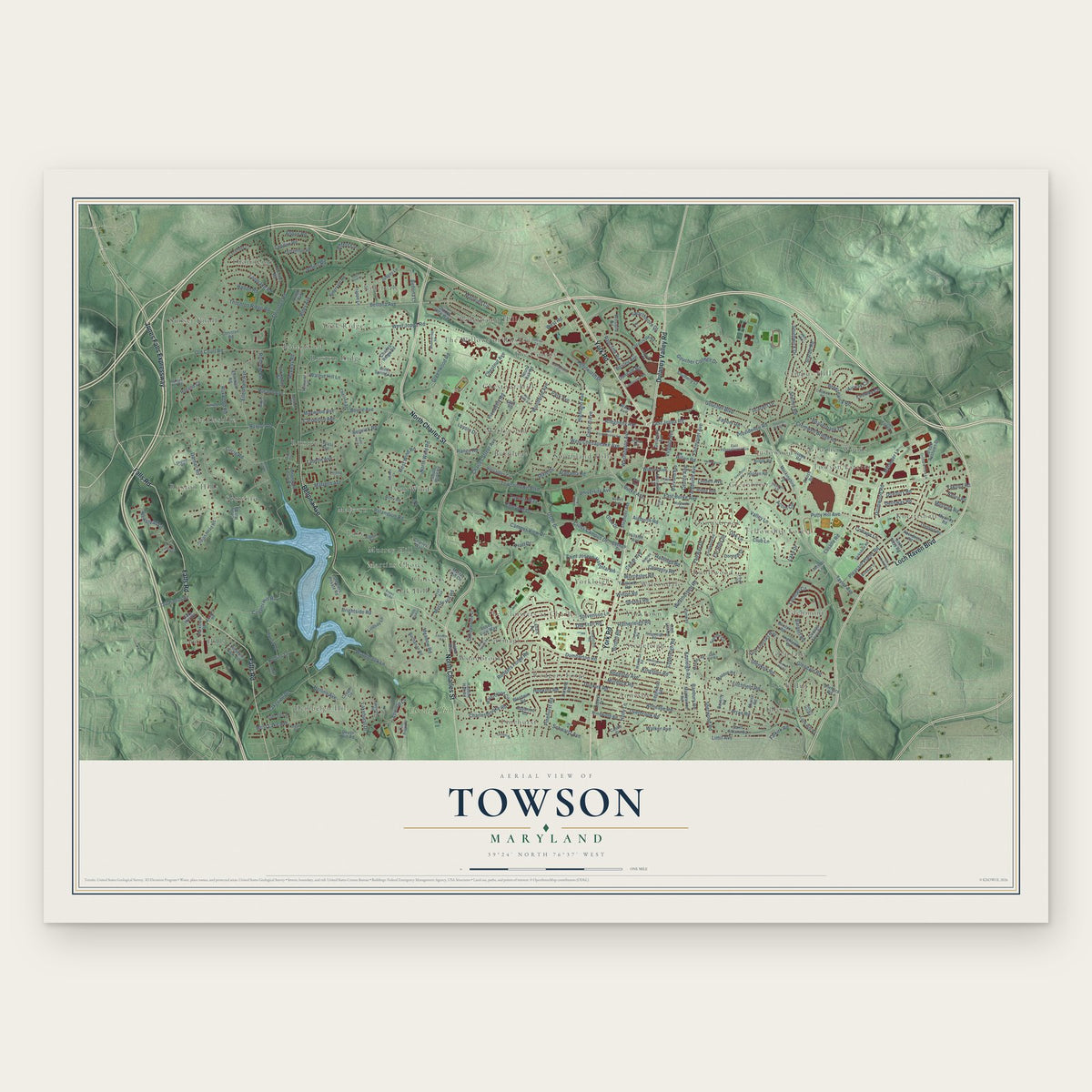
A new map of Towson, Maryland, made in 2026 and printed to order on thick archival matte paper.
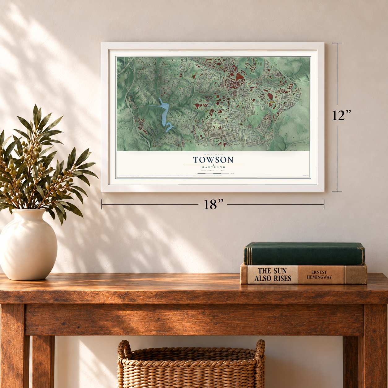
12" x 18" Archival Matte Print
A Map of Home. A Work of Art.
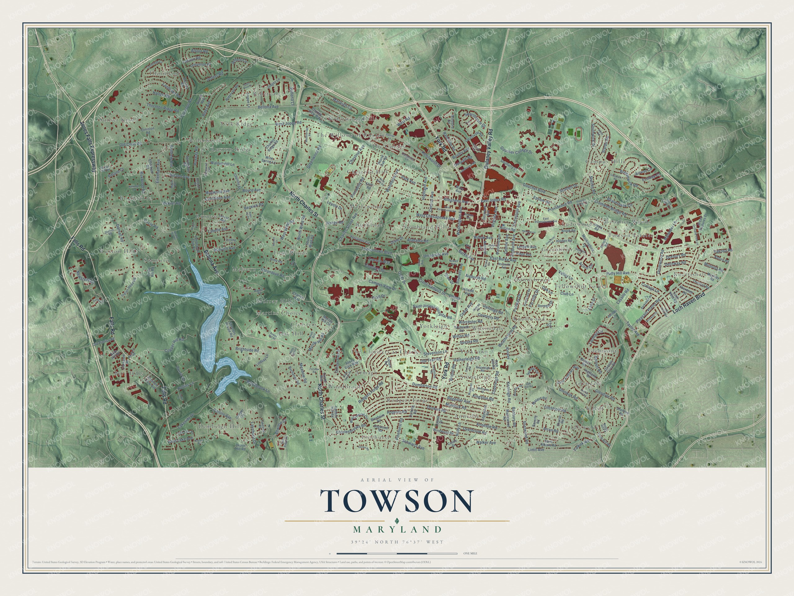
Explore Towson, Maryland from a whole new perspective. Created using aerial imagery and detailed geographic data, this map captures Towson building by building, with labeled streets, familiar landmarks, and shaded topographical relief that highlights the natural contours of the landscape.
Combining modern data with the timeless character of a vintage atlas, this map is just as interesting up close as it is beautiful on the wall. Whether you grew up in Towson, spent memorable years there, or call it home today, this unique map is a great way to celebrate a place that means something to you. Zoom in on the preview to look for your street, and then order a print to put your memories on the wall.
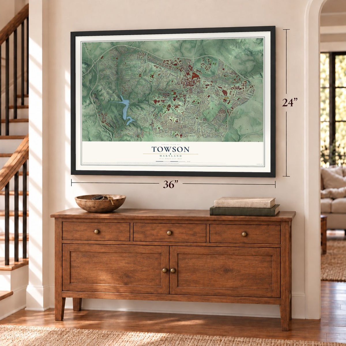
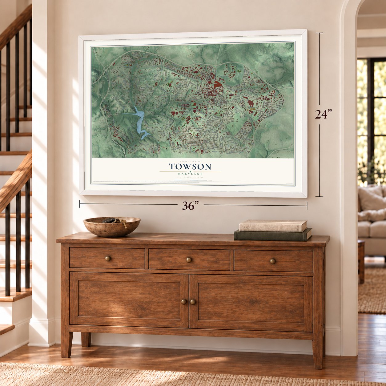
Three ways to hang it
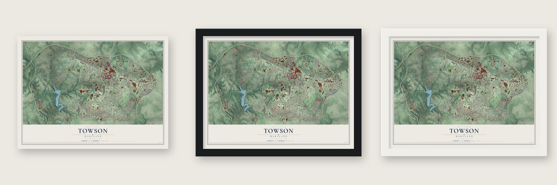
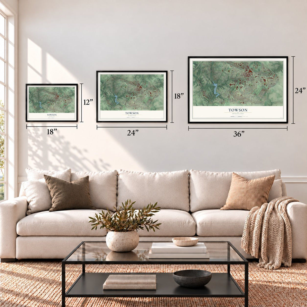
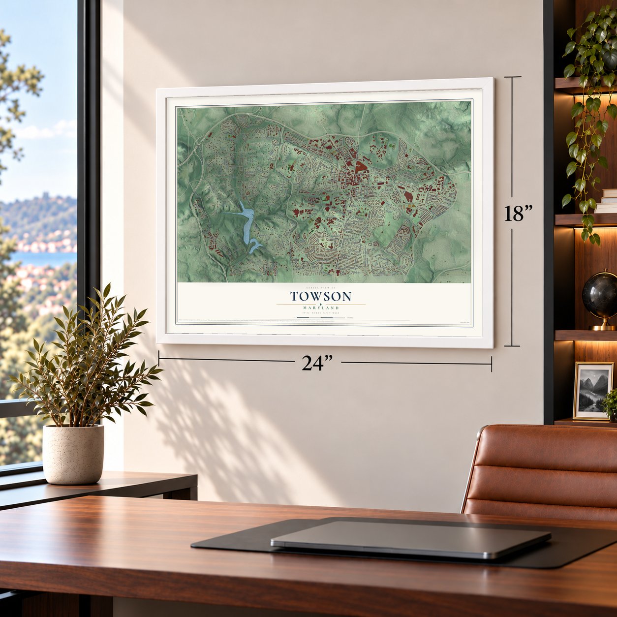
Unframed archival matte, a black wood frame or a white wood frame.
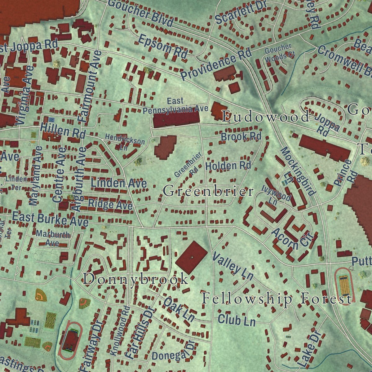
Up close
Geography Worth Displaying
This map was created using accurate cartographic data and authoritative geographic sources, including the U.S. Geological Survey and the Census Bureau. The map brings together terrain, waterways, roads, and building detail. The majority of the streets are labeled, houses are accurately depicted, and the topography is derived from government sources. Combining local data with carefully composed color and shading leads to this beautifully detailed Towson artwork for your wall.
Rather than simply showing street outlines, we’ve included as many of the street names as we could reasonably fit on the map while keeping their names legible. Zoom in on the high resolution preview to see exactly what’s on the map. We truly set out to create a statement piece for anyone who loves Towson. So whether it’s for you, or a gift for someone you love, we hope this map of Towson brings back fond memories.
Read the story behind this map of Towson, Maryland from 2026.
About Towson, Maryland
From the Baltimore Heritage: "Saint James is the second-oldest church operating in Towson and the oldest of the area’s Black congregations."
Find your street
Names on the Towson map
Every name below is printed on this map. Look for your street, your school, the park where you played, or the pond down the road.
Places and landmarks50
- Anneslie
- Armagh
- Bare Hills
- Bridleshire
- Burnbrae
- Campus Hills
- Chestnut Hill
- Cloisters
- Dembeigh Hill
- Donnybrook
- Eudowood
- Fellowship Forest
Show all 50 places
- Four Winds
- Glendale
- Glenmont
- Goucher Woods
- Greenbrier
- Idlewylde
- Knettishall
- Knollwood
- Lake
- Loch Hill
- Malvern
- Marlywood
- Martins Choice
- Murray Hill
- Oak Hill
- Pinehurst
- Ridervale
- Riderwood
- Riderwood Hills
- Rodgers Forge
- Ruxton
- Ruxton Hills
- Ruxton Ridge
- Sorrento
- Southland Hills
- Stoneleigh
- Sunset Knoll
- The Cloisters at Charles
- The Colony
- The Willows of Ruxton
- Thornleigh
- Towson Estates
- Wiltondale
- Woodbrook
- York Ridge
- Yorkleigh
- Yorktown
- Elkridge Club
Streets and roads314
- York Road
- North Charles Street
- Loch Raven Boulevard
- Falls Road
- Bellona Avenue
- Dulaney Valley Road
- Jones Falls Expressway
- East Joppa Road
- Putty Hill Avenue
- Hillen Road
- Limit Avenue
- Bosley Avenue
- Goucher Boulevard
- Stevenson Lane
- Fairmount Avenue
- Southwick Drive
- Acorn Circle
- Schwartz Avenue
- Taylor Avenue
- Aigburth Avenue
- Goucher College Drive
- Berwick Road
- Glendale Road
- Walker Avenue
- Starbit Road
- Lakehurst Drive
- Virginia Avenue
- West Joppa Road
- Kenilworth Drive
- Regester Avenue
Show all 314 streets
- Overbrook Road
- Ruxton Road
- West Chesapeake Avenue
- Circle Road
- Dunkirk Road
- Murdock Road
- Towsontown Boulevard
- Malvern Avenue
- Charles Street Avenue
- Boyce Avenue
- Old Court Road
- Cromwell Bridge Road
- Providence Road
- Pleasant Plains Road
- Greenwood Road
- Osler Drive
- Allegheny Avenue
- Thornton Road
- Aigburth Road
- Dumbarton Road
- West Lake Avenue
- Woodbrook Lane
- Chestnut Avenue
- Woodbine Avenue
- Rolandvue Road
- Fairway Drive
- Sherwood Road
- Anneslie Road
- Mylander Lane
- Rider Avenue
- Copper Hill Road
- Jeffers Road
- Piccadilly Road
- Ruxwood Road
- Litchfield Road
- Shelley Road
- Beaverbank Circle
- Lasalle Road
- Pinehurst Road
- Ellenham Avenue
- Darnall Road
- Willow Avenue
- Cross Campus Drive
- Sussex Road
- Kingston Road
- Scarlett Drive
- East Burke Avenue
- Weatherbee Road
- Alabama Road
- Thornton Ridge Road
- Campus View Drive
- Alston Road
- Roland Avenue
- Ruxway Road
- Washington Avenue
- Landrake Road
- Walnut Hill Lane
- Dixie Drive
- Marleigh Circle
- Newstead Lane
- Brightside Road
- Swarthmore Drive
- Cedar Avenue
- Hopkins Road
- Arran Road
- Banbury Road
- Range Road
- Saint Joseph Hospital Road
- Cottage Lane
- Holly Lane
- Lakeside Drive
- Breezewick Road
- Wilton Road
- Emerson Drive
- Meadow Road
- Far Hills Drive
- University Avenue
- Hatherleigh Road
- Lachlan Circle
- Glenkirk Road
- Charlesbrooke Road
- Carrollton Avenue
- Lake Drive
- North Wind Road
- Old Trail Road
- West Road
- Murray Hill Road
- Hollins Lane
- Rodgers Forge Road
- Hollins Avenue
- Towson Way
- Copeleigh Road
- Highland Avenue
- Valley Lane
- Epsom Road
- Yakona Road
- Maywood Avenue
- Doxbury Road
- Central Avenue
- Kenleigh Road
- Dellsway Road
- Worcester Road
- Mussula Road
- West Wind Road
- Roland Court
- Park Avenue
- Halton Road
- Centre Avenue
- Coventry Road
- Hastings Road
- Pratt Drive
- Club Lane
- Falkirk Road
- Airway Circle
- Bellona Lane
- Labelle Avenue
- Loyola Drive
- Drumwood Road
- Landon Road
- Jeffers Circle
- Ecoway Court
- Radcliffe Road
- Glen Drive
- Bristol Road
- Roldrew Avenue
- Burke Avenue
- Linden Avenue
- Barnett Road
- Oak Lane
- Allwood Court
- Dunvale Road
- Prince Road
- Joppa Road
- Wine Spring Lane
- Ellenham Road
- Blenheim Road
- Brook Road
- Loch Hill Road
- Versailles Circle
- Queens Ferry Road
- Lhirondelle Club Road
- Edgewood Road
- Maryland Avenue
- Yarmouth Road
- Indian Head Road
- Clarkview Road
- Burnley Road
- Walnutwood Circle
- Locust Avenue
- Summit Circle
- Abbey View Way
- South Wind Road
- Buchanan Road
- Barroll Road
- Judges Lane
- Springway Road
- Army Road
- Charles Ridge Road
- Dorking Road
- Green Pastures Drive
- Charles Way
- Saint Andrews Way
- Myamby Road
- Murray Hill Circle
- Shepters Private Road
- Windwood Road
- Locust Drive
- Donegal Drive
- Sharon Road
- Locustvale Road
- Thetford Road
- Cooper Circle
- Meridian Lane
- Stephens Avenue
- Round Oak Road
- Cloister Gate Drive
- Ridervale Road
- Charles View Way
- Chelsea Street
- Aberdeen Road
- Old Pimlico Road
- Haddon Hall Road
- Delaware Avenue
- Saint Albans Road
- Lindsay Lane
- Mockingbird Lane
- Templeton Road
- Highland Drive
- Lanark Road
- Dennis Avenue
- Loch Ness Road
- Naturo Road
- Coniston Road
- Shefford Road
- Brixton Road
- College Drive
- Maplewood Road
- Circle Hill Road
- Ridge Avenue
- Winsford Road
- Southerly Court
- Canter Way
- Maldon Road
- Hillside Avenue
- Gaywood Road
- Holden Road
- Trappe Lane
- Pleasant View Avenue
- Ware Avenue
- Devon Hill Road
- Bare Hill Road
- Jacobo Lane
- Eton Road
- Rich Hill Road
- Castle Drive
- Kimway
- Beverly Road
- Knollwood Road
- East Pennsylvania Avenue
- Carrbridge Circle
- Heathfield Road
- Wardman Road
- Ivywood Lane
- Pratt Avenue
- Skyline Road
- Wagner Road
- Lakeview Road
- Camberley Circle
- Oxford Road
- Hunt Ridge Road
- Lake Falls Road
- Sherwood Avenue
- Aintree Road
- Barksdale Road
- Orchard Tree Lane
- Lambourne Road
- Ridgeleigh Road
- Maple Avenue
- Newell Avenue
- Maxalea Road
- Ruxton Hill Road
- Curving Lane
- Raven Hill Road
- Kirkwall Court
- Marburth Avenue
- Glen Eagles Court
- Ballston Road
- Racquet Road
- Union Avenue
- Oak Hill Road
- Forge Drive
- May Avenue
- Thicket Road
- West Pennsylvania Avenue
- Glen Keith Boulevard
- Southerly Road
- Wellington Road
- Galliton Lane
- Heather Hill Road
- Greenbrier Road
- Goucher Woods Court
- Linden Terrace
- Meadowridge Road
- North Tyrone Road
- Fairford Lane
- Crestwick Road
- Bowen Mill Road
- North Bend Road
- Bankers Way
- Theo Lane
- Malvern Court
- Hendrickson Lane
- Kittredge Lane
- Clarks Lane
- Sibley Road
- Barclay Road
- Rider Hill Road
- Normal Terrace
- Betty Bush Lane
- Fairview Road
- Robin Hood Court
- Ruxlea Court
- Roland Run Road
- Navy Road
Names are listed as they appear on the printed map. Zoom into the product photos to find them.
The art of mapping a place
How This Map Was Made
Real places. Remarkable detail. Discover the layers that turn geographic data into a map of home.

The view from above
Aerial imagery reveals the character of the land: woodland, open fields, and the patterns of a place.

The shape of the land
Elevation data brings hills, valleys, and subtle changes in the landscape into view.

The details of home
Roads, waterways, and building footprints come together to make the map feel unmistakably local.

Geography becomes art
Considered color, shading, and typography bring the layers together in a map made for your wall.


Process illustrated with Mendon, Massachusetts. Aerial imagery: USDA NAIP. Terrain: USGS 3D Elevation Program. Map details and finished artwork: KNOWOL.
The Details
About This Print
Choose an archival matte print, or a black or white Ayous wood frame. The archival matte print is unframed.
Select your size and finish above to see the matching product image and price.
Materials & Craftsmanship
A contemporary map with the character of a classic atlas, printed on archival matte paper. Optional frames are made from Ayous wood.
Your printed map does not include the watermark shown in the full-map preview.
Shipping & Delivery
Free shipping within the United States. Every print is made to order in the USA.
Buying a gift? Add a note in your cart and we'll include it. We never put prices in the package.
Prints ship within 2 to 3 business days. Allow 7 to 10 days total from ordering for delivery. Timing may vary during holidays or periods of high order volume.
Read our shipping policy.
Returns and damaged prints
Each print is made to order. Change-of-mind refunds are not available after production.
If your print arrives damaged, misprinted or incorrect, contact support@knowol.com within 30 days of receiving it. Include your order number, photos and a description of the issue.
Read our full refund and replacement policy. For questions about your order, email support@knowol.com.
Find your town
Looking for another city?
Find a map of home in our Maryland collection, or any town in the country.
Nearby
Maps of towns near Towson
Know someone from one of these towns? Their map makes a great gift.
 Cedarcroft
, Maryland
From $39.99See the map
 Bellona-Gittings
, Maryland
From $39.99See the map
 Lake Walker
, Maryland
From $39.99See the map
More maps nearby: Lake Evesham, The Orchards, Lutherville, Evesham Park and North Roland Park-Poplar Hill.