
Search for another town



Free U.S. delivery 7 to 10 days after you order
Troy, Alabama Map Art
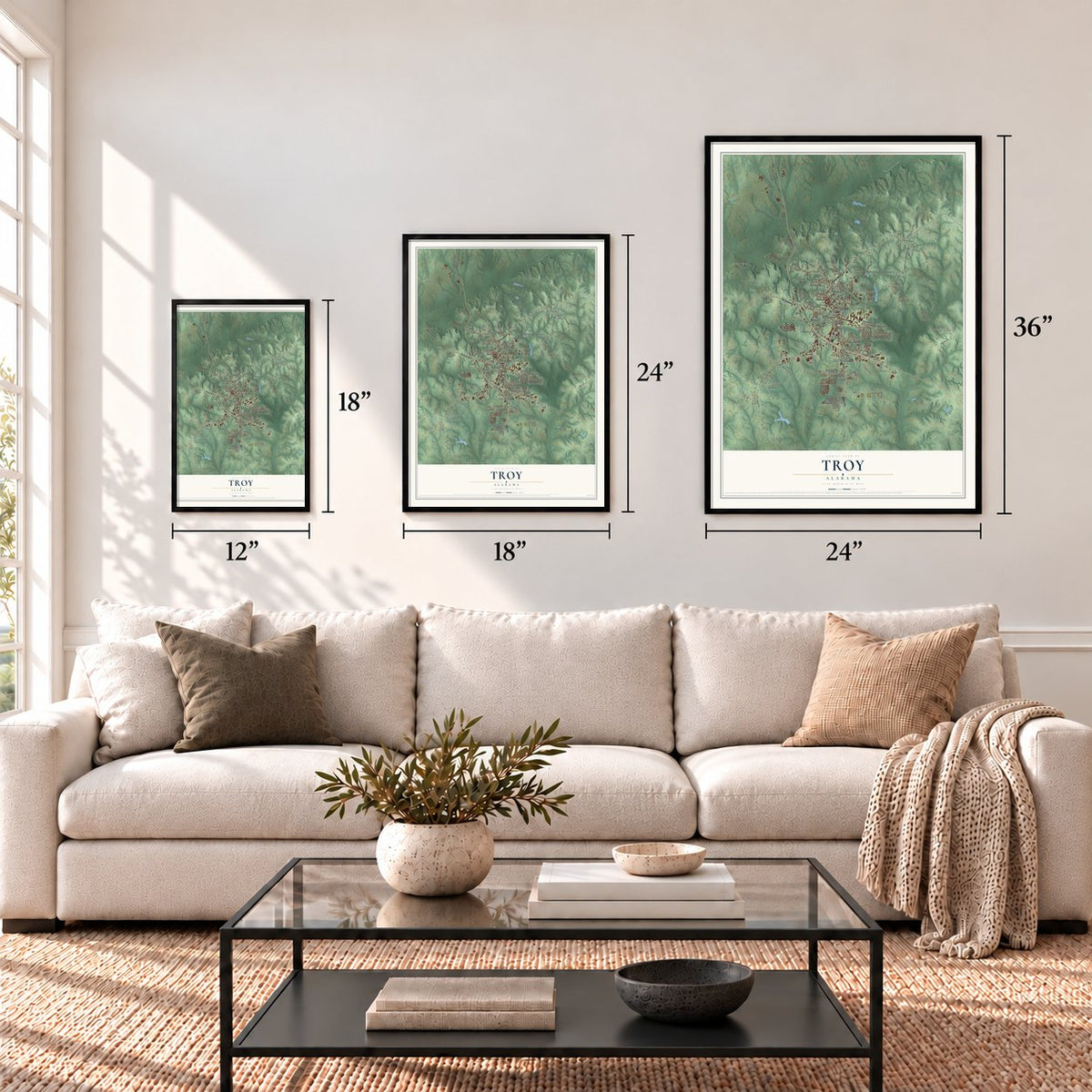
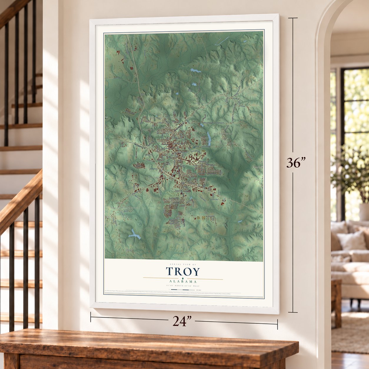
A new map of Troy, Alabama, made in 2026 and printed to order on thick archival matte paper.
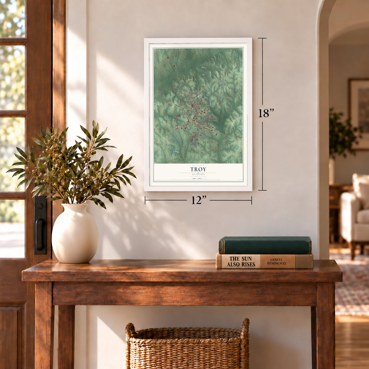
12" x 18" Archival Matte Print
A Map of Home. A Work of Art.
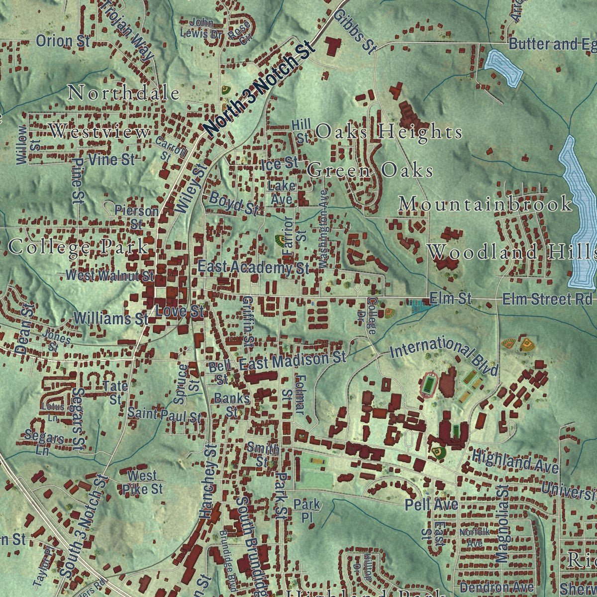
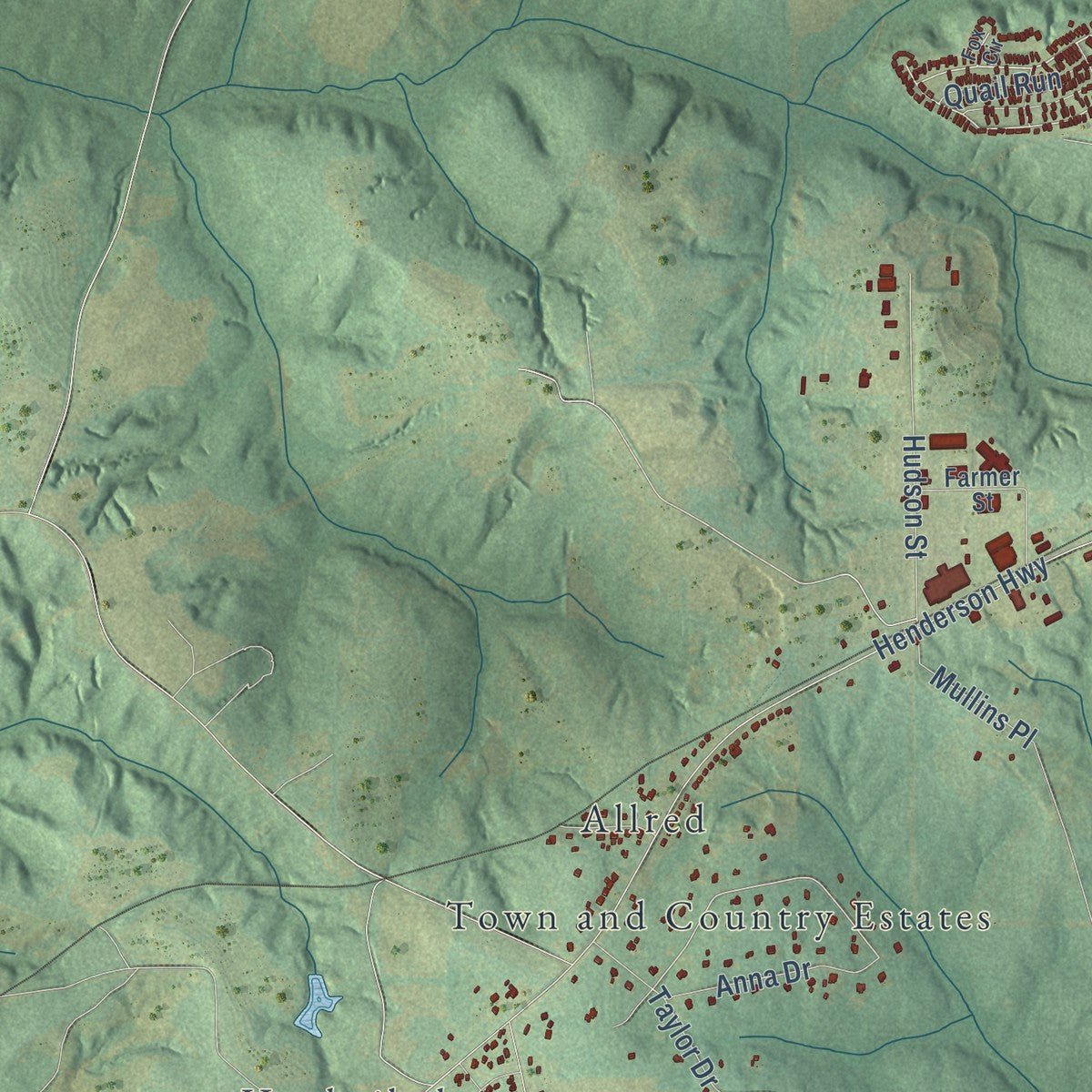
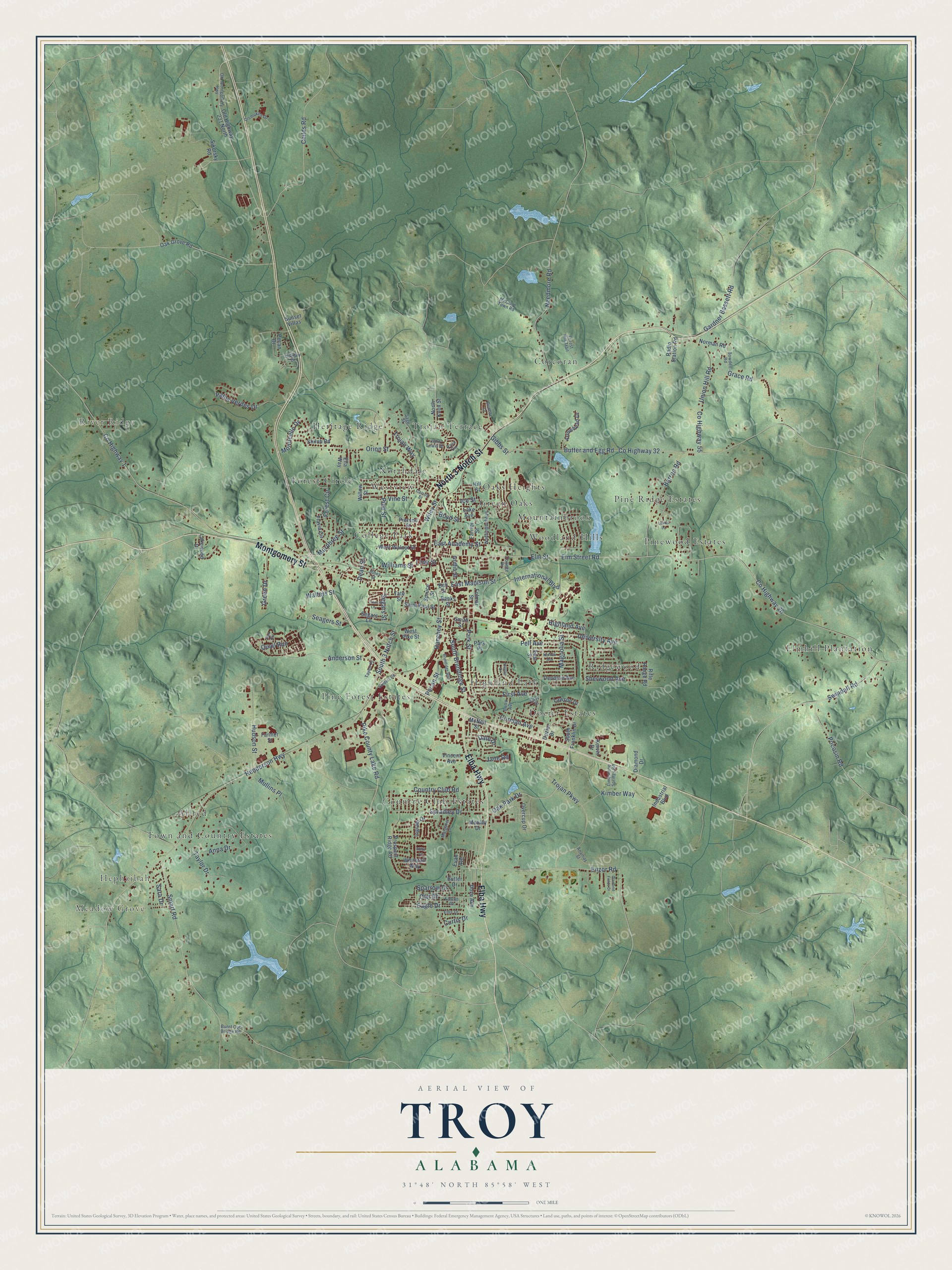
Explore Troy, Alabama from a whole new perspective. Created using aerial imagery and detailed geographic data, this map captures Troy building by building, with labeled streets, familiar landmarks, and shaded topographical relief that highlights the natural contours of the landscape.
Combining modern data with the timeless character of a vintage atlas, this map is just as interesting up close as it is beautiful on the wall. Whether you grew up in Troy, spent memorable years there, or call it home today, this unique map is a great way to celebrate a place that means something to you. Zoom in on the preview to look for your street, and then order a print to put your memories on the wall.
Three ways to hang it
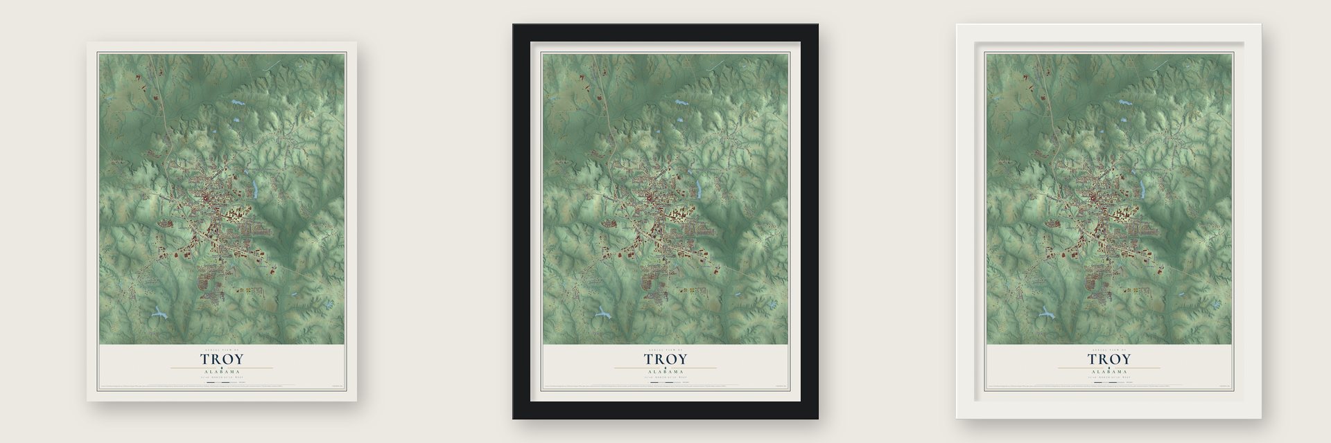
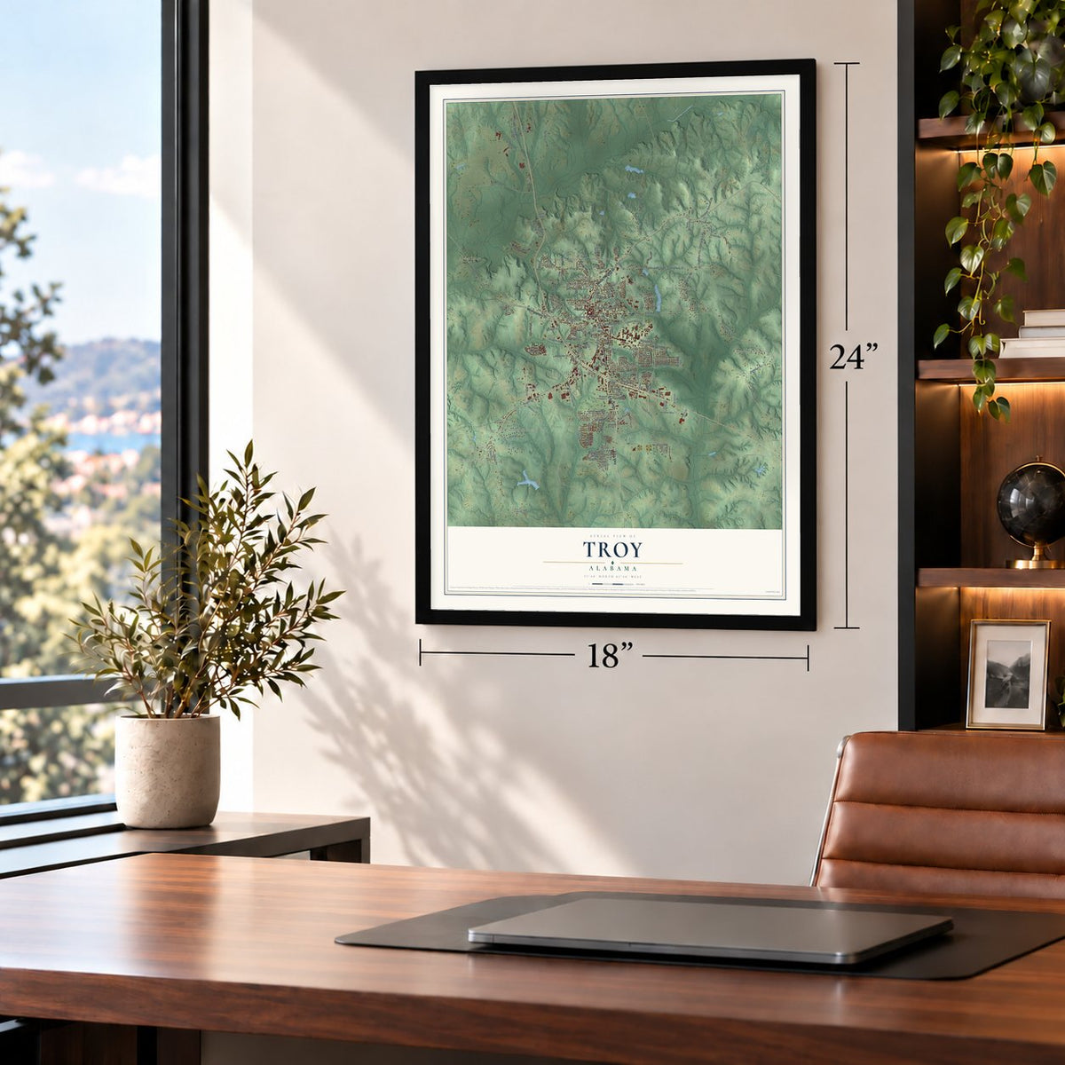
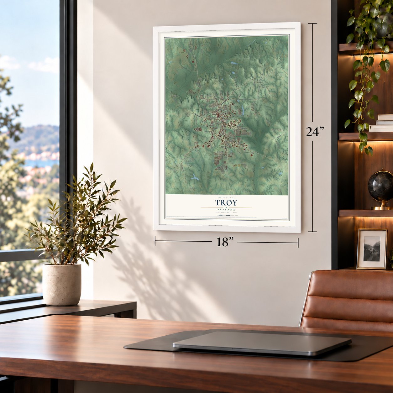
Unframed archival matte, a black wood frame or a white wood frame.
Up close
Geography Worth Displaying
This map was created using accurate cartographic data and authoritative geographic sources, including the U.S. Geological Survey and the Census Bureau. The map brings together terrain, waterways, roads, and building detail. The majority of the streets are labeled, houses are accurately depicted, and the topography is derived from government sources. Combining local data with carefully composed color and shading leads to this beautifully detailed Troy artwork for your wall.
Rather than simply showing street outlines, we’ve included as many of the street names as we could reasonably fit on the map while keeping their names legible. Zoom in on the high resolution preview to see exactly what’s on the map. We truly set out to create a statement piece for anyone who loves Troy. So whether it’s for you, or a gift for someone you love, we hope this map of Troy brings back fond memories.

About Troy, Alabama
Troy is a city of 17,727 people and the county seat of Pike County. The ground here was once Creek land known as Deer Stand Hill, and William Soles, in 1835, is the first white settler on record. In 1838 the hill's owners, John Hanchey and John Coskrey, persuaded the county to move its seat from Monticello to their property because it sat closer to the middle of the county.
Nubel A. Moore built a wooden courthouse in the center of the new square in 1839, and a jail went up soon after, a sign of how rough the frontier still was. Troy was incorporated on February 4, 1843, and the town still counts that day as its birthday. Real growth came in the 1870s, when Urban Louis Jones, the first mayor on record, paid the Mobile and Girard to bring its tracks down from Columbus, Georgia. The town had fewer than 500 people before the line arrived and 3,000 within 10 years, as Troy became the trading center for several counties.
- Named on October 9, 1838The settlement had been called Zebulon and then Centreville before Luke R. Simmons, Pike County's state representative, recorded a deed using the name Troy. One account says Simmons, who came from North Carolina, chose it to honor Alexander Troy, a former attorney general of that state. Another says a newcomer from Troy, New York, offered his hometown's name because it was simpler to say and spell than the old ones.
- Three Notch Road, 1824The U.S. Army opened a road in 1824 from Fort Barrancas at Pensacola north toward the Federal Road. Captain Daniel E. Burch cut three notches into trees to guide a crew under Lt. Elias Phillips, and the clearing cost $1,130. The road was seldom needed for soldiers, but it ran along the ridge through Troy and became the main route for settlers and traders until the railroads came.
- A teachers' school from 1887The Alabama General Assembly created Troy State Normal School in 1887, and the city gave the land and its first building downtown. The school moved to its present campus in 1930 and became Troy University in 2005.
- Turned away in December 1957A young John Lewis, who grew up on a Pike County farm, asked to enroll at the all-white college in Troy, and segregation kept him out. He then sent a letter to Dr. Martin Luther King Jr. King met him in Montgomery and urged him to join the civil rights movement.
- Nearly 1,000 new votersStudent workers from the SCOPE voter project reached Pike County on July 9, 1965, and opened offices in Troy and Brundidge. All summer they and local volunteers drove people to the Pike County Courthouse to register, despite threats and lost jobs, and signed up nearly 1,000 new voters. Judge Frank M. Johnson Jr. ordered Troy's schools desegregated in 1971. In 1985 Alphonso Byrd and Johnnie Mae Warren won seats as the city council's first African American members.
Find your street
Names on the Troy map
Every name below is printed on this map. Look for your street, your school, the park where you played, or the pond down the road.
Places and landmarks24
- Meadow Grove
- Hephzibah
- River Ridge
- Allred
- College Park
- Corcoran
- Country Club Estates
- Dozier Estates
- Elmhill Plantation
- Forest Circle
- Green Oaks
- Heritage Ridge
Show all 24 places
- Highland Park
- Mountainbrook
- Northdale
- Oaks Heights
- Pine Forest Estates
- Pine Ridge Estates
- Pinewood Estates
- Ridgewood
- Town and Country Estates
- Trojan Terrace
- Westview
- Woodland Hills
Streets and roads155
- North 3 Notch Street
- Elba Highway
- Montgomery Street
- Elm Street Road
- Enzor Road
- Elm Street
- South 3 Notch Street
- Oak Park Drive
- Hanchey Street
- Swindall Road
- Pocosin Road
- County Highway 26
- Henderson Highway
- Butter and Egg Road
- County Highway 32
- County Highway 1
- Smart Road
- University Avenue
- Trojan Parkway
- South Brundidge Street
- Park Street
- Trojan Way
- Orion Street
- County Highway 55
- Gibbs Street
- Childs Road
- Needmore Road
- Union Hill Road
- Murphree Street
- Pike County Lake Road
Show all 155 streets
- East Academy Street
- International Boulevard
- Barron Road
- Grace Road
- Gardner Bassett Road
- Spradley Drive
- Anderson Street
- Kimber Way
- East Madison Street
- Mullins Place
- Hudson Street
- Pell Avenue
- Palos Verdes Drive
- Owl Drive
- Country Club Road
- Williams Street
- First Avenue
- Pine Street
- Seagers Street
- Corman Avenue
- Sherwood Avenue
- Taylor Drive
- Eagle Drive
- Magnolia Street
- Green Drive
- Wiley Street
- Pecan Street
- Jane Road
- Segars Street
- Anna Drive
- Monticello Drive
- Vine Street
- Curtis Drive
- Sparrow Drive
- Dale Drive
- Walters Street
- Highland Avenue
- Ice Street
- Quail Run
- Dean Street
- Love Street
- Boyd Street
- Sara Drive
- South Franklin Drive
- Old Highway 231 North
- Oak Grove Road
- North Knox Street
- Prospect Ridge Road
- West Walnut Street
- Flavia Circle
- Sikorsky Road
- Butler Drive
- Lakewood Drive
- Folmar Street
- Rifle Range Road
- Arrowhead Drive
- Overcup Drive
- Tate Street
- Ingram Drive
- Saint Paul Street
- Willow Street
- Dendron Avenue
- Dozier Drive
- Industrial Boulevard
- Radio Station Road
- East Street
- Whitetail Way
- Pecan Drive
- Norman Road
- Vincent Avenue
- Diamond Drive
- Griffin Street
- Lawson Drive
- Dove Avenue
- West Pike Street
- Farrior Street
- Farmer Street
- Segars Lane
- Shiloh Road
- McNeil Street
- Spruce Street
- Pierson Street
- Park Place
- Lake Avenue
- Evan Avenue
- Mobley Drive
- Kervin Drive
- Sunset Villas
- Banks Street
- Smith Street
- Ella Way
- Bell Street
- Hill Street
- Burnt Out Bridge Road
- Old Montgomery Highway
- Botts Avenue
- Falcon Drive
- Dunbar Drive
- Ananias Street
- Washington Avenue
- Forest Hill Trail
- Sage Street
- Ellis Drive
- Carroll Street
- McClure Town Road
- Limestone Springs Road
- Dismukes Drive
- Bowden Road
- Rose Circle
- Hickory Drive
- John Lewis Drive
- Jones Street
- Taylor Place
- Margaret Lane
- College Drive
- Easy Street
- Fox Circle
- Brundidge Boulevard
- Sanders Road
- Norfolk Avenue
- Hilltop Drive
- Diamond Fields Drive
- Lotus Lane
- Laurel Lane
- Abby Lane
Names are listed as they appear on the printed map. Zoom into the product photos to find them.
The art of mapping a place
How This Map Was Made
Real places. Remarkable detail. Discover the layers that turn geographic data into a map of home.

The view from above
Aerial imagery reveals the character of the land: woodland, open fields, and the patterns of a place.

The shape of the land
Elevation data brings hills, valleys, and subtle changes in the landscape into view.

The details of home
Roads, waterways, and building footprints come together to make the map feel unmistakably local.

Geography becomes art
Considered color, shading, and typography bring the layers together in a map made for your wall.


Process illustrated with Mendon, Massachusetts. Aerial imagery: USDA NAIP. Terrain: USGS 3D Elevation Program. Map details and finished artwork: KNOWOL.
The Details
About This Print
Choose an archival matte print, or a black or white Ayous wood frame. The archival matte print is unframed.
Select your size and finish above to see the matching product image and price.
Materials & Craftsmanship
A contemporary map with the character of a classic atlas, printed on archival matte paper. Optional frames are made from Ayous wood.
Your printed map does not include the watermark shown in the full-map preview.
Shipping & Delivery
Free shipping within the United States. Every print is made to order in the USA.
Buying a gift? Add a note in your cart and we'll include it. We never put prices in the package.
Prints ship within 2 to 3 business days. Allow 7 to 10 days total from ordering for delivery. Timing may vary during holidays or periods of high order volume.
Read our shipping policy.
Returns and damaged prints
Each print is made to order. Change-of-mind refunds are not available after production.
If your print arrives damaged, misprinted or incorrect, contact support@knowol.com within 30 days of receiving it. Include your order number, photos and a description of the issue.
Read our full refund and replacement policy. For questions about your order, email support@knowol.com.
Find your town
Looking for another city?
Find a map of home in our Alabama collection, or any town in the country.
Nearby
Maps of towns near Troy
Know someone from one of these towns? Their map makes a great gift.
 Banks
Banks, Alabama
From $39.99See the map
 Brundidge
, Alabama
From $39.99See the map
 Goshen
, Alabama
From $39.99See the map
More maps nearby: Petrey, Glenwood, Luverne, Rutledge and Ariton.