
Search for another town





Free U.S. delivery 7 to 10 days after you order
Tyngsborough, Massachusetts Map Art
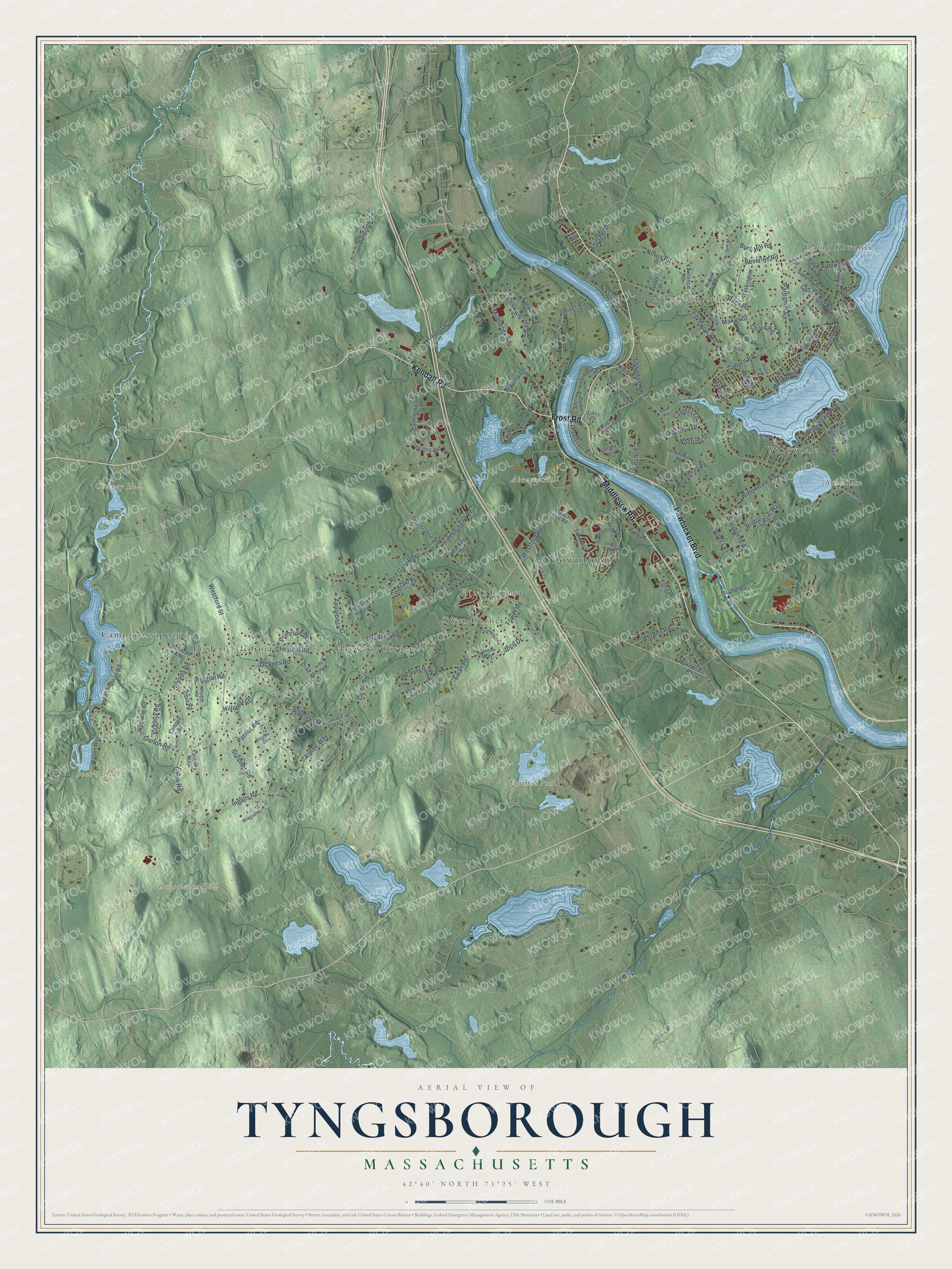
Building by building, with labeled streets and shaded relief.
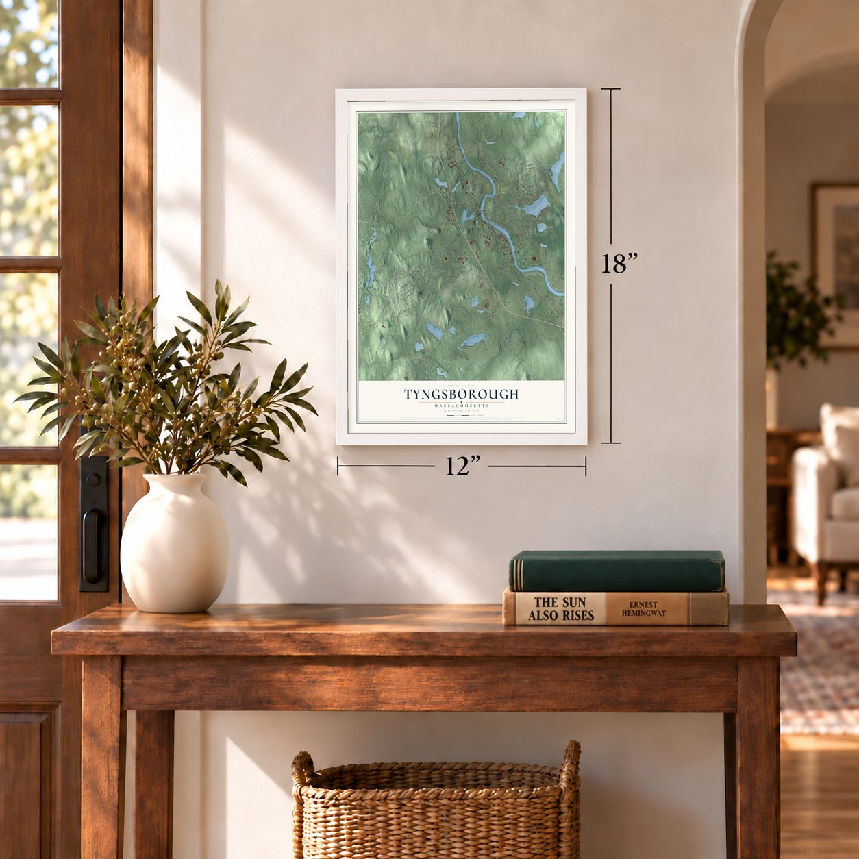
12" x 18" Archival Matte Print
A Map of Home. A Work of Art.
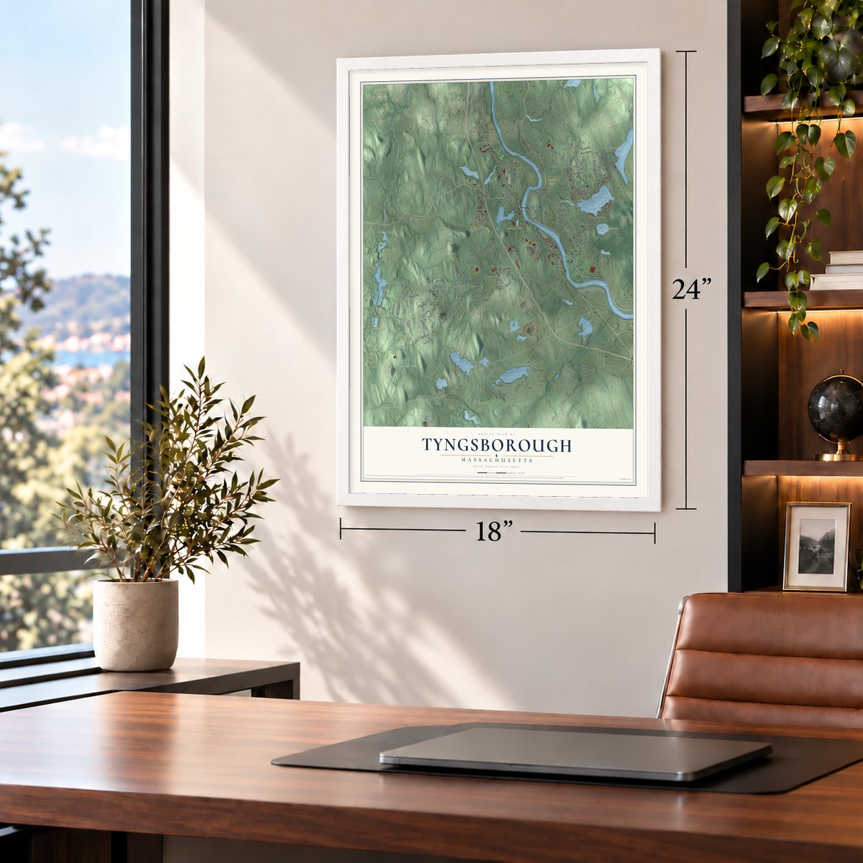
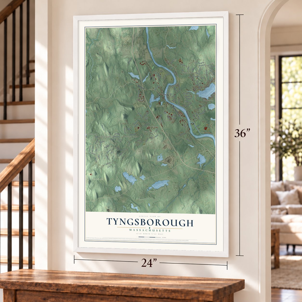
Explore Tyngsborough, Massachusetts from a whole new perspective. Created using aerial imagery and detailed geographic data, this map captures Tyngsborough building by building, with labeled streets, familiar landmarks, and shaded topographical relief that highlights the natural contours of the landscape.
Combining modern data with the timeless character of a vintage atlas, this map is just as interesting up close as it is beautiful on the wall. Whether you grew up in Tyngsborough, spent memorable years there, or call it home today, this unique map is a great way to celebrate a place that means something to you. Zoom in on the preview to look for your street, and then order a print to put your memories on the wall.
Three ways to hang it
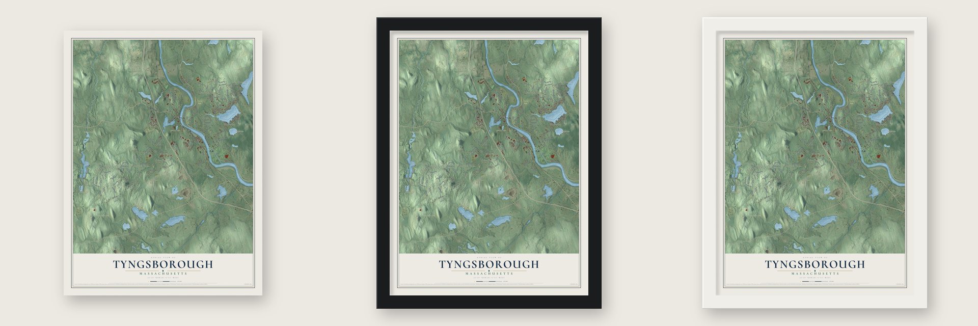
Unframed archival matte, a black wood frame or a white wood frame.
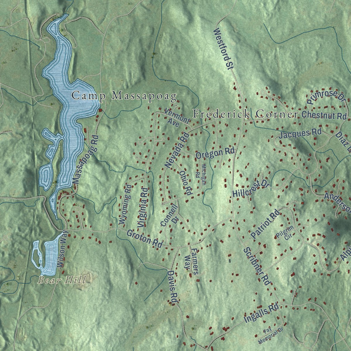
Up close
Geography Worth Displaying
This map was created using accurate cartographic data and authoritative geographic sources, including the U.S. Geological Survey (USGS) and FEMA. The map brings together terrain, waterways, roads, and building detail. The majority of the streets are labeled, houses are accurately depicted, and the topography is derived from government sources. Combining local data with carefully composed color and shading leads to this beautifully detailed Tyngsborough artwork for your wall.
Rather than simply showing street outlines, we’ve included as many of the street names as we could reasonably fit on the map while keeping their names legible. Zoom in on the high resolution preview to see exactly what’s on the map. We truly set out to create a statement piece for anyone who loves Tyngsborough. So whether it’s for you, or a gift for someone you love, we hope this map of Tyngsborough brings back fond memories.
Explore the full map of Tyngsborough, Massachusetts and read about the local places it shows.

Find your street
Names on the Tyngsborough map
Every name below is printed on this map. Look for your street, your school, the park where you played, or the pond down the road.
Places and landmarks16
- Downtown
- Camp Kiwanis
- Abrams Hill
- Bear Hill
- Chaney Hill
- Conscience Hill
- Althea Lake
- Fletchers Pond
- Times Farm
- Swan Corner
- Frederick Corner
- Hayward Corner
Show all 16 places
- Norris Corner
- Flints Corner
- Camp Massapoag
- Willowdale
Streets and roads134
- Frost Road
- Middlesex Road
- Kendall Road
- Pawtucket Boulevard
- Long Pond Road
- Dunstable Road
- Westford Road
- Sherburne Avenue
- Lakeview Avenue
- Scribner Road
- Coburn Road
- Norris Road
- Farwell Road
- Willowdale Road
- Groton Road
- Chestnut Road
- Sequoia Drive
- Jacques Road
- Red Gate Road
- Davis Road
- Patriot Road
- Parham Road
- Locust Avenue
- Massapoag Road
- Althea Avenue
- Danforth Road
- Virginia Road
- Cummings Road
- Appaloosa Circle
- Lawndale Road
Show all 134 streets
- Nevada Road
- Alpine Way
- Makos Street
- Tyng Road
- Cardinal Lane
- Mascuppic Trail
- Anderson Drive
- Island Road
- Beverlee Road
- Tower Road
- Joco Drive
- Ingalls Road
- Swan Road
- Derby Lane
- Willowdale Avenue
- Rock Road
- Emerald Street
- Westford Street
- Bridle Path Way
- River Road
- Worden Road
- Primrose Drive
- Nandina Drive
- Cypress Lane
- Chard Road
- Oregon Road
- Patricia Drive
- Buck Hill Road
- Hillcrest Drive
- Mustang Road
- Diaz Drive
- Flint Road
- Davis Street
- Alden Street
- Fletcher Drive
- Bryants Lane
- Clover Hill Circle
- Westech Drive
- Progress Avenue
- Constantine Drive
- Old Tyng Road
- Highland Street
- Makepeace Road
- Summer Street
- Cannongate Road
- Wyoming Road
- Washington Street
- Robert Road
- Steinbeck Street
- Lawrence Road
- Phalanx Street
- Longfellow Lane
- Nottingham Road
- Audrey Avenue
- Connell Drive
- Canter Drive
- Riverbend Road
- Farmers Way
- Elm Street
- Wilson Way
- Vermont Avenue
- Ohio Road
- Jamie Way
- Morgan Way
- Woodlawn Street
- Malvern Avenue
- Potash Hill Road
- Larson Avenue
- Louis Avenue
- Colony Heights
- Parker Lane
- Mackey Drive
- Village Lane
- Apollo Drive
- Pine Street
- Silk Lane
- Curtis Road
- Christine Avenue
- Robinhood Road
- Strawberry Hill Lane
- Lynne Avenue
- Spring Street
- Pilgrim Circle
- Park Road
- Anderson Way
- Michigan Road
- Highland Way
- Maple Ridge Road
- Old Stonehill Road
- Fay Memorial Drive
- Bowers Avenue
- Autumn Street
- Bridget Avenue
- Wicasse Road
- Trotting Park Road
- Jasper Lane
- Ridge Road
- Helena Drive
- Upton Drive
- Fox Hunt Road
- Cedar Lane
- Rello Way
- Poplar Avenue
- Daisy Lane
Names are listed as they appear on the printed map. Zoom into the product photos to find them.
About Tyngsborough, Massachusetts: Home, Street by Street
Tyngsborough is a town of 12,380 people in Middlesex County, split down the middle by the Merrimack River. By 1661 a fur trader named John Cromwell had bought land and put up a house beside the river, which makes him the earliest English settler on record. When Dunstable was incorporated on October 16, 1673, this land became its east end. During King Philip's War in 1676, Jonathan Tyng held his fortified house there alone while he asked the colony for men.
The two ends of Dunstable spent years arguing over where the meeting house belonged. Residents of the western side said no, so she gave the money to her own parish. On June 22, 1789, that parish was incorporated as a district and given the Tyng family name, Tyngsborough, and a count the next year found 382 people there and 380 in Dunstable. The district became a town on February 23, 1809.
“This day I am 84 years old, and crossed the Merrimack River in a canoe, walked one mile to visit a patient.”
- A bridge won from the riverA town ferry carried walkers across for two cents from January 1809. The Legislature ordered a bridge in 1871; the first contractor quit in 1872, and engineers set the piers on iron cylinders in twenty-three feet of quicksand. Floodwood swept away the first span on October 22, 1873, and ferryman T. J. Orne rescued fourteen men from the river with his small boat.
- Lowell's summer playgroundIn 1857 Jonathan Bowers bought Willow Dale on Tyngsboro Pond, now Lake Mascuppic, and filled its picnic grounds with statuary. By 1890 an electric railroad ran four miles to Lowell, and the street railway had put up a dance hall and pavilion by the pond. The Lowell Country Club bought Tyng's Island in 1890, joined the Vesper Boat Club in 1894 and added golf the following year. A wooden suspension footbridge 500 feet long reached the island in 1908.
- A Baptist church turned town hallThe town's Baptist congregation built its meeting house in 1834, and the town later bought it. The mostly Federal building wears a Colonial Revival cupola added in the late 19th century. The Old Town Hall joined the National Register in 2005, then reopened in January 2014 after a $2.5 million renovation, and it now hosts civic events.
- Winslow School and Littlefield LibraryMoney from Sarah Tyng Winslow paid for the Winslow School, designed by F. H. Bacon and built in 1890, and its first classes met on October 11, 1892. The school was moved to its present lot about 1940. Next to it stands the Littlefield Library, finished in 1905, a gift from Mrs. Lucy Littlefield named for her daughter and the only brick building in the town center. Both joined the National Register in 2017.
Keep exploring Massachusetts
Tyngsborough is one of 470 Massachusetts towns we've mapped. Every dot on the map is a print of its own.
The search covers every state, Massachusetts first.
Near Tyngsborough
Order 2 or more town maps and save 10%. Shown in the size and finish you picked above, so they hang as a set.
- Dunstable 12" x 18" / Archival Matte Print $39.99
- Nabnasset 12" x 18" / Archival Matte Print $39.99
- Westford 12" x 18" / Archival Matte Print $39.99


More maps nearby: Chelmsford, Lowell, Dracut, East Pepperell and Groton.
The art of mapping a place
How This Map Was Made
Real places. Remarkable detail. Discover the layers that turn geographic data into a map of home.

The view from above
Aerial imagery reveals the character of the land: woodland, open fields, and the patterns of a place.

The shape of the land
Elevation data brings hills, valleys, and subtle changes in the landscape into view.

The details of home
Roads, waterways, and building footprints come together to make the map feel unmistakably local.

Geography becomes art
Considered color, shading, and typography bring the layers together in a map made for your wall.


Process illustrated with Mendon, Massachusetts. Aerial imagery: USDA NAIP. Terrain: USGS 3D Elevation Program. Map details and finished artwork: KNOWOL.
The Details
About This Print
Choose an archival matte print, or a black or white Ayous wood frame. The archival matte print is unframed.
Select your size and finish above to see the matching product image and price.
Materials & Craftsmanship
A contemporary map with the character of a classic atlas, printed on archival matte paper. Optional frames are made from Ayous wood.
Your printed map does not include the watermark shown in the full-map preview.
Shipping & Delivery
Free shipping within the United States. Every print is made to order in the USA.
Buying a gift? Add a note in your cart and we'll include it. We never put prices in the package.
Prints ship within 2 to 3 business days. Allow 7 to 10 days total from ordering for delivery. Timing may vary during holidays or periods of high order volume.
Read our shipping policy.
Returns and damaged prints
Each print is made to order. Change-of-mind refunds are not available after production.
If your print arrives damaged, misprinted or incorrect, contact support@knowol.com within 30 days of receiving it. Include your order number, photos and a description of the issue.
Read our full refund and replacement policy. For questions about your order, email support@knowol.com.