
Search for another town


Free U.S. delivery 7 to 10 days after you order
Lowell, Massachusetts Map Art
Building by building, with labeled streets and shaded relief.
12" x 18" Archival Matte Print
A Map of Home. A Work of Art.
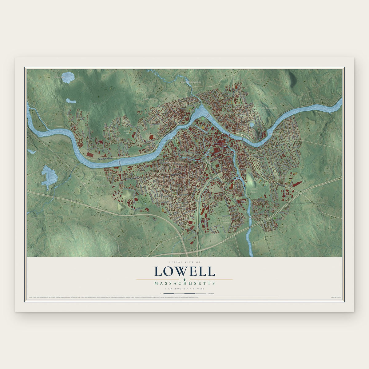
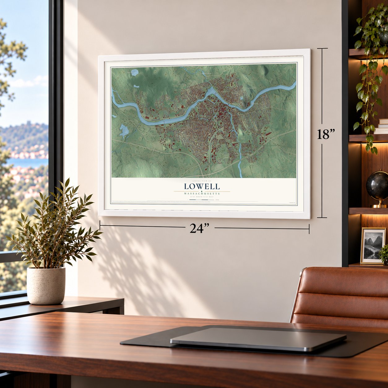
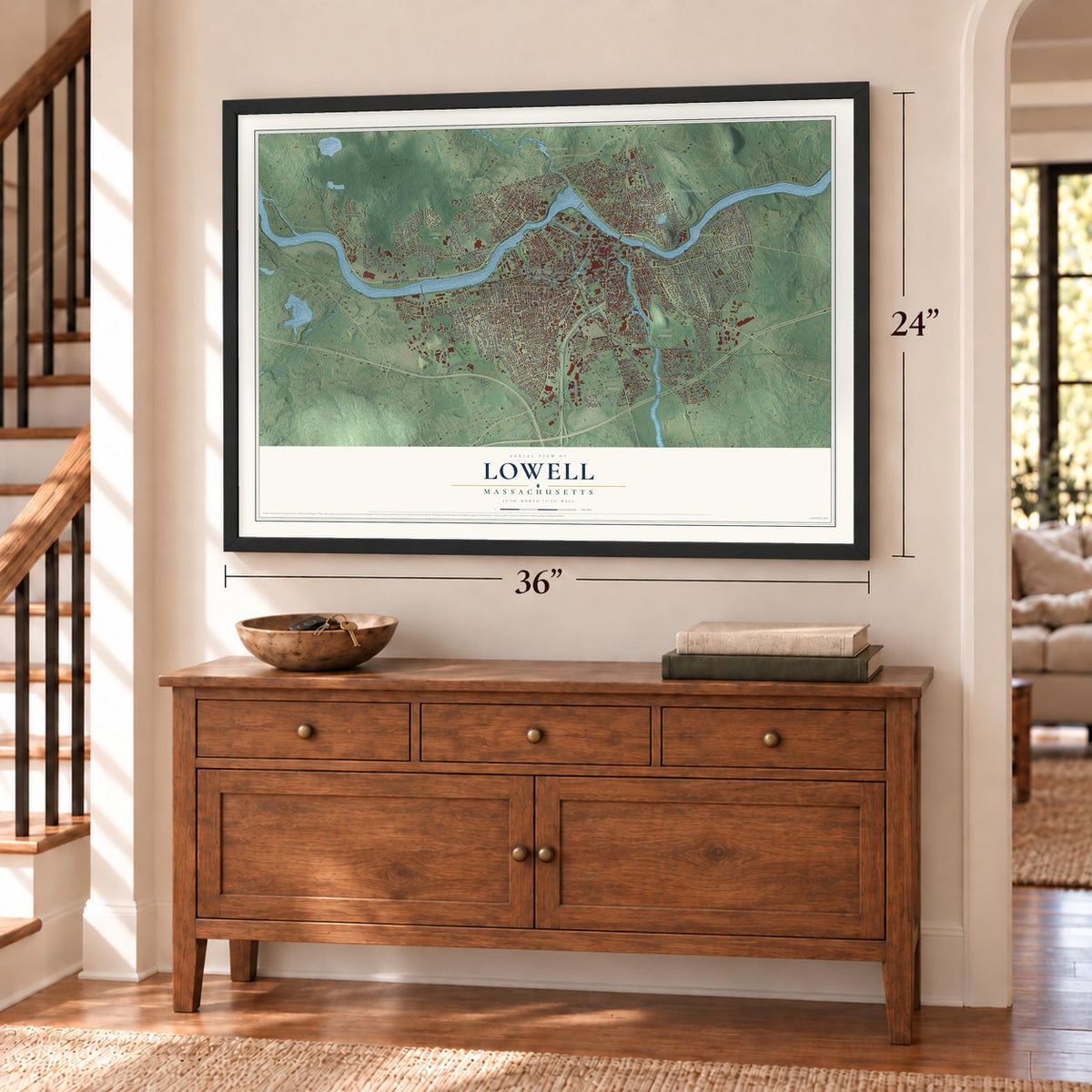
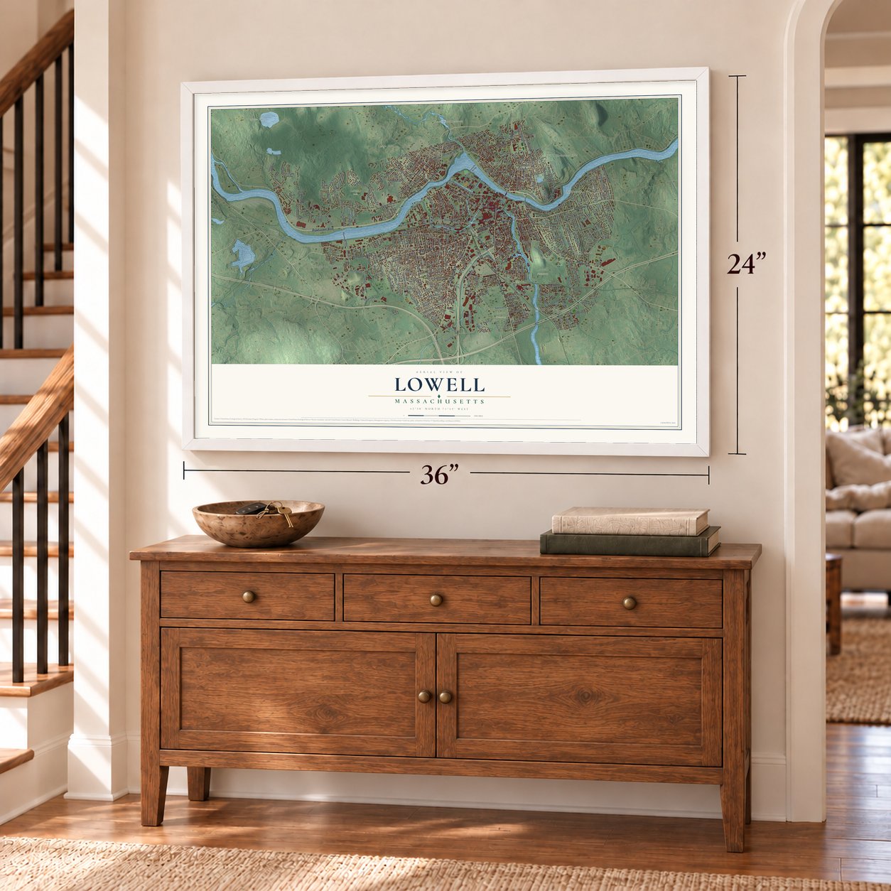
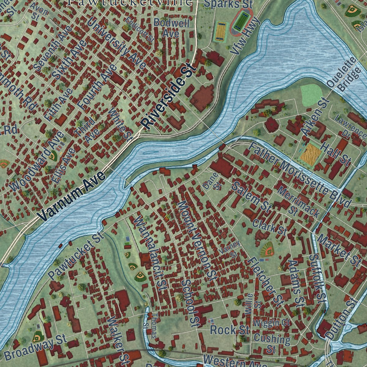
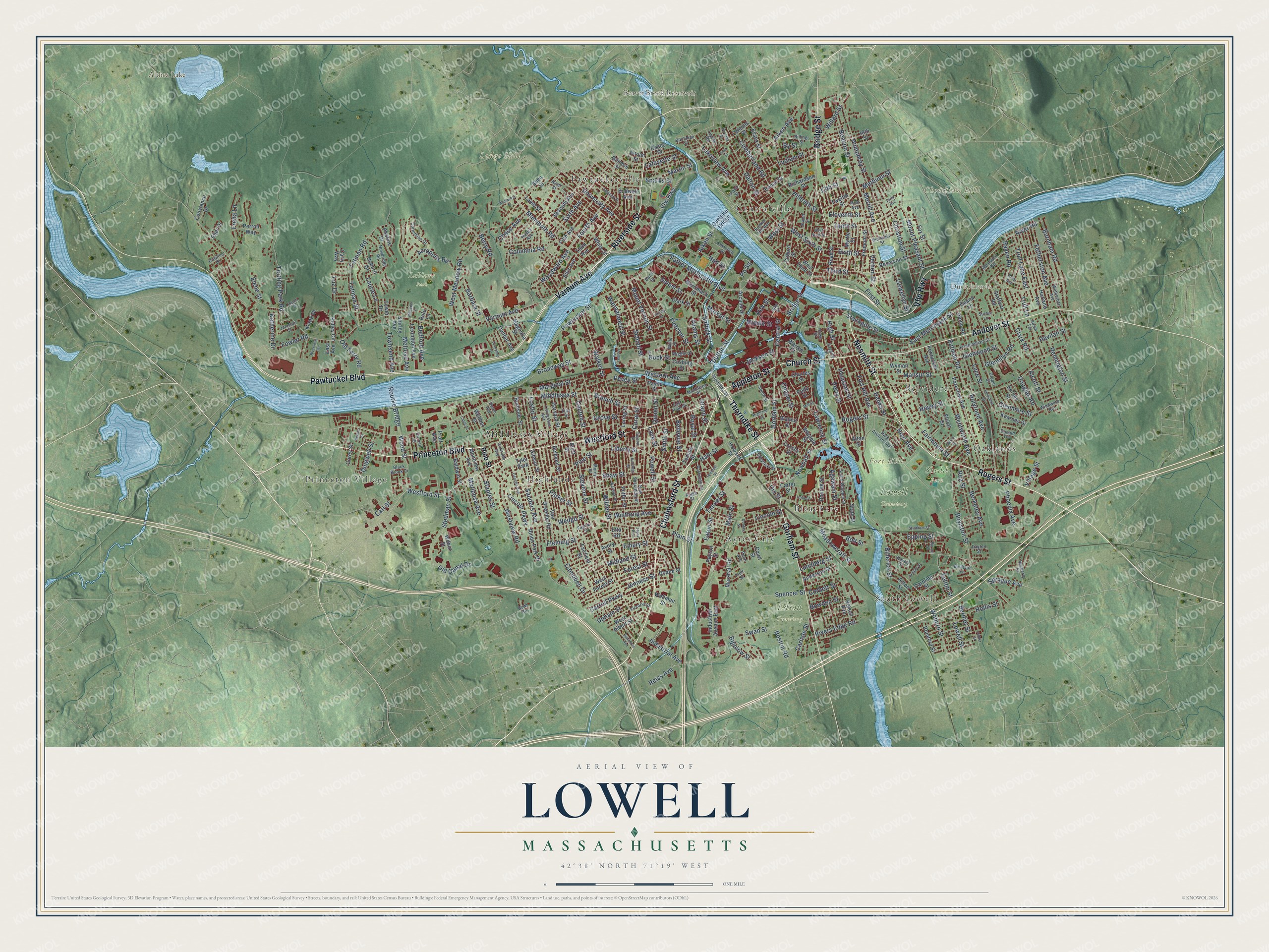
Explore Lowell, Massachusetts from a whole new perspective. Created using aerial imagery and detailed geographic data, this map captures Lowell building by building, with labeled streets, familiar landmarks, and shaded topographical relief that highlights the natural contours of the landscape.
Combining modern data with the timeless character of a vintage atlas, this map is just as interesting up close as it is beautiful on the wall. Whether you grew up in Lowell, spent memorable years there, or call it home today, this unique map is a great way to celebrate a place that means something to you. Zoom in on the preview to look for your street, and then order a print to put your memories on the wall.
Three ways to hang it
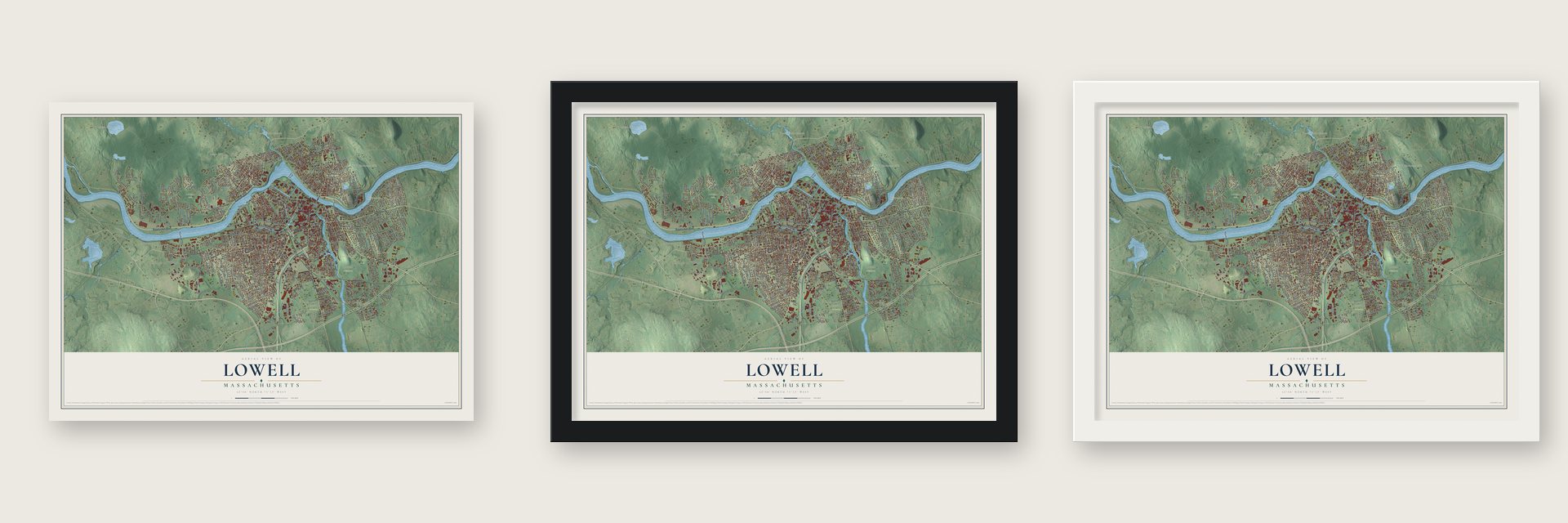
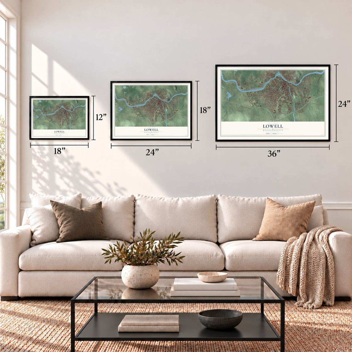
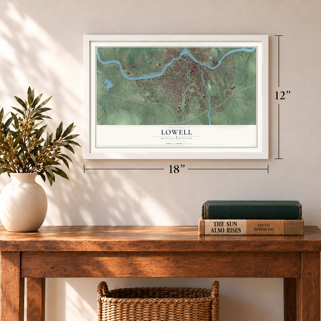
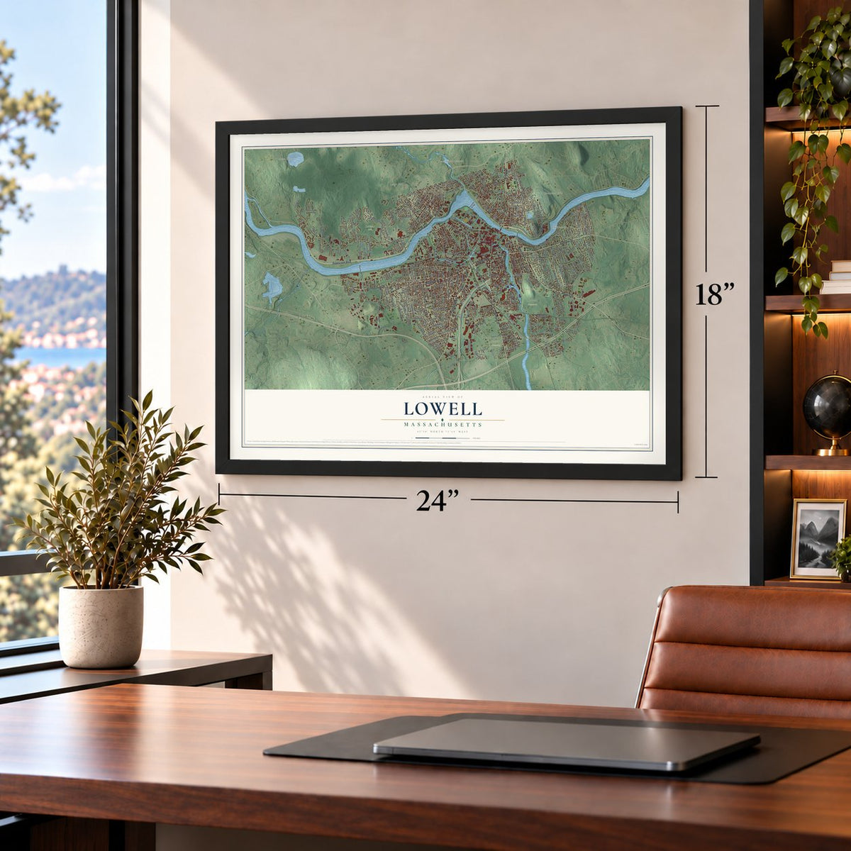
Unframed archival matte, a black wood frame or a white wood frame.
Up close
Geography Worth Displaying
This map was created using accurate cartographic data and authoritative geographic sources, including the U.S. Geological Survey (USGS) and FEMA. The map brings together terrain, waterways, roads, and building detail. The majority of the streets are labeled, houses are accurately depicted, and the topography is derived from government sources. Combining local data with carefully composed color and shading leads to this beautifully detailed Lowell artwork for your wall.
Rather than simply showing street outlines, we’ve included as many of the street names as we could reasonably fit on the map while keeping their names legible. Zoom in on the high resolution preview to see exactly what’s on the map. We truly set out to create a statement piece for anyone who loves Lowell. So whether it’s for you, or a gift for someone you love, we hope this map of Lowell brings back fond memories.
Explore the full map of Lowell, Massachusetts and read about the local places it shows.

Find your street
Names on the Lowell map
Every name below is printed on this map. Look for your street, your school, the park where you played, or the pond down the road.
Places and landmarks22
- South Lowell
- Princeton Village
- Oaklands
- Christian Hill
- Duck Islands
- Fort Hill
- Ledge Hill
- Althea Lake
- Beaver Brook Reservoir
- Edson Cemetery
- Gage Field
- LeBlanc Park
Show all 22 places
- Lowell Cemetery
- Shedd Park
- Highlands
- Centralville
- Bleachery
- Ayres City
- Pawtucketville
- Belvidere
- Middlesex Village
- Tyler Park
Streets and roads380
- Chelmsford Street
- Vfw Highway
- Rogers Street
- Princeton Boulevard
- Thorndike Street
- Appleton Street
- Church Street
- Riverside Street
- Andover Street
- Nesmith Street
- Varnum Avenue
- Pawtucket Boulevard
- Westford Street
- Gorham Street
- Bridge Street
- Middlesex Street
- Dutton Street
- Market Street
- Salem Street
- Trotting Park Road
- Pine Street
- Boylston Street
- Holyrood Avenue
- Willard Street
- Father Morissette Boulevard
- University Avenue
- Boston Road
- Foster Street
- Liberty Street
- Industrial Avenue
Show all 380 streets
- Mariposa Avenue
- Fowler Road
- Lawrence Street
- Pawtucket Street
- Stevens Street
- Wilder Street
- School Street
- Beacon Street
- Broadway Street
- East Merrimack Street
- Lakeview Avenue
- Douglas Road
- Wentworth Avenue
- West Meadow Road
- Butman Road
- Central Street
- Parker Street
- First Street
- Mammoth Road
- West Sixth Street
- Lincoln Street
- Hildreth Street
- Hovey Street
- Walker Street
- Christian Street
- High Street
- Fletcher Street
- Fairmount Street
- Woburn Street
- Totman Road
- Fourth Avenue
- Aiken Street
- Plain Street
- Aiken Avenue
- Perry Street
- Clark Road
- Sanders Avenue
- Methuen Street
- Burnham Road
- Suffolk Street
- Humphrey Street
- Tenth Street
- Acropolis Road
- Shaw Street
- Stackpole Street
- Tanner Street
- Sixth Avenue
- Pleasant Street
- Branch Street
- Raven Road
- Mansur Street
- Totman Street
- Mount Vernon Street
- Third Street
- Smith Street
- Stedman Street
- Campbell Drive
- Lincoln Parkway
- River Road
- Trull Lane East
- Sparks Street
- Ludlam Street
- Powell Street
- Remington Street
- Billerica Street
- Westview Road
- Adams Street
- Havilah Street
- Meadowcroft Street
- Mount Pleasant Street
- Berkeley Avenue
- Rourke Bridge
- Fort Hill Avenue
- Upham Street
- Freda Lane
- Swan Street
- Cumberland Road
- Fetherston Avenue
- Dalton Street
- Glenwood Street
- Luce Street
- Rock Street
- Townsend Avenue
- Wood Street
- Eleventh Street
- Sixth Street
- Chapel Street
- Marginal Street
- Columbia Road
- Agawam Street
- Melrose Avenue
- Woodward Avenue
- Laurie Lane
- Grove Street
- Newhall Street
- Glenmere Street
- Western Avenue
- Martin Street
- Llewellyn Street
- Hale Street
- Winthrop Avenue
- Rea Street
- Midland Street
- Fleming Street
- Bedford Avenue
- Phoenix Avenue
- Village Street
- Bolt Street
- Alcott Street
- Rivers Edge Road
- Jackson Street
- West Street
- Dingwell Street
- Hoyt Avenue
- Carlisle Street
- Wannalancit Street
- Forest Street
- Chase Avenue
- Hanks Street
- Staples Street
- Spencer Street
- Main Street
- Lundberg Street
- Bellevue Street
- Felton Street
- Old Canal Drive
- Pevey Street
- Old Ferry Road
- Hall Street
- Bowden Street
- Reiss Avenue
- Lafayette Street
- Glenellyn Road
- Hollis Street
- Barbara Street
- Katherine Drive
- Epping Street
- Merrill Avenue
- Carroll Parkway
- Jenness Street
- Sprague Avenue
- Lowell Street
- Berry Road
- Grand Street
- Corbett Street
- Canton Street
- Carl Street
- Middle Street
- Vernon Street
- Lane Street
- Eaton Street
- Bigelow Street
- Wedge Street
- Emery Street
- 13th Street
- Queen Street
- Bernier Street
- Po Square
- Elene Street
- Royal Street
- Trull Lane
- By Street
- Luz Drive
- Coral Street
- Kirk Street
- Dix Street
- Arcand Drive
- Merrimack Street
- Industrial Avenue East
- Parkview Avenue
- White Street
- Seventh Avenue
- Coburn Street
- Baldwin Street
- Kianti Drive
- Fifth Avenue
- Shirley Avenue
- Ennell Street
- 18th Street
- Lexington Avenue
- Warren Court
- Van Greenby Road
- Fremont Street
- Howard Street
- Carmine Street
- West Forest Street
- Fairfield Street
- Myrtle Street
- Photine Drive
- Stafford Road
- Orleans Street
- Charles Street
- Burnside Street
- Pratt Avenue
- Reservoir Street
- Puffer Street
- Dunbar Avenue
- Webber Street
- Wyman Street
- Read Street
- Harvard Street
- Rindo Park Drive
- Gilmore Street
- Anderson Street
- Acton Street
- Ellis Avenue
- Marshall Road
- Gibson Street
- Bourne Street
- Coburn Drive
- Tower Drive
- Magnolia Street
- Enfield Street
- Kearney Drive
- Whipple Street
- Lamb Street
- Cushing Street
- Belmont Street
- Rumford Street
- West Third Street
- Clark Street
- West Albert Street
- Twelfth Street
- Richardson Street
- Pentucket Avenue
- Nelson Avenue
- Doane Street
- Loring Street
- Crosby Street
- Constance Drive
- Elliott Drive
- Montview Avenue
- Glenn Road
- Harland Avenue
- Third Avenue
- Wellman Street
- Walnut Street
- Burtt Street
- Kelley Circle
- Temple Street
- Essex Street
- Bodwell Avenue
- Court Street
- Wilbur Street
- Corey Street
- Ouelette Bridge
- Shea Street
- Geana Lane
- State Street
- Payton Street
- Carter Street
- Eljer Drive
- Perron Way
- Jordan Street
- Avery Street
- Fox Street
- Payne Street
- Casco Street
- East Avenue
- Cady Street
- Carly Way
- Rule Lane
- Alton Street
- Etta Road
- Jewett Street
- Avon Street
- Draper Street
- South Street
- Bunker Hill Avenue
- Frothingham Street
- Park Avenue East
- Black Brook Drive
- Willie Street
- Fayette Street
- Billings Street
- Livingston Avenue
- Corinthian Drive
- South Whipple Street
- Westwind Road
- Newbridge Road
- Lawrence Drive
- Surrey Lane
- Hayes Avenue
- New Spaulding Street
- Lupine Road
- Windward Road
- Middlesex Place
- Richards Street
- Wetherbee Avenue
- Congress Street
- Adam Terrace
- Bayberry Drive
- Morey Street
- Victoria Street
- Wiggin Court
- Cornell Street
- Stavely Street
- Island Street
- John Street
- Boylston Lane
- Briar Avenue
- Johnson Street
- Fruit Street
- Dayton Street
- Bachman Street
- Gertrude Avenue
- Dowling Drive
- Donald Terrace
- East Pine Street
- Mort Avenue
- Fairfax Street
- Troy Street
- Duren Avenue
- Angle Street
- Dane Street
- Bowl Road
- Howe Street
- Penn Avenue
- Warwick Street
- Endicott Street
- Quebec Street
- Hastings Street
- Washington Street
- Varney Street
- Highland Street
- Georgia Avenue
- Baltimore Avenue
- Leverett Street
- Birch Street
- Cheryllee Lane
- Stratham Street
- Belvidere Circle
- Anson Street
- Wellworth Street
- Osgood Street
- Juniper Street
- Riverview Avenue
- Burton Street
- Burnaby Street
- Caleb Street
- Meadow Drive
- Fred Street
- West Ninth Street
- Nelson Street
- Thomas Street
- Iowa Street
- Felker Street
- Mill Street
- Joyce Avenue
- Terry Avenue
Names are listed as they appear on the printed map. Zoom into the product photos to find them.
About Lowell, Massachusetts
Lowell is a city of 115,554 people in Middlesex County, where the Concord River joins the Merrimack at the foot of Pawtucket Falls. Native people fished at the falls each season, and Wamesit, a praying town of the mid-1600s, stood where the two rivers meet. By the 1800s the land belonged to East Chelmsford, a town of farms, until Boston investors picked it in the 1820s for a textile city run by the water power of the falls.
The Merrimack Manufacturing Company, the first mill company here, got its charter in 1822. In 1826, as the village prepared to incorporate as a town, the act still had a blank where its name belonged, and agent Kirk Boott told Nathan Appleton it came down to Lowell or Derby, the English mill town. Appleton chose Lowell, for the late Francis Cabot Lowell, and the town became a city in 1836. By the 1850s its mills formed the nation's biggest industrial complex.
“People who visit Lowell casually are impressed with the surprising fact that a manufacturing city can be beautiful.”
- The mill girls' magazineMill companies hired young women from New England farm families, more than 8,000 of them by 1840. From 1840 to 1845 those women wrote their own magazine, the Lowell Offering. Charles Dickens visited briefly in January 1842, took home four hundred pages of it, and reported that nearly every girl belonged to a circulating library. About 1847 several of them testified at the State House to a legislative committee studying the hours of labor.
- The first to fall, 1861Four companies of the Sixth Massachusetts pushed through a mob of thousands in Baltimore on April 19, 1861. Four soldiers died, the Civil War's first deaths. Two of them, Addison O. Whitney, twenty-one, and Luther C. Ladd, in his eighteenth year, were Lowell Guards who had worked in the mills days earlier. Exactly four years later, on April 19, 1865, the state and city dedicated a monument to them in Monument Square, where both lie buried.
- Francis' FollyJames B. Francis built the Great Gate in 1850 so the canals could be sealed off from the Merrimack. It was nicknamed Francis' Folly, but the gate kept the river out of the city during the floods of 1852 and 1936.
- Churches of the newcomersSt. Patrick's parish began in 1831 to serve Irish workers digging the Pawtucket and Merrimack canals, and Patrick C. Keely's stone Gothic church followed in 1853. Holy Trinity Greek Orthodox Church, begun in 1906 and opened in 1908, was the first American church built from the start for Greek Orthodox worship. Syrian and Lebanese families bought a church French Huguenots had built in 1883 and dedicated it in 1919 as St. George Antiochian Orthodox Church.
Keep exploring Massachusetts
Lowell is one of 461 Massachusetts towns we've mapped. Every dot on the map is a print of its own.
The search covers every state, Massachusetts first.
Near Lowell
Order 2 or more town maps and save 10%. Shown in the size and finish you picked above, so they hang as a set.
- Dracut 12" x 18" / Archival Matte Print $39.99
- Chelmsford 12" x 18" / Archival Matte Print $39.99
- Tewksbury 12" x 18" / Archival Matte Print $39.99

More maps nearby: Nabnasset, Tyngsborough, Billerica, Westford and Carlisle.
The art of mapping a place
How This Map Was Made
Real places. Remarkable detail. Discover the layers that turn geographic data into a map of home.

The view from above
Aerial imagery reveals the character of the land: woodland, open fields, and the patterns of a place.

The shape of the land
Elevation data brings hills, valleys, and subtle changes in the landscape into view.

The details of home
Roads, waterways, and building footprints come together to make the map feel unmistakably local.

Geography becomes art
Considered color, shading, and typography bring the layers together in a map made for your wall.


Process illustrated with Mendon, Massachusetts. Aerial imagery: USDA NAIP. Terrain: USGS 3D Elevation Program. Map details and finished artwork: KNOWOL.
The Details
About This Print
Choose an archival matte print, or a black or white Ayous wood frame. The archival matte print is unframed.
Select your size and finish above to see the matching product image and price.
Materials & Craftsmanship
A contemporary map with the character of a classic atlas, printed on archival matte paper. Optional frames are made from Ayous wood.
Your printed map does not include the watermark shown in the full-map preview.
Shipping & Delivery
Free shipping within the United States. Every print is made to order in the USA.
Buying a gift? Add a note in your cart and we'll include it. We never put prices in the package.
Prints ship within 2 to 3 business days. Allow 7 to 10 days total from ordering for delivery. Timing may vary during holidays or periods of high order volume.
Read our shipping policy.
Returns and damaged prints
Each print is made to order. Change-of-mind refunds are not available after production.
If your print arrives damaged, misprinted or incorrect, contact support@knowol.com within 30 days of receiving it. Include your order number, photos and a description of the issue.
Read our full refund and replacement policy. For questions about your order, email support@knowol.com.