
Search for another town




Free U.S. delivery 7 to 10 days after you order
Carlisle, Massachusetts Map Art
Building by building, with labeled streets and shaded relief.
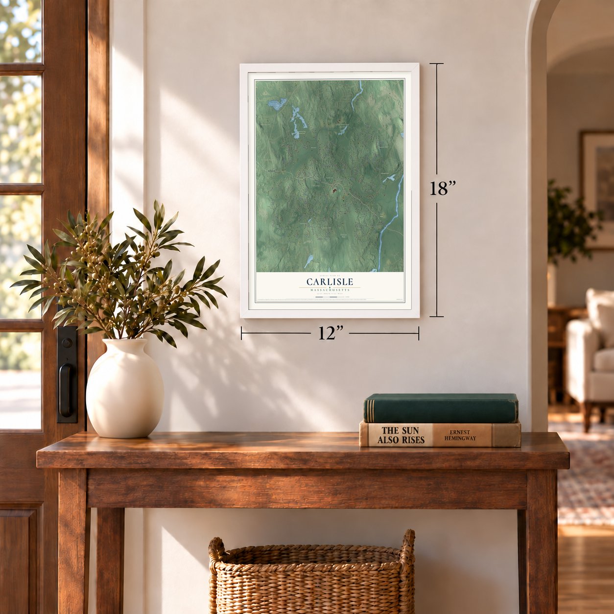
12" x 18" Archival Matte Print
A Map of Home. A Work of Art.
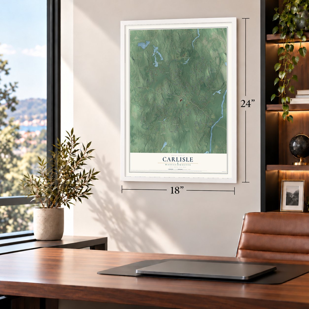
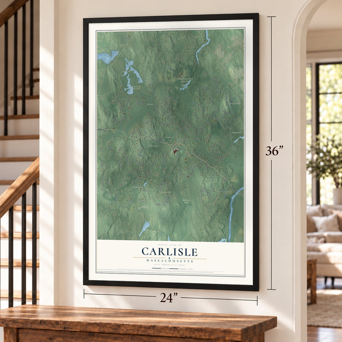
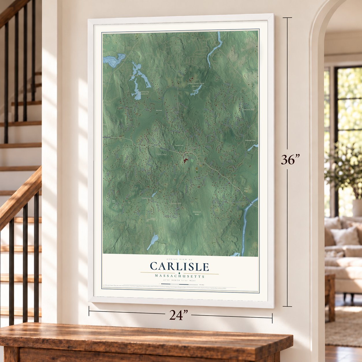
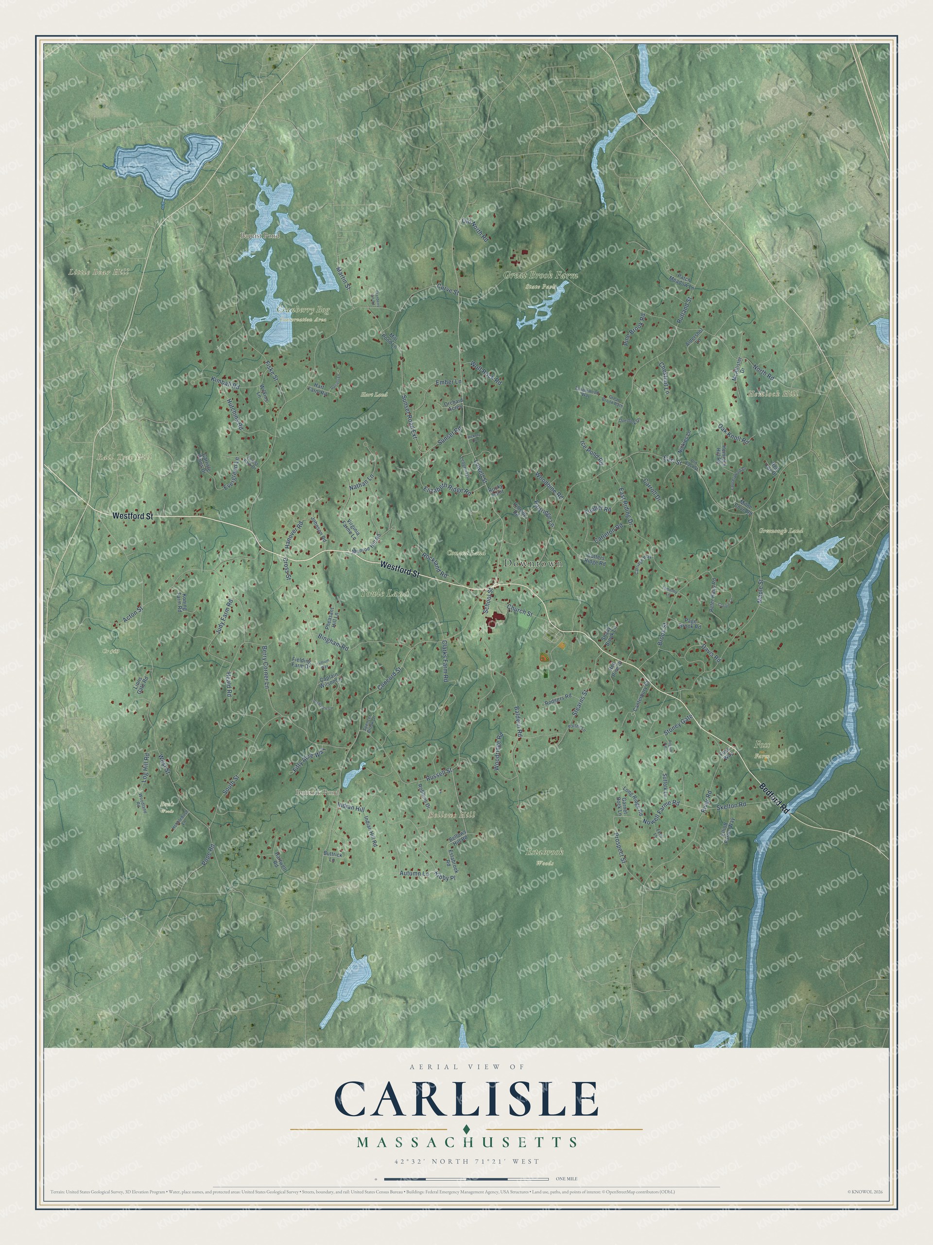
Explore Carlisle, Massachusetts from a whole new perspective. Created using aerial imagery and detailed geographic data, this map captures Carlisle building by building, with labeled streets, familiar landmarks, and shaded topographical relief that highlights the natural contours of the landscape.
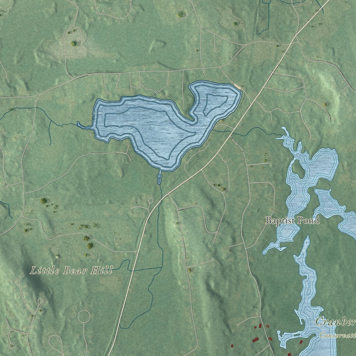
Combining modern data with the timeless character of a vintage atlas, this map is just as interesting up close as it is beautiful on the wall. Whether you grew up in Carlisle, spent memorable years there, or call it home today, this unique map is a great way to celebrate a place that means something to you. Zoom in on the preview to look for your street, and then order a print to put your memories on the wall.
Three ways to hang it
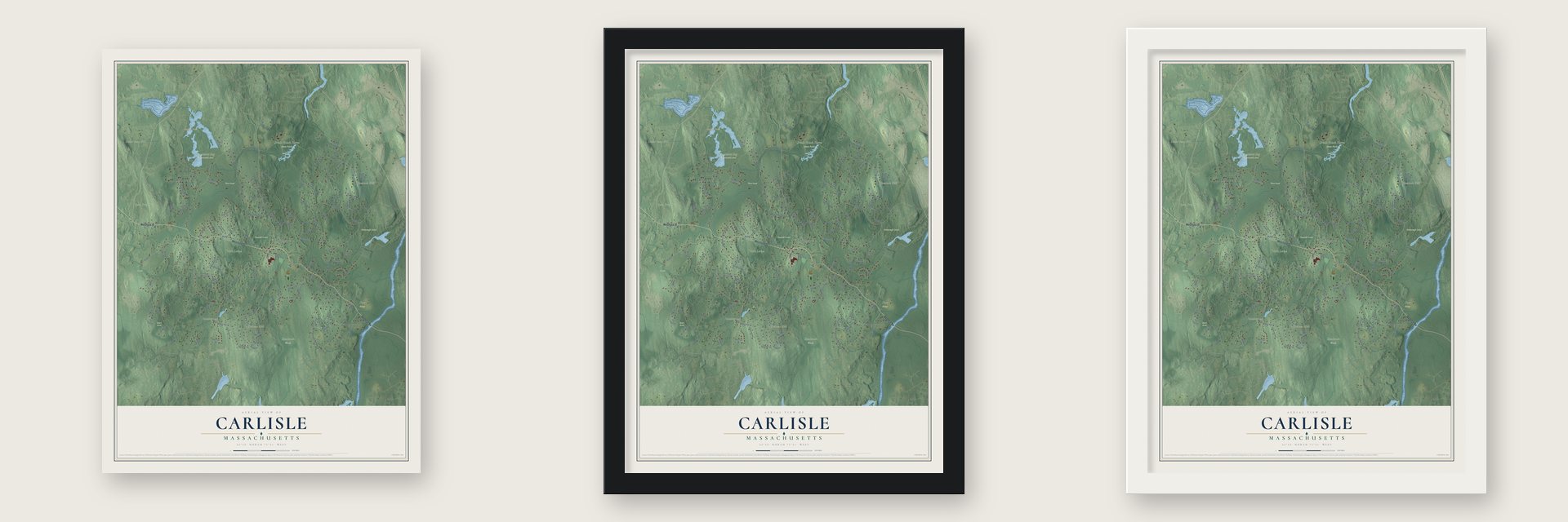
Unframed archival matte, a black wood frame or a white wood frame.
Up close
Geography Worth Displaying
This map was created using accurate cartographic data and authoritative geographic sources, including the U.S. Geological Survey (USGS) and FEMA. The map brings together terrain, waterways, roads, and building detail. The majority of the streets are labeled, houses are accurately depicted, and the topography is derived from government sources. Combining local data with carefully composed color and shading leads to this beautifully detailed Carlisle artwork for your wall.
Rather than simply showing street outlines, we’ve included as many of the street names as we could reasonably fit on the map while keeping their names legible. Zoom in on the high resolution preview to see exactly what’s on the map. We truly set out to create a statement piece for anyone who loves Carlisle. So whether it’s for you, or a gift for someone you love, we hope this map of Carlisle brings back fond memories.
Explore the full map of Carlisle, Massachusetts and read about the local places it shows.
Find your street
Names on the Carlisle map
Every name below is printed on this map. Look for your street, your school, the park where you played, or the pond down the road.
Places and landmarks17
- Downtown
- Bellows Hill
- Hemlock Hill
- Little Bear Hill
- Rail Tree Hill
- Baptist Pond
- Buttrick Pond
- Ben's Woods
- Conant Land
- Cr #43
- Cranberry Bog Conservation Area
- Estabrook Woods
Show all 17 places
- Foss Farm
- Great Brook Farm State Park
- Greenough Land
- Hart Land
- Towle Land
Streets and roads122
- Bedford Road
- Westford Street
- Lowell Street
- Concord Street
- Nowell Farme Road
- Autumn Lane
- West Street
- Curve Street
- North Road
- East Street
- Maple Street
- South Street
- Rutland Street
- Acton Street
- School Street
- Heald Road
- River Road
- Brook Street
- Cross Street
- Baldwin Road
- East Riding Drive
- Stearns Street
- Russell Street
- Sunset Road Extension
- Elizabeth Ridge Road
- Bingham Road
- Fiske Street
- Stoney Gate
- Clarks Farm Road
- Indian Hill
Show all 122 streets
- Church Street
- Hutchins Road
- Judy Farm Road
- Kimball Road
- Woodridge Road
- Davis Road
- Berry Corner Lane
- Rockland Road
- Hanover Road
- Skelton Road
- Tophet Road
- Ice Pond Road
- Partridge Lane
- Ember Lane
- Prospect Street
- Sunset Road
- Nathan Lane
- Log Hill Road
- Carroll Drive
- Martin Street
- Carleton Road
- Wolf Rock Road
- Fifty Acre Way
- Evergreen Lane
- Woodbine Road
- Pine Brook Road
- Chestnut Lane
- Oak Knoll Road
- Old North Road
- Pope Road
- Kibby Place
- Bellows Hill Road
- Munroe Hill Road
- Virginia Farme Lane
- Patch Meadow Lane
- Cutters Ridge Road
- Peter Hans Road
- Buttrick Lane
- Robbins Drive
- Suffolk Lane
- Hemlock Hill Road
- Koning Farm Road
- Canterbury Court
- Mill Pond Lane
- Carlisle Pines Drive
- Long Ridge Road
- Hart Farm Road
- McAllister Drive
- Red Pine Drive
- Elliott Farms Way
- Rodgers Road
- Pheasant Hill Lane
- Indian Hill Road
- Milne Cove Road
- Hartwell Road
- Johnson Road
- Aldershot Lane
- Page Brook Road
- Estabrook Road
- Nickles Lane
- Lions Gate Road
- Fielding Farm Drive
- Shady Brook Lane
- Orchard Acres
- Garnet Rock Lane
- Wilkins Lane
- Captain Wilson Lane
- Hillside Road
- Red Fox Drive
- Foss Way
- Rocky Point
- Forest Park Drive
- Laurelwood Drive
- Ledgeways
- Woodland Road
- Carriage Way
- Overlook Drive
- Old East Street
- Tanglewood Way
- Hobblebush Lane
- Great Brook Path
- Fern Lane
- Spencer Brook Lane
- Patten Lane
- Timothy Lane
- Greystone Lane
- Craigie Circle
- Daniels Lane
- Cranberry Hill Road
- Pilgrim Path
- Hickory Lane
- Trillium Way
Names are listed as they appear on the printed map. Zoom into the product photos to find them.
About Carlisle, Massachusetts
Carlisle is a town of 5,237 people in Middlesex County, 19 miles northwest of Boston. Its land once belonged to four neighbors, Acton, Billerica, Chelmsford and Concord, and English colonists began settling those outlying parcels in 1651. In 1780 the area was set off as a district of Concord, and in 1805 the legislature made it a separate town.
The name came from Carlisle, England, the hometown of James Adams, who was among the first settlers here. Much of the old farm and woodland was never built over, and about a quarter of the town is now conservation land. Its owners include the Great Meadows National Wildlife Refuge on the Concord River, Great Brook Farm State Park, the Carlisle Conservation Foundation and the town itself.
- A working dairy since 1967Great Brook Farm State Park was established in 1967, and it still milks cows. It was the first place in Massachusetts to use a robotic milking system, and its stand sells ice cream made from the farm's own milk. Visitors hike and ride more than 20 miles of trails, paddle Meadow Pond and come in winter for one of New England's best cross-country ski touring centers.
- Thoreau's Easterbrooks CountryWoods, hills, ledge and swamp make up the Estabrook Woods, a tract of over 1,700 acres on the Concord line. Henry David Thoreau wrote about them in his journal as "Easterbrooks Country." In 1996 Carlisle and Concord joined forces to protect another 400 acres, and Carlisle itself owns 188 acres of the woods. No larger unbroken stretch of undeveloped woodland lies within thirty miles of Boston.
- Blue Jay Recording StudioMusicians came to the Blue Jay Recording Studio, in the eastern part of Carlisle, until it shut its doors in 2012. Aerosmith, Lady Gaga, Billy Joel, Roy Orbison, the Platters, Yo-Yo Ma, and John Williams leading the Boston Pops all made records there.
- The Mosquito since 1972Carlisle's weekly paper, the Carlisle Mosquito, began in 1972. It is an independent nonprofit, and every household in town gets it for free, with local news, announcements and logs.
- Old Home DayFor more than 100 years, Carlisle has held Old Home Day on the weekend before the Fourth of July. It is a free day for the whole town, with games and activities for families.
Keep exploring Massachusetts
Carlisle is one of 466 Massachusetts towns we've mapped. Every dot on the map is a print of its own.
The search covers every state, Massachusetts first.
Near Carlisle
Order 2 or more town maps and save 10%. Shown in the size and finish you picked above, so they hang as a set.
- Chelmsford 12" x 18" / Archival Matte Print $39.99
- Bedford 12" x 18" / Archival Matte Print $39.99
- Concord 12" x 18" / Archival Matte Print $39.99


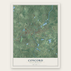
More maps nearby: Westford, Billerica, Acton, Littleton Common and Nabnasset.
The art of mapping a place
How This Map Was Made
Real places. Remarkable detail. Discover the layers that turn geographic data into a map of home.

The view from above
Aerial imagery reveals the character of the land: woodland, open fields, and the patterns of a place.

The shape of the land
Elevation data brings hills, valleys, and subtle changes in the landscape into view.

The details of home
Roads, waterways, and building footprints come together to make the map feel unmistakably local.

Geography becomes art
Considered color, shading, and typography bring the layers together in a map made for your wall.


Process illustrated with Mendon, Massachusetts. Aerial imagery: USDA NAIP. Terrain: USGS 3D Elevation Program. Map details and finished artwork: KNOWOL.
The Details
About This Print
Choose an archival matte print, or a black or white Ayous wood frame. The archival matte print is unframed.
Select your size and finish above to see the matching product image and price.
Materials & Craftsmanship
A contemporary map with the character of a classic atlas, printed on archival matte paper. Optional frames are made from Ayous wood.
Your printed map does not include the watermark shown in the full-map preview.
Shipping & Delivery
Free shipping within the United States. Every print is made to order in the USA.
Buying a gift? Add a note in your cart and we'll include it. We never put prices in the package.
Prints ship within 2 to 3 business days. Allow 7 to 10 days total from ordering for delivery. Timing may vary during holidays or periods of high order volume.
Read our shipping policy.
Returns and damaged prints
Each print is made to order. Change-of-mind refunds are not available after production.
If your print arrives damaged, misprinted or incorrect, contact support@knowol.com within 30 days of receiving it. Include your order number, photos and a description of the issue.
Read our full refund and replacement policy. For questions about your order, email support@knowol.com.