


Search for another town





Free U.S. delivery 7 to 10 days after you order
Concord, Massachusetts Map Art
Building by building, with labeled streets and shaded relief.
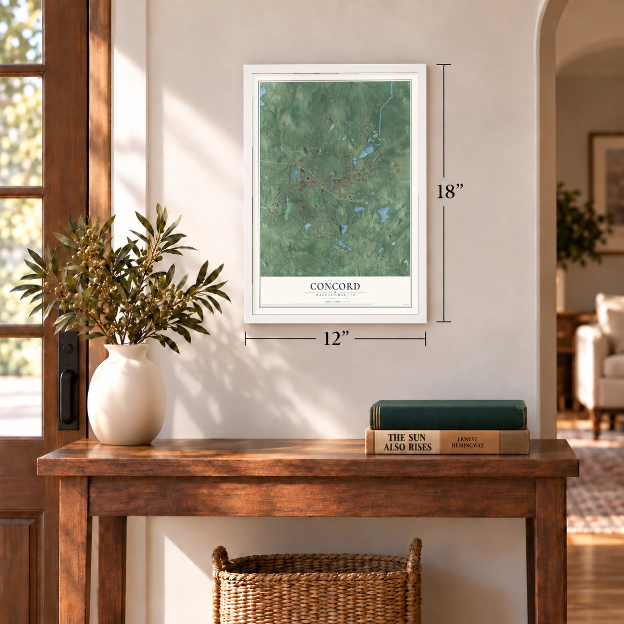
12" x 18" Archival Matte Print
A Map of Home. A Work of Art.
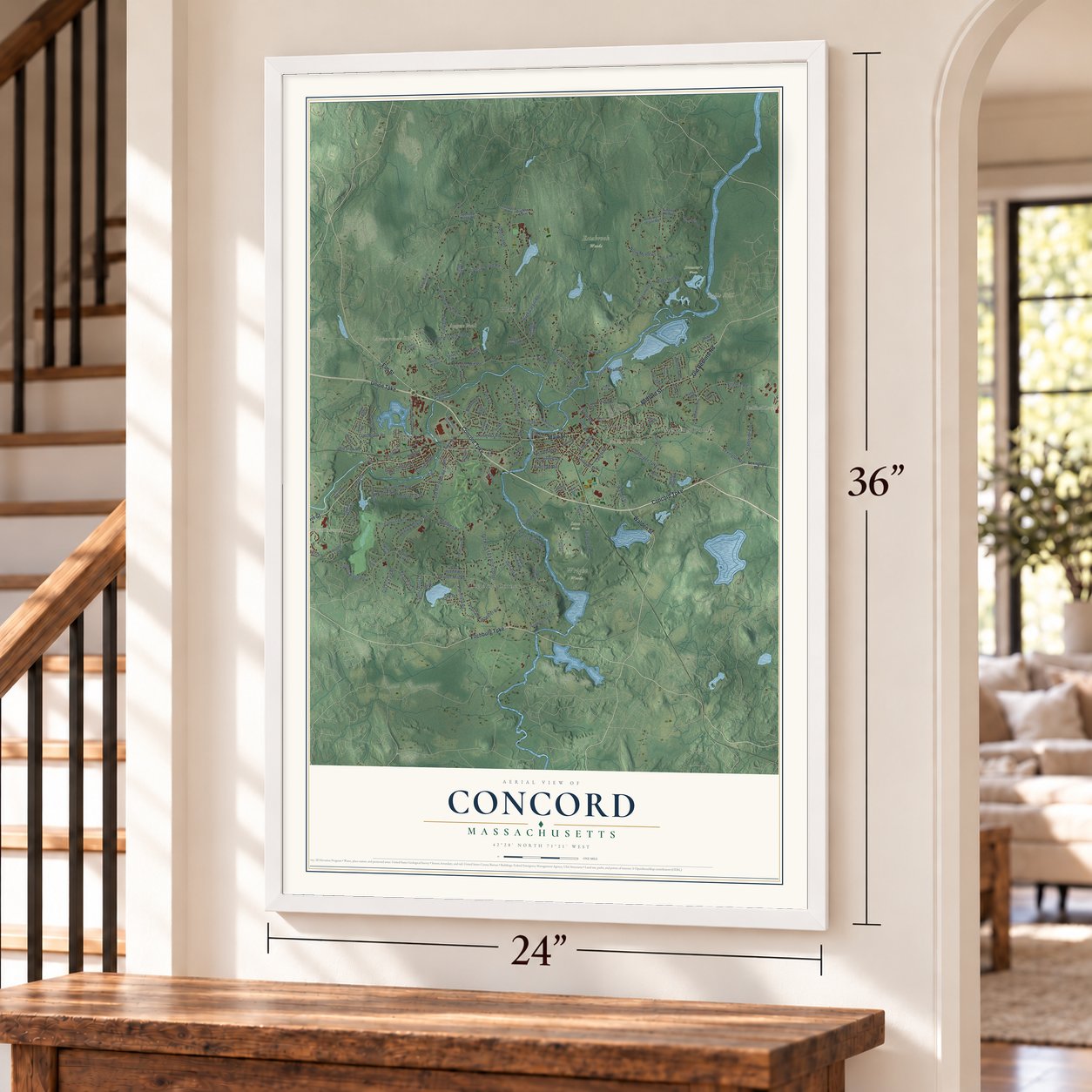
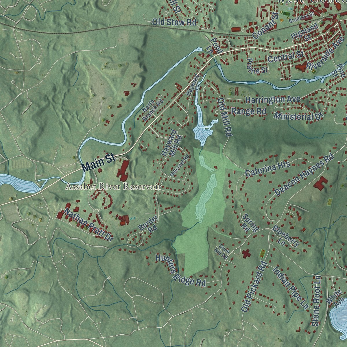
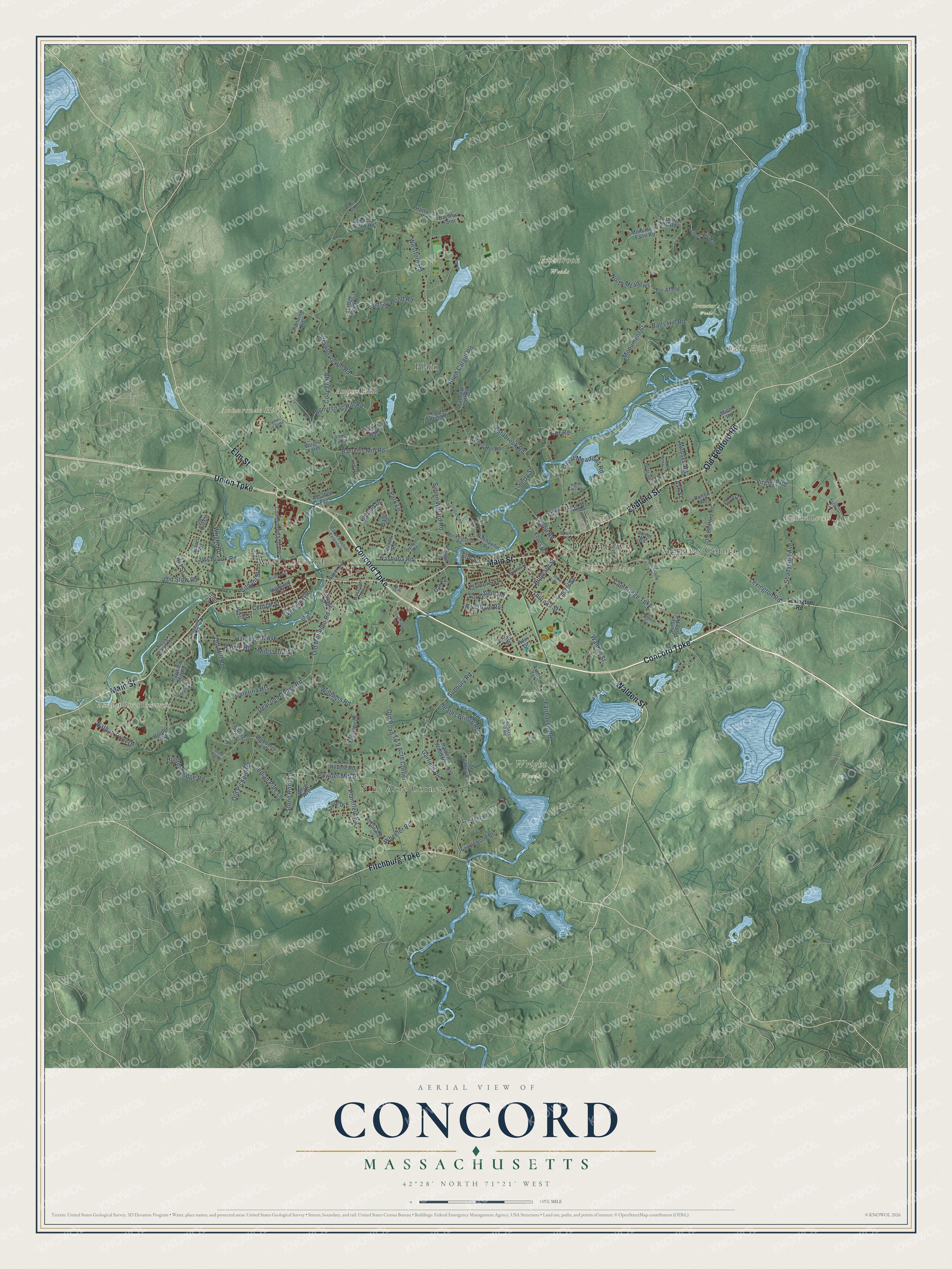
Explore Concord, Massachusetts from a whole new perspective. Created using aerial imagery and detailed geographic data, this map captures Concord building by building, with labeled streets, familiar landmarks, and shaded topographical relief that highlights the natural contours of the landscape.
Combining modern data with the timeless character of a vintage atlas, this map is just as interesting up close as it is beautiful on the wall. Whether you grew up in Concord, spent memorable years there, or call it home today, this unique map is a great way to celebrate a place that means something to you. Zoom in on the preview to look for your street, and then order a print to put your memories on the wall.
Three ways to hang it
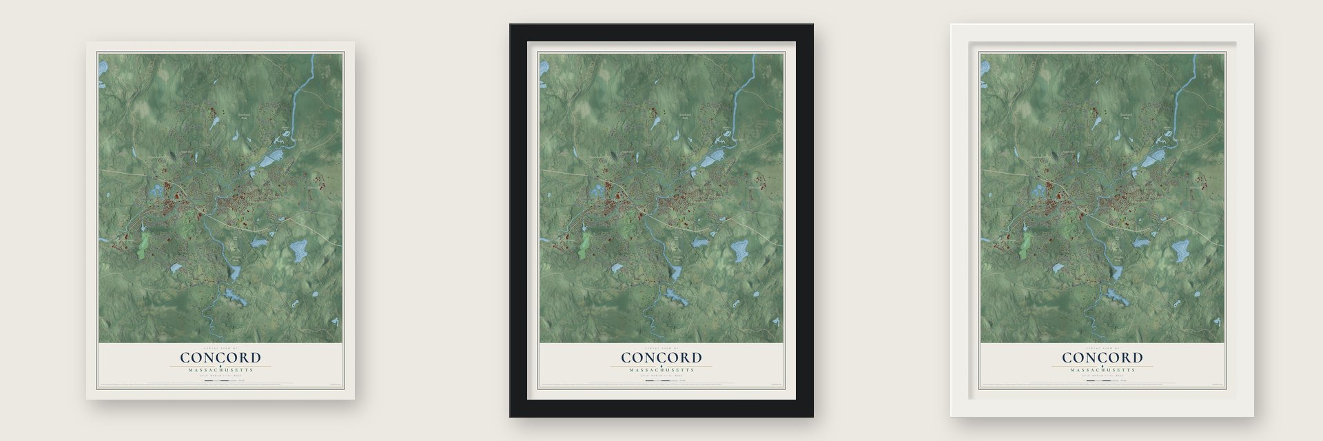
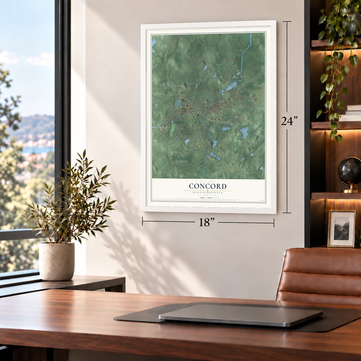
Unframed archival matte, a black wood frame or a white wood frame.
Up close
Geography Worth Displaying
This map was created using accurate cartographic data and authoritative geographic sources, including the U.S. Geological Survey (USGS) and FEMA. The map brings together terrain, waterways, roads, and building detail. The majority of the streets are labeled, houses are accurately depicted, and the topography is derived from government sources. Combining local data with carefully composed color and shading leads to this beautifully detailed Concord artwork for your wall.
Rather than simply showing street outlines, we’ve included as many of the street names as we could reasonably fit on the map while keeping their names legible. Zoom in on the high resolution preview to see exactly what’s on the map. We truly set out to create a statement piece for anyone who loves Concord. So whether it’s for you, or a gift for someone you love, we hope this map of Concord brings back fond memories.
Explore the full map of Concord, Massachusetts and read about the local places it shows.

Find your street
Names on the Concord map
Every name below is printed on this map. Look for your street, your school, the park where you played, or the pond down the road.
Places and landmarks15
- Downtown
- Annursnac Hill
- Authors Ridge
- Balls Hill
- Bedford Levels
- Angiers Pond
- Assabet River Reservoir
- Brewster's Woods
- Estabrook Woods
- Seton Woods
- Wright Woods
- West Concord
Show all 15 places
- Nine Acre Corner
- Meriams Corner
- Plain
Streets and roads149
- Union Turnpike
- Concord Turnpike
- Fitchburg Turnpike
- Main Street
- Bedford Street
- Elm Street
- Old Bedford Road
- Walden Street
- Lexington Road
- Powder Mill Road
- Barretts Mill Road
- Simon Willard Road
- Old Pickard Road
- Sudbury Road
- Monument Street
- Lowell Road
- Old Marlboro Road
- Old Road To 9 Acre Corner
- Strawberry Hill Road
- Fairhaven Road
- Annursnac Hill Road
- Virginia Road
- Cambridge Turnpike
- Harrington Avenue
- Thoreau Street
- Garfield Road
- Hugh Cargill Road
- Plainfield Road
- Laws Brook Road
- Estabrook Road
Show all 149 streets
- Westford Road
- College Road
- Nathan Pratt Drive
- Williams Road
- Deacon Haynes Road
- Great Meadows Road
- Lindsay Pond Road
- Heaths Bridge Road
- Caterina Heights
- Old Stow Road
- Old Mill Road
- Nashoba Road
- Ministerial Drive
- Elsinore Street
- Liberty Street
- Central Street
- Hunters Ridge Road
- Shadyside Avenue
- Balls Hill Road
- Indian Pipe Lane
- Monsen Road
- Park Lane
- Southfield Road
- North Meadows
- Range Road
- Hubbard Street
- Stone Root Lane
- Hill Street
- Conant Street
- Laurel Street
- Wright Road
- Riverside Avenue
- Wheeler Road
- Riverdale Road
- Nimrod Drive
- Carr Road
- Ash Street
- Commonwealth Avenue
- Adin Drive
- Shore Drive
- Wright Farm
- Nashawtuc Road
- Hayward Mill Road
- Border Road
- Mattison Drive
- Silver Hill Road
- The Valley Road
- Holden Wood Road
- Baker Avenue
- Sandy Pond Road
- Prairie Street
- Barnes Hill Road
- Oak Hill Circle
- Monument Farm Road
- Arena Terrace
- Assabet Avenue
- Alcott Road
- Tanglewood Drive
- Bartkus Farm
- Indian Spring Road
- Spencer Brook Road
- Keyes Road
- Pine Street
- Cottage Street
- Lanes End
- Lawrence Drive
- Paul Revere Road
- Minot Road
- Anson Road
- Adams Road
- Farmers Cliff Road
- Sorrel Road
- Far Afield
- Martin Road
- Highland Street
- Blueberry Lane
- Wilson Road
- Hartwell Road
- Channing Road
- Ledge Rock Road
- Lee Drive
- Finigan Way
- Turning Mill Road
- Spring Road
- Potter Street
- Lang Street
- Dalton Road
- Oak Road
- Pond Lane
- White Avenue
- Wood Street
- Fairhaven Hill Road
- Musketaquid Road
- Peter Spring Road
- Hawthorne Lane
- Baker Avenue Extended
- Stow Street
- Fuller Lane
- Kenney Lane
- North Branch Road
- Garland Road
- Macarthur Road
- Middle Street
- Hayward Court
- Court Lane
- Pope Road
- Dee Road
- Musterfield Road
- Mildred Circle
- Hillcrest Road
- Prescott Road
- Ripley Hill Road
- Bradford Street
- Deaconess Road
- Autumn Lane
- King Lane
- Whits End Road
- Drum Hill Road
- Pond Street
Names are listed as they appear on the printed map. Zoom into the product photos to find them.
About Concord, Massachusetts
Concord is a town of 18,491 people in Middlesex County, where the Assabet and Sudbury rivers join to form the Concord River. Native people called the place Musketaquid, an Algonquian word for "grassy plain," and they grew corn there until smallpox emptied much of the area in 1633. Two years later the General Court granted the land to a group of English colonists under Rev. Peter Bulkeley and Major Simon Willard. They paid the Squaw Sachem of Mistick in wampum, hatchets, knives and cloth for six square miles, and they named the town Concord because the deal had been peaceful. It was New England's first inland colonial settlement, and by 1775 it had 1,400 people.
On April 19, 1775, Lieutenant Colonel Francis Smith led 700 British troops out of Boston to seize the militia's arms in Concord, but Patriot leaders had already hidden most of them elsewhere. After a deadly clash at Lexington, the soldiers split into companies to search the town. At 11:00 in the morning, 400 minutemen met 100 of them at the North Bridge, and the British fell back with casualties on both sides. Minutemen harried the column all the way to Charlestown and then sealed it off, which began the siege of Boston. Emerson's 1837 poem "Concord Hymn" called that volley "the shot heard round the world."
“the biggest little place in America.”
- Patriots' Day, a compromiseIn 1894 the Lexington Historical Society asked the Massachusetts legislature to name April 19 Lexington Day, and Concord answered by proposing Concord Day. Governor Frederic T. Greenhalge settled the quarrel by calling it Patriots' Day instead. For the battle's bicentennial in April 1975, President Gerald Ford gave an address at the Old North Bridge.
- Emerson's Concord circleRalph Waldo Emerson, whose grandfather watched the 1775 fight from his house, settled here in 1835. Nathaniel Hawthorne, Bronson Alcott and Concord-born Henry David Thoreau joined him. Their circle produced Self-Reliance in 1841, Mosses from an Old Manse in 1846, Walden in 1854 and Little Women in 1868. Thoreau, jailed here for refusing taxes to protest slavery and the Mexican-American War, wrote Civil Disobedience in 1849. They lie on Sleepy Hollow Cemetery's Authors Ridge.
- The Wayside's many authorsDuring the Revolution, when Harvard College moved to Concord for a time, the scientist John Winthrop lived in this Lexington Road house. The Alcotts later lived there and called it Hillside, then sold it to Hawthorne in 1852 and moved next door to Orchard House in 1858. Hawthorne renamed it The Wayside and stayed until he died. In 1883 publisher Daniel Lothrop bought it. Harriett, his wife, was the author of the Five Little Peppers books, written as Margaret Sidney.
- The Concord grape, 1849Boston-born Ephraim Wales Bull grew some 22,000 seedlings from native grape seeds at his Lexington Road home, looking for a hardy grape that ripened before the northern frosts. He found it in 1849 and won a prize with it at the Boston Horticultural Society Exhibition in 1853. Cuttings later sold for up to $1,000 each, yet Bull died fairly poor. Welch's, the first company to sell grape juice, kept its headquarters in Concord until 2025.
- First to ban bottled waterConcord fought over bottled water for years. The state attorney general threw out a 2010 town meeting ban, and a 2011 try lost 265 to 272. A 403 to 364 vote on September 5, 2012, made Concord the first U.S. community to bar sales of single-serving plastic water bottles of one liter or less, starting January 1, 2013. A repeal failed 621 to 687. Jean Hill, 86, who led the fight, said she had really accomplished something.
Keep exploring Massachusetts
Concord is one of 470 Massachusetts towns we've mapped. Every dot on the map is a print of its own.
The search covers every state, Massachusetts first.
Near Concord
Order 2 or more town maps and save 10%. Shown in the size and finish you picked above, so they hang as a set.
- West Concord 12" x 18" / Archival Matte Print $39.99
- Lincoln 12" x 18" / Archival Matte Print $39.99
- Acton 12" x 18" / Archival Matte Print $39.99


More maps nearby: Bedford, Carlisle, Maynard, Sudbury and Hastings.
The art of mapping a place
How This Map Was Made
Real places. Remarkable detail. Discover the layers that turn geographic data into a map of home.

The view from above
Aerial imagery reveals the character of the land: woodland, open fields, and the patterns of a place.

The shape of the land
Elevation data brings hills, valleys, and subtle changes in the landscape into view.

The details of home
Roads, waterways, and building footprints come together to make the map feel unmistakably local.

Geography becomes art
Considered color, shading, and typography bring the layers together in a map made for your wall.


Process illustrated with Mendon, Massachusetts. Aerial imagery: USDA NAIP. Terrain: USGS 3D Elevation Program. Map details and finished artwork: KNOWOL.
The Details
About This Print
Choose an archival matte print, or a black or white Ayous wood frame. The archival matte print is unframed.
Select your size and finish above to see the matching product image and price.
Materials & Craftsmanship
A contemporary map with the character of a classic atlas, printed on archival matte paper. Optional frames are made from Ayous wood.
Your printed map does not include the watermark shown in the full-map preview.
Shipping & Delivery
Free shipping within the United States. Every print is made to order in the USA.
Buying a gift? Add a note in your cart and we'll include it. We never put prices in the package.
Prints ship within 2 to 3 business days. Allow 7 to 10 days total from ordering for delivery. Timing may vary during holidays or periods of high order volume.
Read our shipping policy.
Returns and damaged prints
Each print is made to order. Change-of-mind refunds are not available after production.
If your print arrives damaged, misprinted or incorrect, contact support@knowol.com within 30 days of receiving it. Include your order number, photos and a description of the issue.
Read our full refund and replacement policy. For questions about your order, email support@knowol.com.