
Search for another town





Free U.S. delivery 7 to 10 days after you order
Acton, Massachusetts Map Art
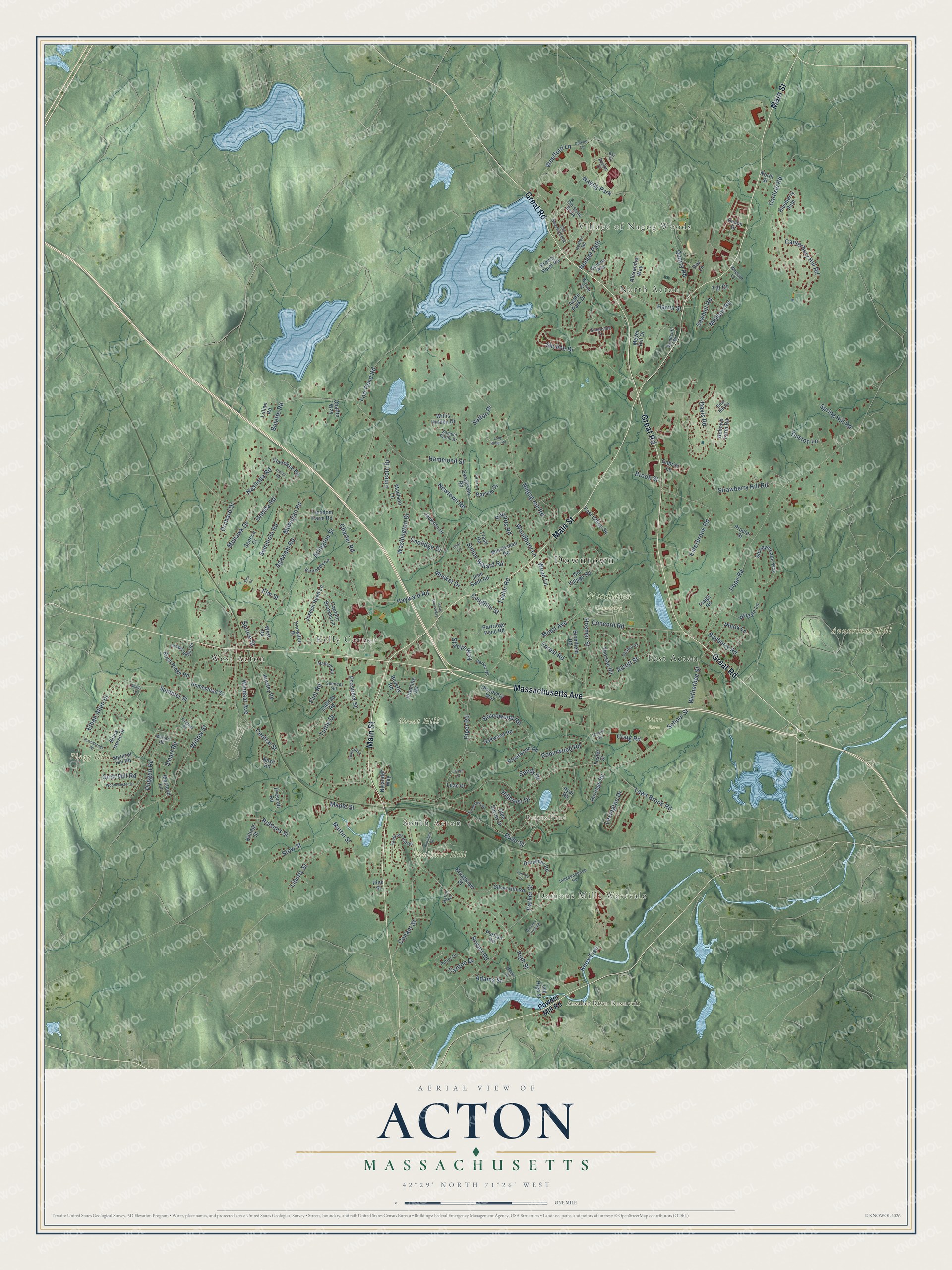
Building by building, with labeled streets and shaded relief.
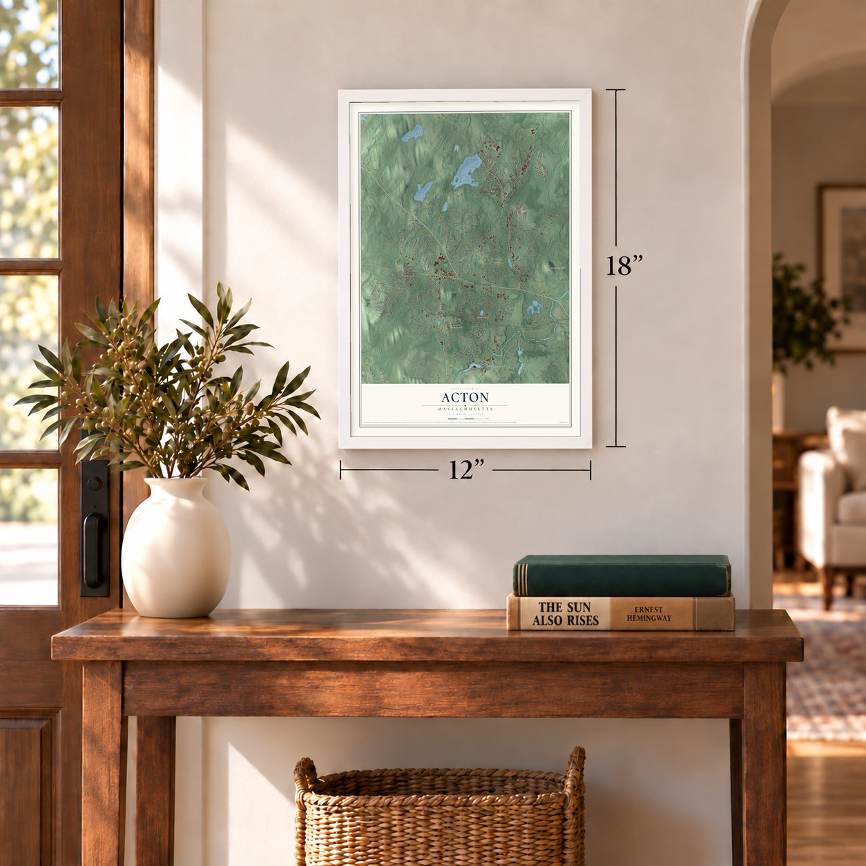
12" x 18" Archival Matte Print
A Map of Home. A Work of Art.
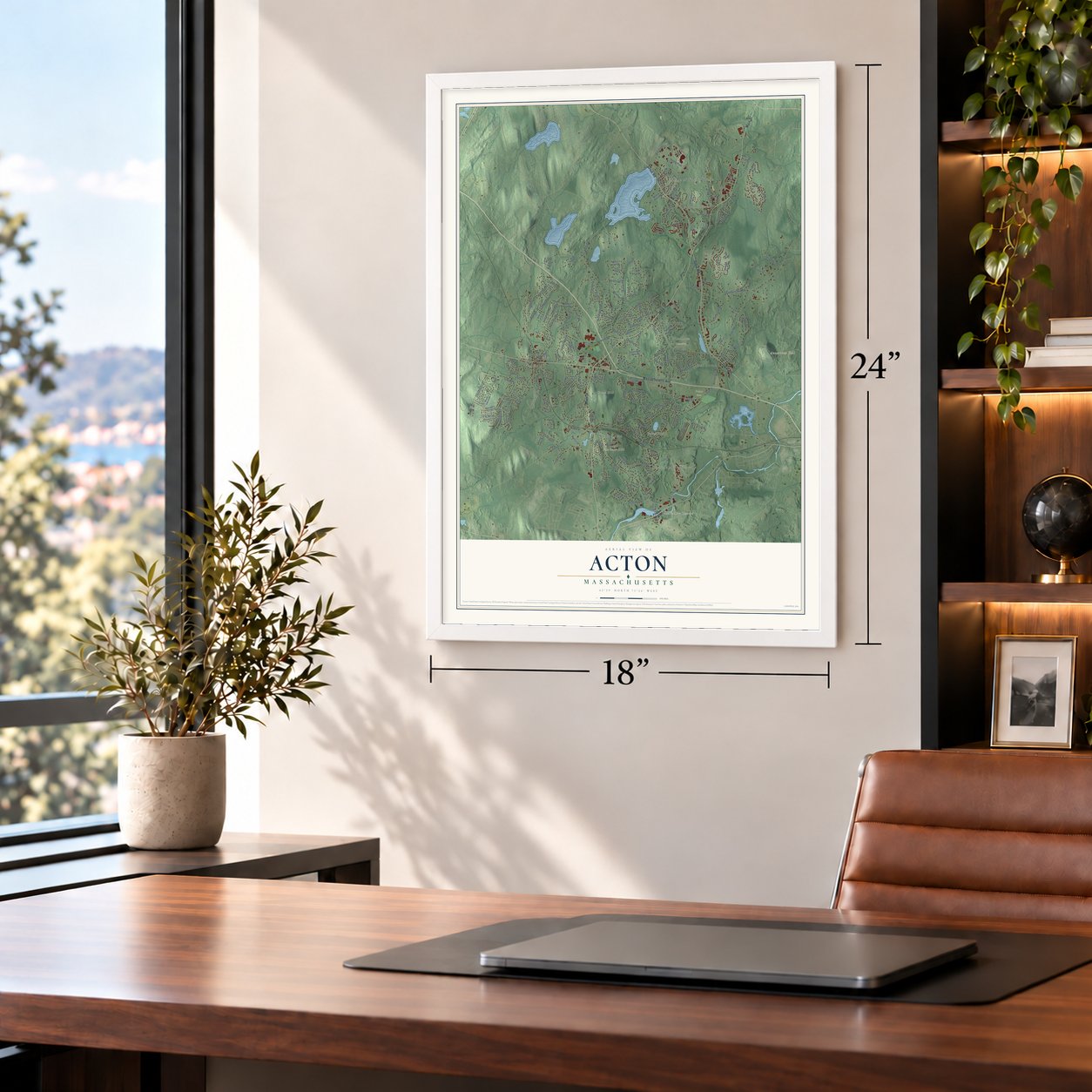
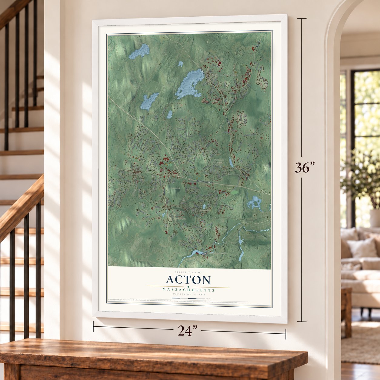
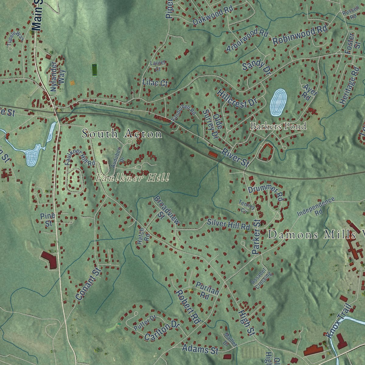
Explore Acton, Massachusetts from a whole new perspective. Created using aerial imagery and detailed geographic data, this map captures Acton building by building, with labeled streets, familiar landmarks, and shaded topographical relief that highlights the natural contours of the landscape.
Combining modern data with the timeless character of a vintage atlas, this map is just as interesting up close as it is beautiful on the wall. Whether you grew up in Acton, spent memorable years there, or call it home today, this unique map is a great way to celebrate a place that means something to you. Zoom in on the preview to look for your street, and then order a print to put your memories on the wall.
Three ways to hang it
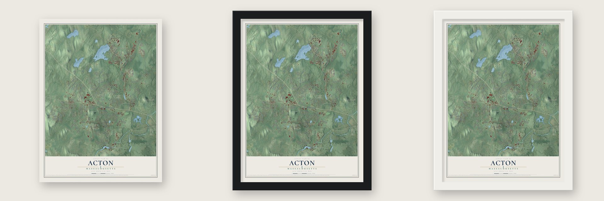
Unframed archival matte, a black wood frame or a white wood frame.
Up close
Geography Worth Displaying
This map was created using accurate cartographic data and authoritative geographic sources, including the U.S. Geological Survey (USGS) and FEMA. The map brings together terrain, waterways, roads, and building detail. The majority of the streets are labeled, houses are accurately depicted, and the topography is derived from government sources. Combining local data with carefully composed color and shading leads to this beautifully detailed Acton artwork for your wall.
Rather than simply showing street outlines, we’ve included as many of the street names as we could reasonably fit on the map while keeping their names legible. Zoom in on the high resolution preview to see exactly what’s on the map. We truly set out to create a statement piece for anyone who loves Acton. So whether it’s for you, or a gift for someone you love, we hope this map of Acton brings back fond memories.
Explore the full map of Acton, Massachusetts and read about the local places it shows.

Find your street
Names on the Acton map
Every name below is printed on this map. Look for your street, your school, the park where you played, or the pond down the road.
Places and landmarks17
- Downtown
- Village of Nagog Woods
- North Acton
- Damons Mills Westvale
- Annursnac Hill
- Faulkner Hill
- Flagg Hill
- Great Hill
- Assabet River Reservoir
- Barkers Pond
- Prison Farm
- Woodlawn Cemetery
Show all 17 places
- West Acton
- Kelly Corner
- East Acton
- South Acton
- Nagog Park
Streets and roads196
- Massachusetts Avenue
- Main Street
- Great Road
- Canterbury Hill Road
- Central Street
- Arlington Street
- School Street
- Pope Road
- Newtown Road
- Nagog Hill Road
- Parker Street
- High Street
- Davis Road
- Concord Road
- Strawberry Hill Road
- Willow Street
- Hayward Road
- Alcott Street
- Charter Road
- Hosmer Street
- Quarry Road
- Skyline Drive
- River Street
- Prospect Street
- Nonset Path
- Summer Street
- Stow Street
- Piper Road
- Washington Drive
- Taylor Road
Show all 196 streets
- Ethan Allen Drive
- Hammond Street
- Harris Street
- Esterbrook Road
- Agawam Road
- Lexington Drive
- Mohawk Drive
- Nashoba Road
- Carlisle Road
- Minot Avenue
- Conant Street
- Martin Street
- Liberty Street
- Robbins Street
- Duggan Road
- Simon Willard Road
- Brucewood Road
- Oneida Road
- Windsor Avenue
- Knox Trail
- Seminole Road
- Elm Street
- Laws Brook Road
- Tuttle Drive
- Flint Road
- Forest Road
- Brook Street
- Wetherbee Street
- Adams Street
- Wood Lane
- Lincoln Drive
- Fort Pond Road
- Maple Street
- Robinwood Road
- Musket Drive
- Carlton Drive
- Mohegan Road
- Spring Hill Road
- Milldam Road
- Grist Mill Road
- Hillcrest Drive
- Duston Lane
- Patriots Road
- Woodbury Lane
- Orchard Drive
- Smart Road
- Bayberry Road
- Coolidge Drive
- Robert Road
- Westford Lane
- Craig Road
- Stacys Way
- Coughlin Street
- Sawmill Road
- Spruce Street
- Bulette Road
- Sutton Place
- Sandy Drive
- Phlox Lane
- Till Drive
- Powder Mill Road
- Stoneymeade Way
- Acorn Park Drive
- Meyer Hill Drive
- Jackson Drive
- Old Village Road
- Heritage Road
- Squirrel Hill Road
- Lothrop Road
- Joseph Reed Lane
- John Swift Road
- Captain Browns Lane
- Silver Hill Road
- Oakwood Road
- Black Horse Drive
- Drummer Road
- Nash Road
- Kinsley Road
- Birch Ridge Road
- Blueberry Path
- Knowlton Drive
- Evergreen Road
- Wingate Lane
- Alexandra Way
- Minuteman Road
- Bellows Farm Road
- Freedom Farm Road
- Cherokee Road
- Willis Holden Drive
- Thoreau Road
- Arborwood Road
- Broadview Street
- Partridge Pond Road
- Prescott Road
- Post Office Square
- Gabriel Lane
- Homestead Street
- Olde Surrey Drive
- Beverly Road
- Nylander Way
- Discovery Way
- Madison Lane
- Puritan Road
- Billings Street
- Old High Street
- Breezy Point Road
- Kennedy Lane
- Balsam Drive
- Bromfield Road
- Devon Drive
- Francine Road
- Proctor Street
- Foster Street
- Macleod Lane
- Flagg Road
- Ayer Road
- Lillian Road
- North Street
- Lilac Court
- Seneca Court
- Chaffin Way
- Trask Road
- West Road
- Pine Street
- Rex Lane
- Avalon Drive
- Faulkner Hill Road
- Independence Road
- Old Stone Brook
- Henley Road
- Samuel Parlin Drive
- Juniper Ridge Road
- Marian Road
- Old Beaverbrook
- Mallard Road
- Greenside Lane
- Briar Hill Road
- Spencer Road
- Wyndcliff Drive
- Barker Road
- Putter Drive
- Phalen Street
- Sachem Way
- Wheeler Lane
- Walnut Street
- Hatch Road
- Audubon Drive
- Woodchester Drive
- Larch Road
- Vanderbelt Road
- Ticonderoga Road
- Assabet Crossing
- Kingman Road
- Long Ridge Road
- Isaac Davis Way
- Tupelo Way
- Huron Road
- Maillet Drive
- Tenney Circle
- Durkee Lane
- Shady Lane
- Russell Road
- Laurel Court
- Eliot Circle
- Elm Court
- Bay Drive
Names are listed as they appear on the printed map. Zoom into the product photos to find them.
About Acton, Massachusetts
Acton is a town of 24,021 people in Middlesex County, just west of Concord. Its land first lay inside Concord's original bounds, and Concord's settlers grazed their animals on it. The first homestead within today's town line went up in 1639. In 1668 Capt. Thomas Wheeler leased land here, agreeing in return to tend 50 cattle for the inhabitants and shut them in a pen every night to guard them from wild animals. Ephraim Jones started mills at South Acton in 1702, and on July 3, 1735, Acton was set off from Concord as a town of its own.
Acton broke with Britain early. On October 3, 1774, residents sent King George III a list of grievances, a date the town still marks as Crown Resistance Day. That November a minuteman company was raised under Isaac Davis from young men aged sixteen to thirty, and on June 14, 1776, the town resolved that an American republic was the only government it hoped to see.
“Concord furnished the ground, and Acton the men.”
- The alarm of April 19, 1775Before dawn an unknown rider clubbed the corner of Capt. Joseph Robbins's house, crying that Acton must be warned. Nearly every man under Davis carried a bayonet. They led at the North Bridge, where Davis, the war's first slain American officer, died beside Private Abner Hosmer.
- God's own graniteIn November 1850 the town meeting voted to rebury Davis, Hosmer and James Hayward on the Common under a monument. The minister, James T. Woodbury, made the town's case at the State House, holding up a powder horn from April 19 and the buckles from Davis's shoes. Lawmakers gave $2,000, Acton added $500, and Governor George S. Boutwell picked the site.
- The Faulkner House of 1707Acton's oldest colonial building was built for Ephraim Jones, whose mills began the settlement, and it served as a garrison house in Queen Anne's War. The Faulkners bought the house and mills in 1742 and held them for six generations, and on the other side of the road they ran a mill that fulled woolen cloth. The Faulkner Homestead joined the National Register in 1971.
- Barrels from Mill CornerFor about a century South Acton's mills formed Mill Corner, whose coopers made fifteen to twenty thousand barrels a year in the early 1800s. Serving those mills, the Fitchburg Railroad ran through South and West Acton from October 1, 1844. In 1874 it held about 500 people, the American House hotel, a woolen factory and pencil and soapstone works. Residents saved nearby Jones Tavern, built in 1732 for Samuel Jones Jr. and likely Acton's first store, from demolition in 1964.
- A house from a lottery prizeFour Acton men split the $10,000 prize of a Harvard College lottery held in 1794 and 1795, and four houses went up afterward. The best preserved is the John Robbins House, a farmhouse built in 1800 and decorated with stencilwork by Moses Eaton Jr. It joined the National Register in 2003.
Keep exploring Massachusetts
Acton is one of 461 Massachusetts towns we've mapped. Every dot on the map is a print of its own.
The search covers every state, Massachusetts first.
Near Acton
Order 2 or more town maps and save 10%. Shown in the size and finish you picked above, so they hang as a set.
- West Concord 12" x 18" / Archival Matte Print $39.99
- Littleton Common 12" x 18" / Archival Matte Print $39.99
- Concord 12" x 18" / Archival Matte Print $39.99

More maps nearby: Maynard, Boxborough, Littleton, Stow and Carlisle.
The art of mapping a place
How This Map Was Made
Real places. Remarkable detail. Discover the layers that turn geographic data into a map of home.

The view from above
Aerial imagery reveals the character of the land: woodland, open fields, and the patterns of a place.

The shape of the land
Elevation data brings hills, valleys, and subtle changes in the landscape into view.

The details of home
Roads, waterways, and building footprints come together to make the map feel unmistakably local.

Geography becomes art
Considered color, shading, and typography bring the layers together in a map made for your wall.


Process illustrated with Mendon, Massachusetts. Aerial imagery: USDA NAIP. Terrain: USGS 3D Elevation Program. Map details and finished artwork: KNOWOL.
The Details
About This Print
Choose an archival matte print, or a black or white Ayous wood frame. The archival matte print is unframed.
Select your size and finish above to see the matching product image and price.
Materials & Craftsmanship
A contemporary map with the character of a classic atlas, printed on archival matte paper. Optional frames are made from Ayous wood.
Your printed map does not include the watermark shown in the full-map preview.
Shipping & Delivery
Free shipping within the United States. Every print is made to order in the USA.
Buying a gift? Add a note in your cart and we'll include it. We never put prices in the package.
Prints ship within 2 to 3 business days. Allow 7 to 10 days total from ordering for delivery. Timing may vary during holidays or periods of high order volume.
Read our shipping policy.
Returns and damaged prints
Each print is made to order. Change-of-mind refunds are not available after production.
If your print arrives damaged, misprinted or incorrect, contact support@knowol.com within 30 days of receiving it. Include your order number, photos and a description of the issue.
Read our full refund and replacement policy. For questions about your order, email support@knowol.com.