
Search for another town





Free U.S. delivery 7 to 10 days after you order
Tewksbury, Massachusetts Map Art
Building by building, with labeled streets and shaded relief.
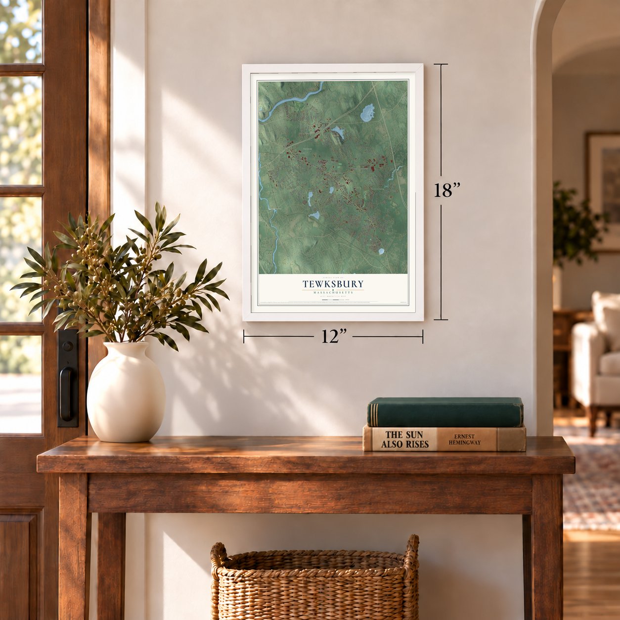
12" x 18" Archival Matte Print
A Map of Home. A Work of Art.
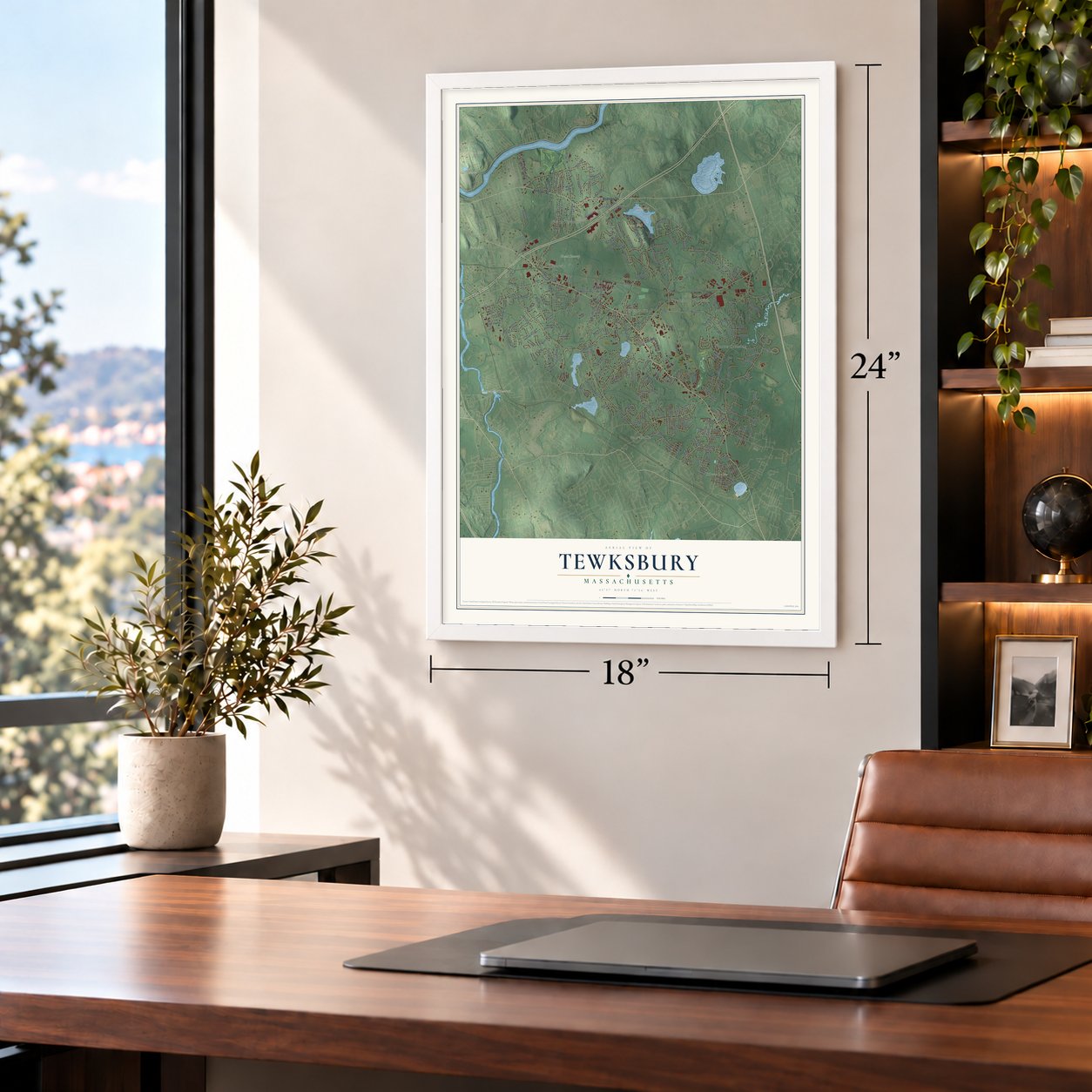
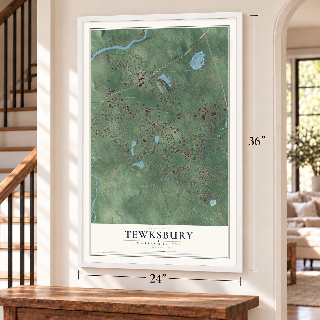
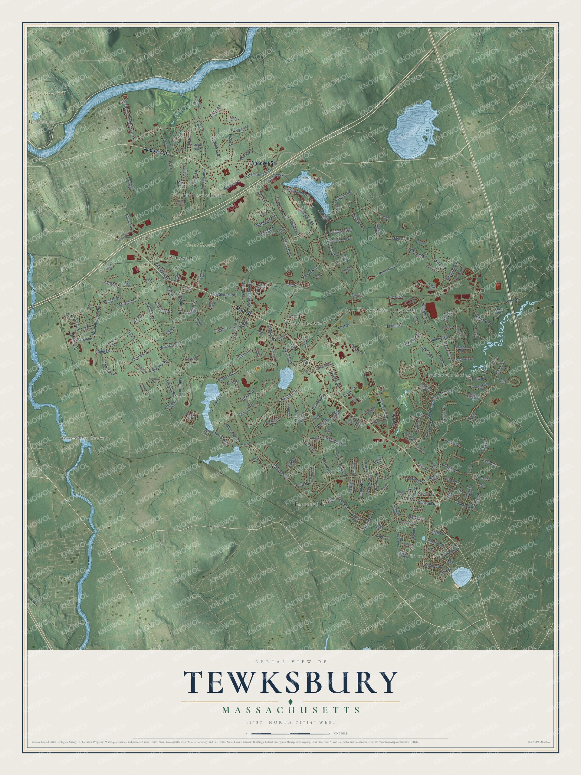
Explore Tewksbury, Massachusetts from a whole new perspective. Created using aerial imagery and detailed geographic data, this map captures Tewksbury building by building, with labeled streets, familiar landmarks, and shaded topographical relief that highlights the natural contours of the landscape.
Combining modern data with the timeless character of a vintage atlas, this map is just as interesting up close as it is beautiful on the wall. Whether you grew up in Tewksbury, spent memorable years there, or call it home today, this unique map is a great way to celebrate a place that means something to you. Zoom in on the preview to look for your street, and then order a print to put your memories on the wall.
Three ways to hang it
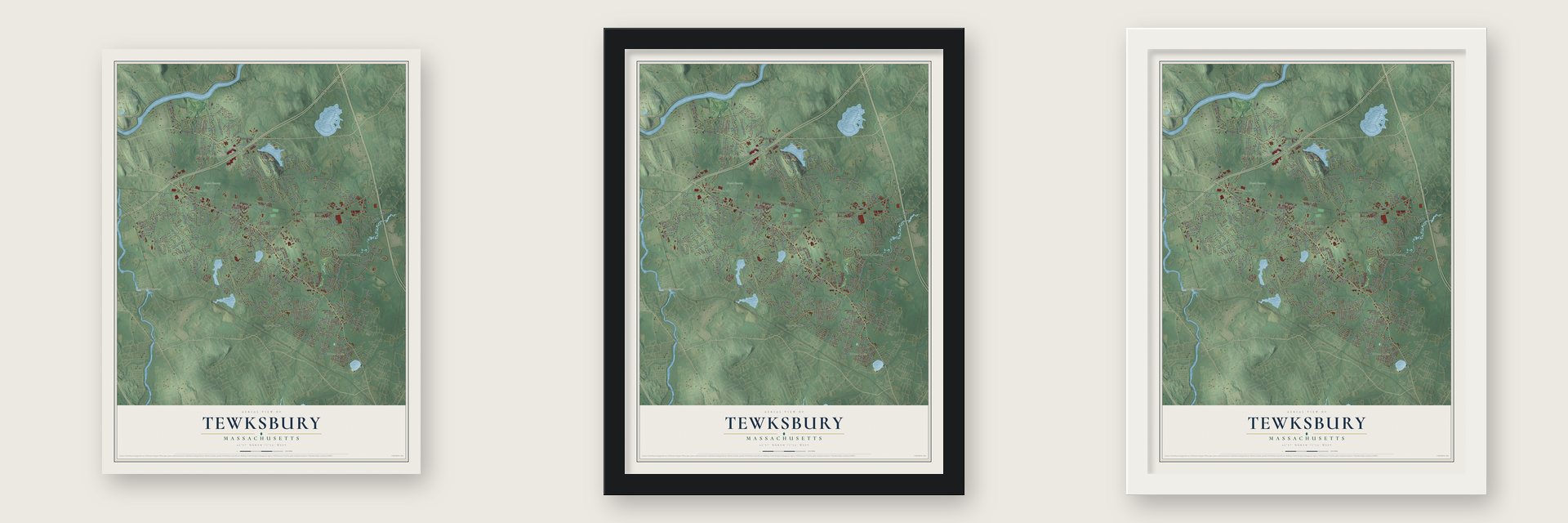
Unframed archival matte, a black wood frame or a white wood frame.
Up close
Geography Worth Displaying
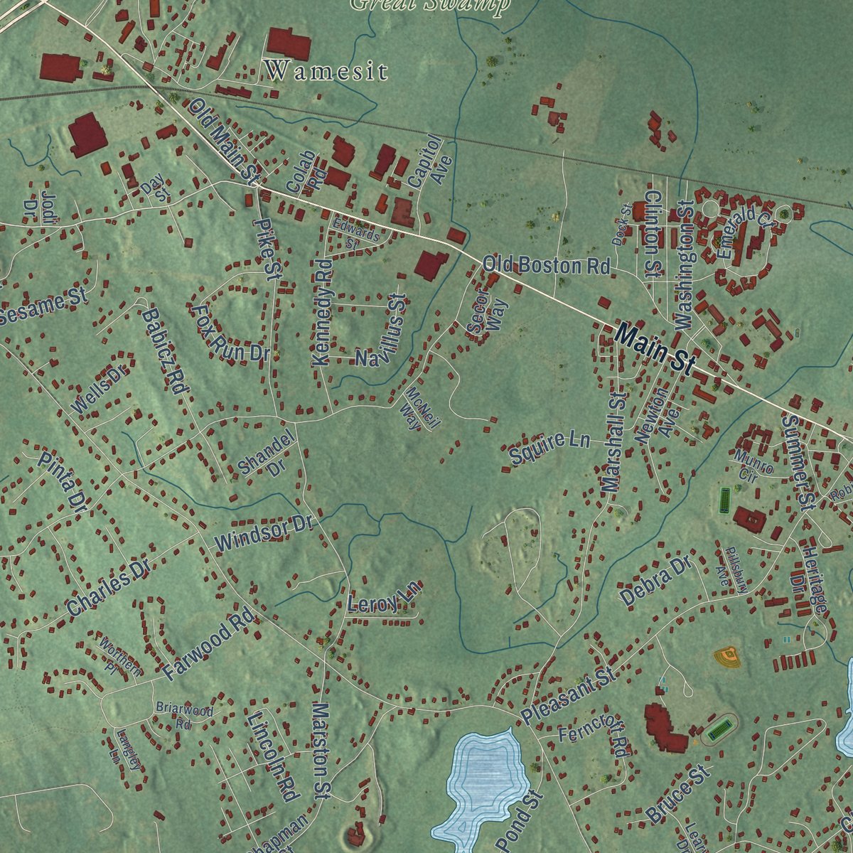
This map was created using accurate cartographic data and authoritative geographic sources, including the U.S. Geological Survey (USGS) and FEMA. The map brings together terrain, waterways, roads, and building detail. The majority of the streets are labeled, houses are accurately depicted, and the topography is derived from government sources. Combining local data with carefully composed color and shading leads to this beautifully detailed Tewksbury artwork for your wall.
Rather than simply showing street outlines, we’ve included as many of the street names as we could reasonably fit on the map while keeping their names legible. Zoom in on the high resolution preview to see exactly what’s on the map. We truly set out to create a statement piece for anyone who loves Tewksbury. So whether it’s for you, or a gift for someone you love, we hope this map of Tewksbury brings back fond memories.
Explore the full map of Tewksbury, Massachusetts and read about the local places it shows.

Find your street
Names on the Tewksbury map
Every name below is printed on this map. Look for your street, your school, the park where you played, or the pond down the road.
Places and landmarks14
- Downtown
- Silver Lake
- Ames Hill
- Christian Hill
- Duck Islands
- Fort Hill
- Ames Pond
- Concord River Reservoir
- Great Swamp
- Burtts Crossing
- Pattenville
- Tewksbury Junction
Show all 14 places
- North Tewksbury
- Wamesit
Streets and roads253
- Main Street
- Andover Street
- South Street
- Astle Street
- Brown Street
- Shawsheen Street
- Whipple Road
- Livingston Street
- East Street
- Chandler Street
- North Street
- Trull Road
- Rogers Street
- Kendall Road
- River Road
- Pinnacle Street
- Foster Road
- Ames Hill Drive
- Pleasant Street
- Marshall Street
- Lancaster Drive
- Marston Street
- Cardigan Road
- North Billerica Road
- Clark Road
- Frasier Lane
- Pine Street
- Old Boston Road
- Beech Street
- Merrimack Meadows Lane
Show all 253 streets
- Pond Street
- Vale Street
- Farwood Road
- Maple Street
- Fiske Street
- Patrick Road
- Helvetia Street
- Salem Road
- Charles Drive
- Starr Avenue
- Pike Street
- Patten Road
- Lowe Street
- Whittemore
- Carter Street
- Woburn Street
- Pringle Street
- Hood Road
- John Street
- French Street
- Kennedy Road
- Babicz Road
- County Road
- McLaren Road
- Old Main Street
- Fox Run Drive
- Westland Drive
- Vernon Street
- Northgate Road
- Charme Road
- Sawyers Lane
- Easement Road
- International Place
- Bradford Road
- Colonial Drive
- Geiger Drive
- Poplar Street
- Sesame Street
- Washington Street
- Bligh Street
- Hill Street
- Lee Street
- Lowell Street
- Navillus Street
- Pennacook Road
- Kent Street
- Judique Road
- Debra Drive
- Marion Drive
- Eagle Drive
- Lake Street
- Ellington Road
- Clinton Street
- Ballard Street
- Heath Street
- Kearsage Street
- Wolcott Street
- Ronald Drive
- Maureen Drive
- Decarolis Drive
- Park West
- Brook Street
- Patriot Road
- Windsor Drive
- Victor Drive
- Tenth Street
- Squire Lane
- Bruce Street
- Leighton Lane
- State Street
- Cayuga Road
- Park Avenue
- Martha Avenue
- Summer Street
- Aprils Way
- Lincoln Road
- Revere Road
- Allen Road
- Oliver Street
- Pinta Drive
- Mill Street
- School Street
- Davis Road
- Eighth Street
- Leroy Lane
- Mount Joy Drive
- Ellis Avenue
- Catamount Road
- Apple Hill Drive
- Apache Way
- Heidenrich Drive
- Emerald Court
- Juniper Lane
- Chapman Street
- Greenmeadow Drive
- Ferncroft Road
- Delaney Drive
- Anthony Road
- Russell Street
- Merrimac Drive
- Tomahawk Drive
- Rounsevell Road
- Prospect Hill Drive
- Elm Street
- Marie Street
- Deering Drive
- Carleton Road
- Newton Avenue
- Emily Road
- Meredith Road
- Judith East Drive
- Country Club Drive
- Redgate Road
- Regina South Drive
- South Rhoda Street
- Felker Street
- Euclid Road
- Louis Road
- Pinedale Avenue
- Brookfield Road
- Mystic Avenue
- Kevin Street
- Capitol Avenue
- Rockvale Road
- Walnut Road
- Cabot Road
- Villa Roma Drive
- Hillside Road
- Heather Row
- Wayside Road
- Nichols Street
- Orchard Street
- Pomfret Road
- Polaris Lane
- Patricia Drive
- Overlook Drive
- Heritage Drive
- Danielle Drive
- Colab Road
- Secor Way
- Lumber Lane
- Wells Drive
- Michigan Road
- Harold Place
- Young Street
- Bemis Circle
- March Road
- New York Road
- Shandel Drive
- Cynthia Road
- Utah Road
- Mollie Drive
- Martin Road
- Jay Street
- Booth Street
- Jodi Drive
- Otis Street
- Jennies Way
- Maplewood Road
- Hinckley Road
- Longmeadow Road
- Quincy Road
- Arkansas Road
- Stonebury Way
- Regis Road
- Chivas Circle
- Oxford Road
- Baldwin Street
- Oakland Avenue
- Roper Lane
- Buckingham Road
- Elm Avenue
- Sharon Street
- Cobleigh Drive
- Windham Road
- Sheffield Road
- Munro Circle
- Bonnie Lane
- Virginia Road
- Leary Drive
- Oak Street
- Raymond Street
- Starbird Avenue
- Floyd Avenue
- Susan Drive
- Donna Drive
- McNeil Way
- Boxcar Boulevard
- Grove Street
- Melim Drive
- Day Street
- Quail Run
- Tanglewood Avenue
- Arlington Street
- Moonlight Drive
- Geddes Drive
- Dirlam Circle
- Balsam Place
- Clark Relocation Road
- Breckenridge Road
- Trull Brook Lane
- Royal Crest Circle
- Germano Drive
- Kensington Way
- Pinewood Road
- Dunvegan Road
- Briarwood Road
- Hillcrest Road
- Compass Lane
- Lucille Drive
- Minuteman Way
- Dock Street
- Maryland Road
- Crest Road
- James Street
- Bayberry Lane
- Robinson Avenue
- Worthern Place
- Magna Vista Circle
- Edwards Street
- Pillsbury Avenue
- Langley Lane
- Dike Court
Names are listed as they appear on the printed map. Zoom into the product photos to find them.
About Tewksbury, Massachusetts, Drawn Like an Old Atlas
Tewksbury was settled in 1637 and became a town in 1734. Its first proprietors took great care to lay out bridle paths so families could ride to church. Many of the town's present roads still keep the crooked courses of those old paths.
On July 24, 1857, a powerful tornado tore across Tewksbury. It began as a small waterspout at Round Pond. The storm flattened barns, uprooted big trees and killed a team of oxen. Homes sat above the valley floor, so no one died and only a few were hurt.
- A presidential visitPresident Andrew Jackson once paid a visit to Tewksbury. He stopped at Brown's Tavern, a local watering hole.
Keep exploring Massachusetts
Tewksbury is one of 470 Massachusetts towns we've mapped. Every dot on the map is a print of its own.
The search covers every state, Massachusetts first.
Near Tewksbury
Order 2 or more town maps and save 10%. Shown in the size and finish you picked above, so they hang as a set.
- Billerica 12" x 18" / Archival Matte Print $39.99
- Andover 12" x 18" / Archival Matte Print $39.99
- Wilmington 12" x 18" / Archival Matte Print $39.99


More maps nearby: Lowell, Pinehurst, Dracut, Lawrence and Chelmsford.
The art of mapping a place
How This Map Was Made
Real places. Remarkable detail. Discover the layers that turn geographic data into a map of home.

The view from above
Aerial imagery reveals the character of the land: woodland, open fields, and the patterns of a place.

The shape of the land
Elevation data brings hills, valleys, and subtle changes in the landscape into view.

The details of home
Roads, waterways, and building footprints come together to make the map feel unmistakably local.

Geography becomes art
Considered color, shading, and typography bring the layers together in a map made for your wall.


Process illustrated with Mendon, Massachusetts. Aerial imagery: USDA NAIP. Terrain: USGS 3D Elevation Program. Map details and finished artwork: KNOWOL.
The Details
About This Print
Choose an archival matte print, or a black or white Ayous wood frame. The archival matte print is unframed.
Select your size and finish above to see the matching product image and price.
Materials & Craftsmanship
A contemporary map with the character of a classic atlas, printed on archival matte paper. Optional frames are made from Ayous wood.
Your printed map does not include the watermark shown in the full-map preview.
Shipping & Delivery
Free shipping within the United States. Every print is made to order in the USA.
Buying a gift? Add a note in your cart and we'll include it. We never put prices in the package.
Prints ship within 2 to 3 business days. Allow 7 to 10 days total from ordering for delivery. Timing may vary during holidays or periods of high order volume.
Read our shipping policy.
Returns and damaged prints
Each print is made to order. Change-of-mind refunds are not available after production.
If your print arrives damaged, misprinted or incorrect, contact support@knowol.com within 30 days of receiving it. Include your order number, photos and a description of the issue.
Read our full refund and replacement policy. For questions about your order, email support@knowol.com.