
Search for another town





Free U.S. delivery 7 to 10 days after you order
Wilmington, Massachusetts Map Art
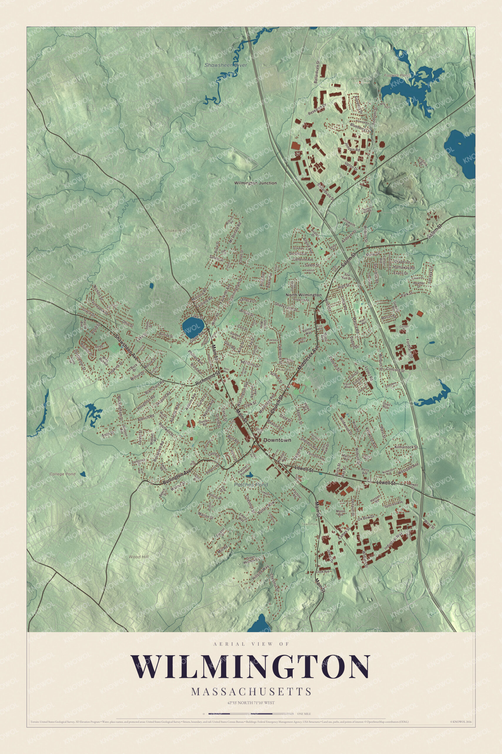
A new map of Wilmington, Massachusetts, made in 2026 and printed to order on thick archival matte paper.
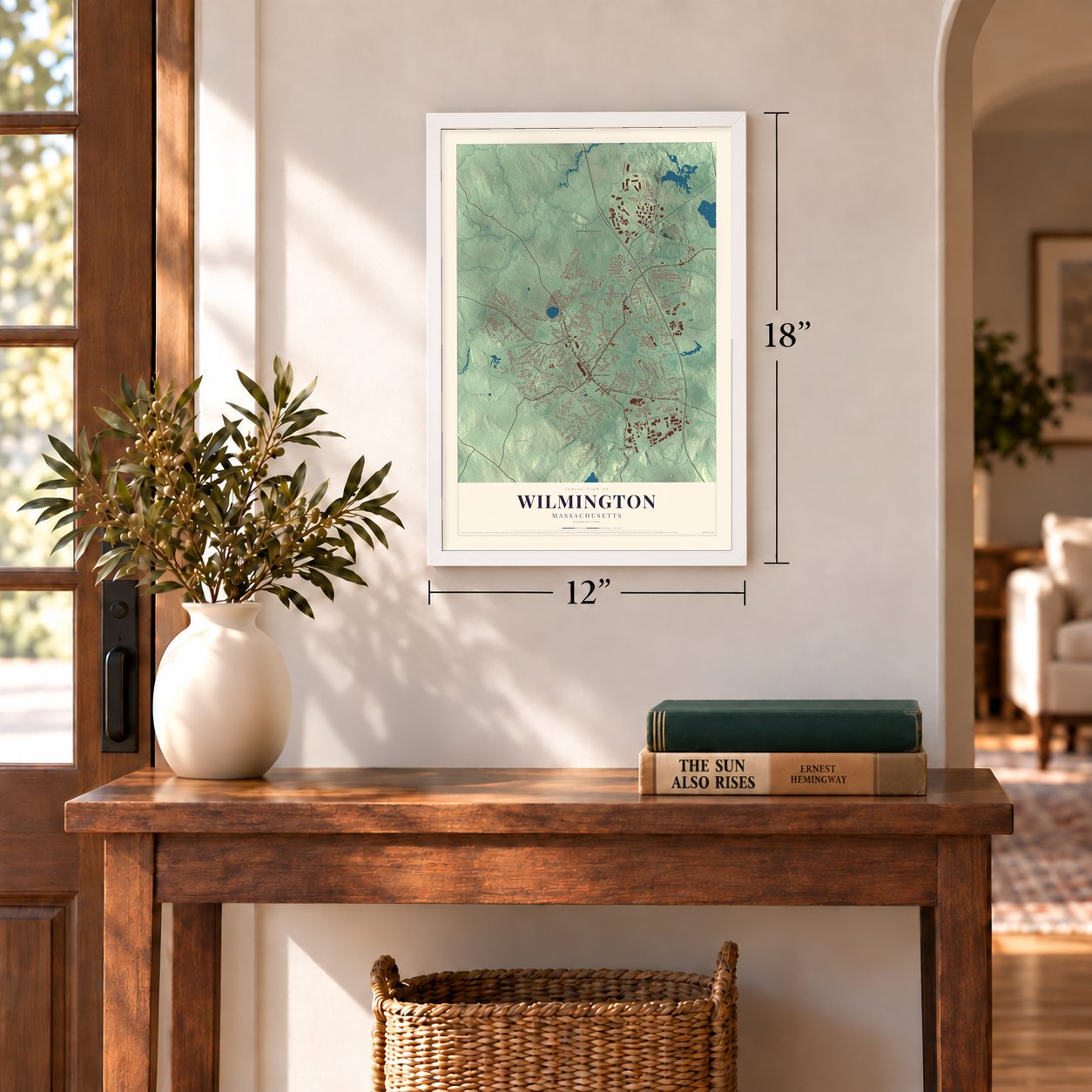
12" x 18" Archival Matte Print
A Map of Home. A Work of Art.
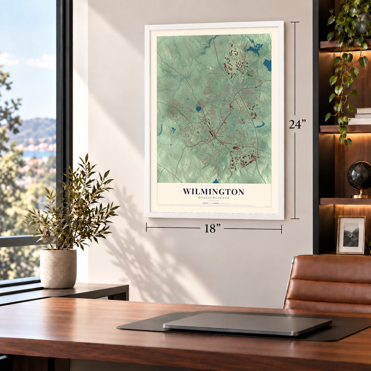
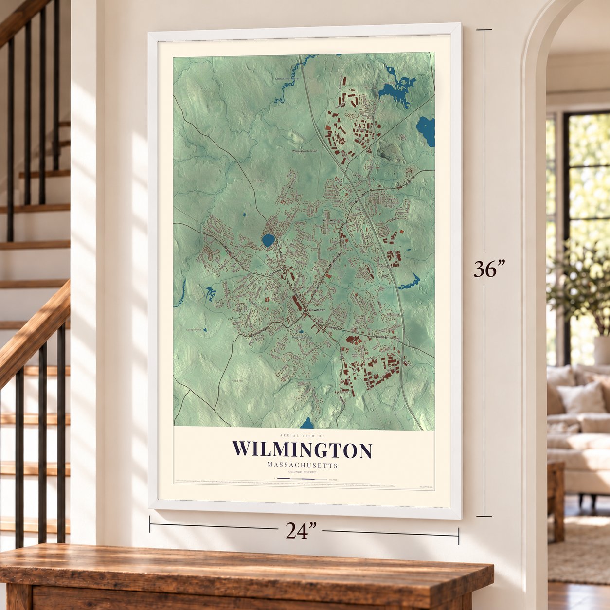
Bring a piece of Wilmington home. Whether it’s where you grew up, your current home, or simply a moment in your life, this Wilmington, Massachusetts map print brings those memories to your wall. Antique-inspired styling and modern geographic detail combine to create artwork that’s beautiful from across the room, with plenty to study and explore when you get up close.
Three ways to hang it
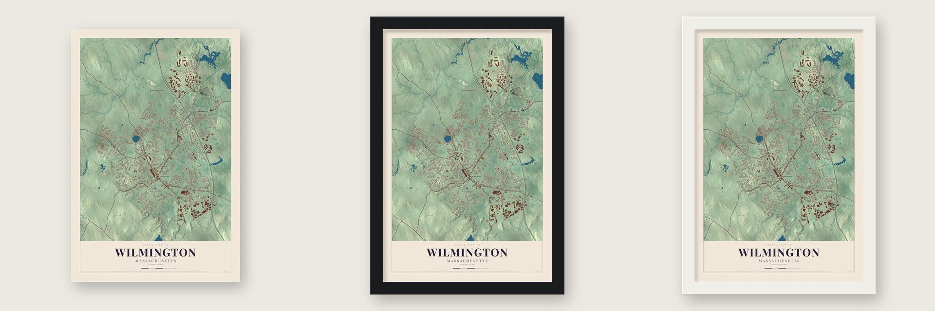
Unframed archival matte, a black wood frame or a white wood frame.
Up close
Real geography. Art worth displaying.
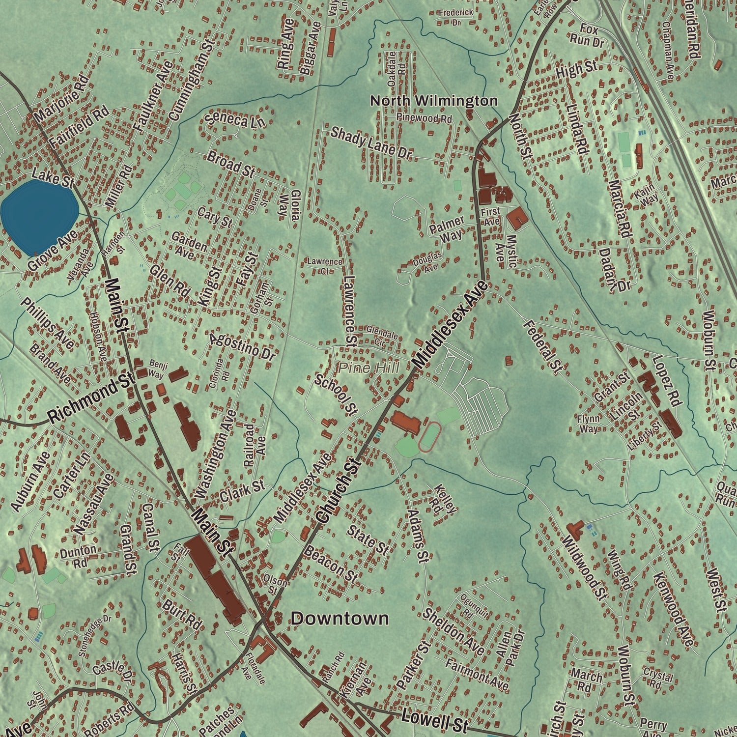
This map was created using accurate cartographic data and authoritative geographic sources, including the U.S. Geological Survey (USGS) and FEMA. The map brings together terrain, waterways, roads, and building detail. The majority of the streets are labeled, houses are accurately depicted, and the topography is derived from government sources. Combining local data with carefully composed color and shading leads to this beautifully detailed Wilmington artwork for your wall.
Rather than simply showing street outlines, we’ve included as many of the street names as we could reasonably fit on the map while keeping their names legible. Zoom in on the high resolution preview to see exactly what’s on the map. We truly set out to create a statement piece for anyone who loves Wilmington. So whether it’s for you, or a gift for someone you love, we hope this map of Wilmington brings back fond memories.
Explore the full map of Wilmington, Massachusetts and read about the local places it shows.

About Wilmington, Massachusetts: Home, Street by Street
Wilmington's recorded European settlement began in 1639, and the community became an incorporated Massachusetts town in 1730. It is part of Middlesex County, and the 2020 census counted 23,349 residents. Harnden Tavern is among the local properties represented in National Register records.
- Settlement in 1639Recorded European settlement in Wilmington began in 1639.
- Incorporated in 1730Wilmington became an incorporated Massachusetts town in 1730.
- Middlesex CountyWilmington is part of this Massachusetts county.
- 23,349 residentsThe 2020 census counted 23,349 people in Wilmington.
- Harnden TavernThis property appears in Wilmington's National Register records.
Find your street
Names on the Wilmington map
Every name below is printed on this map. Look for your street, your school, the park where you played, or the pond down the road.
Places and landmarks12
- Downtown
- Pine Hill
- Snake Hill
- Wood Hill
- College Pond
- Fosters Pond
- Shawsheen River
- Patches Pond
- Town Park
- Wilmington Town Forest
- North Wilmington
- Wilmington Junction
Streets and roads213
- Burlington Avenue
- Church Street
- Middlesex Avenue
- Salem Street
- Main Street
- Lowell Street
- Shawsheen Avenue
- Richmond Street
- Marion Street
- Lake Street
- Hopkins Street
- Dorchester Street
- Chestnut Street
- Woburn Street
- Ballardvale Street
- Andover Street
- West Street
- Glen Road
- Aldrich Road
- Federal Street
- Concord Street
- Wildwood Street
- Research Drive
- Industrial Way
- Boutwell Street
- Grove Avenue
- Lawrence Street
- Forest Street
- Fiorenza Drive
- Upton Drive
Show all 213 streets
- Jonspin Road
- Fordham Road
- Arlene Avenue
- Park Street
- Mc Donald Road
- Adams Street
- Nichols Street
- Carter Lane
- North Street
- High Street
- Butters Row
- Eames Street
- Hathaway Road
- Parker Street
- Pouliot Place
- Houghton Road
- Roosevelt Road
- Shady Lane Drive
- Marcia Road
- Cunningham Street
- Faulkner Avenue
- Clark Street
- Lucaya Circle
- King Street
- Mill Road
- Grace Drive
- Hillside Way
- Moore Street
- Evans Drive
- Jacquith Road
- Sheridan Road
- Washington Avenue
- Blanchard Road
- Kilmarnock Street
- School Street
- Kenwood Avenue
- Linda Road
- Ox Bow Drive
- Westdale Avenue
- Phillips Avenue
- Dadant Drive
- Buckingham Street
- Marie Drive
- Burt Road
- Marjorie Road
- Apache Way
- Auburn Avenue
- Nassau Avenue
- Broad Street
- Blueberry Lane
- Agostino Drive
- Draper Drive
- Canal Street
- Grand Street
- Beacon Street
- Seneca Lane
- Fairfield Road
- Ohio Street
- Lopez Road
- Sheldon Avenue
- Jewel Drive
- Denault Drive
- Fay Street
- Reed Street
- Ring Avenue
- Birch Street
- Wilton Drive
- Walnut Street
- Bay Street
- State Street
- Avon Street
- South Street
- Winston Avenue
- Avalon Drive
- Palmer Way
- Swain Road
- Allen Park Drive
- Fairmeadow Road
- Marcus Road
- Eleanor Drive
- Garden Avenue
- Roberts Road
- Burnap Street
- Dell Drive
- Brand Avenue
- Ainsworth Road
- Mink Run Road
- Dorothy Avenue
- Railroad Avenue
- Fairmont Avenue
- Castle Drive
- Catherine Avenue
- Harold Avenue
- Mystic Avenue
- Biggar Avenue
- Heather Drive
- Morse Avenue
- Suncrest Avenue
- Green Meadow Drive
- Patches Pond Lane
- Dunton Road
- Fox Run Drive
- Cary Street
- Royal Street
- Beech Street
- Rollins Road
- Congress Street
- Carson Avenue
- Virginia Road
- Lords Court
- Cook Avenue
- Kelley Road
- Gowing Road
- Cobalt Street
- Lt Buck Drive
- Miller Road
- Harris Street
- Gloria Way
- Factory Road
- Hanson Road
- Grant Street
- Wabash Road
- Wing Road
- Kiernan Avenue
- Lincoln Street
- Perry Avenue
- Emery Way
- March Road
- Quail Run
- Day Street
- Towpath Drive
- Oakdale Road
- McGrane Road
- Chapman Avenue
- Pinewood Road
- Hobson Avenue
- Gunderson Road
- Cross Street
- Ella Avenue
- Cushing Drive
- Willard Circle
- Nickerson Avenue
- Crystal Road
- Veranda Avenue
- Oak Street
- Cherokee Lane
- Treasure Hill Road
- Liberty Street
- Olson Street
- Flynn Way
- Gorham Street
- Mozart Avenue
- Valyn Lane
- Cornell Place
- Clifton Street
- Baland Road
- Kajin Way
- First Avenue
- John Street
- Fall Street
- Ashwood Avenue
- Freeport Drive
- Douglas Avenue
- Stonehedge Drive
- Elizabeth Drive
- Earles Row
- Frederick Drive
- Glendale Circle
- Manning Street
- Clorinda Road
- Russell Road
- Lawrence Court
- Wirth Avenue
- Benji Way
- Ranch Road
- Doane Street
- Progress Way
- Harnden Street
- Ogunquit Road
- Floradale Avenue
- Bruning Road
- Jordan Street
- Lee Avenue
Names are listed as they appear on the printed map. Zoom into the product photos to find them.
The art of mapping a place
How This Map Was Made
Real places. Remarkable detail. Discover the layers that turn geographic data into a map of home.

The view from above
Aerial imagery reveals the character of the land: woodland, open fields, and the patterns of a place.

The shape of the land
Elevation data brings hills, valleys, and subtle changes in the landscape into view.

The details of home
Roads, waterways, and building footprints come together to make the map feel unmistakably local.

Geography becomes art
Considered color, shading, and typography bring the layers together in a map made for your wall.


Process illustrated with Mendon, Massachusetts. Aerial imagery: USDA NAIP. Terrain: USGS 3D Elevation Program. Map details and finished artwork: KNOWOL.
The Details
About This Print
Choose an archival matte print, or a black or white Ayous wood frame. The archival matte print is unframed.
Select your size and finish above to see the matching product image and price.
Materials & Craftsmanship
A contemporary map with the character of a classic atlas, printed on archival matte paper. Optional frames are made from Ayous wood.
Your printed map does not include the watermark shown in the full-map preview.
Shipping & Delivery
Free shipping within the United States. Every print is made to order in the USA.
Buying a gift? Add a note in your cart and we'll include it. We never put prices in the package.
Prints ship within 2 to 3 business days. Allow 7 to 10 days total from ordering for delivery. Timing may vary during holidays or periods of high order volume.
Read our shipping policy.
Returns and damaged prints
Each print is made to order. Change-of-mind refunds are not available after production.
If your print arrives damaged, misprinted or incorrect, contact support@knowol.com within 30 days of receiving it. Include your order number, photos and a description of the issue.
Read our full refund and replacement policy. For questions about your order, email support@knowol.com.
Find your town
Looking for another city?
Find a map of home in our Massachusetts collection.
Nearby
Maps of towns near Wilmington
Know someone from one of these towns? Their map makes a great gift.


