
Search for another town


Free U.S. delivery 7 to 10 days after you order
Valparaiso, Indiana Map Art
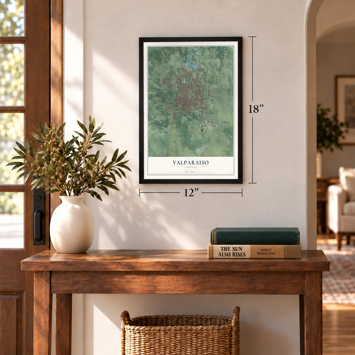
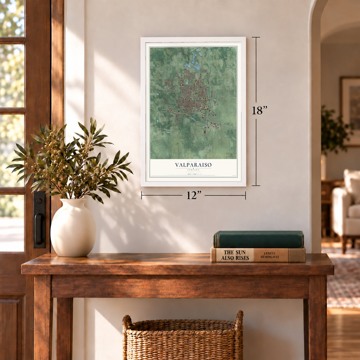
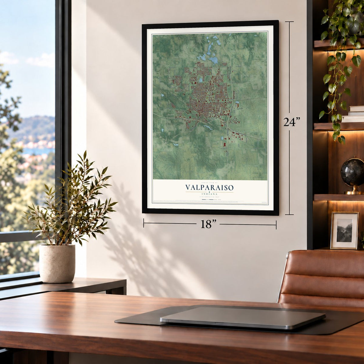
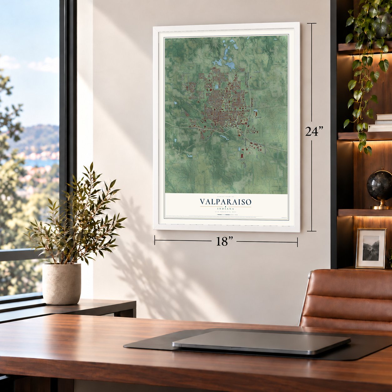
Building by building, with labeled streets and shaded relief.
12" x 18" Archival Matte Print
A Map of Home. A Work of Art.
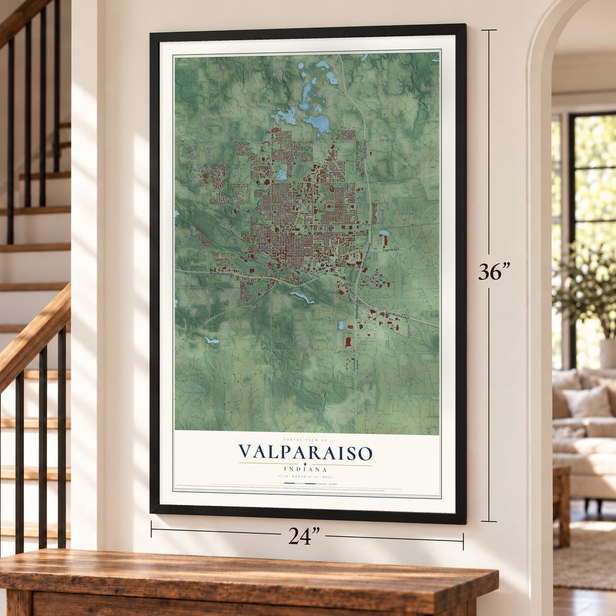
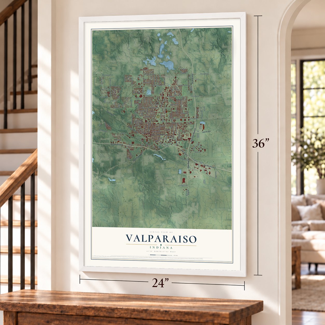
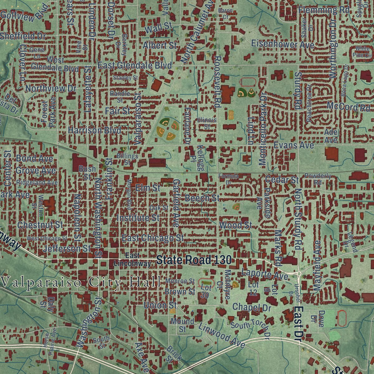
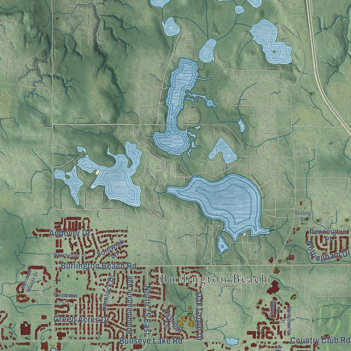
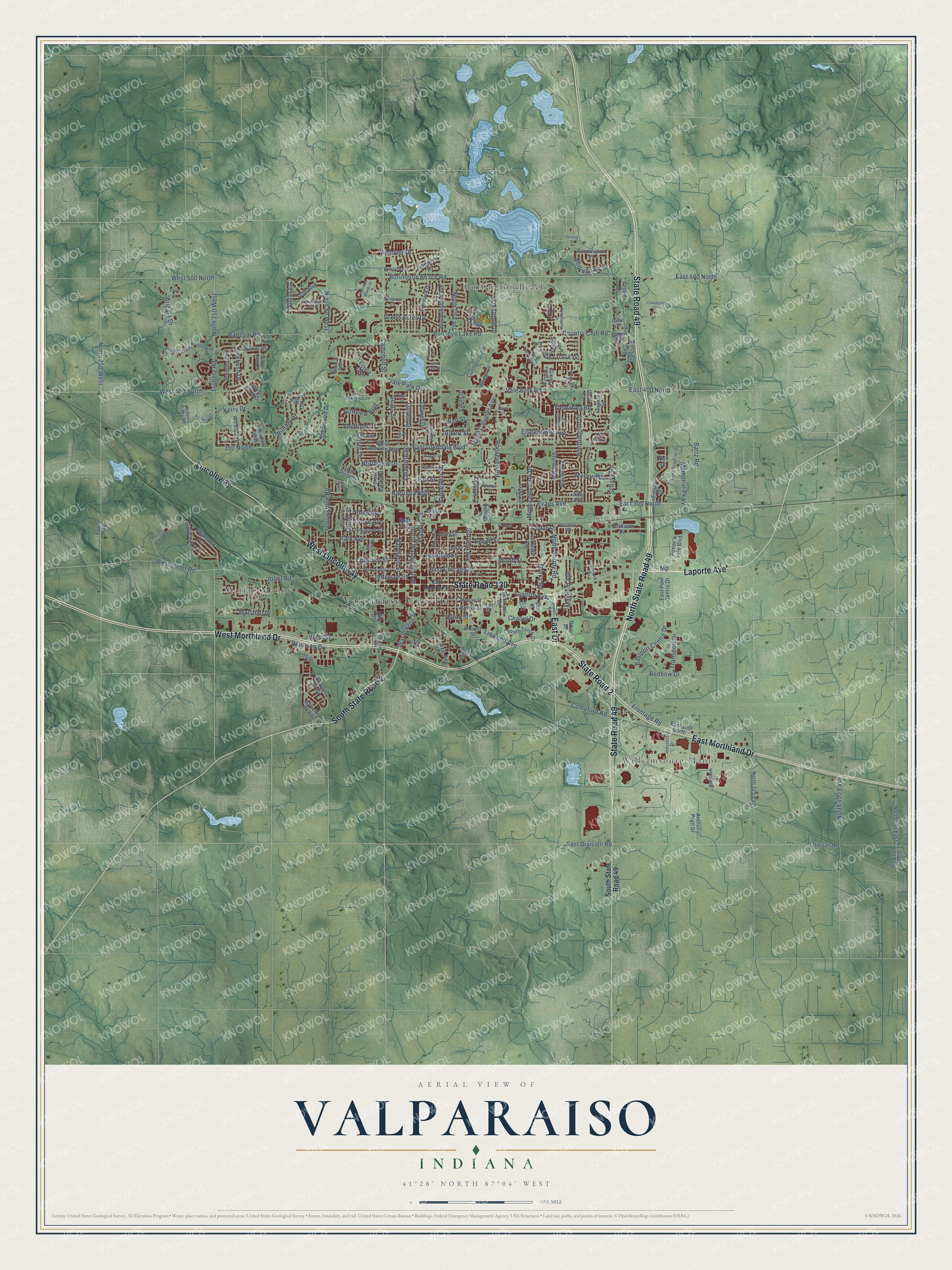
Explore Valparaiso, Indiana from a whole new perspective. Created using aerial imagery and detailed geographic data, this map captures Valparaiso building by building, with labeled streets, familiar landmarks, and shaded topographical relief that highlights the natural contours of the landscape.
Combining modern data with the timeless character of a vintage atlas, this map is just as interesting up close as it is beautiful on the wall. Whether you grew up in Valparaiso, spent memorable years there, or call it home today, this unique map is a great way to celebrate a place that means something to you. Zoom in on the preview to look for your street, and then order a print to put your memories on the wall.
Three ways to hang it
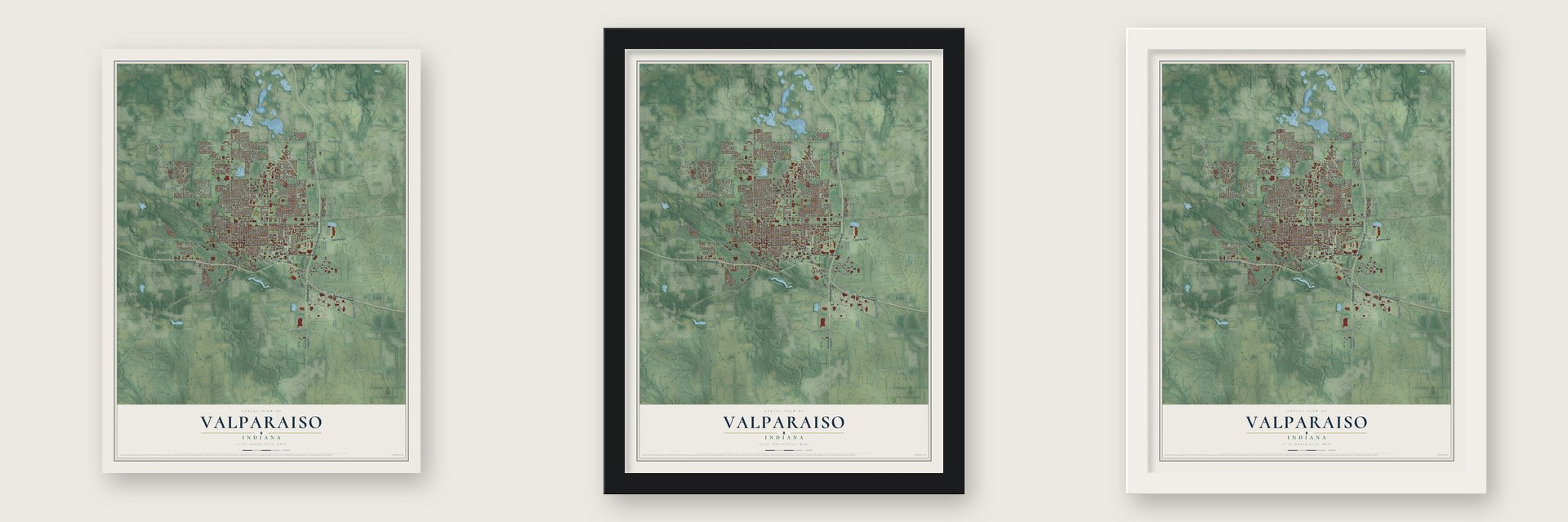
Unframed archival matte, a black wood frame or a white wood frame.
Up close
Geography Worth Displaying
This map was created using accurate cartographic data and authoritative geographic sources, including the U.S. Geological Survey and the Census Bureau. The map brings together terrain, waterways, roads, and building detail. The majority of the streets are labeled, houses are accurately depicted, and the topography is derived from government sources. Combining local data with carefully composed color and shading leads to this beautifully detailed Valparaiso artwork for your wall.
Rather than simply showing street outlines, we’ve included as many of the street names as we could reasonably fit on the map while keeping their names legible. Zoom in on the high resolution preview to see exactly what’s on the map. We truly set out to create a statement piece for anyone who loves Valparaiso. So whether it’s for you, or a gift for someone you love, we hope this map of Valparaiso brings back fond memories.
Read the story behind this map of Valparaiso, Indiana from 2026.

Find your street
Names on the Valparaiso map
Every name below is printed on this map. Look for your street, your school, the park where you played, or the pond down the road.
Places and landmarks4
- Valparaiso City Hall
- Burlington Beach
- Williamsburg Manor
- Marian Manor
Streets and roads215
- State Road 49
- North State Road 49
- State Road 130
- West Morthland Drive
- East Drive
- East Morthland Drive
- Laporte Avenue
- State Road 2
- West Lincolnway
- Lincolnway
- South State Road 2
- Sturdy Road
- North Sturdy Road
- Washington Street
- Axe Avenue
- Flemming Road
- Burlington Beach Road
- North Washington Street
- Union Street
- Winter Lane
- Vale Park Road
- Campbell Street
- Bullseye Lake Road
- Silhavy Road
- North Calumet Avenue
- Valparaiso Street
- Evans Avenue
- Harrison Boulevard
- Beech Street
- Joliet Road
Show all 215 streets
- North 150 West
- East Chicago Street
- Frontage Road
- Roosevelt Road
- East Glendale Boulevard
- Froberg Road
- Franklin Street
- Ransom Road
- Lafayette Street
- Memorial Parkway
- Napoleon Street
- East Division Road
- Eisenhower Avenue
- McCord Road
- Institute Street
- West 400 North
- Elm Street
- Garfield Avenue
- Wood Street
- West Street
- East 500 North
- East 400 North
- Sheffield Drive
- Comeford Road
- North 75 East
- West 500 North
- Park Avenue
- West Joliet Road
- Northview Drive
- Yellowstone Road
- North 250 West
- Country Club Road
- William Drive
- Monticello Park Drive
- Andover Drive
- Sherwood Drive
- Oak Grove Drive
- Eastport Centre Drive
- Kickbush Drive
- North 400 East
- Green Acres Drive
- East 300 North
- Vale Park Drive
- Center Street
- Golfview Boulevard
- North 50 West
- Chapel Drive
- Linwood Avenue
- Galway Drive
- Linden Drive
- Worthington Drive
- 350 North
- Clover Lane
- Redbow Drive
- Mayfield Avenue
- Chestnut Street
- Bartz Road
- Brigata Drive
- Wall Street
- Fair Street
- Nottingham Drive
- Transport Drive
- Peterson Drive
- Jefferson Street
- Grove Avenue
- Bond Avenue
- Albert Street
- Kerry Drive
- Dorset Drive
- Marshall Drive
- Sears Street
- Lind Lane
- Marks Road
- Cedar Street
- South State Road 49
- Cumberland Drive
- Brown Street
- Divison Road
- Tower Road
- Old Oak Drive
- Danvers Parkway
- Del Vista Drive
- Walker Drive
- Chandana Trail East
- Bloomingdale Avenue
- Shamrock Lane
- West Glendale Boulevard
- West Wind Drive
- South Torch Drive
- Hemlock Drive
- East 100 North
- Byfield Parkway
- Anthony Pratt Drive
- Jade Boulevard
- East Port Centre Drive
- North 450 East
- North 325 East
- Prentiss Drive
- Hastings Terrace
- Bush Street
- Blue Grouse Street
- Porter's Vale Boulevard
- Wicklow Drive
- Forest Park Avenue
- Fordwick Lane
- Pennington Place
- Hendon Way
- Village Lane
- Valley Drive
- Fairlane Drive
- Parkside Avenue
- Cascade Drive
- Ade Avenue
- McIntyre Court
- Virginia Park Drive
- Club Court
- Nick Drive
- Treaty Drive
- Kellogg Place
- South 450 East
- Crown Drive
- Emma Court
- Mound Street
- Forest Glen
- Dove Drive
- Brick Street
- Lot 30
- Lot 9
- Daly Street
- Lot 12
- Finney Drive
- Powderly Road
- Pepper Creek Bridge Parkway
- Monroe Street
- Oak Street
- Peachtree Drive
- Lake Superior Drive
- Weston Street
- Ridgeland Avenue
- Milton Street
- Shaker Drive
- Randle Street
- Viking Street South
- Industrial Drive
- Black Partridge Lane
- Berkley Drive
- Pepper Ridge Road
- Vine Street
- Billings Street
- Raystone Drive
- Ore Street
- South Street
- Windsor Trail
- Winter Park Drive
- Gene Lane
- Spyglass Drive
- Tanager Avenue
- Pineview Lane
- Legend Drive
- Illinois Street
- Parker Drive
- Carter Court
- East Lincolnway
- Morgan Boulevard
- Hatch Lake Parkway
- West Chicago Street
- Meridian Woods Drive
- Horse Prairie Avenue
- Boca Lago Drive
- White Pine Circle
- Gleneagles Boulevard
- Diamond Boulevard
- Worchester Drive
- Bridgewater Drive
- Urschel Drive
- Siena Drive
- Community Drive
- Brisbane Drive
- Stanley Street
- High Street
- Formula Drive
- Lake Side Drive
- Stirling Drive
- Calvin Avenue
- Baron Court
Names are listed as they appear on the printed map. Zoom into the product photos to find them.
About Valparaiso, Indiana
Valparaiso is a city of 34,151 people and the seat of Porter County, part of the Chicago metropolitan area. The United States bought this land from the Potawatomi in October 1832, and a Potawatomi village called Chiqua's town stood on the Sauk Trail, about a mile east of today's courthouse, until after that year. The first log cabin went up in 1834, and the town was founded in 1836 as Portersville.
In 1837 the town took a new name, Valparaiso, Spanish for "Vale of Paradise." The name honored Valparaíso, Chile, where David Porter, the man the county is named for, fought a battle during the War of 1812. The Pittsburgh, Fort Wayne and Chicago Railroad arrived in 1858 and gave the town a direct link to Chicago, and by 1910 an interurban line also ran to Gary.
- A college for men and womenValparaiso Male and Female College opened here in 1859. It was one of the first schools in the country to admit both men and women. It shut down in 1871 but came back in 1873 under the name Northern Indiana Normal School and Business Institute. Early in the 20th century the name changed to Valparaiso College, then Valparaiso University. It was Methodist at first, joined the Lutheran University Association after 1925, and grew a great deal after World War II.
- A tower 168 feet tallThe Porter County Courthouse was finished in 1883, replacing an earlier brick building, and it measures 128 feet by 98 feet. A square tower with a clock on each side rose 168 feet from its center. A fire in 1934 damaged the inside of the building, and the tower had to be taken down.
- The Popcorn FestivalOrville Redenbacher lived in Valparaiso and built a popcorn factory here. The city honors him every year with the Popcorn Festival on the first Saturday after Labor Day. He rode in most of its parades until he died in 1995.
Keep exploring Indiana
Valparaiso is one of 1,023 Indiana towns we've mapped. Every dot on the map is a print of its own.
The search covers every state, Indiana first.
Near Valparaiso
Order 2 or more town maps and save 10%. Shown in the size and finish you picked above, so they hang as a set.
- Aberdeen 12" x 18" / Archival Matte Print $39.99
- Salt Creek Commons 12" x 18" / Archival Matte Print $39.99
- Shorewood Forest 12" x 18" / Archival Matte Print $39.99

More maps nearby: South Haven, Wheeler, Malden, Lake Eliza and Chesterton.
The art of mapping a place
How This Map Was Made
Real places. Remarkable detail. Discover the layers that turn geographic data into a map of home.

The view from above
Aerial imagery reveals the character of the land: woodland, open fields, and the patterns of a place.

The shape of the land
Elevation data brings hills, valleys, and subtle changes in the landscape into view.

The details of home
Roads, waterways, and building footprints come together to make the map feel unmistakably local.

Geography becomes art
Considered color, shading, and typography bring the layers together in a map made for your wall.


Process illustrated with Mendon, Massachusetts. Aerial imagery: USDA NAIP. Terrain: USGS 3D Elevation Program. Map details and finished artwork: KNOWOL.
The Details
About This Print
Choose an archival matte print, or a black or white Ayous wood frame. The archival matte print is unframed.
Select your size and finish above to see the matching product image and price.
Materials & Craftsmanship
A contemporary map with the character of a classic atlas, printed on archival matte paper. Optional frames are made from Ayous wood.
Your printed map does not include the watermark shown in the full-map preview.
Shipping & Delivery
Free shipping within the United States. Every print is made to order in the USA.
Buying a gift? Add a note in your cart and we'll include it. We never put prices in the package.
Prints ship within 2 to 3 business days. Allow 7 to 10 days total from ordering for delivery. Timing may vary during holidays or periods of high order volume.
Read our shipping policy.
Returns and damaged prints
Each print is made to order. Change-of-mind refunds are not available after production.
If your print arrives damaged, misprinted or incorrect, contact support@knowol.com within 30 days of receiving it. Include your order number, photos and a description of the issue.
Read our full refund and replacement policy. For questions about your order, email support@knowol.com.