
Search for another town
Free U.S. delivery 7 to 10 days after you order
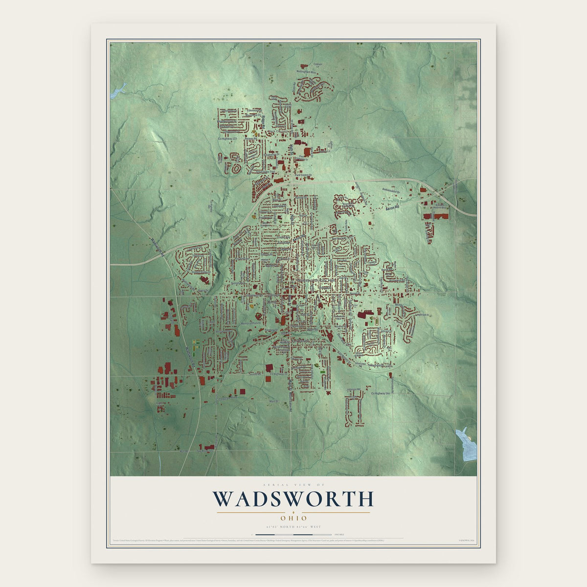
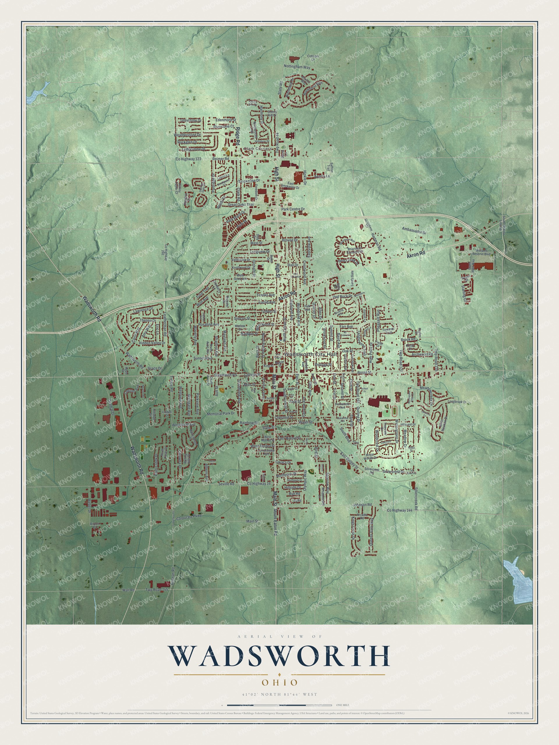
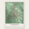
Wadsworth, Ohio Map Art
Building by building, with labeled streets and shaded relief.
12" x 18" Archival Matte Print
A Map of Home. A Work of Art.
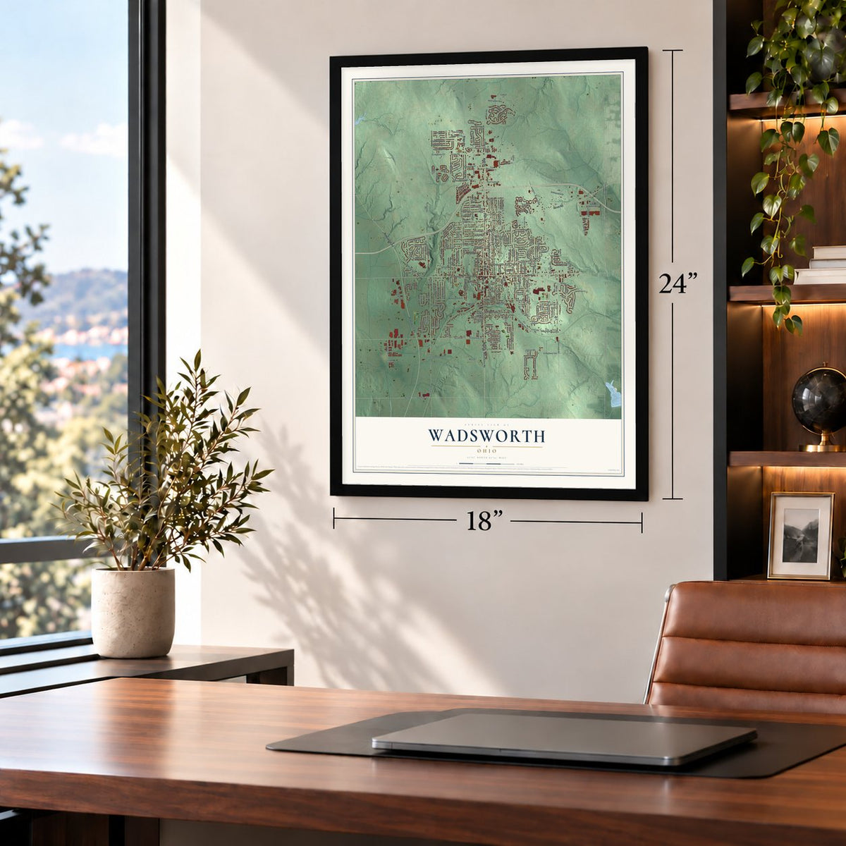
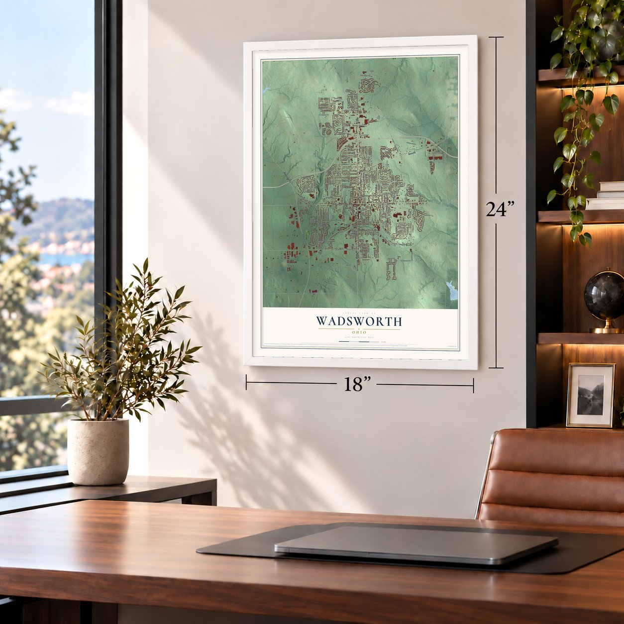
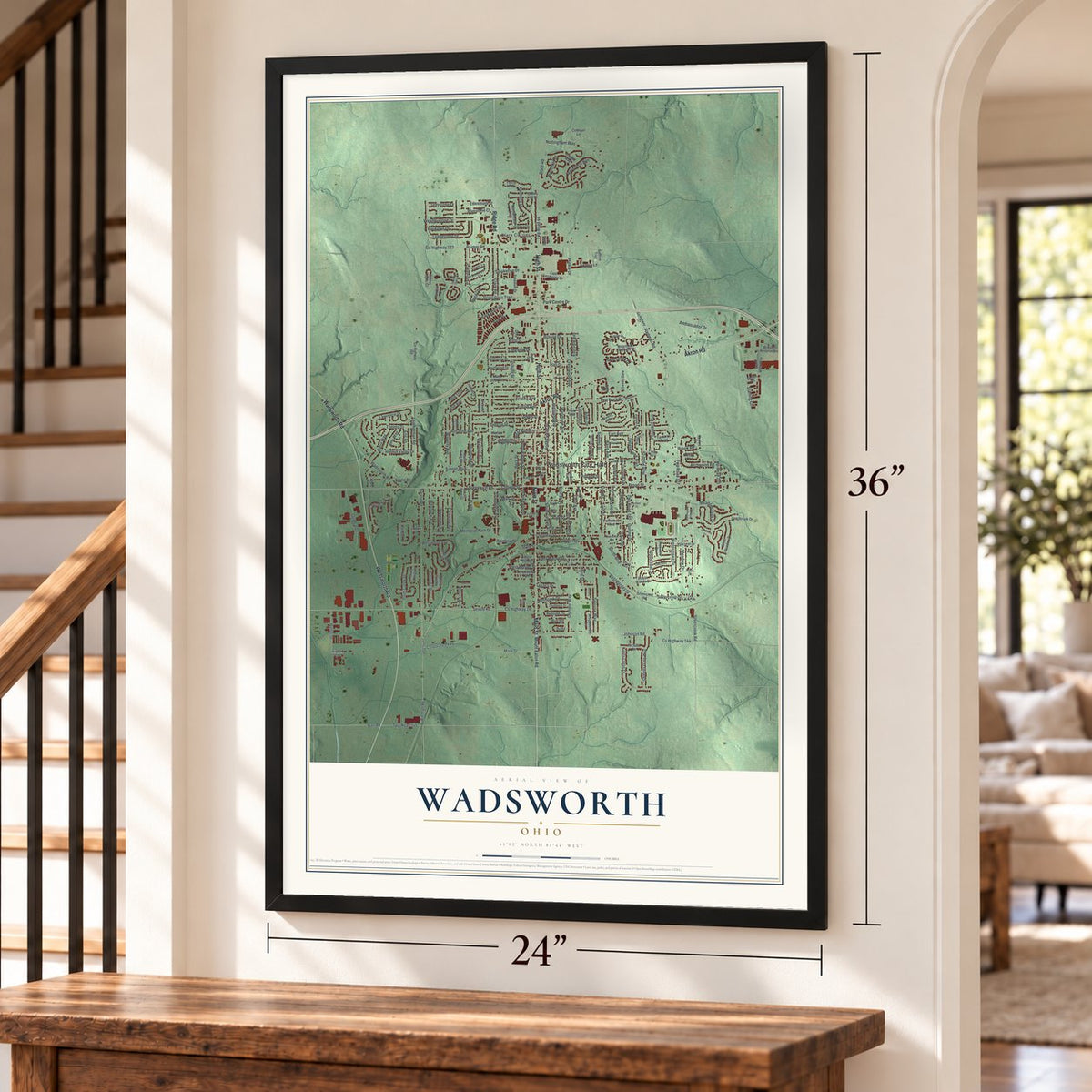
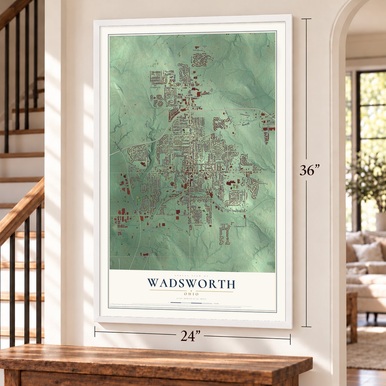
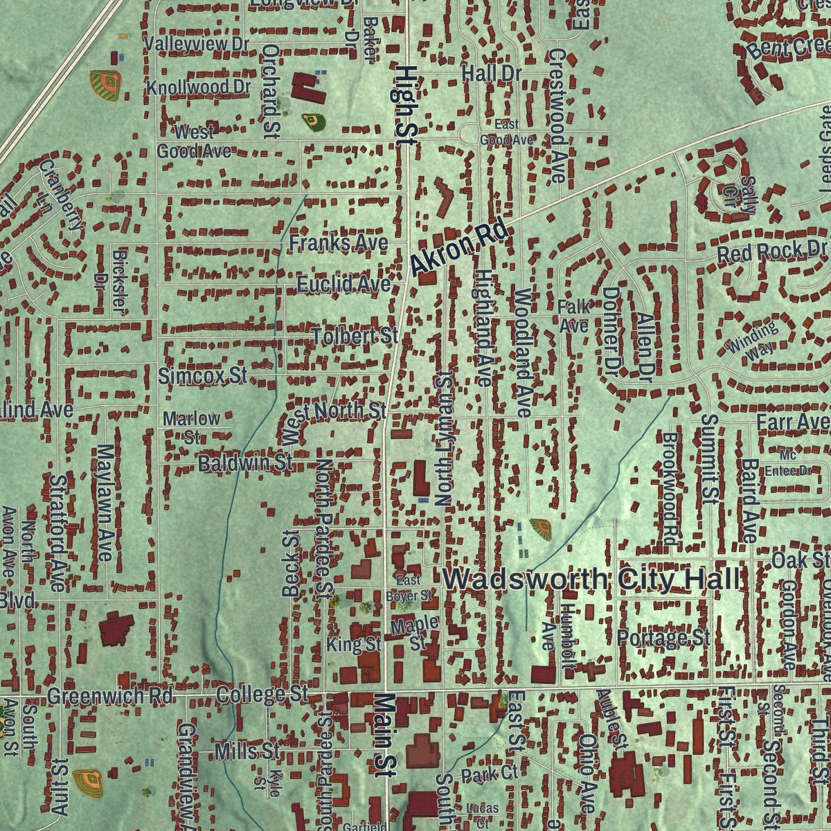
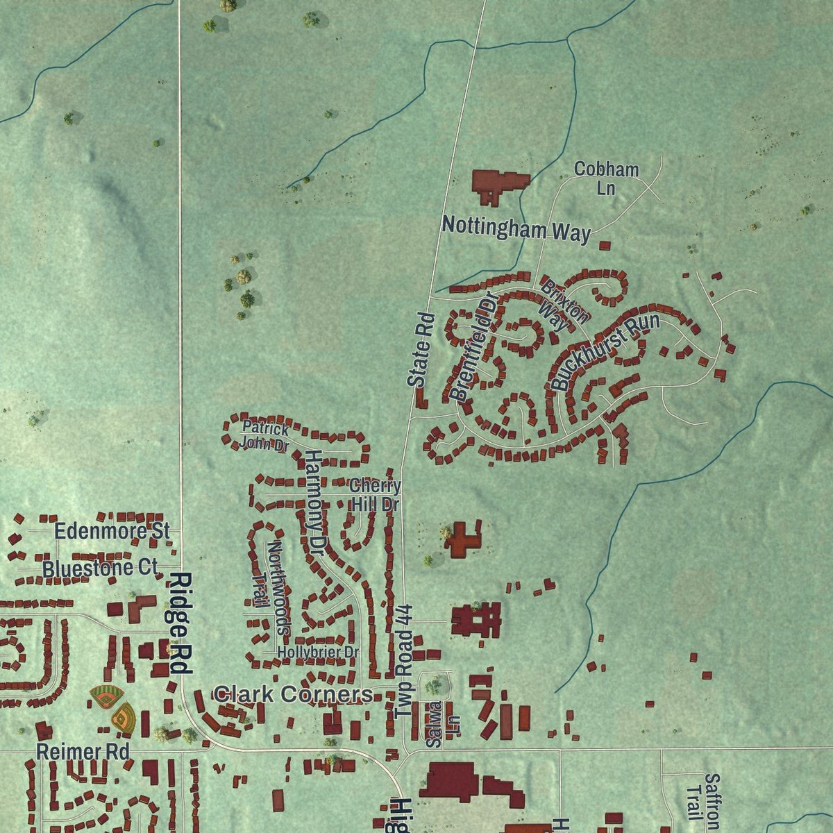
Explore Wadsworth, Ohio from a whole new perspective. Created using aerial imagery and detailed geographic data, this map captures Wadsworth building by building, with labeled streets, familiar landmarks, and shaded topographical relief that highlights the natural contours of the landscape.
Combining modern data with the timeless character of a vintage atlas, this map is just as interesting up close as it is beautiful on the wall. Whether you grew up in Wadsworth, spent memorable years there, or call it home today, this unique map is a great way to celebrate a place that means something to you. Zoom in on the preview to look for your street, and then order a print to put your memories on the wall.
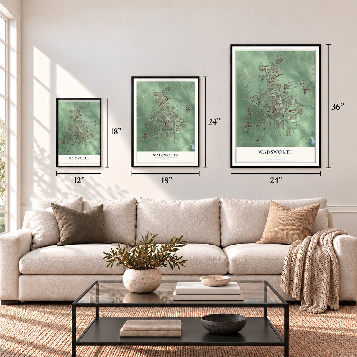
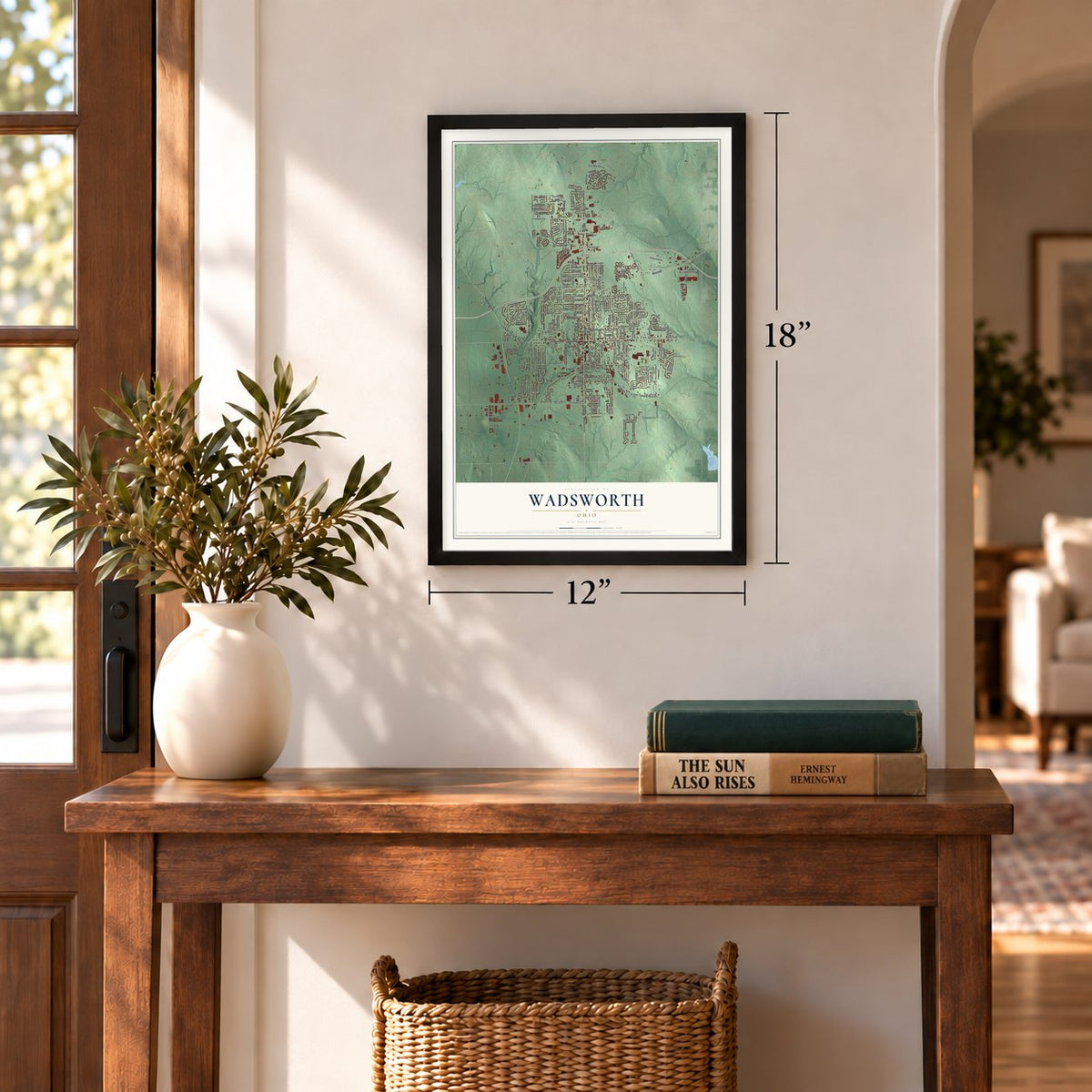
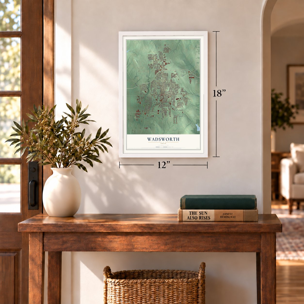
Three ways to hang it
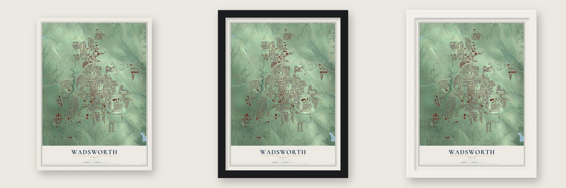
Unframed archival matte, a black wood frame or a white wood frame.
Up close
Geography Worth Displaying
This map was created using accurate cartographic data and authoritative geographic sources, including the U.S. Geological Survey and the Census Bureau. The map brings together terrain, waterways, roads, and building detail. The majority of the streets are labeled, houses are accurately depicted, and the topography is derived from government sources. Combining local data with carefully composed color and shading leads to this beautifully detailed Wadsworth artwork for your wall.
Rather than simply showing street outlines, we’ve included as many of the street names as we could reasonably fit on the map while keeping their names legible. Zoom in on the high resolution preview to see exactly what’s on the map. We truly set out to create a statement piece for anyone who loves Wadsworth. So whether it’s for you, or a gift for someone you love, we hope this map of Wadsworth brings back fond memories.
Read the story behind this map of Wadsworth, Ohio from 2026.
Find your street
Names on the Wadsworth map
Every name below is printed on this map. Look for your street, your school, the park where you played, or the pond down the road.
Places and landmarks2
- Wadsworth City Hall
- Clark Corners
Streets and roads236
- Main Street
- High Street
- Akron Road
- Wadsworth Road
- Ridge Road
- Greenwich Road
- Broad Street
- Durling Drive
- East Bergey Street
- Silvercrest Drive
- South Boulevard
- Hartman Road
- Memorial Park Drive
- First Street
- Ault Street
- Park Centre Drive
- Seville Road
- West Street
- College Street
- Silvercreek Road
- Highland Avenue
- Trease Road
- Reimer Road
- County Highway 144
- Johnson Road
- County Highway 123
- Leatherman Road
- State Street
- County Highway 16
- Woodland Avenue
Show all 236 streets
- Great Oaks Trail
- Twp Road 192
- Crestwood Avenue
- State Road
- Twp Road 44
- Summit Street
- Wolf Avenue
- Twp Road 127
- Farr Avenue
- Brentfield Drive
- Park Place Drive
- Ledgestone Drive
- North Lyman Street
- Twp Road 145
- Wall Road
- Red Rock Drive
- Tolbert Street
- Third Street
- Meadowcreek Drive
- Stratford Avenue
- High Point Drive
- Weatherstone Drive
- Orchard Street
- Sunset Boulevard
- Hidden Valley Drive
- Water Street
- Sparrow Way
- Ambassador Drive
- Simcox Street
- Chestnut Street
- Queens Gate Way
- Rittman Road
- Kings Cross Drive
- Waverly Avenue
- Lawrence Drive
- Archwood Road
- Franks Avenue
- Woodcrest Drive
- Quadral Drive
- East Walnut Street
- Oak Street
- Westview Avenue
- South Lyman Street
- East Street
- Grandview Avenue
- Chester Avenue
- Dohner Drive
- Baird Avenue
- Thelma Drive
- Nottingham Way
- Clark Road
- Carol Way
- Harmony Drive
- Westgate Avenue
- Euclid Avenue
- Buckhurst Run
- North Pardee Street
- Rosalind Avenue
- Park Place
- Fairview Avenue
- Westwood Avenue
- Pheasant Run
- Plum Creek Drive
- Baldwin Street
- Smokerise Drive
- Olympic Way
- Weber Drive
- Tanglewood Trail
- Allen Drive
- Partridge Drive
- Parkview Avenue
- Wintergreen Drive
- Brouse Drive
- Rainbow Street
- Longview Drive
- Takacs Drive
- Meadow Drive
- Mills Street
- Bent Creek Drive
- Maylawn Avenue
- Tulip Trail
- Ohio Avenue
- Northpark Drive
- Corporate Parkway
- Catawba Drive
- Park Street
- Twp Road 235
- Rockglen Drive
- Bluestone Court
- Beck Street
- West Bergey Street
- Hinkle Drive
- Edenmore Street
- Hall Drive
- Bird Street
- Acacia Lane
- Eastview Avenue
- Second Street
- Amy Way
- West North Street
- Greystone Drive
- Starling Court
- Eric Lane
- Athens Avenue
- Brook Road
- Hillside Drive
- Reedy Drive
- Grace Drive
- Rye Road
- Portage Street
- Mount Eaton Road
- Briarthorn Crescent Drive
- Williams Reserve Boulevard
- Silvercrest Road
- Longbrook Drive
- Hillsdale Circle
- North Avon Avenue
- Valleyview Drive
- West Good Avenue
- Barrenwood Drive
- Grant Allen Way
- Cobham Lane
- County Highway 260
- Hillcrest Drive
- Brixton Way
- Rolling Hills Drive
- Silver Meadow Drive
- South Medina Line Road
- East Smokerise Drive
- Tamarac Trail
- South Pardee Street
- Royal Woods Drive
- Freedom Drive
- Cherry Hill Drive
- Brookwood Road
- Ashley Taylor Court
- Leeds Gate
- Knollwood Drive
- Arcadia Road
- Falk Avenue
- Gordon Avenue
- Overlook Avenue
- Saffron Trail
- Northwoods Trail
- Terraceview Avenue
- Humbolt Avenue
- Whippoorwill Lane
- Laurel Lane
- West Walnut Street
- Sally Circle
- Fernwood Avenue
- Raven Place
- Flanders Drive
- Treeview Drive
- Linden Drive
- South Kaser Drive
- Cranberry Lane
- Forest Lane
- Bicksler Drive
- Park Court
- Marlow Street
- Auble Street
- Baker Drive
- Fixler Drive
- South Avon Street
- King Street
- Maple Street
- Airport Drive
- Kristy Court
- Kaylee Drive
- Doty Drive
- Apple Drive
- Salwa Lane
- Ry Road
- Oakcrest Drive
- County Highway 127
- Brookpoint Circle
- Sterling Oaks Drive
- Southpark Drive
- Pine Street
- Windfall Lane
- Patrick John Drive
- Kyle Street
- Briarthorn Way
- Hollybrier Drive
- Oakwood Avenue
- Newton Road
- Ivanhoe Avenue
- Winding Way
- Robin Drive
- East Good Avenue
- Twp Road 143
- County Highway 233
- East Boyer Street
- Mc Entee Drive
- Whitestone Circle
- Dalton Drive
- Garfield Street
- Morningview Ridge Circle
- School Drive
- Midway Avenue
- Clearview Circle
- Ardale Avenue
- Lucas Court
- Jessica Lane
- Barlett Street
Names are listed as they appear on the printed map. Zoom into the product photos to find them.
About Wadsworth, Ohio
Wadsworth is a Medina County city founded on March 1, 1814, and named for General Elijah Wadsworth, who owned the largest share of lands that became the county. Its population reached 24,007 in the 2020 census. Local traditions include the Blue Tip Festival, named for the strike-anywhere matches once manufactured here.
- Land and LocationWadsworth covers 10.62 square miles, all of it land, and lies a few miles south of the Saint Lawrence River Divide.
- Early Postal ServiceA post office bearing the Wadsworth name has operated since 1823.
- Blue Tip FestivalThis annual gathering features a parade, rides, food, games, merchants, entertainment, and contests.
- Historic ChurchSt. Mark's Episcopal Church was listed on the National Register of Historic Places in 1973.
- Nearby AirportsWadsworth Municipal Airport is two miles southwest of the city, while Skypark Airport is two miles west.
Keep exploring Ohio
Wadsworth is one of 1,389 Ohio towns we've mapped. Every dot on the map is a print of its own.
The search covers every state, Ohio first.
Near Wadsworth
Order 2 or more town maps and save 10%. Shown in the size and finish you picked above, so they hang as a set.
- Doylestown 12" x 18" / Archival Matte Print $39.99
- Norton 12" x 18" / Archival Matte Print $39.99
- Rittman 12" x 18" / Archival Matte Print $39.99
More maps nearby: Sharon Center, Pigeon Creek, Copley, Barberton and Seville.
The art of mapping a place
How This Map Was Made
Real places. Remarkable detail. Discover the layers that turn geographic data into a map of home.

The view from above
Aerial imagery reveals the character of the land: woodland, open fields, and the patterns of a place.

The shape of the land
Elevation data brings hills, valleys, and subtle changes in the landscape into view.

The details of home
Roads, waterways, and building footprints come together to make the map feel unmistakably local.

Geography becomes art
Considered color, shading, and typography bring the layers together in a map made for your wall.


Process illustrated with Mendon, Massachusetts. Aerial imagery: USDA NAIP. Terrain: USGS 3D Elevation Program. Map details and finished artwork: KNOWOL.
The Details
About This Print
Choose an archival matte print, or a black or white Ayous wood frame. The archival matte print is unframed.
Select your size and finish above to see the matching product image and price.
Materials & Craftsmanship
A contemporary map with the character of a classic atlas, printed on archival matte paper. Optional frames are made from Ayous wood.
Your printed map does not include the watermark shown in the full-map preview.
Shipping & Delivery
Free shipping within the United States. Every print is made to order in the USA.
Buying a gift? Add a note in your cart and we'll include it. We never put prices in the package.
Prints ship within 2 to 3 business days. Allow 7 to 10 days total from ordering for delivery. Timing may vary during holidays or periods of high order volume.
Read our shipping policy.
Returns and damaged prints
Each print is made to order. Change-of-mind refunds are not available after production.
If your print arrives damaged, misprinted or incorrect, contact support@knowol.com within 30 days of receiving it. Include your order number, photos and a description of the issue.
Read our full refund and replacement policy. For questions about your order, email support@knowol.com.