
Search for another town





Free U.S. delivery 7 to 10 days after you order
Walla Walla, Washington Map Art
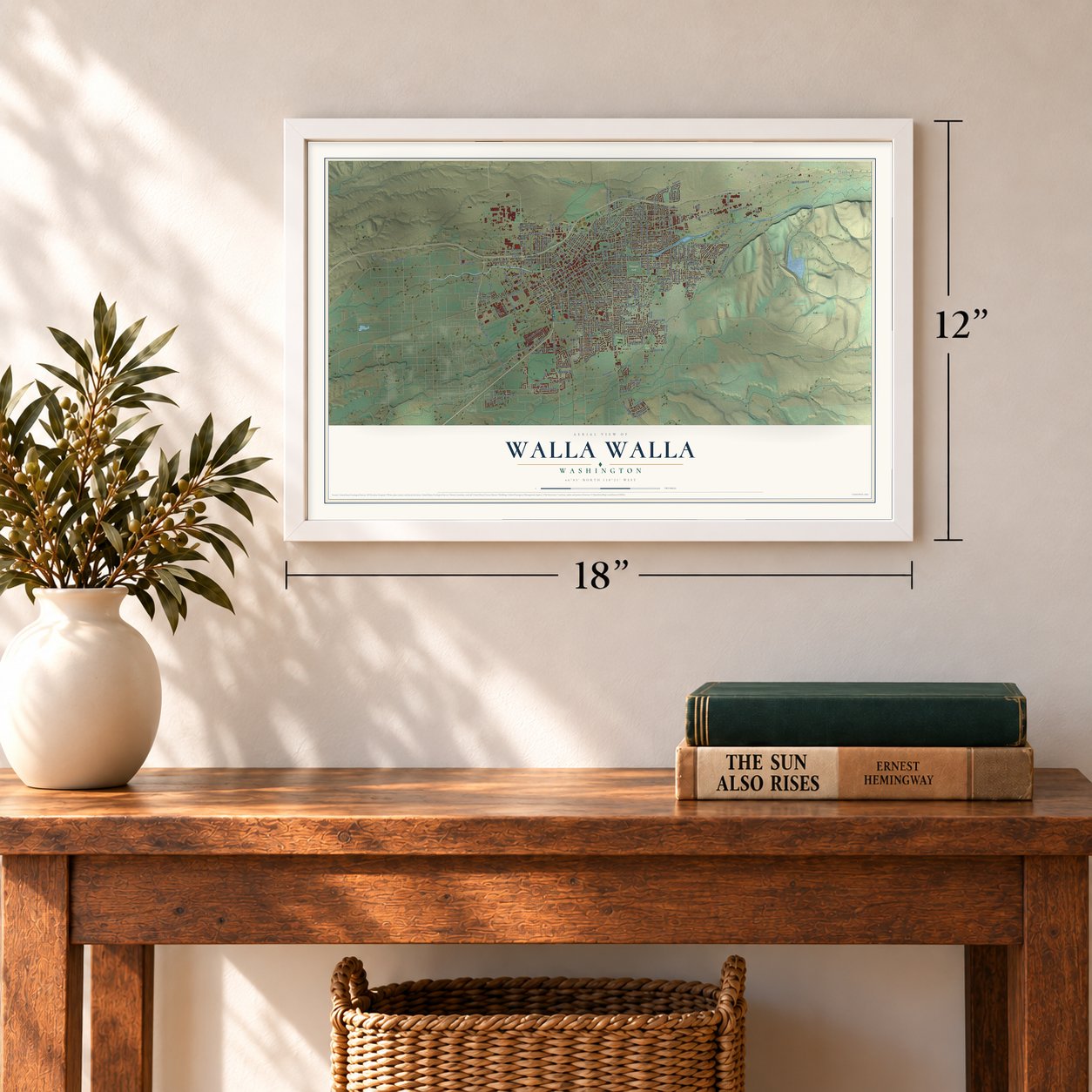
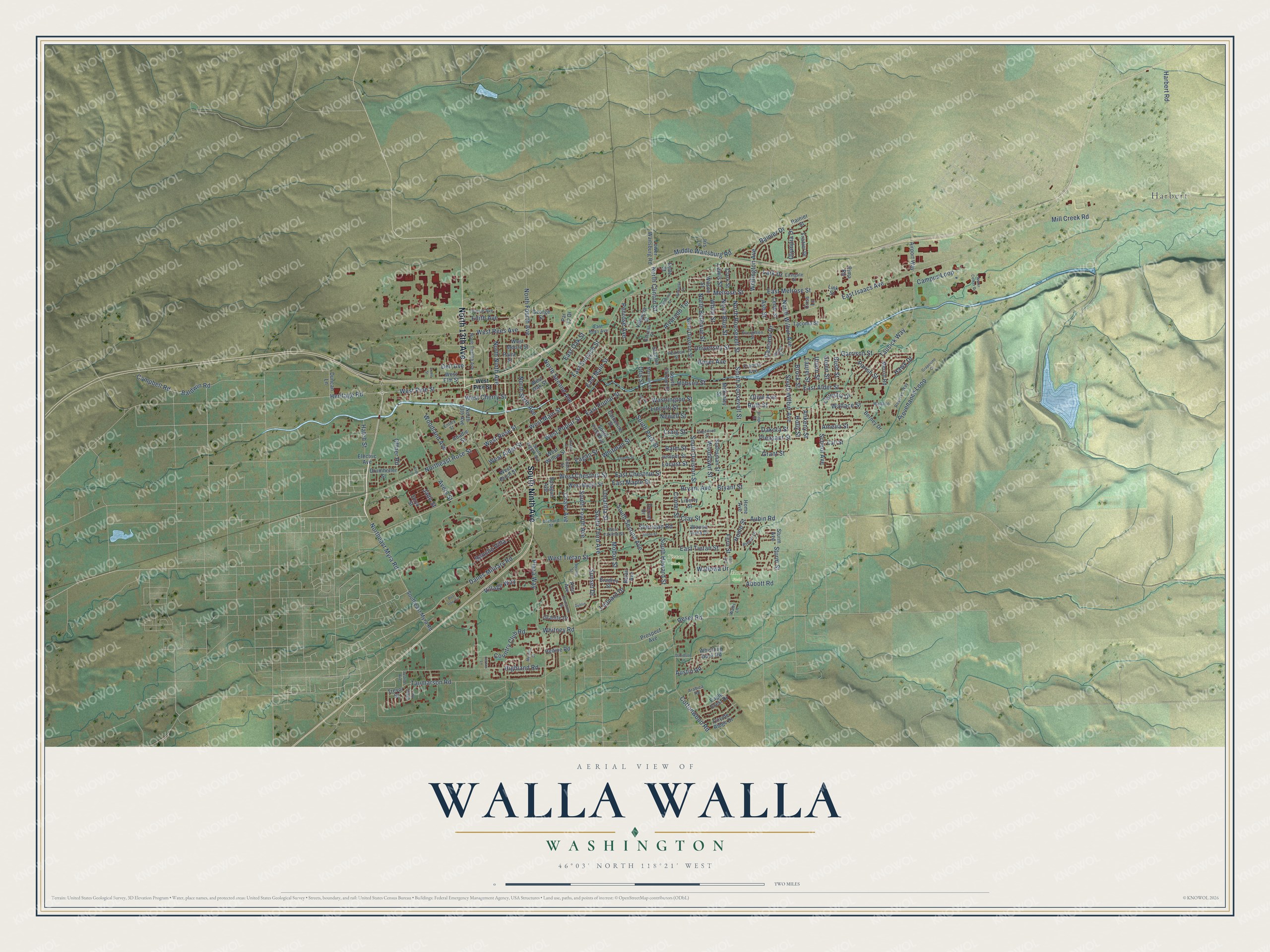
A new map of Walla Walla, Washington, made in 2026 and printed to order on thick archival matte paper.
12" x 18" Archival Matte Print
A Map of Home. A Work of Art.
Explore Walla Walla, Washington from a whole new perspective. Created using aerial imagery and detailed geographic data, this map captures Walla Walla building by building, with labeled streets, familiar landmarks, and shaded topographical relief that highlights the natural contours of the landscape.
Combining modern data with the timeless character of a vintage atlas, this map is just as interesting up close as it is beautiful on the wall. Whether you grew up in Walla Walla, spent memorable years there, or call it home today, this unique map is a great way to celebrate a place that means something to you. Zoom in on the preview to look for your street, and then order a print to put your memories on the wall.
Three ways to hang it
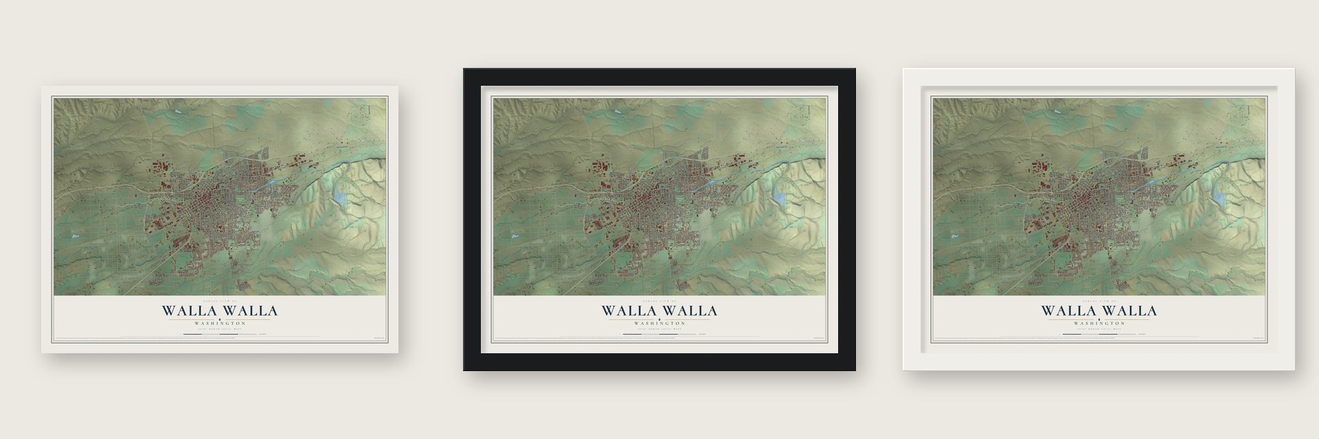
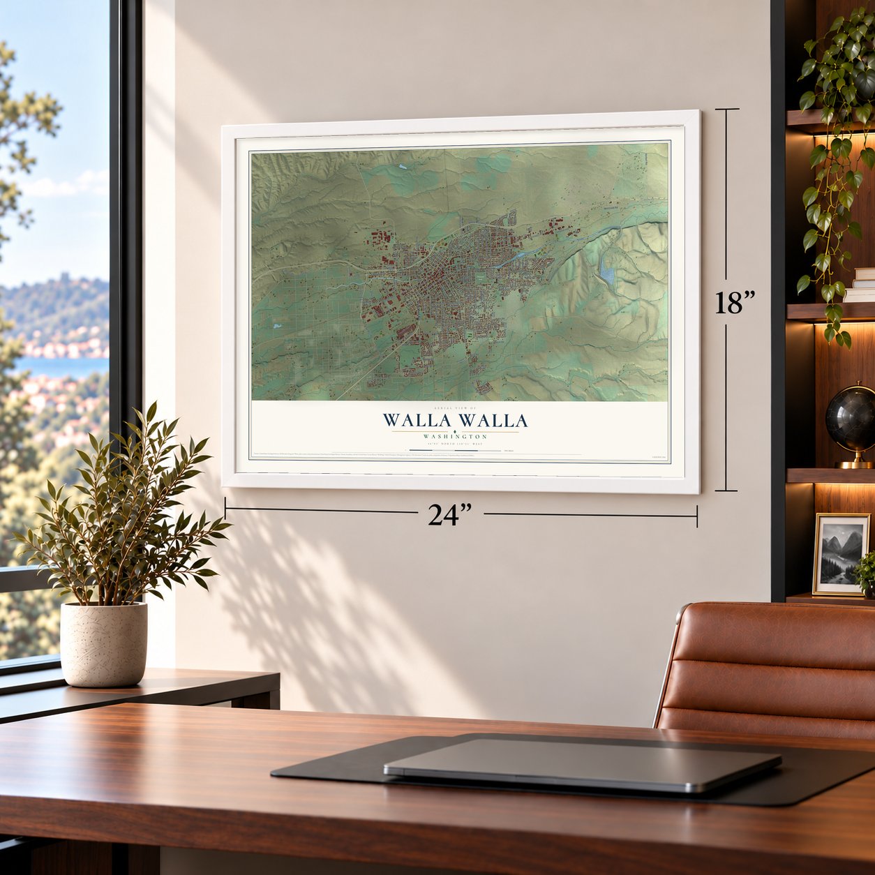
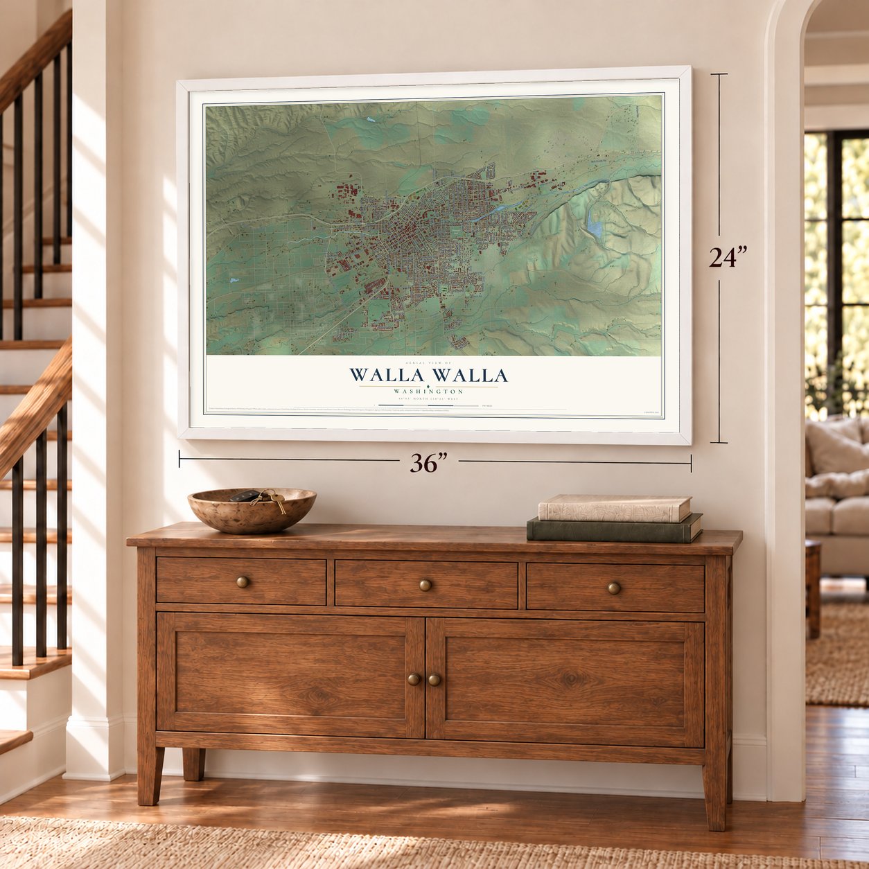
Unframed archival matte, a black wood frame or a white wood frame.
Up close
Geography Worth Displaying
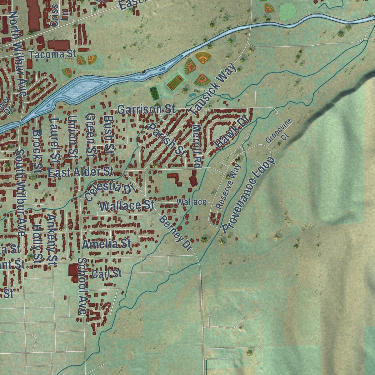
This map was created using accurate cartographic data and authoritative geographic sources, including the U.S. Geological Survey and the Census Bureau. The map brings together terrain, waterways, roads, and building detail. The majority of the streets are labeled, houses are accurately depicted, and the topography is derived from government sources. Combining local data with carefully composed color and shading leads to this beautifully detailed Walla Walla artwork for your wall.
Rather than simply showing street outlines, we’ve included as many of the street names as we could reasonably fit on the map while keeping their names legible. Zoom in on the high resolution preview to see exactly what’s on the map. We truly set out to create a statement piece for anyone who loves Walla Walla. So whether it’s for you, or a gift for someone you love, we hope this map of Walla Walla brings back fond memories.
Read the story behind this map of Walla Walla, Washington from 2026.

About Walla Walla, Washington
Walla Walla is a city of 34,060 people and the seat of Walla Walla County, in Southeastern Washington. In 1856 Lieutenant Colonel E. J. Steptoe built a temporary stockade where downtown stands today, and it borrowed the name of the old Hudson's Bay post, Fort Walla Walla. Cabins, shacks and tents gathered around it, and the settlement was first known as Steptoeville.
War with the Walla Wallas lasted until 1858. In 1859 Congress ratified the 1855 treaties and the tribes were forced onto reservations. On November 17 of that year the county commissioners voted to call the town Walla Walla. Lots were then surveyed and sold, and early business meant raising cattle and supplying the fort. The city was incorporated on January 11, 1862, and became the county seat that year. A gold rush in the early 1860s brought crowds, and the farming that came after kept them. By 1880 it was Washington Territory's largest city.
“honest and friendly ... Wallah wallahs”
- Whitman College since 1859Marcus and Narcissa Whitman were killed at their Waiilatpu mission in 1847. Cushing Eells, a former missionary colleague of theirs, bought the old mission land in 1859. He wanted to honor them with a high school for pioneer boys and girls. He won its charter on December 20, 1859, and Whitman Seminary opened on October 15, 1866. It became Whitman College, a four-year private college, in 1882. Its Memorial Building is on the National Register.
- The state's oldest bankDorsey Syng Baker, one of the city's first council members, started Baker Boyer Bank in 1869 with his brother-in-law, John Franklin Boyer. It was the first bank in the state, and as of March 2022 it was still the oldest. The John F. Boyer House is on the National Register.
- The Pen on 160 acresBusinessman Levi Ankeny donated 160 acres to the city in 1886 for a prison, while Washington was pushing to become a state. Lawmakers accepted the land, and the first inmates arrived in 1887. William Murphy, a local man sentenced to 18 years for manslaughter, was the first. After statehood in 1889 it became the Washington State Penitentiary, known to inmates as "The Walls" and "The Pen."
- Sweet onions and wineItalian settlers from Lonate Pozzolo and Calabria built the city's gardening trade and lived in neighborhoods called Blalock and the South Ninth. They planted vineyards, and Frank Orselli and Pasquale Saturno opened the first two wine tasting rooms in the 1880s. Italian growers also raised the Walla Walla sweet onion, now the official state vegetable. In 1984 the valley became its own American Viticultural Area.
Find your street
Names on the Walla Walla map
Every name below is printed on this map. Look for your street, your school, the park where you played, or the pond down the road.
Places and landmarks4
- Murr Field
- Pioneer Park
- Tietan Park
- Harbert
Streets and roads224
- South Ninth Avenue
- North 13th Avenue
- Northeast Myra Road
- West Pine Street
- Heritage Road
- Dalles Military Road
- East Main Street
- East Isaacs Avenue
- West Poplar Street
- South Second Avenue
- East Poplar Street
- East Melrose Street
- Abbott Road
- North Second Avenue
- Sturm Street
- East Alder Street
- North Roosevelt Street
- North Wilbur Avenue
- North Bellevue Street
- North Fourth Avenue
- South Roosevelt Street
- Wallace Street
- Whitman Street
- Northeast Rose Street
- West Rose Street
- South Third Avenue
- South Howard Street
- Pleasant Street
- East Sumach Street
- Fern Street
Show all 224 streets
- Boyer Avenue
- Highland Road
- Plaza Way
- West Rees Avenue
- South Fourth Avenue
- East Chestnut Street
- South Division Street
- West Chestnut Street
- Rancho Villa
- North Clinton Street
- Melrose Street
- Tausick Way
- Harbert Road
- West Cherry Street
- Home Street
- Taumarson Road
- Bryant Avenue
- Bryant Street
- Cottonwood Road
- Hobson Street
- Provenance Loop
- Dell Avenue
- University Street
- South Park Street
- Middle Waitsburg Road
- West Tietan Street
- Newell Street
- North Ninth Avenue
- West Alder Street
- Center Street
- South Wilbur Avenue
- West Main Street
- Country Club Road
- Avery Street
- Alvarado Terrace
- Wellington Avenue
- East Tietan Street
- Chase Avenue
- North Sixth Avenue
- East Maple Street
- School Avenue
- Garrison Street
- White Street
- Rainier Drive
- Locust Street
- Campus Loop
- Ruth Street
- North Blue Street
- Village Way
- Olive Avenue
- Clay Street
- Mill Creek Road
- Modoc Street
- Washington Street
- Umatilla Street
- Woodland Avenue
- Lincoln Street
- Hatch Street
- Offner Road
- Baldwin Road
- Leonard Drive
- Craig Street
- Woodlawn Street
- Edith Avenue
- Sheridan Road
- Austin Road
- Penrose Avenue
- East Oak Street
- Reser Road
- Ash Street
- Balm Street
- Sunset Drive
- Hawk Drive
- Dakota Street
- Parish Street
- Campbell Road
- Jade Street
- Eagan Street
- Cascade Drive
- Bush Street
- Celestia Drive
- Olympia Drive
- Whitney Road
- Union Street
- Aubin Road
- Wallowa Drive
- Green Street
- Ankeny Street
- Laurel Street
- Lark Drive
- Amelia Street
- Lewis Street
- Brock Street
- Grant Street
- Otis Street
- Holly Street
- Alco Avenue
- Valencia Street
- West Moore Street
- West Elm Street
- Sturm Avenue
- Onyx Street
- Belair Avenue
- Catherine Street
- South First Avenue
- Francis Avenue
- North Division Street
- Juniper Street
- West Birch Street
- West Maple Street
- Granite Drive
- West Willow Street
- South Clinton Street
- Berney Drive
- Wauna Vista Drive
- Coyote Ridge Drive
- Rainier Street
- Frazier Drive
- Southeast Myra Road
- Tacoma Street
- Home Avenue
- Sprague Avenue
- Whistling Duck Road
- Prospect Avenue
- Eagle Crest Drive
- Paine Street
- Drumheller Street
- Lower Waitsburg Road
- Liberty Street
- Par 72 Drive
- Merrill Road
- Statesman Street
- Airport Way
- Durum Drive
- Cedar Street
- West Oak Street
- Bradley Street
- Abadie Street
- George Street
- Duncan Lane
- Hedine Road
- Trevor Street
- Clark Street
- Stanton Street
- McKinley Street
- Carl Street
- Wilson Street
- Electric Avenue
- Criss Lane
- Link Street
- Belle Street
- Iris Lane
- Pima Road
- East Rees Avenue
- Eastgate Street
- Chase Street
- North Twelfth Avenue
- Orchard Street
- Evergreen Street
- South Eighth Avenue
- Boyer Drive
- Reserve Way
- Brevor Drive
- West Yakima Street
- Carrie Avenue
- Arabica Road
- Merriam Street
- Entley Street
- Pearson Street
- Estrella Street
- Wallace
- Walts Lane
- Dublin
- Bonsella Street
- Figueroa Street
- Bridge Street
- Stone Street
- Fern Avenue
- Gemstone Street
- Stevens Street
- Shelly Avenue
- Mercita Drive
- Water Center Drive
- Irene Street
- Bus One Circle
- Edgewood Street
- Grove Street
- Grapevine Court
- Davidson Lane
- Thorne Street
- Justice Avenue
- Leroux Lane
- Grape Street
- Erin Lane
Names are listed as they appear on the printed map. Zoom into the product photos to find them.
The art of mapping a place
How This Map Was Made
Real places. Remarkable detail. Discover the layers that turn geographic data into a map of home.

The view from above
Aerial imagery reveals the character of the land: woodland, open fields, and the patterns of a place.

The shape of the land
Elevation data brings hills, valleys, and subtle changes in the landscape into view.

The details of home
Roads, waterways, and building footprints come together to make the map feel unmistakably local.

Geography becomes art
Considered color, shading, and typography bring the layers together in a map made for your wall.


Process illustrated with Mendon, Massachusetts. Aerial imagery: USDA NAIP. Terrain: USGS 3D Elevation Program. Map details and finished artwork: KNOWOL.
The Details
About This Print
Choose an archival matte print, or a black or white Ayous wood frame. The archival matte print is unframed.
Select your size and finish above to see the matching product image and price.
Materials & Craftsmanship
A contemporary map with the character of a classic atlas, printed on archival matte paper. Optional frames are made from Ayous wood.
Your printed map does not include the watermark shown in the full-map preview.
Shipping & Delivery
Free shipping within the United States. Every print is made to order in the USA.
Buying a gift? Add a note in your cart and we'll include it. We never put prices in the package.
Prints ship within 2 to 3 business days. Allow 7 to 10 days total from ordering for delivery. Timing may vary during holidays or periods of high order volume.
Read our shipping policy.
Returns and damaged prints
Each print is made to order. Change-of-mind refunds are not available after production.
If your print arrives damaged, misprinted or incorrect, contact support@knowol.com within 30 days of receiving it. Include your order number, photos and a description of the issue.
Read our full refund and replacement policy. For questions about your order, email support@knowol.com.
Find your town
Looking for another city?
Find a map of home in our Washington collection, or any town in the country.
Nearby
Maps of towns near Walla Walla
Know someone from one of these towns? Their map makes a great gift.
 Walla Walla East
, Washington
From $39.99See the map
 Garrett
, Washington
From $39.99See the map
 College Place
, Washington
From $39.99See the map
More maps nearby: Dixie, Prescott, Touchet, Waitsburg and Dayton.