
Search for another town



Free U.S. delivery 7 to 10 days after you order
Warner, New Hampshire Map Art
Building by building, with labeled streets and shaded relief.
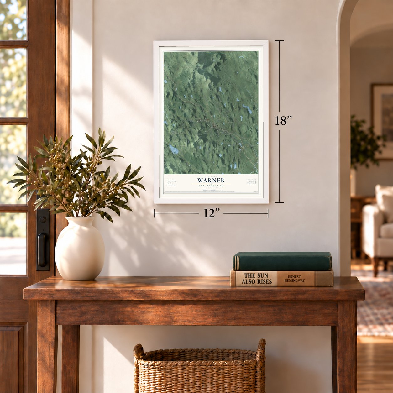
12" x 18" Archival Matte Print
A Map of Home. A Work of Art.
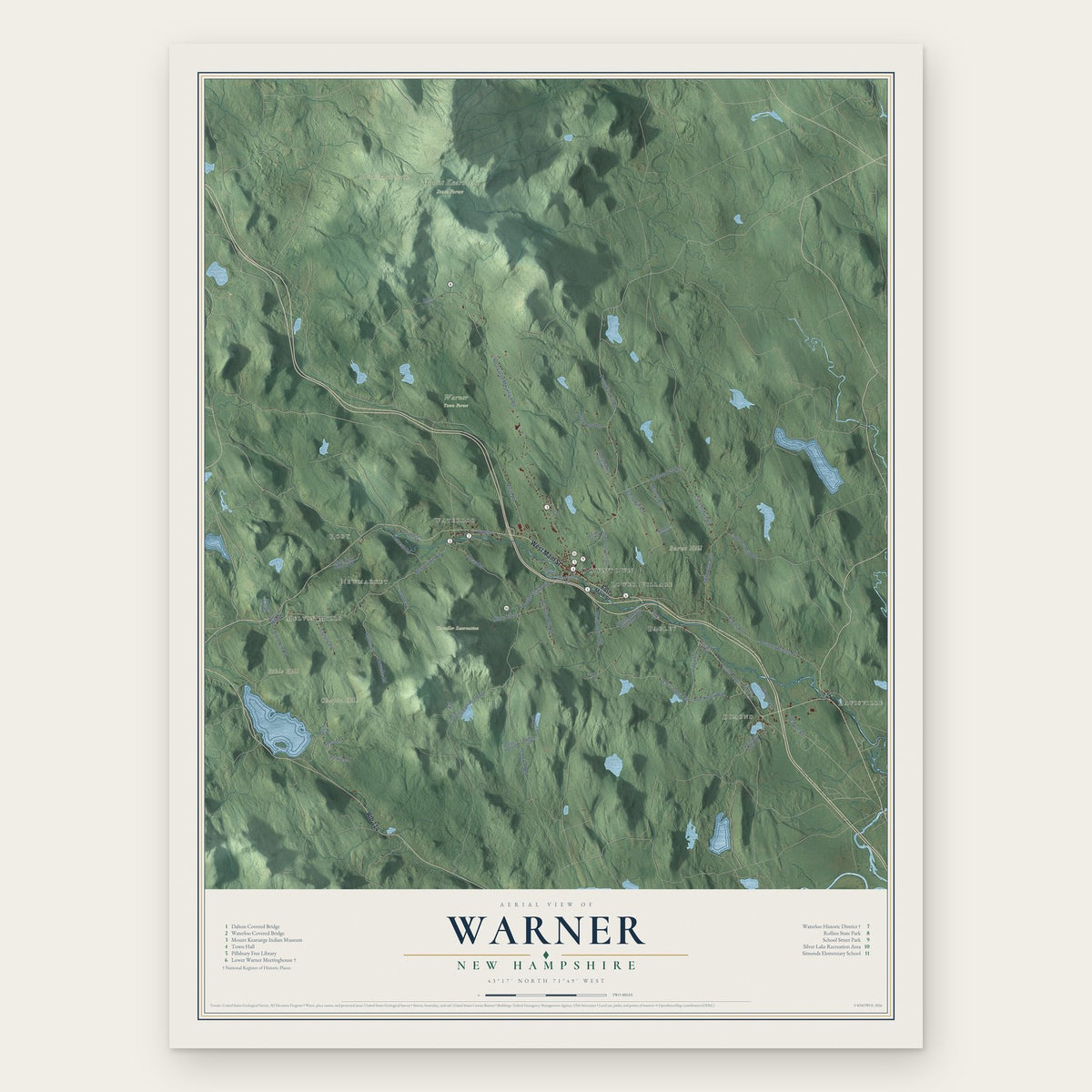
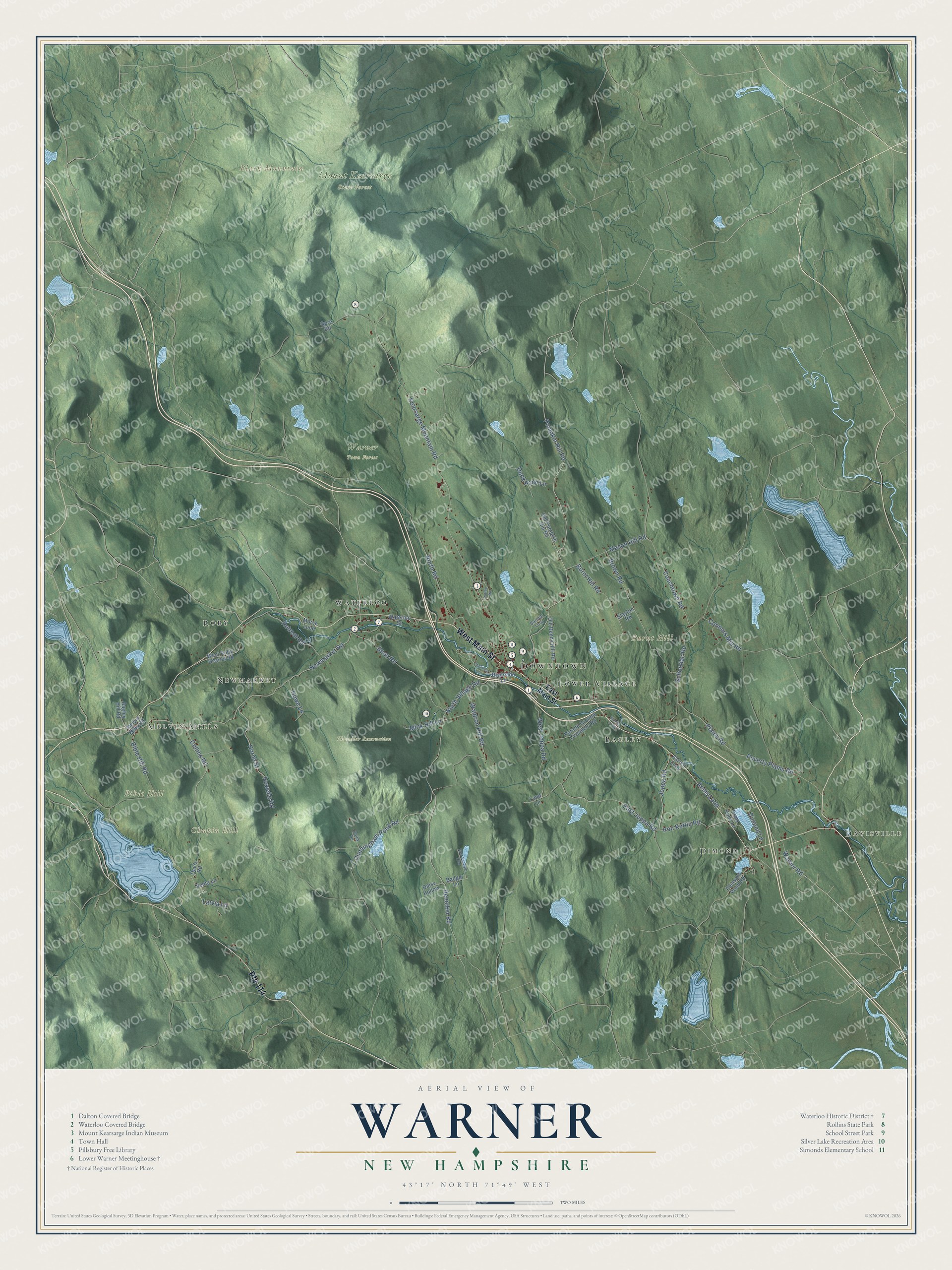
Explore Warner, New Hampshire from a whole new perspective. Created using aerial imagery and detailed geographic data, this map captures Warner building by building, with labeled streets, familiar landmarks, and shaded topographical relief that highlights the natural contours of the landscape.
Combining modern data with the timeless character of a vintage atlas, this map is just as interesting up close as it is beautiful on the wall. Whether you grew up in Warner, spent memorable years there, or call it home today, this unique map is a great way to celebrate a place that means something to you. Zoom in on the preview to look for your street, and then order a print to put your memories on the wall.
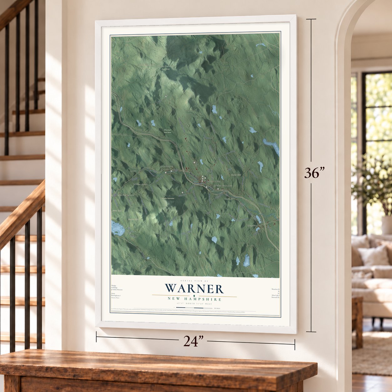
Three ways to hang it
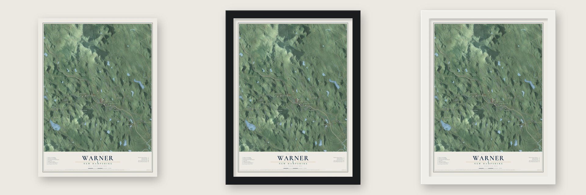
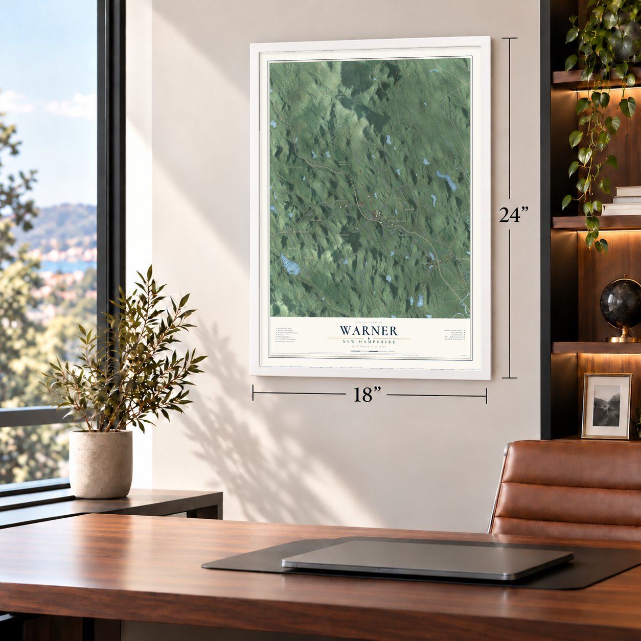
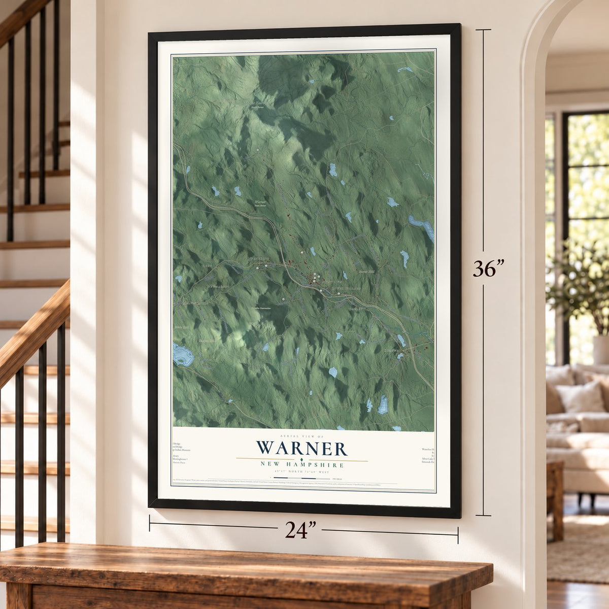
Unframed archival matte, a black wood frame or a white wood frame.
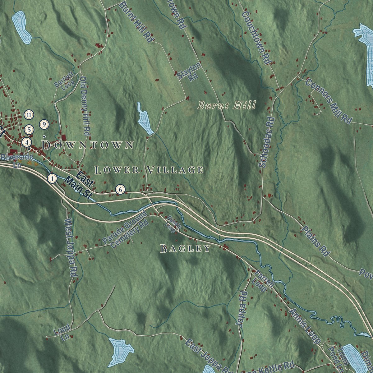
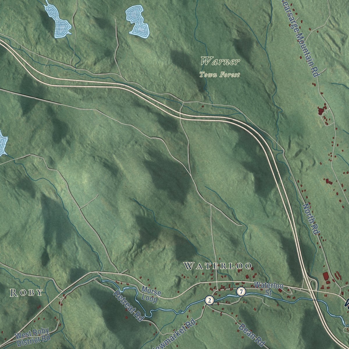
Up close
Geography Worth Displaying
This map was created using accurate cartographic data and authoritative geographic sources, including the U.S. Geological Survey (USGS) and FEMA. The map brings together terrain, waterways, roads, and building detail. The majority of the streets are labeled, houses are accurately depicted, and the topography is derived from government sources. Combining local data with carefully composed color and shading leads to this beautifully detailed Warner artwork for your wall.
Rather than simply showing street outlines, we’ve included as many of the street names as we could reasonably fit on the map while keeping their names legible. Zoom in on the high resolution preview to see exactly what’s on the map. We truly set out to create a statement piece for anyone who loves Warner. So whether it’s for you, or a gift for someone you love, we hope this map of Warner brings back fond memories.
Explore the full map of Warner, New Hampshire and read about the local places it shows.
Find your street
Names on the Warner map
Every name below is printed on this map. Look for your street, your school, the park where you played, or the pond down the road.
Places and landmarks16
- Downtown
- Melvin Mills
- Davisville
- Dimond
- Roby
- Newmarket
- Bible Hill
- Black Mountain
- Burnt Hill
- Chapin Hill
- Chandler Reservation
- Mount Kearsarge State Forest
Show all 16 places
- Warner Town Forest
- Waterloo
- Bagley
- Lower Village
Streets and roads61
- Route 114
- West Main Street
- Pumpkin Hill Road
- Cunningham Pond Road
- East Joppa Road
- Newmarket Road
- Latvia Lane
- Mink Hill Lane
- Henniker Road
- North Village Road
- Collins Road
- Kearsarge Mountain Road
- Couchtown Road
- Schoodac Road
- North Road
- Poverty Plains Road
- Burnt Hill Road
- West Joppa Road
- Bean Road
- Brown Road
- Horne Street
- Howelle Road
- Mason Hill Road
- Joppa Road
- Iron Kettle Road
- Waldron Hill Road
- Retreat Road
- Plains Road
- Connors Mill Road
- Bible Hill Road
Show all 61 streets
- Duck Pond Lane
- Howe Lane
- Warner Road
- Annis Loop
- Dimond Lane
- East Main Street
- Gore Road
- Parade Ground Cemetery Road
- Waterloo Street
- Old Denny Hill Road
- Old Pumpkin Hill Road
- West Roby District Road
- Pleasant Pond Road
- Toms Pond Lane
- Morse Loop
- Bagley Hill Road
- Melvin Mills Road
- Riverside Lane
- Farrell Loop
- Badger Lane
- Daisy Hollow
- Venta Lane
- Loud Lane
- Slayton Road
- Davis Road
- Bartlett Loop
- Colby Lane
- Chemical Lane
- East Sanborn Trce
- Pattee Road
- Runels Loop
Names are listed as they appear on the printed map. Zoom into the product photos to find them.
About Warner, New Hampshire
Warner is a town of 2,937 people in Merrimack County, 19 miles northwest of Concord by road. Massachusetts Governor Jonathan Belcher first granted its land in 1735 as Number One, a settlement called New Amesbury after the Massachusetts town most of its petitioners came from. The Masonian Proprietors granted it again in 1749 as Jennesstown, and four houses and a sawmill went up, but settlers abandoned the place in the French and Indian War, and it was destroyed.
A third grant in 1767 went to Jonathan Barnard and others, who called the town Amesbury. The town gained its charter on September 3, 1774, under the name Warner, for Jonathan Warner of Portsmouth, a relative of Governor John Wentworth, which made it one of the last towns created under English rule before the Revolution. Farms raised meat, dairy goods, hay and apples, and by 1832 the Warner River and its brooks turned twelve sawmills and six gristmills, along with a paper mill and two clothing factories.
- The tornado of 1821On September 9, 1821, a tornado cut a path 16 to 18 miles long, starting west of Lake Sunapee and crossing New London, Sutton and the southwest spur of Mount Kearsarge before it ended at the Webster line. It flattened houses and woods along the way, killed four people in Warner, badly hurt others and wrecked a great deal of property.
- The Dalton Covered Bridge, 1853Joshua Sanborn built this bridge over the Warner River on Joppa Road in 1853, setting it on abutments that local men had laid. Its 76-foot span uses a king post truss braced with queen posts, after a design Stephen Long patented in 1837. It takes its name from a neighbor remembered first as Mrs. Dalton and later as Widow Dalton, and it joined the National Register in 1976.
- The Waterloo Covered BridgeBuilt around 1860 with a Town lattice truss, this bridge crosses the Warner River near Waterloo Falls in the west of town, where one of the river's first mills stood. The 1836 Chandler Mill and the Bean Tavern of 1793 are its neighbors. The bridge joined the National Register in 1976.
- A church born of a splitA meetinghouse stood near this spot on East Main Street from 1789. In the 1840s the congregation voted to relocate to Centre Village, farther west, and those who disagreed stayed behind and began a Greek Revival church of their own in 1844. Methodists shared it from 1846 into the 1860s. Lightning struck the steeple around 1893, and work to restore the building started in 1897. Since 1969 the Lower Warner Meetinghouse has belonged to the Warner Historical Society.
- Two governors behind one counterWalter Harriman, born in Warner, kept a store in town with John S. Pillsbury, who later became governor of Minnesota. Harriman later served as New Hampshire's 31st governor, and he published a History of Warner in 1879.
Keep exploring New Hampshire
Warner is one of 279 New Hampshire towns we've mapped. Every dot on the map is a print of its own.
The search covers every state, New Hampshire first.
Near Warner
Order 2 or more town maps and save 10%. Shown in the size and finish you picked above, so they hang as a set.
- Webster 12" x 18" / Archival Matte Print $39.99
- Sutton 12" x 18" / Archival Matte Print $39.99
- Contoocook 12" x 18" / Archival Matte Print $39.99


More maps nearby: Salisbury, Henniker, Bradford, Boscawen and Hopkinton.
The art of mapping a place
How This Map Was Made
Real places. Remarkable detail. Discover the layers that turn geographic data into a map of home.

The view from above
Aerial imagery reveals the character of the land: woodland, open fields, and the patterns of a place.

The shape of the land
Elevation data brings hills, valleys, and subtle changes in the landscape into view.

The details of home
Roads, waterways, and building footprints come together to make the map feel unmistakably local.

Geography becomes art
Considered color, shading, and typography bring the layers together in a map made for your wall.


Process illustrated with Mendon, Massachusetts. Aerial imagery: USDA NAIP. Terrain: USGS 3D Elevation Program. Map details and finished artwork: KNOWOL.
The Details
About This Print
Choose an archival matte print, or a black or white Ayous wood frame. The archival matte print is unframed.
Select your size and finish above to see the matching product image and price.
Materials & Craftsmanship
A contemporary map with the character of a classic atlas, printed on archival matte paper. Optional frames are made from Ayous wood.
Your printed map does not include the watermark shown in the full-map preview.
Shipping & Delivery
Free shipping within the United States. Every print is made to order in the USA.
Buying a gift? Add a note in your cart and we'll include it. We never put prices in the package.
Prints ship within 2 to 3 business days. Allow 7 to 10 days total from ordering for delivery. Timing may vary during holidays or periods of high order volume.
Read our shipping policy.
Returns and damaged prints
Each print is made to order. Change-of-mind refunds are not available after production.
If your print arrives damaged, misprinted or incorrect, contact support@knowol.com within 30 days of receiving it. Include your order number, photos and a description of the issue.
Read our full refund and replacement policy. For questions about your order, email support@knowol.com.