
Search for another town




Free U.S. delivery 7 to 10 days after you order
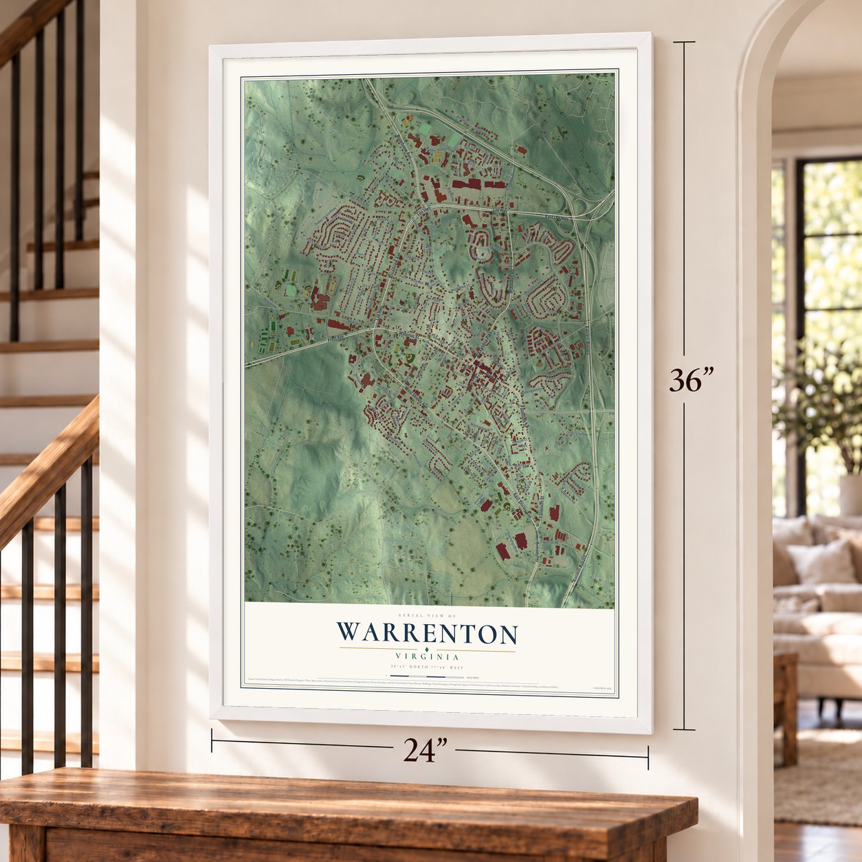
Warrenton, Virginia Map Art
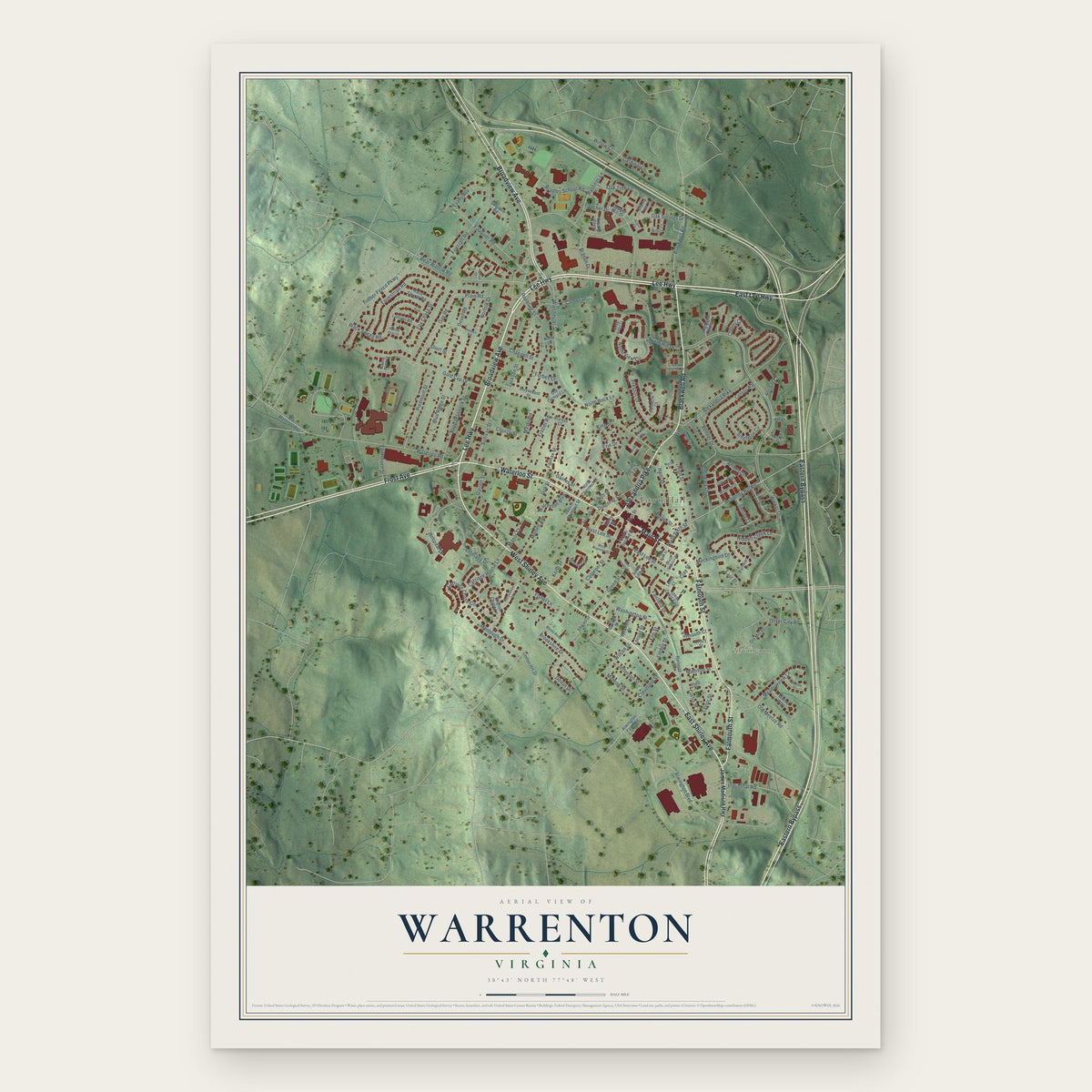
A new map of Warrenton, Virginia, made in 2026 and printed to order on thick archival matte paper.
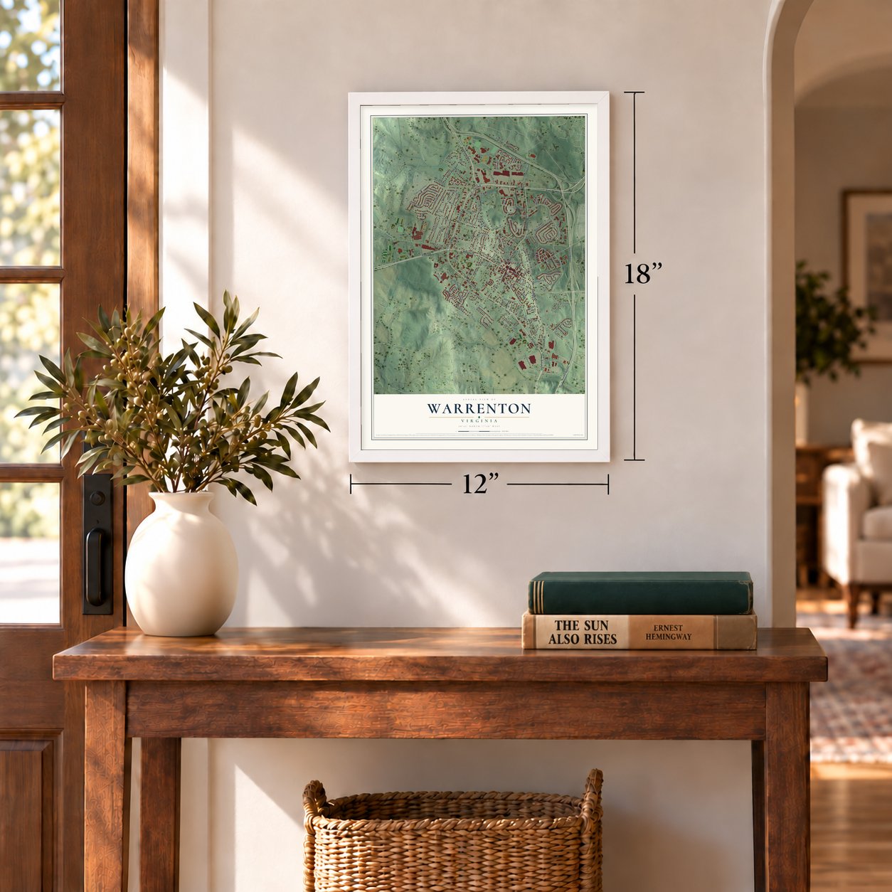
12" x 18" Archival Matte Print
A Map of Home. A Work of Art.
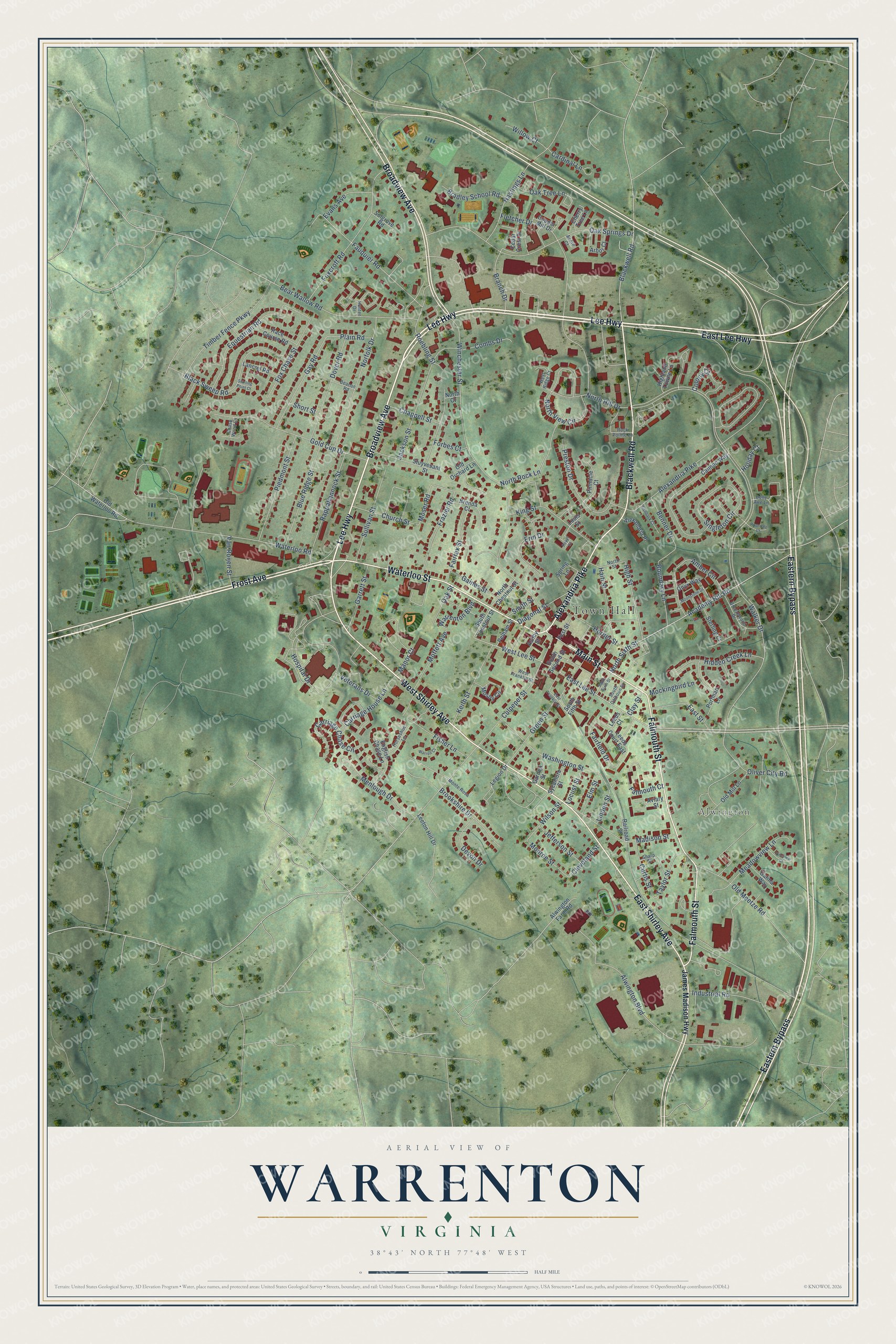
Explore Warrenton, Virginia from a whole new perspective. Created using aerial imagery and detailed geographic data, this map captures Warrenton building by building, with labeled streets, familiar landmarks, and shaded topographical relief that highlights the natural contours of the landscape.
Combining modern data with the timeless character of a vintage atlas, this map is just as interesting up close as it is beautiful on the wall. Whether you grew up in Warrenton, spent memorable years there, or call it home today, this unique map is a great way to celebrate a place that means something to you. Zoom in on the preview to look for your street, and then order a print to put your memories on the wall.
Three ways to hang it
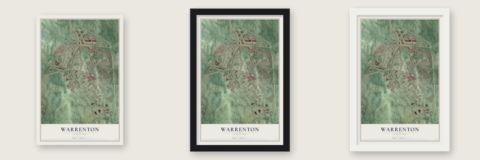
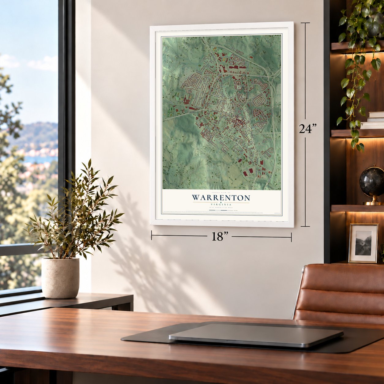
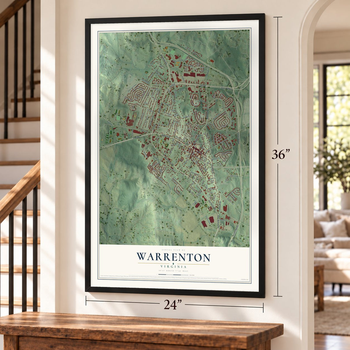
Unframed archival matte, a black wood frame or a white wood frame.
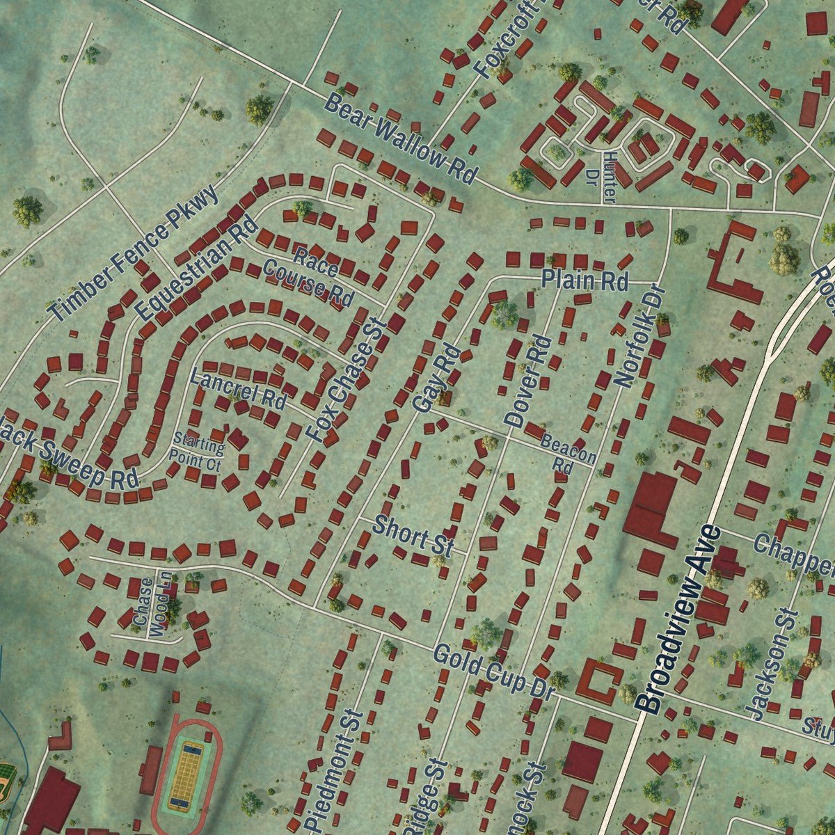
Up close
Geography Worth Displaying
This map was created using accurate cartographic data and authoritative geographic sources, including the U.S. Geological Survey and the Census Bureau. The map brings together terrain, waterways, roads, and building detail. The majority of the streets are labeled, houses are accurately depicted, and the topography is derived from government sources. Combining local data with carefully composed color and shading leads to this beautifully detailed Warrenton artwork for your wall.
Rather than simply showing street outlines, we’ve included as many of the street names as we could reasonably fit on the map while keeping their names legible. Zoom in on the high resolution preview to see exactly what’s on the map. We truly set out to create a statement piece for anyone who loves Warrenton. So whether it’s for you, or a gift for someone you love, we hope this map of Warrenton brings back fond memories.
Read the story behind this map of Warrenton, Virginia from 2026.

About Warrenton, Virginia
Warrenton is a town of 10,057 people and the county seat of Fauquier County, in the Virginia Piedmont just east of the Blue Ridge. It grew from a crossroads where the Falmouth-Winchester road met the Alexandria-Culpeper road, and a trading post known as the Red Store stood at that corner. When a courthouse went up there in the 1790s, people began calling the place Fauquier Courthouse.
Richard Henry Lee gave the land for the county seat, and on January 5, 1810, the town was incorporated as Warrenton. It took the name of General Joseph Warren, a hero of the Revolutionary War. Work on a branch line began in 1852, and in 1853 it tied Warrenton to the Orange and Alexandria Railroad. The branch was attacked twice during the Civil War and lay mostly abandoned by 1863. Southern Railway brought passenger trains back from 1909 to 1944, and Norfolk Southern took up the tracks in 1989.
“The Black Horse led a successful charge against Union forces at the First Battle of Manassas, winning the special praise of Confederate President Jefferson Davis.”
- McClellan's farewell, 1862Guests at the Warren Green Hotel included Andrew Jackson, Theodore Roosevelt, the Marquis de Lafayette, Henry Clay, Wallis Simpson and James Monroe. On November 11, 1862, Union General George B. McClellan said goodbye to his officers from its steps. The building later held offices of the Fauquier County government, and in March 2026 developers Kevin and Remington Ash offered to buy it and reopen it as a hotel and club.
- Dynamite stopped the 1909 fireIn 1909 a fire burned almost half the buildings in Warrenton. It was finally halted when dynamite blasted a firebreak in its path, keeping the flames from spreading any farther.
- The first Virginia Gold CupThe first Virginia Gold Cup steeplechase was organized in Warrenton in 1922, and it ranked with the Maryland Hunt Cup among the leading horse races of its time. After the 1984 race it moved to The Plains, where the Gold Cup races have drawn upwards of 50,000 people a year.
- Mosby's raids and law officeConfederate Colonel John S. Mosby raided Warrenton during the Civil War. After the war he came back to stay, making his home in the town and practicing law here.
Find your street
Names on the Warrenton map
Every name below is printed on this map. Look for your street, your school, the park where you played, or the pond down the road.
Places and landmarks2
- Town Hall
- Alwington
Streets and roads176
- Lee Highway
- Broadview Avenue
- East Lee Highway
- Eastern Bypass
- Blackwell Road
- Waterloo Street
- Alexandria Pike
- West Shirley Avenue
- East Shirley Avenue
- Falmouth Street
- Main Street
- Frost Avenue
- East Lee Street
- West Lee Street
- High Street
- North Sixth Street
- Moser Road
- Branch Drive
- Monroe Street
- Walker Drive
- Winchester Street
- Academy Hill Road
- Culpeper Street
- Fletcher Drive
- Oak Springs Drive
- Hospital Drive
- Waterloo Road
- Roebling Street
- Foxcroft Road
- Gold Cup Drive
Show all 176 streets
- Bear Wallow Road
- Old Meetze Road
- North View Circle
- Norfolk Drive
- Jackson Street
- Black Sweep Road
- Washington Street
- Fauquier Road
- Timber Fence Parkway
- Fox Chase Street
- Singleton Circle
- Preston Drive
- Hastings Lane
- Madison Street
- Equestrian Road
- Rappahannock Street
- Amber Circle
- Piedmont Street
- Gay Road
- Dover Road
- Blue Ridge Street
- North Rock Lane
- King Street
- Meadowview Lane
- Carriage Chase Circle
- Sullivan Street
- Hidden Creek Lane
- North Hill Drive
- Oliver City Road
- Horner Street
- Frazier Road
- Keith Street
- Boundary Lane
- Menlough Drive
- Carriage House Lane
- Green Street
- Brookshire Drive
- Fairfax Street
- Fairfield Drive
- Industrial Road
- Haiti Street
- Church Street
- Alwington Boulevard
- Falmouth Court
- Fisher Lane
- East Street
- Moffett Avenue
- Bradley School Road
- Garrett Street
- Colony Court
- Curtis Street
- Cardinal Lane
- Erin Drive
- Diagonal Street
- Oak Tree Lane
- Devon Drive
- Evans Avenue
- Mockingbird Lane
- Jefferson Street
- Chappell Street
- Gaines Street
- Warrenton Boulevard
- Benner Drive
- Wilson Street
- Combs Drive
- Taylor Street
- Van Roijen Street
- Veterans Drive
- Willow Court
- Elm Street
- Cleveland Street
- Oak Street
- Plain Road
- Locust Street
- Linden Street
- Forbes Court
- Smith Street
- Manor Court
- Short Street
- Holiday Court
- Clay Street
- James Madison Highway
- South Chestnut Street
- Cedar Crest Drive
- Cannon Way
- Highland Towne Lane
- Stuyvesant Street
- Old Mill Lane
- Spring Lane
- Portman Lane
- Mosby Circle
- South Fifth Street
- English Chase Lane
- Aviary Street
- Legion Drive
- Onyx Way
- Pinnacle Court
- Brenda Court
- Race Course Road
- Old Waterloo Road
- Sterling Court
- Lancrel Road
- Alexandria Place
- Leeton Hill Drive
- North Chestnut Street
- Galina Way
- Alwington Farm Road
- South Second Street
- Sycamore Street
- Cherry Tree Lane
- Arbor Court
- Garden Street
- Old Orchard Lane
- Pelham Street
- Leeds Court East
- First Street
- Solgrove Road
- Ashby Street
- Railroad Street
- Copper Mill Drive
- Leeds Court
- North Court
- Louis Street
- Breezewood Drive
- Beacon Road
- Rock Pointe Lane
- North Street
- Horseshoe Lane
- Monte Rosa
- West Ridge Court
- Acorn Court
- South Calhoun Street
- Hunter Drive
- West Franklin Street
- Chase Wood Lane
- Belle Aire Lane
- Sharp Street
- East Franklin Street
- Fishback Court
- Pineview Court
- Warren Court
- Moonstone Drive
- Royal Court
- South Sixth Street
- Rosedale Court
- Starting Point Court
Names are listed as they appear on the printed map. Zoom into the product photos to find them.
The art of mapping a place
How This Map Was Made
Real places. Remarkable detail. Discover the layers that turn geographic data into a map of home.

The view from above
Aerial imagery reveals the character of the land: woodland, open fields, and the patterns of a place.

The shape of the land
Elevation data brings hills, valleys, and subtle changes in the landscape into view.

The details of home
Roads, waterways, and building footprints come together to make the map feel unmistakably local.

Geography becomes art
Considered color, shading, and typography bring the layers together in a map made for your wall.


Process illustrated with Mendon, Massachusetts. Aerial imagery: USDA NAIP. Terrain: USGS 3D Elevation Program. Map details and finished artwork: KNOWOL.
The Details
About This Print
Choose an archival matte print, or a black or white Ayous wood frame. The archival matte print is unframed.
Select your size and finish above to see the matching product image and price.
Materials & Craftsmanship
A contemporary map with the character of a classic atlas, printed on archival matte paper. Optional frames are made from Ayous wood.
Your printed map does not include the watermark shown in the full-map preview.
Shipping & Delivery
Free shipping within the United States. Every print is made to order in the USA.
Buying a gift? Add a note in your cart and we'll include it. We never put prices in the package.
Prints ship within 2 to 3 business days. Allow 7 to 10 days total from ordering for delivery. Timing may vary during holidays or periods of high order volume.
Read our shipping policy.
Returns and damaged prints
Each print is made to order. Change-of-mind refunds are not available after production.
If your print arrives damaged, misprinted or incorrect, contact support@knowol.com within 30 days of receiving it. Include your order number, photos and a description of the issue.
Read our full refund and replacement policy. For questions about your order, email support@knowol.com.
Find your town
Looking for another city?
Find a map of home in our Virginia collection, or any town in the country.
Nearby
Maps of towns near Warrenton
Know someone from one of these towns? Their map makes a great gift.
 New Baltimore
, Virginia
From $39.99See the map
 Opal
Opal, Virginia
From $39.99See the map
 Calverton
, Virginia
From $39.99See the map
More maps nearby: Midland, Bealeton, Catlett, The Plains and Marshall.