
Search for another town





Free U.S. delivery 7 to 10 days after you order
Waukegan, Illinois Map Art
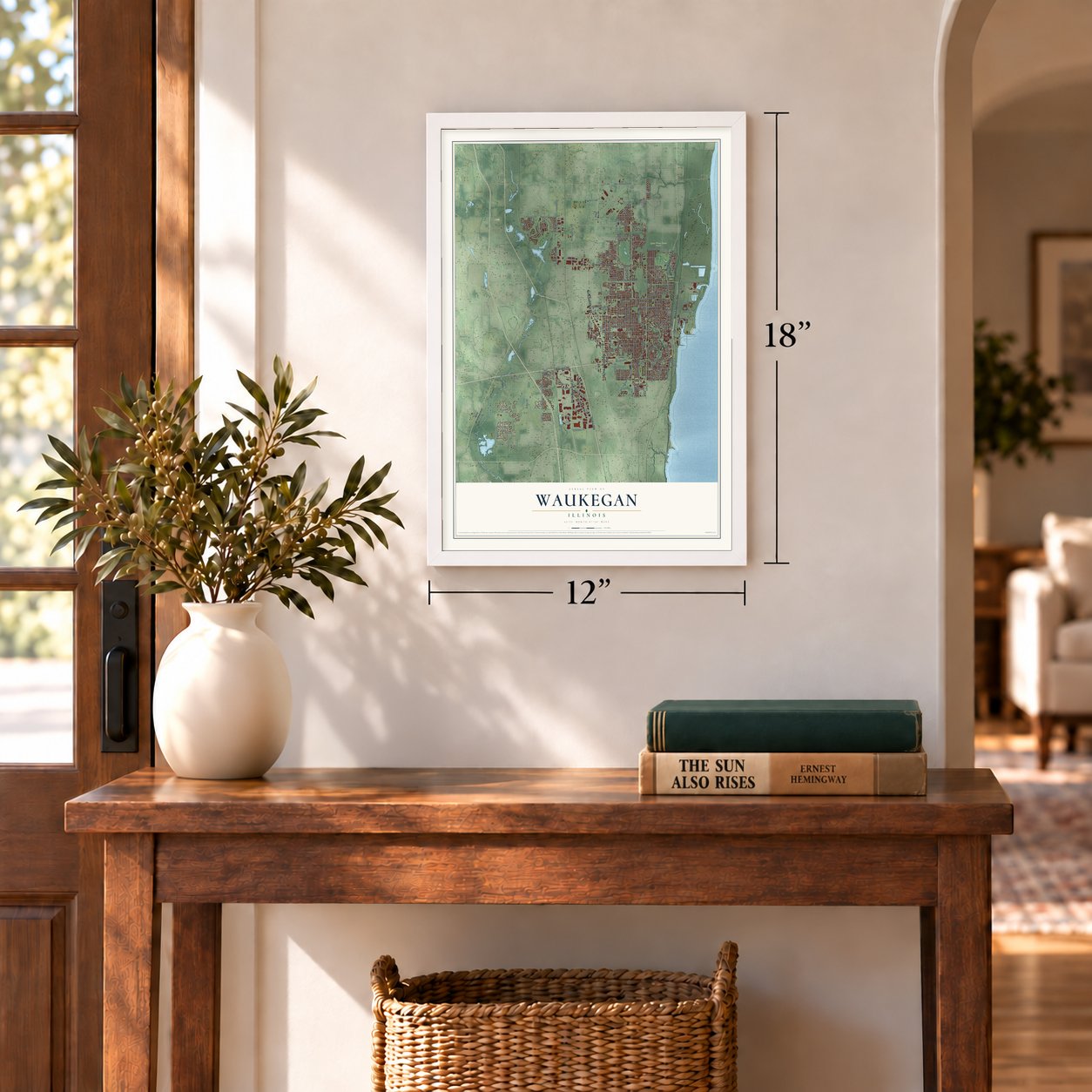
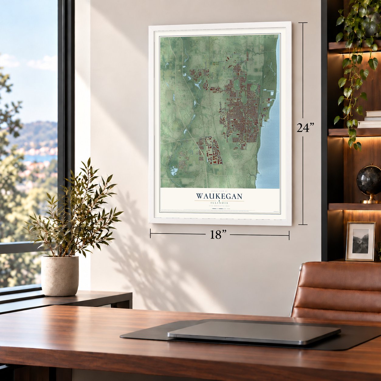
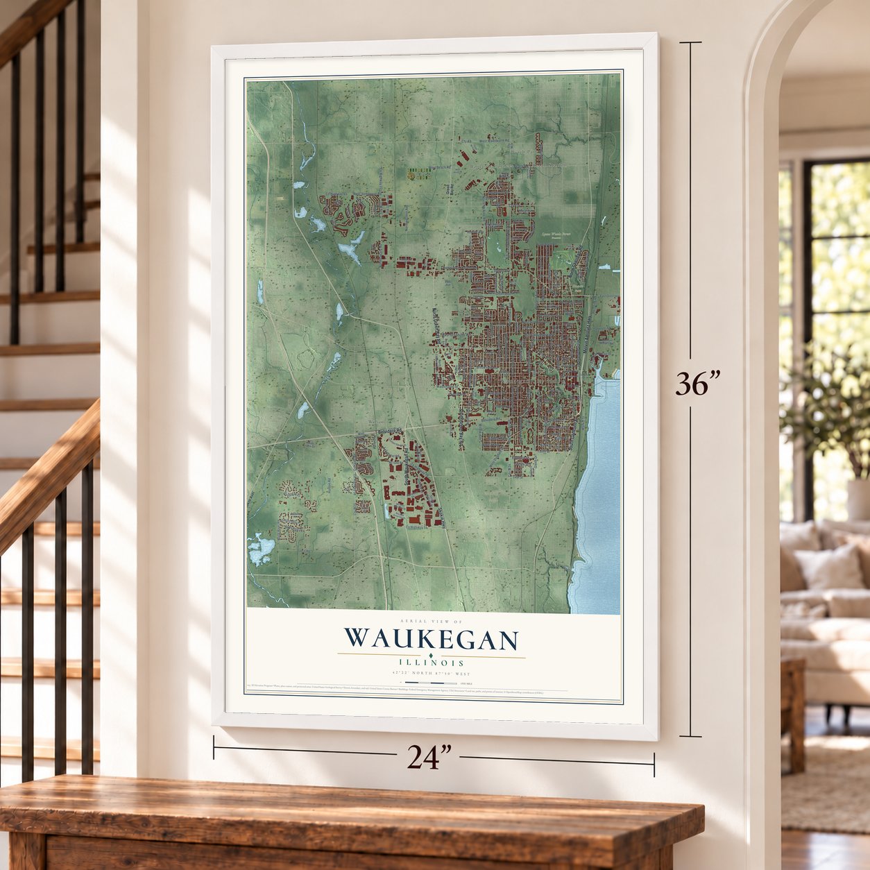
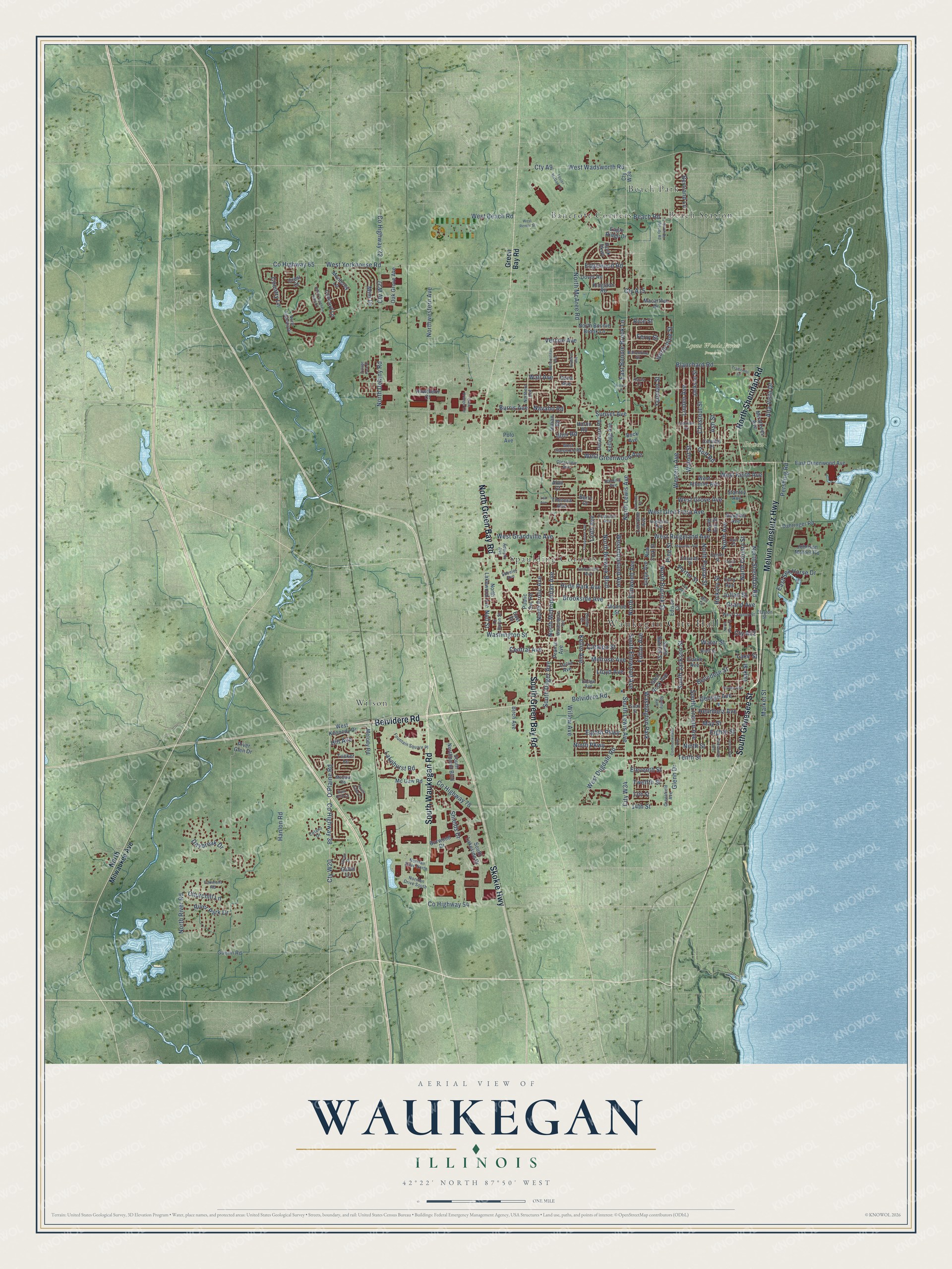
A new map of Waukegan, Illinois, made in 2026 and printed to order on thick archival matte paper.
12" x 18" Archival Matte Print
A Map of Home. A Work of Art.
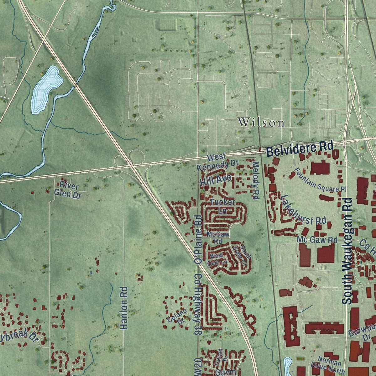
Explore Waukegan, Illinois from a whole new perspective. Created using aerial imagery and detailed geographic data, this map captures Waukegan building by building, with labeled streets, familiar landmarks, and shaded topographical relief that highlights the natural contours of the landscape.
Combining modern data with the timeless character of a vintage atlas, this map is just as interesting up close as it is beautiful on the wall. Whether you grew up in Waukegan, spent memorable years there, or call it home today, this unique map is a great way to celebrate a place that means something to you. Zoom in on the preview to look for your street, and then order a print to put your memories on the wall.
Three ways to hang it
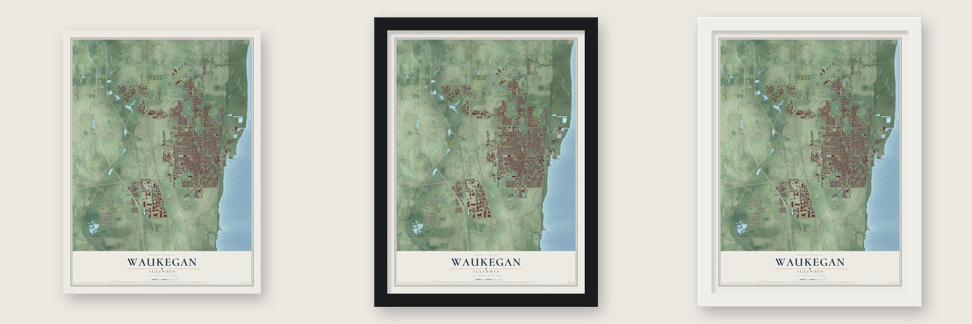
Unframed archival matte, a black wood frame or a white wood frame.
Up close
Geography Worth Displaying
This map was created using accurate cartographic data and authoritative geographic sources, including the U.S. Geological Survey and the Census Bureau. The map brings together terrain, waterways, roads, and building detail. The majority of the streets are labeled, houses are accurately depicted, and the topography is derived from government sources. Combining local data with carefully composed color and shading leads to this beautifully detailed Waukegan artwork for your wall.
Rather than simply showing street outlines, we’ve included as many of the street names as we could reasonably fit on the map while keeping their names legible. Zoom in on the high resolution preview to see exactly what’s on the map. We truly set out to create a statement piece for anyone who loves Waukegan. So whether it’s for you, or a gift for someone you love, we hope this map of Waukegan brings back fond memories.
Read the story behind this map of Waukegan, Illinois from 2026.

About Waukegan, Illinois
Waukegan is a city of 89,321 people and the seat of Lake County, with most of it built on a bluff about fifty feet above Lake Michigan. A 1778 map by Thomas Hutchins marked the site as Rivière du Vieux Fort, the Old Fort River. By the 1820s English speakers called the settlement Little Fort, after the ruins of an old fort that had stood there.
John H. Kinzie and Solomon Juneau made up a new name from a Potawatomi word for a fort, first Waukegance and then Waukegan. The town took the name on March 31, 1849. The Chicago and Milwaukee Railway came through by 1855, and its arrival set off fast growth in local industry. Soon nearly 1000 ships a year were calling at the harbor.
- Lincoln's unfinished speechAbraham Lincoln came to Waukegan to campaign in 1860. A fire alarm started ringing while he spoke, and he never got to finish. Waukegan may be the only place where that ever happened to him.
- Ale shipped past AmericaBrewer William Besley ran the Waukegan Brewing Company, among the town's top businesses, and its beer sold beyond the nation's borders. The Historical Encyclopedia of Illinois listed ale among Waukegan's leading exports, along with grain, wool and butter.
- Sugar, starch and barbed wireEarly Waukegan built ships and wagons, milled flour, raised sheep, packed pork and made dairy goods. A sugar refinery opened in 1890, and the barbed wire maker Washburn & Moen drew workers starting in 1891. Immigrants followed, many of them from Sweden, Finland and Lithuania, and the city also gained a large Armenian community.
Find your street
Names on the Waukegan map
Every name below is printed on this map. Look for your street, your school, the park where you played, or the pond down the road.
Places and landmarks9
- Waukegan City Hall
- Bowen Park
- Lyons Woods Forest Preserve
- Bancroft Corners
- Beach Park
- Beach Station
- Spaulding Corners
- Wilson
- Washington Park
Streets and roads233
- South Genesee Street
- North Sheridan Road
- Melvin Amstutz Highway
- Belvidere Road
- North Green Bay Road
- South Waukegan Road
- Skokie Highway
- South Green Bay Road
- City W34
- Cty A22
- County Highway 38
- O'Plaine Road
- County Highway 54
- South Lewis Avenue
- Hill Avenue
- Wall Avenue
- North Lewis Avenue
- North McAree Road
- West Yorkhouse Road
- Grand Avenue
- Washington Street
- Sunset Avenue
- West Glen Flora Avenue
- North Butrick Street
- North River Road
- North Avenue
- Tenth Street
- Pershing Road
- West Ridgeland Avenue
- Chestnut Street
Show all 233 streets
- Cty W27
- North Delany Road
- County Highway 65
- County Highway 22
- Linden Avenue
- North Elmwood Avenue
- South Elmwood Avenue
- Cty W20
- North Frolic Avenue
- Brookside Avenue
- Walnut Street
- North Metropolitan Avenue
- Hickory Street
- Yeoman Street
- West Dugdale Road
- West Greenwood Avenue
- West Beach Road
- Western Avenue
- West Grove Avenue
- North Berwick Boulevard
- Belvidere Street
- North Poplar Street
- East Sea Horse Drive
- Westmoreland Avenue
- Blanchard Road
- South Jackson Street
- Cty A15
- Hanlon Road
- Northwestern Avenue
- Fulton Avenue
- Hyde Park Avenue
- West Keith Avenue
- Leith Avenue
- South Lincoln Avenue
- Golf Road
- Lakehurst Road
- West Wadsworth Road
- Cty A9
- Melrose Avenue
- Market Street
- Eighth Street
- 14th Street
- North County Street
- Ninth Street
- South Dilger Avenue
- Catalpa Street
- Eleventh Street
- Keller Avenue
- Pine Street
- Daybreak Drive
- Lloyd Avenue
- West Grandville Avenue
- May Street
- River Park Drive
- North Pine Street
- Bertrand Lane
- Beach Road
- East Bonnie Brook Lane
- Eighth Parkway
- Helmholz Avenue
- County Highway 78
- Alta Vista Drive
- Edgewood Road
- George Avenue
- Water Street
- Ninth Parkway
- Glenn Drive
- Shields Drive
- Churchill Lane
- Willow Avenue
- Ash Street
- Porter Street
- Country Lane
- Twelfth Street
- Central Avenue
- Mini Drive
- Julian Street
- Vercoe Avenue
- Ferry Street
- Oak Street
- Burris Avenue
- Navaho Road
- Lake Street
- Rice Street
- Noll Street
- Illini Road
- North Milwaukee Avenue
- Green Bay Road
- Eagle Ridge Drive
- Tucker Lane
- Cty W34
- Macarthur Drive
- Kingston Road
- South Lakeside Drive
- North Ash Street
- Lorraine Avenue
- West Atlantic Avenue
- Monroe Street
- South Northpoint Boulevard
- New York Street
- Glen Rock Avenue
- Jackson Street
- Johnson Motors Road
- Judge Avenue
- East Greenwood Avenue
- Oak Grove Avenue
- Lucia Avenue
- North Bonnie Brook Lane
- Douglas Avenue
- Burwood Drive
- Monterey Lane
- Buck Avenue
- Kellogg Avenue
- 13th Street
- Delaware Road
- West Kennedy Drive
- North Lakewood Avenue
- South Butrick Street
- Miraflores Avenue
- Dahringer Road
- Concord Lane
- Edison Court
- Mc Gaw Road
- Birch Avenue
- Public Svc Road
- Cory Avenue
- Guerin Road
- Melody Road
- Colville Place
- Hawthorn Court
- Theresa Avenue
- Dover Road
- Clarke Avenue
- Prairie Avenue
- Stanley Avenue
- River Glen Drive
- Huron Road
- Gavin Lane
- Dana Avenue
- Indian Road
- Rock Parkway
- Crest Court
- Berry Court
- East Drive
- Polo Avenue
- Alan Court
- McGaw Road
- Crescent Avenue
- Adelphi Avenue
- North Augusta Drive
- Harding Avenue
- West Clayton Street
- University Avenue
- West Cheyenne Road
- Dodge Avenue
- Center Street
- Northern Avenue
- Fountain Square Place
- Clearview Avenue
- Norman Drive South
- Clayton Street
- Greenfield Avenue
- Dunlay Court
- Highland Avenue
- Norman Drive North
- Celano Drive
- Washington Terrace
- Edwards Street
- Le Baron Street
- Ballentine Street
- Fairmont Road
- Benny Avenue
- Bluff Street
- Sheeler Avenue
- Hull Court
- Kayla Lane
- Sixth Street
- Mill Court
- North Southern Hills Drive
- Flossmoor Avenue
- Metropolitan Avenue
- Massena Avenue
- Longview Road
- Lenox Avenue
- Village Park Drive
- North West Street
- Traditions Drive
- North De Woody Road
- Roberts Avenue
- Fourth Street
- Wadsworth Avenue
- South Elder Lane
- Commonwealth Avenue
- Foster McGaw Drive
- West Quill Lane
- Ravine Avenue
- Ernie Krueger Circle
- Falcon Drive
- West Renier Street
- Lee Avenue
- Lorraine Place
- Fields Terrace
- Low Avenue
Names are listed as they appear on the printed map. Zoom into the product photos to find them.
The art of mapping a place
How This Map Was Made
Real places. Remarkable detail. Discover the layers that turn geographic data into a map of home.

The view from above
Aerial imagery reveals the character of the land: woodland, open fields, and the patterns of a place.

The shape of the land
Elevation data brings hills, valleys, and subtle changes in the landscape into view.

The details of home
Roads, waterways, and building footprints come together to make the map feel unmistakably local.

Geography becomes art
Considered color, shading, and typography bring the layers together in a map made for your wall.


Process illustrated with Mendon, Massachusetts. Aerial imagery: USDA NAIP. Terrain: USGS 3D Elevation Program. Map details and finished artwork: KNOWOL.
The Details
About This Print
Choose an archival matte print, or a black or white Ayous wood frame. The archival matte print is unframed.
Select your size and finish above to see the matching product image and price.
Materials & Craftsmanship
A contemporary map with the character of a classic atlas, printed on archival matte paper. Optional frames are made from Ayous wood.
Your printed map does not include the watermark shown in the full-map preview.
Shipping & Delivery
Free shipping within the United States. Every print is made to order in the USA.
Buying a gift? Add a note in your cart and we'll include it. We never put prices in the package.
Prints ship within 2 to 3 business days. Allow 7 to 10 days total from ordering for delivery. Timing may vary during holidays or periods of high order volume.
Read our shipping policy.
Returns and damaged prints
Each print is made to order. Change-of-mind refunds are not available after production.
If your print arrives damaged, misprinted or incorrect, contact support@knowol.com within 30 days of receiving it. Include your order number, photos and a description of the issue.
Read our full refund and replacement policy. For questions about your order, email support@knowol.com.
Find your town
Looking for another city?
Find a map of home in our Illinois collection, or any town in the country.
Nearby
Maps of towns near Waukegan
Know someone from one of these towns? Their map makes a great gift.
 Park City
, Illinois
From $39.99See the map
 Gurnee
, Illinois
From $39.99See the map
 North Chicago
, Illinois
From $39.99See the map
More maps nearby: Beach Park, Green Oaks, Gages Lake, Knollwood and Lake Bluff.