
Search for another town





Free U.S. delivery 7 to 10 days after you order
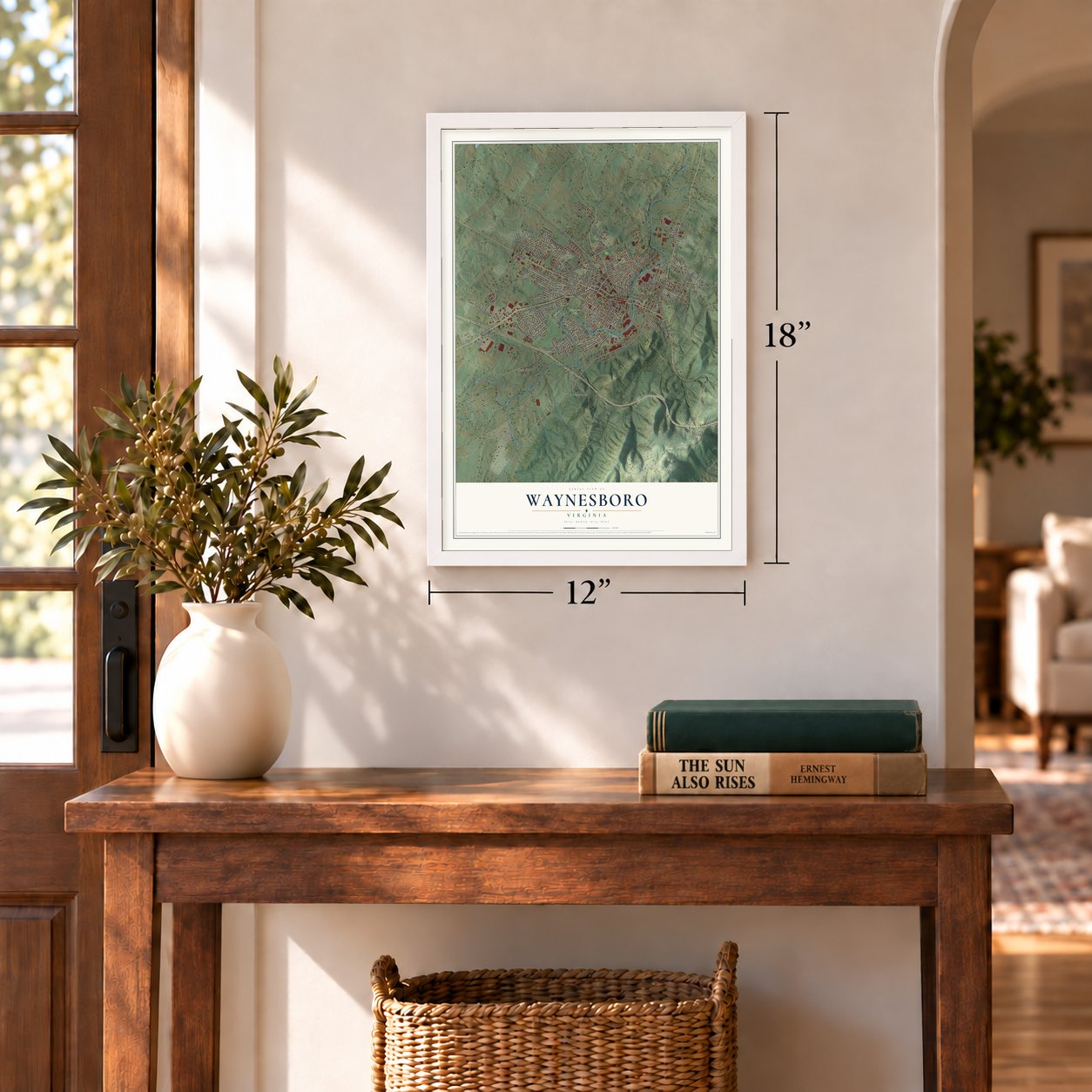
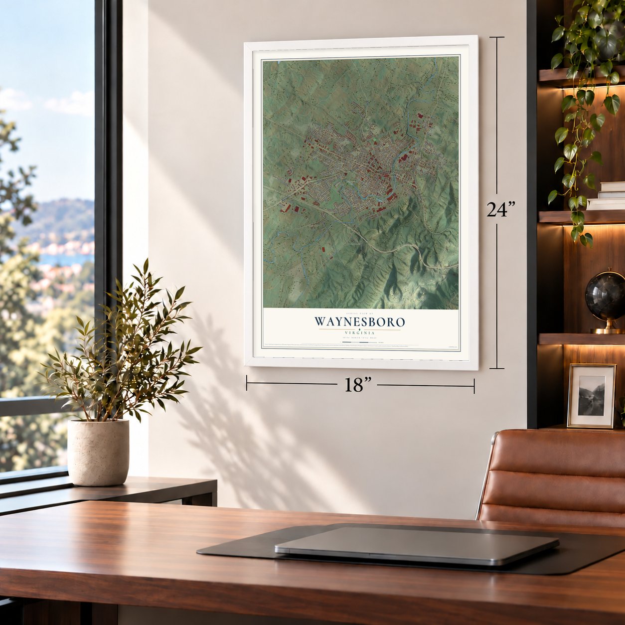
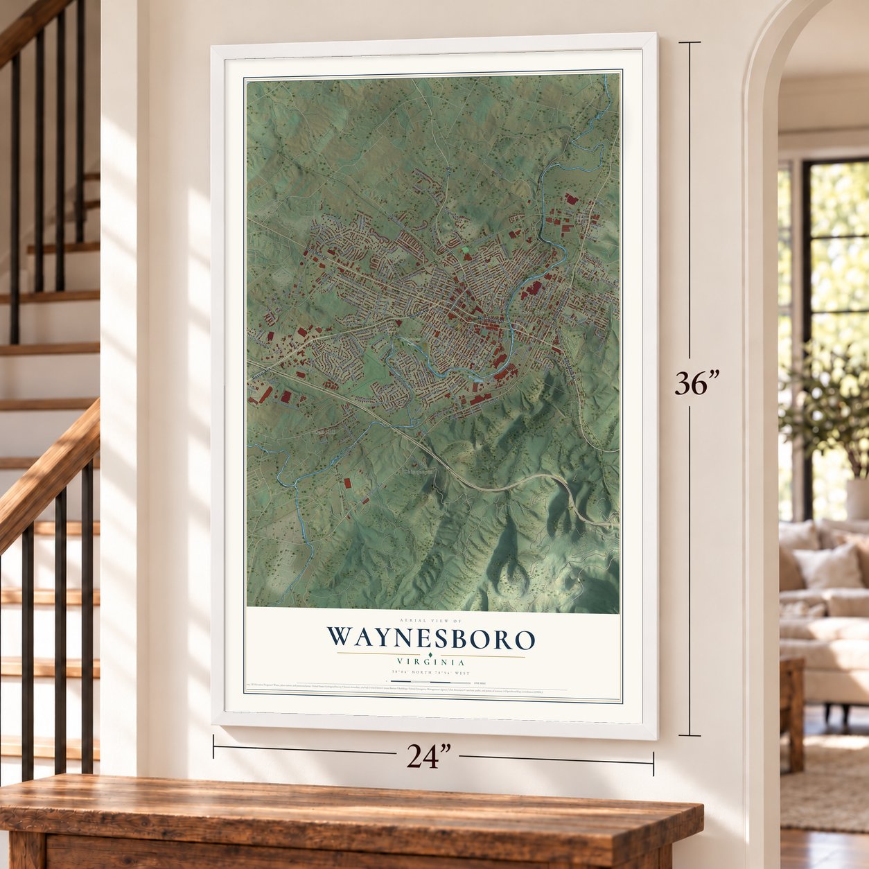
Waynesboro, Virginia Map Art
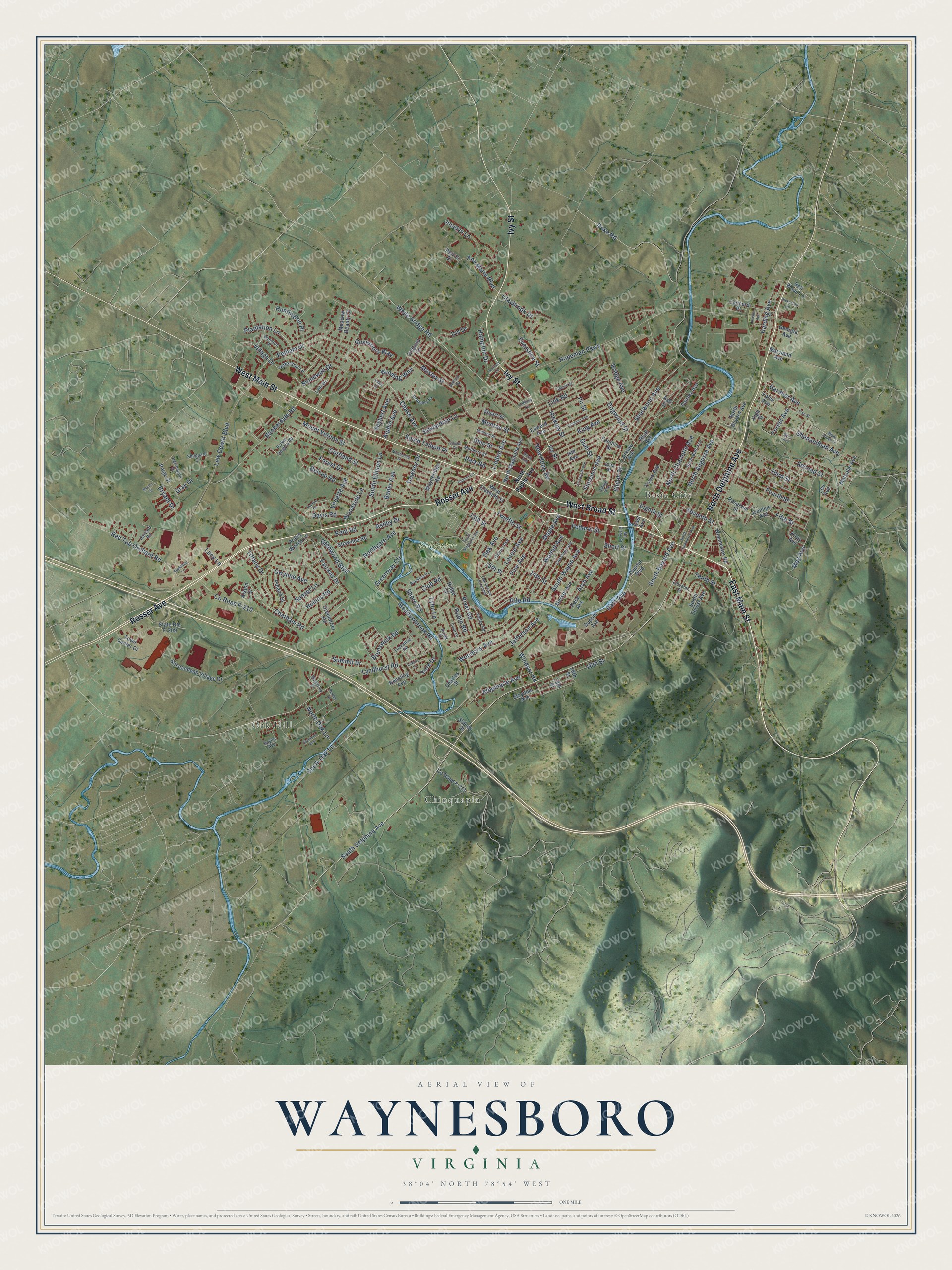
A new map of Waynesboro, Virginia, made in 2026 and printed to order on thick archival matte paper.
12" x 18" Archival Matte Print
A Map of Home. A Work of Art.
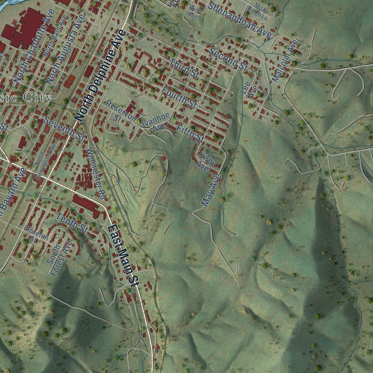
Explore Waynesboro, Virginia from a whole new perspective. Created using aerial imagery and detailed geographic data, this map captures Waynesboro building by building, with labeled streets, familiar landmarks, and shaded topographical relief that highlights the natural contours of the landscape.
Combining modern data with the timeless character of a vintage atlas, this map is just as interesting up close as it is beautiful on the wall. Whether you grew up in Waynesboro, spent memorable years there, or call it home today, this unique map is a great way to celebrate a place that means something to you. Zoom in on the preview to look for your street, and then order a print to put your memories on the wall.
Three ways to hang it
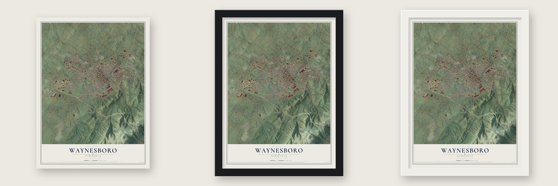
Unframed archival matte, a black wood frame or a white wood frame.
Up close
Geography Worth Displaying
This map was created using accurate cartographic data and authoritative geographic sources, including the U.S. Geological Survey and the Census Bureau. The map brings together terrain, waterways, roads, and building detail. The majority of the streets are labeled, houses are accurately depicted, and the topography is derived from government sources. Combining local data with carefully composed color and shading leads to this beautifully detailed Waynesboro artwork for your wall.
Rather than simply showing street outlines, we’ve included as many of the street names as we could reasonably fit on the map while keeping their names legible. Zoom in on the high resolution preview to see exactly what’s on the map. We truly set out to create a statement piece for anyone who loves Waynesboro. So whether it’s for you, or a gift for someone you love, we hope this map of Waynesboro brings back fond memories.
Read the story behind this map of Waynesboro, Virginia from 2026.

About Waynesboro, Virginia
Waynesboro is an independent city of 22,196 people in the Shenandoah Valley, with the South River running through it. In the mid-18th century the settlement was known as Teasville, and it stood on land owned by James Flack. After Gen. Anthony Wayne won the Battle of Fallen Timbers in 1794, people began calling it Waynesborough. Many settlers had come from Pennsylvania, where Wayne was popular, and that likely helped the name stick. Downtown lots were laid out and sold by 1798, when Samuel and J. Estill added twenty-one acres of streets and alleys, and Virginia recognized the town on January 8, 1801.
The town was incorporated by 1834, but it grew slowly, from 250 people in 1810 to 457 in 1860. Travelers kept it busy because it sat on Three Notch'd Road, which ran from Staunton east to Charlottesville and Richmond and climbed the Blue Ridge at Jarman's Gap. Shortly before the Civil War, a railroad tunnel was cut through Rockfish Gap, and that pass became the main route over the mountains toward Charlottesville.
- Twenty minutes in 1865On March 2, 1865, George Armstrong Custer routed Lt. General Jubal A. Early here in a fight that lasted twenty minutes. It was Early's last battle of the war and the end of the Confederate army in the Shenandoah Valley, which soon passed to General Philip Sheridan. Some buildings still carry scars from the fighting, and soldiers killed in the Valley Campaign lie in Ridgeview Cemetery, where the Waynesboro Confederate Monument records their names and states.
- The Iron Cross and Basic CityAfter the war, a Chesapeake and Ohio line running east and west crossed the Shenandoah Valley Railroad's north-south line near town, a junction nicknamed the Iron Cross. In 1890 speculators sold lots east of the South River and incorporated Basic City, which built an opera house, Commerce Avenue and the Hotel Brunswick. Unlike dry Waynesboro, it allowed liquor sales. The Panic of 1896 ended its boom, and in 1923 the rival towns merged, soon taking the single name Waynesboro.
- Where spandex was inventedSpandex was invented at DuPont's Benger Laboratory in Waynesboro, and the company's plant here made it under the Lycra brand. Along with the Wayn-Tex textile mill and a General Electric site that made relays and later computer printers, the plant employed many residents for much of the 20th century. It now operates as The Lycra Company.
- The first brick house, 1806Two buildings on the National Register survive from the young town's early years. The Coiner-Quesenbery House on Main Street went up in 1806 and is thought to be the first house in Waynesboro built of brick. The Plumb House from the same period is now a museum that opens for tours in season.
Find your street
Names on the Waynesboro map
Every name below is printed on this map. Look for your street, your school, the park where you played, or the pond down the road.
Places and landmarks4
- Basic City
- Chinquapin
- Oak Hill
- Ridgeview Park
Streets and roads220
- Rosser Avenue
- North Delphine Avenue
- West Main Street
- East Main Street
- Ivy Street
- West Broad Street
- South Delphine Avenue
- Lyndhurst Road
- King Avenue
- White Bridge Road
- Pine Avenue
- South Oak Lane
- Lucy Lane
- Second Street
- Dogwood Street
- Fifth Street
- Bath Avenue
- Shiloh Street
- Tenth Street
- North Augusta Avenue
- South Wayne Avenue
- South Ellison Lane
- Oak Avenue
- May Avenue
- Chase Avenue
- Hopeman Parkway
- Lew Dewitt Boulevard
- Mount Vernon Street
- Sherwood Avenue
- Village Drive
Show all 220 streets
- 13th Street
- Twelfth Street
- Third Street
- Monroe Street
- Fairway Drive
- New Hope Road
- Florence Avenue
- Bridge Avenue
- Ohio Street
- 14th Street
- Jefferson Avenue
- Bookerdale Road
- Duke Road
- Fourth Street
- Pelham Drive
- Arch Avenue
- Chatham Road
- Northgate Avenue
- Shenandoah Avenue
- Red Top Orchard Road
- Meadowbrook Road
- Forest Drive
- Maple Avenue
- Stonewall Drive
- Cortland Street
- Fir Street
- Link Road
- Vedette Avenue
- North Charlotte Avenue
- County Road F-210
- Woodrow Avenue
- Plantation Lane
- South Bayard Avenue
- Belvue Road
- Greenway Circle
- Sunset Lane
- Locust Avenue
- Mosley Street
- Walnut Avenue
- Albemarle Avenue
- Bryant Drive
- Tiffany Drive
- Rife Road
- York Drive
- Bader Avenue
- Windsor Road
- Glenwood Boulevard
- Gum Street
- Hickory Street
- Alphin Avenue
- Harding Avenue
- Hollins Road
- 16th Street
- Federal Street
- Claybrook Drive
- Ana Marie Boulevard
- Short Street
- Gardner Avenue
- Jocelyn Lane
- Lynn Lane
- Linden Avenue
- Edwardian Lane
- Davis Road
- Hampton Drive
- Forest Avenue
- River Road
- 15th Street
- Seventh Street
- Huntington Place
- Woodside Lane
- Gwynne Avenue
- North Oak Lane
- Downey Drive
- Seybert Avenue
- Eighth Street
- Summit Drive
- South Talbott Place
- Shore Road
- Brunswick Road
- Governors Way
- Winding Way
- Iris Drive
- Park Road
- Robin Road
- Ashby Drive
- Club Road
- Evershire Street
- Kent Road
- Gray Drive
- Maryland Avenue
- Lee Avenue
- Bell Wood Lane
- Ivanhoe Avenue
- Ridge Circle
- Fairview Avenue
- North Bayard Avenue
- Keesling Avenue
- Kirby Avenue
- Dupont Boulevard
- West Eleventh Street
- Shenandoah Village Drive
- Market Avenue
- Lee Drive
- Edward Avenue
- Paige Street
- Malcolm Avenue
- Essex Avenue
- North Magnolia Avenue
- Jefferson Lane
- Reservoir Street
- Isle Avenue
- Wayneridge Road
- Winchester Road
- Georgia Avenue
- Poland Street
- Concord Place
- Alston Court
- County Road F-211
- Meadow Beauty Court
- State Route F-209
- Greenbrier Road
- Sidney Street
- Town Center Drive
- Charles Street
- Shawnee Road
- Ash Street
- Fairfax Avenue
- Faber Avenue
- Stuart Street
- South Forest Avenue
- Dupont Avenue
- Stayman Avenue
- Pratts Woods Lane
- Race Avenue
- Fontaine Street
- Holland Circle
- High Street
- Petros Drive
- 18th Street
- Bluff Avenue
- 19th Street
- East Avenue
- North Poplar Avenue
- North Bath Avenue
- Chestnut Avenue
- Cherry Avenue
- Mulberry Street
- Eleventh Street
- Parker Heights Road
- Harvard Road
- Valley Road
- Herrington Drive
- Beta Street
- Sheppard Court
- Waverley Drive
- Quenton Place
- Rhoades Drive
- Tuckahoe Road
- Mc Elroy Street
- Baylor Avenue
- Brook Court
- Oak Avenue Extended
- Misty Ridge Lane
- Appletree Lane
- North Commerce Avenue
- South Magnolia Avenue
- Loudoun Avenue
- Frye Street
- Madison Street
- Wine Avenue
- Monticello Street
- Ellison Circle
- Dupont Circle
- Court Road
- Allison Avenue
- Brookwood Lane
- North Avenue
- Elizabeth Avenue
- Lowery Lane
- Stanford Avenue
- Elkton Avenue
- Dickerson Lane
- Spruce Street
- Purdue Street
- Guilford Lane
- Sumter Road
- Bedford Road
- Anthony Circle
- Moore Street
- Haley Drive
Names are listed as they appear on the printed map. Zoom into the product photos to find them.
The art of mapping a place
How This Map Was Made
Real places. Remarkable detail. Discover the layers that turn geographic data into a map of home.

The view from above
Aerial imagery reveals the character of the land: woodland, open fields, and the patterns of a place.

The shape of the land
Elevation data brings hills, valleys, and subtle changes in the landscape into view.

The details of home
Roads, waterways, and building footprints come together to make the map feel unmistakably local.

Geography becomes art
Considered color, shading, and typography bring the layers together in a map made for your wall.


Process illustrated with Mendon, Massachusetts. Aerial imagery: USDA NAIP. Terrain: USGS 3D Elevation Program. Map details and finished artwork: KNOWOL.
The Details
About This Print
Choose an archival matte print, or a black or white Ayous wood frame. The archival matte print is unframed.
Select your size and finish above to see the matching product image and price.
Materials & Craftsmanship
A contemporary map with the character of a classic atlas, printed on archival matte paper. Optional frames are made from Ayous wood.
Your printed map does not include the watermark shown in the full-map preview.
Shipping & Delivery
Free shipping within the United States. Every print is made to order in the USA.
Buying a gift? Add a note in your cart and we'll include it. We never put prices in the package.
Prints ship within 2 to 3 business days. Allow 7 to 10 days total from ordering for delivery. Timing may vary during holidays or periods of high order volume.
Read our shipping policy.
Returns and damaged prints
Each print is made to order. Change-of-mind refunds are not available after production.
If your print arrives damaged, misprinted or incorrect, contact support@knowol.com within 30 days of receiving it. Include your order number, photos and a description of the issue.
Read our full refund and replacement policy. For questions about your order, email support@knowol.com.
Find your town
Looking for another city?
Find a map of home in our Virginia collection, or any town in the country.
Nearby
Maps of towns near Waynesboro
Know someone from one of these towns? Their map makes a great gift.
 Dooms
Dooms, Virginia
From $39.99See the map
 Lyndhurst
, Virginia
From $39.99See the map
 Afton
Afton, Virginia
From $39.99See the map
More maps nearby: Fishersville, Sherando, Crimora, Stuarts Draft and New Hope.