
Search for another town

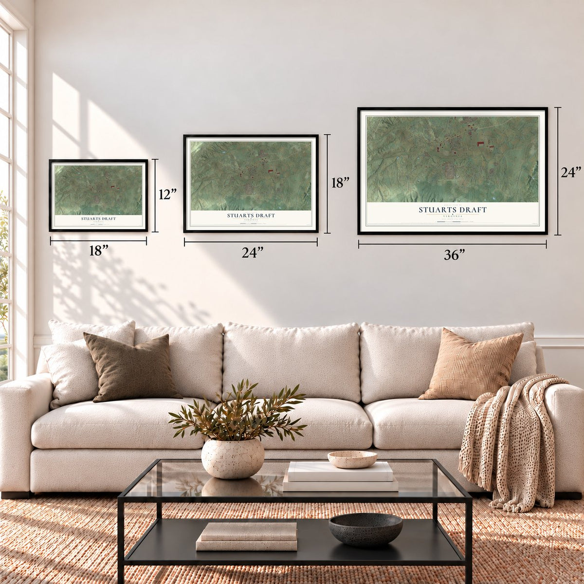
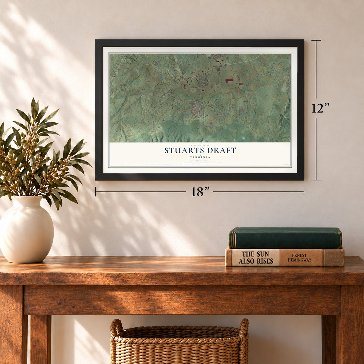
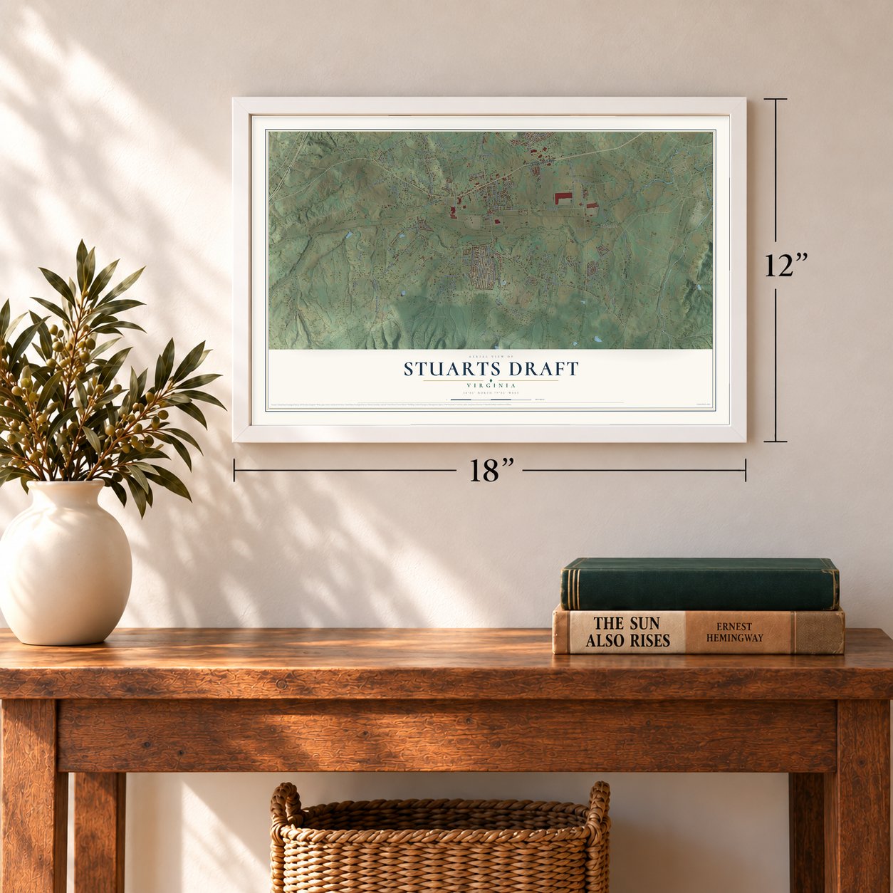
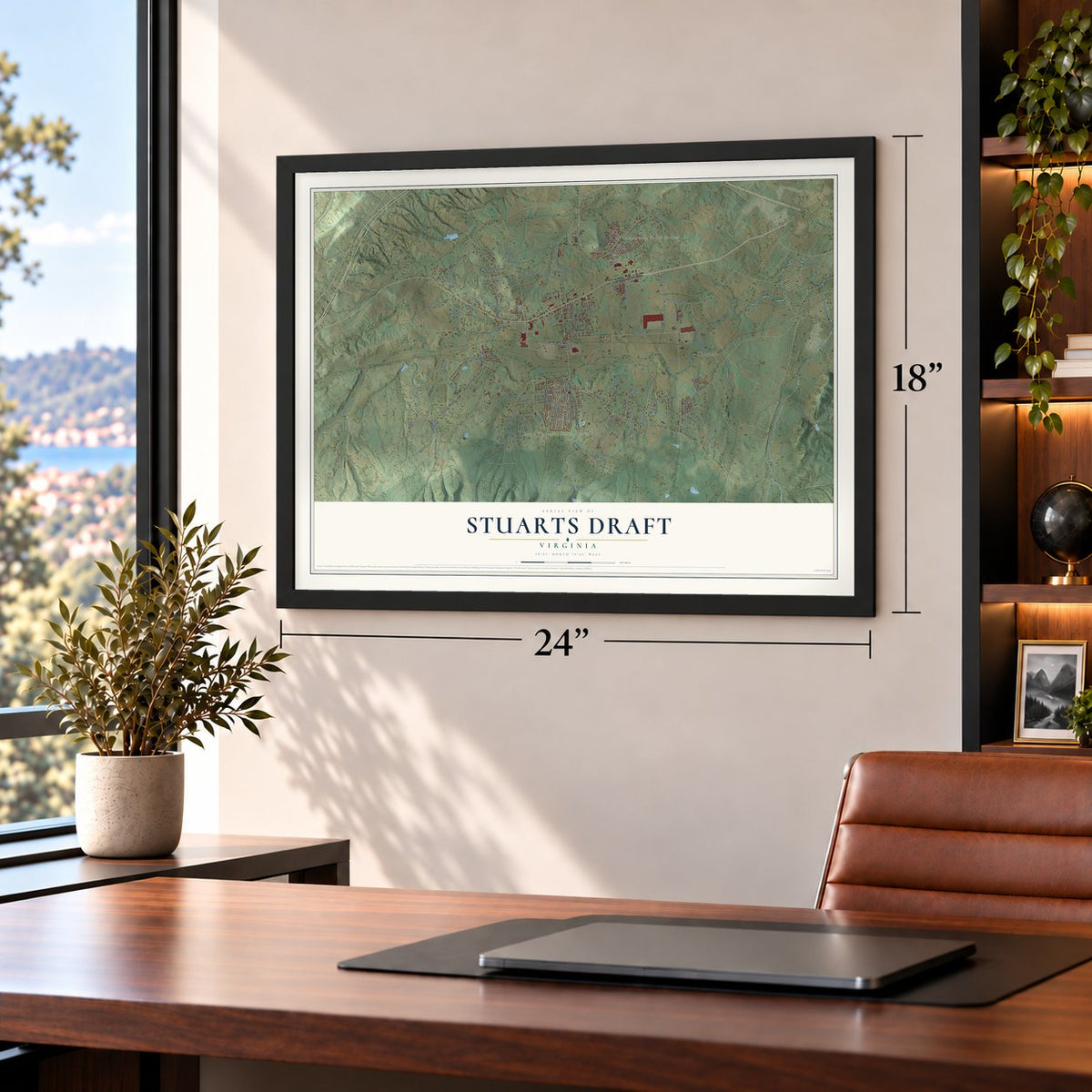
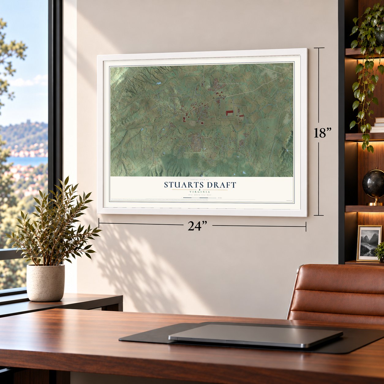

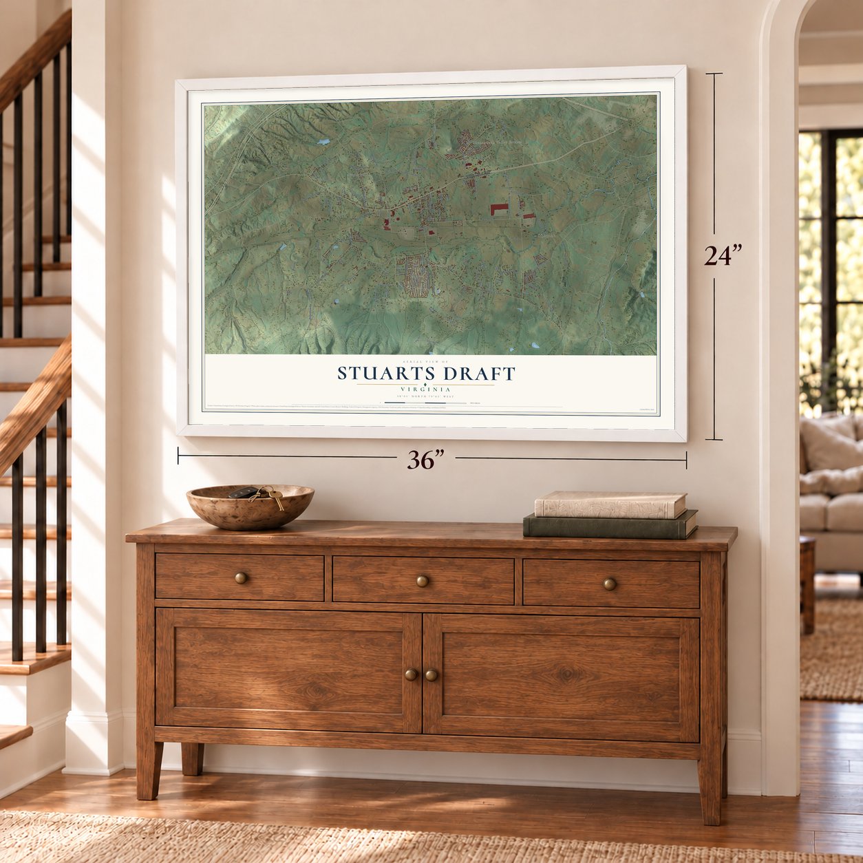

Free U.S. delivery 7 to 10 days after you order
Stuarts Draft, Virginia Map Art
A new map of Stuarts Draft, Virginia, made in 2026 and printed to order on thick archival matte paper.
12" x 18" Archival Matte Print
A Map of Home. A Work of Art.
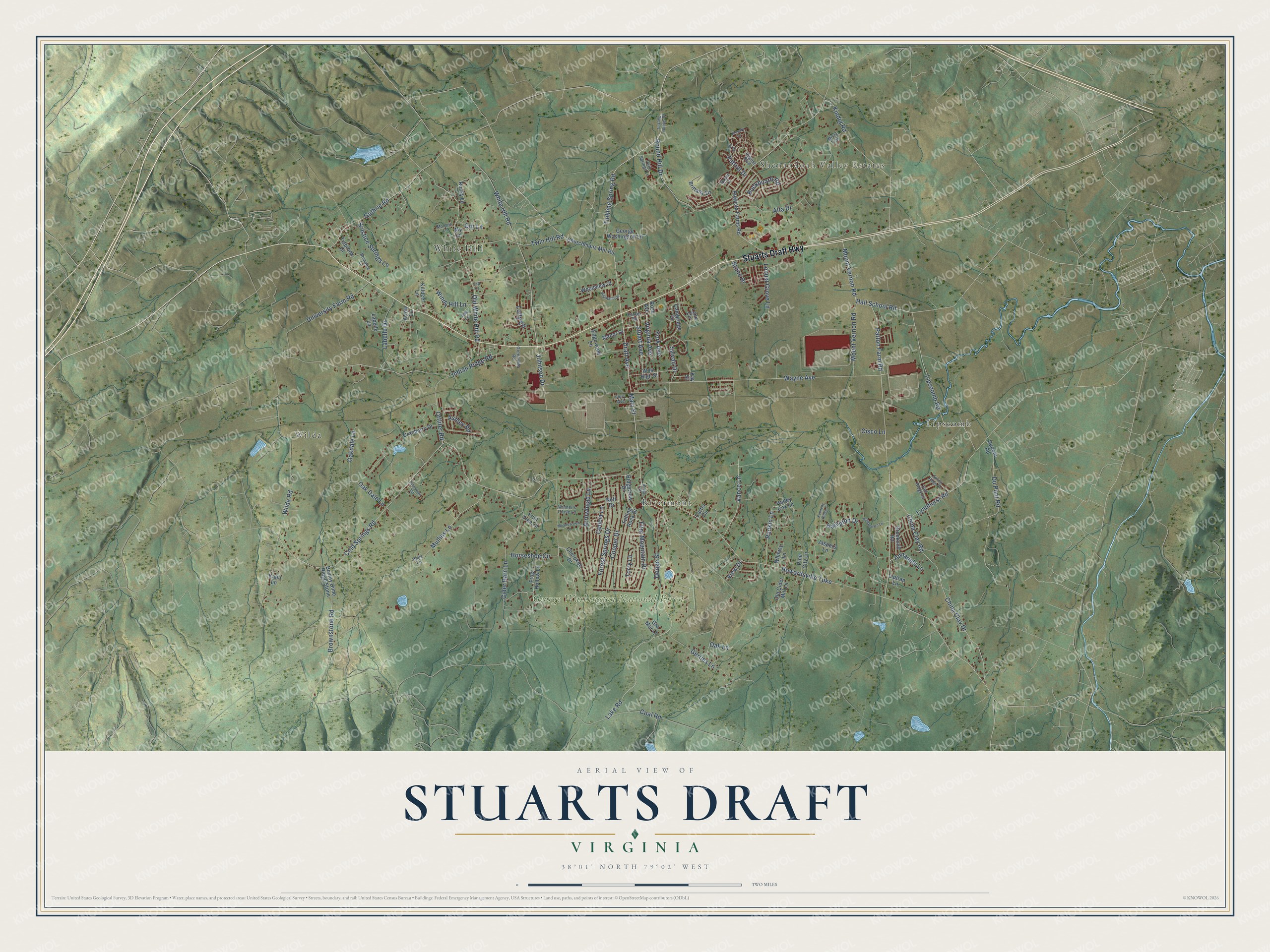
Explore Stuarts Draft, Virginia from a whole new perspective. Created using aerial imagery and detailed geographic data, this map captures Stuarts Draft building by building, with labeled streets, familiar landmarks, and shaded topographical relief that highlights the natural contours of the landscape.
Combining modern data with the timeless character of a vintage atlas, this map is just as interesting up close as it is beautiful on the wall. Whether you grew up in Stuarts Draft, spent memorable years there, or call it home today, this unique map is a great way to celebrate a place that means something to you. Zoom in on the preview to look for your street, and then order a print to put your memories on the wall.
Three ways to hang it
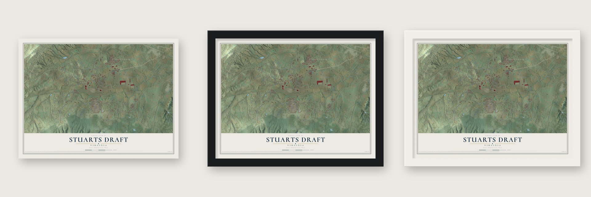
Unframed archival matte, a black wood frame or a white wood frame.
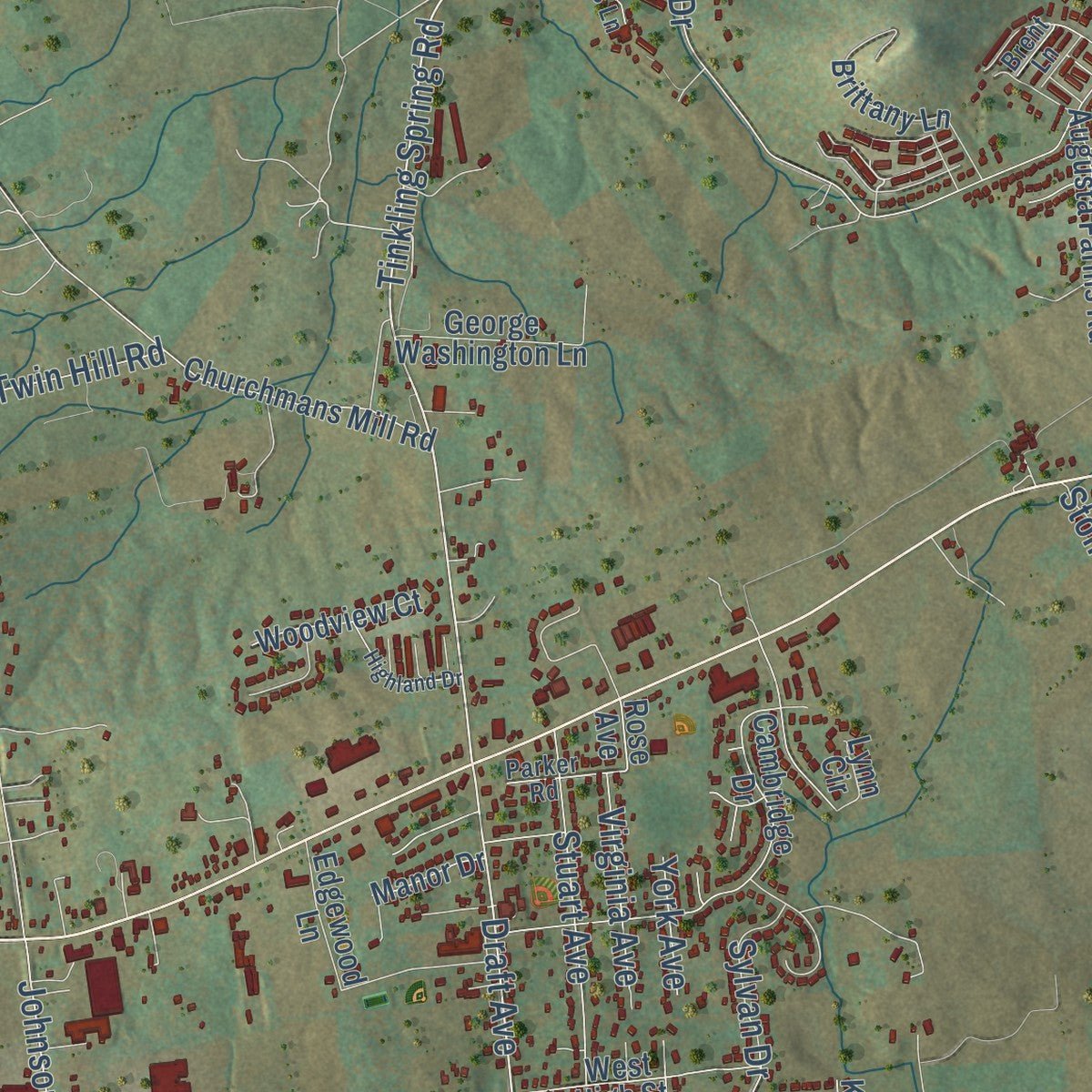
Up close
Geography Worth Displaying
This map was created using accurate cartographic data and authoritative geographic sources, including the U.S. Geological Survey and the Census Bureau. The map brings together terrain, waterways, roads, and building detail. The majority of the streets are labeled, houses are accurately depicted, and the topography is derived from government sources. Combining local data with carefully composed color and shading leads to this beautifully detailed Stuarts Draft artwork for your wall.
Rather than simply showing street outlines, we’ve included as many of the street names as we could reasonably fit on the map while keeping their names legible. Zoom in on the high resolution preview to see exactly what’s on the map. We truly set out to create a statement piece for anyone who loves Stuarts Draft. So whether it’s for you, or a gift for someone you love, we hope this map of Stuarts Draft brings back fond memories.
Read the story behind this map of Stuarts Draft, Virginia from 2026.

About Stuarts Draft, Virginia
Stuarts Draft is a community of 12,142 people in Augusta County, in the Shenandoah Valley near the South River. William Beverly received a huge land patent from Governor William Gooch in 1736 and sold parcels to settlers. One of them, Archibald Stuart, a Scotch Presbyterian, came in 1738 and helped found Tinkling Spring Presbyterian Church in 1744. In 1749 his son Thomas bought 353 acres near the South River, a tract with a small cove that people in the region called a draft.
John Harper bought the Stuart property in 1800. When the settlement finally got a post office in 1837, it opened in Thomas Stuart's old hewed-pine log cabin on the Harper land, so the office and the community took the name Stuarts Draft. The Shenandoah Valley Railroad began stopping here in 1882, linking the farms to Roanoke and Hagerstown. Stores and a village grew up along the tracks, and by 1893 Charles H. Cohron had built the Stuarts Draft Mill beside them.
“A visitor to Stuarts Draft can see these imposing plants with cattle grazing in a nearby field...”
- Hemp for naval ropeThe first settlers cleared land and grew corn, wheat and flax, which they mixed with wool to make linsey-woolsey clothes. They tried tobacco and cotton, but hemp became their best cash crop because it supplied the raw material for rope used by navies. In the 1850s the Howardsville Turnpike let farmers haul wheat by wagon to Howardsville on the James River, a trip of a week, and bring back flour, sugar and other staples.
- With Lewis and ClarkJohn Colter was born in Stuarts Draft about 1775. He went on to join the expedition that Meriwether Lewis and William Clark led to the Northwest from 1804-1806.
- Apples by the carloadIn an average year of the 1920s, the community shipped 200 to 400 railroad car loads of apples, and its largest orchards grew 1,000 to 6,000 barrels apiece. Dr. William Baldwin Dodge, a railroad doctor turned businessman, ran the Dodge Inn on old Main Street, now Draft Avenue. The only large-scale cranberry grower south of New Jersey, he harvested 500 to 1,000 bushels a year and developed Mountain Lake, now Shenandoah Acres.
- A nine-month school in 1906The community's first school was a one-room schoolhouse at Barterbrook, four miles away, built before the Civil War. Its replacement stood behind today's Finley Memorial Presbyterian Church and grew from one room to five as more students came. In 1906 Stuarts Draft School became the first school in Augusta County to hold classes for a nine-month term, and the Citizens Educational League raised money for a playground, a library and an organ.
- Factories among the farmsIndustry arrived in the 1960s, when Draftco opened along with the J. K. Porter plant, which is NIBCO today. Hollister and other manufacturers followed in the 1970s, then a Hershey Company plant in the 1980s and McKee Foods in the 1990s. The new jobs brought many more people and much new building to the old farming community.
Find your street
Names on the Stuarts Draft map
Every name below is printed on this map. Look for your street, your school, the park where you played, or the pond down the road.
Places and landmarks6
- Shenandoah Valley Estates
- George Washington National Forest
- Lipscomb
- Rivermont
- White Hill
- Wilda
Streets and roads125
- Stuarts Draft Highway
- Du Pont Road
- Tinkling Spring Road
- Mount Vernon Road
- Draft Avenue
- Brownstone Road
- Offliter Road
- Johnson Drive
- Cold Springs Road
- Howardsville Turnpike
- Coal Road
- Patton Farm Road
- Wilda Road
- Lake Road
- Indian Ridge Road
- Wayne Avenue
- White Hill Road
- Old White Hill Road
- Horseshoe Circle
- Lipscomb Road
- Guthrie Road
- Kindig Road
- China Clay Drive
- Round Hill Drive
- University Farm Road
- Labelle Drive
- Lyndhurst Road
- Forest Springs Drive
- Twin Hill Road
- Gerties Lane
Show all 125 streets
- Cooper Drive
- Mullins Lane
- Hampton Drive
- Vance Lane
- Cider Barn Lane
- China Clay Road
- Flint Mountain Drive
- Oak Lane
- Dodge Street
- Rankin Lane
- Alta Drive
- Oak Dale Lane
- Locust Grove Lane
- Cisco Lane
- Stuart Avenue
- Buckboard Road
- Hall School Road
- Solstice Springs Lane
- Oakdale Lane
- Main Street
- Ceocia Lane
- Arrowhead Lane
- Sylvan Drive
- Torry Lane
- Windy Hill Lane
- Virginia Avenue
- Annadale Lane
- Patriot Drive
- Lofty Circle
- Ashley Road
- Our Lane
- Stone Drive
- York Avenue
- View Drive
- Cherokee Drive
- Arrow Lane
- Rose Avenue
- Augusta Farms Road
- Boxley Dime Ridge Stone
- Cambridge Drive
- Falling Rock Drive
- Frog Hollow Lane
- Edgewood Lane
- Churchmans Mill Road
- Ridgeview Drive
- Jaspers Lane
- Old Cider Mill Lane
- Brittany Lane
- Killdeer Lane
- George Washington Lane
- Carter Circle
- Cranberry Drive
- Pine City Lane
- Hailey Cox Lane
- Fruit Tree Lane
- Rocky Lane
- Labelle Lane
- Brookmill Road
- Woodview Court
- Neff Drive
- West High Street
- Whimsy Lane
- Tisbrook Drive
- Dupont Road
- Manor Drive
- Gra Mar Lane
- My Lane
- Liptrap Lane
- Lynn Circle
- Kalin Lane
- Kay Street
- Romaine Lane
- Twin Springs Lane
- Fall Ridge Drive
- Misty Trail
- Parker Road
- Greenville Road
- August Boulevard
- Winner's Circle Lane
- Flory Avenue
- Moores Lane
- Fall Lane
- Halls Lane
- Brent Lane
- Tinkling Springs Road
- Hodge Street
- Bauserman Lane
- Spring Ridge Drive
- Highland Drive
- Meadowview Lane
- January Drive
- Kennedy Ridge Court
- Allentown Road
- Jays Lane
- Tag Lane
Names are listed as they appear on the printed map. Zoom into the product photos to find them.
The art of mapping a place
How This Map Was Made
Real places. Remarkable detail. Discover the layers that turn geographic data into a map of home.

The view from above
Aerial imagery reveals the character of the land: woodland, open fields, and the patterns of a place.

The shape of the land
Elevation data brings hills, valleys, and subtle changes in the landscape into view.

The details of home
Roads, waterways, and building footprints come together to make the map feel unmistakably local.

Geography becomes art
Considered color, shading, and typography bring the layers together in a map made for your wall.


Process illustrated with Mendon, Massachusetts. Aerial imagery: USDA NAIP. Terrain: USGS 3D Elevation Program. Map details and finished artwork: KNOWOL.
The Details
About This Print
Choose an archival matte print, or a black or white Ayous wood frame. The archival matte print is unframed.
Select your size and finish above to see the matching product image and price.
Materials & Craftsmanship
A contemporary map with the character of a classic atlas, printed on archival matte paper. Optional frames are made from Ayous wood.
Your printed map does not include the watermark shown in the full-map preview.
Shipping & Delivery
Free shipping within the United States. Every print is made to order in the USA.
Buying a gift? Add a note in your cart and we'll include it. We never put prices in the package.
Prints ship within 2 to 3 business days. Allow 7 to 10 days total from ordering for delivery. Timing may vary during holidays or periods of high order volume.
Read our shipping policy.
Returns and damaged prints
Each print is made to order. Change-of-mind refunds are not available after production.
If your print arrives damaged, misprinted or incorrect, contact support@knowol.com within 30 days of receiving it. Include your order number, photos and a description of the issue.
Read our full refund and replacement policy. For questions about your order, email support@knowol.com.
Find your town
Looking for another city?
Find a map of home in our Virginia collection, or any town in the country.
Nearby
Maps of towns near Stuarts Draft
Know someone from one of these towns? Their map makes a great gift.
 Lyndhurst
, Virginia
From $39.99See the map
 Sherando
, Virginia
From $39.99See the map
 Fishersville
, Virginia
From $39.99See the map
More maps nearby: Jolivue, Greenville, Waynesboro, Wintergreen and Staunton.