
Search for another town


Free U.S. delivery 7 to 10 days after you order
Webb City, Missouri Map Art
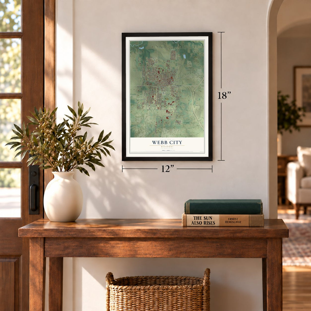
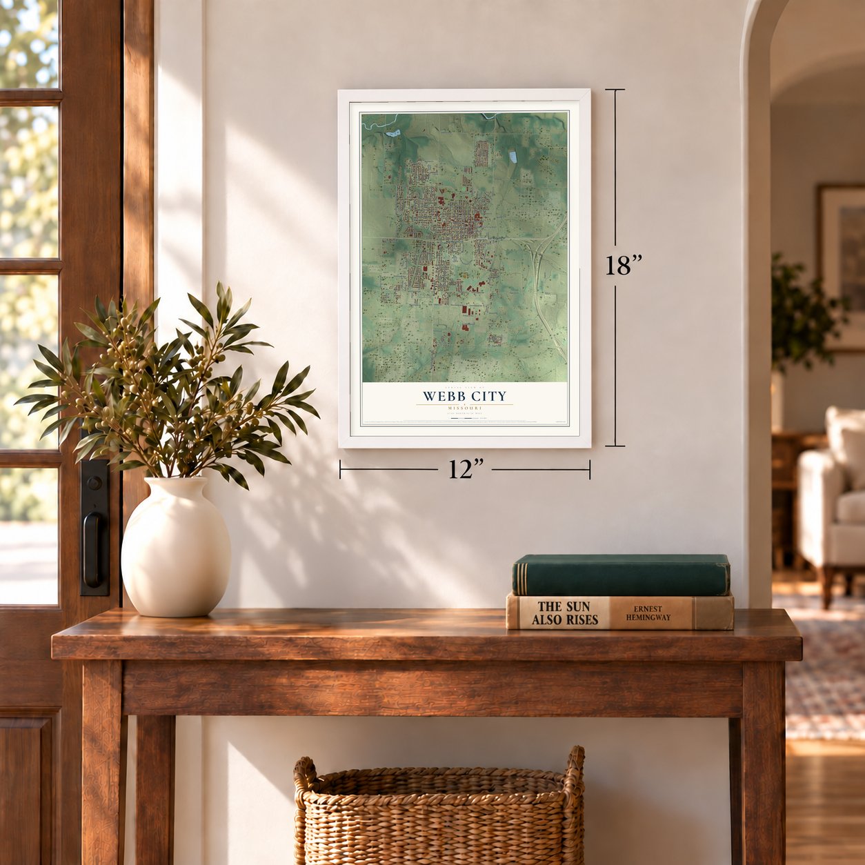
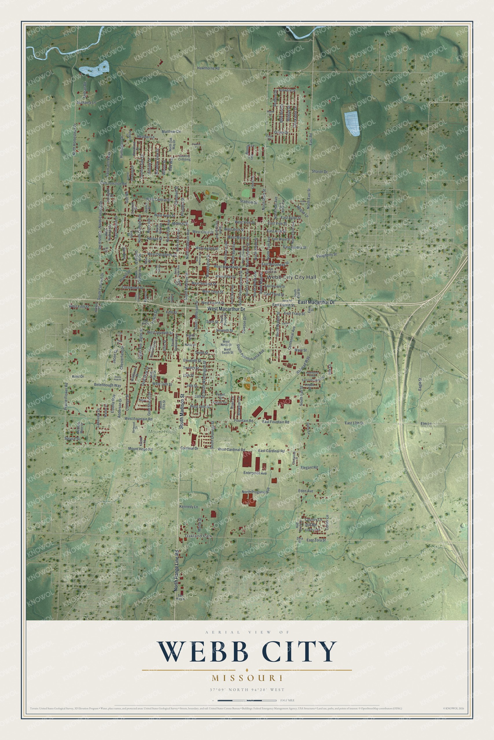
A new map of Webb City, Missouri, made in 2026 and printed to order on thick archival matte paper.
12" x 18" Archival Matte Print
A Map of Home. A Work of Art.
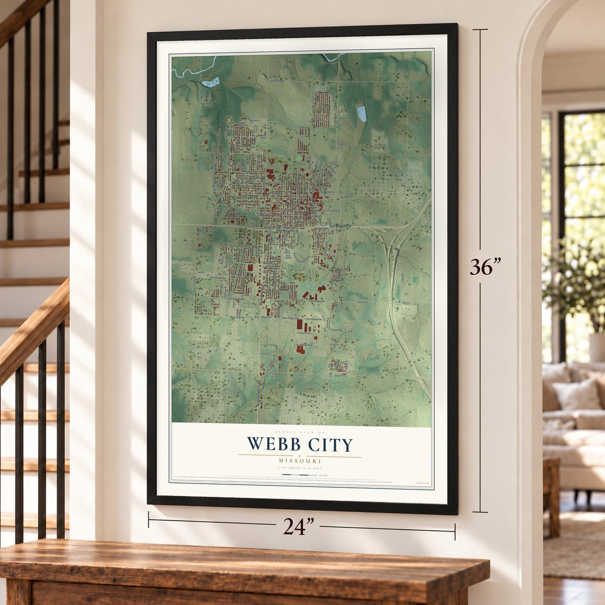
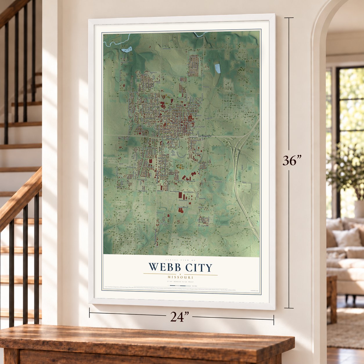
Explore Webb City, Missouri from a whole new perspective. Created using aerial imagery and detailed geographic data, this map captures Webb City building by building, with labeled streets, familiar landmarks, and shaded topographical relief that highlights the natural contours of the landscape.
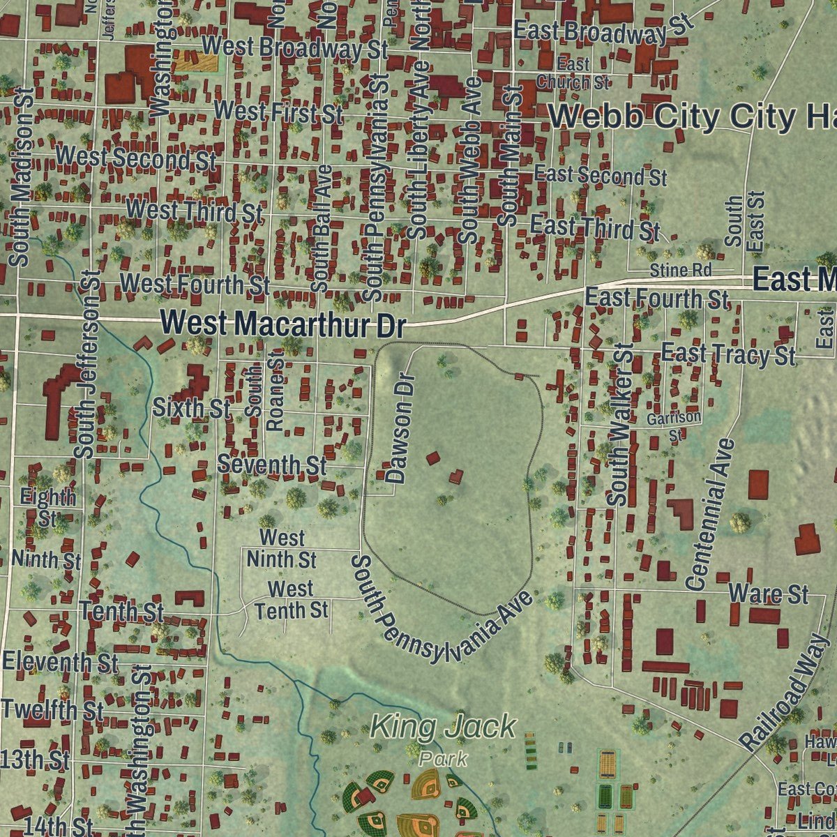
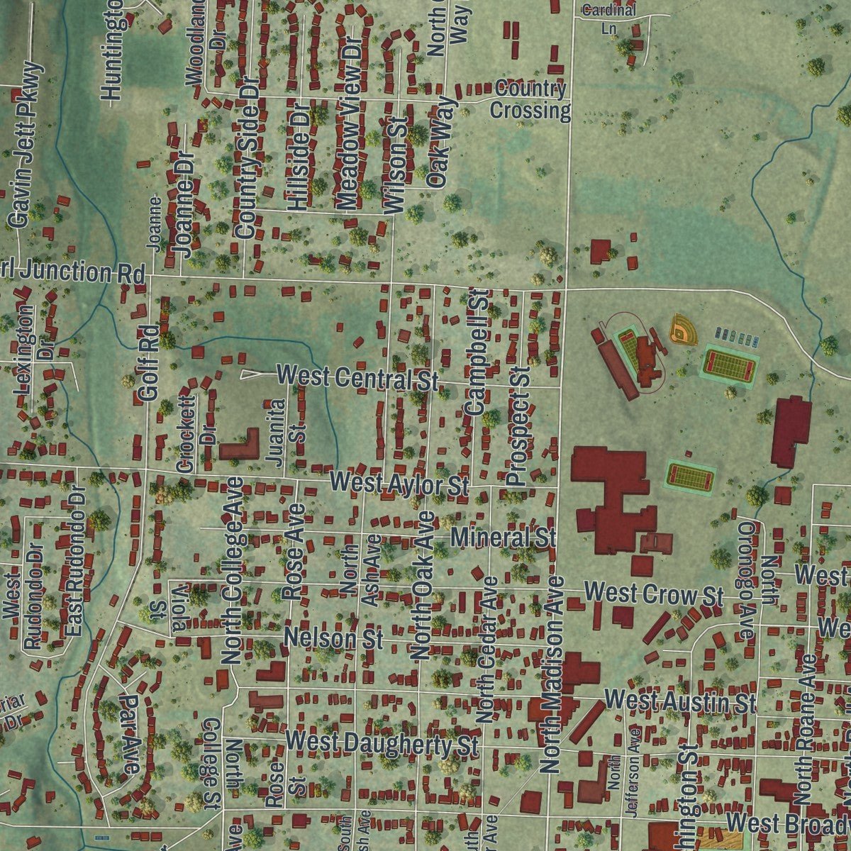
Combining modern data with the timeless character of a vintage atlas, this map is just as interesting up close as it is beautiful on the wall. Whether you grew up in Webb City, spent memorable years there, or call it home today, this unique map is a great way to celebrate a place that means something to you. Zoom in on the preview to look for your street, and then order a print to put your memories on the wall.
Three ways to hang it
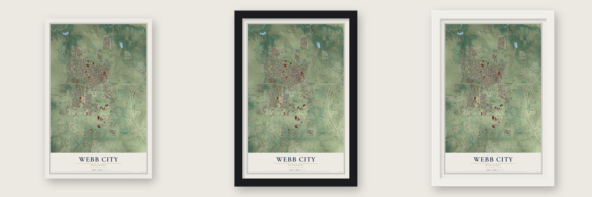
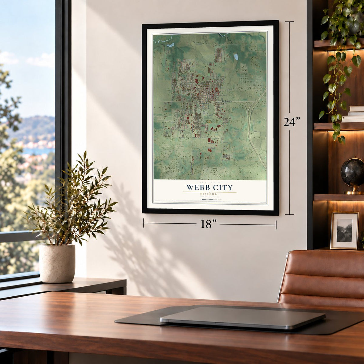
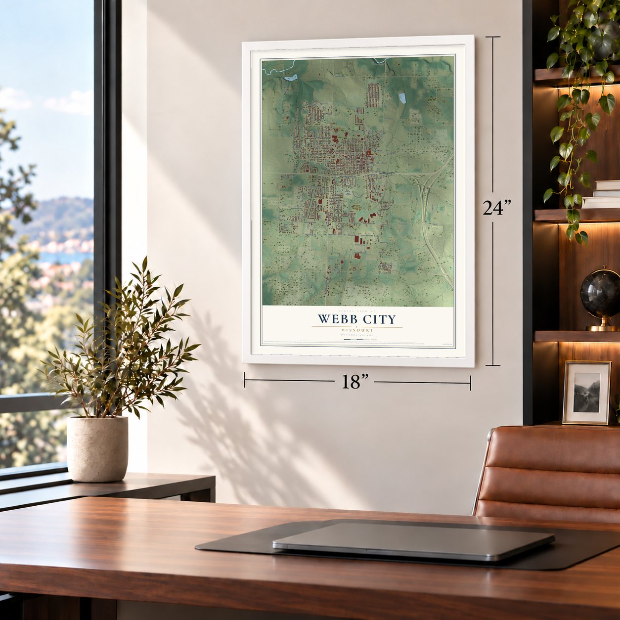
Unframed archival matte, a black wood frame or a white wood frame.
Up close
Geography Worth Displaying
This map was created using accurate cartographic data and authoritative geographic sources, including the U.S. Geological Survey and the Census Bureau. The map brings together terrain, waterways, roads, and building detail. The majority of the streets are labeled, houses are accurately depicted, and the topography is derived from government sources. Combining local data with carefully composed color and shading leads to this beautifully detailed Webb City artwork for your wall.
Rather than simply showing street outlines, we’ve included as many of the street names as we could reasonably fit on the map while keeping their names legible. Zoom in on the high resolution preview to see exactly what’s on the map. We truly set out to create a statement piece for anyone who loves Webb City. So whether it’s for you, or a gift for someone you love, we hope this map of Webb City brings back fond memories.
Read the story behind this map of Webb City, Missouri from 2026.

About Webb City, Missouri
Webb City is a city of 13,031 people in Jasper County, in the Joplin metro area. John C. Webb claimed a 200-acre farm here in February 1857, and in 1873 his plow turned up lead. In 1874 he and W.A. Daugherty put down the first pump-shaft together, and Webb then leased the land to Daugherty and G.P. Ashcraft. Webb platted a town on part of his farm in 1875, and it was incorporated in December 1876 with 700 people.
Railroads followed: the St. Louis and San Francisco in 1879 and the Missouri Pacific in 1881. The town grew from 1,588 people in 1880 to 9,201 in 1900, and business boomed after the Yellow Dog, its first sheet ground mine, succeeded in the 1890s. About 20 years after Webb's strike, 700 mines worked the ground inside Webb City and neighboring Carterville, and their district ranked first in zinc ore. During World War I its lead and zinc concentrate was worth more than $18 million, and the population reached about 15,000. When mining declined after the war, the city turned to other industries and to farming.
- Built by its founderJohn C. Webb did more than lend the town his name. He gave land for a school and for the first Methodist Episcopal Church, South, and he put up the Webb City Bank and the town's first hotel. His son Elijah later built a three-story house in the Queen Anne style, and the Elijah Thomas Webb House joined the National Register in 2020.
- From mules to an interurbanIn 1889 A.H. Rogers started a streetcar line pulled by mules between Webb City and Carterville. It became the SouthWest Missouri Electric Railway in 1893 and, in the 1900s, grew into the Southwest Missouri Railroad Company, a large interurban network. The company kept its power plant, its car barns and a clubhouse for its workers at Webb City.
- Red Hot Street goes dryThe miners pouring into town kept a busy row of saloons going on Daugherty Street, which people called Red Hot Street. The Prohibition movement and the Woman's Christian Temperance Union pushed back, and in 1910 Webb City voted to become a dry city.
- A silver medal for oreThe Webb City Mining District sent strong displays to the Chicago exposition of 1893 and to the 1898 exhibition in Omaha. Its mineral display brought home the only silver medal given out.
- A record football coachJohn Roderique coached football at Webb City High School from 1997 to 2022 and won more state titles than any other coach in Missouri history.
Find your street
Names on the Webb City map
Every name below is printed on this map. Look for your street, your school, the park where you played, or the pond down the road.
Places and landmarks5
- Webb City City Hall
- King Jack Park
- Mount Hope Cemetery
- Webb City Cemetery
- Oakland Park
Streets and roads215
- South Madison Street
- East Macarthur Drive
- West Macarthur Drive
- North Range Line Road
- North Main Street
- North East Street
- South Main Street
- East Road
- South Jefferson Street
- North Madison Avenue
- Mount Hope Road
- East Tracy Street
- Center Lane
- Prairie Flower Road
- West Wood Street
- South Colonial Drive
- East Arch Street
- East Fountain Road
- North Webb Street
- Stadium Drive
- Gold Dust Drive
- 15th Street
- East Vine Street
- East Broadway Street
- South Hall Street
- South Oronogo Street
- West Broadway Street
- East Zora Street
- Carl Junction Road
- West Fountain Road
Show all 215 streets
- West Aylor Street
- West Daugherty Street
- West Austin Street
- Cardinal Drive
- South Pennsylvania Avenue
- South Pennsylvania Street
- West Fourth Street
- West First Street
- Washington Street
- Fountain Road
- East 17th Street
- Golf Road
- North Homestead Drive
- North Colonial Drive
- South Walker Street
- West Third Street
- West Crow Street
- North Oak Avenue
- Colonial Road
- College Street
- North Tom Avenue
- West Second Street
- West Cardinal Road
- Nelson Street
- West Seventh Street
- North Hall Avenue
- Wilson Street
- Eagle Street
- North Progress Avenue
- Enterprise Avenue
- Zigler Avenue
- Zigler Street
- Lakeview Drive
- Betenbough Way
- West 14th Street
- South Washington Street
- Fifth Street
- Redbird Drive
- Mineral Street
- Bluejay Drive
- Blue Bird Drive
- Chickadee Drive
- West Central Street
- North College Avenue
- North Ball Avenue
- North Liberty Street
- Chesterfield Drive
- East Aylor Street
- Rose Avenue
- Crestwood Drive
- Matthew Circle
- West Fifth Street
- East Galena Street
- Centennial Avenue
- East Cardinal Road
- Ellis Street
- Country Side Drive
- Sixth Street
- West 16th Street
- Powell Drive
- Seventh Street
- Heather Lane
- West Arch Street
- Daugherty Street
- Anderson Drive
- East Fourth Street
- Gavin Jett Parkway
- South Liberty Avenue
- Ware Street
- Dawson Drive
- West Vine Street
- Gold Stream Drive
- South Webb Avenue
- Elegant Road
- Bonnie Lane
- Eden Avenue
- Elm Lane
- Kennedy Lane
- Eleventh Street
- 14th Street
- Twelfth Street
- 13th Street
- Tenth Street
- Huntington Drive
- Hawthorne Road
- Country Lane
- Campbell Street
- Hillside Drive
- Prospect Street
- Myrtle Street
- Sharon Drive
- Meadow View Drive
- Railroad Way
- Michaela Lane
- East Third Street
- Kent Drive
- Frisco Street
- Par Avenue
- Megan Lane
- Prier Lane
- Brewster Lane
- Andrae Road
- Joanne Drive
- Dirt Road
- Estella Way
- Oriole Drive
- Oak Way
- Jacee Circle
- Spruce Street
- Elm Court
- South East Street
- North Roane Avenue
- North Oak Way Drive
- Woodland Drive
- South Ball Avenue
- South Roane Street
- Country Crossing
- North College Street
- Rose Street
- North Cedar Avenue
- North Oronogo Avenue
- North Ash Avenue
- South Oakland Avenue
- South College Avenue
- North Elliott Avenue
- East Wood Street
- Zora Street
- South Ellis Street
- West Ninth Street
- Meadow Moor Drive
- East Rudondo Drive
- West Tenth Street
- East Second Street
- Wildflower Drive
- Bobwhite Drive
- West Rudondo Drive
- Gold Pan Drive
- Lexington Drive
- Linden Street
- Fallon Terrace
- Juanita Street
- Rose Lane
- Half Circle Drive
- Mando Lane
- Liberty Street
- Powell Court
- Ginny Lane
- Hatten Street
- Crockett Drive
- Kristin Lane
- Eighth Street
- Ninth Street
- Ten Pin Lane
- Forest Street
- Cedar Circle
- Viola Street
- East Street
- East Church Street
- West Wickersham Drive
- North Pennsylvania Street
- North Walker Avenue
- Redwood Drive
- East Pool Road
- East Cottonwood Street
- Centennial Street
- Newport Circle
- Hawthorne Loop
- Stine Road
- Mary Lane
- South Cedar Avenue
- Joanne
- Briar Drive
- Robin Lane
- Finch Drive
- South Ash Avenue
- South College Street
- Garrison Street
- North Jefferson Avenue
- Jillian Lane
- West Sixth Street
- Nuggett
- Cardinal Lane
- Donna Ruth Place
- Kohl Court
- Evan Court
Names are listed as they appear on the printed map. Zoom into the product photos to find them.
The art of mapping a place
How This Map Was Made
Real places. Remarkable detail. Discover the layers that turn geographic data into a map of home.

The view from above
Aerial imagery reveals the character of the land: woodland, open fields, and the patterns of a place.

The shape of the land
Elevation data brings hills, valleys, and subtle changes in the landscape into view.

The details of home
Roads, waterways, and building footprints come together to make the map feel unmistakably local.

Geography becomes art
Considered color, shading, and typography bring the layers together in a map made for your wall.


Process illustrated with Mendon, Massachusetts. Aerial imagery: USDA NAIP. Terrain: USGS 3D Elevation Program. Map details and finished artwork: KNOWOL.
The Details
About This Print
Choose an archival matte print, or a black or white Ayous wood frame. The archival matte print is unframed.
Select your size and finish above to see the matching product image and price.
Materials & Craftsmanship
A contemporary map with the character of a classic atlas, printed on archival matte paper. Optional frames are made from Ayous wood.
Your printed map does not include the watermark shown in the full-map preview.
Shipping & Delivery
Free shipping within the United States. Every print is made to order in the USA.
Buying a gift? Add a note in your cart and we'll include it. We never put prices in the package.
Prints ship within 2 to 3 business days. Allow 7 to 10 days total from ordering for delivery. Timing may vary during holidays or periods of high order volume.
Read our shipping policy.
Returns and damaged prints
Each print is made to order. Change-of-mind refunds are not available after production.
If your print arrives damaged, misprinted or incorrect, contact support@knowol.com within 30 days of receiving it. Include your order number, photos and a description of the issue.
Read our full refund and replacement policy. For questions about your order, email support@knowol.com.
Find your town
Looking for another city?
Find a map of home in our Missouri collection, or any town in the country.
Nearby
Maps of towns near Webb City
Know someone from one of these towns? Their map makes a great gift.
 Carterville
, Missouri
From $39.99See the map
 Airport Drive
, Missouri
From $39.99See the map
 Oronogo
, Missouri
From $39.99See the map
More maps nearby: Carl Junction, Duenweg, Duquesne, Brooklyn Heights and Joplin.