
Search for another town




Free U.S. delivery 7 to 10 days after you order
Weirton, West Virginia Map Art
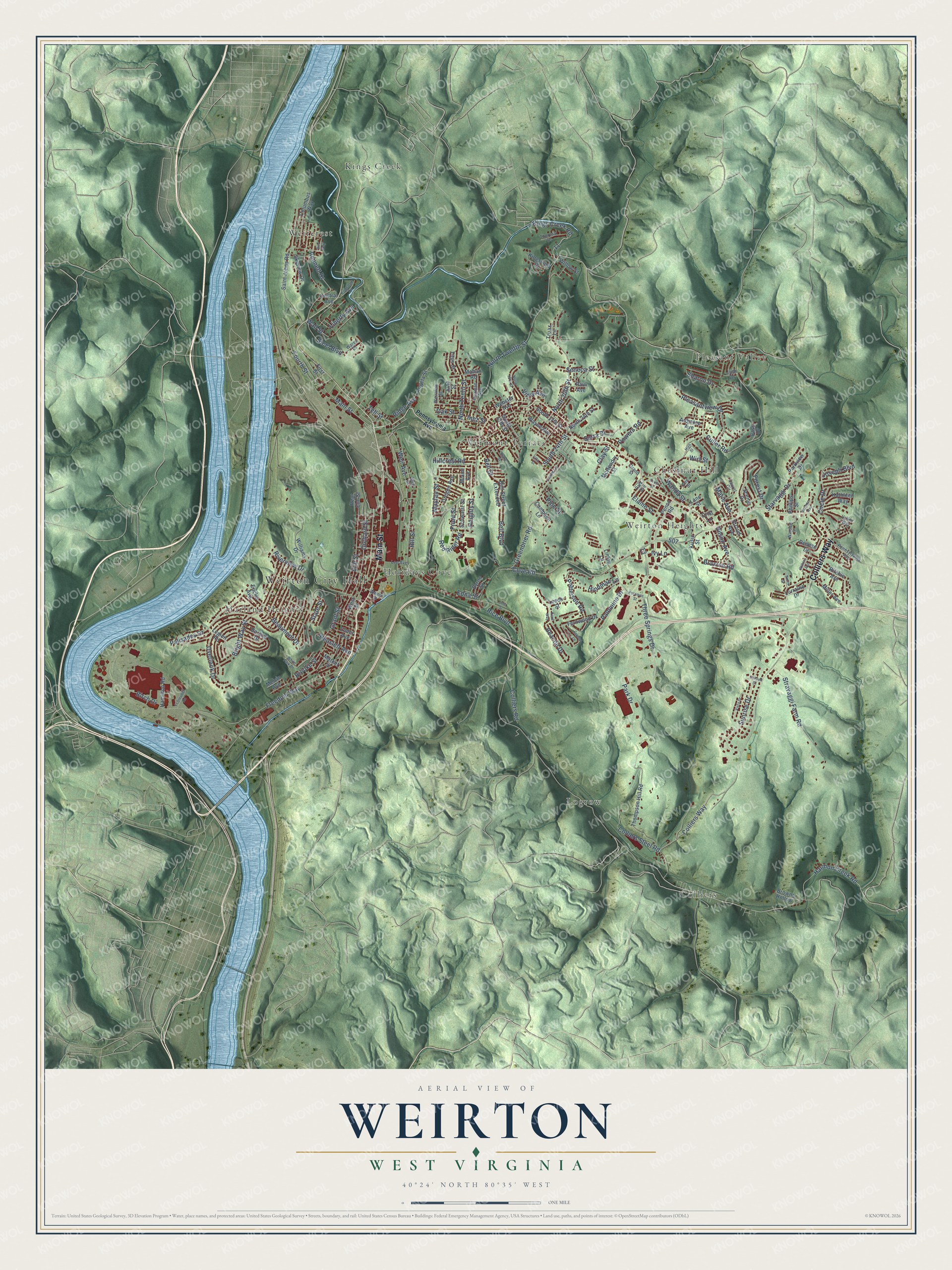
A new map of Weirton, West Virginia, made in 2026 and printed to order on thick archival matte paper.
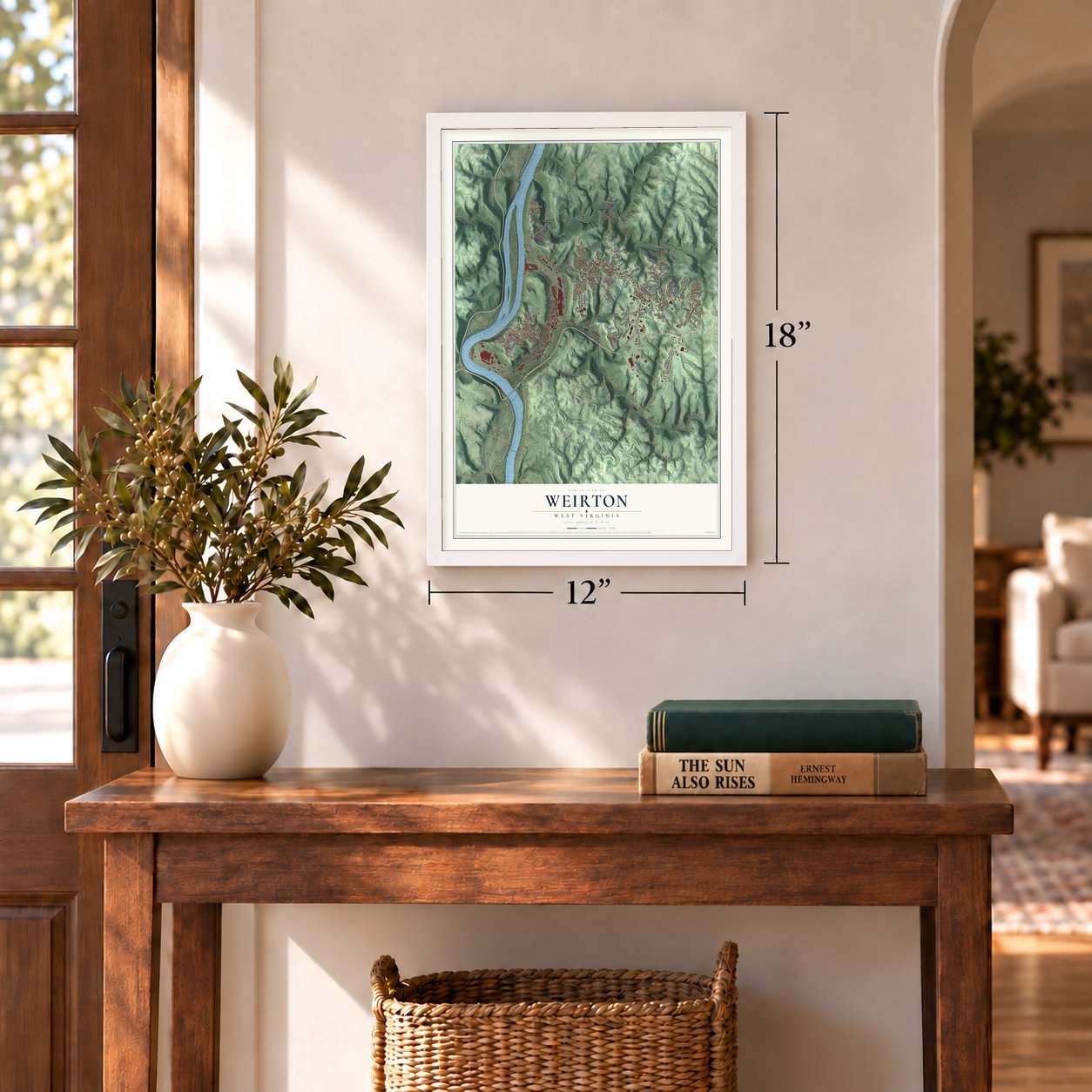
12" x 18" Archival Matte Print
A Map of Home. A Work of Art.
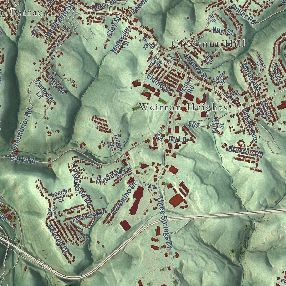
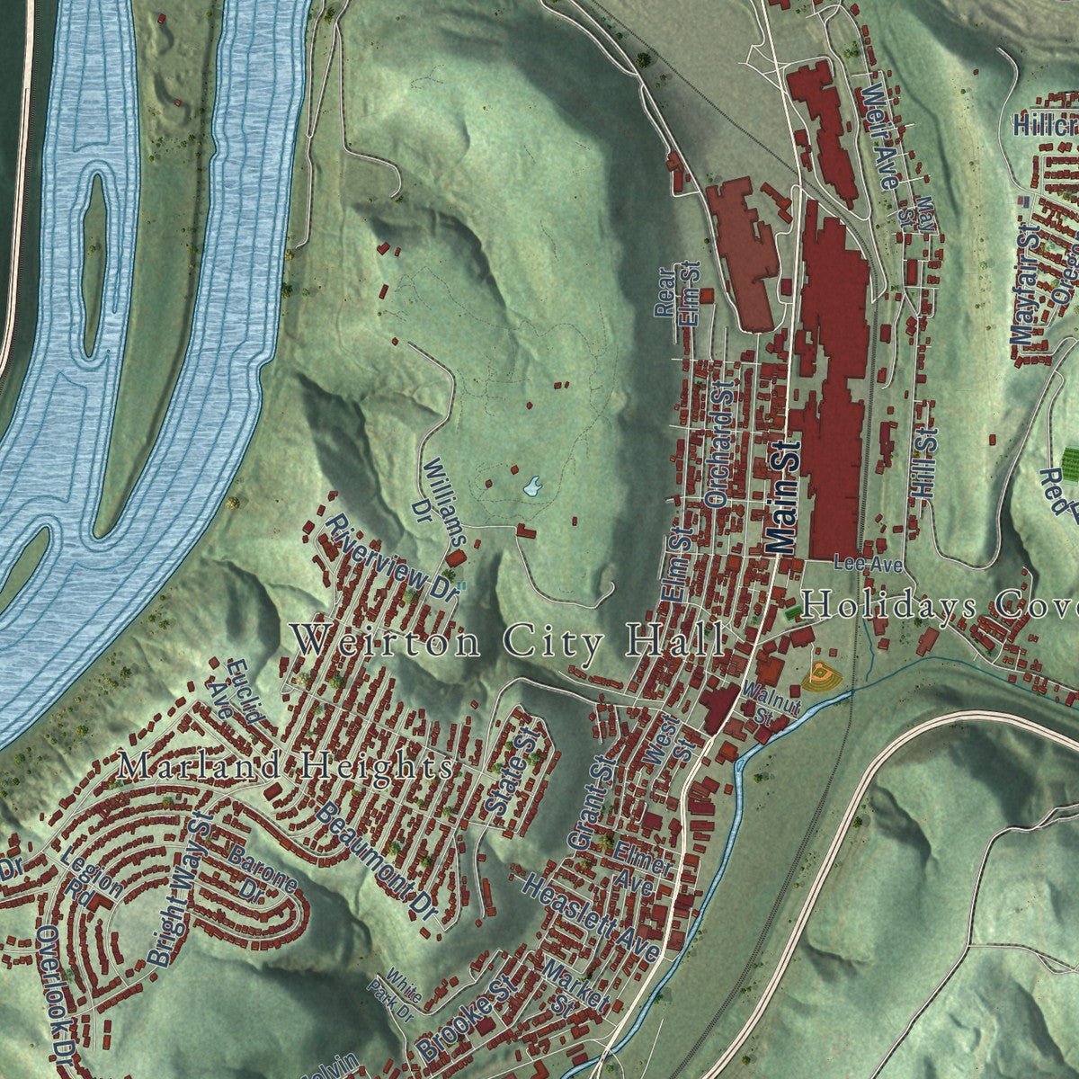
Explore Weirton, West Virginia from a whole new perspective. Created using aerial imagery and detailed geographic data, this map captures Weirton building by building, with labeled streets, familiar landmarks, and shaded topographical relief that highlights the natural contours of the landscape.
Combining modern data with the timeless character of a vintage atlas, this map is just as interesting up close as it is beautiful on the wall. Whether you grew up in Weirton, spent memorable years there, or call it home today, this unique map is a great way to celebrate a place that means something to you. Zoom in on the preview to look for your street, and then order a print to put your memories on the wall.
Three ways to hang it
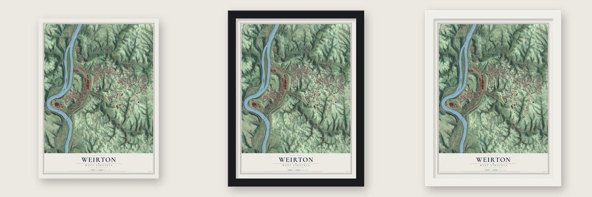
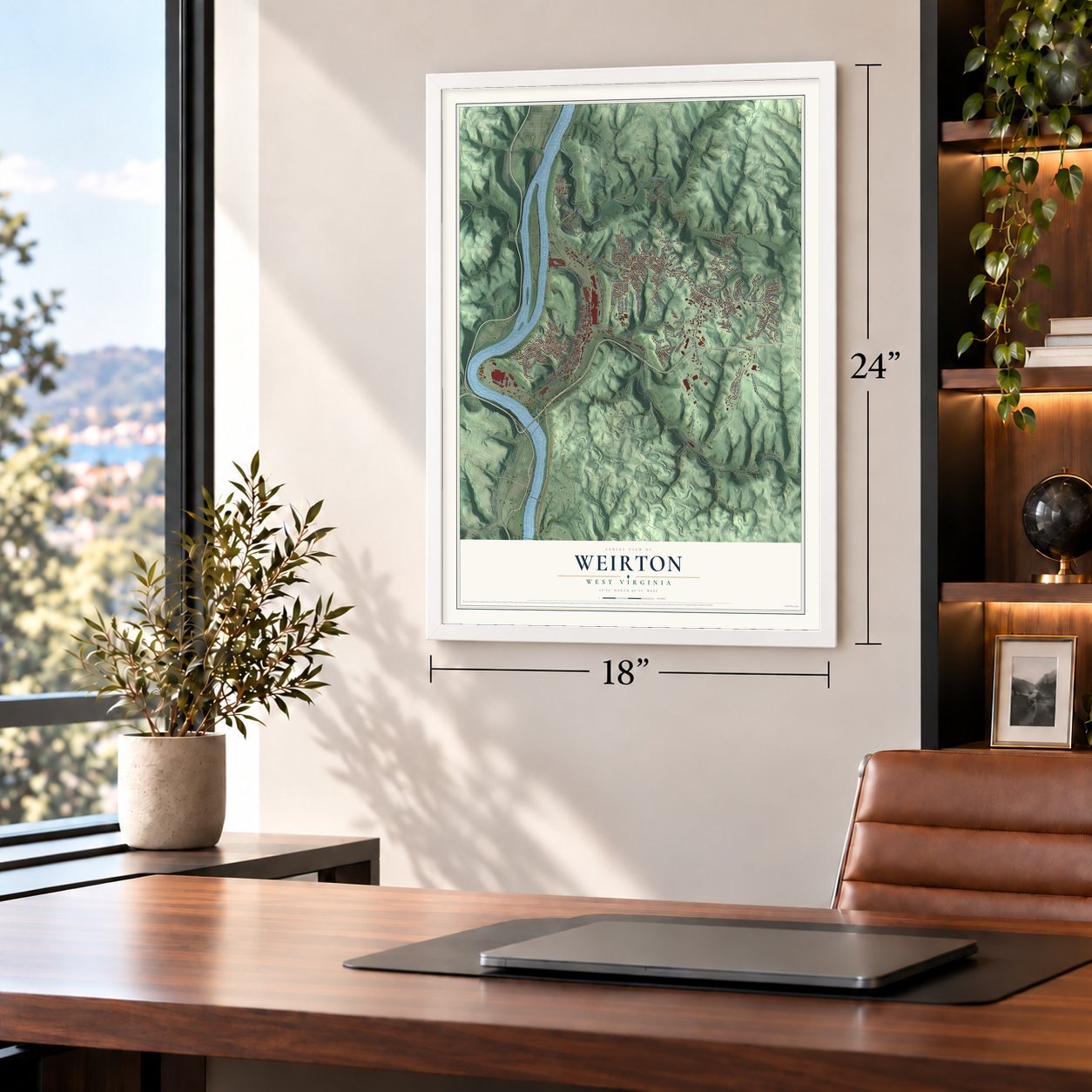
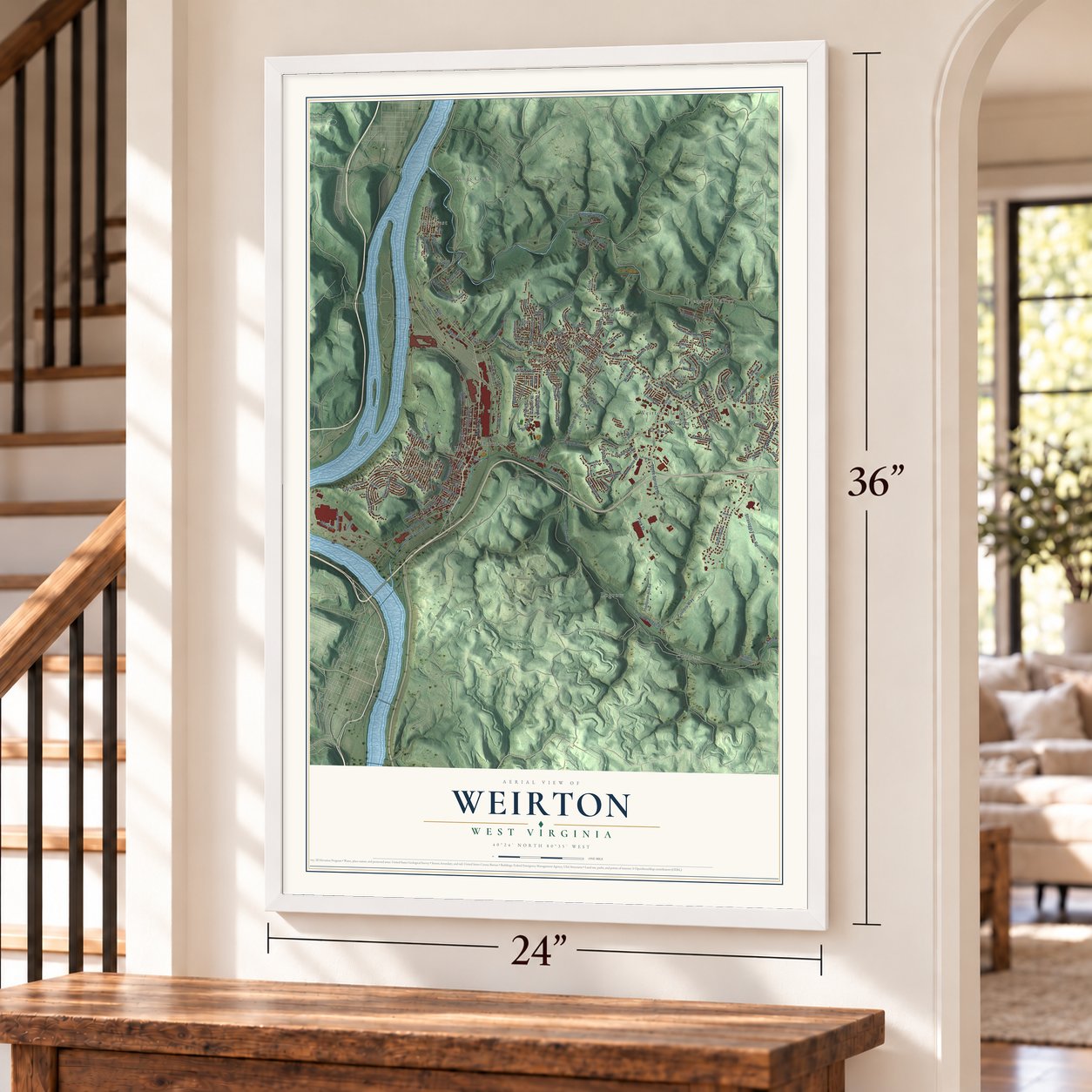
Unframed archival matte, a black wood frame or a white wood frame.
Up close
Geography Worth Displaying
This map was created using accurate cartographic data and authoritative geographic sources, including the U.S. Geological Survey and the Census Bureau. The map brings together terrain, waterways, roads, and building detail. The majority of the streets are labeled, houses are accurately depicted, and the topography is derived from government sources. Combining local data with carefully composed color and shading leads to this beautifully detailed Weirton artwork for your wall.
Rather than simply showing street outlines, we’ve included as many of the street names as we could reasonably fit on the map while keeping their names legible. Zoom in on the high resolution preview to see exactly what’s on the map. We truly set out to create a statement piece for anyone who loves Weirton. So whether it’s for you, or a gift for someone you love, we hope this map of Weirton brings back fond memories.
Read the story behind this map of Weirton, West Virginia from 2026.
About Weirton, West Virginia
Weirton is a city of 19,163 people on the Ohio River, across from Steubenville, Ohio. Most of it lies in Hancock County, with a small part in Brooke County. Soldiers built Fort Holliday here during the Revolutionary War, and in 1793 the village of Hollidays Cove was founded where the fort had stood. That village makes up most of today's downtown.
In 1909 Ernest T. Weir came from Pittsburgh and built a steel mill just north of Hollidays Cove. A settlement called Weirton grew up around the mill but never incorporated, and by 1940 people called it the biggest unincorporated place in the United States. Hollidays Cove, Marland Heights and Weirton Heights had each become towns by the 1940s. On July 1, 1947, those three towns joined the unincorporated land to form one city. Thomas E. Millsop, who ran the Weirton Steel division of National Steel, became its first mayor, and voters approved the city charter in 1950.
- Fort Holliday, 1776Soldiers from Fort Pitt built Fort Holliday in 1776 on Harmons Creek, about 3 miles up from the Ohio. Colonel Andrew Van Swearingen commanded it. In 1777 he took a dozen men down the Ohio by longboat to help rescue the people of Fort Henry in Wheeling, which the British and Indian tribes had under siege. A mural at the Cove Station Post Office honors the trip. By 1779 more than 28 militiamen were posted at the fort.
- The mill its workers boughtWeirton Steel once employed over 12,000 people and was West Virginia's largest private employer and taxpayer. In the early 1980s its workers bought the mill from National Steel through the nation's largest Employee Stock Ownership Program, which kept it out of bankruptcy. After losing more than $700 million from 1998 on, the company went bankrupt in 2003. Cleveland-Cliffs bought the tin mill in 2020, then closed it in 2024 and laid off its last 800 workers.
- Weir's Weirton in LifeLife magazine ran a photo essay called Weir's Weirton in its September 13, 1937, issue. Its cover carried a portrait of Ernest T. Weir, the mill's founder.
- Filmed in WeirtonThe Deer Hunter, released in 1978, used Weirton and other towns along the Ohio Valley as locations. Six years later the city was the main setting for filming Reckless. In the fall of 2010, the movie Super 8 was shot downtown and in many other parts of the city.
Find your street
Names on the Weirton map
Every name below is printed on this map. Look for your street, your school, the park where you played, or the pond down the road.
Places and landmarks11
- Weirton City Hall
- Chestnut Hill
- Colliers
- Holidays Cove
- Kings Creek
- Logrow
- Marland Heights
- Pleasant Valley
- Vermont Terrace
- Weircrest
- Weirton Heights
Streets and roads162
- Main Street
- Colliers Way
- Weir Avenue
- Tell Street
- Three Springs Drive
- Fourth Street
- North Twelfth Street
- Bright Way Street
- Cove Road
- Culler Road
- Harmon Creek Road
- Birch Drive
- Freedom Way
- Greenbrier Road
- Orchard Street
- North 20th Street
- Patterson Road
- Stravaggi Farm Road
- Elm Street
- Sunrise Drive
- North Tenth Street
- Palisades Drive
- Riverview Drive
- Elaine Street
- Pleasantview Drive
- Bennett Drive
- Beaumont Drive
- Kings Creek Road
- Beacon Drive
- Heights Street
Show all 162 streets
- Bell Boulevard
- Colliers Steel Road
- Park Drive
- Overlook Drive
- Steel Boulevard
- Liberty Avenue
- Sharon Drive
- Wall Street
- Mayfair Street
- Red Rider Road
- Seneca Street
- Gilson Avenue
- Starvaggi Drive
- Hindman Lane
- South 24th Street
- State Street
- Forest Drive
- Grant Street
- Palomino Drive
- Ridge Avenue
- Hillcrest Road
- Serra Drive
- Brooke Street
- Heaslett Avenue
- Joseph Boulevard
- Braxton Road
- Rice Boulevard
- Powers Road
- Wanda Street
- Oak Street
- Marie Avenue
- Colliers Road
- Circle Drive
- Front Street
- Edna Street
- Clay Street
- Wirt Street
- Bell Street
- Pine Street
- Inez Street
- Ivy Lane
- View Avenue
- Hill Street
- Webster Avenue
- Thompson Hill Road
- Saint Johns Road
- West Street
- Penco Road
- Williams Drive
- Euclid Avenue
- Bell Street Extended
- Barone Drive
- Campbell Lane
- Skyview Drive
- Hamilton Road
- Columbus Way
- Miller Avenue
- Central Avenue
- Ritchie Avenue
- Oregon Avenue
- Fernwood Drive
- Denese Drive
- Scenic Drive
- South 17th Street
- Lorraine Drive
- Angela Street
- Leech Street
- Titus Street
- South 13th Street
- Wayne Avenue
- Kingsview Drive
- Browns Hollow
- North 24th Street
- Kathleen Way
- Market Street
- Mahan Road
- Phillips Street
- McHendry Street
- Parkview Drive
- Schwartz Street
- Willow Street
- Ardmore Avenue
- Elmer Avenue
- Stroud Avenue
- Rear Elm Street
- Legion Road
- Byron Street
- Paul Avenue
- Miami Avenue
- Truax Lane
- Linton Lane
- Lane Street
- June Street
- Kusic Street
- Melvin Avenue
- Bass Drive
- Judi Drive
- First Street
- Crist Lane
- Pennsylvania Avenue
- Valley Way
- Lee Avenue
- May Street
- Theresa Drive
- Warsaw Street
- Thurman Avenue
- Laurel Circle
- Wares Drive
- Grand Street
- Weirview Street
- Ann Street
- Park Avenue
- Walnut Street
- Vista Drive
- Potomac Street
- North 15th Street
- High Street
- White Park Drive
- Crystal Lane
- Harmon Avenue
- Kingsdale Road
- Effa Street
- Ft Steuben Road
- Clara Street
- Lucille Lane
- Wilkins Avenue
- Kent Way
- Colwell Court
- John Street
- Bird Way
- Smith Street
- Crest Street
Names are listed as they appear on the printed map. Zoom into the product photos to find them.
The art of mapping a place
How This Map Was Made
Real places. Remarkable detail. Discover the layers that turn geographic data into a map of home.

The view from above
Aerial imagery reveals the character of the land: woodland, open fields, and the patterns of a place.

The shape of the land
Elevation data brings hills, valleys, and subtle changes in the landscape into view.

The details of home
Roads, waterways, and building footprints come together to make the map feel unmistakably local.

Geography becomes art
Considered color, shading, and typography bring the layers together in a map made for your wall.


Process illustrated with Mendon, Massachusetts. Aerial imagery: USDA NAIP. Terrain: USGS 3D Elevation Program. Map details and finished artwork: KNOWOL.
The Details
About This Print
Choose an archival matte print, or a black or white Ayous wood frame. The archival matte print is unframed.
Select your size and finish above to see the matching product image and price.
Materials & Craftsmanship
A contemporary map with the character of a classic atlas, printed on archival matte paper. Optional frames are made from Ayous wood.
Your printed map does not include the watermark shown in the full-map preview.
Shipping & Delivery
Free shipping within the United States. Every print is made to order in the USA.
Buying a gift? Add a note in your cart and we'll include it. We never put prices in the package.
Prints ship within 2 to 3 business days. Allow 7 to 10 days total from ordering for delivery. Timing may vary during holidays or periods of high order volume.
Read our shipping policy.
Returns and damaged prints
Each print is made to order. Change-of-mind refunds are not available after production.
If your print arrives damaged, misprinted or incorrect, contact support@knowol.com within 30 days of receiving it. Include your order number, photos and a description of the issue.
Read our full refund and replacement policy. For questions about your order, email support@knowol.com.
Find your town
Looking for another city?
Find a map of home in our West Virginia collection, or any town in the country.
Nearby
Maps of towns near Weirton
Know someone from one of these towns? Their map makes a great gift.
 Colliers
, West Virginia
From $39.99See the map
 Follansbee
, West Virginia
From $39.99See the map
 Hooverson Heights
, West Virginia
From $39.99See the map
More maps nearby: New Cumberland, Wellsburg, Beech Bottom, Bethany and Chester.