
Search for another town




Free U.S. delivery 7 to 10 days after you order
Wenatchee, Washington Map Art
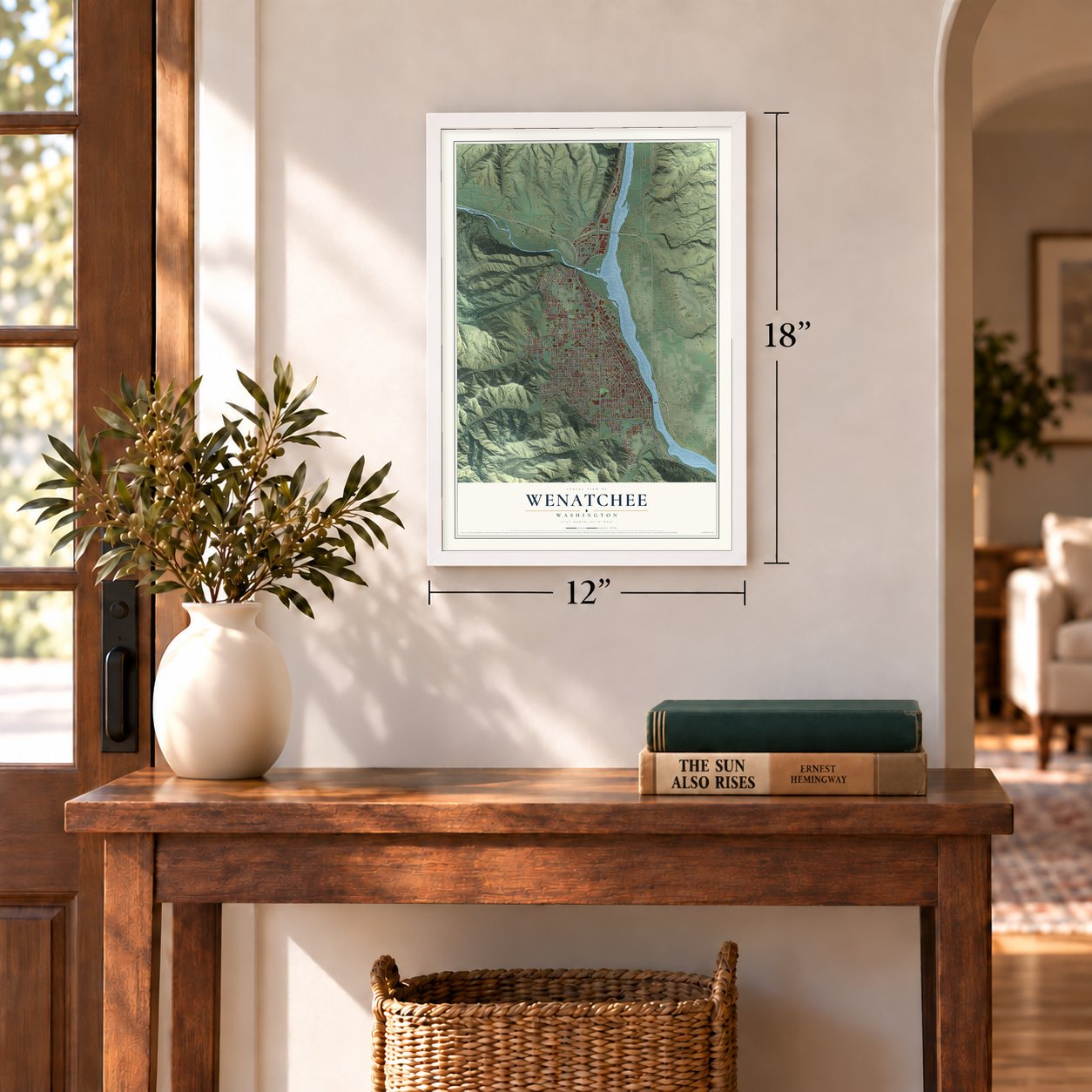
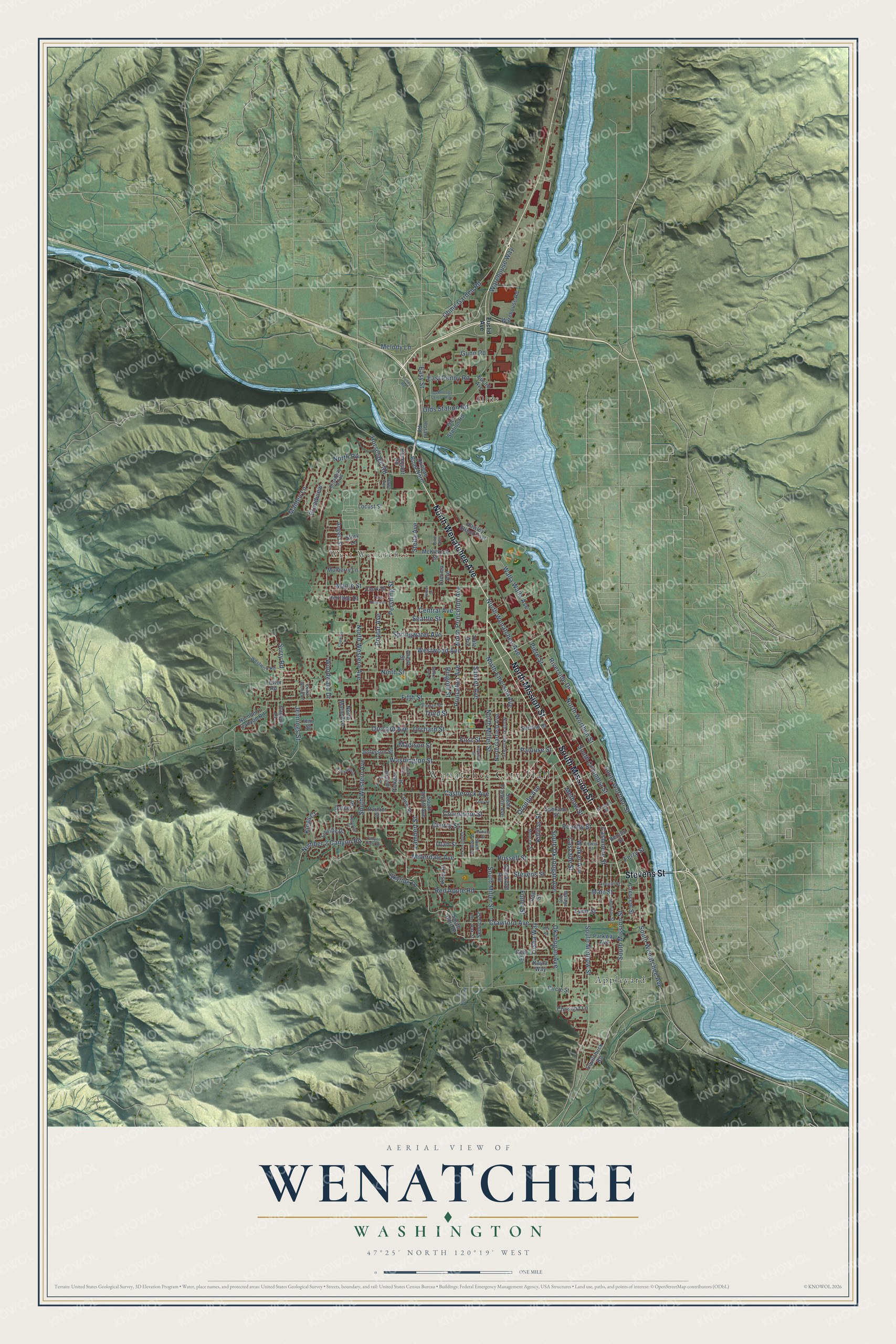
A new map of Wenatchee, Washington, made in 2026 and printed to order on thick archival matte paper.
12" x 18" Archival Matte Print
A Map of Home. A Work of Art.
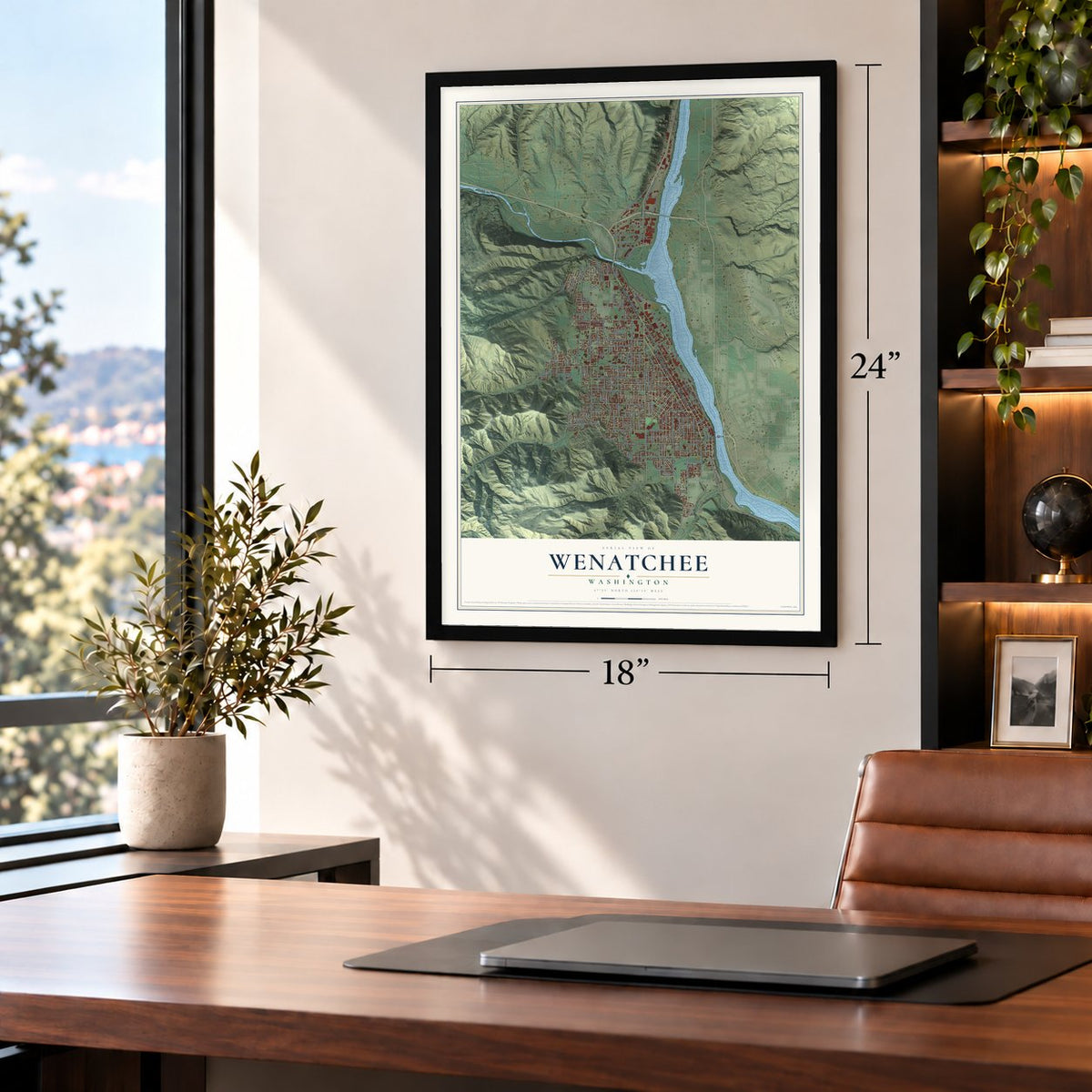
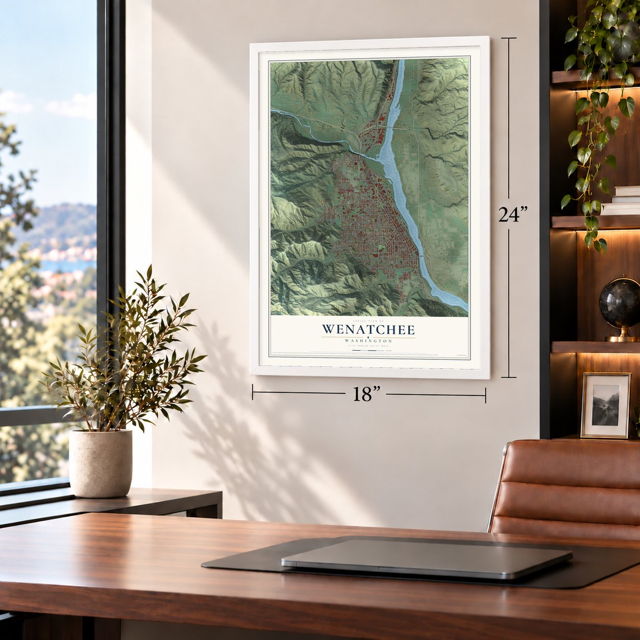
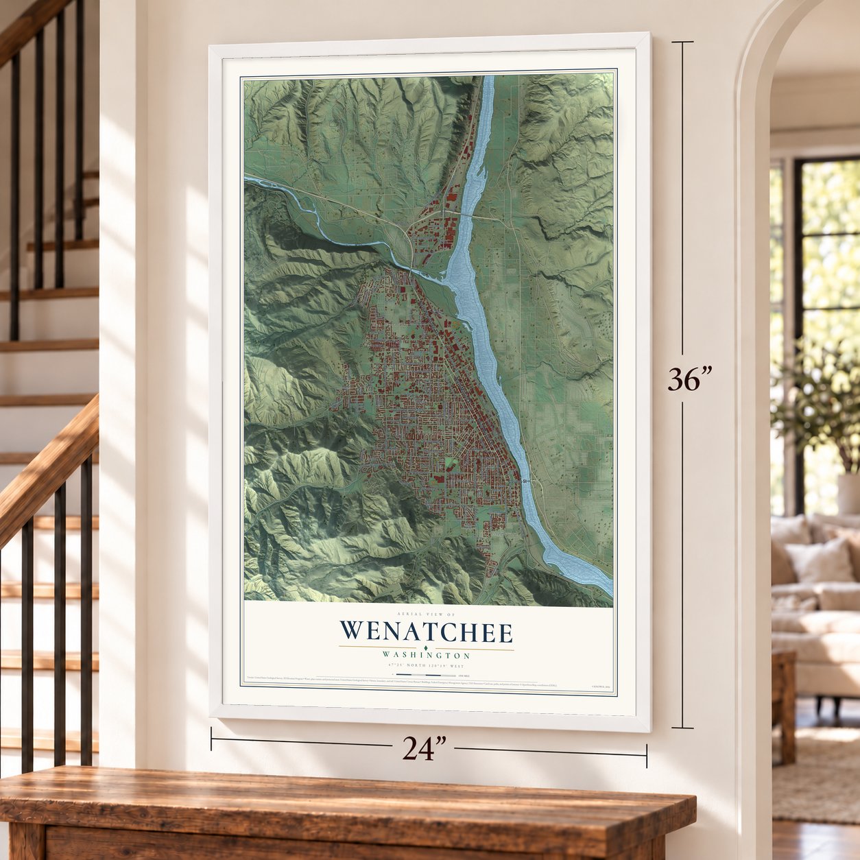
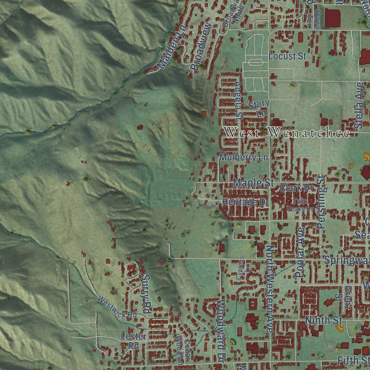
Explore Wenatchee, Washington from a whole new perspective. Created using aerial imagery and detailed geographic data, this map captures Wenatchee building by building, with labeled streets, familiar landmarks, and shaded topographical relief that highlights the natural contours of the landscape.
Combining modern data with the timeless character of a vintage atlas, this map is just as interesting up close as it is beautiful on the wall. Whether you grew up in Wenatchee, spent memorable years there, or call it home today, this unique map is a great way to celebrate a place that means something to you. Zoom in on the preview to look for your street, and then order a print to put your memories on the wall.
Three ways to hang it
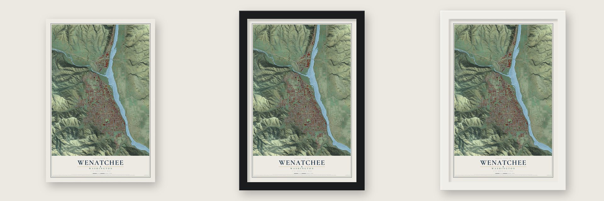
Unframed archival matte, a black wood frame or a white wood frame.
Up close
Geography Worth Displaying
This map was created using accurate cartographic data and authoritative geographic sources, including the U.S. Geological Survey and the Census Bureau. The map brings together terrain, waterways, roads, and building detail. The majority of the streets are labeled, houses are accurately depicted, and the topography is derived from government sources. Combining local data with carefully composed color and shading leads to this beautifully detailed Wenatchee artwork for your wall.
Rather than simply showing street outlines, we’ve included as many of the street names as we could reasonably fit on the map while keeping their names legible. Zoom in on the high resolution preview to see exactly what’s on the map. We truly set out to create a statement piece for anyone who loves Wenatchee. So whether it’s for you, or a gift for someone you love, we hope this map of Wenatchee brings back fond memories.
Read the story behind this map of Wenatchee, Washington from 2026.

About Wenatchee, Washington
Wenatchee is a city of 35,508 people and the county seat of Chelan County, where the Wenatchee River meets the Columbia. Samuel C. Miller and the brothers Franklin and David Freer had hauled freight by horse and mule to the Idaho mines, and in 1871 or 1872 they opened a trading post here. In 1891 Judge Thomas Burke of Seattle and other investors formed the Wenatchee Development Company and bought land near this first settlement, expecting a railroad to come through. That line failed, so the company laid out a new townsite on a different route, traded lots and helped settlers move. The Great Northern Railway reached it on October 17, 1892, and Wenatchee was incorporated that December.
The valley got little rain, and the narrow benches along the river were too small for grain to pay. Philip Miller, born in Germany, came in 1872 and planted the first apple trees, which did well. In 1904 William Timothy Clark, backed by Burke and the development company, finished the 16-mile Highline Canal, which watered 9,000 acres. Orchards spread across that land, and the town that had called itself the "Apple Capital of the World" since 1902 became the center of the nation's apple country.
- Winning the county seatUntil March 13, 1899, the land that is now Chelan County was split between Kittitas and Okanogan counties, and Wenatchee had a hard time reaching either courthouse. When the new county formed, Chelan and Wenatchee both wanted to be its seat. Wenatchee pointed to its place on a transcontinental railroad, and Burke's company tipped the contest by donating land for a courthouse. Wenatchee won.
- The bridge of 1908Before 1908, ferries carried people across the Columbia at Wenatchee. That year a bridge was finished to carry Highline Canal water over the river, and it took vehicles too, the first such crossing of the Columbia in the United States. A new four-lane bridge followed in 1950, and the old one now carries walkers and cyclists on the Apple Capital Loop Trail.
- The Saga of WenatcheePeggy Strong painted the oil-on-canvas mural The Saga of Wenatchee in 1940 for the post office, under a Treasury Department art program that ran from 1934 to 1943. The U.S. Post Office and Annex is on the National Register.
- Apple Blossom FestivalEach spring, from the last week of April through the first week of May, Wenatchee holds the Washington State Apple Blossom Festival. A youth parade fills the streets on April's last Saturday, and the main parade follows on the opening Saturday of May. The festival also has a food fair with dishes from around the world and a traveling carnival.
Find your street
Names on the Wenatchee map
Every name below is printed on this map. Look for your street, your school, the park where you played, or the pond down the road.
Places and landmarks4
- Wenatchee City Hall
- Olds
- West Wenatchee
- Appleyard
Streets and roads157
- Stevens Street
- South Mission Street
- North Mission Street
- North Wenatchee Avenue
- North Miller Street
- Ninth Street
- Walla Walla Avenue
- Easy Street
- East Penny Road
- Washington Street
- South Wenatchee Avenue
- South Western Avenue
- Millerdale Avenue
- Olds Station Road
- Russell Street
- Trisha Way
- North Western Avenue
- Methow Street
- South Methow Street
- Fifth Street
- Okanogan Avenue
- Crawford Avenue
- South Miller Street
- Springwater Avenue
- Maiden Lane
- Maple Street
- First Street
- Castlerock Avenue
- Kittitas Street
- Orchard Street
Show all 157 streets
- Fuller Street
- South Columbia Street
- Red Apple Road
- Cherry Street
- South Okanogan Avenue
- Poplar Avenue
- Ohme Garden Road
- Skyline Drive
- Cashmere Street
- Madison Street
- Westwood Avenue
- Pershing Street
- Third Street
- Orondo Avenue
- Cascade Street
- Ferry Street
- North Princeton Avenue
- North Emerson Avenue
- Princeton Avenue
- Woodward Drive
- Peachy Street
- Horselake Road
- Walker Avenue
- Riverside Drive
- Orchard Avenue
- South Worthen Street
- Number 2 Canyon Road
- Central Avenue
- North Worthen Street
- Warehouse Way
- Palouse Street
- Marr Street
- Surry Road
- Sunset Avenue
- Jennings Street
- Lambert Street
- Columbine Street
- Piere Street
- Seattle Street
- Broadview
- Melody Lane
- Lynn Street
- Stella Avenue
- Utah Street
- Ringold Street
- Gunn Road
- North Road
- Kings Court
- Euclid Avenue
- Hawley Street East
- Heritage Drive
- Second Street
- Jefferson Street
- McKittrick Street
- South Hills Drive
- Spokane Street
- South Franklin Avenue
- North Garfield Avenue
- South Elliott Avenue
- Vista Place
- Warehouse Road
- Circle Street
- Gehr Street
- Angela Street
- Duncan Road North
- Crescent Street
- Linville Drive
- Number 1 Canyon Road
- Brandi Lane
- Kayla Way
- Mulberry Lane
- North Marie Avenue
- Lowe Street
- Horan Road
- Squilchuck Road
- Honeysett Road
- Old Station Road
- Poe Street
- Pickens Street
- Grenz Street
- Glenwood Avenue
- Parkway Avenue
- Chrisand Lane
- Seneca Street
- Tacoma Avenue
- Rainier Street
- Clark Drive
- Dorner Place
- Canyon Place
- Locust Street
- Story Lane
- Benton Street
- Lester Road
- Yale Avenue
- Ione Street
- Fourth Street
- South Wilson Street
- Malaga Avenue
- Monroe Street
- North Franklin Avenue
- Monitor Street
- Westwick Road
- Lewis Street
- Lincoln Street
- Pine Avenue
- Broadway North
- Cedar Wood Lane
- Dawn Terrace
- Oak Street
- Saddlerock Drive
- Technology Center Way
- Rocklund Drive
- Dakota Street
- Twin Peaks Drive
- Kenaston Drive
- Rex Road
- Canyon Crest Drive
- Chehalis Street
- Dry Gulch Road
- Harrison Street
- Quail Run
- Tyler Street
- Cypress Lane
- Nelson Avenue
- Helper Drive
- Penny Road
- Oak
Names are listed as they appear on the printed map. Zoom into the product photos to find them.
The art of mapping a place
How This Map Was Made
Real places. Remarkable detail. Discover the layers that turn geographic data into a map of home.

The view from above
Aerial imagery reveals the character of the land: woodland, open fields, and the patterns of a place.

The shape of the land
Elevation data brings hills, valleys, and subtle changes in the landscape into view.

The details of home
Roads, waterways, and building footprints come together to make the map feel unmistakably local.

Geography becomes art
Considered color, shading, and typography bring the layers together in a map made for your wall.


Process illustrated with Mendon, Massachusetts. Aerial imagery: USDA NAIP. Terrain: USGS 3D Elevation Program. Map details and finished artwork: KNOWOL.
The Details
About This Print
Choose an archival matte print, or a black or white Ayous wood frame. The archival matte print is unframed.
Select your size and finish above to see the matching product image and price.
Materials & Craftsmanship
A contemporary map with the character of a classic atlas, printed on archival matte paper. Optional frames are made from Ayous wood.
Your printed map does not include the watermark shown in the full-map preview.
Shipping & Delivery
Free shipping within the United States. Every print is made to order in the USA.
Buying a gift? Add a note in your cart and we'll include it. We never put prices in the package.
Prints ship within 2 to 3 business days. Allow 7 to 10 days total from ordering for delivery. Timing may vary during holidays or periods of high order volume.
Read our shipping policy.
Returns and damaged prints
Each print is made to order. Change-of-mind refunds are not available after production.
If your print arrives damaged, misprinted or incorrect, contact support@knowol.com within 30 days of receiving it. Include your order number, photos and a description of the issue.
Read our full refund and replacement policy. For questions about your order, email support@knowol.com.
Find your town
Looking for another city?
Find a map of home in our Washington collection, or any town in the country.
Nearby
Maps of towns near Wenatchee
Know someone from one of these towns? Their map makes a great gift.
 East Wenatchee
, Washington
From $39.99See the map
 South Wenatchee
, Washington
From $39.99See the map
 Sunnyslope
, Washington
From $39.99See the map
More maps nearby: Cashmere, Rock Island, Entiat, Waterville and Leavenworth.