
Search for another town




Free U.S. delivery 7 to 10 days after you order
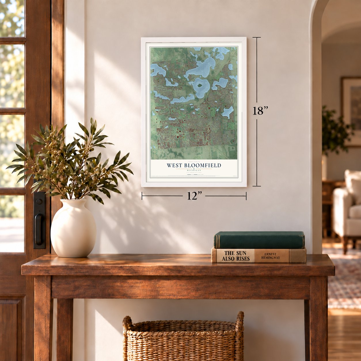
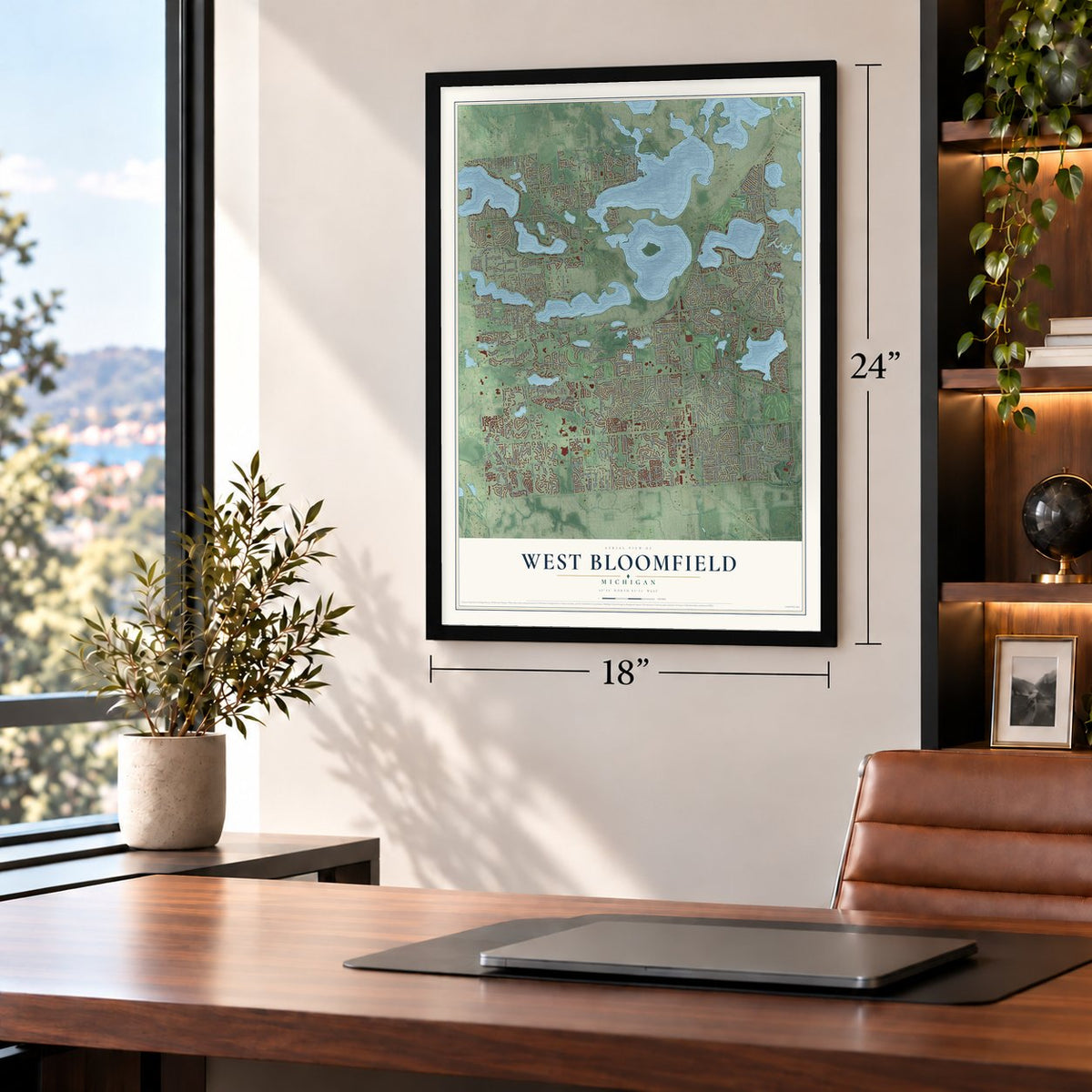
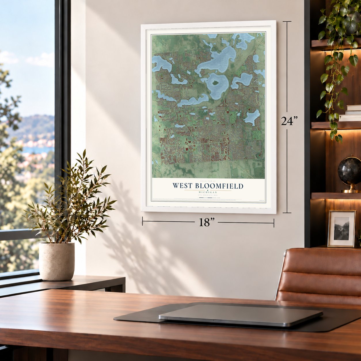
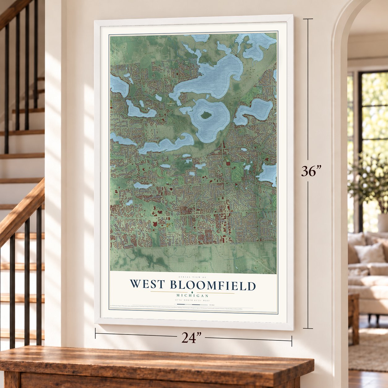
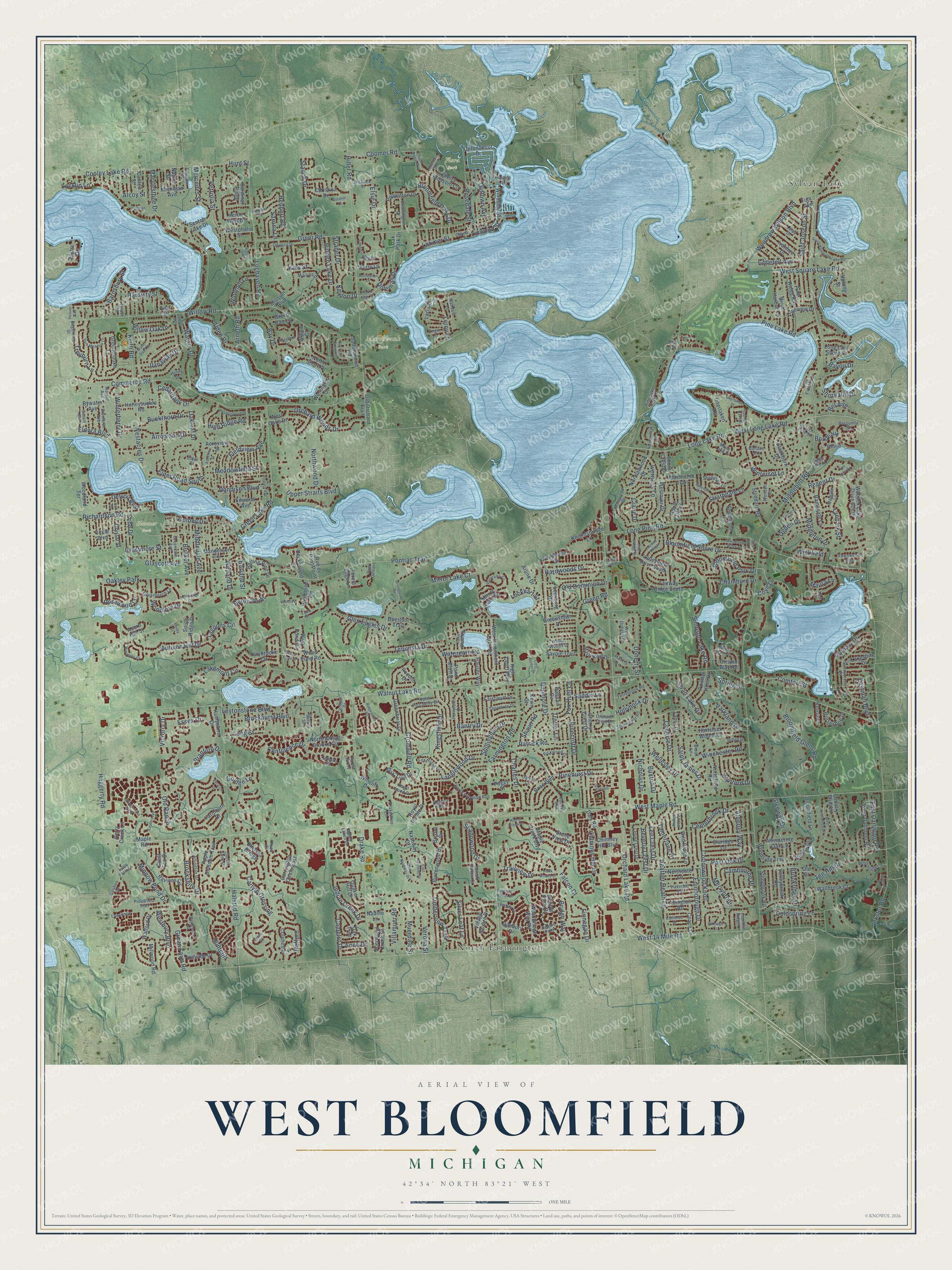
West Bloomfield, Michigan Map Art
Building by building, with labeled streets and shaded relief.
12" x 18" Archival Matte Print
A Map of Home. A Work of Art.
Explore West Bloomfield, Michigan from a whole new perspective. Created using aerial imagery and detailed geographic data, this map captures West Bloomfield building by building, with labeled streets, familiar landmarks, and shaded topographical relief that highlights the natural contours of the landscape.
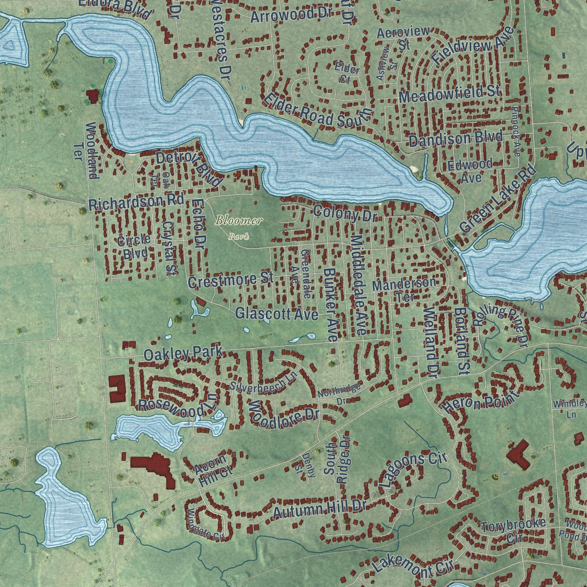
Combining modern data with the timeless character of a vintage atlas, this map is just as interesting up close as it is beautiful on the wall. Whether you grew up in West Bloomfield, spent memorable years there, or call it home today, this unique map is a great way to celebrate a place that means something to you. Zoom in on the preview to look for your street, and then order a print to put your memories on the wall.
Three ways to hang it
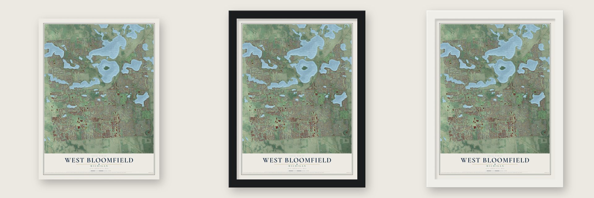
Unframed archival matte, a black wood frame or a white wood frame.
Up close
Geography Worth Displaying
This map was created using accurate cartographic data and authoritative geographic sources, including the U.S. Geological Survey and the Census Bureau. The map brings together terrain, waterways, roads, and building detail. The majority of the streets are labeled, houses are accurately depicted, and the topography is derived from government sources. Combining local data with carefully composed color and shading leads to this beautifully detailed West Bloomfield artwork for your wall.
Rather than simply showing street outlines, we’ve included as many of the street names as we could reasonably fit on the map while keeping their names legible. Zoom in on the high resolution preview to see exactly what’s on the map. We truly set out to create a statement piece for anyone who loves West Bloomfield. So whether it’s for you, or a gift for someone you love, we hope this map of West Bloomfield brings back fond memories.
Read the story behind this map of West Bloomfield, Michigan from 2026.

Find your street
Names on the West Bloomfield map
Every name below is printed on this map. Look for your street, your school, the park where you played, or the pond down the road.
Places and landmarks6
- Bloomer Park
- Flora Park
- Marshbank Park
- North Farmington
- Sylvan Lake
- Oakley Park
Streets and roads466
- West Maple Road
- West 14 Mile Road
- Farmington Road
- Bordeaux
- Linwood Street
- Walnut Lake Road
- Middlebelt Road
- Orchard Lake Road
- Haggerty Road
- Commerce Road
- Pontiac Trail
- Halsted Road
- Willow Road
- Inkster Road
- Drake Road
- Lone Pine Road
- Hiller Road
- Greer Road
- Locklin Lane
- Green Lake Road
- Long Lake Road
- West Long Lake Road
- Kingsfield Drive
- Cooley Lake Road
- Pine Lake Road
- Hardwoods Drive
- Heather Heath Lane
- Fieldview Avenue
- Lochaven Road
- Branford Drive
Show all 466 streets
- Tamerlane Drive
- Richardson Road
- Tequesta Drive
- Glen Eagles Drive
- Alden Drive
- Carlyle Crossing
- Old Ranch
- Edinborough Drive
- Lagoons Circle
- Parkland Drive
- Bloomfield Glens Road
- Patrick Road
- Cottonwood Knoll
- Leytonstone Boulevard
- Putnam Drive
- Green Road
- Elder Road South
- Golden Lane
- Keith Road
- Dunmore Drive
- Post Oak Drive
- Bloomfield Park Drive
- Oakleaf Drive
- Coldspring Lane
- Winchester Road
- Pinecroft Drive
- Saint Joseph Street
- Bloomfield Shore Drive
- Ten Hill Drive
- Westacres Drive
- Orchard Woods Drive
- Strathdale Lane
- Brockhurst Boulevard
- Bantry Drive
- Muerdale Street
- Wellesley Drive
- Shaun Road
- Bridge Way
- Iverness Lane
- Confluence Drive
- Chimney Hill Drive
- Colony Drive
- Bay Drive
- Saint James Drive
- Alderley Way
- Old Dominion Drive
- Langlewood Drive
- Welland Drive
- Verona Street
- Beverly Crest Drive
- Winterset Lane
- Dandison Boulevard
- Henbert Road
- Detroit Boulevard
- Silver Leaf Lane
- Shore Hill Drive
- Cambourne Place
- West Square Lake Road
- Warner Drive
- Upper Straits Boulevard
- Pinehurst Drive
- Keylon Drive
- Middleton Drive
- Charles Drive
- Coomer Road
- Autumn Hill Drive
- Green Farm Road
- Rosedale Street
- Nicholas Drive
- Centerbrook Drive
- Crestmore Street
- Glascott Avenue
- Oldtown Avenue
- Simpson Lake Road
- Lakemont Circle
- Westbury Boulevard
- Treyburn Lane
- Woodrow Wilson Boulevard
- Doherty Street
- Eastman Boulevard
- Lee Crest Drive
- Barnsbury Street
- Shillingham Drive
- Trailview Drive
- Brookridge Drive
- Regent Drive
- Long Street
- Lockhart Street
- Finnegan Drive
- Cedarbank Drive
- Huntcliff
- Bloomfield Oaks Drive
- Woodlore Drive
- Timberview Trail
- Arrowood Drive
- Buckthorn Drive
- Petrolia Street
- Bunker Avenue
- Cochise Drive
- Winterberry Drive
- Villamuer Road
- Merrybrook
- Watergate Road
- Cromwell Road
- Ogden Drive
- Brookshire Drive
- Heron Point
- Wynford Drive
- Middledale Avenue
- Meadowfield Street
- East Dartmoor Road
- Buxton Drive
- Cove Lane
- Indian Creek Drive
- Victoria Drive
- Minnow Pond Drive
- Comfort Street
- Kiev Street
- Ilanaway Drive
- Fox Hunt Lane
- Leroy Lane
- Hidden Lake Drive
- Shadowood Drive
- Elsie Drive
- Falcon Court
- Swan Lake Drive
- Mirror Lake Court
- Chambord Drive
- Maura Lane
- Camelot Drive
- Marylestone Drive
- Northwood Drive
- Glenway Drive
- Rosewood Lane
- Littletell Avenue
- Willow Oak Drive
- Tanbark Street
- Windmill Lane
- High Ridge Road
- Borland Street
- Strader Drive
- Essex Drive
- Stauch Drive
- Doleman Drive
- Saddle Lane
- Bayou Drive
- Latimer Street
- Arneth Road
- Hollyhock Drive
- Bel Aire
- Mercedes Street
- Echo Drive
- Wickfield
- Claire Drive
- Rafford
- Hardisty Street
- Sarona Lane
- Eldora Boulevard
- Trotter Lane
- Anne Drive
- Spring Street
- Alcoy Street
- Hunt Street
- Bywater Avenue
- West Bloomfield Lake Road
- Greenbriar Drive
- Torybrooke Circle
- Woodbine Circle
- Wabeek Lake Drive South
- Poppleton Drive
- Maple Creek Boulevard
- Cherry Blossom Circle
- Scotch Lake Drive
- Daly Road
- Pond Bluff Drive
- Interlaken Road
- Westover Drive
- Northfield Road
- Macnichol Trail
- Old Orchard Trail
- Hartslock Woods Drive
- Danbury Drive
- Mirror Lake Drive
- Gerundecut Drive
- West Pond Circle
- Watford Drive
- Fairway Ridge South
- Apple Blossom Trail
- Cherry Crest Drive
- Birch Harbor Lane
- Circle Boulevard
- Ramsgate Lane
- Burtonwood Drive
- Woodside Trail
- Wild Ridge Lane
- Greenbrooke Lane
- Foxpointe Drive
- West Dartmoor Road
- North Alding Brooke Circle
- Valleyview Drive South
- Aeroview Street
- Carrington Circle East
- Rose Boulevard
- Normanwood Drive
- Rolling Pine Drive
- Quaker Hill Drive
- Crispin Way Road
- Apple Valley Lane
- Rhine
- Hillside Drive
- Chelsea Bridge
- Village Square Drive
- Pineview Drive
- South Ridge Drive
- Blackburn Drive
- Whispering Oak Lane
- Colchester
- Manderson Terrace
- Yarmouth Drive
- Stoddard Road
- Oak Park Drive
- Oak Tree
- Southmoor Lane
- Hampshire Drive
- West Bridge Way Road
- Cardinal Ridge
- Lakeshire Drive
- Corners Drive
- Ravines Circle
- Millwood Road
- Horseshoe Drive
- Honeysuckle Road
- Pine Ridge Road
- Country Club Lane
- Heron View Drive
- Oak Trail Drive
- Pocono Drive
- Stonebrook Road
- Stone View Drive
- Knightsbridge Lane
- Claridge Lane
- Woodland Terrace
- Royal Pointe Drive
- High Court Way
- Sherwood Creek Court
- Ivanhoe Drive
- Powder Horn Drive
- Bloomfield Lane
- Wallbrook Court
- Hauser Way
- Marlwood Drive
- Greenstown Drive
- Windside Drive
- Long Lake Shore Drive
- Edwood Avenue
- North Shore Drive
- Hobnail Circle
- Crest Top Drive
- Faircourt Drive
- Westphalia Street
- Pebble Park Drive
- Leesburg Drive
- Savoie Trail
- Valleybrook Road
- Crystal Street
- Wellington Court
- Northcote Lane
- Abington Road
- Christina Drive
- Michigan Avenue
- Uplong Street
- Coach Lane
- Saddlewood Road
- Arline Drive
- Nashway Drive
- Chimney Hill Boulevard
- Deckerland Street
- Wood Pond Road
- Shore Crest Drive
- Forest Edge Lane
- Harris Lane
- Kevin Court
- Rue du Pont Point
- Figa Avenue
- West Oaks Drive
- Nadine Lane
- Peggy Street
- Green Bay Lane
- Deerfoot Trail
- Cherry Lane
- Canton Street
- Naylor Street
- Berry Creek Lane
- Tabor Drive
- Willow Court
- Wincliff Drive
- Mission Boulevard
- Lari Court
- Old Court
- Bristol Drive
- Maple Road
- Acorn Hill Court
- First Street
- Alpha Drive
- Bentley Road
- Mandale Lane
- Sunnycrest Drive
- Moon Lake Drive
- North Potomac Run
- Perrytown Drive
- Odessa Drive
- Lake Bluff Road
- Mission Drive
- Wendell Road
- Silverbeech Lane
- Macqueen Drive
- Leslee Crest Drive
- Timberridge Drive
- Pickwood Drive
- Maple Lakes Drive
- Orchard Crest Drive
- West Doherty Drive
- Broomfield Lane
- Stonecrest Road
- White Hall Circle
- Pebble Point
- Charrington Drive
- Shadydale Lane
- Arlington Drive
- Fox Ridge Drive
- Pine Lake Knoll Drive
- Haverhill Road
- North Piccadilly Circle
- Pine Estates Drive
- Walnut Woods Drive
- Terrybrook Road
- Margate Lane
- Queen Anne Drive
- Greendale Avenue
- Royal Wood Drive
- Lafay Drive
- Thorntree Drive
- Goshen Drive
- Burgundy Street
- Horace Street
- Stanforth Avenue
- Brook Hollow Court
- Carroll Lane
- Drakeshire Lane
- Celeste Road
- Pinewood Trail
- Fawnwood Way
- Tamson Street
- Naneva Court
- Hickock Street
- Lawrence
- Edgemere Street
- Canal Street
- Brewster
- Rue Demers
- Virgie Lane
- Harold Avenue
- Centaur Drive
- Scotch Pine Street
- Franklin Ridge Lane
- Baltane Road
- Little Farm Lane
- Brook Lane
- Burrell Street
- Grand Court
- Henry Drive
- Reed Court
- Forest Grove
- Lynn Court
- Elder Court
- Pine Court
- Simsbury Court
- Arrowhead Road
- Eastbrooke
- West Knollwood Circle
- Water Oaks Drive
- Ridgewood Road
- Woodland Ridge Drive
- Spanish Oaks Drive
- Island View Drive
- Interlaken Street
- Pepperhill
- Silverbrooke West
- Cornwall Court
- South Hammond Lake Road
- Laurel Club Circle
- Elizabeth Lane
- Park Meadow Lane
- Westchester Road
- West Nashway Drive
- Civic Center Drive
- Panorama Circle
- Fairway Ridge
- Recreation Drive
- East Nashway Drive
- Bauervic Boulevard
- Walnut Creek Drive
- Mountain Ash Drive
- Barcroft Way
- Hermana Road
- Heatherwood Drive
- Windgate Circle
- Sugar Maple Way
- Pine Village Drive
- Hawk Woods Drive
- Normanwood Circle
- Mellow Wood Lane
- Turner Street
- Birchena Crescent
- Pinnock Avenue
- Castleton Drive
- Suncrest Road
- Daventry Woods Drive
- Northridge Drive
- Essex Court
- Forest Glen
- Fox Lake Drive
- Ashview Street
- Windrift Court
- Sutcliff Avenue
- Wood Pond Drive
- Cameo Lake Court
- Berwick Drive
- Prospect Street
- Wimbley Lane
- Tara Court
- Pullman
- Oak Terrace
- Hoover Avenue
- Denby Street
- Pine Hill Court
Names are listed as they appear on the printed map. Zoom into the product photos to find them.
About West Bloomfield, Michigan
West Bloomfield is a charter township of 65,888 people in Oakland County, about 27 miles northwest of downtown Detroit. James Herrington bought the first land here in May 1823, and the township was organized in 1833. When the county board met in October 1834, Terrel Benjamin sat for the new township, which was assessed at $40,971.00 and paid $226.44 in county and town taxes that year.
For well over a century the township stayed rural, and most of its growth came after the 1960s, when families moved out from the older suburbs closer to Detroit. Orchard Lake Road and West Maple Road became its main business streets, lined with shops and restaurants. The township board chose a new form of government in March 1982, and on April 1, 1982, West Bloomfield became a charter township, which gave it more taxing power and home rule.
“The first person to commence the business of merchandising in West Bloomfield was William Henderson, a settler from the State of New York, who came in the year 1833, settled on the north shore of Pleasant lake, where the farm of F. Tremper now is, and in the following year opened a dry- goods store at that point.”
- The lake townshipResidents sometimes call West Bloomfield the lake township of Oakland County, since small and medium lakes dot its land. Part of Cass Lake, the biggest lake in the county, lies here, and Pine Lake sits entirely inside the township. Water covers 3.9 of its 31.2 square miles.
- A trail on an old railroadThe Michigan Air Line Railway built a line across the township to link Pontiac and Jackson. Grand Trunk Western later took it over and gave it up in 1984. The old roadbed became the West Bloomfield Trail, which now runs east and west, joining the Michigan Air Line Trail at its Commerce end and the Clinton River Trail at its Pontiac end.
- Cass Lake, a new villageThe state named the Cass Lake area in the north of the township a village in 2025. Voters approved its charter by a wide margin in August 2026 and elected a first village board, making it the newest municipality in Michigan. It was Oakland County's first new village since Beverly Hills in 1958 and the state's first since Lake Isabella in 1998.
- Michigan's largest Jewish communityMore Jewish residents live in West Bloomfield than anywhere else in Michigan. The Frankel Jewish Academy of Metropolitan Detroit has its school here, alongside West Bloomfield High School.
Keep exploring Michigan
West Bloomfield is one of 2,009 Michigan towns we've mapped. Every dot on the map is a print of its own.
The search covers every state, Michigan first.
Near West Bloomfield
Order 2 or more town maps and save 10%. Shown in the size and finish you picked above, so they hang as a set.
- Orchard Lake Village 12" x 18" / Archival Matte Print $39.99
- Keego Harbor 12" x 18" / Archival Matte Print $39.99
- Sylvan Lake 12" x 18" / Archival Matte Print $39.99


More maps nearby: Walled Lake, Wolverine Lake, Franklin, Commerce and Oakley Park.
The art of mapping a place
How This Map Was Made
Real places. Remarkable detail. Discover the layers that turn geographic data into a map of home.

The view from above
Aerial imagery reveals the character of the land: woodland, open fields, and the patterns of a place.

The shape of the land
Elevation data brings hills, valleys, and subtle changes in the landscape into view.

The details of home
Roads, waterways, and building footprints come together to make the map feel unmistakably local.

Geography becomes art
Considered color, shading, and typography bring the layers together in a map made for your wall.


Process illustrated with Mendon, Massachusetts. Aerial imagery: USDA NAIP. Terrain: USGS 3D Elevation Program. Map details and finished artwork: KNOWOL.
The Details
About This Print
Choose an archival matte print, or a black or white Ayous wood frame. The archival matte print is unframed.
Select your size and finish above to see the matching product image and price.
Materials & Craftsmanship
A contemporary map with the character of a classic atlas, printed on archival matte paper. Optional frames are made from Ayous wood.
Your printed map does not include the watermark shown in the full-map preview.
Shipping & Delivery
Free shipping within the United States. Every print is made to order in the USA.
Buying a gift? Add a note in your cart and we'll include it. We never put prices in the package.
Prints ship within 2 to 3 business days. Allow 7 to 10 days total from ordering for delivery. Timing may vary during holidays or periods of high order volume.
Read our shipping policy.
Returns and damaged prints
Each print is made to order. Change-of-mind refunds are not available after production.
If your print arrives damaged, misprinted or incorrect, contact support@knowol.com within 30 days of receiving it. Include your order number, photos and a description of the issue.
Read our full refund and replacement policy. For questions about your order, email support@knowol.com.