
Search for another town

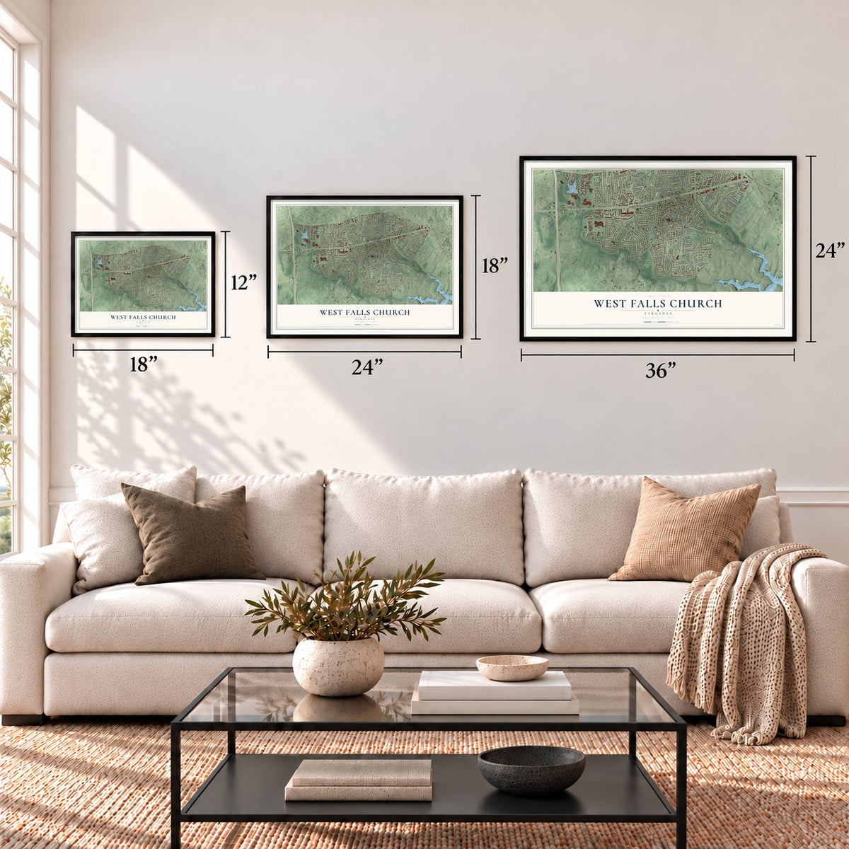
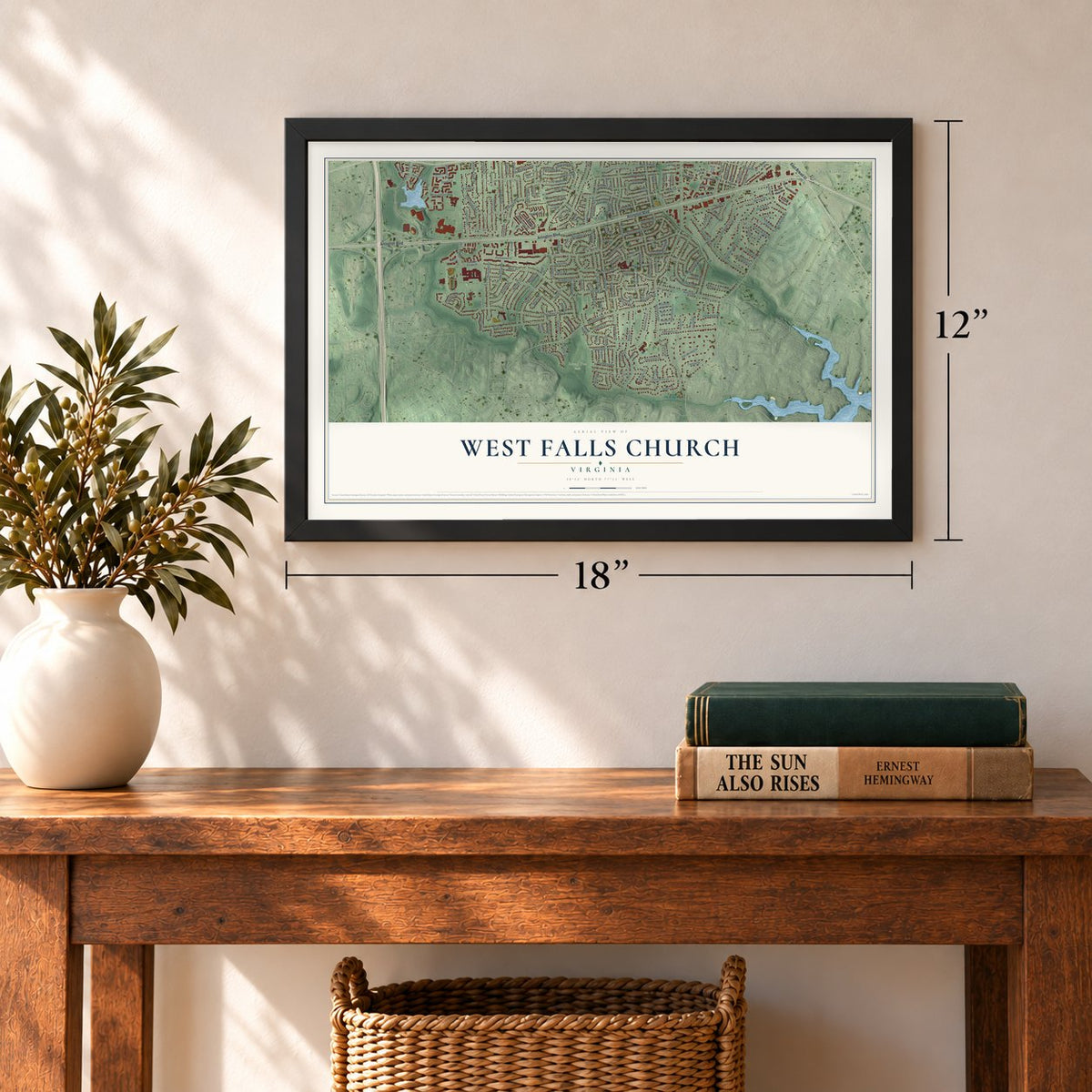
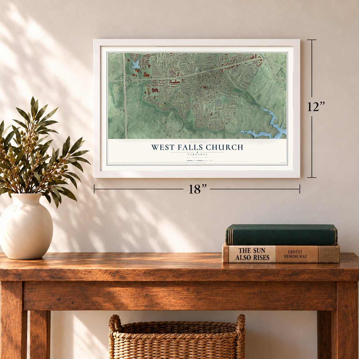
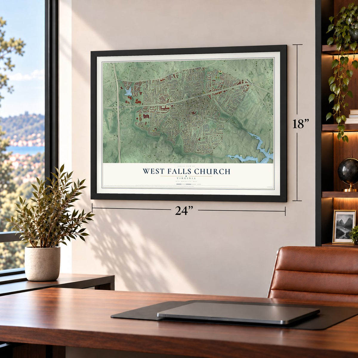
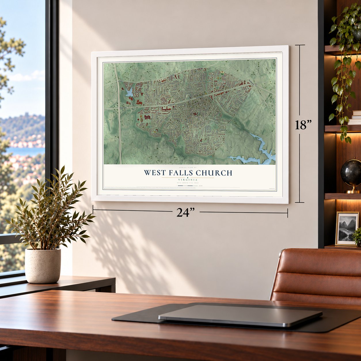

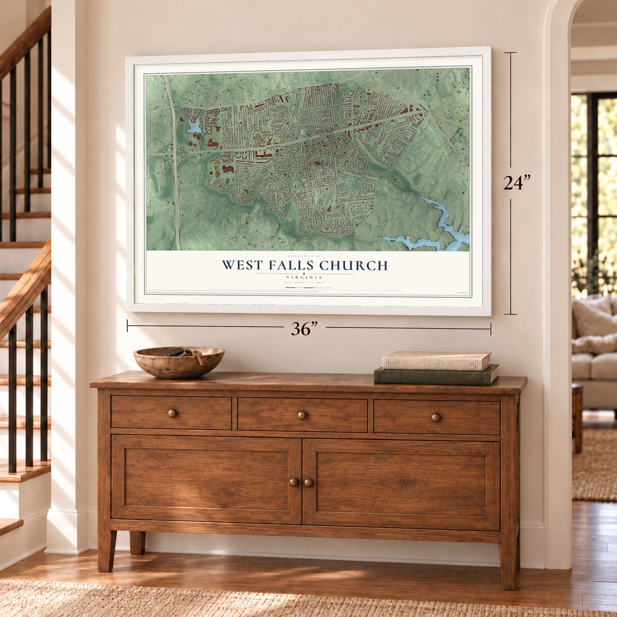

Free U.S. delivery 7 to 10 days after you order
West Falls Church, Virginia Map Art
A new map of West Falls Church, Virginia, made in 2026 and printed to order on thick archival matte paper.
12" x 18" Archival Matte Print
A Map of Home. A Work of Art.
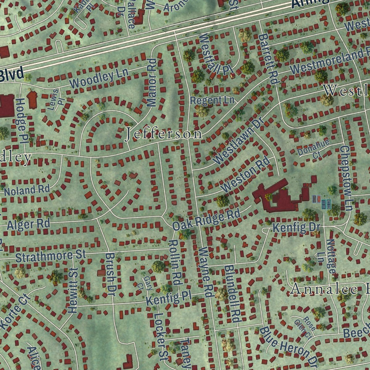
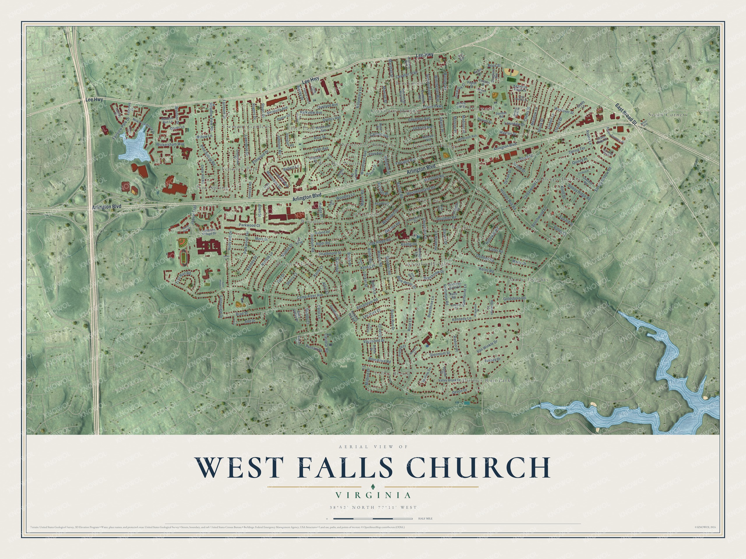
Explore West Falls Church, Virginia from a whole new perspective. Created using aerial imagery and detailed geographic data, this map captures West Falls Church building by building, with labeled streets, familiar landmarks, and shaded topographical relief that highlights the natural contours of the landscape.
Combining modern data with the timeless character of a vintage atlas, this map is just as interesting up close as it is beautiful on the wall. Whether you grew up in West Falls Church, spent memorable years there, or call it home today, this unique map is a great way to celebrate a place that means something to you. Zoom in on the preview to look for your street, and then order a print to put your memories on the wall.
Three ways to hang it
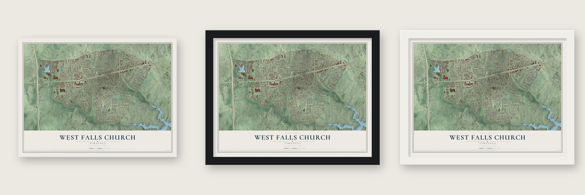
Unframed archival matte, a black wood frame or a white wood frame.
Up close
Geography Worth Displaying
This map was created using accurate cartographic data and authoritative geographic sources, including the U.S. Geological Survey and the Census Bureau. The map brings together terrain, waterways, roads, and building detail. The majority of the streets are labeled, houses are accurately depicted, and the topography is derived from government sources. Combining local data with carefully composed color and shading leads to this beautifully detailed West Falls Church artwork for your wall.
Rather than simply showing street outlines, we’ve included as many of the street names as we could reasonably fit on the map while keeping their names legible. Zoom in on the high resolution preview to see exactly what’s on the map. We truly set out to create a statement piece for anyone who loves West Falls Church. So whether it’s for you, or a gift for someone you love, we hope this map of West Falls Church brings back fond memories.
Read the story behind this map of West Falls Church, Virginia from 2026.

About West Falls Church, Virginia
West Falls Church is a community of 30,243 people in Fairfax County, lying to the south and southwest of the city of Falls Church. Most of its homes went up in the 1940s and early 1950s. Its neighborhoods from those years include Broyhill Park, Woodley, Hillwood, Raymondale, Sleepy Hollow, Westlawn and Jefferson Village.
After the Civil War, Black families built thriving communities in an area then known as South Falls Church, including along Tinner's Hill. In 1887 white residents of Falls Church redrew the town limits to leave out mostly Black South Falls Church, which cut the town's area by a third. Many believe they feared Black voters could swing local elections. The change was never undone, so the City of Falls Church still ends at South Washington Street, and the name South Falls Church faded away.
- Called Jefferson until 2010Before 2010 the area's official name was Jefferson, after Thomas Jefferson. Few people used it outside Jefferson Village, but the county's Thomas Jefferson Library here still carries the name.
- Falls Church High SchoolFalls Church High School, run by Fairfax County Public Schools, stands inside West Falls Church rather than in the city it is named for.
Find your street
Names on the West Falls Church map
Every name below is printed on this map. Look for your street, your school, the park where you played, or the pond down the road.
Places and landmarks22
- Round Tree Park
- Annalee Heights
- Bel Air
- Brockmont
- Broyhill Park
- Devonshire Gardens
- Fenwick Park
- Greenway Downs
- Hillwood
- Holmes Run Park
- Jefferson
- Jefferson Village
Show all 22 places
- Marlo Heights
- Pine Spring
- Seven Corners
- Sleepy Hollow
- Tremont Gardens
- Tyler Park
- Valley Brook
- Westlawn
- Woodley
- Woodley North
Streets and roads218
- East Broad Street
- Arlington Boulevard
- Lee Highway
- Annandale Road
- Sleepy Hollow Road
- Graham Road
- Barrett Road
- Camp Alger Avenue
- Slade Run Drive
- Westmoreland Road
- Marc Drive
- Rosemary Lane
- Carol Lane
- South Street
- Custis Parkway
- Holmes Run Road
- Wayne Road
- Marshall Street
- Van Winkle Drive
- Summerfield Road
- Fairview Park Drive
- Woodlawn Avenue
- Fairmont Street
- Chestnut Avenue
- Beechwood Lane
- Parkwood Court
- Rose Lane
- Dashiell Road
- Pine Spring Road
- Westlawn Drive
Show all 218 streets
- Oak Ridge Road
- Rogers Drive
- Kerns Road
- Westcott Road
- Monticello Drive
- Lawrence Drive
- Brad Street
- Brush Drive
- Wickersham Way
- Kennedy Lane
- Kenfig Drive
- Holly Hill Drive
- Devon Drive
- Cedarwood Lane
- Cherry Street
- Manor Road
- Dye Drive
- Beechtree Lane
- Cavalier Trail
- Norfolk Lane
- Cofer Road
- Strathmore Street
- Holloman Road
- Nealon Drive
- Meadow Lane
- Stuart Drive
- Woodley Lane
- Farragut Avenue
- Kenney Drive
- Gouthier Road
- Allen Street
- Mildred Drive
- Westover Street
- Dover Lane
- Westcott Street
- Tyler Avenue
- Aspen Lane
- Parkwood Terrace
- Elmwood Drive
- Lee Park Court
- Spring Terrace
- Brandy Court
- Brook Drive
- Alger Road
- Tansey Drive
- Holloway Road
- Linden Lane
- Trail Run Road
- Meadow View Road
- Bolling Road
- Winchester Way
- Knoll Drive
- Kenfig Place
- Quincy Avenue
- Slade Court
- Roundtree Road
- Blundell Road
- Goldsboro Road
- Willow Lane
- Putnam Street
- Carlton Avenue
- Chepstow Lane
- Mendota Avenue
- Cleave Drive
- Lawndale Drive
- Beechview Drive
- Parkview Avenue
- Sleepy Ridge Road
- Blue Heron Drive
- Oakland Avenue
- Crane Drive
- Vagabond Drive
- Add Drive
- Jaguar Trail
- Westfall Place
- Rice Street
- Glenmont Street
- Radnor Place
- Sylvan Drive
- Jackson Avenue
- Marlo Drive
- Locker Street
- Monroe Street
- Weston Road
- Fallowfield Drive
- Korte Court
- Adams Place
- Hewitt Street
- Monroe Place
- Hawthorne Lane
- Madison Place
- Hodge Place
- Windsor Drive
- Headrow Lane
- Casilear Road
- Mayfair Drive
- Rollin Road
- Darwin Drive
- Taney Lane
- Bisvey Drive
- Johnson Road
- Eppard Street
- Quincy Place
- Sherry Court
- Valley Court
- Robert Lane
- Brice Street
- Alice Court
- Lakeside Village Drive
- Katherine Paige Lane
- Jefferson Avenue
- Valley Brook Drive
- New Providence Drive
- Hickory Hill Road
- Roosevelt Avenue
- Cameron Road
- Nottage Lane
- Wallace Drive
- Cedar Hill Road
- Irvington Road
- Shady Lane
- Noland Road
- Overhill Road
- Labella Walk
- Poplar Court
- Kincaid Avenue
- Graham Court
- Seven Corners Place
- Saint James Place
- Yancey Drive
- Ellen Avenue
- James Lee Street
- Frenora Court
- Dauphine Drive
- Douglass Avenue
- Princess Anne Lane
- Horseman Lane
- Random Run Lane
- Aronow Drive
- Graydon Street
- Great Oak Court
- Siesta Drive
- Fenwick Road
- Rolfs Road
- Skyview Terrace
- Regent Lane
- Upside Court
- Harriett Street
- Lakeford Drive
- Poplar Street
- Dandon Road
- Costner Drive
- Seven Oaks Place
- Scipio Lane
- Rose Place
- Siron Street
- Linda Lane
- Greenway Boulevard
- Strathmeade Street
- West George Mason Road
- Jessica Taylor Place
- Crooked Oak Lane
- Kalmia Lee Court
- Kadala Place
- Little Falls Place
- Wraywood Place
- Donahue Court
- Hockett Street
- Hickory Court
- Lewis Place
- Hall Court
- Willow Point Drive
- Colton Crawford Circle
- Terry Lane
- Yarling Court
- Ted Drive
- Harrison Road
- Nicholson Road
- Wilson Boulevard
- Ichabod Place
- Arnold Lane
- Rose Glen Court
- Saint Philips Court
- Wheatley Court
- Sampson Street
- Gary Court
- Tinner Hill Road
- Jacks Lane
Names are listed as they appear on the printed map. Zoom into the product photos to find them.
The art of mapping a place
How This Map Was Made
Real places. Remarkable detail. Discover the layers that turn geographic data into a map of home.

The view from above
Aerial imagery reveals the character of the land: woodland, open fields, and the patterns of a place.

The shape of the land
Elevation data brings hills, valleys, and subtle changes in the landscape into view.

The details of home
Roads, waterways, and building footprints come together to make the map feel unmistakably local.

Geography becomes art
Considered color, shading, and typography bring the layers together in a map made for your wall.


Process illustrated with Mendon, Massachusetts. Aerial imagery: USDA NAIP. Terrain: USGS 3D Elevation Program. Map details and finished artwork: KNOWOL.
The Details
About This Print
Choose an archival matte print, or a black or white Ayous wood frame. The archival matte print is unframed.
Select your size and finish above to see the matching product image and price.
Materials & Craftsmanship
A contemporary map with the character of a classic atlas, printed on archival matte paper. Optional frames are made from Ayous wood.
Your printed map does not include the watermark shown in the full-map preview.
Shipping & Delivery
Free shipping within the United States. Every print is made to order in the USA.
Buying a gift? Add a note in your cart and we'll include it. We never put prices in the package.
Prints ship within 2 to 3 business days. Allow 7 to 10 days total from ordering for delivery. Timing may vary during holidays or periods of high order volume.
Read our shipping policy.
Returns and damaged prints
Each print is made to order. Change-of-mind refunds are not available after production.
If your print arrives damaged, misprinted or incorrect, contact support@knowol.com within 30 days of receiving it. Include your order number, photos and a description of the issue.
Read our full refund and replacement policy. For questions about your order, email support@knowol.com.
Find your town
Looking for another city?
Find a map of home in our Virginia collection, or any town in the country.
Nearby
Maps of towns near West Falls Church
Know someone from one of these towns? Their map makes a great gift.
 Falls Church
, Virginia
From $39.99See the map
 Annandale
, Virginia
From $39.99See the map
 Lake Barcroft
, Virginia
From $39.99See the map
More maps nearby: Idylwood, Seven Corners, Woodburn, Dunn Loring and Bailey's Crossroads.