
Search for another town





Free U.S. delivery 7 to 10 days after you order
Annandale, Virginia Map Art
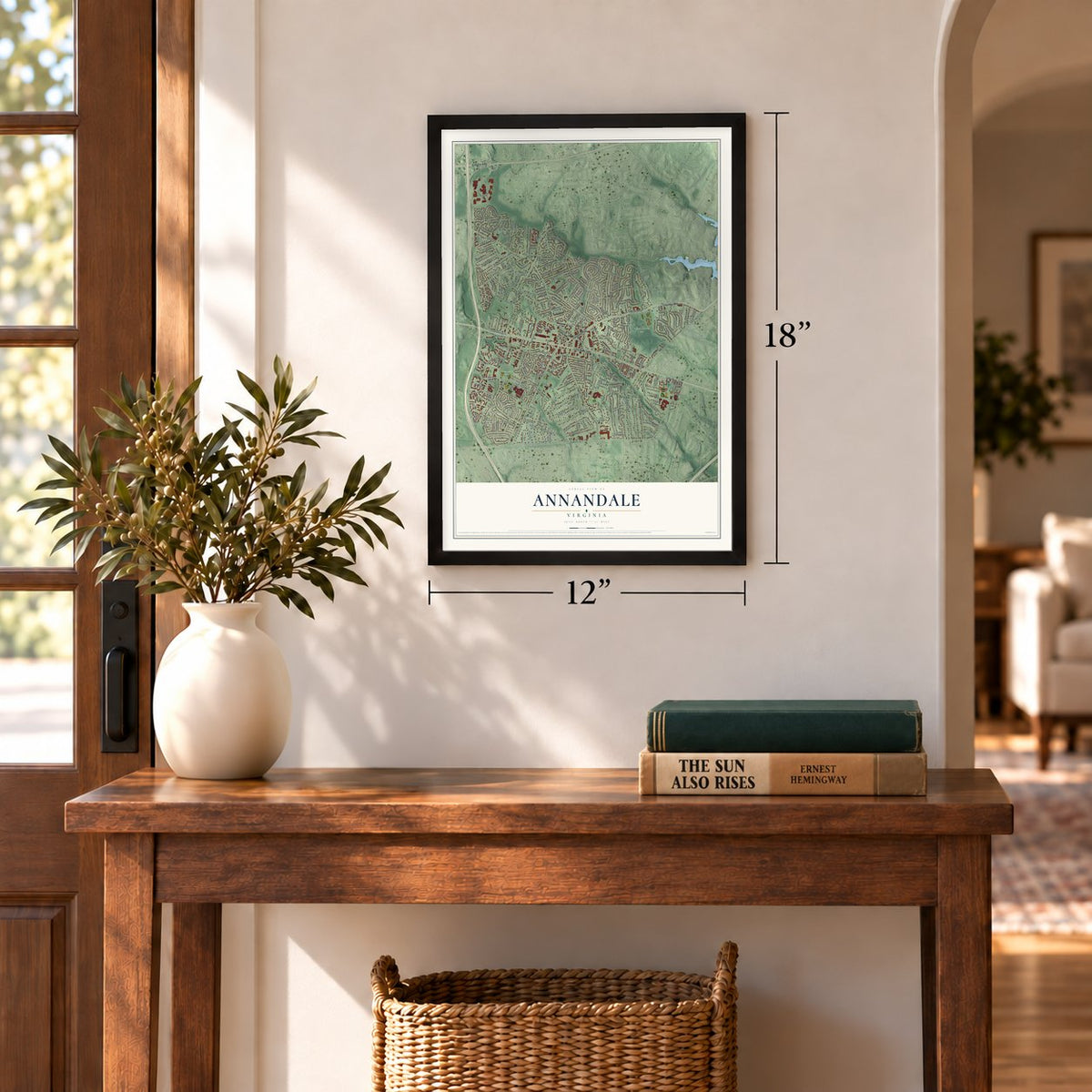
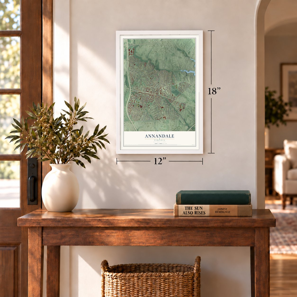
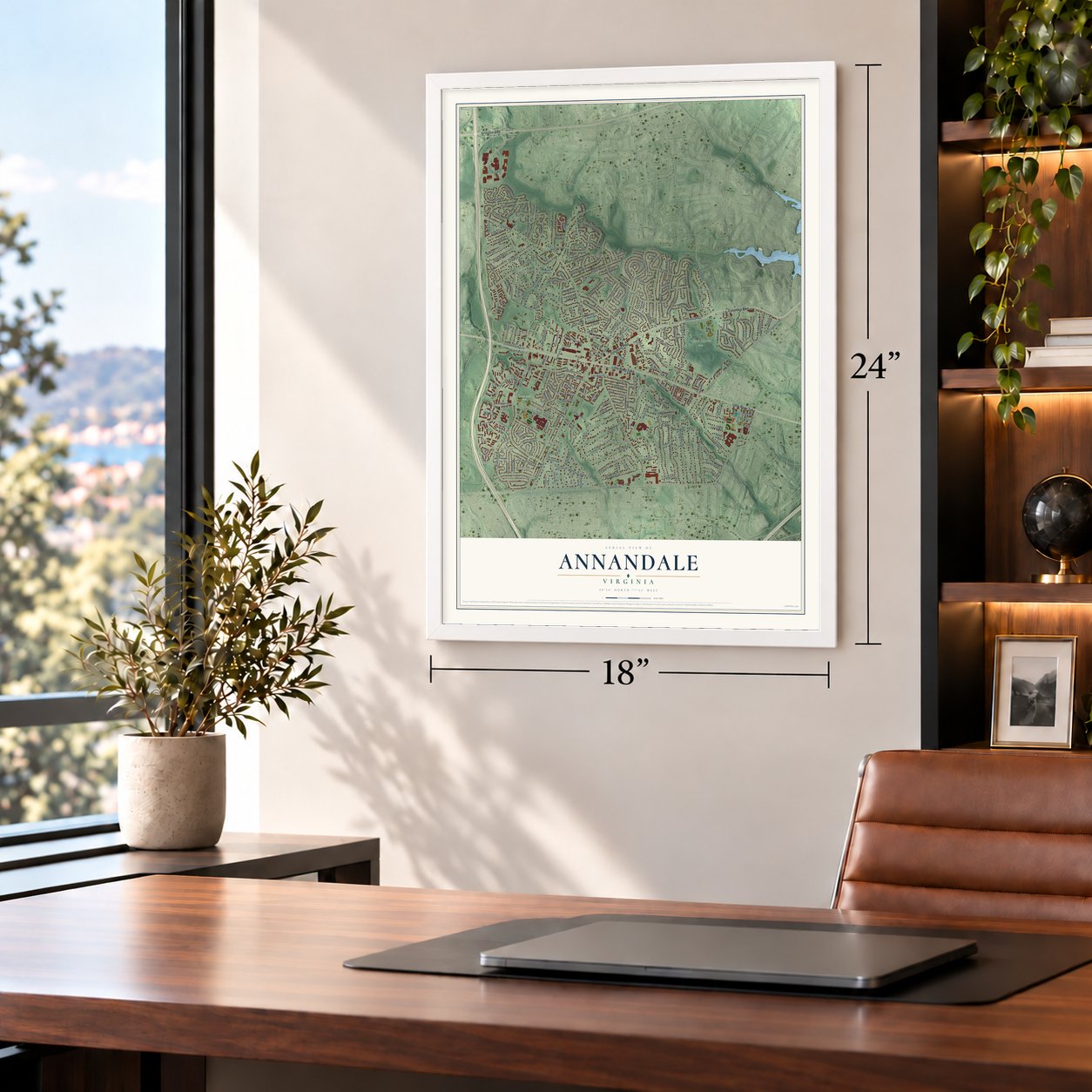
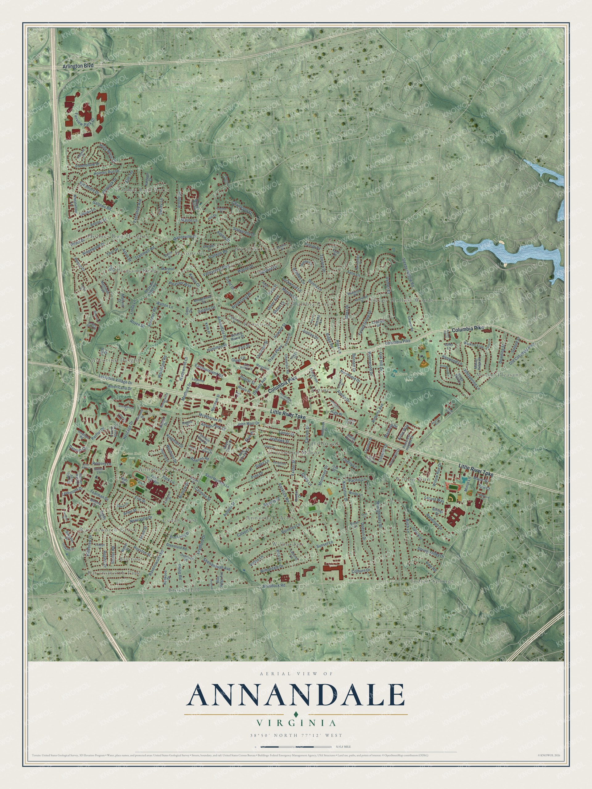
A new map of Annandale, Virginia, made in 2026 and printed to order on thick archival matte paper.
12" x 18" Archival Matte Print
A Map of Home. A Work of Art.
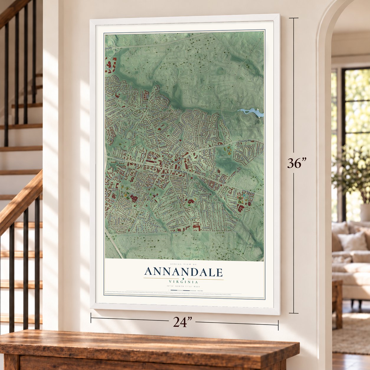
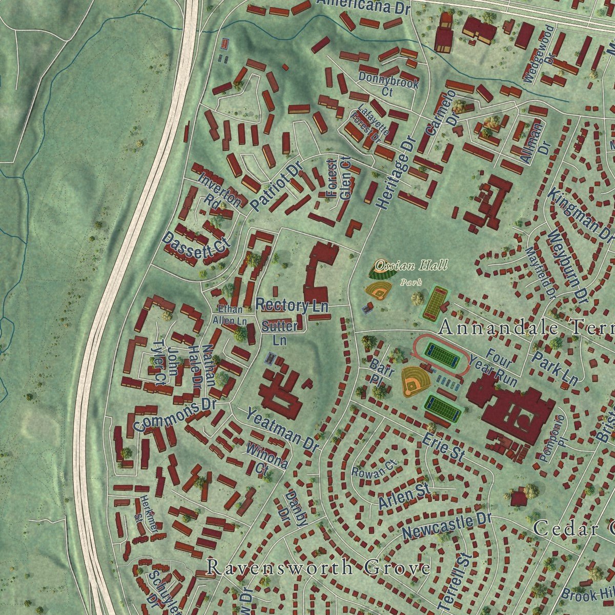
Explore Annandale, Virginia from a whole new perspective. Created using aerial imagery and detailed geographic data, this map captures Annandale building by building, with labeled streets, familiar landmarks, and shaded topographical relief that highlights the natural contours of the landscape.
Combining modern data with the timeless character of a vintage atlas, this map is just as interesting up close as it is beautiful on the wall. Whether you grew up in Annandale, spent memorable years there, or call it home today, this unique map is a great way to celebrate a place that means something to you. Zoom in on the preview to look for your street, and then order a print to put your memories on the wall.
Three ways to hang it
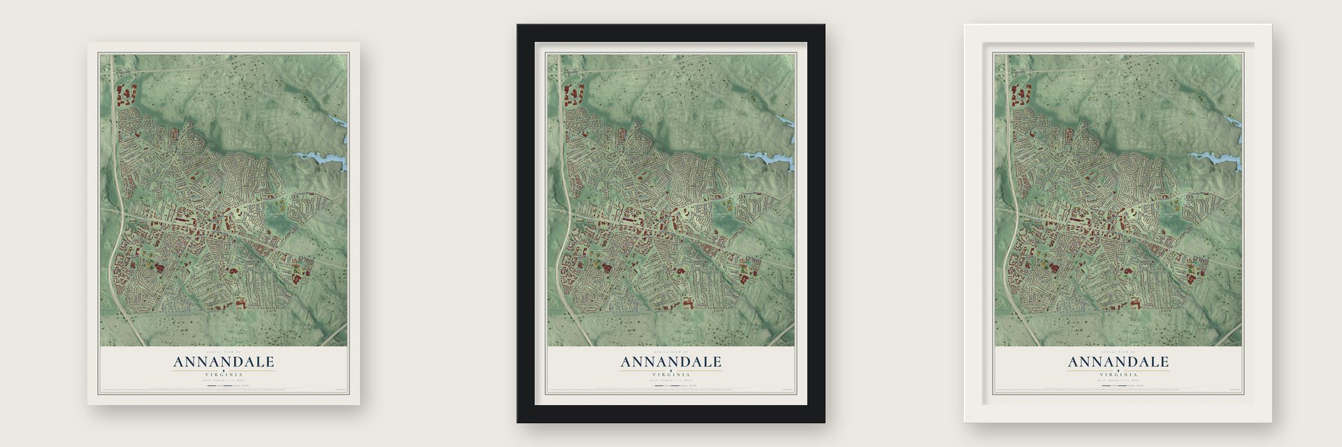
Unframed archival matte, a black wood frame or a white wood frame.
Up close
Geography Worth Displaying
This map was created using accurate cartographic data and authoritative geographic sources, including the U.S. Geological Survey and the Census Bureau. The map brings together terrain, waterways, roads, and building detail. The majority of the streets are labeled, houses are accurately depicted, and the topography is derived from government sources. Combining local data with carefully composed color and shading leads to this beautifully detailed Annandale artwork for your wall.
Rather than simply showing street outlines, we’ve included as many of the street names as we could reasonably fit on the map while keeping their names legible. Zoom in on the high resolution preview to see exactly what’s on the map. We truly set out to create a statement piece for anyone who loves Annandale. So whether it’s for you, or a gift for someone you love, we hope this map of Annandale brings back fond memories.
Read the story behind this map of Annandale, Virginia from 2026.

About Annandale, Virginia
Annandale is a community of 43,363 people in Fairfax County. When Europeans arrived, the Taux people, also called the Doeg or Dogue, lived on this land. In 1685 Col. William H. Fitzhugh bought more than 24,000 acres here and made it one of the biggest tobacco plantations in Northern Virginia. His descendants named it Ravensworth, and for over six generations they farmed it and sold off pieces a little at a time.
The Little River Turnpike was finished through the area in 1806, linking it to Alexandria and Fairfax. Two years later, in 1808, the Columbia Pike came out from the District of Columbia to meet it. A Scottish settler gave the place its name in 1830, after the town of Annan at the mouth of the River Annan. William Garges, the first businessman here, built a blacksmith shop and a livery stable where Columbia Pike, Little River Turnpike and Backlick Road cross. That corner grew into the center of town, and Garges became postmaster when the post office opened in 1837.
- A chapel lost in 1863The town's first church, the Annandale Methodist Chapel, went up in 1846. During the Civil War, Union soldiers guarding the approaches to Washington often camped in and around Annandale, and Confederate scouts skirmished with them. The neglected chapel was taken apart by Union troops in 1863, who used its materials for their own building.
- Dairy country by 1925After the war, farmers came home and dairy farming spread across Fairfax County. By 1925 the county had more dairy farms than any other in Virginia. After World War II, new housing, schools and roads turned Annandale into a suburb where many people lived and rode to jobs in Washington.
- Lake Accotink, 1918The Springfield Dam on Accotink Creek was built in 1918, forming Lake Accotink to supply water to Army Camp A.A. Humphreys, now Fort Belvoir. The Army no longer needed the lake by 1960, so the Fairfax County Park Authority leased the land that year and bought it in 1965. Today people come to fish, rent boats and walk its trails.
- NOVA's first campusThe oldest and largest campus of Northern Virginia Community College, known as NOVA, opened at Annandale in 1965 with 761 students. The college now has more than 75,000 students on six campuses, drawn from more than 180 countries.
- Annandale's KoreatownKorean immigrants began opening shops and restaurants in downtown Annandale in the 1990s, and the area came to be called Koreatown. Fairfax County is now home to nearly 40,000 Koreans, and people from around Washington come to Annandale for karaoke, barbecue and bingsu.
Find your street
Names on the Annandale map
Every name below is printed on this map. Look for your street, your school, the park where you played, or the pond down the road.
Places and landmarks25
- Mason District Park
- Ossian Hall Park
- Accotink Heights
- Alpine
- Annandale Acres
- Annandale Terrace
- Bristow
- Brook Hill
- Broyhill Crest
- Cedar Crest
- Columbia Pines
- Crestwood Manor
Show all 25 places
- Hillbrook
- Holmes Run Acres
- Holmes Run Heights
- Indian Springs
- Kenwood
- Masonville
- Mount Pleasant
- Pleasant Ridge
- Ravensworth Grove
- Ravensworth Park
- Sleepy Hollow Woods
- Wilburdale
- Willow Run
Streets and roads259
- Little River Turnpike
- Columbia Pike
- Arlington Boulevard
- McWhorter Place
- Ravensworth Road
- John Marr Drive
- Braddock Road
- Americana Drive
- Old Columbia Pike
- Gallows Road
- Annandale Road
- Medford Drive
- Backlick Road
- Heritage Drive
- Murray Lane
- Bristow Drive
- Sleepy Hollow Road
- Hummer Road
- Terrace Drive
- Rose Lane
- Lafayette Village Drive
- Fairview Park Drive
- Killebrew Drive
- Fern Lane
- Randolph Drive
- Masonville Drive
- Dodson Drive
- Commons Drive
- Montgomery Street
- Trammell Road
Show all 259 streets
- Thor Drive
- Alpine Drive
- Kingston Drive
- Bradford Drive
- Linda Lane
- Calvert Street
- Forest Grove Drive
- Jayhawk Street
- Walton Lane
- Valleycrest Boulevard
- Wilburdale Drive
- Ridge Road
- Erie Street
- Wayne Drive
- Patriot Drive
- Auburn Street
- Beverly Street
- Moss Drive
- Minor Lane
- Oak Hill Drive
- Holmes Run Drive
- Holly Berry Court
- Birch Lane
- Sunset Lane
- Pacific Lane
- Vellex Lane
- Byrneley Lane
- Whispering Lane
- Surrey Lane
- Ivydale Drive
- Statecrest Drive
- Freehollow Drive
- Aston Street
- Royston Street
- Bradley Circle
- Newcastle Drive
- Executive Avenue
- Woodland Road
- Terrell Street
- Arnold Lane
- Lanier Street
- Rawlins Road
- Exeter Street
- Weyburn Drive
- Charleson Street
- Hemlock Drive
- Roberts Avenue
- Arlen Street
- Wynnwood Drive
- Franklin Road
- Howard Street
- Justine Drive
- Pine Drive
- Ridgewood Drive
- Cindy Lane
- Oliver Avenue
- Philip Road
- Rebel Drive
- Downing Street
- Wadsworth Court
- Cherry Lane
- Crest Drive
- Regina Drive
- Thornton Street
- Farr Street
- Northfield Drive
- Eastmoreland Road
- Airlie Way
- Shenandoah Avenue
- Austin Street
- Sycamore Drive
- Spring Valley Drive
- Antiopi Street
- Renwood Lane
- Pence Court
- Oxford Street
- Carrico Drive
- Pleasant Way
- High Place
- Roslyn Road
- Elm Terrace
- Monterey Drive
- Brookcrest Place
- Donna Lane
- Pine Road
- Daniels Avenue
- Sipes Lane
- Adams Park Court
- Willow Run Drive
- Park Lane
- Travis Parkway
- Sanford Court
- Carmine Street
- Bennett Drive
- Poplar Street
- Dassett Court
- Locust Way
- Libeau Lane
- Major Street
- Lockwood Lane
- Rectory Lane
- Krysia Court
- Conwell Drive
- Maxfield Drive
- Hamilton Street
- Yeatman Drive
- Royce Street
- Kingman Drive
- Colburn Drive
- Galanis Drive
- Mason Lane
- Irvin Court
- Quiet Cv
- Elan Place
- Stuart Court
- Hillbrook Drive
- Chanel Road
- Allman Drive
- Beverly Manor Drive
- Evergreen Lane
- Watkins Trail
- Markham Street
- Winter Lane
- Four Year Run
- Marshall Drive
- Capstan Drive
- Weber Street
- Pleasant Ridge Road
- Mason Ridge Drive
- Brook Hills Drive
- Dolce Drive
- Carmelo Drive
- Kenwood Drive
- Tunlaw Street
- Nathan Hale Drive
- Hartwell Court
- Donna Circle
- Saint Michaels Lane
- Walnut Hill Lane
- Oak Court
- Hirst Drive
- Blue Ridge Avenue
- Wheatwheel Lane
- Chatelain Road
- Silver Lane
- Schuyler Drive
- John Tyler Court
- Chester Drive
- Fountain Head Drive
- Merrimac Trail
- Pinecrest Heights Drive
- Indian Run Court
- Aspen Hill Court
- Maple Place
- Greenfield Road
- Kandel Court
- King Edward Court
- Annanwood Court
- Laburch Lane
- Billings Drive
- Inverton Road
- Kings Mill Lane
- Dade Drive
- Logsdon Drive
- Raleigh Road
- Sutter Lane
- Wills Lane
- Overlook Place
- Lucerne Lane
- Royal Court Drive
- Malcolm Court
- Forest Glen Court
- Brenda Lane
- Keith Place
- Early Street
- Winona Court
- Hill Drive
- Danby Drive
- Sulky Lane
- Fern Place
- Barr Place
- Donnybrook Court
- Rosewood Street
- Davian Drive
- Sprucedale Drive
- Mangalore Drive
- Mayfield Drive
- Glen Hollow Court
- Annandale Center Drive
- College Lane
- Cordell Street
- Oriskany Drive
- Wedgewood Drive
- Pomponio Place
- Village Drive
- Maplecrest Drive
- Vermillion Place
- Ashley Glen Road
- Patricia Street
- Windy Pines Place
- Rowan Court
- Honey Lane
- Ivycrest Place
- Madeira Place
- Pathway Court
- Cynthia Court
- Delta Place
- Pine Street
- Lincolnshire Street
- Lafayette Forest Drive
- Falcon Street
- Greenberry Lane
- Lafayette Park Drive
- Herkimer Street
- Breezewood Lane
- Perry Penney Drive
- Butterfield Lane
- Reserves Hill Court
- Bruce Lane
- Rodes Court
- Nightwind Court
- Piedmont Place
- Ethan Allen Lane
- Sheffield Court
- Zanuck Court
- Fenton Drive
- Ancient Oak Court
- Knob Hill Court
- Conti Court
Names are listed as they appear on the printed map. Zoom into the product photos to find them.
The art of mapping a place
How This Map Was Made
Real places. Remarkable detail. Discover the layers that turn geographic data into a map of home.

The view from above
Aerial imagery reveals the character of the land: woodland, open fields, and the patterns of a place.

The shape of the land
Elevation data brings hills, valleys, and subtle changes in the landscape into view.

The details of home
Roads, waterways, and building footprints come together to make the map feel unmistakably local.

Geography becomes art
Considered color, shading, and typography bring the layers together in a map made for your wall.


Process illustrated with Mendon, Massachusetts. Aerial imagery: USDA NAIP. Terrain: USGS 3D Elevation Program. Map details and finished artwork: KNOWOL.
The Details
About This Print
Choose an archival matte print, or a black or white Ayous wood frame. The archival matte print is unframed.
Select your size and finish above to see the matching product image and price.
Materials & Craftsmanship
A contemporary map with the character of a classic atlas, printed on archival matte paper. Optional frames are made from Ayous wood.
Your printed map does not include the watermark shown in the full-map preview.
Shipping & Delivery
Free shipping within the United States. Every print is made to order in the USA.
Buying a gift? Add a note in your cart and we'll include it. We never put prices in the package.
Prints ship within 2 to 3 business days. Allow 7 to 10 days total from ordering for delivery. Timing may vary during holidays or periods of high order volume.
Read our shipping policy.
Returns and damaged prints
Each print is made to order. Change-of-mind refunds are not available after production.
If your print arrives damaged, misprinted or incorrect, contact support@knowol.com within 30 days of receiving it. Include your order number, photos and a description of the issue.
Read our full refund and replacement policy. For questions about your order, email support@knowol.com.
Find your town
Looking for another city?
Find a map of home in our Virginia collection, or any town in the country.
Nearby
Maps of towns near Annandale
Know someone from one of these towns? Their map makes a great gift.
 West Falls Church
, Virginia
From $39.99See the map
 Lake Barcroft
, Virginia
From $39.99See the map
 Woodburn
, Virginia
From $39.99See the map
More maps nearby: Lincolnia, North Springfield, Ravensworth, Seven Corners and Falls Church.