
Search for another town





Free U.S. delivery 7 to 10 days after you order
Westmont, Illinois Map Art
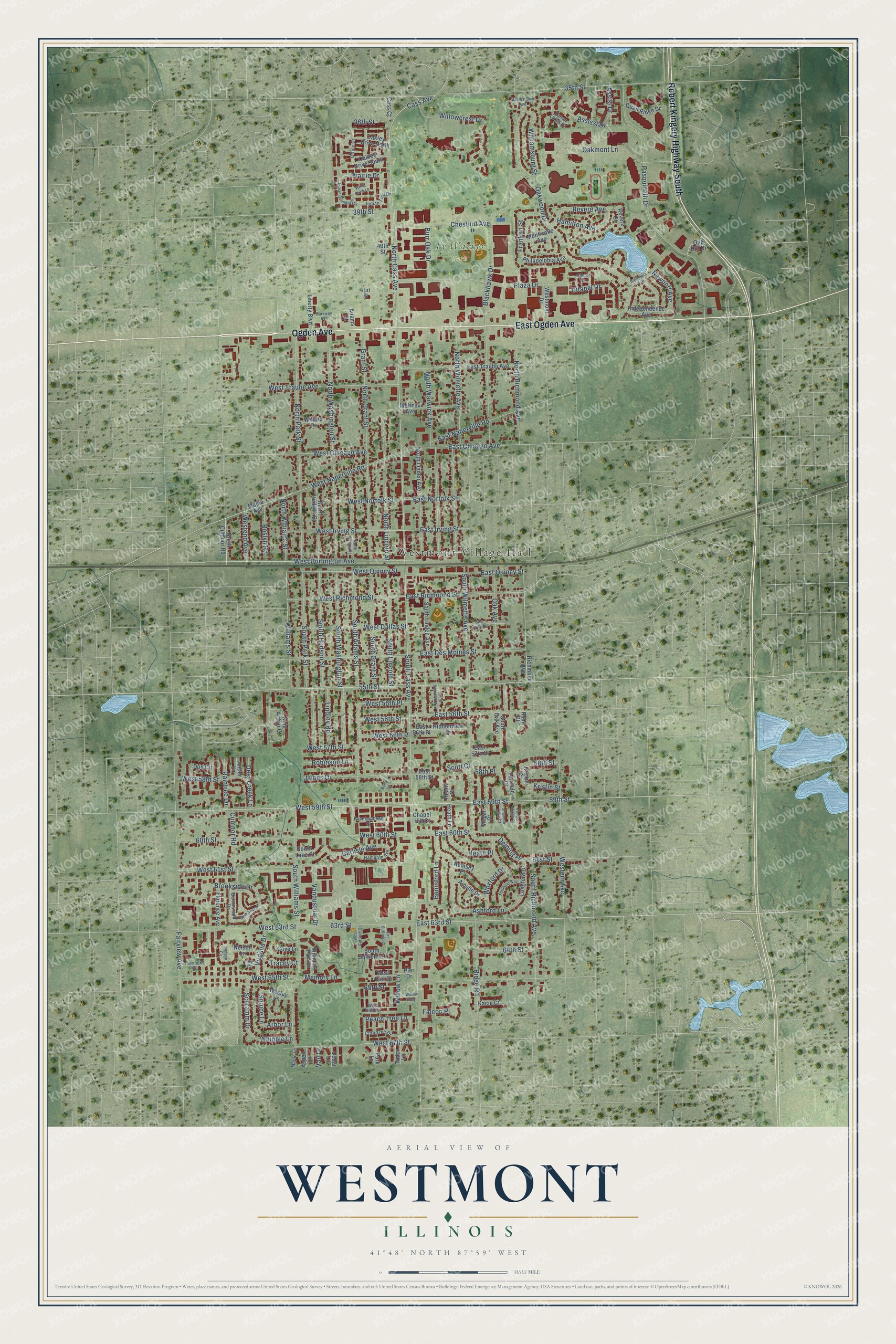
A new map of Westmont, Illinois, made in 2026 and printed to order on thick archival matte paper.
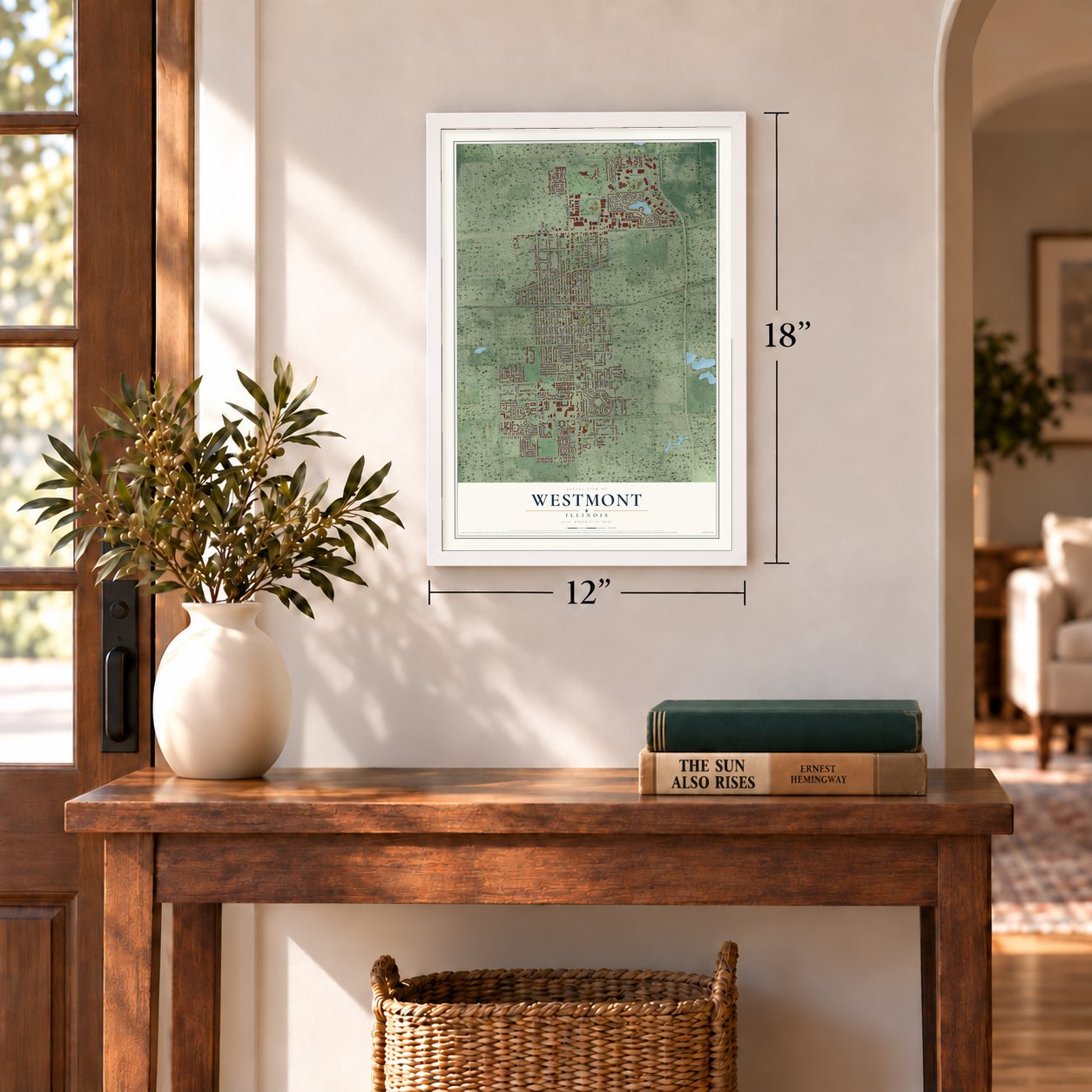
12" x 18" Archival Matte Print
A Map of Home. A Work of Art.
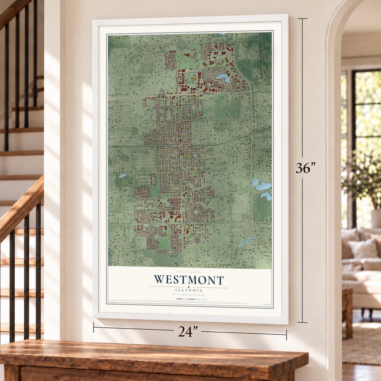
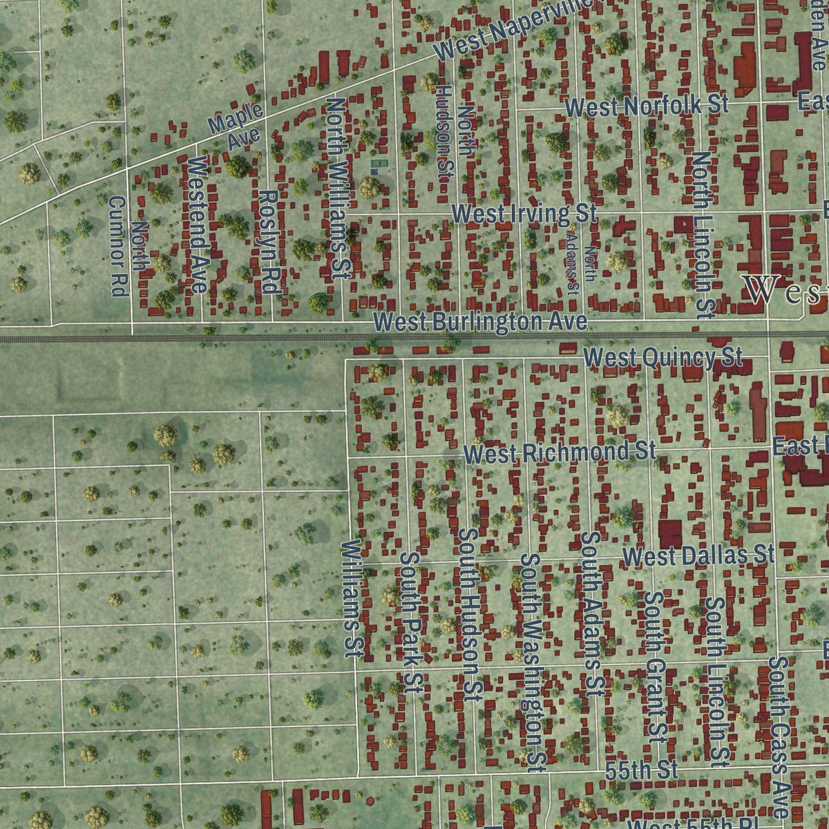
Explore Westmont, Illinois from a whole new perspective. Created using aerial imagery and detailed geographic data, this map captures Westmont building by building, with labeled streets, familiar landmarks, and shaded topographical relief that highlights the natural contours of the landscape.
Combining modern data with the timeless character of a vintage atlas, this map is just as interesting up close as it is beautiful on the wall. Whether you grew up in Westmont, spent memorable years there, or call it home today, this unique map is a great way to celebrate a place that means something to you. Zoom in on the preview to look for your street, and then order a print to put your memories on the wall.
Three ways to hang it
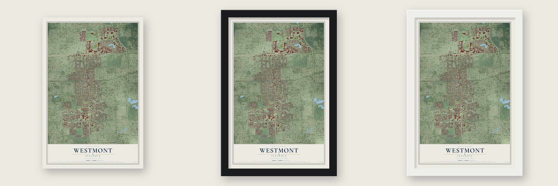
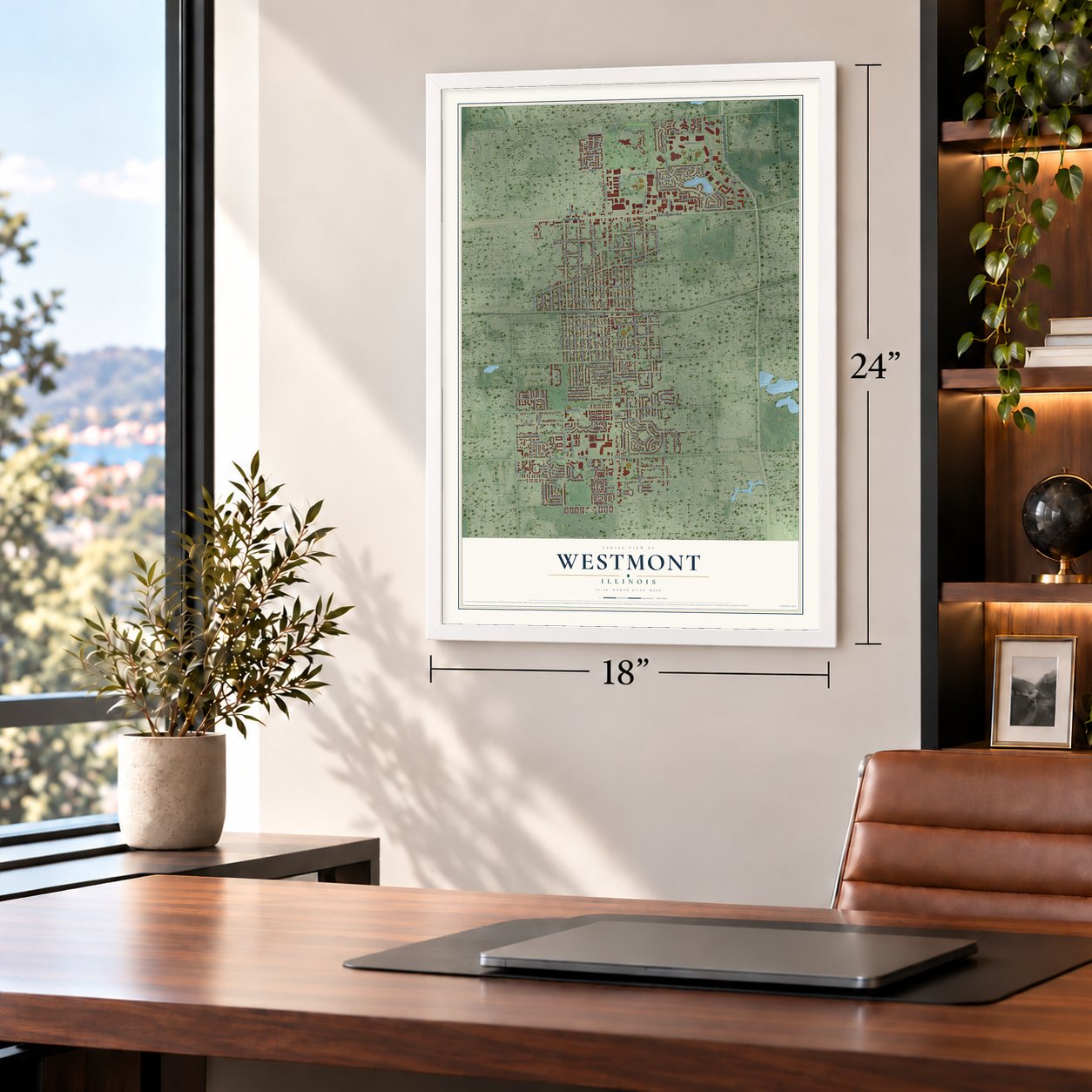
Unframed archival matte, a black wood frame or a white wood frame.
Up close
Geography Worth Displaying
This map was created using accurate cartographic data and authoritative geographic sources, including the U.S. Geological Survey and the Census Bureau. The map brings together terrain, waterways, roads, and building detail. The majority of the streets are labeled, houses are accurately depicted, and the topography is derived from government sources. Combining local data with carefully composed color and shading leads to this beautifully detailed Westmont artwork for your wall.
Rather than simply showing street outlines, we’ve included as many of the street names as we could reasonably fit on the map while keeping their names legible. Zoom in on the high resolution preview to see exactly what’s on the map. We truly set out to create a statement piece for anyone who loves Westmont. So whether it’s for you, or a gift for someone you love, we hope this map of Westmont brings back fond memories.
Read the story behind this map of Westmont, Illinois from 2026.

About Westmont, Illinois
Westmont is a village of 24,429 people in DuPage County, a suburb southwest of Chicago. The Potawatami lived here until 1833, when the U.S. government pressured them into giving up their land for a token payment. Workers then came to dig the Illinois and Michigan Canal. When the panic of 1837 stopped the work, many of them took up farming and sold their crops in Chicago.
To get those crops to market, builders started a plank road out of Chicago in 1840 and laid it across nine miles of swamp. It reached Naperville by 1851, and today it is Ogden Avenue. In 1858 nearby towns asked the Chicago, Burlington and Quincy Railroad for a branch line, and the first train came in 1864, stopping at a place then called Bushville. Voters chose to incorporate by 41 to 28, and Westmont became a village on November 4, 1921, with Vince Pastor as the first village board president.
- Gregg's Milk StationFarmers loaded their crops and dairy goods onto trains at a stop known as Gregg's Milk Station, and the village grew up around it. Over the years the farm town became a commuter suburb built around the station, which is now on Metra's BNSF Line between Aurora and Chicago. The William L. Gregg House joined the National Register in 1980.
- Muddy Waters and Ty WarnerThe Chicago blues musician Muddy Waters lived in Westmont before he died in 1983, and Muddy Waters Park on 63rd Street is named for him. Ty Warner, the businessman who invented Beanie Babies, also comes from Westmont, and Ty Warner Park carries his name.
- Forty-three years at the parksFor forty-three years, Robert W. Bernas worked for the Westmont Park District, and for thirty-nine of them he was president of its board of commissioners. Under his leadership the district grew from 32 acres of land to more than 137, and Robert W. Bernas Park now carries his name.
- A high school and a libraryWestmont High School opened in 1974. The Westmont Public Library followed in 1993.
Find your street
Names on the Westmont map
Every name below is printed on this map. Look for your street, your school, the park where you played, or the pond down the road.
Places and landmarks2
- Westmont Village Hall
- Ty Warner Park
Streets and roads202
- Ogden Avenue
- East Ogden Avenue
- Robert Kingery Highway South
- 35th Street
- West 59th Street
- East 59th Street
- 59th Street
- 63rd Street
- Cass Avenue
- North Cass Avenue
- East 63rd Street
- South Richmond Avenue
- South Cass Avenue
- West Burlington Avenue
- Willowcrest Drive
- East Norfolk Street
- Peach Tree Lane
- Prairie Drive
- South Williams Street
- Oakwood Drive
- Blackhawk Drive
- Pasquinelli Drive
- 55th Street
- South Wilmette Avenue
- North Washington Street
- West 63rd Street
- West 61st Street
- Fairview Avenue
- North Park Street
- North Wilmette Avenue
Show all 202 streets
- North Warwick Avenue
- South Adams Street
- West Naperville Road
- 65th Street
- South Park Street
- South Washington Street
- North Grant Street
- Plaza Drive
- Cumnor Road
- North Lincoln Street
- Oak Avenue
- Ashford Lane
- West Traube Avenue
- West 67th Street
- Williams Street
- Brookside Drive
- North Richmond Avenue
- Oakmont Lane
- West Irving Street
- West Richmond Street
- West 60th Street
- West Quincy Street
- West Dallas Street
- East 56th Street
- East Des Moines Street
- East Richmond Street
- East Quincy Street
- 60th Street
- West 65th Street
- South Hudson Street
- South Grant Street
- South Lincoln Street
- Western Avenue
- East Naperville Road
- James Drive
- West 58th Street
- East Chicago Avenue
- Ridge Road
- Chestnut Avenue
- Roslyn Road
- West Chicago Avenue
- Carlisle Avenue
- Grant Street
- Williamsburg Street
- West 57th Street
- Revere Avenue
- Deming Place
- North Williams Street
- Assissi Drive
- Beninford Lane
- Citadel Drive
- West Norfolk Street
- Schramm Drive
- Hamilton Avenue
- Vandustrial Drive
- 61st Street
- Lindley Road
- East Irving Street
- 64th Street
- East 60th Street
- 39th Street
- Burr Oak Drive
- Heath Place
- Robinson Lane
- Deer Creek Lane
- Virginia Drive
- West 56th Street
- West 56th Place
- West 55th Place
- Westend Avenue
- Newport Avenue
- Wexford Drive
- Memory Lane
- Raintree Lane
- Franklin Street
- Falcon Place
- Willow Lane
- 58th Street
- 36th Street
- Whipple Lane
- Spruce Lane
- Arbor Lane
- Kristin Street
- 58th Place
- Tracey Court
- Assisi Drive
- Scott Court
- Vail Drive
- Kristin Court
- Richmond Avenue
- East Traube Avenue
- North Linden Avenue
- King Arthur Court
- South Linden Avenue
- North Hudson Street
- Doe Circle
- Melrose Avenue
- Longford Drive
- Megan Court
- Philadelphia Avenue
- Oakley Drive South
- Williams Port Drive
- Florence Avenue
- North Cumnor Road
- Quail Ridge Drive
- Maple Avenue
- Rumsey Place
- Independence Avenue
- Ainslie Drive
- Westmont Drive
- Liberty Boulevard
- Oakley Drive North
- Hiddenview Drive
- Monticello Avenue
- South Oak Avenue
- South Lake Court
- Willard Place
- Wesley Lane
- East 57th Street
- East 58th Street
- Heath Lane
- South Suffield Court
- Fairfield Court
- Nelson Lane
- Oak Hill Drive
- Chapel Hill Court
- Pier Drive
- Kacie Court
- Park Lane
- Revere Court
- Cove Lane
- Tudor Lane
- East 56th Place
- Adams Street
- Cass Court
- Aspen Lane
- Heath Court
- Cedar Lane
- West Pier Drive
- Antler Lane
- 40th Street
- Ryan Court
- Crab Tree Drive
- Tartan Lakes Drive
- Hampton Avenue
- Indian Trail Drive
- Buttonwood Drive
- Fountainhead Drive
- 41st Street
- Fairmont Court
- West 66th Street
- Office Drive
- Maple Lane
- Ivy Court
- North Adams Street
- East Dallas Street
- South Warwick Avenue
- Indian Boundary Drive
- Fordham Way
- Nelson Circle
- White Birch Lane
- Citadel Circle
- Baltimore Avenue
- Beechwood Drive
- East Suffield Court
- West Suffield Court
- Shannon Lake Court
- Timber Ridge Court
- Jamestown Avenue
- Parkway Avenue
- Willow Way
- Barry Lane
Names are listed as they appear on the printed map. Zoom into the product photos to find them.
The art of mapping a place
How This Map Was Made
Real places. Remarkable detail. Discover the layers that turn geographic data into a map of home.

The view from above
Aerial imagery reveals the character of the land: woodland, open fields, and the patterns of a place.

The shape of the land
Elevation data brings hills, valleys, and subtle changes in the landscape into view.

The details of home
Roads, waterways, and building footprints come together to make the map feel unmistakably local.

Geography becomes art
Considered color, shading, and typography bring the layers together in a map made for your wall.


Process illustrated with Mendon, Massachusetts. Aerial imagery: USDA NAIP. Terrain: USGS 3D Elevation Program. Map details and finished artwork: KNOWOL.
The Details
About This Print
Choose an archival matte print, or a black or white Ayous wood frame. The archival matte print is unframed.
Select your size and finish above to see the matching product image and price.
Materials & Craftsmanship
A contemporary map with the character of a classic atlas, printed on archival matte paper. Optional frames are made from Ayous wood.
Your printed map does not include the watermark shown in the full-map preview.
Shipping & Delivery
Free shipping within the United States. Every print is made to order in the USA.
Buying a gift? Add a note in your cart and we'll include it. We never put prices in the package.
Prints ship within 2 to 3 business days. Allow 7 to 10 days total from ordering for delivery. Timing may vary during holidays or periods of high order volume.
Read our shipping policy.
Returns and damaged prints
Each print is made to order. Change-of-mind refunds are not available after production.
If your print arrives damaged, misprinted or incorrect, contact support@knowol.com within 30 days of receiving it. Include your order number, photos and a description of the issue.
Read our full refund and replacement policy. For questions about your order, email support@knowol.com.
Find your town
Looking for another city?
Find a map of home in our Illinois collection, or any town in the country.
Nearby
Maps of towns near Westmont
Know someone from one of these towns? Their map makes a great gift.
 Clarendon Hills
, Illinois
From $39.99See the map
 Hinsdale
, Illinois
From $39.99See the map
 Willowbrook
, Illinois
From $39.99See the map
More maps nearby: Downers Grove, Oak Brook, Darien, Western Springs and Oakbrook Terrace.