
Search for another town




Free U.S. delivery 7 to 10 days after you order
Downers Grove, Illinois Map Art
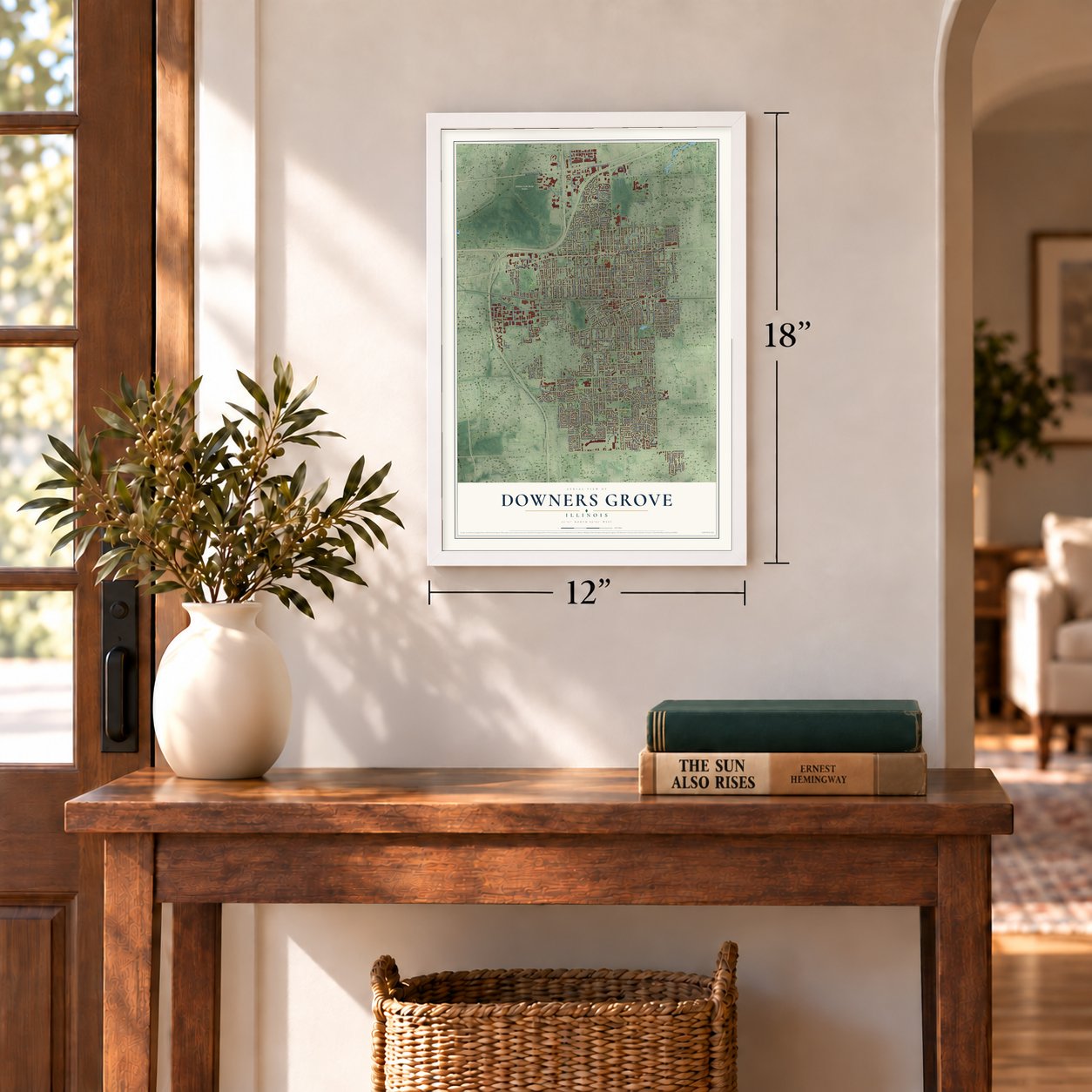
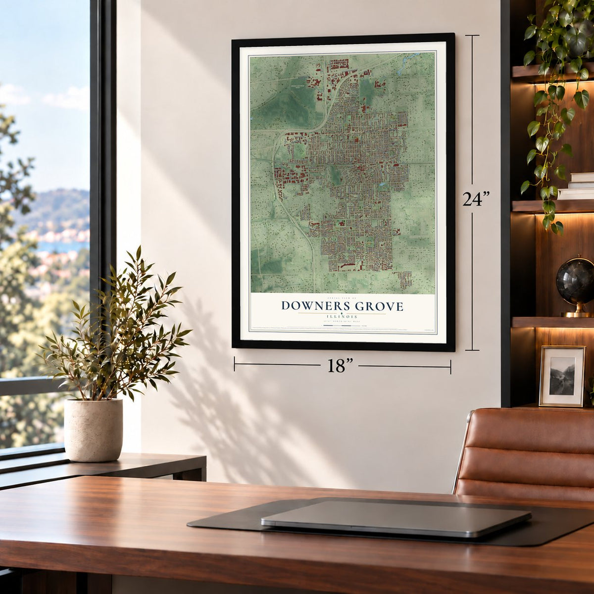
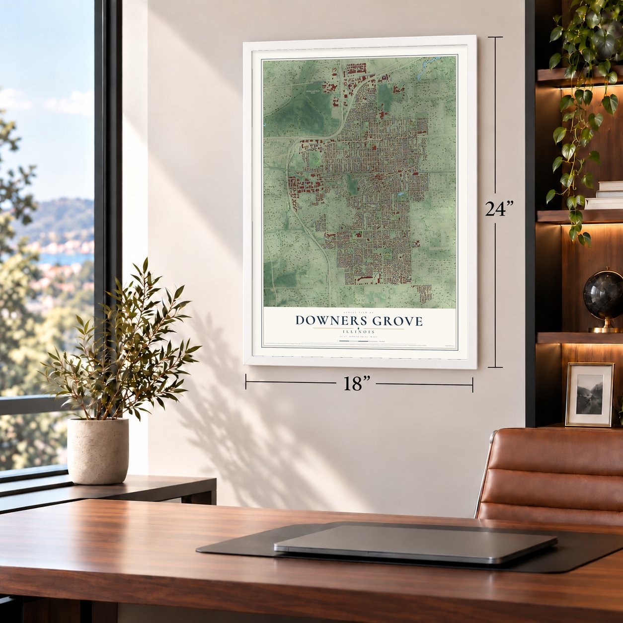
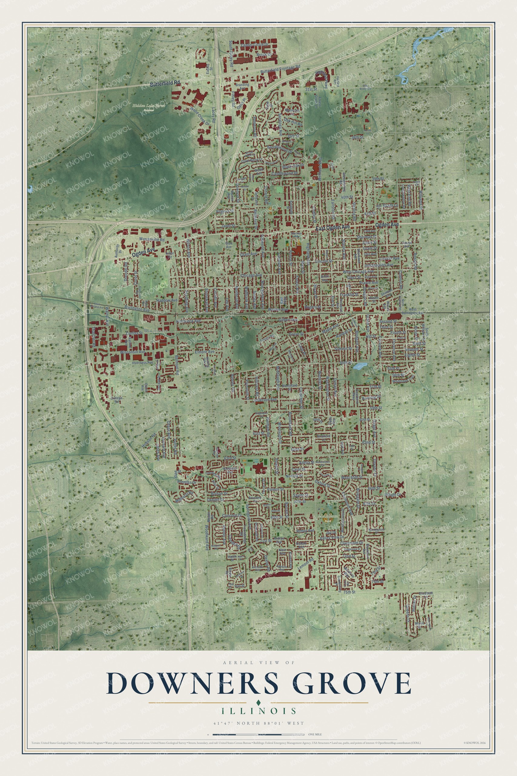
A new map of Downers Grove, Illinois, made in 2026 and printed to order on thick archival matte paper.
12" x 18" Archival Matte Print
A Map of Home. A Work of Art.
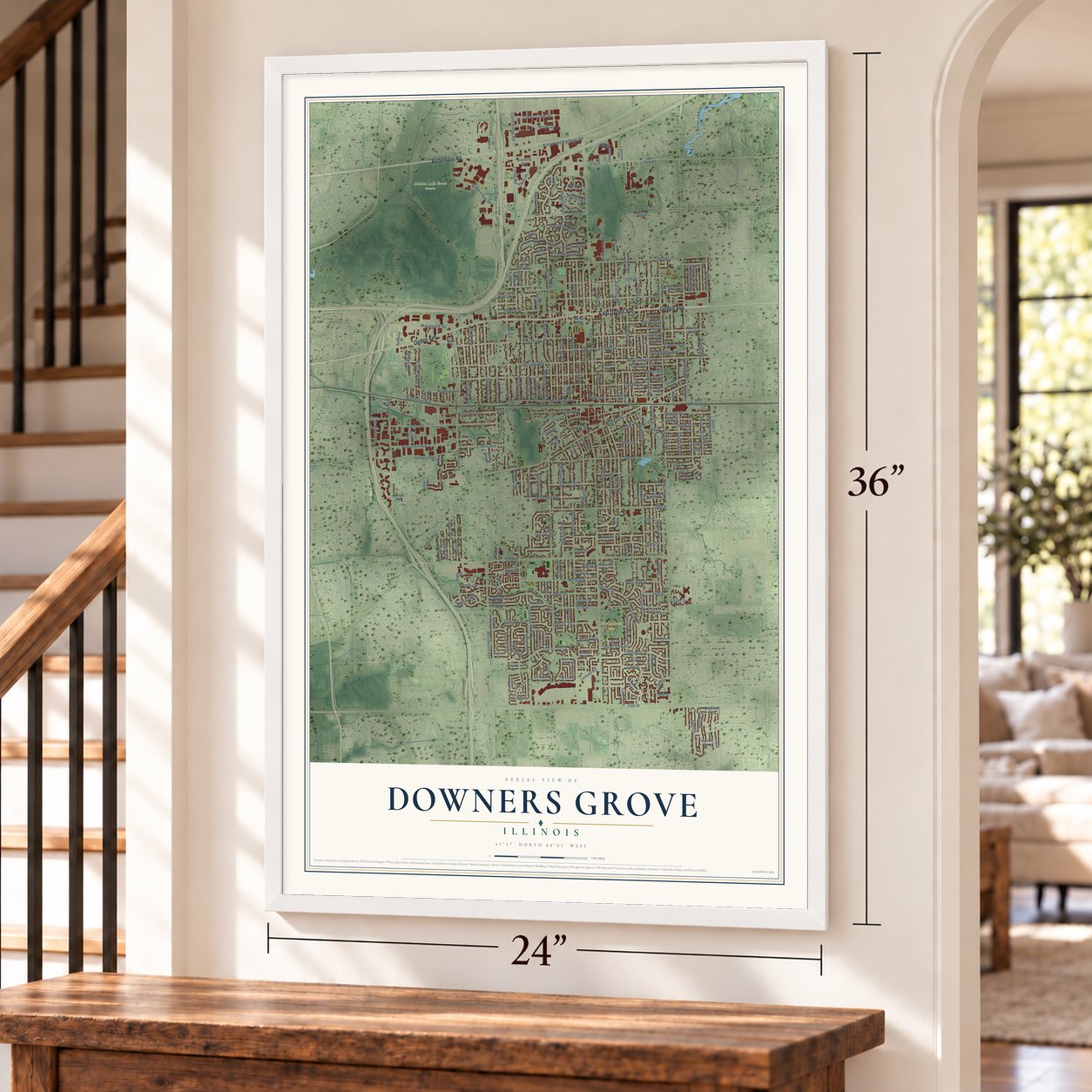
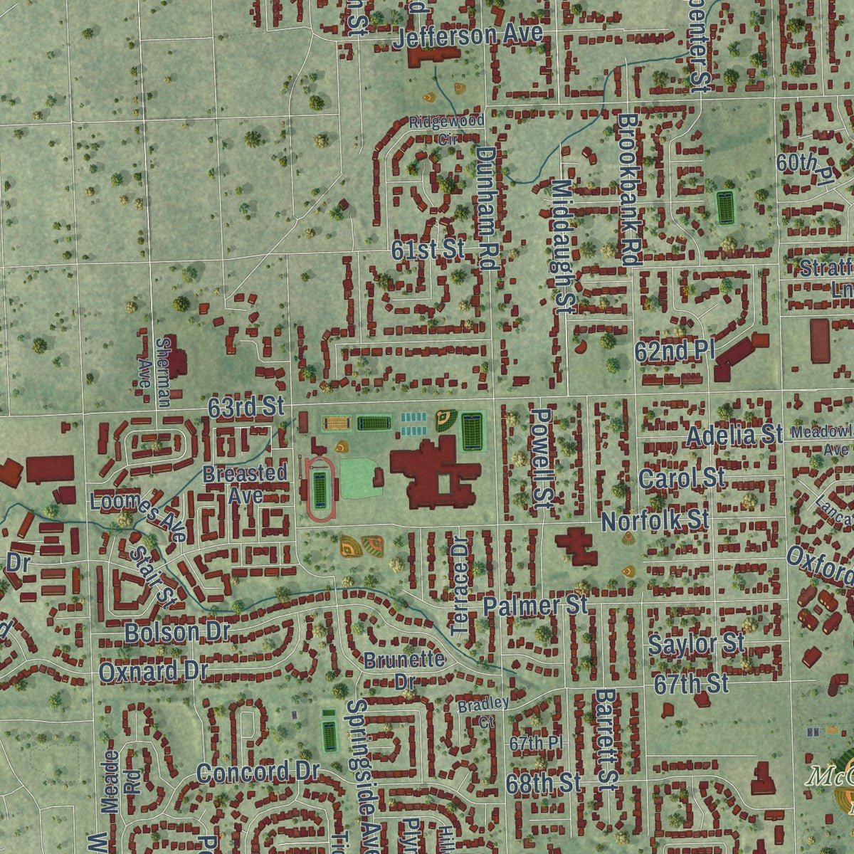
Explore Downers Grove, Illinois from a whole new perspective. Created using aerial imagery and detailed geographic data, this map captures Downers Grove building by building, with labeled streets, familiar landmarks, and shaded topographical relief that highlights the natural contours of the landscape.
Combining modern data with the timeless character of a vintage atlas, this map is just as interesting up close as it is beautiful on the wall. Whether you grew up in Downers Grove, spent memorable years there, or call it home today, this unique map is a great way to celebrate a place that means something to you. Zoom in on the preview to look for your street, and then order a print to put your memories on the wall.
Three ways to hang it
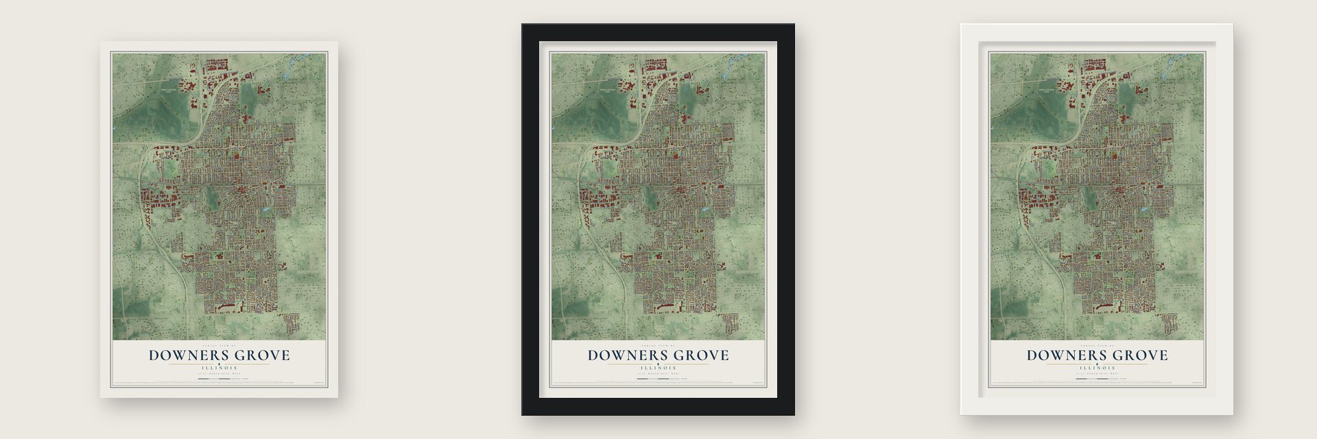
Unframed archival matte, a black wood frame or a white wood frame.
Up close
Geography Worth Displaying
This map was created using accurate cartographic data and authoritative geographic sources, including the U.S. Geological Survey and the Census Bureau. The map brings together terrain, waterways, roads, and building detail. The majority of the streets are labeled, houses are accurately depicted, and the topography is derived from government sources. Combining local data with carefully composed color and shading leads to this beautifully detailed Downers Grove artwork for your wall.
Rather than simply showing street outlines, we’ve included as many of the street names as we could reasonably fit on the map while keeping their names legible. Zoom in on the high resolution preview to see exactly what’s on the map. We truly set out to create a statement piece for anyone who loves Downers Grove. So whether it’s for you, or a gift for someone you love, we hope this map of Downers Grove brings back fond memories.
Read the story behind this map of Downers Grove, Illinois from 2026.

About Downers Grove, Illinois
Downers Grove is a village of 50,247 people in DuPage County, in the western suburbs of Chicago. Pierce Downer, a farmer born in Vermont who came west from Rutland, New York, settled here in 1832. The village took his name, along with the grove of old bur oaks that rose above the open savanna around it. Families such as the Blodgetts, Curtisses and Carpenters followed, most of them from the Northeast or Northern Europe, and they put up the first schoolhouse in 1844.
In 1864 the Chicago, Burlington and Quincy Railroad ran its new line from Aurora to Chicago through the settlement, and the population grew. Downers Grove incorporated in March 1873 and spelled its name without an apostrophe, a choice no one has fully explained. Later highways tied the village to the whole region, with I-88 arriving in 1958 and I-355 in 1989.
- Homes on the Underground RailroadThe Reverend Orange Lyman, a Presbyterian minister, came with his wife, Maria Dewey Lyman, in 1839, and the house they built is believed to be the village's first. Israel and Avis Blodgett built their own house in 1846. Both couples opposed slavery, and both homes later served as stops on the Underground Railroad.
- The Tivoli Theatre, 1928The Tivoli opened in 1928 with 1,390 seats, and no theater in DuPage County showed talkies before it did. Its first Wurlitzer organ gave way in 1992 to Opus 942, an instrument once housed in East Chicago, Indiana, at that city's Indian Theatre. The organ still plays as the credits begin on weekend nights.
- The Zephyr wreck of 1947In April 1947 the Burlington's Twin Cities Zephyr, a streamlined passenger train, hit a big tractor that had slipped off a freight train. Two of its passenger cars smashed through a wall of the Main Street Station, and three people died, the engineer among them.
- Lyman Woods kept wildLyman Woods began as ranch land. The village bought the 150 acres of oak savanna, prairie and marsh in 1987, and in 1996 residents passed a referendum to keep homes and businesses off it. More than 300 native kinds of plants and animals live there, and six of them are rare in northern Illinois.
Find your street
Names on the Downers Grove map
Every name below is printed on this map. Look for your street, your school, the park where you played, or the pond down the road.
Places and landmarks4
- Belmont
- Hidden Lake Forest Preserve
- McCollum Park
- Walnut Park
Streets and roads280
- Ogden Avenue
- Butterfield Road
- East Ogden Avenue
- Belmont Road
- Lyman Avenue
- 31st Street
- Wellness Way
- 64th Street
- 40th Street
- Saratoga Avenue
- Finley Road
- South Finley Road
- 39th Street
- 72nd Street
- 63rd Street
- Middaugh Avenue
- Valley View Drive
- Fairview Avenue
- Main Street
- Maple Avenue
- Washington Street
- Fairmount Avenue
- Highland Avenue
- Dunham Road
- 75th Street
- Prairie Avenue
- Grant Street
- Carpenter Street
- Cumnor Road
- Woodward Avenue
Show all 280 streets
- Grand Avenue
- Downers Drive
- Lee Avenue
- Warren Avenue
- Florence Avenue
- 55th Street
- Curtiss Street
- Springside Avenue
- West Chicago Avenue
- Burlington Avenue
- Venard Road
- Walnut Avenue
- 41st Street
- Brookbank Road
- Douglas Road
- Elm Street
- Lacey Road
- 61st Street
- Webster Street
- Stonewall Avenue
- Forest Avenue
- Williams Street
- 59th Street
- Franklin Street
- 62nd Street
- Seeley Avenue
- Blodgett Avenue
- Puffer Road
- Powell Street
- Sterling Road
- 67th Street
- Gilbert Avenue
- Middaugh Street
- 68th Street
- Claremont Drive
- Chase Avenue
- Roslyn Road
- Wisconsin Avenue
- Osage Avenue
- Chicago Avenue
- Concord Drive
- Lincoln Street
- Oakwood Avenue
- Norfolk Street
- Cornell Avenue
- Elmore Avenue
- Pershing Avenue
- Rogers Street
- Bolson Drive
- Camden Road
- Oxnard Drive
- Stanley Avenue
- Cross Street
- Wood Creek Drive
- Linscott Avenue
- Barrett Street
- 73rd Street
- Prince Street
- Warrenville Road
- Jefferson Avenue
- Hitchcock Avenue
- Prentiss Drive
- Palmer Street
- 35th Street
- Sherman Street
- Northcott Avenue
- Indianapolis Avenue
- Oxford Street
- 71st Street
- Summit Street
- Grant Avenue
- 56th Street
- Center Circle Drive
- Hillcrest Road
- Hobson Road
- Plymouth Street
- Lemont Road
- Earlston Road
- Rohrer Drive
- Brook Drive
- Butterfield Frontage Road
- Eighth Street
- Seventh Street
- Sixth Street
- Fourth Street
- Second Street
- Gierz Street
- Haddow Avenue
- Randall Street
- Barneswood Drive
- Carol Street
- Belleaire Drive
- Highland Parkway
- Queens Court
- Lincoln Avenue
- Village Drive
- Oak Hill Road
- Janes Avenue
- Janet Street
- Victor Street
- Drendel Road
- Briargate Drive
- Midhurst Road
- Wilson Avenue
- Thatcher Road
- Montgomery Avenue
- Leonard Avenue
- West 65th Street
- Wallbank Avenue
- Bryan Place
- Dexter Road
- Saylor Street
- Virginia Street
- Penner Avenue
- Candlewood Drive
- Third Street
- 57th Street
- 66th Street
- Aubrey Terrace
- Davis Street
- West End Road
- Robey Avenue
- Lindley Street
- Lane Place
- Black Oak Drive
- Adelia Street
- Hill Street
- Bunning Drive
- 67th Court
- 55th Place
- Pomeroy Road
- 62nd Place
- 74th Street
- Davane Court
- Grove Street
- Opus Place
- Shady Lane
- 36th Street
- Jay Drive
- Ticonderoga Road
- Binder Road
- Kidwell Road
- Hall Street
- Blanchard Street
- Blackburn Avenue
- Prospect Avenue
- Glendenning Road
- Durand Drive
- Meadowcrest Drive
- South Williams Street
- Inverness Avenue
- Easton Street
- Turvey Road
- 60th Place
- Belleaire Lane
- Park Avenue
- Katrine Avenue
- Terrace Drive
- Winthrop Way
- Plymouth Road
- Austin Street
- 60th Street
- Clyde Avenue
- Otis Avenue
- Longmeadow Road
- Sheldon Avenue
- Whitefawn Trail
- Wilcox Avenue
- Sherwood Avenue
- West Burlington Avenue
- Mistwood Lane
- Coral Berry Lane
- Arbor Circle
- Dearborn Parkway
- Authority Drive
- Loomes Avenue
- Forest Grove Lane
- Elizabeth Lane
- Hobart Avenue
- Branding Avenue
- Stratford Lane
- Canterbury Place
- Brunette Drive
- Traube Avenue
- Meade Road
- Morton Avenue
- Saratoga Street
- Breasted Avenue
- Wood Avenue
- Andrus Avenue
- Drew Street
- Marie Drive
- Stair Street
- East Parkway
- College Road
- Klein Avenue
- Birch Avenue
- Hatch Street
- Elinor Avenue
- Glen Avenue
- Fairfield Avenue
- Oak Brook Road
- Linden Place
- Ridgeview Street
- Fifth Street
- Hawkins Avenue
- Francisco Avenue
- Tower Road
- Sherman Avenue
- Hillcrest Drive
- Richards Avenue
- North Cumnor Road
- Buckingham Place
- Bending Oaks Place
- Arrow Wood Lane
- Gierz Avenue
- Almond Court
- Meadow Lane
- Lake Avenue
- Sherman Road
- 67th Place
- Rose Avenue
- Dillon Court
- Trent Road
- 40th Place
- Hall Place
- Herbert Street
- Ridgewood Circle
- Knottingham Lane
- Wilson Street
- Devereux Road
- Lancaster Avenue
- South Railroad Avenue
- Meadowlawn Avenue
- Brookside Lane
- Newport Road
- Barberry Court
- Elmwood Avenue
- Blodgett Court
- Maplewood Place
- Bradley Court
- Statton Street
- Fairhaven Court
- Quince Court
- Ashbrook Place
- 62nd Court
- Woods Lane
- Belle Aire Lane
- Hatch Place
- 71st Terrace
Names are listed as they appear on the printed map. Zoom into the product photos to find them.
The art of mapping a place
How This Map Was Made
Real places. Remarkable detail. Discover the layers that turn geographic data into a map of home.

The view from above
Aerial imagery reveals the character of the land: woodland, open fields, and the patterns of a place.

The shape of the land
Elevation data brings hills, valleys, and subtle changes in the landscape into view.

The details of home
Roads, waterways, and building footprints come together to make the map feel unmistakably local.

Geography becomes art
Considered color, shading, and typography bring the layers together in a map made for your wall.


Process illustrated with Mendon, Massachusetts. Aerial imagery: USDA NAIP. Terrain: USGS 3D Elevation Program. Map details and finished artwork: KNOWOL.
The Details
About This Print
Choose an archival matte print, or a black or white Ayous wood frame. The archival matte print is unframed.
Select your size and finish above to see the matching product image and price.
Materials & Craftsmanship
A contemporary map with the character of a classic atlas, printed on archival matte paper. Optional frames are made from Ayous wood.
Your printed map does not include the watermark shown in the full-map preview.
Shipping & Delivery
Free shipping within the United States. Every print is made to order in the USA.
Buying a gift? Add a note in your cart and we'll include it. We never put prices in the package.
Prints ship within 2 to 3 business days. Allow 7 to 10 days total from ordering for delivery. Timing may vary during holidays or periods of high order volume.
Read our shipping policy.
Returns and damaged prints
Each print is made to order. Change-of-mind refunds are not available after production.
If your print arrives damaged, misprinted or incorrect, contact support@knowol.com within 30 days of receiving it. Include your order number, photos and a description of the issue.
Read our full refund and replacement policy. For questions about your order, email support@knowol.com.
Find your town
Looking for another city?
Find a map of home in our Illinois collection, or any town in the country.
Nearby
Maps of towns near Downers Grove
Know someone from one of these towns? Their map makes a great gift.
 Westmont
, Illinois
From $39.99See the map
 Clarendon Hills
, Illinois
From $39.99See the map
 Lisle
Lisle, Illinois
From $39.99See the map
More maps nearby: Darien, Woodridge, Willowbrook, Oak Brook and Hinsdale.