
Search for another town



Free U.S. delivery 7 to 10 days after you order
Lisle, Illinois Map Art
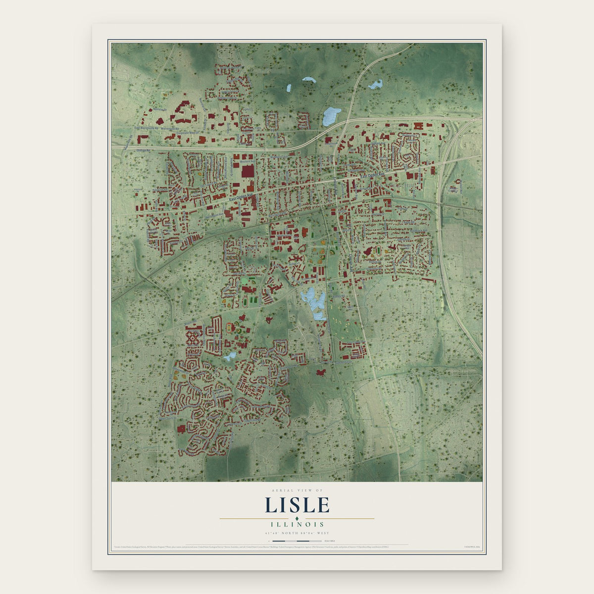
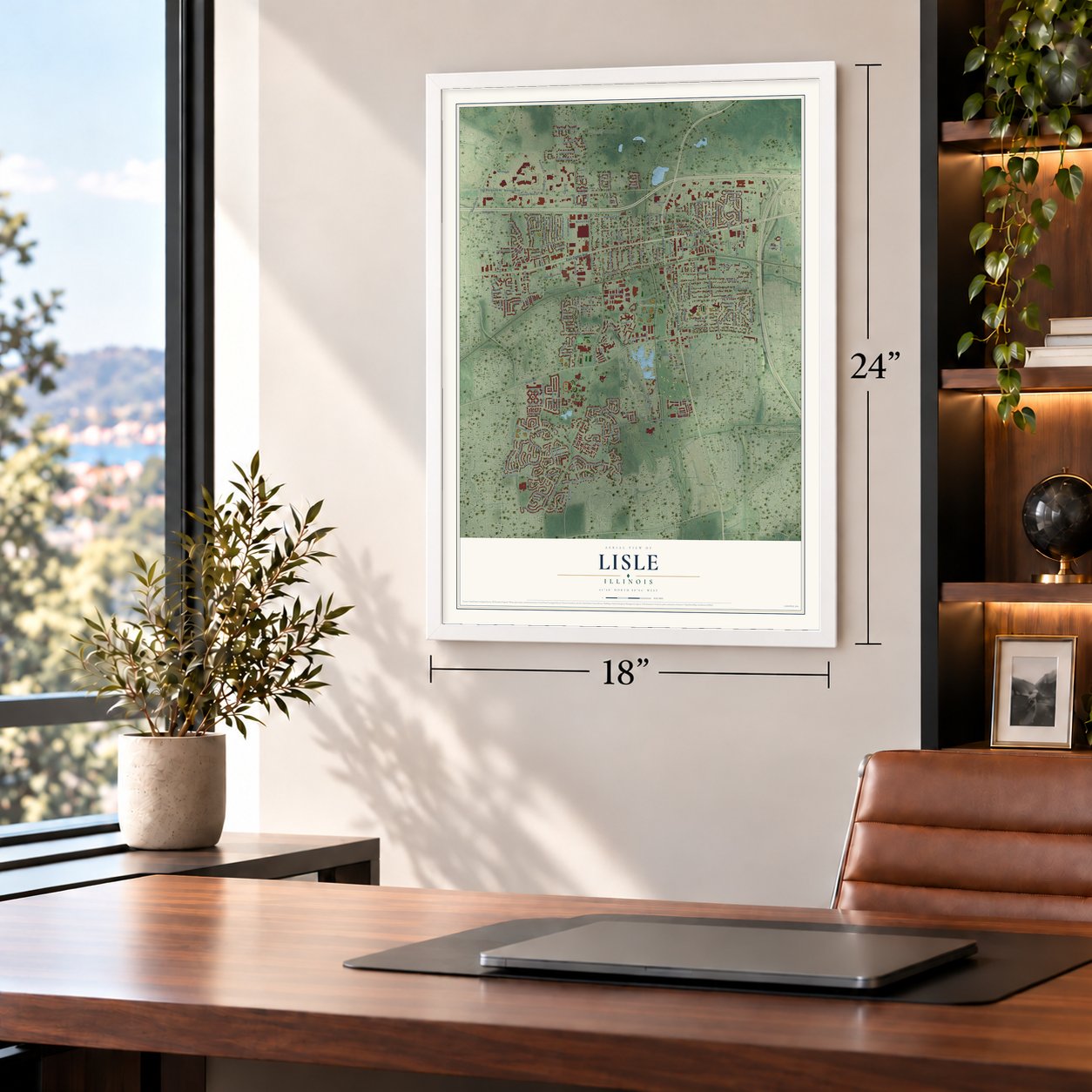
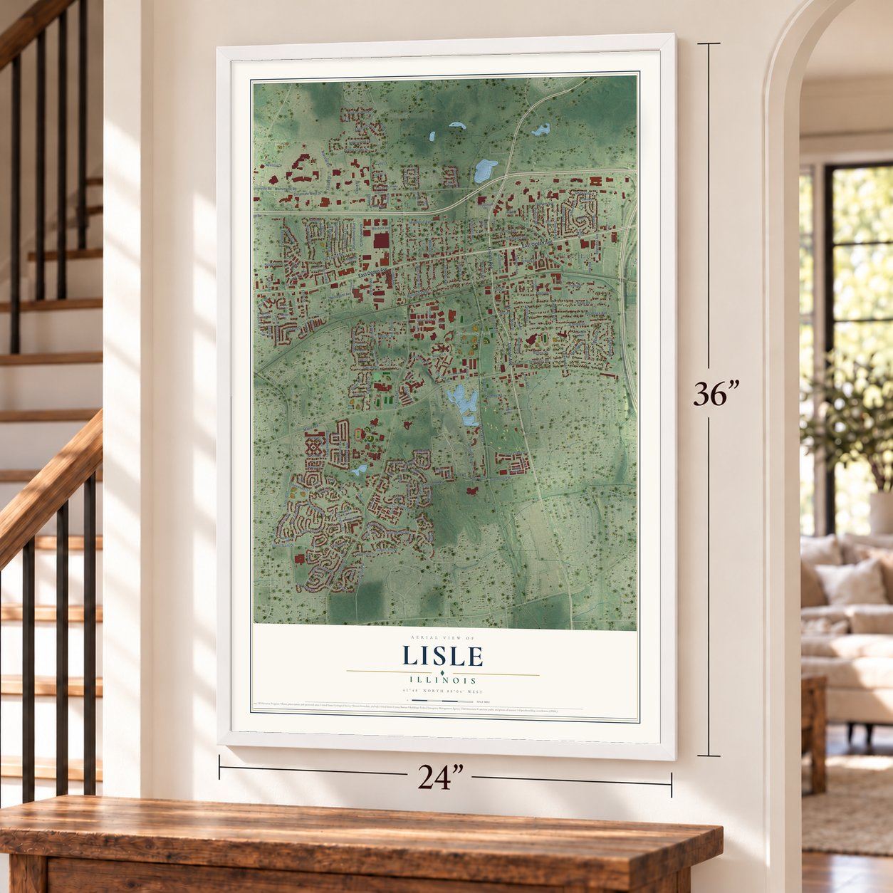
A new map of Lisle, Illinois, made in 2026 and printed to order on thick archival matte paper.
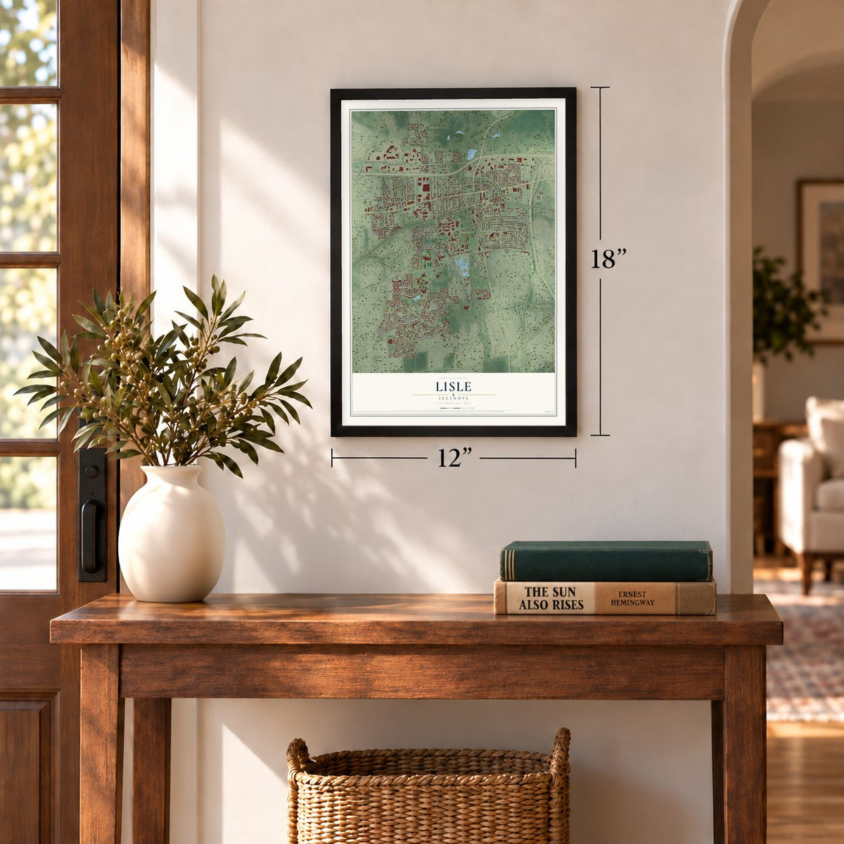
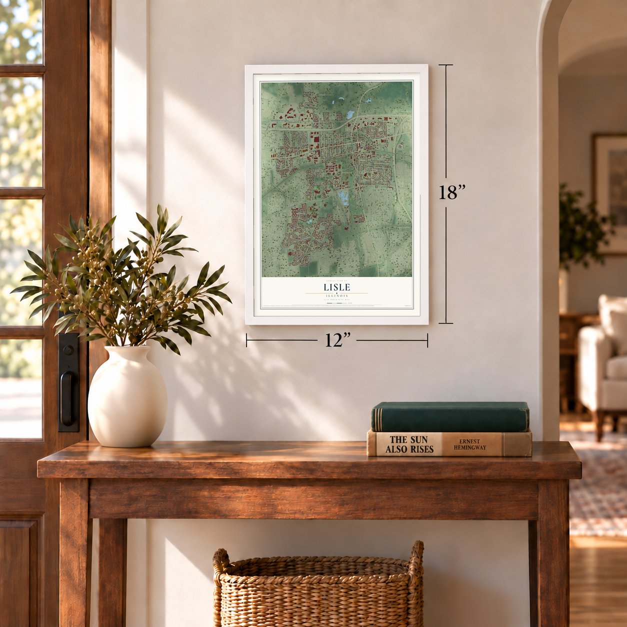
12" x 18" Archival Matte Print
A Map of Home. A Work of Art.
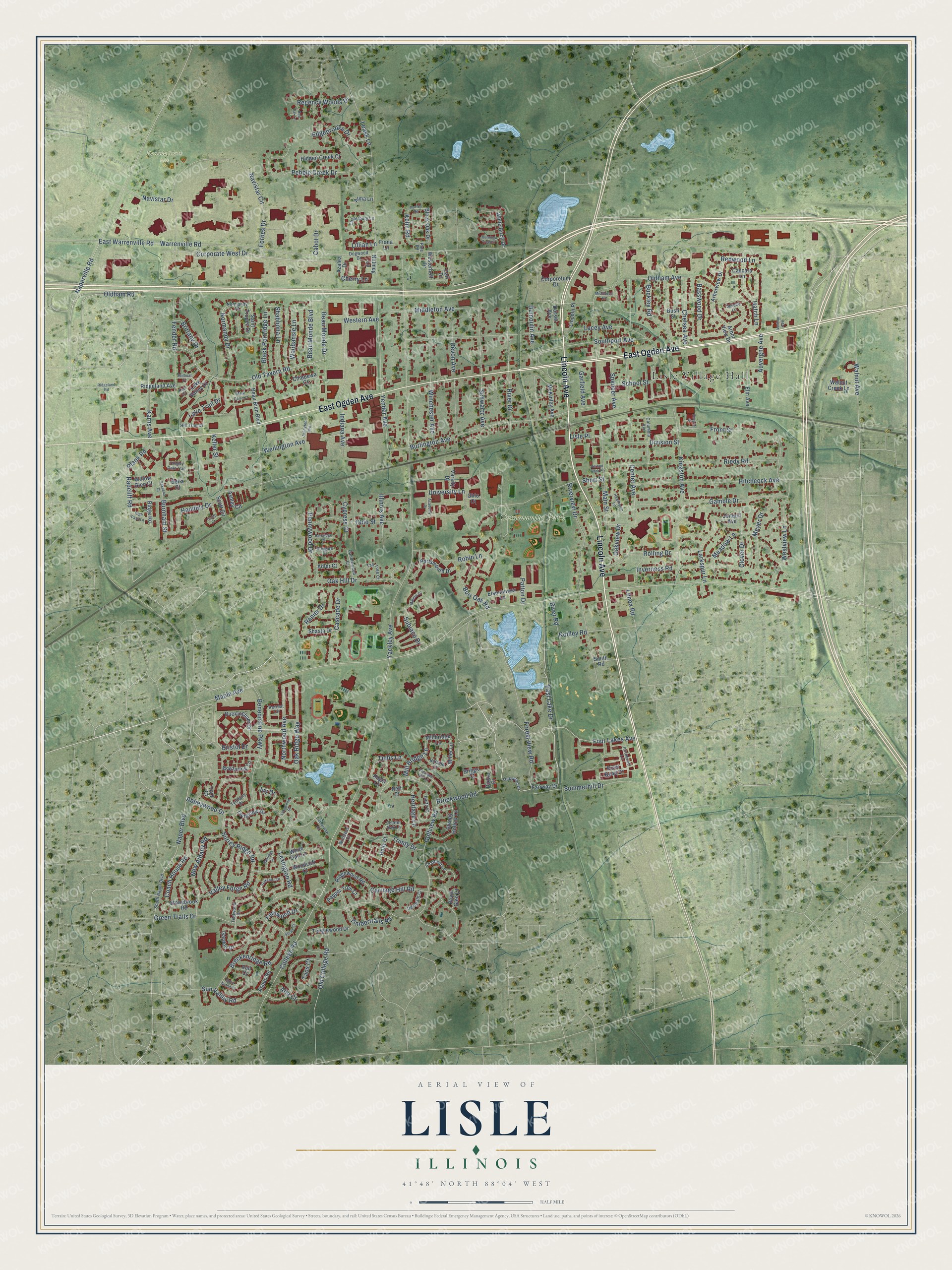
Explore Lisle, Illinois from a whole new perspective. Created using aerial imagery and detailed geographic data, this map captures Lisle building by building, with labeled streets, familiar landmarks, and shaded topographical relief that highlights the natural contours of the landscape.
Combining modern data with the timeless character of a vintage atlas, this map is just as interesting up close as it is beautiful on the wall. Whether you grew up in Lisle, spent memorable years there, or call it home today, this unique map is a great way to celebrate a place that means something to you. Zoom in on the preview to look for your street, and then order a print to put your memories on the wall.
Three ways to hang it
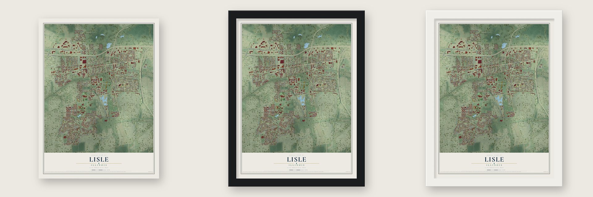
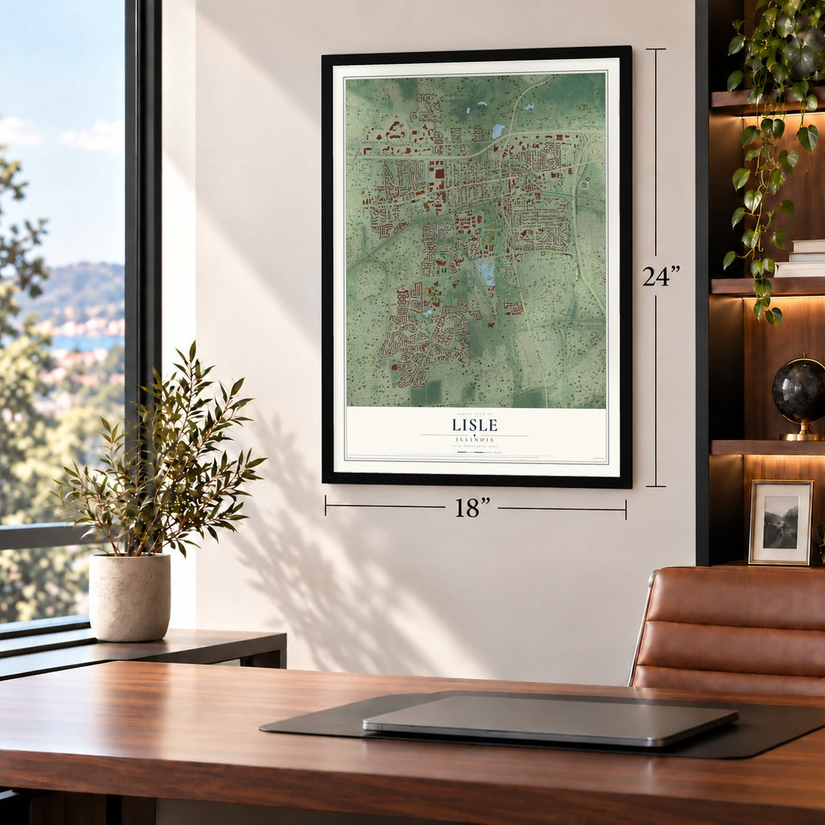
Unframed archival matte, a black wood frame or a white wood frame.
Up close
Geography Worth Displaying
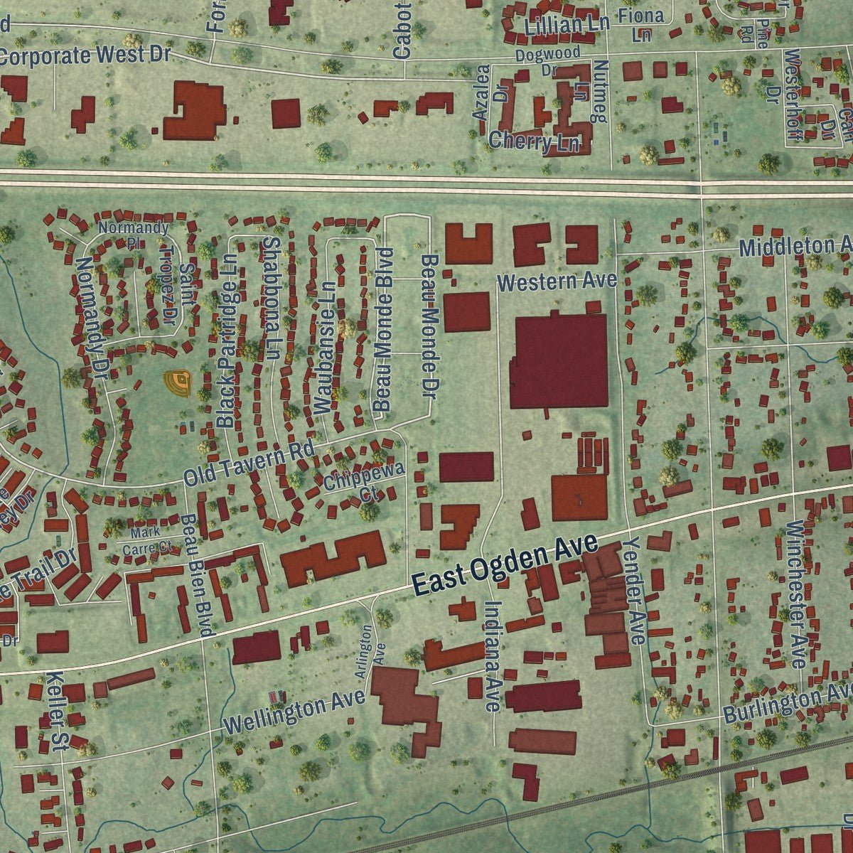
This map was created using accurate cartographic data and authoritative geographic sources, including the U.S. Geological Survey and the Census Bureau. The map brings together terrain, waterways, roads, and building detail. The majority of the streets are labeled, houses are accurately depicted, and the topography is derived from government sources. Combining local data with carefully composed color and shading leads to this beautifully detailed Lisle artwork for your wall.
Rather than simply showing street outlines, we’ve included as many of the street names as we could reasonably fit on the map while keeping their names legible. Zoom in on the high resolution preview to see exactly what’s on the map. We truly set out to create a statement piece for anyone who loves Lisle. So whether it’s for you, or a gift for someone you love, we hope this map of Lisle brings back fond memories.
Read the story behind this map of Lisle, Illinois from 2026.
About Lisle, Illinois
From the Lisle Area Chamber of Commerce: "The Chicago, Burlington & Quincy Railroad line was constructed in 1863, making its way through Lisle and offering a significant connection in and out of the fledgling community."
Find your street
Names on the Lisle map
Every name below is printed on this map. Look for your street, your school, the park where you played, or the pond down the road.
Places and landmarks3
- Lisle Village Hall
- Community Park
- Danada South Park
Streets and roads236
- Lincoln Avenue
- East Ogden Avenue
- Corporate West Drive
- East Lake Drive
- Beau Monde Boulevard
- Beau Monde Drive
- Maple Avenue
- Old Tavern Road
- Bristol Drive
- College Road
- Kingston Avenue
- Hatch Lane
- Forbes Drive
- Lacey Avenue
- Western Avenue
- Four Lakes Avenue
- University Lane
- Warrenville Road
- Burlington Avenue
- Yackley Avenue
- Green Trails Drive
- Abbeywood Drive
- Main Street
- Center Avenue
- Middleton Avenue
- Fender Road
- Ohio Street
- Naper Boulevard
- Hitchcock Avenue
- Front Street
Show all 236 streets
- Yender Avenue
- Devon Avenue
- Riedy Road
- Riverview Drive
- Sun Valley Road
- Gamble Drive
- East Warrenville Road
- Pebble Creek Drive
- Westview Lane
- Breckenridge Road
- Navistar Circle
- Winchester Avenue
- Naperville Road
- Short Street
- River Drive
- Inverness Road
- Benedictine Parkway
- Carriage Hill Road
- Golfview Road
- Leask Lane
- Schwartz Avenue
- Oak Ridge Way
- Wellington Avenue
- Oldham Avenue
- Fernwood Drive
- Cabot Drive
- Forest View Road
- Trinity Drive
- Basswood Drive
- Rolling Drive
- Valley Forge Road
- New Albany Road
- Indiana Avenue
- Dumoulin Avenue
- Oak Hill Drive
- Meadow Lane
- Navistar Drive
- Northwood Avenue
- Spencer Avenue
- Robin Lane
- Southport Avenue
- Brookwood Road
- Handley Drive
- Meyer Drive
- Radcliff Road
- Summerhill Drive
- Timbertrails Road
- Shabbona Lane
- Division Street
- Mill Bridge Lane
- Black Partridge Lane
- Heritage Lane
- Lexington Road
- Surrey Ridge Road
- Normandy Drive
- Cascade Drive
- Pennywood Drive
- Chelsea Avenue
- Larkspur Lane
- Lake Trail Drive
- Waubansie Lane
- Coach House Road
- Burr Oak Road
- Edgebrooke Drive
- Walnut Avenue
- Garfield Avenue
- Keller Street
- Old College Road
- Regency Woods Drive
- Illinois Avenue
- River Road
- School Street
- Karns Avenue
- Auvergne Avenue
- Clover Drive
- Subiaco Drive
- Brittany Drive
- Ranier Drive
- Redwood Lane
- Plank Road
- Tellis Lane
- Cypress Court
- Kohley Road
- Burnham Street
- Oakview Drive
- Buckley Road
- Oldham Road
- Ivy Drive
- Lisle Place
- Keim Road
- Alta Court
- Cherry Lane
- Lenox Road
- Lillian Lane
- Patton Drive
- Taos Court
- Fairway Drive
- Buckingham Drive
- Saint Tropez Drive
- Arborview Drive
- Dixon Drive
- Holly Court
- Miller Lane
- River Bend Drive
- Arbor View Drive
- Beau Bien Boulevard
- Millbridge Lane
- Corporetum Drive
- Longview Drive
- Ridgewood Road
- Garden Drive
- Eisenhower Lane
- Wayfaring Lane
- Sleepy Hollow Lane
- Ridgeland Avenue
- Jonquil Avenue
- White Birch Drive
- Hidden Creek Court
- McKinley Avenue
- Cascara Lane
- Lake Valley Drive
- Tanglewood Drive
- Portsmouth Drive
- Scott Circle
- Ashley Circle
- Pepper Tree Court
- Elm Avenue
- Black Oak Drive
- Woodcliff Court
- Fiona Lane
- Stonebrook Road
- Aspen Road
- Lincoln Place
- Walnut Creek Lane
- Shasta Drive
- Westerhoff Drive
- White Oak Lane
- Angel Lane
- Alma Lane
- Nutmeg Lane
- Dorset Avenue
- Ridge Road
- Chippewa Court
- Varsity Drive
- Willow Glen Court
- Azalea Drive
- Adler Court
- Royal Glen Court
- Vail Court
- Tory Court
- Bella Court
- Bush Street
- Briggs Court
- Neff Court
- Ohio Court
- Smith Road
- Carl Drive
- Oakwood Drive
- Winstead Court
- Normandy Place
- South Naper Boulevard
- Ironwood Lane
- Retreat Circle
- Columbia Avenue
- Tyrnbury Drive
- Spruce Lane
- Hill Trail Drive
- Scarlet Oak Lane
- Canterbury Lane
- Candlewood Court
- Dogwood Drive
- Pine Road
- Hillside Lane
- Tall Tree Court
- Deerpath Court
- Chatfield Lane
- Bayside Court
- Tealwood Drive
- Harth Court
- Ridgeland Road
- Middleton Place
- Pleasant Hill Lane
- Hastings Lane
- Arlington Avenue
- Yorkshire Drive
- Ivanhoe Avenue
- Tangley Oaks Trail
- Lakewood Drive
- Sailboat Cv
- Hawthorne Lane
- Barkridge Court
- Academy Drive
- Mark Carre Court
- Saint Anton Court
- High Pass Lane
- Burning Tree Court
- Timberview Drive
- Sakeena Court
- Morton Road
- Maurus Court
- Red Oak Lane
- Stowe Court
- Venture Street
- Keel Court
- Vernon Park Place
- Scott Court
Names are listed as they appear on the printed map. Zoom into the product photos to find them.
The art of mapping a place
How This Map Was Made
Real places. Remarkable detail. Discover the layers that turn geographic data into a map of home.

The view from above
Aerial imagery reveals the character of the land: woodland, open fields, and the patterns of a place.

The shape of the land
Elevation data brings hills, valleys, and subtle changes in the landscape into view.

The details of home
Roads, waterways, and building footprints come together to make the map feel unmistakably local.

Geography becomes art
Considered color, shading, and typography bring the layers together in a map made for your wall.


Process illustrated with Mendon, Massachusetts. Aerial imagery: USDA NAIP. Terrain: USGS 3D Elevation Program. Map details and finished artwork: KNOWOL.
The Details
About This Print
Choose an archival matte print, or a black or white Ayous wood frame. The archival matte print is unframed.
Select your size and finish above to see the matching product image and price.
Materials & Craftsmanship
A contemporary map with the character of a classic atlas, printed on archival matte paper. Optional frames are made from Ayous wood.
Your printed map does not include the watermark shown in the full-map preview.
Shipping & Delivery
Free shipping within the United States. Every print is made to order in the USA.
Buying a gift? Add a note in your cart and we'll include it. We never put prices in the package.
Prints ship within 2 to 3 business days. Allow 7 to 10 days total from ordering for delivery. Timing may vary during holidays or periods of high order volume.
Read our shipping policy.
Returns and damaged prints
Each print is made to order. Change-of-mind refunds are not available after production.
If your print arrives damaged, misprinted or incorrect, contact support@knowol.com within 30 days of receiving it. Include your order number, photos and a description of the issue.
Read our full refund and replacement policy. For questions about your order, email support@knowol.com.
Find your town
Looking for another city?
Find a map of home in our Illinois collection, or any town in the country.
Nearby
Maps of towns near Lisle
Know someone from one of these towns? Their map makes a great gift.
 Downers Grove
, Illinois
From $39.99See the map
 Woodridge
, Illinois
From $39.99See the map
 Wheaton
, Illinois
From $39.99See the map
More maps nearby: Naperville, Glen Ellyn, Warrenville, Westmont and Darien.