
Search for another town





Free U.S. delivery 7 to 10 days after you order
Wheaton, Illinois Map Art
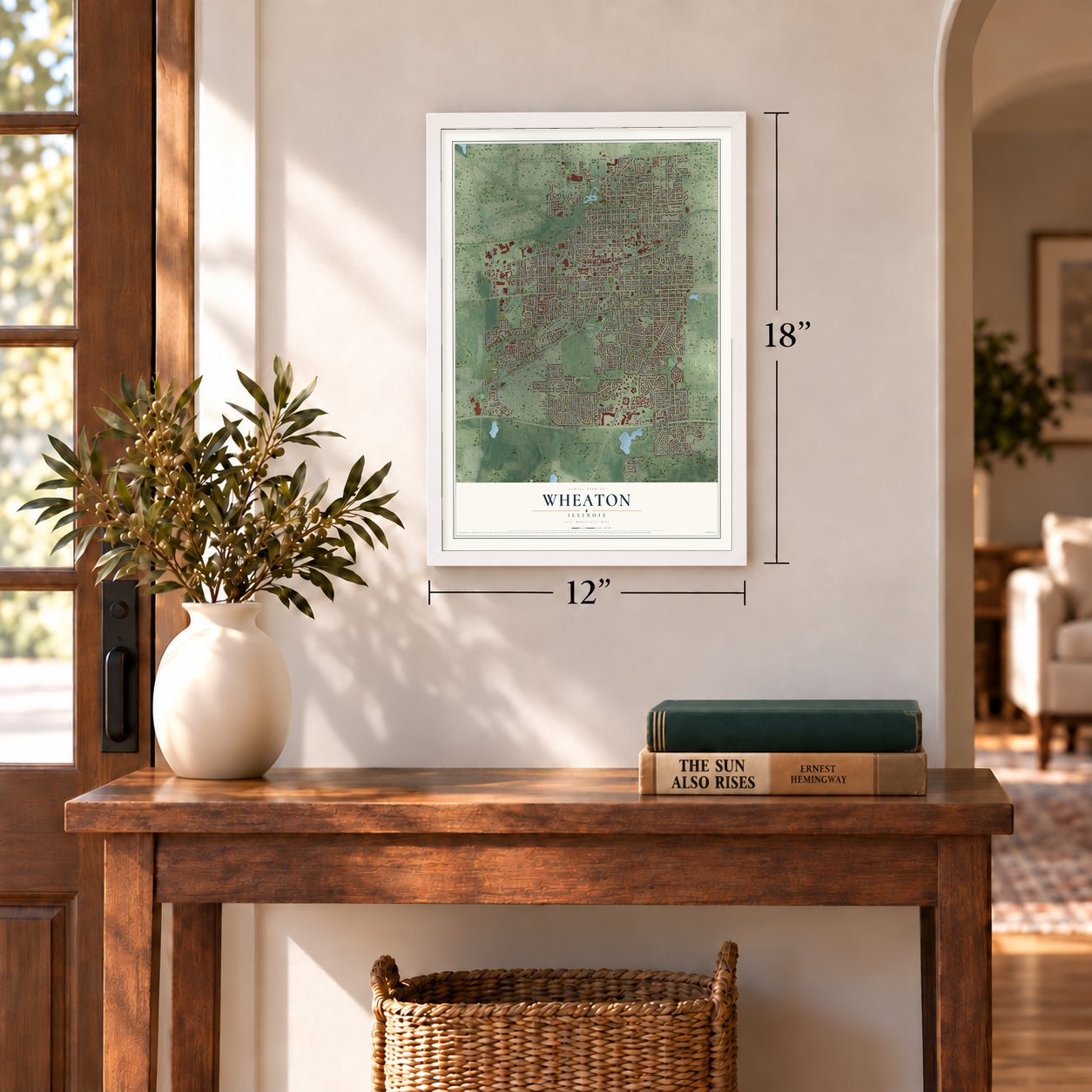
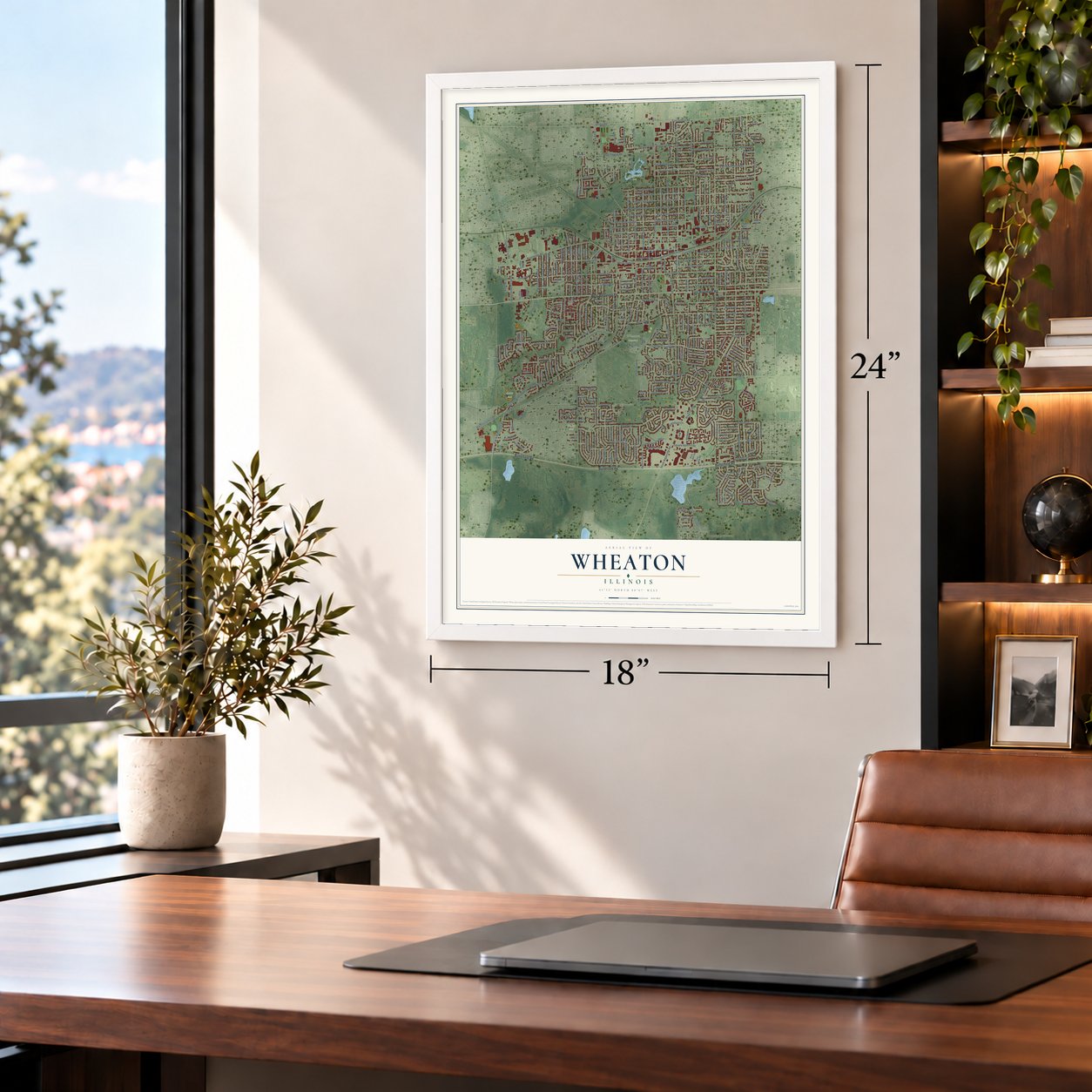
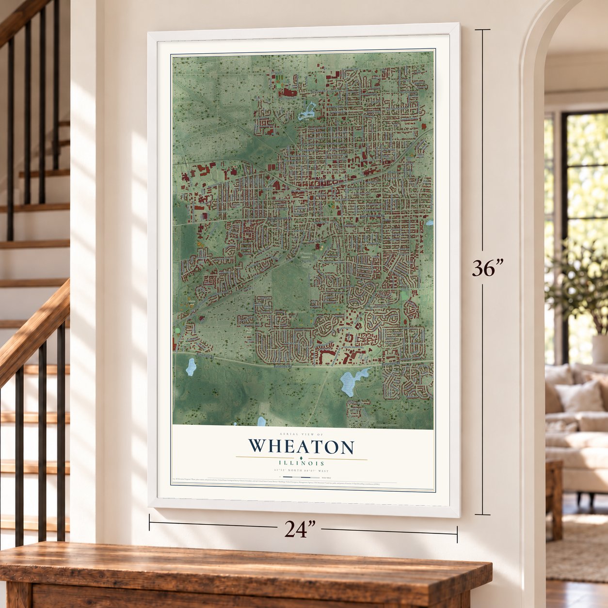
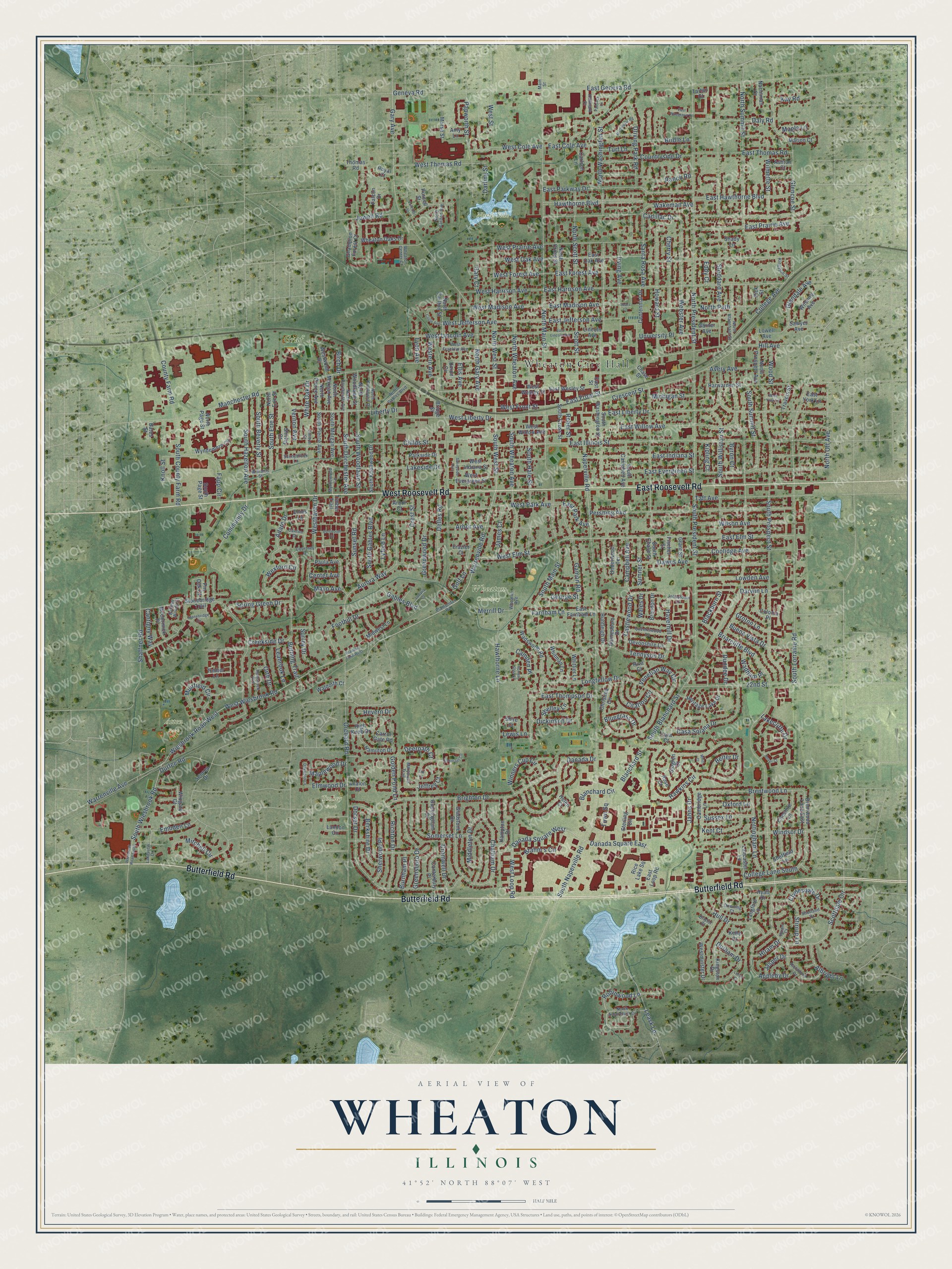
A new map of Wheaton, Illinois, made in 2026 and printed to order on thick archival matte paper.
12" x 18" Archival Matte Print
A Map of Home. A Work of Art.
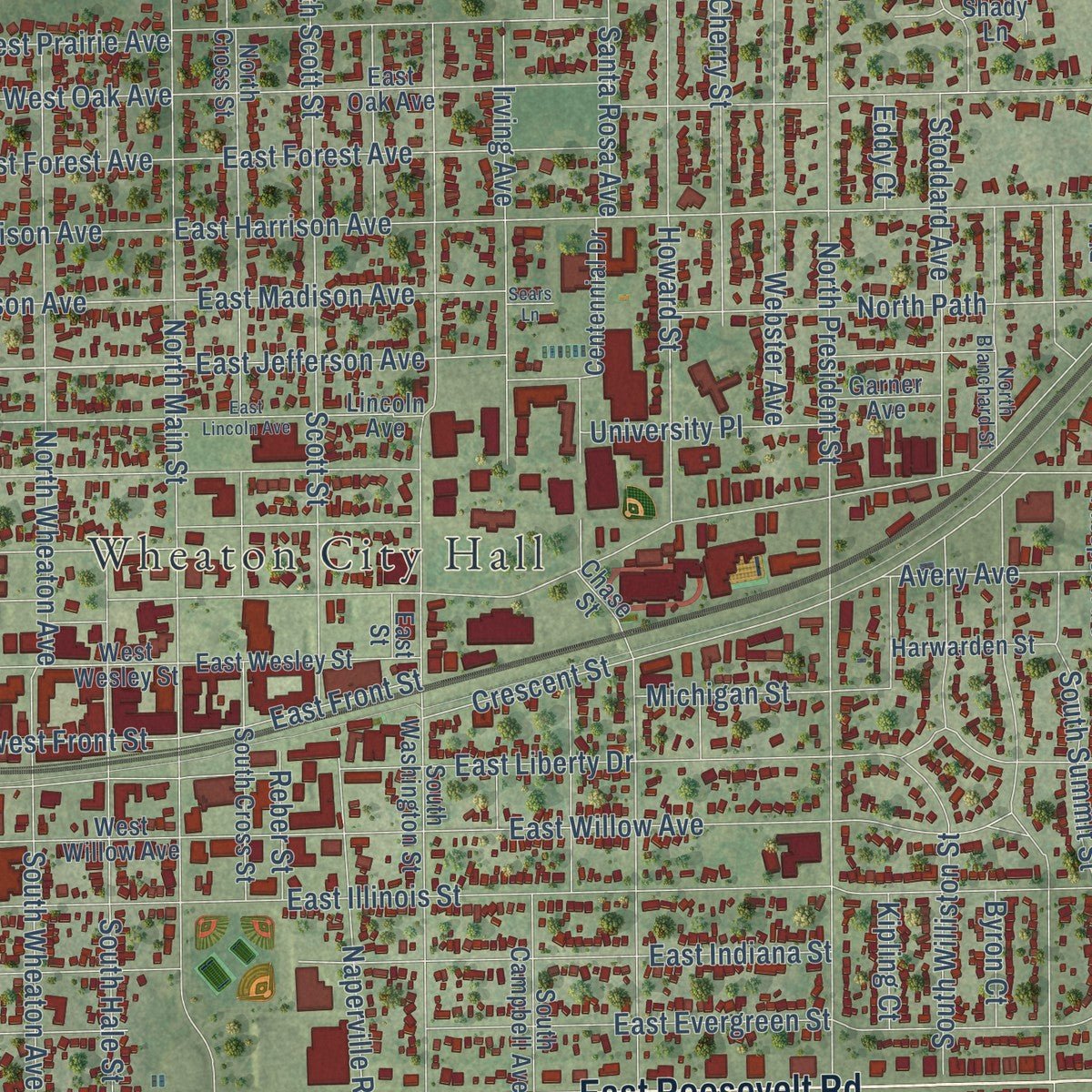
Explore Wheaton, Illinois from a whole new perspective. Created using aerial imagery and detailed geographic data, this map captures Wheaton building by building, with labeled streets, familiar landmarks, and shaded topographical relief that highlights the natural contours of the landscape.
Combining modern data with the timeless character of a vintage atlas, this map is just as interesting up close as it is beautiful on the wall. Whether you grew up in Wheaton, spent memorable years there, or call it home today, this unique map is a great way to celebrate a place that means something to you. Zoom in on the preview to look for your street, and then order a print to put your memories on the wall.
Three ways to hang it
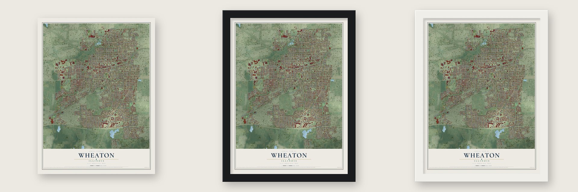
Unframed archival matte, a black wood frame or a white wood frame.
Up close
Geography Worth Displaying
This map was created using accurate cartographic data and authoritative geographic sources, including the U.S. Geological Survey and the Census Bureau. The map brings together terrain, waterways, roads, and building detail. The majority of the streets are labeled, houses are accurately depicted, and the topography is derived from government sources. Combining local data with carefully composed color and shading leads to this beautifully detailed Wheaton artwork for your wall.
Rather than simply showing street outlines, we’ve included as many of the street names as we could reasonably fit on the map while keeping their names legible. Zoom in on the high resolution preview to see exactly what’s on the map. We truly set out to create a statement piece for anyone who loves Wheaton. So whether it’s for you, or a gift for someone you love, we hope this map of Wheaton brings back fond memories.
Read the story behind this map of Wheaton, Illinois from 2026.

About Wheaton, Illinois
Wheaton is a city of 53,970 people and the county seat of DuPage County, 25 miles west of Chicago. Brothers Warren L. and Jesse Wheaton came from Connecticut. In 1837 Warren claimed 640 acres at what is now the heart of town, and Jesse later took 300 acres just to the west. Other New England families soon joined them.
In 1848 the settlers handed three miles of right of way to the Galena and Chicago Union Railroad, which named its depot Wheaton. Ten blocks were laid out in 1850, with free lots for anyone who would build at once. Wheaton became a village on February 24, 1859, with Warren as its first president, and a city on April 24, 1890. Its first mayor was Judge Elbert Gary, son of early settler Erastus Gary and the founder of Gary, Indiana.
- The Midnight RaidNaperville won an 1857 vote on moving the county seat to Wheaton, 1,542 to 762. Wheaton won the next vote in 1867, 1,686 to 1,635, and dedicated a $20,000 courthouse on July 4, 1868. When Naperville held back the last records, Wheaton's Civil War veterans raided its courthouse by night. Naperville sent the records it saved to Chicago, where the Great Chicago Fire of 1871 destroyed them, and Wheaton was soon declared the county seat.
- A courthouse for 94 yearsWheaton rebuilt its courthouse in 1887 for $69,390, modeling it on the one in Aledo. The county used it for 94 years, until growth sent the courts to a new complex two miles west. The old Du Page County Courthouse joined the National Register in 1978.
- Dry from 1887 to 1985In 1887 Wheaton, home to many evangelical Christians, banned the sale of alcohol. The ban covered supermarkets, convenience stores and restaurants alike, and it held until 1985.
- A $50,000 library giftBy 1903 the city owned a new $60,000 waterworks and had a public library valued at $50,000, given by a resident, J. Q. Adams. Wheaton then had eight churches, two graded schools, four weekly newspapers and two carriage factories. The Adams Memorial Library joined the National Register in 1981.
- Stars over the GrandThe Grand Theater opened in 1925. Volunteers restored it to its first look, with a lit dome ceiling scattered with stars, and it reopened on May 11, 2002. It joined the National Register in 2005.
Find your street
Names on the Wheaton map
Every name below is printed on this map. Look for your street, your school, the park where you played, or the pond down the road.
Places and landmarks6
- Wheaton City Hall
- Atten Park
- Graf Park
- North Side Park
- Wheaton Cemetery
- Toohey Park
Streets and roads394
- Butterfield Road
- West Roosevelt Road
- East Roosevelt Road
- Warrenville Road
- South West Street
- West Liberty Drive
- Robinwood Lane
- Community Drive
- Childs Street
- Scottdale Circle
- Danada Square West
- West Loop Road
- West Jefferson Avenue
- Haverhill Drive
- South Naperville Road
- South Blanchard Street
- North Main Street
- Briarcliffe Boulevard
- North President Street
- North Gary Avenue
- Manchester Road
- South Lorraine Road
- South Prospect Street
- East Illinois Street
- North Washington Street
- Hawkins Circle
- South President Street
- East Geneva Road
- East Liberty Drive
- East Willow Avenue
Show all 394 streets
- Wakeman Avenue
- College Avenue
- East Forest Avenue
- East Harrison Avenue
- East Elm Street
- Orchard Road
- East Evergreen Street
- Shaffner Road
- Stoddard Avenue
- Brighton Drive
- East Hawthorne Boulevard
- East Prairie Avenue
- South Main Street
- Wiesbrook Road West
- Creekside Drive
- Pershing Avenue
- West Wiesbrook Road
- North Summit Street
- Hawthorne Boulevard
- Somerset Lane
- South Williston Street
- Gamon Road
- Aurora Way
- Dorset Drive
- South Wheaton Avenue
- Farnham Lane
- East Indiana Street
- Dawes Avenue
- South Gables Boulevard
- Glencoe Street
- North West Street
- North Wheaton Avenue
- South County Farm Road
- Howard Street
- East Parkway Drive
- Crescent Street
- West Lincoln Avenue
- Arbor Avenue
- Delles Road
- Longfellow Drive
- West Elm Street
- Naperville Road
- Tennyson Drive
- North Scott Street
- South Hale Street
- Irving Avenue
- Danada Drive
- Gary Avenue
- Lakeside Drive
- Taft Avenue
- Webster Avenue
- Casa Solana Drive
- Danada Square East
- East Jefferson Avenue
- West Prairie Avenue
- Windsor Drive
- Ellis Avenue
- 22nd Street
- West Front Street
- Brentwood Lane
- South Wiesbrook Road
- Driving Park Road
- West Madison Avenue
- North Path
- Cromwell Drive
- East Thomas Road
- Sumner Street
- Ranch Road
- Crest Street
- Geneva Road
- Jahns Drive
- Cherry Street
- West Park Avenue
- Appleby Drive
- Bridle Lane
- Greensboro Drive
- Countryside Drive
- Westhaven Drive
- Coolidge Avenue
- Wilson Avenue
- Chatham Drive
- Sunset Road
- Muirfield Circle
- Greenwood Drive
- Hull Drive
- Brahm's Circle
- South Hazelton Avenue
- South Beverly Street
- North Ott Avenue
- South Summit Street
- Richton Drive
- South Erie Street
- West Harrison Avenue
- Golf Lane
- Nottingham Lane
- Mitchell Circle
- Warrenville Avenue
- South Dorchester Avenue
- South Woodlawn Street
- Campbell Avenue
- County Farm Road
- Wexford Circle
- Fapp Circle
- Daly Road
- Scott Street
- West Thomas Road
- Blanchard Street
- East Thompson Drive
- East Madison Avenue
- Foothill Drive
- Durham Drive
- Santa Rosa Avenue
- Lowden Avenue
- West Cole Avenue
- Wilmette Street
- Sherwood Place
- Hawthorne Lane
- Lakecliffe Drive
- Lyford Lane
- Blanchard Circle
- Buena Vista Drive
- Winners Cup Circle
- Venetian Way Circle
- Middleton Drive
- West Oak Avenue
- Papworth Street
- Castlewood Drive
- Spring Green Drive
- Glendale Avenue
- Avery Avenue
- Dickinson Drive
- Stirrup Lane
- Western Avenue
- Center Avenue
- Berkshire Drive
- Durfee Road
- College Lane South
- Citation Circle
- Michigan Street
- East Front Street
- University Place
- Merrill Drive
- East Cole Avenue
- Gary Court
- Hill Avenue
- Knoll Street
- Jewell Road
- Leask Lane
- Adare Drive
- Town Square
- James Court
- Albright Lane
- Gables Boulevard
- Sussex Lane
- Embden Lane
- Clydesdale Drive
- Dundee Drive
- Oxford Lane
- West Forest Avenue
- East Park Avenue
- Kent Court
- Leabrook Lane
- Surrey Drive
- Darling Street
- Maplewood Drive
- Golden Pond Lane
- Wadham Place
- Elmwood Drive
- Shelley Lane
- Bluegrass Drive
- Lyon Avenue
- Orth Drive
- Burning Trail
- Cantigny Way
- West Street
- Wood Street
- Belter Drive
- George Street
- Vernon Avenue
- Cadillac Drive
- Kay Road
- Groton Lane
- Burnham Place
- Blackburn Street
- White Oak Drive
- Hevern Drive
- Turf Lane
- Mayo Avenue
- Deerpath Court
- Jasper Drive
- Reber Street
- Jeffrey Court
- Hiram Drive
- Byron Court
- Camden Place
- Kipling Court
- Maple Lane
- Darwin Lane
- Lewis Lane
- Liberty Drive
- Wales Drive
- Eddy Court
- Birch Drive
- Sterling Circle
- Timber Trail
- Coloma Place
- Travers Street
- Union Circle
- Wingate Court
- North Cross Street
- Stonebridge Trail
- South Chase Street
- Christina Circle
- South Washington Street
- East Loop Road
- West Wesley Street
- Gladstone Drive
- Wyndemere Circle
- East Oak Avenue
- Wadsworth Road
- Harwarden Street
- North Woodlawn Street
- West Indiana Street
- Brentwood Lane East
- Hampton Drive
- South Pierce Avenue
- Buckingham Drive
- East Farnham Lane
- Cheshire Lane
- Champion Forest Court
- Chase Street
- North Carlton Street
- Kingston Drive
- Rice Lake Square
- Heritage Lake Drive
- Landon Circle
- West Evergreen Street
- East Wesley Street
- North Prospect Avenue
- Cambridge Lane
- Morse Street
- South Knollwood Drive
- West Willow Avenue
- Carrol Gate Road
- Midwest Lane
- South Morgan Avenue
- Lancaster Lane
- Wheaton Oaks Drive
- Sheffield Lane
- South Campbell Avenue
- Tara Court
- Devonshire Lane
- Canterbury Place
- Westminster Drive
- Centennial Drive
- Fischer Street
- South Cross Street
- North Morgan Avenue
- Whitman Lane
- Underwood Terrace
- McCormick Place
- Huntleigh Drive
- Wilshire Avenue
- Gainesboro Drive
- North Pierce Avenue
- Westwood Drive
- Thomas Road
- Bridge Street
- Shady Lane
- Langford Lane
- Parkside Drive
- Waldorth Court
- Hamilton Drive
- Lincoln Avenue
- Whittier Lane
- Brandon Drive
- Falcon Drive
- High Knob Drive
- Marion Court
- Seneca Drive
- Paula Avenue
- Carlson Lane
- Garner Avenue
- Pick Street
- East York Lane
- Nachtman Court
- Ashton Court
- Grant Street
- Shire Court
- Amy Lane
- Pin Oak Court
- North Erie Street
- Lowell Avenue
- Timber Lane
- South Page Street
- Sjogren Court
- Ennis Lane
- Hyatt Drive
- Shirley Court
- Rose Court
- Arbor Court
- North Page Street
- Sawyer Avenue
- Purnell Street
- Bates Street
- Helen Court
- Kelle Court
- Avalon Court
- Frazier Court
- Royal Court
- Tartan Court
- East Street
- Riva Court
- Plamondon Road
- Sunnybrook Lane
- West Franklin Avenue
- North Blanchard Street
- Richmond Drive
- Marywood Trail
- Queenswood Lane
- Johnstown Lane
- North Knollwood Drive
- Hemstock Avenue
- Williams Street
- North Arboretum Circle
- North Dorchester Avenue
- North Gables Boulevard
- Shetland Drive
- North Carlton Avenue
- Lakeview Drive
- Myrtlewood Lane
- Caxton Drive
- Belleau Woods Court
- Hallmark Court
- Kingston Street
- Courtney Drive
- Wheaton Center Court
- Wheaton Avenue
- Downing Court
- Clinton Court
- Hiram Court
- Bristol Court
- Main Street
- Wiesbrook Road South
- Dartmouth Drive
- Somerset Circle
- Stonebridge Circle
- Circle Avenue
- Sunnyside Avenue
- East Lincoln Avenue
- Martingale Road
- Fanchon Street
- Oakwood Court
- East Pinegrove Court
- Lodalia Court
- West York Lane
- Academy Lane West
- Paddock Lane
- Dover Court
- Hunters Glen Court
- Sears Lane
- Leeds Court
- Whitt Court
- Elk Court
Names are listed as they appear on the printed map. Zoom into the product photos to find them.
The art of mapping a place
How This Map Was Made
Real places. Remarkable detail. Discover the layers that turn geographic data into a map of home.

The view from above
Aerial imagery reveals the character of the land: woodland, open fields, and the patterns of a place.

The shape of the land
Elevation data brings hills, valleys, and subtle changes in the landscape into view.

The details of home
Roads, waterways, and building footprints come together to make the map feel unmistakably local.

Geography becomes art
Considered color, shading, and typography bring the layers together in a map made for your wall.


Process illustrated with Mendon, Massachusetts. Aerial imagery: USDA NAIP. Terrain: USGS 3D Elevation Program. Map details and finished artwork: KNOWOL.
The Details
About This Print
Choose an archival matte print, or a black or white Ayous wood frame. The archival matte print is unframed.
Select your size and finish above to see the matching product image and price.
Materials & Craftsmanship
A contemporary map with the character of a classic atlas, printed on archival matte paper. Optional frames are made from Ayous wood.
Your printed map does not include the watermark shown in the full-map preview.
Shipping & Delivery
Free shipping within the United States. Every print is made to order in the USA.
Buying a gift? Add a note in your cart and we'll include it. We never put prices in the package.
Prints ship within 2 to 3 business days. Allow 7 to 10 days total from ordering for delivery. Timing may vary during holidays or periods of high order volume.
Read our shipping policy.
Returns and damaged prints
Each print is made to order. Change-of-mind refunds are not available after production.
If your print arrives damaged, misprinted or incorrect, contact support@knowol.com within 30 days of receiving it. Include your order number, photos and a description of the issue.
Read our full refund and replacement policy. For questions about your order, email support@knowol.com.
Find your town
Looking for another city?
Find a map of home in our Illinois collection, or any town in the country.
Nearby
Maps of towns near Wheaton
Know someone from one of these towns? Their map makes a great gift.
 Glen Ellyn
, Illinois
From $39.99See the map
 Winfield
, Illinois
From $39.99See the map
 Glendale Heights
, Illinois
From $39.99See the map
More maps nearby: Carol Stream, Lisle, Warrenville, Lombard and Downers Grove.