
Search for another town




Free U.S. delivery 7 to 10 days after you order
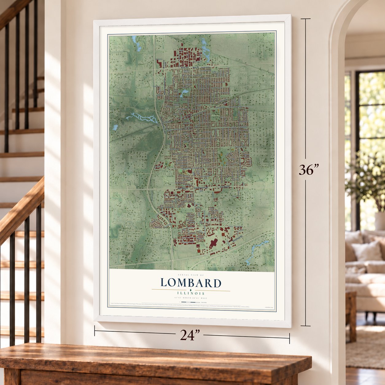
Lombard, Illinois Map Art
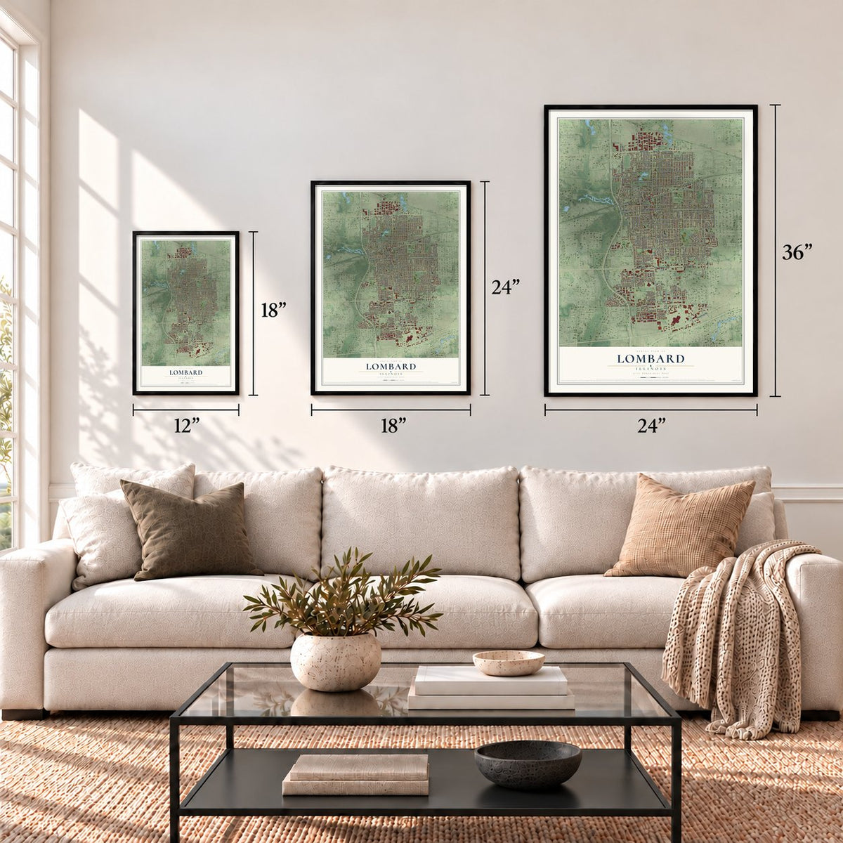
A new map of Lombard, Illinois, made in 2026 and printed to order on thick archival matte paper.
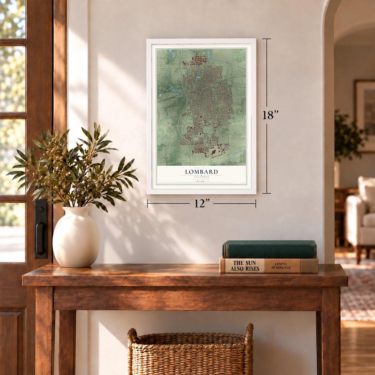
12" x 18" Archival Matte Print
A Map of Home. A Work of Art.
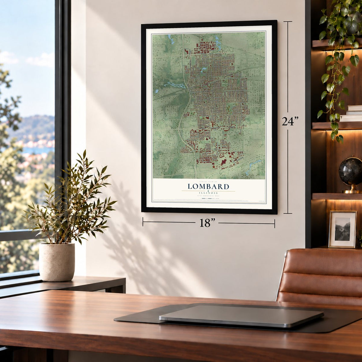
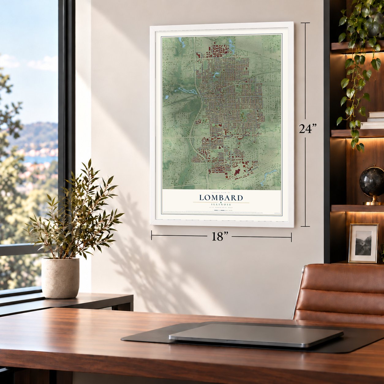
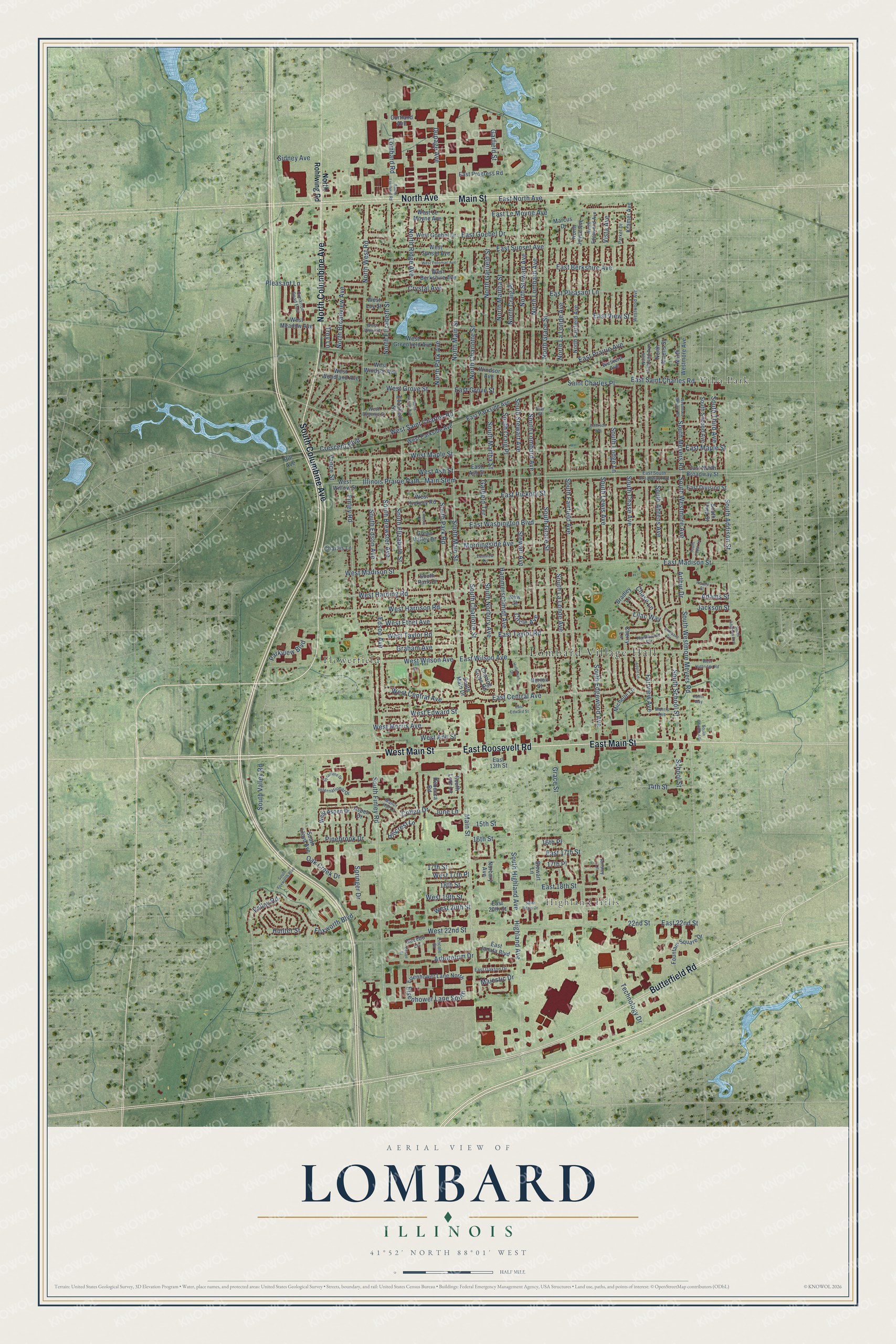
Explore Lombard, Illinois from a whole new perspective. Created using aerial imagery and detailed geographic data, this map captures Lombard building by building, with labeled streets, familiar landmarks, and shaded topographical relief that highlights the natural contours of the landscape.
Combining modern data with the timeless character of a vintage atlas, this map is just as interesting up close as it is beautiful on the wall. Whether you grew up in Lombard, spent memorable years there, or call it home today, this unique map is a great way to celebrate a place that means something to you. Zoom in on the preview to look for your street, and then order a print to put your memories on the wall.
Three ways to hang it
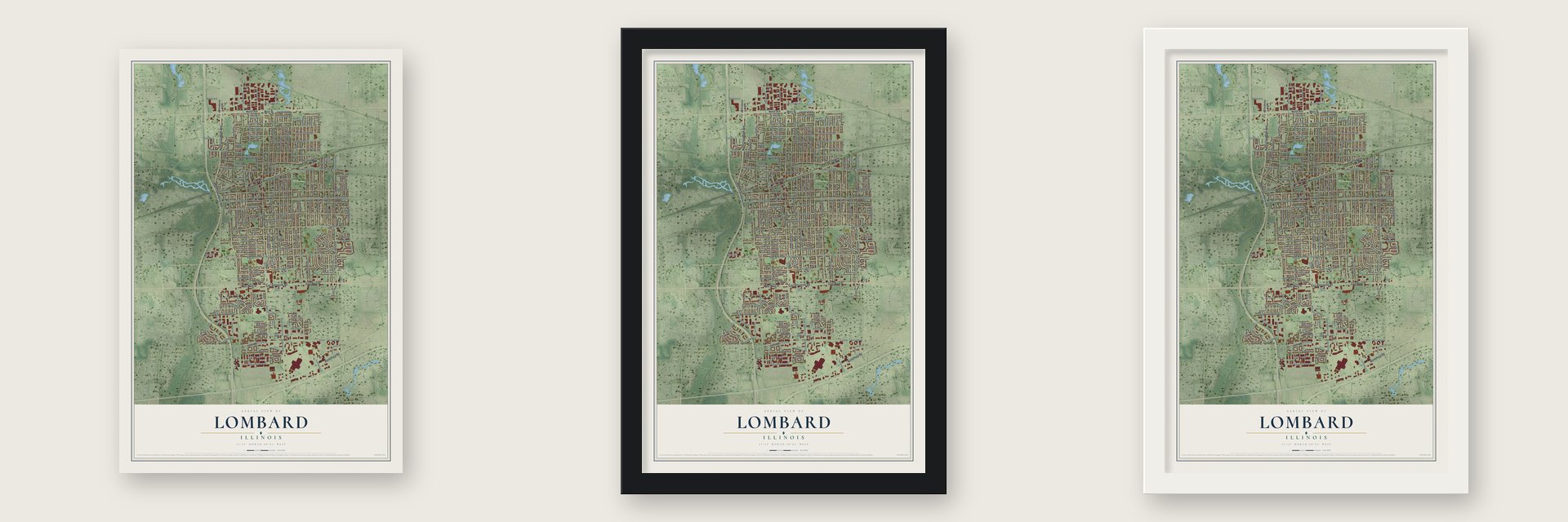
Unframed archival matte, a black wood frame or a white wood frame.
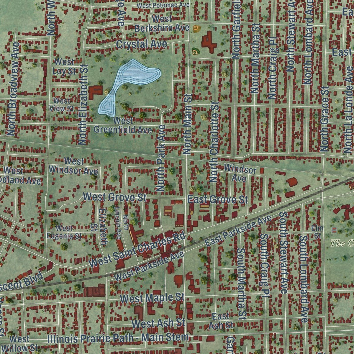
Up close
Geography Worth Displaying
This map was created using accurate cartographic data and authoritative geographic sources, including the U.S. Geological Survey and the Census Bureau. The map brings together terrain, waterways, roads, and building detail. The majority of the streets are labeled, houses are accurately depicted, and the topography is derived from government sources. Combining local data with carefully composed color and shading leads to this beautifully detailed Lombard artwork for your wall.
Rather than simply showing street outlines, we’ve included as many of the street names as we could reasonably fit on the map while keeping their names legible. Zoom in on the high resolution preview to see exactly what’s on the map. We truly set out to create a statement piece for anyone who loves Lombard. So whether it’s for you, or a gift for someone you love, we hope this map of Lombard brings back fond memories.
Read the story behind this map of Lombard, Illinois from 2026.

About Lombard, Illinois
Lombard is a village of 44,476 people in DuPage County, west of Chicago. Its first name was Babcock's Grove, for the Babcock brothers, who settled along the DuPage River. When the Galena and Chicago Union Railroad came through in 1848, farmers and merchants here could ship straight to Chicago, and stores and shops quickly grew up near the depot.
In 1868 Josia Lewis Lombard, a Chicago banker and real estate developer, mapped out plans for the settlement. The village was incorporated the next year, in 1869, and took his name. By 1880 it had 378 people, and in 1873 two local churches joined together as the First Church of Lombard, which joined the National Register in 1978.
- First woman to vote in IllinoisEllen A. Martin took a group of women to the polls at the general store on April 6, 1891, and told the three male election judges to let them vote. The startled judges reportedly staggered, and one tumbled into a flour barrel. They gave in but still didn't want the women voting, so the question went to a county judge, who ruled for the women. Martin cast her ballot, and in 2008 the village named April 6 Ellen Martin Day.
- The Lilac VillageColonel William Plum, a Lombard resident, left his estate to the village in 1927, including his home and a garden of 200 varieties of lilac. His house became the Helen M. Plum Memorial Library, and the Chicago landscape architect Jens Jensen redesigned the grounds as Lilacia Park in 1929. The village held its first Lilac Festival in 1930, crowning Adeline Fleege as Lilac Princess, and the park joined the National Register in 2019.
- Little Orphan Annie's houseWilliam LeRoy, who made artificial limbs for Civil War veterans, built an Italianate house on Main Street in 1881 and lived there until 1900. It later became the home of Harold Gray's parents and his studio. Gray drew the Little Orphan Annie strips in its study, and its grand staircase and outer deck turned up in his cartoons.
- A painter's farm and schoolSheldon and Harriet Peck came from Onondaga, New York, in 1837 to farm 80 acres here. Sheldon also painted portraits, traveling to clients across northeastern Illinois, and their house served as the area's first school. The Lombard Historical Society restored it, and in 2011 the National Park Service added it to the Network to Freedom as a verified Underground Railroad site.
Find your street
Names on the Lombard map
Every name below is printed on this map. Look for your street, your school, the park where you played, or the pond down the road.
Places and landmarks5
- Lombard Village Hall
- Highland Hills
- The Commons
- Flowerfield
- Villa Park
Streets and roads230
- East Main Street
- West Main Street
- East Roosevelt Road
- South Columbine Avenue
- North Columbine Avenue
- North Avenue
- Butterfield Road
- Main Street
- South Main Street
- South Meyers Road
- South Westmore Avenue
- North Main Street
- South Westmore Meyers Road
- South Park Road
- West Saint Charles Road
- Majestic Drive
- West Madison Street
- East Madison Street
- West Harding Road
- East Hickory Street
- Finley Road
- South Finley Road
- South Grace Street
- South Fairfield Avenue
- Illinois Prairie Path - Main Stem
- South Highland Avenue
- South Stewart Avenue
- South Elizabeth Street
- Stewart Avenue
- South School Street
Show all 230 streets
- East Wilson Avenue
- East Washington Boulevard
- East Saint Charles Road
- East Maple Street
- South Edgewood Avenue
- South Edson Avenue
- Edson Avenue
- Highland Avenue
- South Lombard Avenue
- East 22nd Street
- North West Road
- South Lewis Avenue
- South Ahrens Avenue
- South Lodge Lane
- South Charlotte Street
- North Garfield Street
- North Grace Street
- East Prairie Avenue
- North Craig Place
- East Sunset Avenue
- East View Street
- East Berkshire Avenue
- South Chase Avenue
- North Elizabeth Street
- East Pleasant Lane
- West Wilson Avenue
- South Craig Place
- North Ridge Avenue
- East Central Avenue
- North Charlotte Street
- North Martha Street
- Hammerschmidt Avenue
- North Broadview Avenue
- West Harrison Road
- North La Londe Avenue
- South Addison Street
- School Street
- South La Londe Avenue
- North Lombard Avenue
- Dupage Avenue
- South Norbury Avenue
- 17th Street
- East Le Moyne Avenue
- Vista Avenue
- East Taylor Road
- West Maple Street
- South Brewster Avenue
- North Park Avenue
- Foxworth Boulevard
- Collen Drive
- South Valley Road
- Valley Road
- South Martha Street
- North Stewart Avenue
- Technology Drive
- Springer Drive
- Grace Street
- 22nd Street
- West Ethel Avenue
- South Third Avenue
- West Grove Street
- Oak Creek Drive
- Crystal Avenue
- West 22nd Street
- Morningside Avenue
- East Goebel Drive
- Lombard Road
- West Taylor Road
- Parkview Boulevard
- Graham Avenue
- West Edward Street
- Arboretum Drive
- Hunter Street
- West Central Avenue
- 16th Street
- West Ann Street
- Eisenhower Lane South
- West Ash Street
- West Morris Avenue
- East 17th Street
- Saint Charles Place
- Fairview Avenue
- Pinebrook Drive
- East North Avenue
- Arthur Drive
- Crescent Boulevard
- Garfield Street
- Vance Street
- Pleasant Lane
- East 18th Street
- June Lane
- Adams Street
- West 20th Street
- Lilac Way
- Garfield Terrace
- Jackson Street
- 14th Street
- West 19th Street
- Sidney Avenue
- 18th Street
- West 17th Place
- 16th Place
- East Grove Street
- Hillcrest Lane
- Chase Lane
- 15th Street
- Circle Avenue
- Troy Lane
- 17th Place
- North Rohlwing Road
- Aspen Drive
- West Aspen Drive
- North Westmore Avenue
- South Park Drive
- East 13th Street
- East North Broadway Street
- North Fairfield Avenue
- West Greenfield Avenue
- North Joyce Avenue
- West Willow Street
- Green Valley Drive
- South Third Street
- East Parkside Avenue
- Eisenhower Lane North
- Kramer Avenue
- East Ash Street
- West Sunset Avenue
- Elizabeth Street
- South Second Avenue
- West Meadow Avenue
- West Windsor Avenue
- Cherry Lane
- Norton Street
- West Goebel Drive
- West Berkshire Avenue
- Fountain Square Drive
- West Parkside Avenue
- Stewart Lane
- West Woodland Avenue
- East Janata Boulevard
- East Progress Road
- East Division Street
- West Le Moyne Avenue
- Norbury Avenue
- North Ahrens Street
- West Hickory Road
- Western Avenue
- East 20th Street
- Rebecca Road
- South Lloyd Avenue
- Michelle Lane
- Hill Avenue
- Charing Cross Road
- Gazebo Lane
- Windsor Avenue
- Charles Lane
- Marcus Drive
- South Main Drive
- Bradley Lane
- Cortland Avenue
- South Lore Lane
- West Loy Street
- New Street
- North Edgewood Avenue
- East South Broadway Avenue
- Westwood Avenue
- Cimarron Road East
- West Eugenia Street
- Lincoln Street
- Hawthorne Circle
- East Oakton Drive
- West View Street
- International Drive
- Elm Street
- Morris Avenue
- North Highland Avenue
- Manor Hill Lane
- Parker Drive
- Ainsley Lane
- Westmore Meyers Road
- West Potomac Avenue
- South Lombard Road
- Lombard Circle
- North Lincoln Avenue
- Saint Regis Drive
- Emerson Avenue
- Sycamore Drive
- Apple Lane
- South Addison Avenue
- South Foxworth Boulevard
- Eastview Terrace
- West Highridge Road
- Holloman Drive
- South Church Avenue
- South Cedar Lane
- Edson Street
- East Edward Street
- Kufrin Way
- Lincoln Court
- Revere Court
Names are listed as they appear on the printed map. Zoom into the product photos to find them.
The art of mapping a place
How This Map Was Made
Real places. Remarkable detail. Discover the layers that turn geographic data into a map of home.

The view from above
Aerial imagery reveals the character of the land: woodland, open fields, and the patterns of a place.

The shape of the land
Elevation data brings hills, valleys, and subtle changes in the landscape into view.

The details of home
Roads, waterways, and building footprints come together to make the map feel unmistakably local.

Geography becomes art
Considered color, shading, and typography bring the layers together in a map made for your wall.


Process illustrated with Mendon, Massachusetts. Aerial imagery: USDA NAIP. Terrain: USGS 3D Elevation Program. Map details and finished artwork: KNOWOL.
The Details
About This Print
Choose an archival matte print, or a black or white Ayous wood frame. The archival matte print is unframed.
Select your size and finish above to see the matching product image and price.
Materials & Craftsmanship
A contemporary map with the character of a classic atlas, printed on archival matte paper. Optional frames are made from Ayous wood.
Your printed map does not include the watermark shown in the full-map preview.
Shipping & Delivery
Free shipping within the United States. Every print is made to order in the USA.
Buying a gift? Add a note in your cart and we'll include it. We never put prices in the package.
Prints ship within 2 to 3 business days. Allow 7 to 10 days total from ordering for delivery. Timing may vary during holidays or periods of high order volume.
Read our shipping policy.
Returns and damaged prints
Each print is made to order. Change-of-mind refunds are not available after production.
If your print arrives damaged, misprinted or incorrect, contact support@knowol.com within 30 days of receiving it. Include your order number, photos and a description of the issue.
Read our full refund and replacement policy. For questions about your order, email support@knowol.com.
Find your town
Looking for another city?
Find a map of home in our Illinois collection, or any town in the country.
Nearby
Maps of towns near Lombard
Know someone from one of these towns? Their map makes a great gift.
 Villa Park
, Illinois
From $39.99See the map
 Glen Ellyn
, Illinois
From $39.99See the map
 Oakbrook Terrace
, Illinois
From $39.99See the map
More maps nearby: Addison, Elmhurst, Oak Brook, Glendale Heights and Wheaton.