
Search for another town





Free U.S. delivery 7 to 10 days after you order
Addison, Illinois Map Art
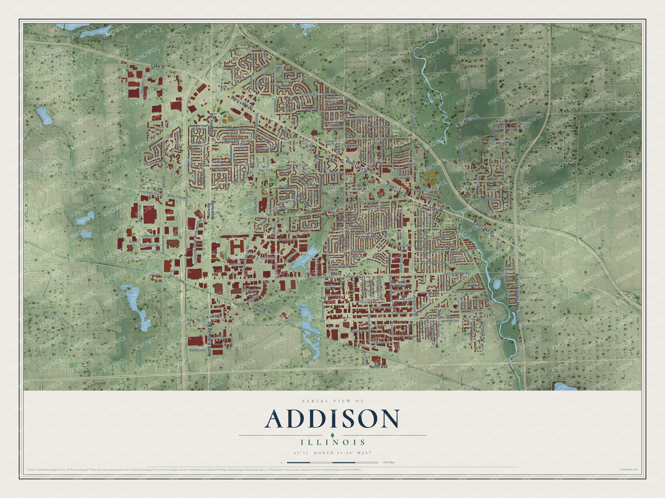
A new map of Addison, Illinois, made in 2026 and printed to order on thick archival matte paper.
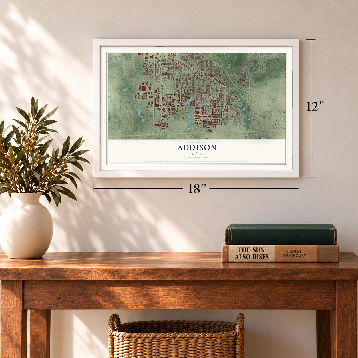
12" x 18" Archival Matte Print
A Map of Home. A Work of Art.
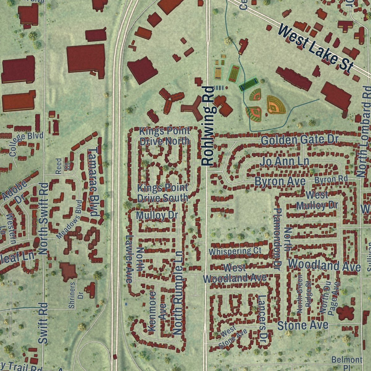
Explore Addison, Illinois from a whole new perspective. Created using aerial imagery and detailed geographic data, this map captures Addison building by building, with labeled streets, familiar landmarks, and shaded topographical relief that highlights the natural contours of the landscape.
Combining modern data with the timeless character of a vintage atlas, this map is just as interesting up close as it is beautiful on the wall. Whether you grew up in Addison, spent memorable years there, or call it home today, this unique map is a great way to celebrate a place that means something to you. Zoom in on the preview to look for your street, and then order a print to put your memories on the wall.
Three ways to hang it
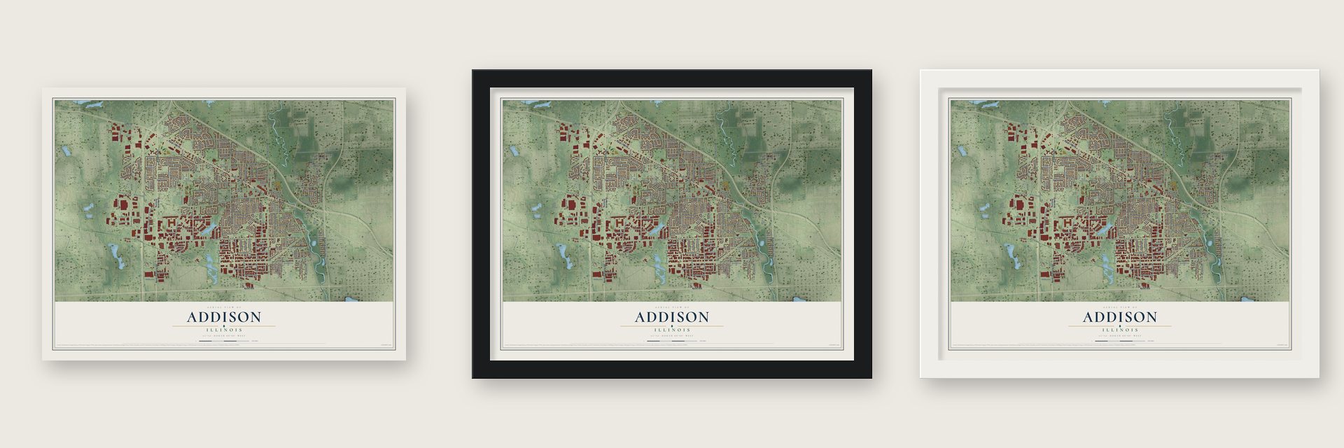
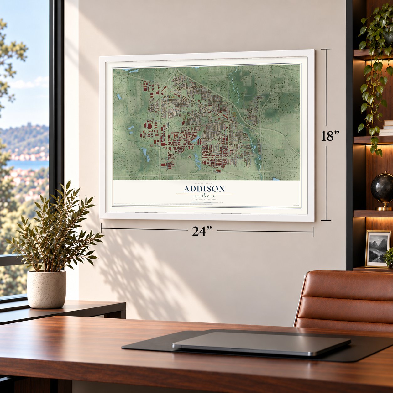
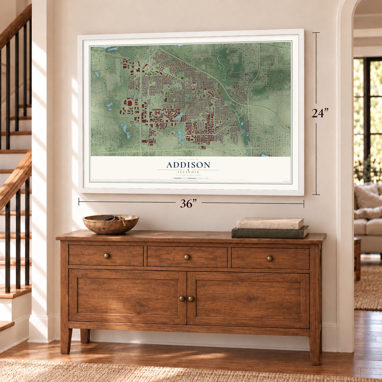
Unframed archival matte, a black wood frame or a white wood frame.
Up close
Geography Worth Displaying
This map was created using accurate cartographic data and authoritative geographic sources, including the U.S. Geological Survey and the Census Bureau. The map brings together terrain, waterways, roads, and building detail. The majority of the streets are labeled, houses are accurately depicted, and the topography is derived from government sources. Combining local data with carefully composed color and shading leads to this beautifully detailed Addison artwork for your wall.
Rather than simply showing street outlines, we’ve included as many of the street names as we could reasonably fit on the map while keeping their names legible. Zoom in on the high resolution preview to see exactly what’s on the map. We truly set out to create a statement piece for anyone who loves Addison. So whether it’s for you, or a gift for someone you love, we hope this map of Addison brings back fond memories.
Read the story behind this map of Addison, Illinois from 2026.
About Addison, Illinois
Addison is a DuPage County village whose population reached 35,702 in the 2020 Census. Incorporated in 1884, it developed from a community once known as Dunkley's Grove into a suburb as residential building spread across former farmland beginning in the 1960s. Salt Creek passes through the village.
- Village Since 1884Addison incorporated in 1884 with a population of 400.
- Dunkley's GroveBefore becoming Addison, the community was named Dunkley's Grove for settler Hezekiah Dunklee.
- Army Trail RoadIn 1832, Winfield Scott built Army Trail Road atop a Potawatomi trail for 50 broad-tired wagons.
- Teachers SeminaryThe Lutheran Church-Missouri Synod established Addison Teachers Seminary in 1864, and the school relocated to River Forest in 1913.
- Historical MuseumOn July 4, 1976, Addison's historical museum began welcoming visitors in the former municipal hall at 131 W. Lake St.
Find your street
Names on the Addison map
Every name below is printed on this map. Look for your street, your school, the park where you played, or the pond down the road.
Places and landmarks5
- Addison Village Hall
- Swift
- Byron Park
- Foxdale Park
- Louis Reservoir
Streets and roads283
- North Avenue
- West Lake Street
- Lake Street
- Rohlwing Road
- East Lake Street
- North Rohlwing Road
- Robert Kingery Highway
- North Lombard Road
- Itasca Road
- Foxdale Drive
- Oak Meadow Drive
- Villa Avenue
- South Addison Road
- South Villa Avenue
- Third Avenue
- North Swift Road
- North Addison Road
- East Palmer Avenue
- Army Trail Road
- Swift Road
- Corporate Drive
- South Lombard Road
- Sidney Avenue
- Central Avenue
- East Fullerton Avenue
- North Pioneer Drive
- West Fullerton Avenue
- Grace Street
- North Mitchell Court
- Grove Street
Show all 283 streets
- South Lincoln Avenue
- South Grace Street
- Country Club Drive
- Comstock Avenue
- Army Trail Boulevard
- West Byron Avenue
- West Army Trail Boulevard
- North Mill Road
- Lombard Road
- Woodland Avenue
- Byron Avenue
- Armitage Avenue
- South Harvard Avenue
- North Lincoln Avenue
- West Diversey Avenue
- Factory Road
- Lorraine Avenue
- Holtz Avenue
- South Westgate Street
- Westgate Drive
- West Lake Park Drive
- East Lorraine Avenue
- Stone Avenue
- West Interstate Road
- Winthrop Avenue
- National Avenue
- Ellsworth Avenue
- North Highview Avenue
- Sable Drive
- South Westwood Avenue
- Fairbank Street
- South Wisconsin Avenue
- Vista Avenue
- Eighth Avenue
- Neva Avenue
- South Iowa Avenue
- West Amelia Lane
- Natoma Avenue
- Fay Avenue
- Belden Avenue
- South Church Street
- Stonemill Avenue
- Golden Gate Drive
- East Myrick Avenue
- Chatham Avenue
- Grand Avenue
- Rozanne Drive
- School Street
- Surrey Road
- Laura Drive
- North Sixth Avenue
- Craig Place
- Fischer Drive
- North Rumple Lane
- South Mitchell Court
- West Moreland Avenue
- East Oak Street
- Greenbriar Drive
- Ashley Lane
- Adeline Avenue
- Republic Drive
- Rose Avenue
- North Wesley Drive
- Tamarac Boulevard
- Meadow Road
- Jo Ann Lane
- Park Avenue
- Jeffrey Drive
- Ninth Avenue
- South Mill Road
- Adams Drive
- Crest Avenue
- Sherwood Drive
- Capitol Drive
- Hale Street
- May Street
- Fourth Avenue
- West Myrick Avenue
- Executive Drive
- Collins Avenue
- Maple Street
- Stewart Avenue
- South Lincoln Street
- Clarendon Avenue
- East Red Oak Street
- Forest Drive
- Jeffery Drive
- Wisconsin Avenue
- Valerie Lane
- Iowa Avenue
- Farmwood Drive
- Meadow Avenue
- West Gerri Lane
- Royal Drive
- Circle Drive
- Silverleaf Lane
- Oakleaf Drive
- Beach Drive
- Tallyho Drive
- Richard Court
- Bernard Drive
- Sable Avenue
- Linda Lane
- Irmen Drive
- First Avenue
- Fifth Avenue
- Drake Avenue
- Holly Court
- Park Place
- Rohlwing Road North
- North Wood Dale Road
- Heritage Drive
- Fullerton Avenue
- South Swift Road
- Sunrise Road
- West Army Trail Road
- West Armitage Avenue
- South Michigan Avenue
- Frontage Road
- Wrightwood Avenue
- West Mulloy Drive
- South Yale Avenue
- West Ronald Drive
- Sixth Avenue
- South La Londe Avenue
- West Willow Glen Street
- Ardmore Avenue
- Armitage Court
- North Plamondon Drive
- Kay Avenue
- West Woodland Avenue
- West Natalie Lane
- Westwood Trail
- Oak Street
- North Iowa Avenue
- Hickory Avenue
- North Grant Drive
- North Catalpa Street
- West Stevens Drive
- Industrial Road
- Green Meadow Drive
- Cherry Hill Drive
- Aspen Way
- West Meyer Drive
- Central Court
- North Lawler Avenue
- North Church Street
- Commercial Road
- West Saint Aubin Drive
- Thatcher Lane
- Annoreno Drive
- Racquet Club Drive
- Cortland Court
- Anvil Court
- West Official Road
- North Baynard Road
- Fairbanks Street
- Veterans Parkway
- Dale Drive
- East North Avenue
- Jamey Lane
- Gramercy Lane
- Valley View Road
- West Driscoll Lane
- Barry Avenue
- Kings Point Drive North
- Janice Lane
- Wood Avenue
- Kings Point Drive South
- Prairie Drive
- Kenmore Avenue
- Grove Avenue
- North Flora Parkway
- Compton Point
- Mare Barn Lane
- Rosebud Lane
- Lancers Drive
- Adobe Drive
- Ruga Court
- Mulloy Drive
- Trinity Drive
- Bruce Avenue
- Fiene Drive
- Kramer Avenue
- Briar Hill Lane
- Lilac Lane
- Lois Avenue
- Park Street
- Tara Lane
- Cedar Lane
- Pine Avenue
- Ari Court
- South Central Avenue
- Ardmore Terrace
- East Third Avenue
- Byron Road
- North Du Page Avenue
- East Crest Avenue
- Honey Hill Road
- East Normandy Drive
- Hilton Avenue
- Sumner Street
- North Michigan Avenue
- Seventh Avenue
- West Kendall Terrace
- North Brashares Drive
- Parkview Drive
- North Wisconsin Avenue
- Whispering Court
- North Oak Mill Street
- College Boulevard
- Beverly Avenue
- Wrightwood Court
- East Blecke Avenue
- Elizabeth Drive
- Pleasant Drive
- Natalie Lane
- Tenth Avenue
- Western Lane
- Windsor Court
- Sullivan Street
- Lloyd Avenue
- Justin Court
- Eagle Court
- Heather Court
- Belmont Place
- Squire Lane
- Sunset Lane
- Millns Court
- Saint John's Place
- Links Drive
- West Stone Avenue
- East Belmont Avenue
- Meadows Boulevard
- West Pinehurst Boulevard
- North Central Avenue
- South Evergreen Street
- Wenbriar Square
- Diversey Avenue
- North Green Ridge Street
- Grant Street
- Douglas Avenue
- Scarlet Drive
- East Stone Avenue
- Overkamp Avenue
- Georgian Court
- Wilson Lane
- Joyce Lane
- Shriners Drive
- Eleventh Avenue
- Helen Street
- Astor Lane
- Reed Court
Names are listed as they appear on the printed map. Zoom into the product photos to find them.
The art of mapping a place
How This Map Was Made
Real places. Remarkable detail. Discover the layers that turn geographic data into a map of home.

The view from above
Aerial imagery reveals the character of the land: woodland, open fields, and the patterns of a place.

The shape of the land
Elevation data brings hills, valleys, and subtle changes in the landscape into view.

The details of home
Roads, waterways, and building footprints come together to make the map feel unmistakably local.

Geography becomes art
Considered color, shading, and typography bring the layers together in a map made for your wall.


Process illustrated with Mendon, Massachusetts. Aerial imagery: USDA NAIP. Terrain: USGS 3D Elevation Program. Map details and finished artwork: KNOWOL.
The Details
About This Print
Choose an archival matte print, or a black or white Ayous wood frame. The archival matte print is unframed.
Select your size and finish above to see the matching product image and price.
Materials & Craftsmanship
A contemporary map with the character of a classic atlas, printed on archival matte paper. Optional frames are made from Ayous wood.
Your printed map does not include the watermark shown in the full-map preview.
Shipping & Delivery
Free shipping within the United States. Every print is made to order in the USA.
Buying a gift? Add a note in your cart and we'll include it. We never put prices in the package.
Prints ship within 2 to 3 business days. Allow 7 to 10 days total from ordering for delivery. Timing may vary during holidays or periods of high order volume.
Read our shipping policy.
Returns and damaged prints
Each print is made to order. Change-of-mind refunds are not available after production.
If your print arrives damaged, misprinted or incorrect, contact support@knowol.com within 30 days of receiving it. Include your order number, photos and a description of the issue.
Read our full refund and replacement policy. For questions about your order, email support@knowol.com.
Find your town
Looking for another city?
Find a map of home in our Illinois collection, or any town in the country.
Nearby
Maps of towns near Addison
Know someone from one of these towns? Their map makes a great gift.
 Wood Dale
, Illinois
From $39.99See the map
 Itasca
, Illinois
From $39.99See the map
 Villa Park
, Illinois
From $39.99See the map
More maps nearby: Glendale Heights, Bensenville, Lombard, Elmhurst and Bloomingdale.