
Search for another town





Free U.S. delivery 7 to 10 days after you order
Elmhurst, Illinois Map Art
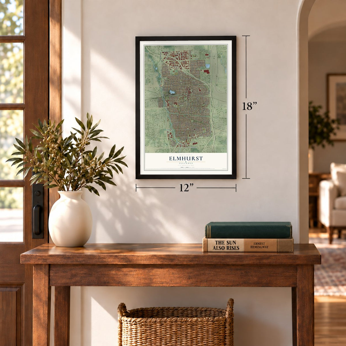
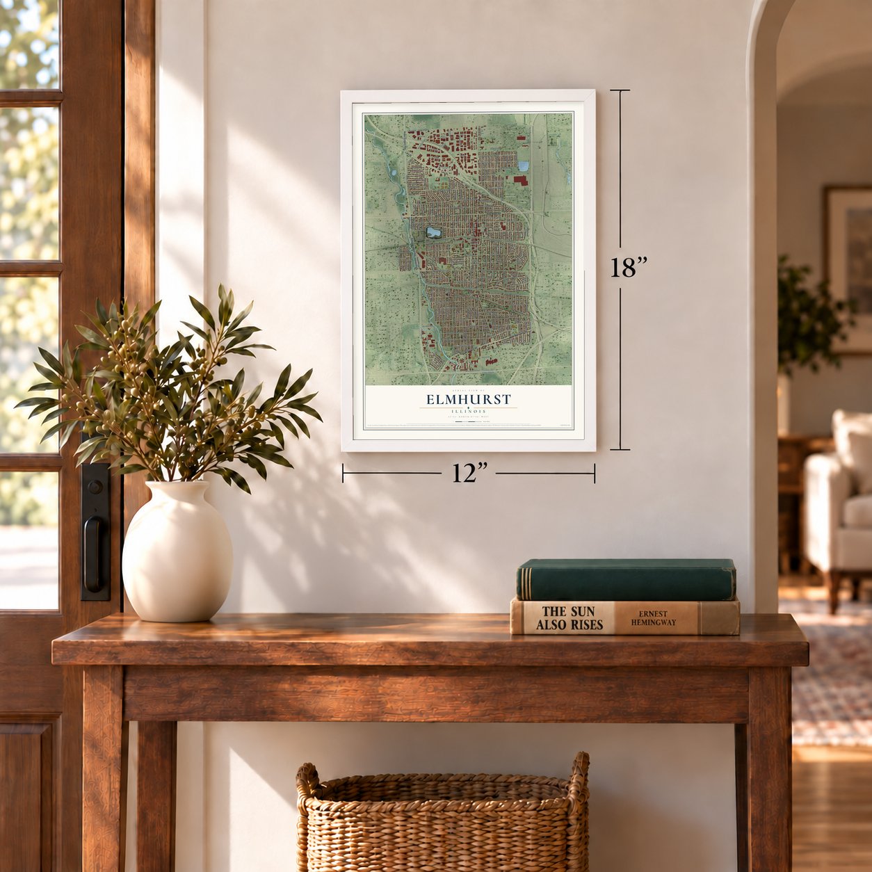
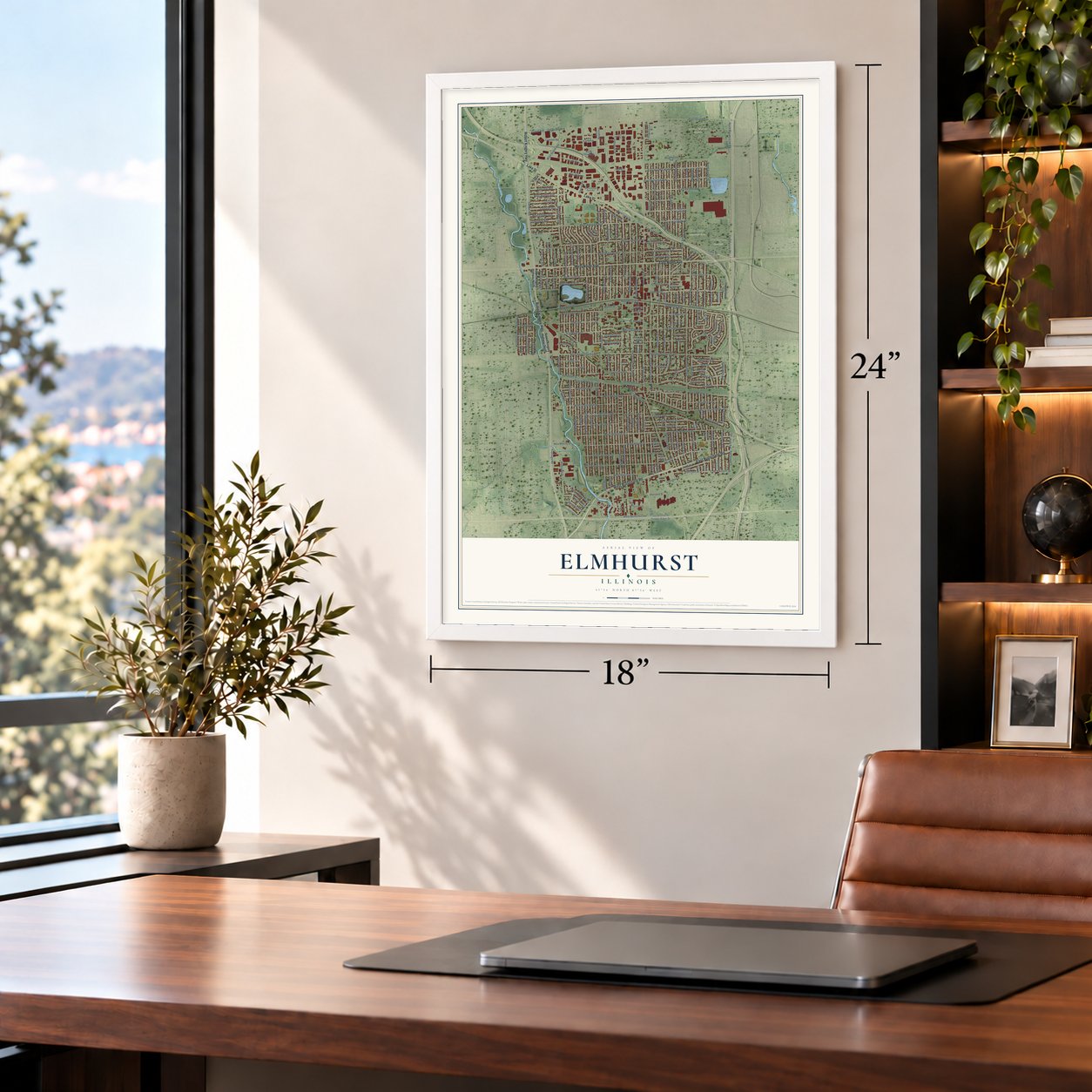
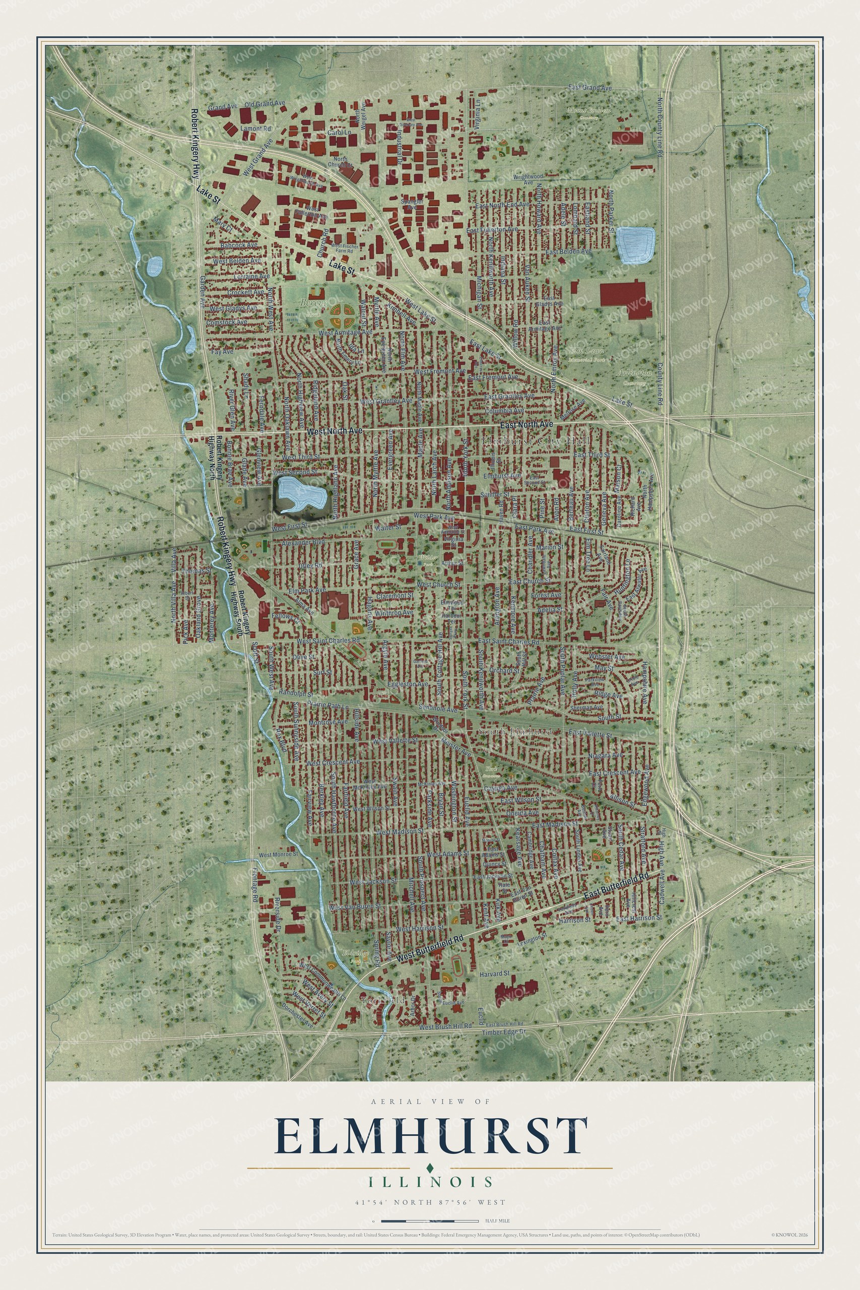
A new map of Elmhurst, Illinois, made in 2026 and printed to order on thick archival matte paper.
12" x 18" Archival Matte Print
A Map of Home. A Work of Art.
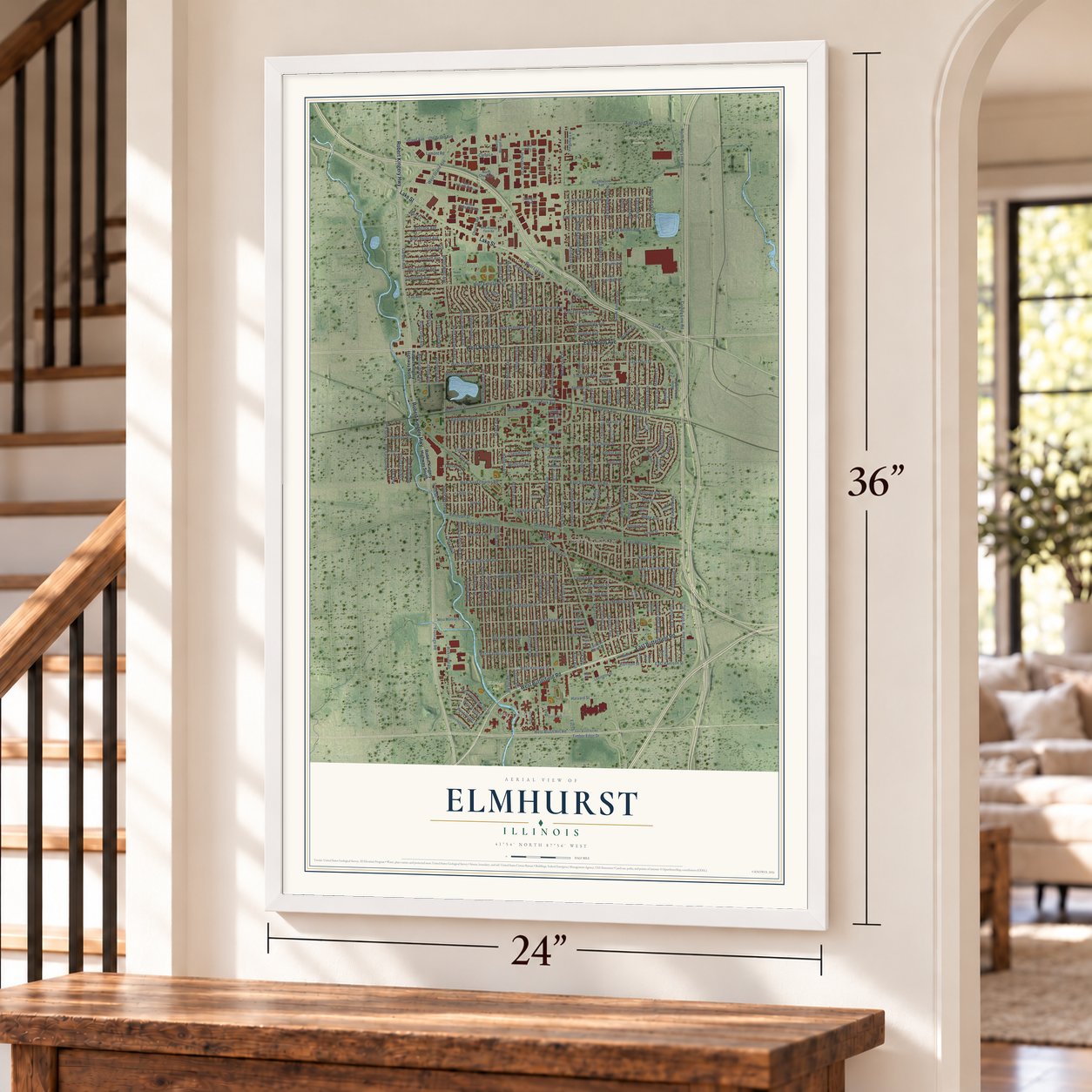
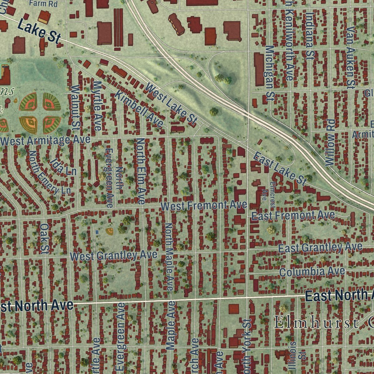
Explore Elmhurst, Illinois from a whole new perspective. Created using aerial imagery and detailed geographic data, this map captures Elmhurst building by building, with labeled streets, familiar landmarks, and shaded topographical relief that highlights the natural contours of the landscape.
Combining modern data with the timeless character of a vintage atlas, this map is just as interesting up close as it is beautiful on the wall. Whether you grew up in Elmhurst, spent memorable years there, or call it home today, this unique map is a great way to celebrate a place that means something to you. Zoom in on the preview to look for your street, and then order a print to put your memories on the wall.
Three ways to hang it
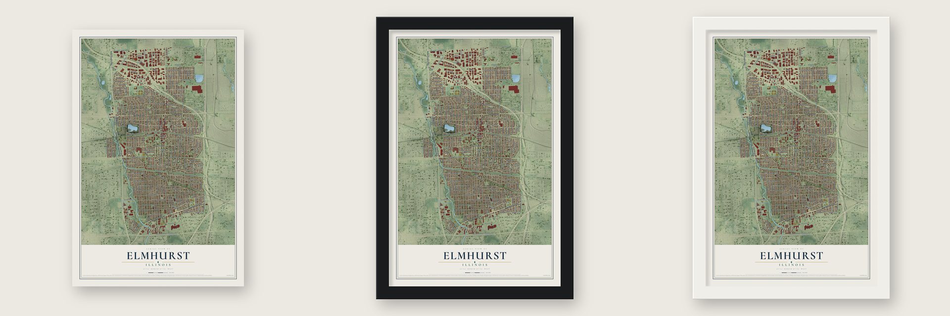
Unframed archival matte, a black wood frame or a white wood frame.
Up close
Geography Worth Displaying
This map was created using accurate cartographic data and authoritative geographic sources, including the U.S. Geological Survey and the Census Bureau. The map brings together terrain, waterways, roads, and building detail. The majority of the streets are labeled, houses are accurately depicted, and the topography is derived from government sources. Combining local data with carefully composed color and shading leads to this beautifully detailed Elmhurst artwork for your wall.
Rather than simply showing street outlines, we’ve included as many of the street names as we could reasonably fit on the map while keeping their names legible. Zoom in on the high resolution preview to see exactly what’s on the map. We truly set out to create a statement piece for anyone who loves Elmhurst. So whether it’s for you, or a gift for someone you love, we hope this map of Elmhurst brings back fond memories.
Read the story behind this map of Elmhurst, Illinois from 2026.

About Elmhurst, Illinois
Elmhurst is a city of 45,786 people in DuPage County, with a small part in Cook County, west of Chicago. Potawatomi people living along Salt Creek are the first known settlers here, and European-American families claimed land beside the same creek around 1836. In 1842 Gerry Bates, who came from Ohio, started a settlement on open, treeless ground where the city center stands today.
Hill Cottage Tavern opened the next year at what is now the corner of St. Charles Road and Cottage Hill Avenue, and when a post office arrived in 1845 the settlement was named Cottage Hill. The Galena and Chicago Union Railroad then laid its tracks through town, which gave farmers an easier route to Chicago. People kept confusing Cottage Hill with places like Cottage Grove and Council Hill, so in 1869 it took the name Elmhurst. It was incorporated as a village in 1882, with between 723 and 1,050 people.
- The Father of ElmhurstThomas Barbour Bryan, a prominent resident, is credited with giving the town its new name, and he is often called the "Father of Elmhurst." He also donated the land for Elmhurst University, which was organized in 1871 and is today a private liberal arts college tied to the United Church of Christ.
- From village to city in 1910Henry Glos was elected the first village president after Elmhurst incorporated in June 1882. In 1910 the village adopted a city form of government, and Henry C. Schumacher, village president since 1905, was elected its first mayor. In 1926 the city opened Elmhurst Memorial Hospital, the first hospital in DuPage County.
- Houses by Wright and GriffinSeveral noted architects built homes in Elmhurst. Frank Lloyd Wright designed the Frank B. Henderson House, which joined the National Register in 2002. Walter Burley Griffin designed the William H. Emery Jr. House, listed in 2004, and the William and Jennette Sloane House, listed in 2016. Mies van der Rohe designed the McCormick House here as well.
- A quarry that holds floodwaterHeavy rains have flooded Elmhurst in the past, and an old limestone quarry west of downtown now helps protect it. The pit along West Avenue and 1st Street is 150 feet deep and covers about 59 acres. When Salt Creek rises, a tunnel sends its water into the quarry, which can store up to 8,300 acre-feet as part of DuPage County's stormwater system.
- A parade since 1918Elmhurst has held its Memorial Parade every Memorial Day since 1918. The city's St. Patrick's Day Parade is the third largest of its kind in the Chicago area, behind only the downtown and South Side parades in Chicago itself.
Find your street
Names on the Elmhurst map
Every name below is printed on this map. Look for your street, your school, the park where you played, or the pond down the road.
Places and landmarks10
- Elmhurst City Hall
- Yorkfield
- South Elmhurst
- Arlington Cemetery
- Berens Park
- Eldridge Park
- Elm Lawn Memorial Park
- Mount Emblem Cemetery
- Wilder Park
- York Commons
Streets and roads258
- West North Avenue
- East Butterfield Road
- East North Avenue
- West Butterfield Road
- Robert Kingery Highway
- Lake Street
- South York Street
- North York Street
- Frontage Road
- County Line Road
- East Grand Avenue
- North Villa Avenue
- Villa Avenue
- Cadwell Avenue
- West Grand Avenue
- East Lake Street
- Old Grand Avenue
- North Addison Avenue
- West Saint Charles Road
- Rex Boulevard
- East Belden Avenue
- East First Street
- Timber Edge Drive
- South Prospect Avenue
- South Poplar Avenue
- Berkley Avenue
- Spring Road
- South Hawthorne Avenue
- Fairfield Avenue
- Mitchell Avenue
Show all 258 streets
- North West Avenue
- East Park Avenue
- Walnut Street
- Willow Road
- North Larch Avenue
- Hillside Avenue
- Saylor Avenue
- West Second Street
- East Saint Charles Road
- Euclid Avenue
- Fairview Avenue
- West Third Street
- Swain Avenue
- West Armitage Avenue
- Parkside Avenue
- Washington Street
- Stratford Avenue
- North Oaklawn Avenue
- North Emroy Avenue
- Arlington Avenue
- Industrial Drive
- Indiana Street
- Bryan Street
- North Howard Avenue
- East Vallette Street
- West First Street
- North Elm Avenue
- South Street
- North Highland Avenue
- South Cottage Hill Avenue
- Oak Street
- West Fremont Avenue
- East Church Street
- East Crescent Avenue
- West Vallette Street
- West Grantley Avenue
- May Street
- South Sunnyside Avenue
- South Kenilworth Avenue
- Schiller Street
- North Kenilworth Avenue
- Van Auken Street
- East Madison Street
- Michigan Street
- Alexander Boulevard
- West Van Buren Street
- Chatham Avenue
- South Cedar Avenue
- Elm Park Avenue
- Church Road
- South West Avenue
- North Myrtle Avenue
- Fair Avenue
- West Madison Street
- East Third Street
- Geneva Avenue
- West Brush Hill Road
- Huntington Lane
- Eggleston Avenue
- East Fullerton Avenue
- East North End Avenue
- West Lake Street
- West Adams Street
- West Jackson Street
- Prairie Path Lane
- Adele Street
- West Crescent Avenue
- Ridgeland Avenue
- Riverside Drive
- Berteau Avenue
- North Highview Avenue
- Niagara Avenue
- Crockett Avenue
- Cayuga Avenue
- Colfax Avenue
- Kenmore Avenue
- Chandler Avenue
- Marion Street
- Clinton Avenue
- Garden Avenue
- Montrose Avenue
- Kearsage Avenue
- Maple Avenue
- Kent Avenue
- Adelia Street
- Oneida Avenue
- Kirk Avenue
- Oakland Grove
- East Wilson Street
- East Harrison Street
- Harrison Street
- West Gladys Avenue
- West Park Avenue
- Utley Road
- Pick Avenue
- Columbia Avenue
- East Grantley Avenue
- West Harrison Street
- North County Line Road
- Evergreen Avenue
- Ridge Avenue
- West Belden Avenue
- Elmhurst Avenue
- Grace Avenue
- Surf Street
- Holly Avenue
- Monterey Avenue
- Edgewood Avenue
- Glenview Avenue
- Kimbell Avenue
- Comstock Avenue
- Lorraine Avenue
- Winthrop Avenue
- Hampshire Avenue
- Prairie Avenue
- Babcock Avenue
- Fay Avenue
- West Avery Street
- Olive Street
- Harvard Street
- River Glen Avenue
- East Fremont Avenue
- North Parker Street
- Shady Lane
- Lombard Street
- Eastland Street
- Lamont Road
- Hagans Avenue
- Avon Road
- Orchard Street
- Webster Avenue
- Argyle Avenue
- Seminole Avenue
- Glade Avenue
- Virginia Lane
- Bonnie Brae Avenue
- West Verret Street
- Elm Tree Lane
- Randolph Street
- Fellows Court
- West Church Street
- Claremont Street
- Ferndale Avenue
- Walter Street
- Grand Avenue
- High Avenue
- Maison Court
- Thomas Street
- Meister Avenue
- Allison Street
- Myrtle Avenue
- Forest Avenue
- Carol Lane
- Pine Street
- Scott Street
- Ida Lane
- Mary Court
- Clara Place
- Euclid
- Robert Kingery Highway South
- Robert Kingery Highway North
- Arbor Drive
- Dorchester Avenue
- South Linden Avenue
- East Adams Street
- Hillcrest Avenue
- East Van Buren Street
- Cambridge Avenue
- West Wilson Street
- North Maple Avenue
- West McKinley Avenue
- East Gladys Avenue
- Caroline Avenue
- Lexington Street
- Melrose Avenue
- North Evergreen Avenue
- West Commonwealth Lane
- East Jackson Street
- Fern Avenue
- East Armitage Avenue
- West Fullerton Avenue
- Wrightwood Avenue
- Illinois Street
- Haven Road
- East Atwater Avenue
- South Hill Street
- North Emery Lane
- Fairlane Avenue
- West Monroe Street
- North Hampshire Avenue
- North Weigel Avenue
- Sherman Avenue
- North Church Court
- Alma Avenue
- Windsor Drive
- Richard Avenue
- Quincy Street
- Spangler Avenue
- Virginia Street
- Arthur Street
- Elmwood Terrace
- Harbour Terrace
- Stuart Avenue
- Hale Street
- Fern Court
- Lawndale Avenue
- East Brush Hill Road
- West Wrightwood Avenue
- Parkview Avenue
- Yorkfield Avenue
- McKinley Avenue
- Albert Street
- South Euclid Avenue
- High Street
- South Boyd Avenue
- West Fischer Farm Road
- East Second Street
- West Adelaide Street
- Oriole Avenue
- Benton Avenue
- Mayo Court
- West Diversey Avenue
- Garfield Avenue
- Elmcrest Avenue
- Sturges Parkway
- Monroe Street
- Killarney Court
- Linden Avenue
Names are listed as they appear on the printed map. Zoom into the product photos to find them.
The art of mapping a place
How This Map Was Made
Real places. Remarkable detail. Discover the layers that turn geographic data into a map of home.

The view from above
Aerial imagery reveals the character of the land: woodland, open fields, and the patterns of a place.

The shape of the land
Elevation data brings hills, valleys, and subtle changes in the landscape into view.

The details of home
Roads, waterways, and building footprints come together to make the map feel unmistakably local.

Geography becomes art
Considered color, shading, and typography bring the layers together in a map made for your wall.


Process illustrated with Mendon, Massachusetts. Aerial imagery: USDA NAIP. Terrain: USGS 3D Elevation Program. Map details and finished artwork: KNOWOL.
The Details
About This Print
Choose an archival matte print, or a black or white Ayous wood frame. The archival matte print is unframed.
Select your size and finish above to see the matching product image and price.
Materials & Craftsmanship
A contemporary map with the character of a classic atlas, printed on archival matte paper. Optional frames are made from Ayous wood.
Your printed map does not include the watermark shown in the full-map preview.
Shipping & Delivery
Free shipping within the United States. Every print is made to order in the USA.
Buying a gift? Add a note in your cart and we'll include it. We never put prices in the package.
Prints ship within 2 to 3 business days. Allow 7 to 10 days total from ordering for delivery. Timing may vary during holidays or periods of high order volume.
Read our shipping policy.
Returns and damaged prints
Each print is made to order. Change-of-mind refunds are not available after production.
If your print arrives damaged, misprinted or incorrect, contact support@knowol.com within 30 days of receiving it. Include your order number, photos and a description of the issue.
Read our full refund and replacement policy. For questions about your order, email support@knowol.com.
Find your town
Looking for another city?
Find a map of home in our Illinois collection, or any town in the country.
Nearby
Maps of towns near Elmhurst
Know someone from one of these towns? Their map makes a great gift.
 Berkeley
, Illinois
From $39.99See the map
 Villa Park
, Illinois
From $39.99See the map
 Northlake
, Illinois
From $39.99See the map
More maps nearby: Hillside, Stone Park, Oakbrook Terrace, Bellwood and Lombard.