
Search for another town





Free U.S. delivery 7 to 10 days after you order
Naperville, Illinois Map Art
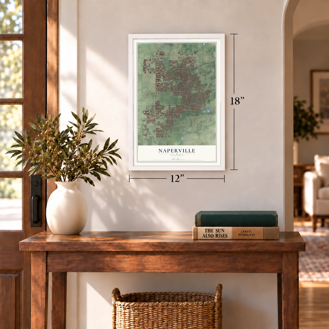
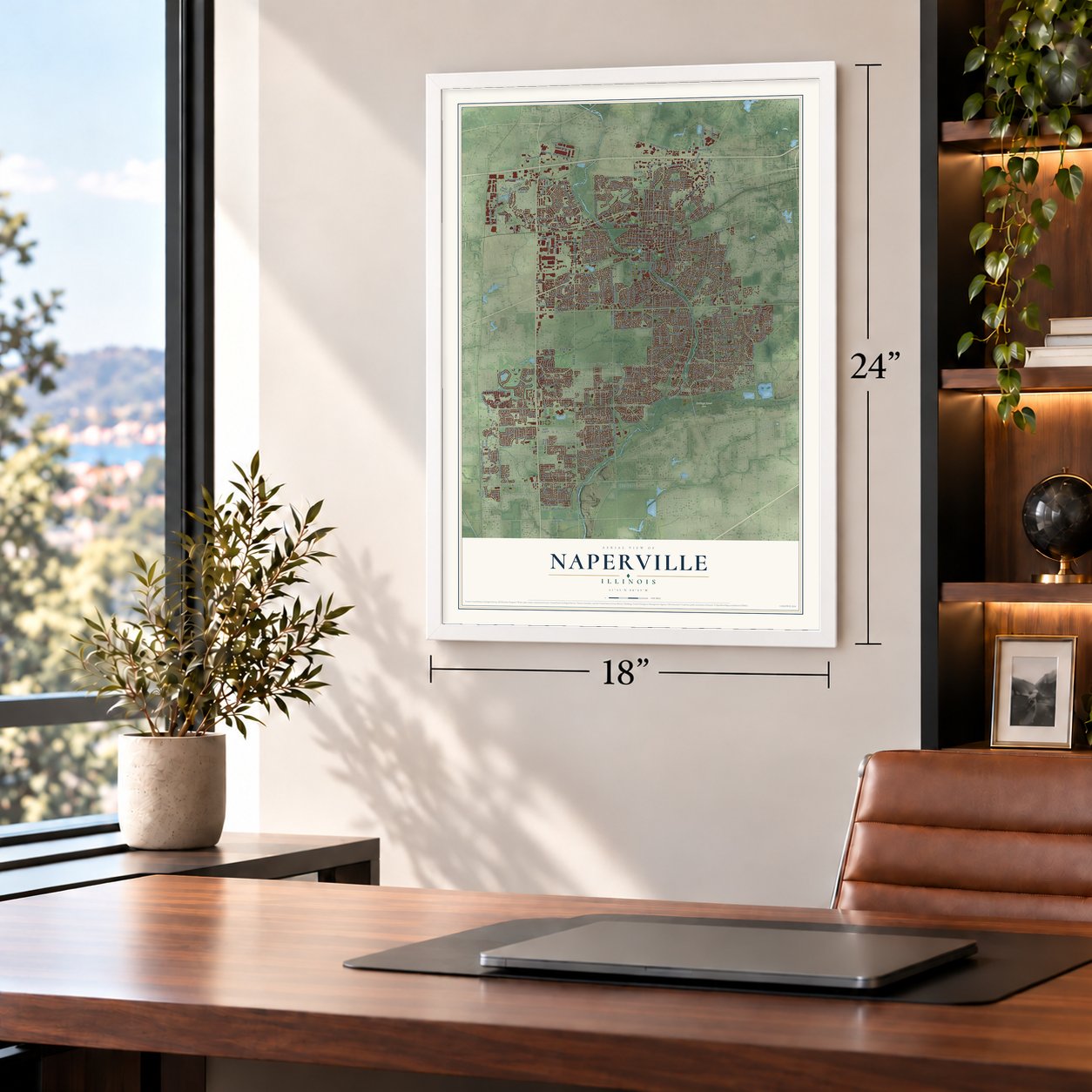
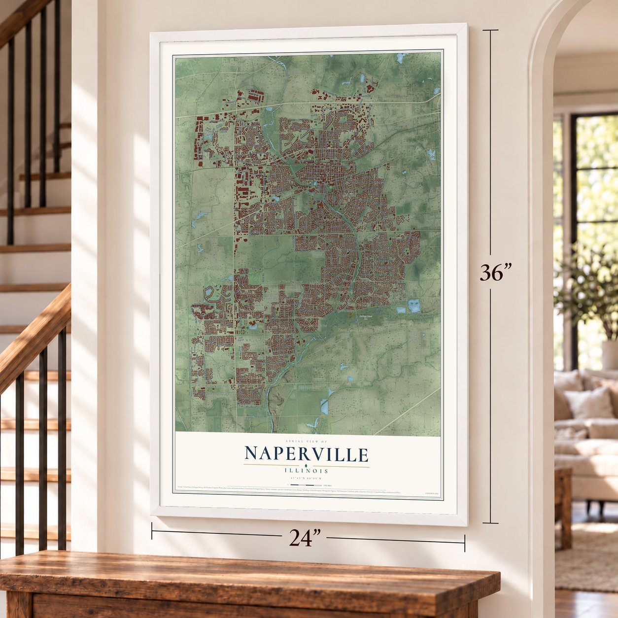
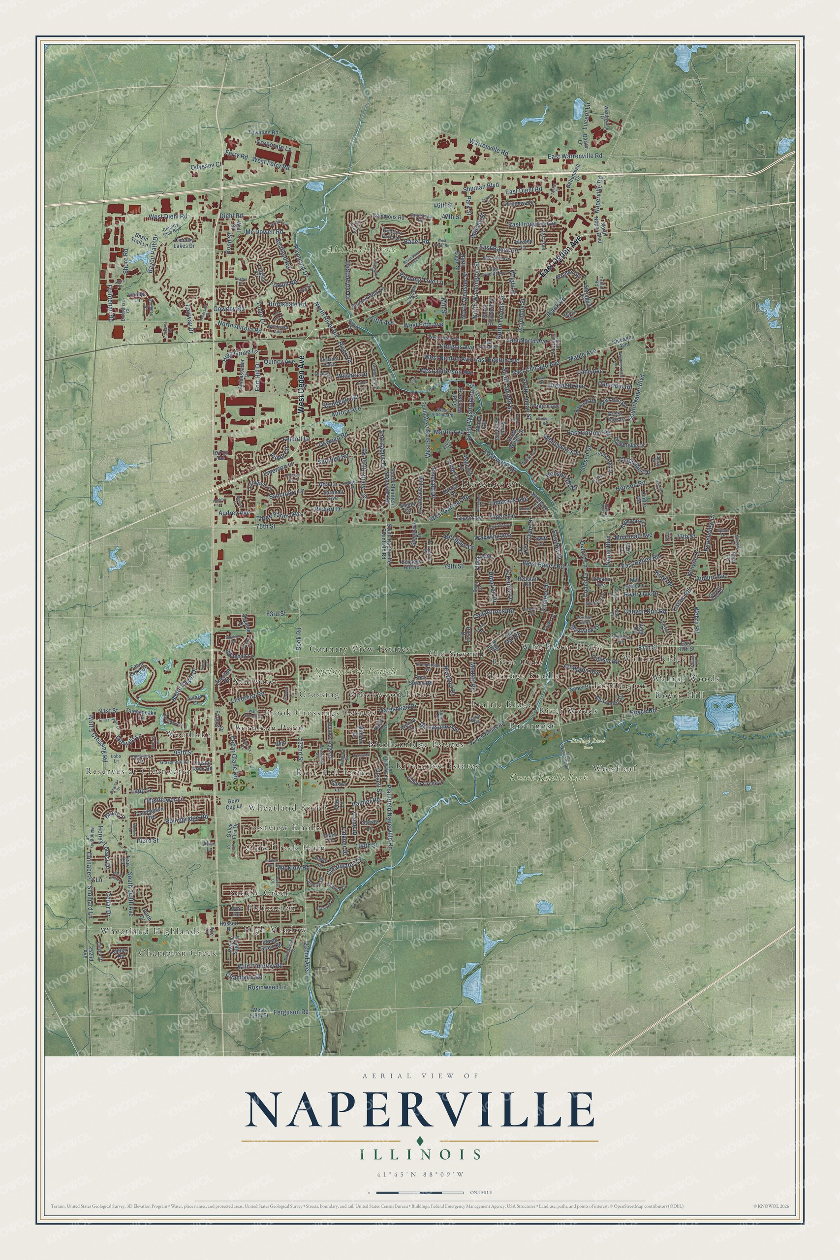
A new map of Naperville, Illinois, made in 2026 and printed to order on thick archival matte paper.
12" x 18" Archival Matte Print
A Map of Home. A Work of Art.
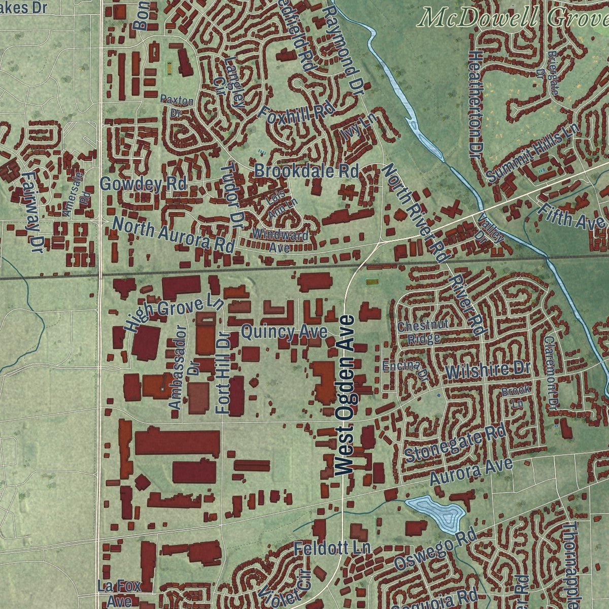
Explore Naperville, Illinois from a whole new perspective. Created using aerial imagery and detailed geographic data, this map captures Naperville building by building, with labeled streets, familiar landmarks, and shaded topographical relief that highlights the natural contours of the landscape.
Combining modern data with the timeless character of a vintage atlas, this map is just as interesting up close as it is beautiful on the wall. Whether you grew up in Naperville, spent memorable years there, or call it home today, this unique map is a great way to celebrate a place that means something to you. Zoom in on the preview to look for your street, and then order a print to put your memories on the wall.
Three ways to hang it
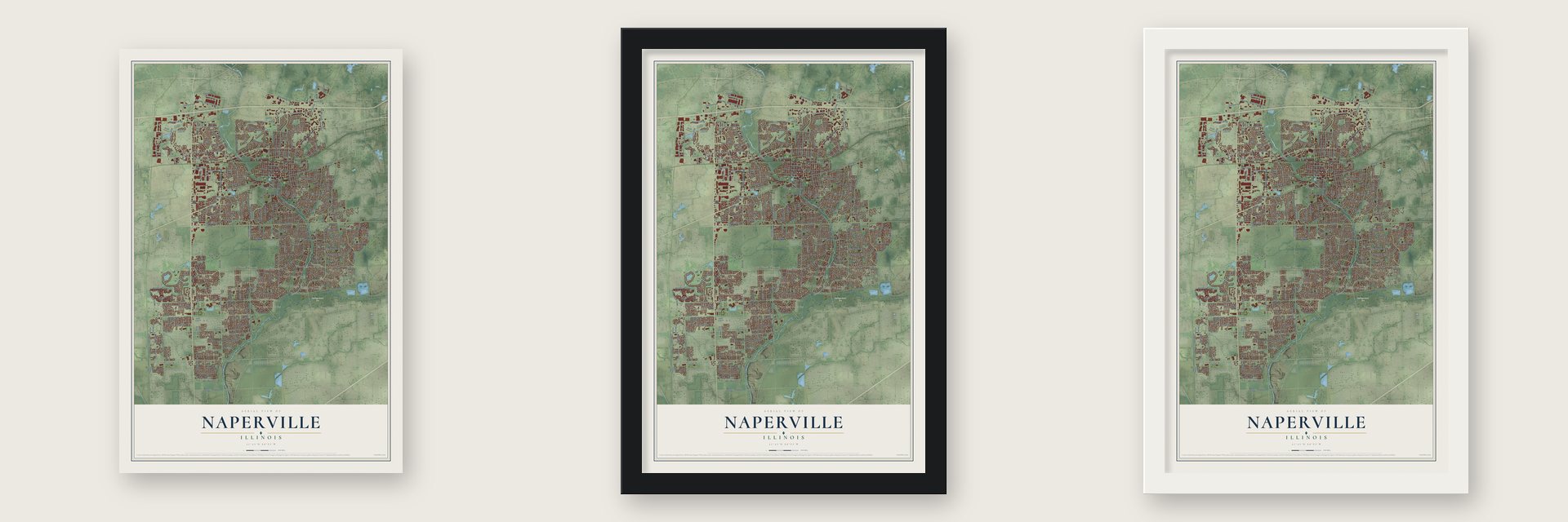
Unframed archival matte, a black wood frame or a white wood frame.
Up close
Geography Worth Displaying
This map was created using accurate cartographic data and authoritative geographic sources, including the U.S. Geological Survey and the Census Bureau. The map brings together terrain, waterways, roads, and building detail. The majority of the streets are labeled, houses are accurately depicted, and the topography is derived from government sources. Combining local data with carefully composed color and shading leads to this beautifully detailed Naperville artwork for your wall.
Rather than simply showing street outlines, we’ve included as many of the street names as we could reasonably fit on the map while keeping their names legible. Zoom in on the high resolution preview to see exactly what’s on the map. We truly set out to create a statement piece for anyone who loves Naperville. So whether it’s for you, or a gift for someone you love, we hope this map of Naperville brings back fond memories.
Read the story behind this map of Naperville, Illinois from 2026.

About Naperville, Illinois
Naperville is a city in DuPage County, Illinois. Its population in the 2020 census was 149,540.
- 149,540 residentsThis was the population recorded by the 2020 census.
- Founded in 1831It was founded in 1831.
Find your street
Names on the Naperville map
Every name below is printed on this map. Look for your street, your school, the park where you played, or the pond down the road.
Places and landmarks36
- Springbrook Prairie
- Knoch Knolls Park
- Downtown
- McDowell Grove
- DuPage River Park
- Breckenridge Estates
- Brook Crossings Estates
- Brookwood Estates
- Burnham Point
- Champion Creek
- Clow Creek Farm
- Country View Estates
Show all 36 places
- Crestview Knolls
- Crossing
- Farmington
- Heritage Knolls
- High Meadow
- Old Sawmill
- Plantation
- Prairie Ridge
- Reserves at Clearwater
- River Oaks
- River Woods
- Rivercrest Estates
- Rivermist
- Rose Hill Farms
- Royce Hill
- Saddle Creek
- Stillwater
- Walnut Ridge
- Walnut Woods
- Wheatland Highlands
- Wheatland South
- Winchester Place
- Woodlake
- Woodleaf
Streets and roads357
- West Ogden Avenue
- East Ogden Avenue
- 87th Street
- South Washington Street
- Naper Boulevard
- Naperville Road
- 232nd Avenue
- Book Road
- South Naper Boulevard
- 232nd Street
- White Eagle Drive
- Lisson Road
- Brookdale Road
- South Sleight Street
- North River Road
- River Road
- Warwick Drive
- 75th Street
- 95th Street
- Aurora Avenue
- Plainfield Naperville Road
- West Jefferson Avenue
- West Street
- Modaff Road
- West Diehl Road
- Mill Street
- South 248th Avenue
- Wehrli Road
- North Washington Street
- North Aurora Road
Show all 357 streets
- 103rd Street
- Diehl Road
- Gateshead Drive
- Warrenville Road
- Bauer Road
- Rickert Drive
- Fort Hill Drive
- Leverenz Road
- Maple Avenue
- Hobson Road
- Raymond Drive
- Fairway Drive
- East Bailey Road
- Olesen Drive
- West Bailey Road
- South River Road
- 79th Street
- East Gartner Road
- Royce Road
- Clearwater Lane
- Clyde Drive
- East Diehl Road
- East Warrenville Road
- West Gartner Road
- Newport Drive
- North Loomis Street
- East Chicago Avenue
- Oswego Road
- Ferry Road
- Columbia Street
- Bond Street
- East Iroquois Avenue
- North Webster Street
- Mistflower Lane
- Chinaberry Lane
- Sanctuary Lane
- Auburn Avenue
- Cedar Glade Road
- Falkner Drive
- Terrance Drive
- Tupelo Drive
- Frontenac Road
- Honey Locust Drive
- Douglas Avenue
- Ranchview Drive
- Canyon Run Road
- Sequoia Road
- Rosinweed Lane
- Plank Road
- 104th Street
- 83rd Street
- Killdeer Drive
- Arlington Avenue
- East Benton Avenue
- River Oak Drive
- South Julian Street
- Heatherton Drive
- East Bauer Road
- Rollingridge Road
- Culpepper Drive
- Wolf's Crossing Road
- Champion Road
- West Ferry Road
- Mc Dowell Road
- Waxwing Avenue
- Corporate Lane
- Hobson Mill Drive
- West Fifth Avenue
- Idlewild Lane
- East North Avenue
- Coach Drive
- West Benton Avenue
- Flock Avenue
- Muirhead Avenue
- Westglen Drive
- Feldott Lane
- Elizabeth Avenue
- De Lasalle Avenue
- 77th Street
- Shore Road
- Birch Lane
- Cedarbrook Road
- Shuman Boulevard
- Whirlaway Avenue
- Edgewater Drive
- Lucent Lane
- Tamarack Avenue
- Bayou Path Drive
- High Grove Lane
- Knoll Drive
- Cassin Road
- Ferguson Road
- 91st Street
- Wild Timothy Road
- Emerald Drive
- Swallow Street
- Cedar Drive
- Wicklow Road
- Lapp Lane
- Redfield Road
- Apache Drive
- Shumard Lane
- Ada Lane
- Jane Avenue
- Three Farms Avenue
- Thornapple Drive
- Emerson Lane
- Caine Drive
- Burning Tree Lane
- Gowdey Road
- Oxford Lane
- Hamlet Road
- Riparian Drive
- Audrey Avenue
- Quincy Avenue
- Dunrobin Road
- Kenyon Drive
- Martin Avenue
- Stonegate Road
- Foxhill Road
- Wright Street
- Tussell Street
- Odyssey Court
- Tudor Drive
- Violet Circle
- Wilshire Drive
- Fifth Avenue
- 46th Street
- Park Street
- Tulip Lane
- 47th Street
- Hassert Bl
- East 87th Street
- North Naper Boulevard
- La Fox Avenue
- Knoch Knolls Road
- South West Street
- Skylane Drive
- North Eagle Street
- Keim Road
- South Wright Street
- Timber Creek Lane
- Chesapeake Lane
- Hyde Park Lane
- Naper Bl
- Alexandria Drive
- Tupelo Avenue
- Chicago Avenue
- Ring Road
- Chippewa Drive
- Commons Road
- South Loomis Street
- Redstart Road
- Fawn Lake Circle
- Prairie Avenue
- South Naperville Plainfield Road
- Johnson Drive
- Hunter Circle
- Prairie Sage Lane
- Willow Ridge Drive
- West 119th Street
- North Ellsworth Street
- Century Farm Lane
- Country Lakes Drive
- Springhill Circle
- Teak Circle
- Whitehall Lane
- Gold Cup Lane
- Bellemead Drive
- Edward Road
- South Webster Street
- Basin Trail Lane
- Rock Spring Road
- Daisy Lane
- Wendy Drive
- Celeste Lane
- Lexington Lane
- Sheehan Drive
- Williamsburg Drive
- Ambassador Drive
- South Plainfield Naperville Road
- Deep Run Road
- Burgess Hill Road
- Rockbridge Drive
- Magnolia Lane
- Spruce Drive
- Summit Hills Lane
- 252nd Avenue
- Landsdown Avenue
- Midland Drive
- Green Trails Drive
- Sandpiper Lane
- Langley Circle
- Willow Road
- Townline Road
- Vest Avenue
- Split Oak Road
- Eliot Lane
- Ivy Lane
- Saranell Avenue
- Brighton Road
- Mill Race Lane
- Shepherd Drive
- Lark Lane
- Forgue Drive
- Orleans Avenue
- Barkei Lane
- Indian Grass Road
- Perth Drive
- Saxon Lane
- Quick Fire Drive
- Swift Lane
- Shiloh Circle
- Pawnee Lane
- Callery Road
- Oneida Lane
- Crystal Rock Road
- Ace Lane
- Town Drive
- Beth Lane
- Dorval Drive
- Aviara Court
- Wall Street
- Wait Road
- Alice Lane
- Friar Lane
- Eton Lane
- Weatherbee Lane
- East Twelfth Avenue
- Bourbon Lane
- County Highway 14
- Grassmere Road
- East School Street
- North Charles Street
- West Spring Avenue
- Country Club Boulevard
- Robert Lane
- Benedetti Drive
- Oakton Lane
- Stanford Drive
- West Hillside Road
- Seiler Drive
- Trillium Lane
- Esquire Circle
- Claremont Drive
- Camelot Circle
- Quail Drive
- Coneflower Drive
- Orwell Road
- Slippery Rock Drive
- Highknob Circle
- East 14th Avenue
- Torrington Drive
- Lobo Lane
- Brossman Street
- Mahogany Lane
- Tuthill Road
- Chestnut Ridge
- Hempstead Avenue
- Genesee Drive
- Milton Drive
- Christa Drive
- Conestoga Road
- Windward Avenue
- Ashbury Drive
- Enterprise Court
- Encina Drive
- Brom Drive
- Elm Street
- Valley Drive
- Liberty Drive
- Sierra Avenue
- Spice Lane
- Golf Drive
- North Naperville Road
- West Bauer Road
- Royal Saint George Drive
- Chevy Chase Lane
- Haider Avenue
- Templar Drive
- Briergate Drive
- Hillsboro Lane
- Warm Springs Lane
- Spindletree Avenue
- Hamilton Lane
- Basswood Drive
- Bluejay Lane
- Pradel Drive
- Foxcroft Road
- Scottsdale Circle
- Empress Drive
- Carriage Hill Road
- Kilburne Lane
- Blakely Lane
- White Ash Lane
- Westmoreland Lane
- Palmer Circle
- Bay Colony Drive
- Baybrook Lane
- Henley Lane
- Parkside Road
- Sudbury Street
- Hobson Oaks Drive
- Cromwell Lane
- Watercress Drive
- Anne Road
- Amersale Road
- Wehrli Drive
- Abriter Court
- Crystal Avenue
- Stanton Drive
- Lonsdale Avenue
- Stockton Road
- Mustang Drive
- Mirror Lake Drive
- Industrial Drive
- Melrose Lane
- Shore Drive
- Lois Ann Lane
- Nevis Drive
- Paxton Drive
- Tower Court
- Winola Court
- Cortez Court
- Thrush Lane
- Brook Lane
- Cody Court
Names are listed as they appear on the printed map. Zoom into the product photos to find them.
The art of mapping a place
How This Map Was Made
Real places. Remarkable detail. Discover the layers that turn geographic data into a map of home.

The view from above
Aerial imagery reveals the character of the land: woodland, open fields, and the patterns of a place.

The shape of the land
Elevation data brings hills, valleys, and subtle changes in the landscape into view.

The details of home
Roads, waterways, and building footprints come together to make the map feel unmistakably local.

Geography becomes art
Considered color, shading, and typography bring the layers together in a map made for your wall.


Process illustrated with Mendon, Massachusetts. Aerial imagery: USDA NAIP. Terrain: USGS 3D Elevation Program. Map details and finished artwork: KNOWOL.
The Details
About This Print
Choose an archival matte print, or a black or white Ayous wood frame. The archival matte print is unframed.
Select your size and finish above to see the matching product image and price.
Materials & Craftsmanship
A contemporary map with the character of a classic atlas, printed on archival matte paper. Optional frames are made from Ayous wood.
Your printed map does not include the watermark shown in the full-map preview.
Shipping & Delivery
Free shipping within the United States. Every print is made to order in the USA.
Buying a gift? Add a note in your cart and we'll include it. We never put prices in the package.
Prints ship within 2 to 3 business days. Allow 7 to 10 days total from ordering for delivery. Timing may vary during holidays or periods of high order volume.
Read our shipping policy.
Returns and damaged prints
Each print is made to order. Change-of-mind refunds are not available after production.
If your print arrives damaged, misprinted or incorrect, contact support@knowol.com within 30 days of receiving it. Include your order number, photos and a description of the issue.
Read our full refund and replacement policy. For questions about your order, email support@knowol.com.
Find your town
Looking for another city?
Find a map of home in our Illinois collection, or any town in the country.
Nearby
Maps of towns near Naperville
Know someone from one of these towns? Their map makes a great gift.
 Lisle
Lisle, Illinois
From $39.99See the map
 Warrenville
, Illinois
From $39.99See the map
 Bolingbrook
, Illinois
From $39.99See the map
More maps nearby: Woodridge, Aurora, Downers Grove, Wheaton and Winfield.