
Search for another town





Free U.S. delivery 7 to 10 days after you order
Bolingbrook, Illinois Map Art
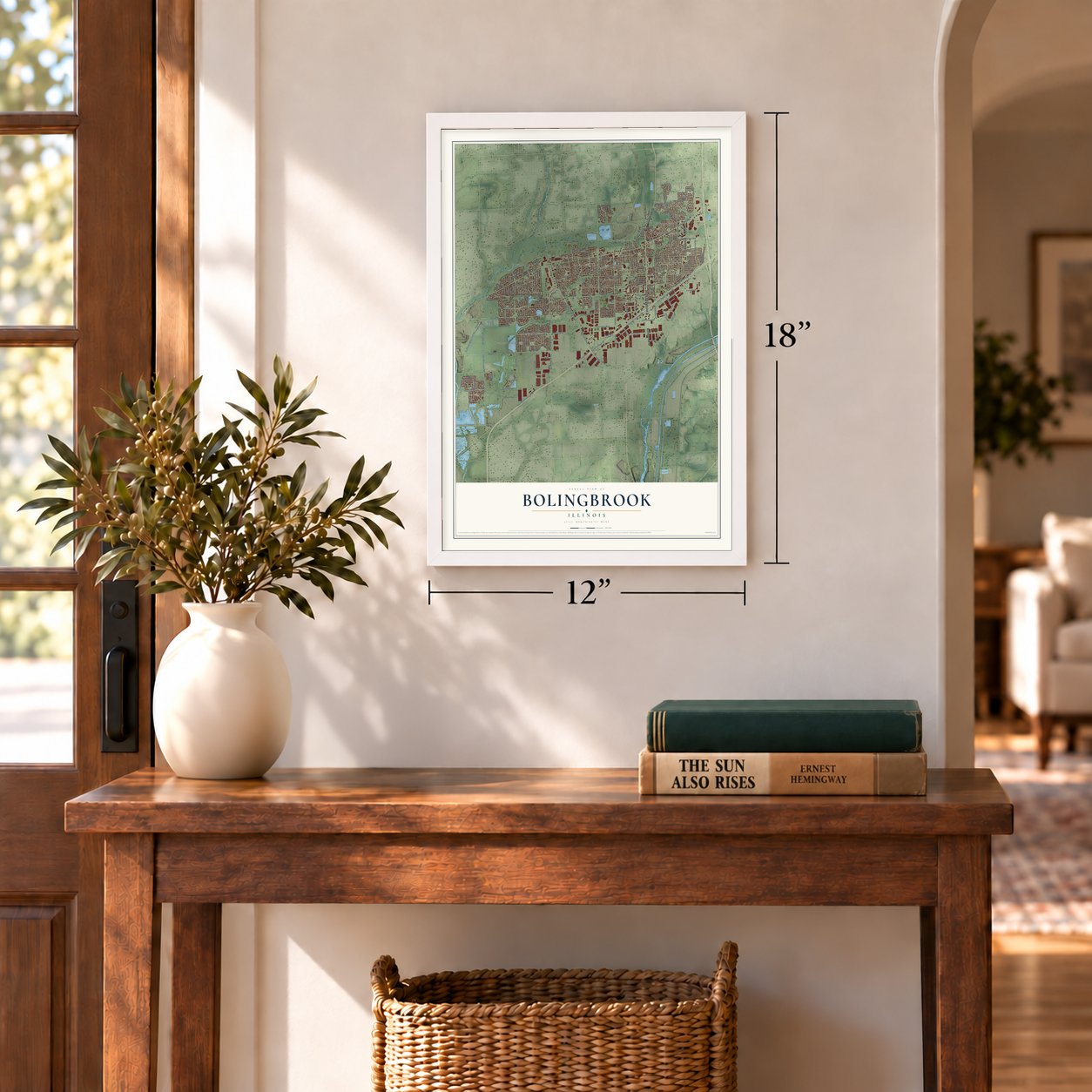
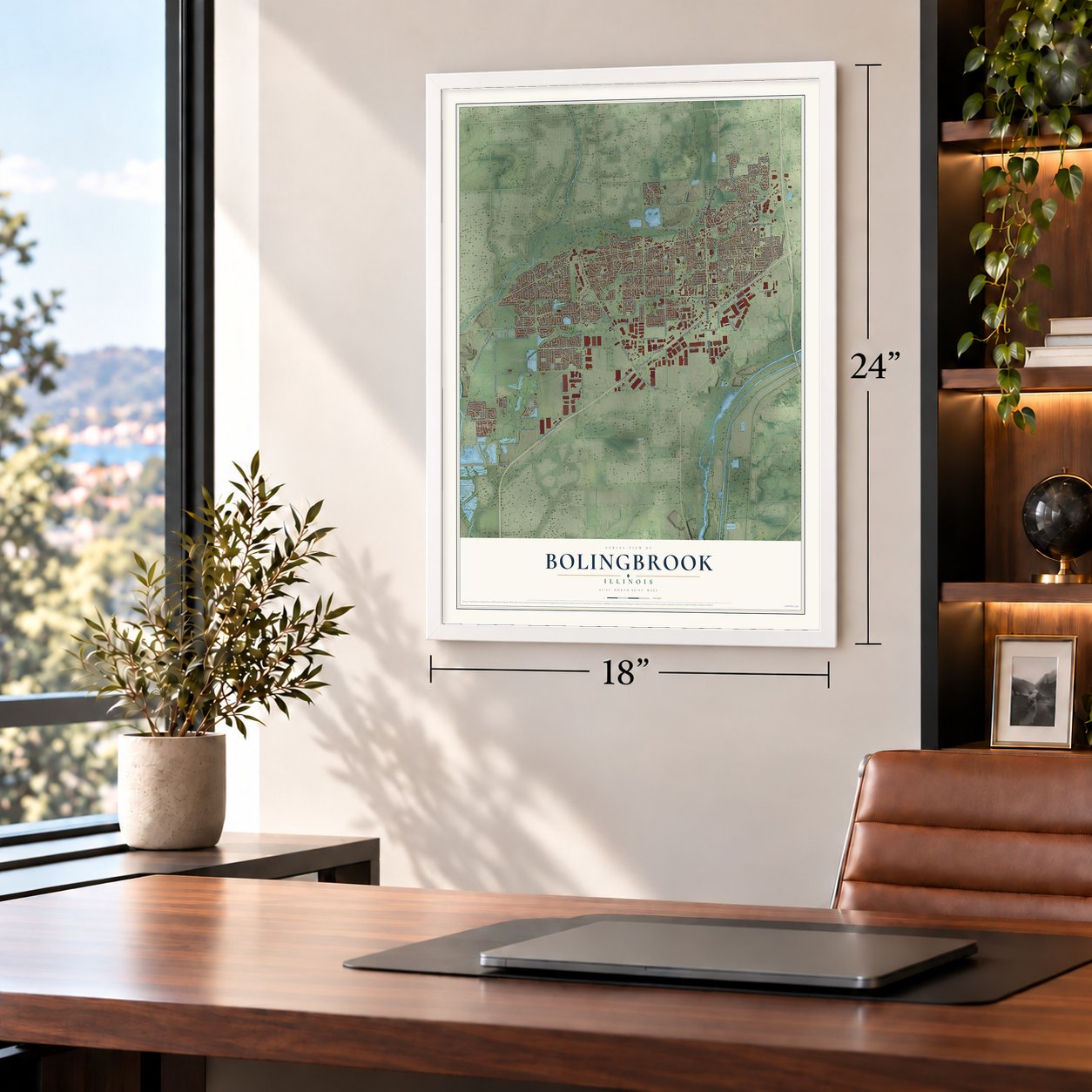
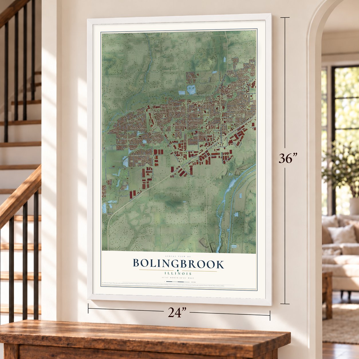
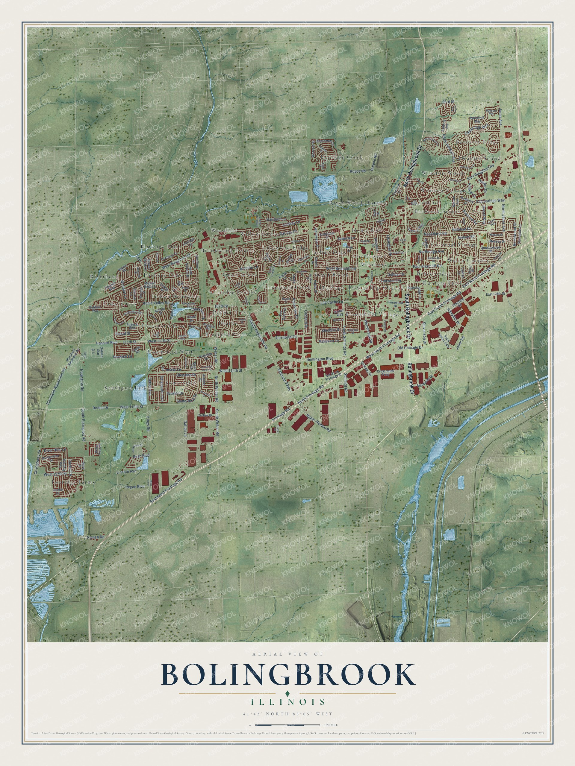
A new map of Bolingbrook, Illinois, made in 2026 and printed to order on thick archival matte paper.
12" x 18" Archival Matte Print
A Map of Home. A Work of Art.
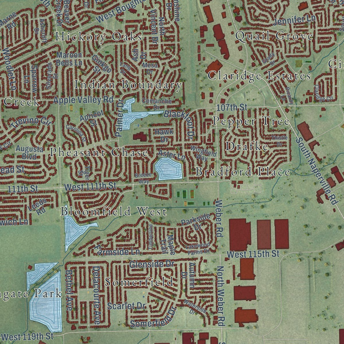
Explore Bolingbrook, Illinois from a whole new perspective. Created using aerial imagery and detailed geographic data, this map captures Bolingbrook building by building, with labeled streets, familiar landmarks, and shaded topographical relief that highlights the natural contours of the landscape.
Combining modern data with the timeless character of a vintage atlas, this map is just as interesting up close as it is beautiful on the wall. Whether you grew up in Bolingbrook, spent memorable years there, or call it home today, this unique map is a great way to celebrate a place that means something to you. Zoom in on the preview to look for your street, and then order a print to put your memories on the wall.
Three ways to hang it
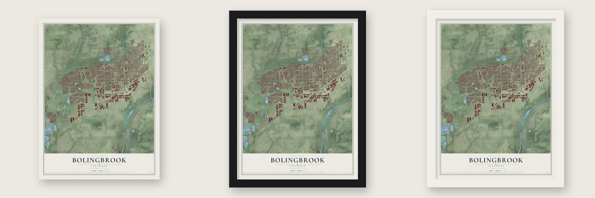
Unframed archival matte, a black wood frame or a white wood frame.
Up close
Geography Worth Displaying
This map was created using accurate cartographic data and authoritative geographic sources, including the U.S. Geological Survey and the Census Bureau. The map brings together terrain, waterways, roads, and building detail. The majority of the streets are labeled, houses are accurately depicted, and the topography is derived from government sources. Combining local data with carefully composed color and shading leads to this beautifully detailed Bolingbrook artwork for your wall.
Rather than simply showing street outlines, we’ve included as many of the street names as we could reasonably fit on the map while keeping their names legible. Zoom in on the high resolution preview to see exactly what’s on the map. We truly set out to create a statement piece for anyone who loves Bolingbrook. So whether it’s for you, or a gift for someone you love, we hope this map of Bolingbrook brings back fond memories.
Read the story behind this map of Bolingbrook, Illinois from 2026.

About Bolingbrook, Illinois
Bolingbrook is an Illinois village spanning Will and DuPage counties, about 28 miles southwest of downtown Chicago. Though settlement began in 1831, the modern community emerged from 1950s subdivisions and incorporated in 1965. Interstate 55 improved access from Chicago in the early 1960s, and the village grew quickly during the following decades.
- Population in 2020The 2020 census recorded 73,922 residents in Bolingbrook.
- A Decade of GrowthBolingbrook's population rose from 7,000 in 1970 to more than 37,000 in 1980.
- Gateway WetlandsThe village stands within the Gateway Wetlands, which extend from Downers Grove to just north of Joliet.
- Park District MilestoneCreated by referendum in 1970, the Bolingbrook Park District opened the nation's first indoor wave pool in 1982.
- Local Aviation MuseumFounded in 2004, the volunteer-staffed Illinois Aviation Museum occupies a remodeled hangar at village-owned Clow International Airport.
Find your street
Names on the Bolingbrook map
Every name below is printed on this map. Look for your street, your school, the park where you played, or the pond down the road.
Places and landmarks39
- DuPage Township Office
- Bayberry Ridge
- Barbers Corners
- Beaconridge
- Bloomfield Village
- Bloomfield West
- Bradford Place
- Brookwood Estates
- Cherrywood
- Cider Creek
- Cinnamon Creek
- Claridge Estates
Show all 39 places
- Colonial Village
- Drafke
- Foxridge Farms
- Heather Sound
- Heritage Creek
- Heritage Place
- Hickory Oaks
- Home Run
- Hunters Trail
- Indian Boundary
- Indian Oaks
- Ivanhoe
- Lakewood Ridge
- Pepper Tree
- Pheasant Chase
- Quail Grove
- River Woods Estates
- Riverbend
- Somerfield
- Southgate Park
- Sugar Brook
- Welco Corners
- Westbury
- Willow Grove
- Winston Village
- Winston Woods
- Woodleaf
Streets and roads210
- South Bolingbrook Drive
- Bolingbrook Drive
- North Bolingbrook Drive
- South Schmidt Road
- Joliet Road
- South Naperville Road
- Veterans Parkway
- North Frontage Road
- East North Frontage Road
- Frontage Road
- Remington Boulevard
- Naper-Romeo Road
- West Briarcliff Road
- Plainfield-Naperville Road
- North Weber Road
- Regan Boulevard
- County Highway 14
- Trevino Circle
- Lincoln Avenue
- Romeo Road
- West Boughton Road
- Lily Cache Lane
- 107th Street
- Schmidt Road
- Rodeo Drive
- West 119th Street
- Janes Avenue
- East Boughton Road
- Weber Road
- North Ashbury Avenue
Show all 210 streets
- 111th Street
- Hassert Boulevard
- West 111th Street
- South Weber Road
- Falconridge Way
- South Essington Road
- Rockhurst Road
- East South Frontage Road
- Lindsey Lane
- Orchard Drive
- Royce Road
- Palmer Drive
- West 115th Street
- Kings Road
- East Briarcliff Road
- Dalton Lane
- Southwest Frontage Road
- Apple Valley Road
- Territorial Drive
- Cambridge Way
- Old Chicago Drive
- Essington Road
- Rebecca Lane
- North Janes Avenue
- Woodcreek Drive
- River Hills Lane
- West South Frontage Road
- Glenside Drive
- Homewood Drive
- Plainview Drive
- Somerfield Drive
- Barclay Drive
- Danhof Drive
- Jennifer Lane
- Hartford Lane
- Bluebird Drive
- Northridge Avenue
- Greene Road
- West 127th Street
- Gibralter Drive
- Lexington Drive
- Bush Boulevard
- Farmside Lane
- Norwich Lane
- Woodlet Lane
- Kildeer Drive
- Lee Lane
- 83rd Street
- Seneca Lane
- Stevenson Drive
- Preston Drive
- Fairwood Drive
- Delacourte Avenue
- Blackfoot Drive
- Snead Street
- Delmar Drive
- Sword Way
- Galahad Road
- 95th
- Bethel Avenue
- Scarlet Drive
- Plainfield Naperville Road
- Beaver Creek Drive
- Ashbury Avenue
- Pinecrest Road
- Crossroads Parkway
- Parkside Drive
- Fernwood Drive
- Seabury Road
- Marne Road
- Delaware Drive
- Augusta Boulevard
- Malibu Drive
- Blair Lane
- Boardman Circle
- Melissa Drive
- Mark Circle
- Winding Way
- Beaconridge Drive
- Sunshine Drive
- Fox Bend Circle
- Queenswood Road
- Whitewater Drive
- Saint James Gate
- Maroon Bells Lane
- Firethorn Street
- Nassau Avenue
- Carlow Drive
- Baldwin Way
- Concord Lane
- Whitehall Way
- Stonegate Road
- Golden Star
- Marquette Drive
- Penny Lane
- Danube Way
- Raider Way
- Camelot Way
- Lawton Lane
- Valley Drive
- North Vincent Drive
- Wescott Road
- Brookstone Drive
- Carriage Lane
- Shady Lane
- Hst US 66 Frontage Street
- East 107th Street
- Crossing Road
- Betsy Ross Place
- Sparrow Lane
- Gateway Drive
- Sundance Drive
- Rothbury Drive
- York Street
- Poplar Lane
- Apricot Street
- Autumn Drive
- Aster Lane
- Maple Trail
- Leeds Road
- Hillside Drive
- Denver Drive
- Ginkgo Street
- Ash Drive
- Janice Lane
- Hawk Drive
- Joy Drive
- Clifton Lane
- South Lindsey Lane
- Paxson Drive
- Bonnie Brae Lane
- Forest Way
- Ayers Street
- Tiger Street
- Pampas Circle
- Comanche Drive
- Silverado Street
- Larkspur Drive
- Oxford Road
- Garden Drive
- Jefferson Drive
- Banbury Way
- Wingfield Way
- Appling Lane
- Niagara Drive
- Riverside Drive
- Juniper Lane
- Alcott Lane
- Beech Drive
- Ivory Lane
- Ashcroft Drive
- Vista Drive
- Mesa Drive
- Hosler Drive
- West 127th
- Blackhawk Lane
- Charlestown Drive
- Waterside Drive
- Canterbury Lane
- Claridge Circle
- Lakewood Farms Drive
- Quadrangle Drive
- Grady Drive
- Enclave Circle
- Thistle Drive
- Christine Drive
- Redwood Road
- Assembly Drive
- Pamela Drive
- Carolina Street
- Rain Tree Drive
- Picardy Lane
- Westwind Drive
- Timberline
- Lang Drive
- Julie Road
- Breeze Way
- Marian Court
- Brook Court
- Bur Lane
Names are listed as they appear on the printed map. Zoom into the product photos to find them.
The art of mapping a place
How This Map Was Made
Real places. Remarkable detail. Discover the layers that turn geographic data into a map of home.

The view from above
Aerial imagery reveals the character of the land: woodland, open fields, and the patterns of a place.

The shape of the land
Elevation data brings hills, valleys, and subtle changes in the landscape into view.

The details of home
Roads, waterways, and building footprints come together to make the map feel unmistakably local.

Geography becomes art
Considered color, shading, and typography bring the layers together in a map made for your wall.


Process illustrated with Mendon, Massachusetts. Aerial imagery: USDA NAIP. Terrain: USGS 3D Elevation Program. Map details and finished artwork: KNOWOL.
The Details
About This Print
Choose an archival matte print, or a black or white Ayous wood frame. The archival matte print is unframed.
Select your size and finish above to see the matching product image and price.
Materials & Craftsmanship
A contemporary map with the character of a classic atlas, printed on archival matte paper. Optional frames are made from Ayous wood.
Your printed map does not include the watermark shown in the full-map preview.
Shipping & Delivery
Free shipping within the United States. Every print is made to order in the USA.
Buying a gift? Add a note in your cart and we'll include it. We never put prices in the package.
Prints ship within 2 to 3 business days. Allow 7 to 10 days total from ordering for delivery. Timing may vary during holidays or periods of high order volume.
Read our shipping policy.
Returns and damaged prints
Each print is made to order. Change-of-mind refunds are not available after production.
If your print arrives damaged, misprinted or incorrect, contact support@knowol.com within 30 days of receiving it. Include your order number, photos and a description of the issue.
Read our full refund and replacement policy. For questions about your order, email support@knowol.com.
Find your town
Looking for another city?
Find a map of home in our Illinois collection, or any town in the country.
Nearby
Maps of towns near Bolingbrook
Know someone from one of these towns? Their map makes a great gift.
 Romeoville
, Illinois
From $39.99See the map
 Woodridge
, Illinois
From $39.99See the map
 Naperville
, Illinois
From $39.99See the map
More maps nearby: Lockport Heights, Lemont, Bonnie Brae, Lisle and Darien.